Sept 8. min. max. avg
Bitt 2nw valley 50.2 65.3 57.7
Garrett College 51.0 65.9 58.4
Can-Heights 51.1 64.6 57.8
CRN-Canaan 52.3 65.2 58.1
Cabin Mt 48.4 63.3 55.8
Cabin Mt north 48.6 62.2 55.4
Spruce Knob 48.6 63.1 55.8
Snowshoe 55.6 73.8 64.7
Can-Valley Floor 52.7 66.6 59.6
7Springs 46.9 64.1 55.5
Cloudy, high ground fog, drizzle, rain eastern slopes in the morning..Easterly moist flow. Morning high temps dropping through the day.
Temp profile this afternoon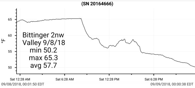


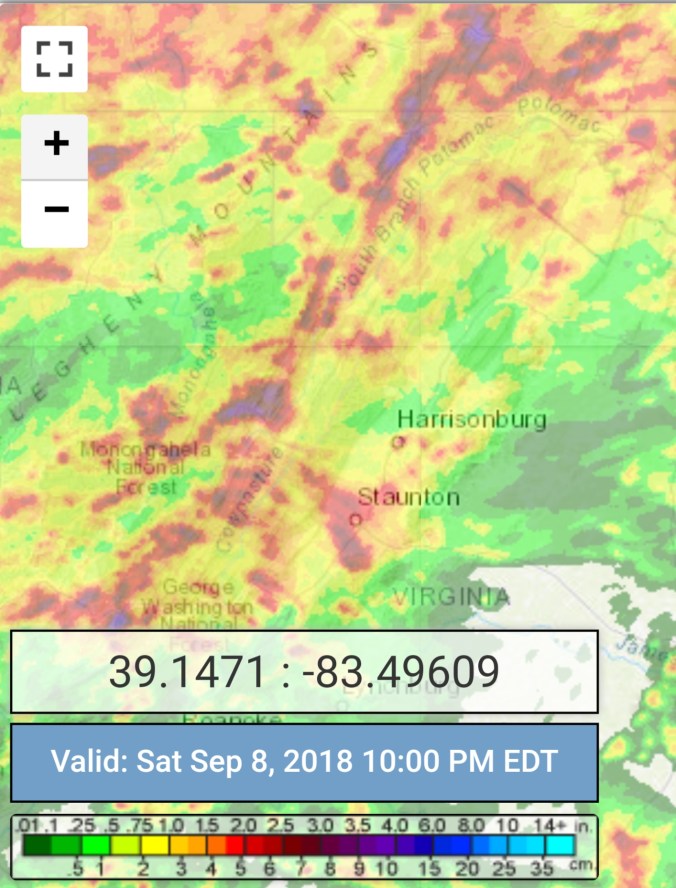
Radar with estimates 10pm-10pm .8 at Bittinger 2nw Valley since Thursday night
 Satellite
Flow
Surface features and 500mb height anomalies and flow


On the models
18z 3km Nam
2m temperatures
Wind Chills(30s Wv High Ground)
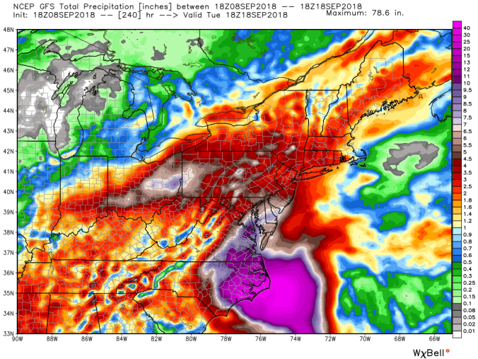
Rainfall through Monday off the 18z GFS and 12z ECMWF


Looking ahead, eyes still on Florence and where it will go late week. The big worry is, does it move inland and stall? Does it stay near the coast and not a impact to the mts, does it stay just offshore… Something to watch during the week.
12z ECMWF precip type next 240 hours
10 day totals(including this rain event now)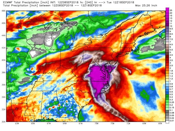
18z GFS precip type next 384 hrs
Precip totals next 240 hrs(including current event)
Spaghetti Charts for Florence off the ECMWF, GFS


