Sept 9 min. max. avg
Bitt 2nw valley 48.7 54.0 51.3
Garrett College 48.9 54.0 51.4
Can-Heights 46.4 54.5 50.4
CRN-Canaan 48.5 57.0 52.8
Cabin Mt 44.4 49.8 47.1
Cabin Mt north 44.2 49.8 47.0
Spruce Knob 45.0 50.5 47.8
Snowshoe 54.0 57.7 55.8
Can-Valley Floor 48.6 55.8 52.2
7Springs 46.7 52.6 49.7
Rain, some fog, east wind, flooding.
Temp profile this afternoon/w windchills


Radar with estimates 9pm-9pm . Bittinger 2nw Valley I recorded 3.6″ more at the 2:30 gauge dump. 4.4″ event total.. Next check 7am. Radar estimates appear to be low in many instances.


Satellite
Flow
Surface features and 500mb 500mb height anomalies and flow


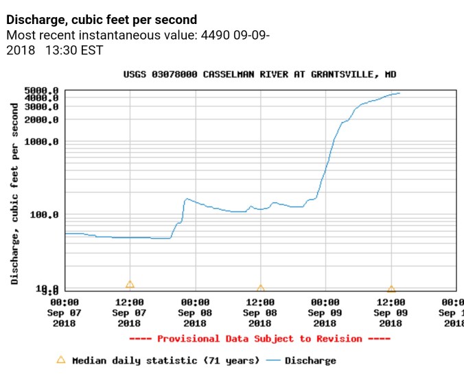
Cassleman River at Grantsville coming in at its 4th highest reading in the 71 year History of the gauge….it peaked out at over 4500cfs…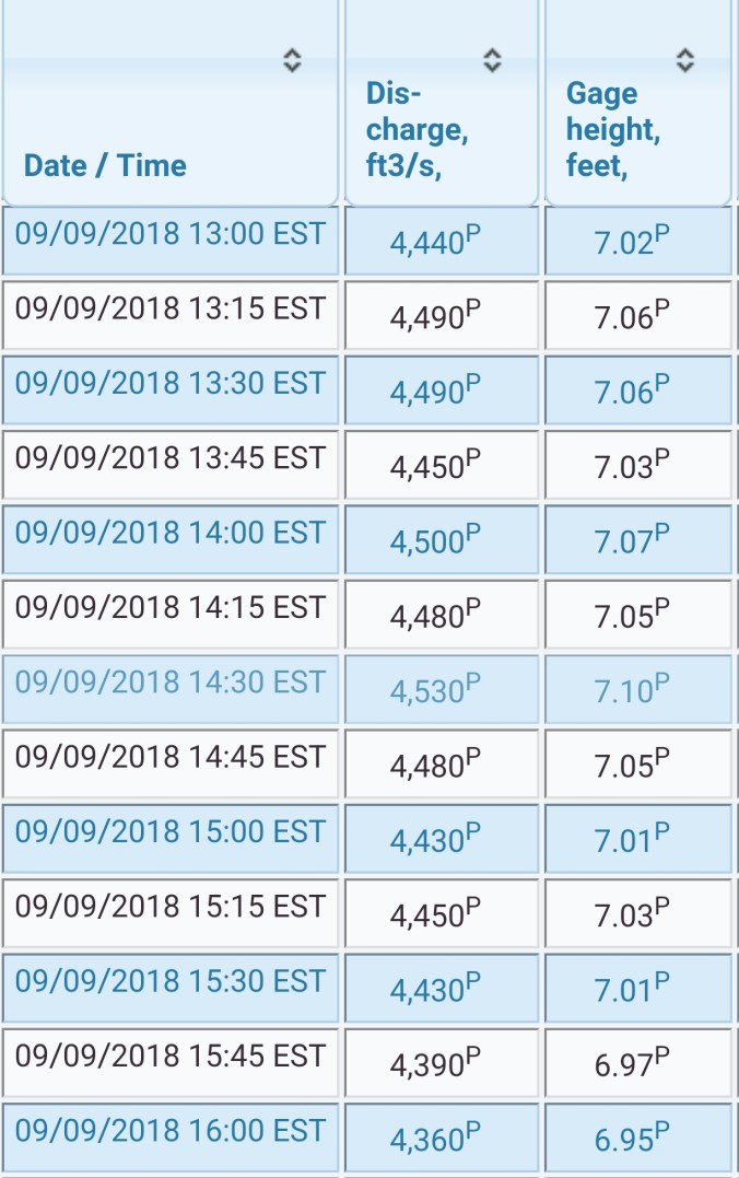


Tributaries to the Cassleman
Muddy Creek Falls


Pics by Mike Petenbrink shared on Social media took today in Meyersdale Pa, down river on the Cassleman from Grantsville.


Not to go unmentioned, Wv high ground holding 40s, northern Sods had mid 30s windchills this morning….rainfall amounts have varied significantly from northern Cabin to Bald Knob


On the models
short term, temps creep up over the next few days to more seasonal levels. and the risk of heavy pockets of rain remain through Monday. Areas of 1-2″ additional rainfall exist
18z 3km Nam
2m temperatures
Simulated Radar
Further out, the attention goes to Florence. Big questions remain. The risk of this storm moving inland and stalling for 2-3 days does exist. The 12z ECMWF shows that scenario. That is a worst case scenario should this occur. How far west does the moisture get. If, and I say this cautiously, not to hype. But, if you are in a low lying area, flood prone, keep this in the front of your mind this week, stay up to date with the latest info…this would have destructive, to catastrophic flood potential that could rival the Wv floods of 85′ should it come inland. I don’t think that is what will happen, but it can not be ruled out. With luck it will stall well east and be picked up by a front and lifted off to the north and our area goes unaffected. What scenario occurs has MAJOR implications. That said, here is the 12z ECMWF and it brings it inland and hammers Va, with significant rains back to the Alleghenies

The GFS is the scenario that leaves us largely unaffected.

The Beast this morning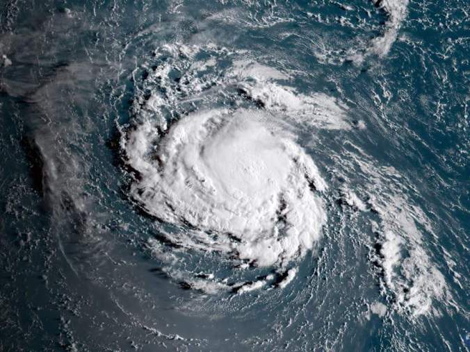
Spaghetti Charts for Florence


