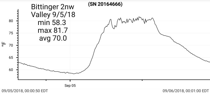
Sept 10. min. max. avg
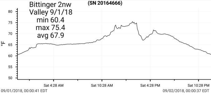
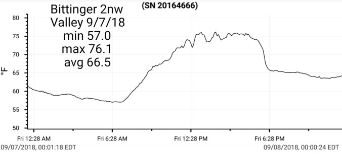
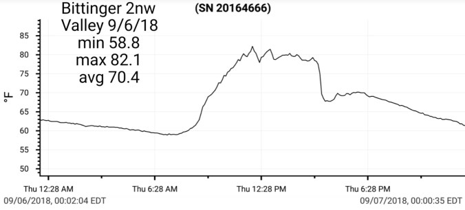
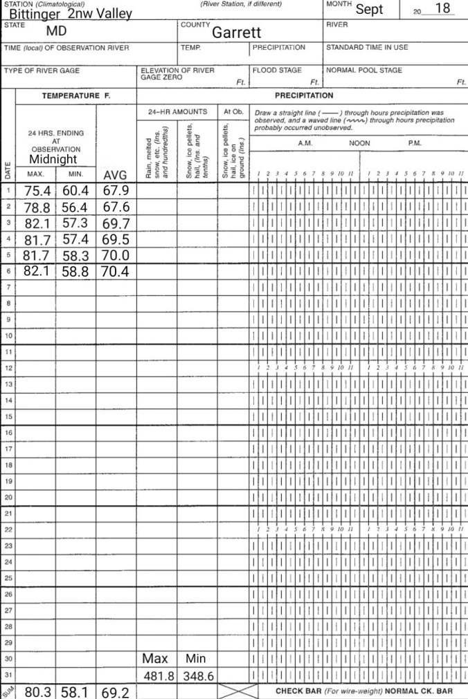
Bitt 2nw valley 52.0 60.6 56.3
Garrett College 52.1 65.8 58.9
Can-Heights 51.6 69.5 60.5
CRN-Heights 53.5 68.5 61.0
Cabin Mt 49.1 65.1 57.1
Cabin Mt north 49.5 69.1 59.3
Spruce Knob 49.3 60.6 54.9
Snowshoe 54.1 63.1 58.6
Can-Valley Floor 53.2 74.7 63.9
7Springs 50.1 60.5 55.3
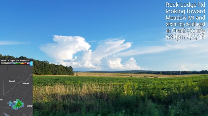
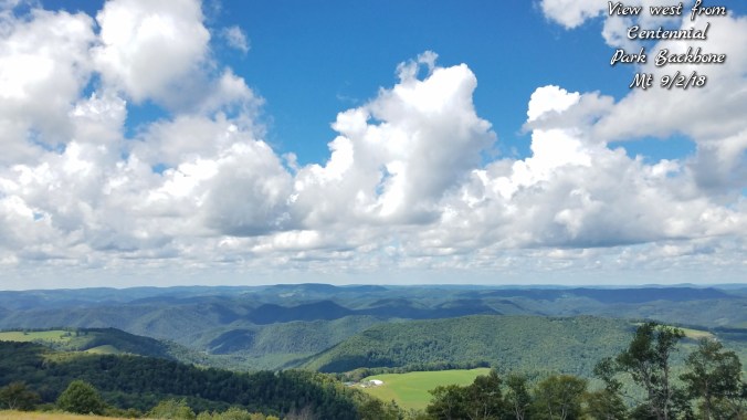
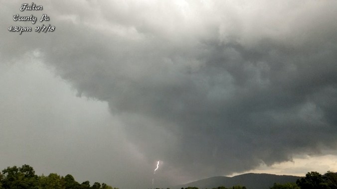
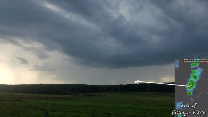
Cloudy, foggy. se breeze, few showers, drizzle at times. North central Garrett and points NE remained drearier and cooler vs elsewhere. High ground here remaining in the 50s
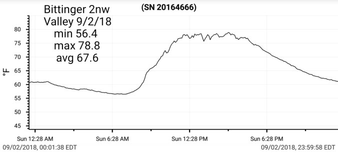
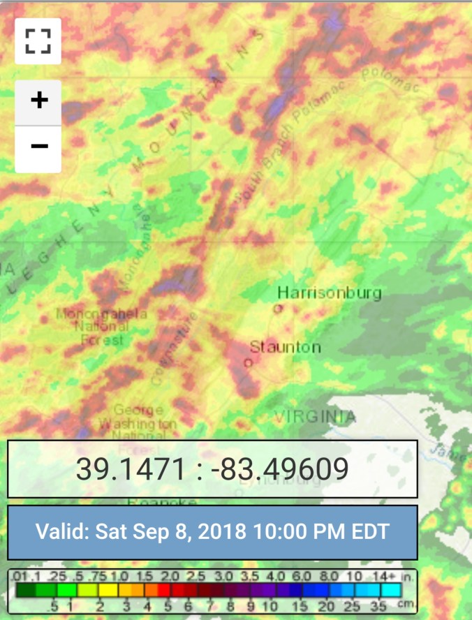
Temp profile this afternoon


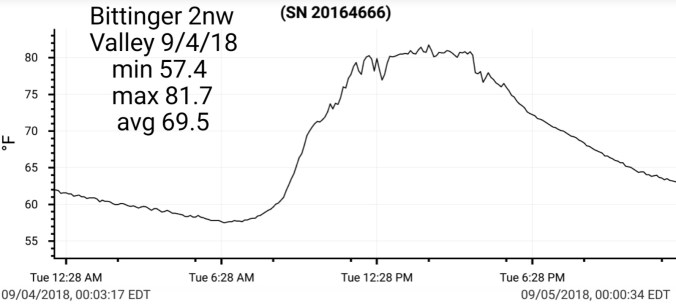
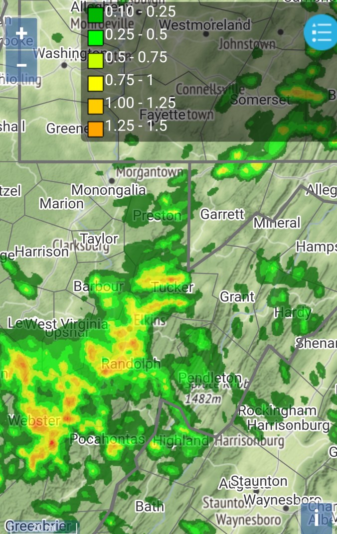
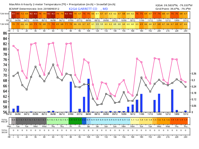
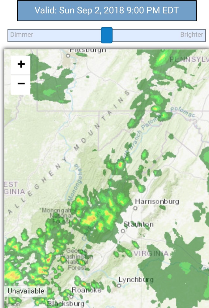
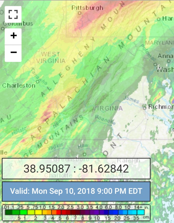
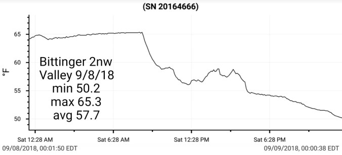
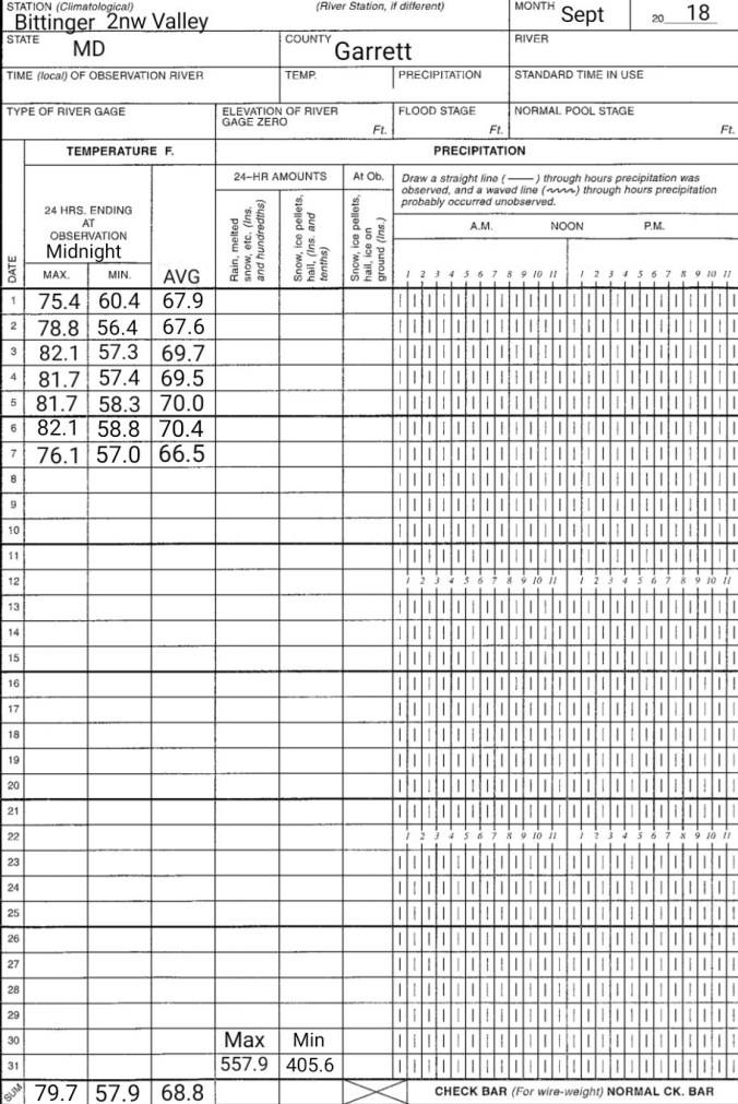
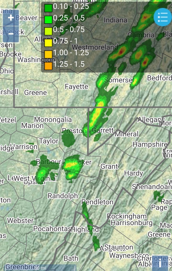
Radar with estimates 9pm-9pm. At Bittinger 2nw Valley, .8 from 2:30pm yesterday through 7am today, with .1 more today for .9 total
Satellite
Flow
Surface features and 500mb height anomalies and flow


High water is receeding, some locations down river cresting today. While upstream, headwater areas falling back but still high. Water coming out of the ground in lots of places water typically doesn’t. Chilly SE flow, fog all day in spots… Some videos to fit those descriptions…
SE flow, typical cooler areas with the setup
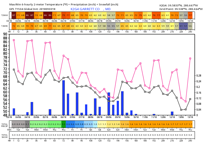
On the models…
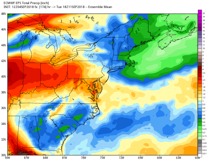
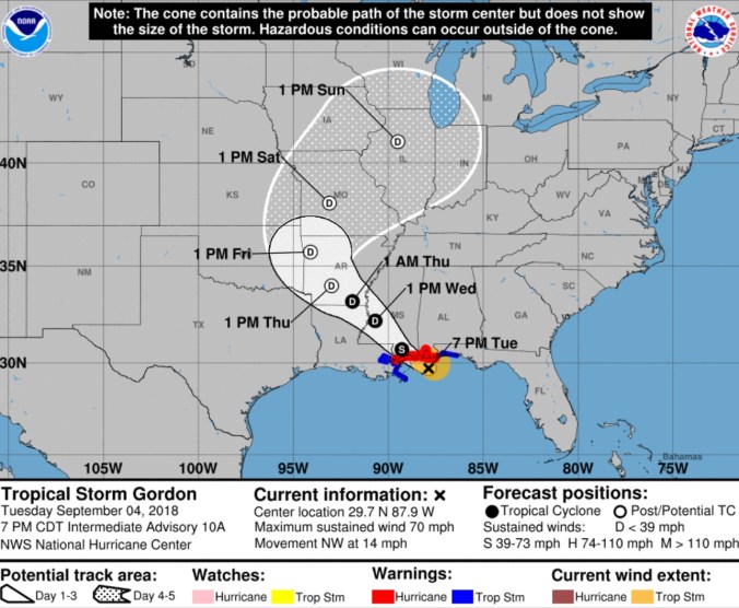
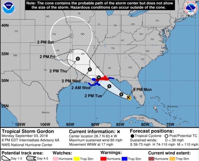
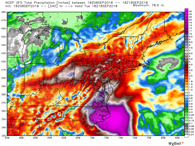
Nothing exciting near term, so eyes to Florence. Florence strengthening to a Cat 4 in the Atlantic and has a target of the Carolinas. That’s about all that is known. Models are extremely varied, There is NO forecast or model this far out that will give you an exact rain amount, a exact path, or timing of a landfall even. The ECMWF, GFS, UKMET, CMC, NAM(to 84hrs) are all varied. The GFS holds Florence just off the coast and has it do a loop before coming onshore and inland late weekend, early next week and drops lighter rains. 1-2″ The ECMWF, that 12z run is a big time player for us. If this plays out, 5-10″+ is possible in parts of the region. So, everytime you see a rainfall map, hear amounts, hear timing, take that with a grain of salt. The NHC uses those wide cones of track for a reason. That’s the cone of uncertainty. 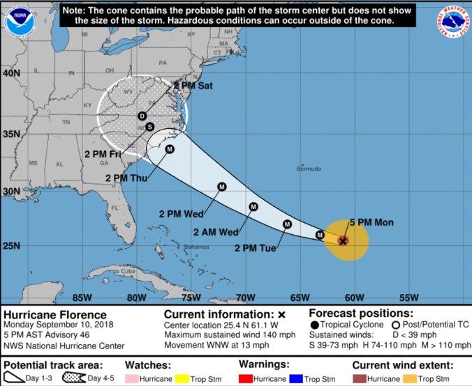 Say it takes on the southern route of that cone, or stalls east, our impact may be small and it may stay dry until late weekend or early next week. That is one scenario.
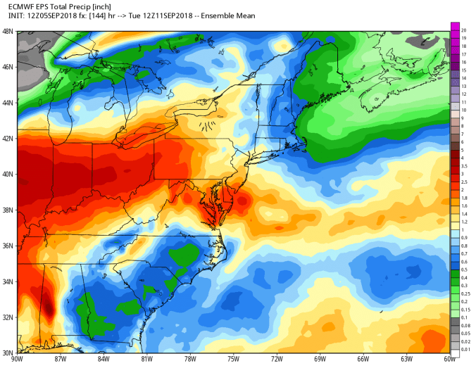
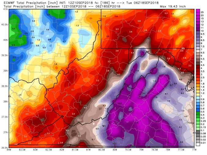
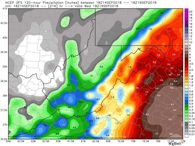
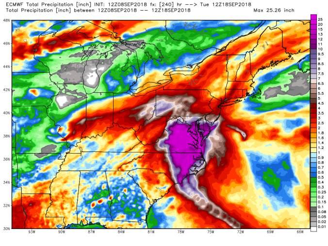
Here is the 12z ECMWF run, with rainfall totals…. this is towards the extreme scenario
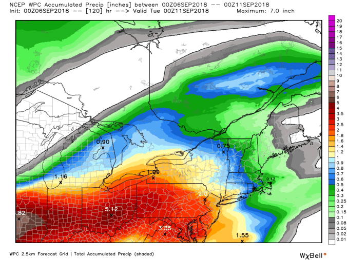
The 18z GFS, watching the Nam at 84 hours looking similiar, to me, makes this scenario one that can’t be ruled out. GFS is not very impactful in this scenario to our area with 1-2″ maxes
The 12z UKMET, similar to the ECMWF
Look at spaghetti charts


Bottom line sitting here Monday evening, a storm of this size is constantly evolving, models are fed new data every run, and these storms have a HUGE degree of uncertainty and things unforeseen each and everytime. If someone says how much will rain….it is only answered with possibilities, scenarios at this point. As the models are fed new data, we will see some convergence as we get closer. DO NOT let your gaurd down. The extreme risk is still on the table, and the scenario of little impact exist also.
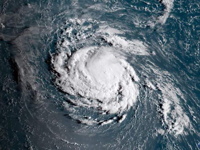
Florence at nightfall


 Satellite


 Radar with estimates 9pm-9pm .1 with evening burst at Bittinger 2nw Valley by 6pm , next recording will be Saturday, away tomorrow
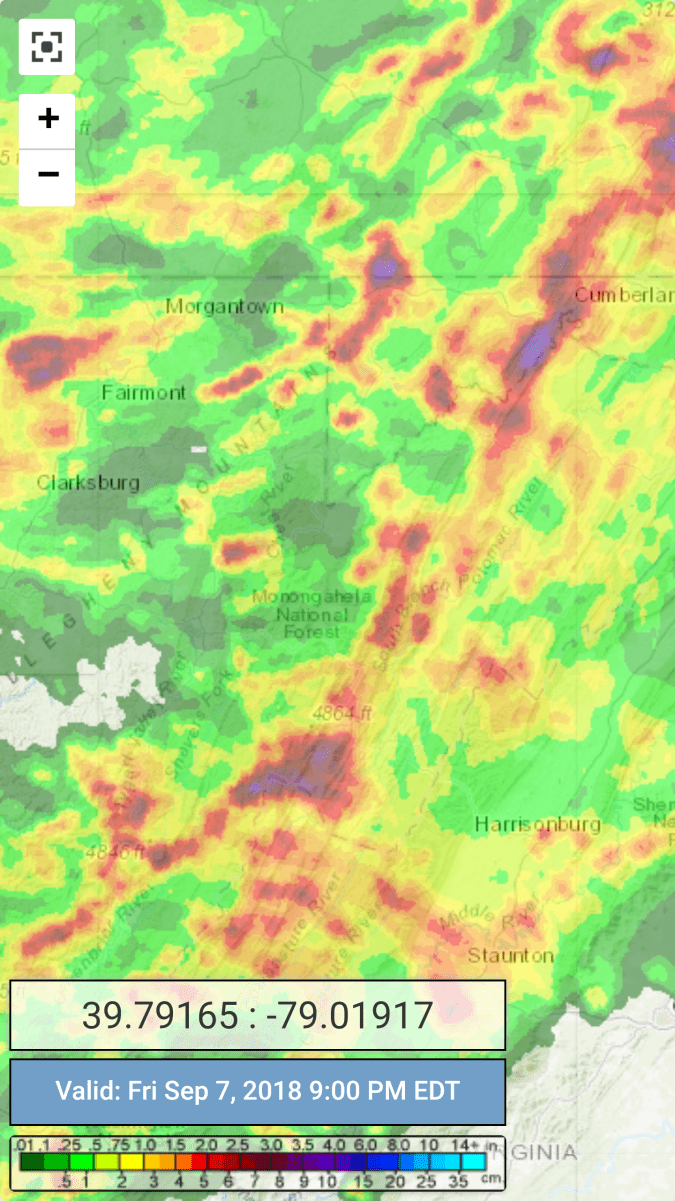


 Radar with estimates 9pm-9pm, .1 Bittinger 2nw Valley through 3pm reading, remainder will go on tomorrows amount.
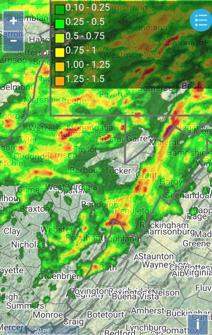


 Satellite