Oct 9 min. max. avg
Bitt 2nw valley 56.7 73.8 65.2
Garrett College 63.4 75.8 69.6
Can-Heights 60.8 71.2 66.0
CRN-Canaan 57.2 73.5 65.4
Cabin Mt. 58.8 68.2 63.5
Cabin Mt north 59.2 69.1 64.1
Spruce Knob x
Snowshoe 57.9 65.3 61.6
Can-Valley Floor 59.7 74.8 67.2
7Springs 61.5 73.2 67.3
Partly cloudy day. Mild.
Temp profile this afternoon,


Radar estimates. Dry in the region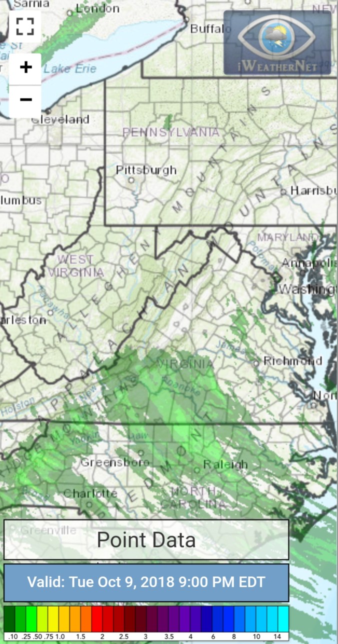
Satellite
Flow
Surface features and 500mb height anomalies and flow,


Hurricane Michael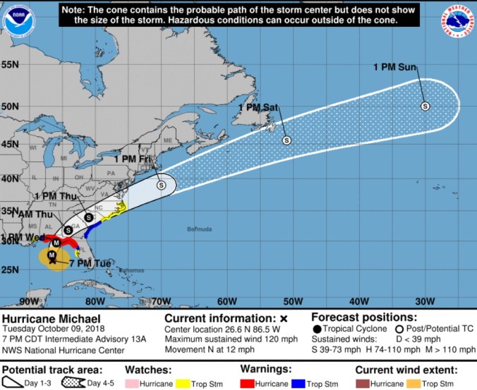
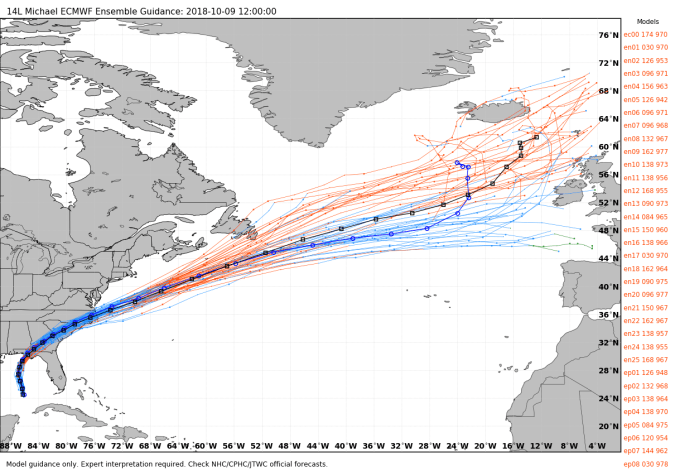
On the models..
Cold push begins Thursday, rain, wind with the front, setting up a chilly to cold Friday-Saturday. Then we rebound ahead of the next cold push Tuesday-Wednesday. That one potentially brings the 1st flakes of the season, if not another a few days later may. Widespread frost and feeezes day 6-15.
18z GFS precip type next 240hrs
18z GFS 2m temperatures
12Z ECMWF ensemble members for snowfall next 15 days. Some members seeing some accumulation. This time of year, you’ll hear. The ground is too warm too stick. One of the sayings I hate the most. Typically early fall, or in the spring, any system that can produce snow in a high temp gradient pattern brings along with it, strong winds, and with 850s -2 to -5c , the WV high ground falls 28-32. The top duff layer, leaf layer, grass, is all that has to chill off, snow can stick. Once you surpass 1-2″, thats when the warm ground plays a factor as the duff layer is insulated and the warm within the ground plays a factor and melts from underneath.
Anyhoo, the 12z ECMWF ensemble members next 15. Enough members with a threat that the upcoming systems beyond day 6 are worth watching,


Da Leaves
Bittinger area… bare or dull maples, green oaks is the theme.


Pic by Renee Morris at Canaan Valley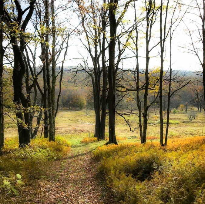
social media pic by Tucker County page along the Blackwater above the falls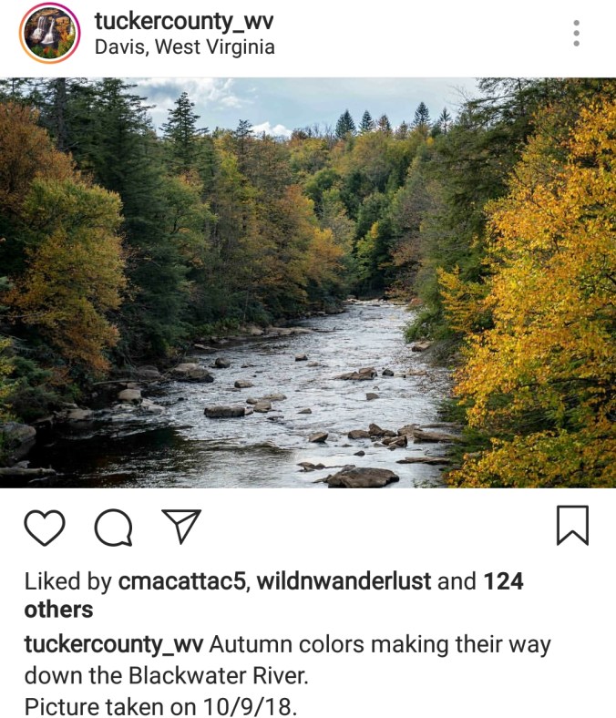
pic by Rosanna Springston along the Highland Scenic Highway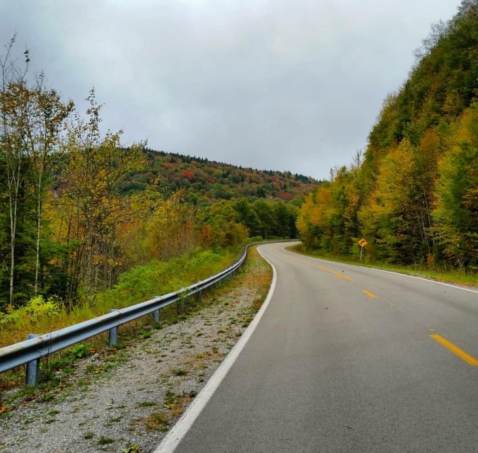
Few pics by Tina Hendershot. One from Spruce Knob, looking mostly all bare west, and one from Blackwater Canyon at Lindy.. The canyon is running behind schedule, but also it appears less affected by anthracnose, at least partially due to tree type… Still have high hopes over the next week, especially after the cold shot arrives, that the canyon will go vibrant yellow and provide the best foliage in a otherwise dull foliage season. Here are her pics,


