Oct 11. min. max. avg
Bitt 2nw valley 47.7 66.7 57.2
Garrett College 47.8 67.3 57.5
Can-Heights 46.0 65.4 55.7
CRN-Canaan 44.1 66.3 55.2
Cabin Mt. 43.0 63.1 53.0
Cabin Mt north 43.5 64.0 53.7
Spruce Knob. x
Snowshoe 40.8 63.5 52.2
Can-Valley Floor 48.2 67.1 57.6
7Springs 45.3 65.5 55.4
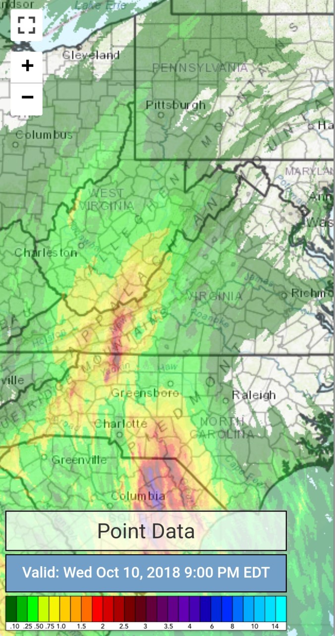
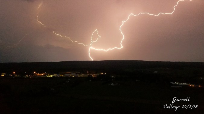
Cloudy, some fog and rains, some heavy.
Temp profile this afternoon


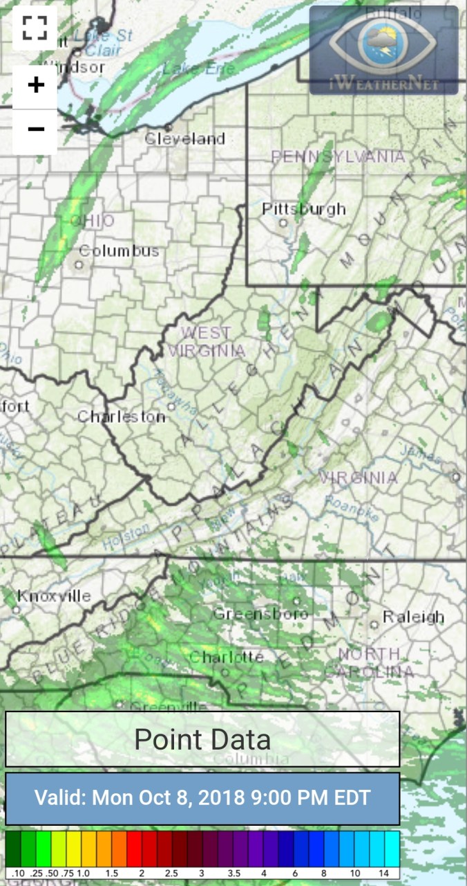
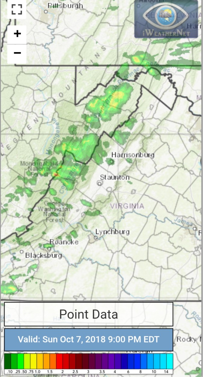
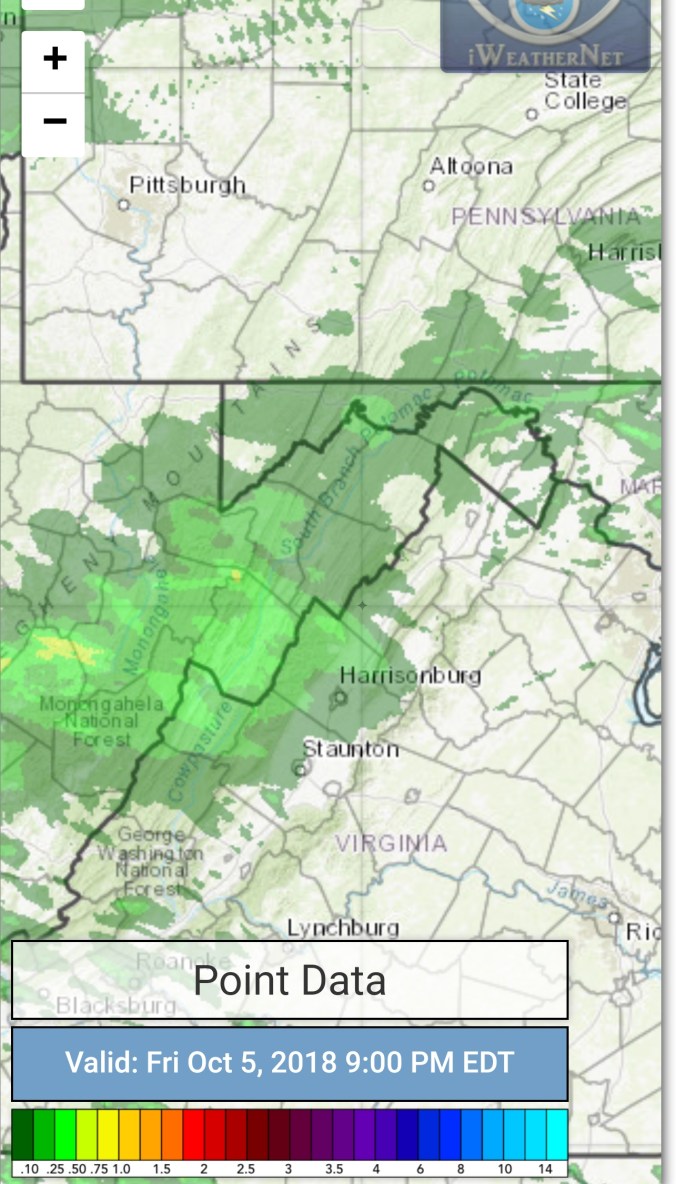
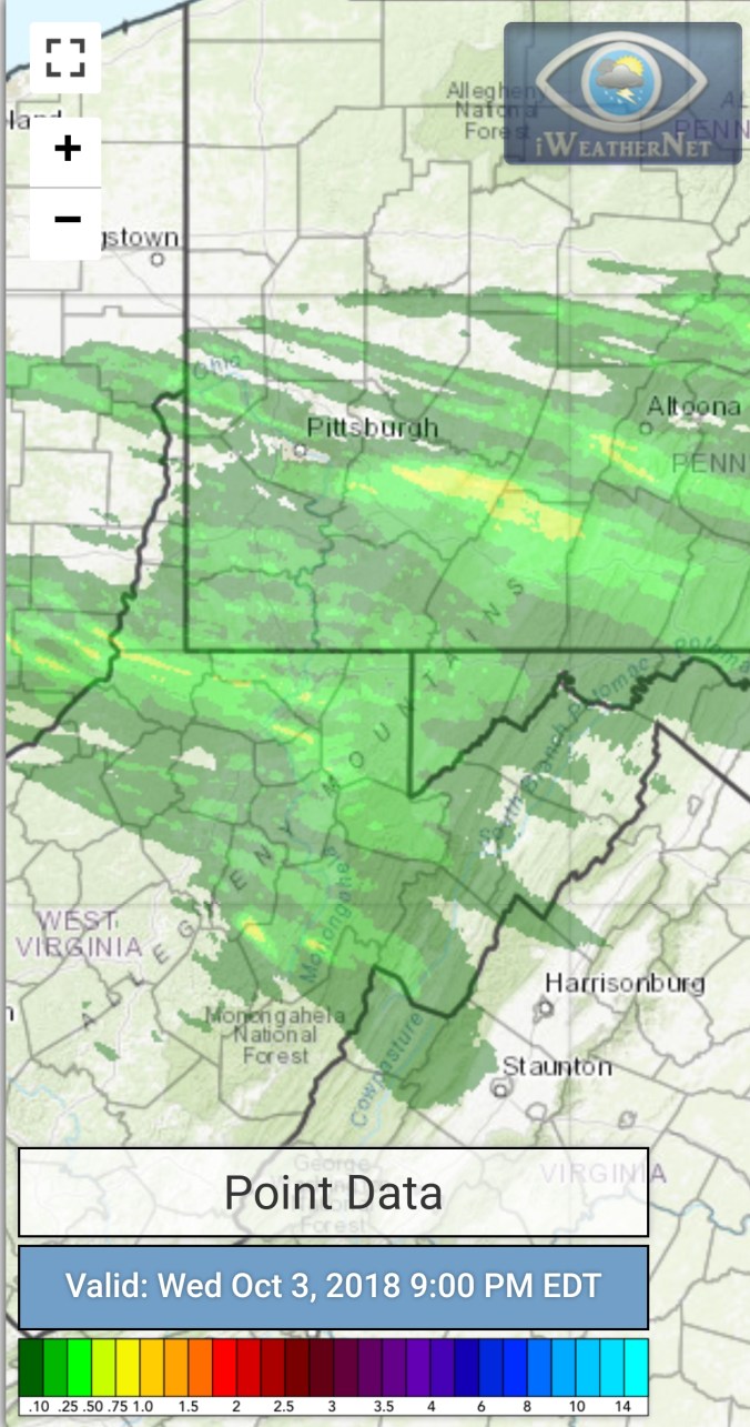
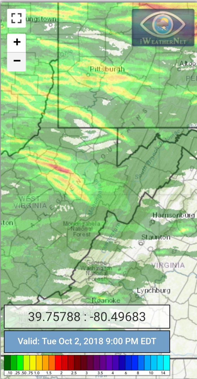
Radar with estimates 9pm-9pm … Event rainfall total at Bittinger 2nw Valley 1.7″


Some other stations event totals


Satellite
Flow
Surface features and 500mb height anomalies and flow


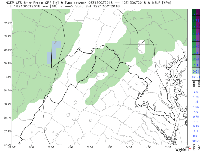
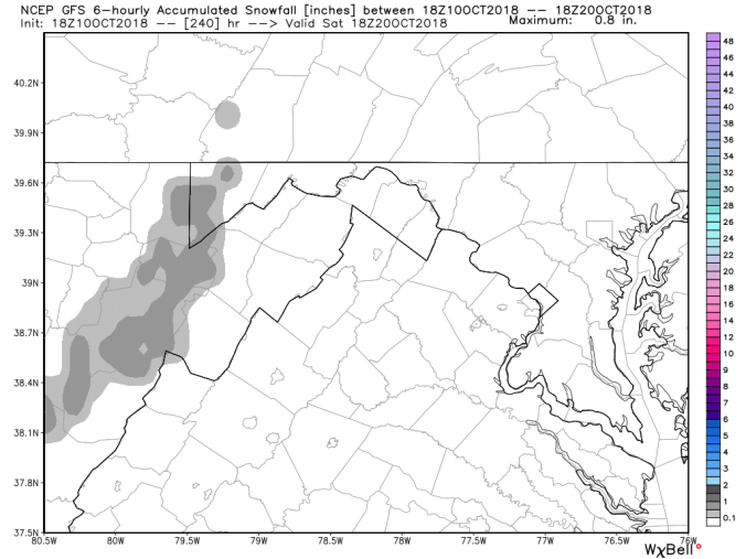
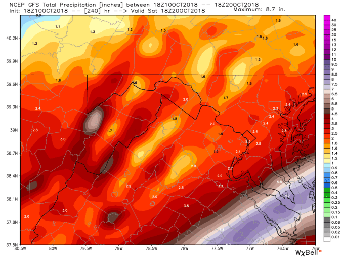
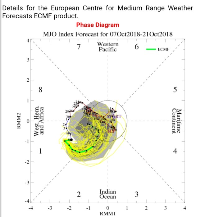
On the models….
Colder air pushing in. Here at 10:30pm, temps down to 37° at Mt. Mitchell, 46° Bald Knob at Canaan, 51° at Mt. Washington in N.H.
Temps falling overnight. Many high ground locations seeing their Friday max at midnight tonight. High ground from Spruce Knob and especially the Roaring Plains, Sods area will hold 30s tomorrow. Likely 35-39, elsewhere 40-45°. Windchills starting out 18-24° Wv high ground above 3800′, 25-34°elsewhere in the Mts. Some very early morning rime possible above 4000′ before breaks of sun occur….Friday night into Saturday, precip pushes back in. This looks to have some flakes above 2600′, and possible coatings above 3700′. Especially the northern Alleghenies where there currently looks to be a touch more precip. Saturday holds 30s above 3700′, and 40-45° elsewhere. Windchills again start 18-24° across those high spots. 25-35 elsewhere. Similar temps into Sunday.
0z 3km Nam 2m temperatures
0z 3km Nam Windchills
0z 3km Nam Simulated Radar
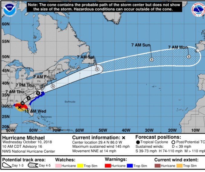
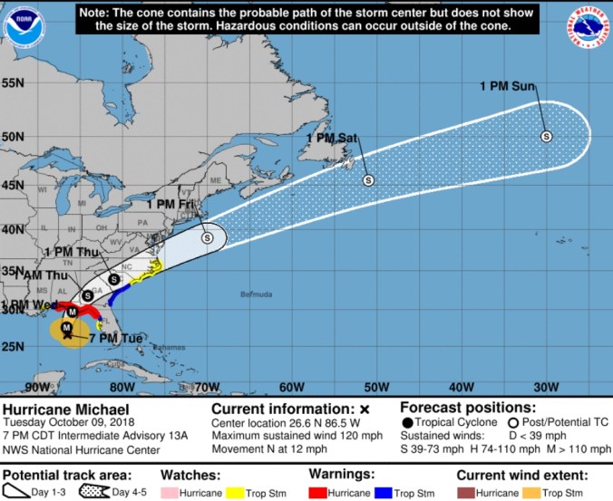
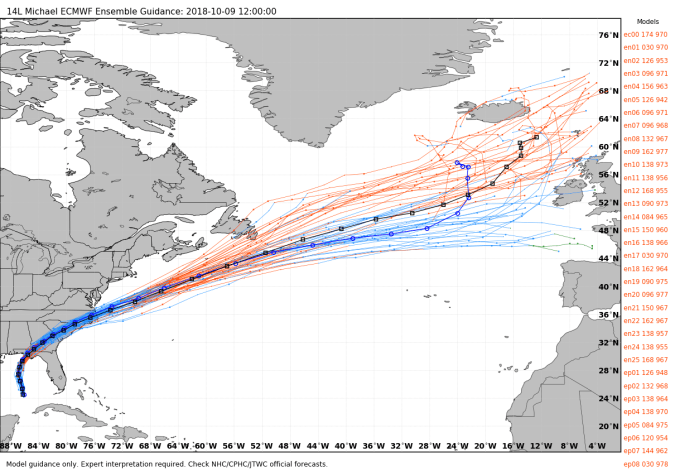
Hurricane Michael
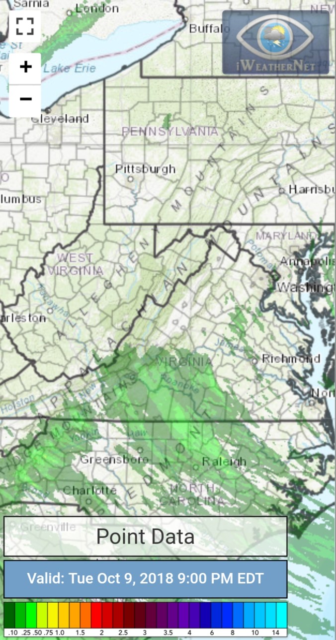
Aftermath