December 12, 2019
Dec 12(Thurs)
High overcast, east flow
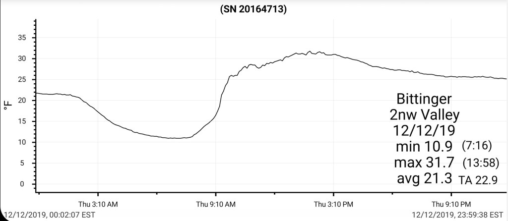
Bittinger 2nw Valley
MIN[10.9]—MAX[31.7]—AVGERAGE MEAN[21.3]—TRUE AVERAGE[22.9]—PRECIP[0]
Garrett College
MIN[14.1]—MAX[35.3]—AVERAGE MEAN[24.7]—TRUE AVERAGE[24.9]

Canaan Heights/Davis 3SE
Will be filled in later
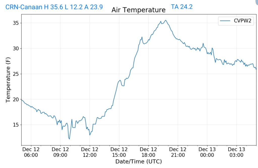
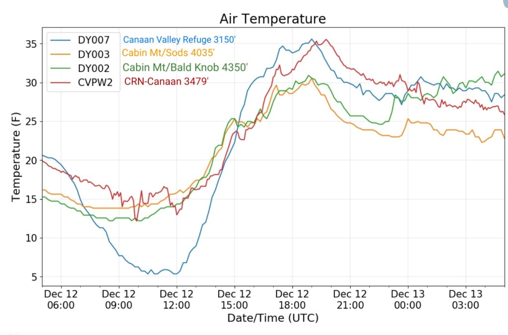
Climate Reference Network Canaan
MIN[12.2]—MAX[35.6]—AVERAGE MEAN[23.9]—TRUE AVERAGE[24.2]—PRECIP[0]
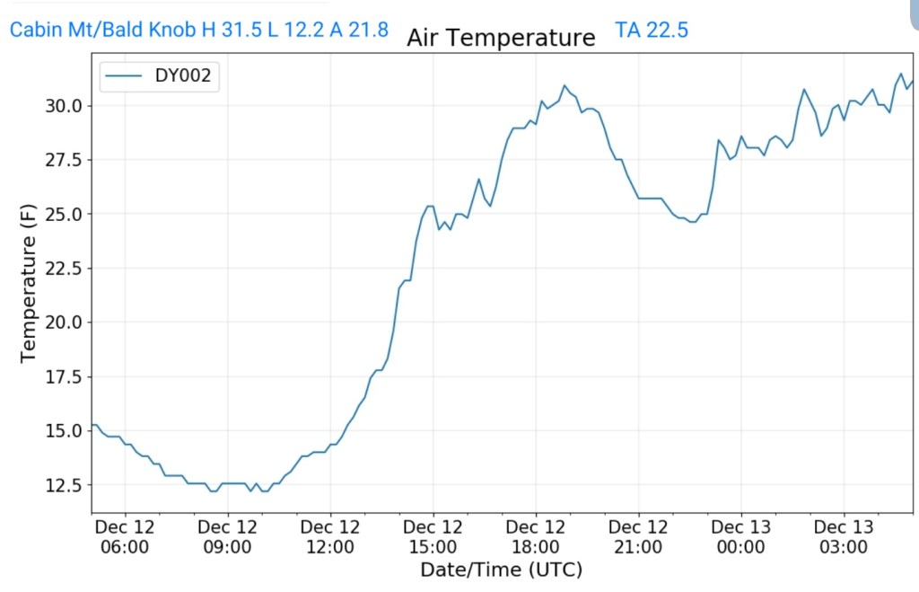
Cabin Mt at Bald Knob
MIN[12.2]—MAX[31.5]—AVERAGE MEAN[21.8]—TRUE AVERAGE[22.5]—PRECIP[0]
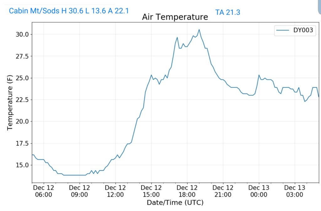
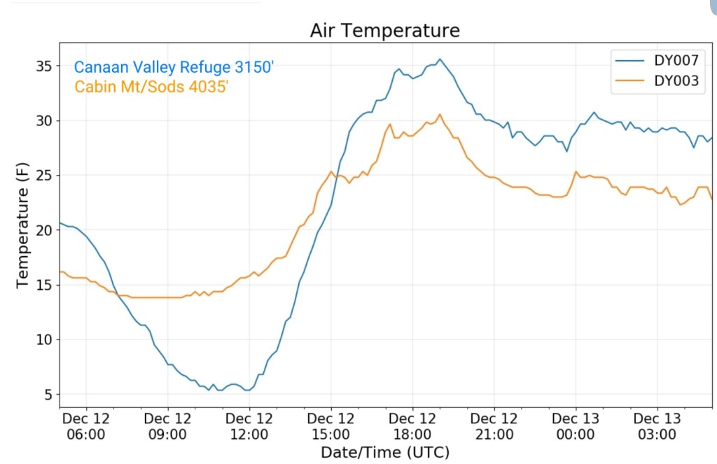
Cabin Mt-Western Sods
MIN[13.6]—MAX[30.6]—AVERAGE MEAN[22.1]—TRUE AVERAGE[21.3]—PRECIP[0]
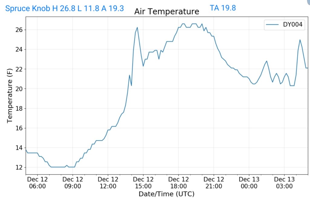
Spruce Knob
MIN[11.8]—MAX[26.8]—AVERAGE MEAN[19.3]—TRUE AVERAGE[19.8]
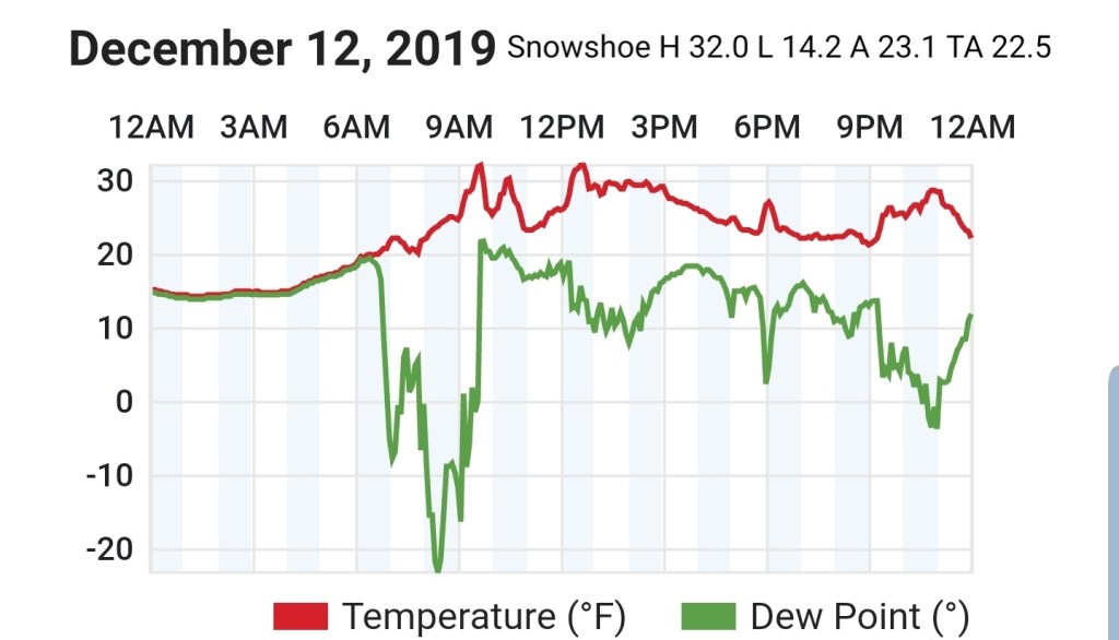
Snowshoe
MIN[14.2]—MAX[32.0]—AVERAGE MEAN[23.1]—TRUE AVERAGE[22.5]
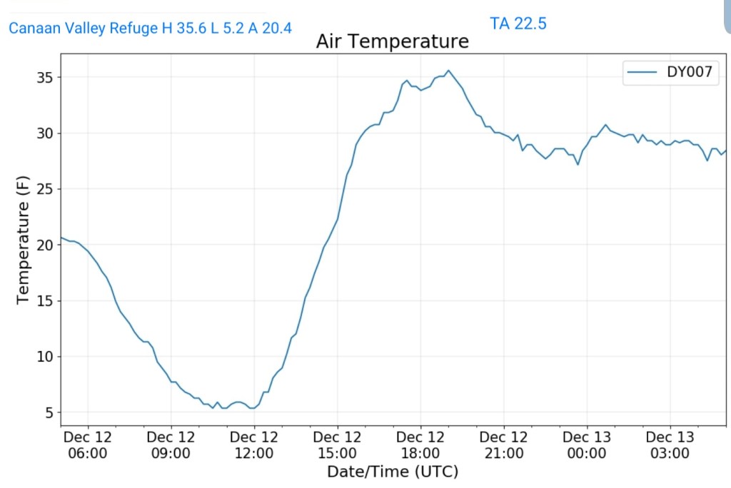
Canaan Valley Refuge
MIN[5.2]—MAX[35.6]—AVERAGE MEAN[20.4]—TRUE AVERAGE[22.5]
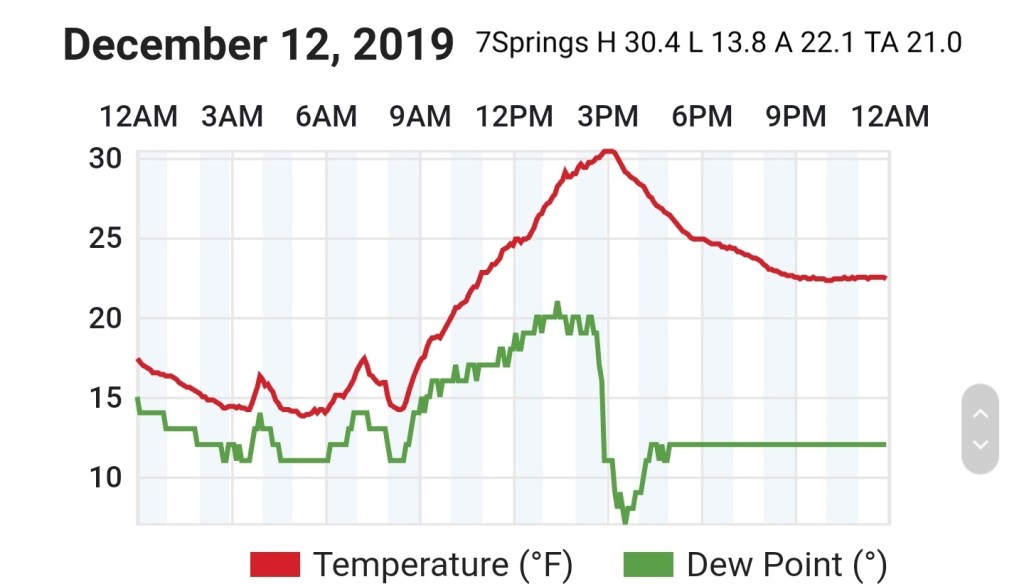
7Springs
MIN[13.8]—MAX[30.4]—AVERAGE MEAN[22.1]—TRUE AVERAGE[21.0]
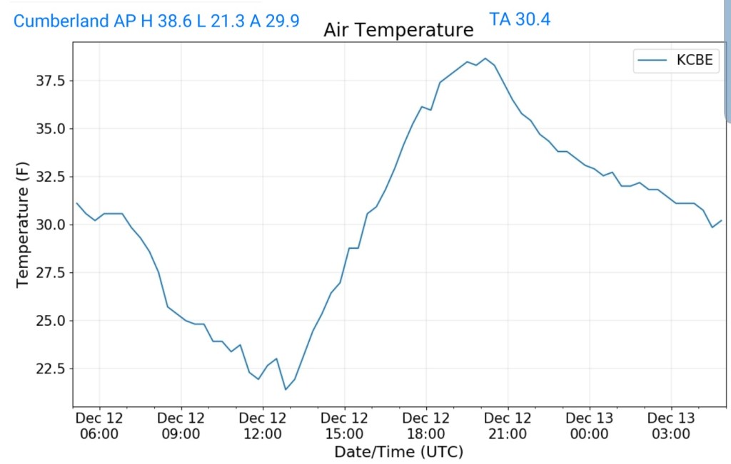
Cumberland Airport
MIN[21.3]—MAX[38.6]—AVERAGE MEAN[29.9]—TRUE AVERAGE[30.4]
The Valley vs Cabin Mt

Canaan area temps
Comparison view

RTMA
Radar
Void
Satellite
Flow
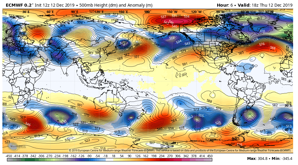
Surface features and 500mb height anomalies and flow

Afternoon update:
Afternoon thoughts based off the latest model runs-
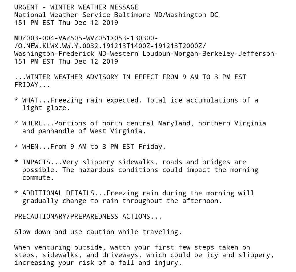
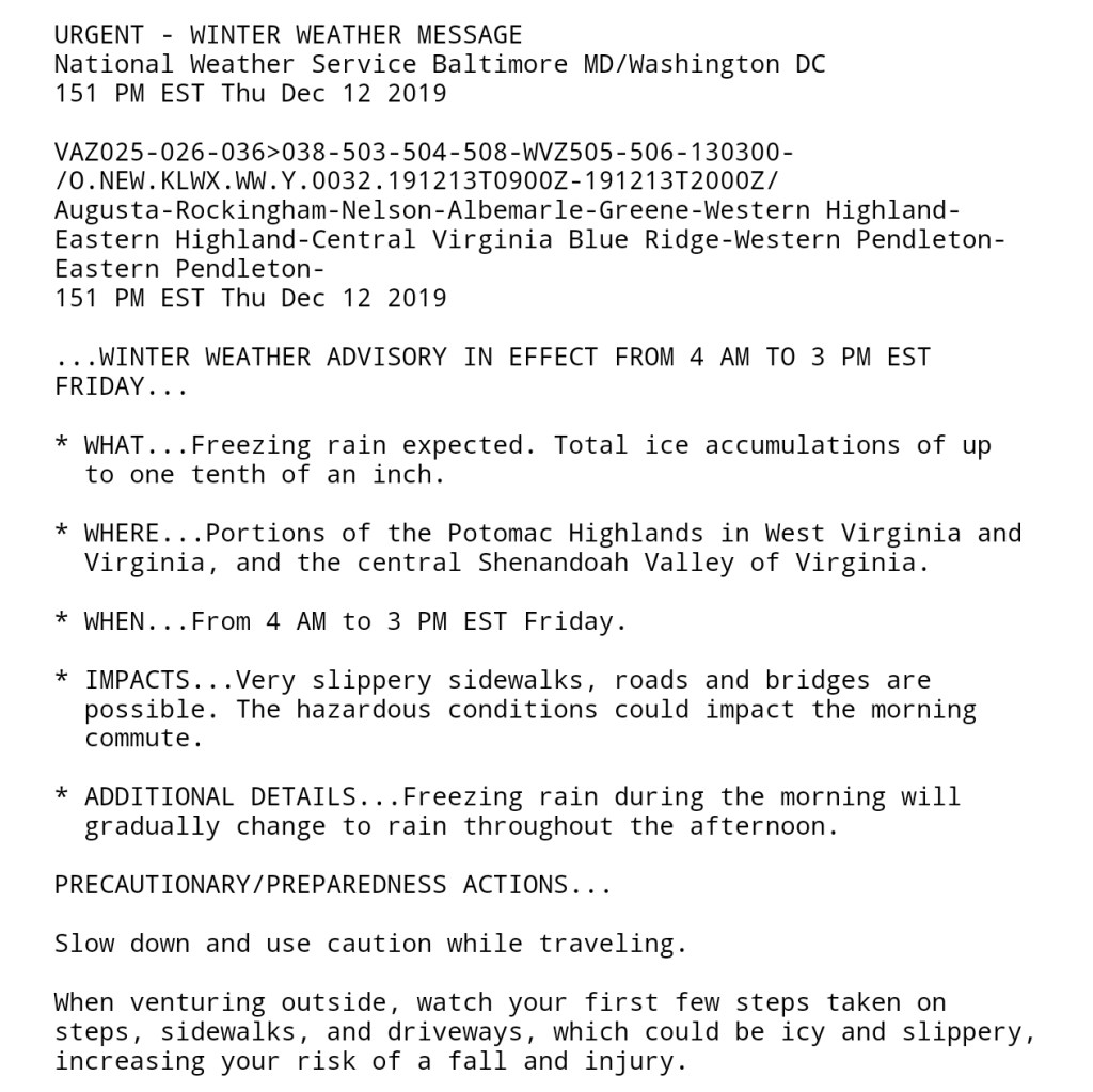
Light precip pushes in to the southern areas in the region in the morning. Main concern is a light freezing rain glazing things over. This pushes north through the day. Overall precip is mostly light. Tomorrow night, any areas in the classic high elevation ice zones(those same spots that’s saw ice on Dec 1) that are typical holdouts for freezing rain, those areas will rise +32 early in the night. The remaining areas to watch for freezing rain turns to the deeper valleys, the Savage River valleys and valleys mainly east of the Allegheny Front. Those pockets may hold below freezing into Saturday morning.
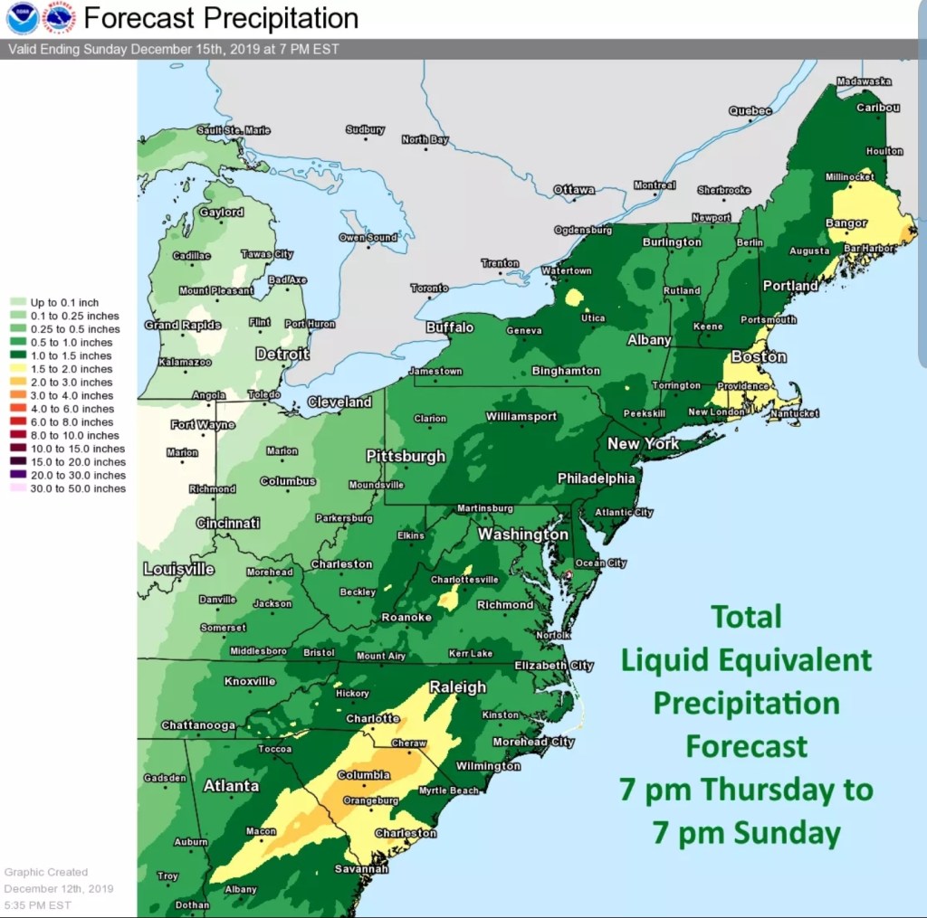
Temps creep up across the board post dawn Saturday, rain into the afternoon region wide. Early to mid afternoon that rain begins to transition to snow, first across the WV high ground, then north into Preston, Garrett and high ground in southern Pa.
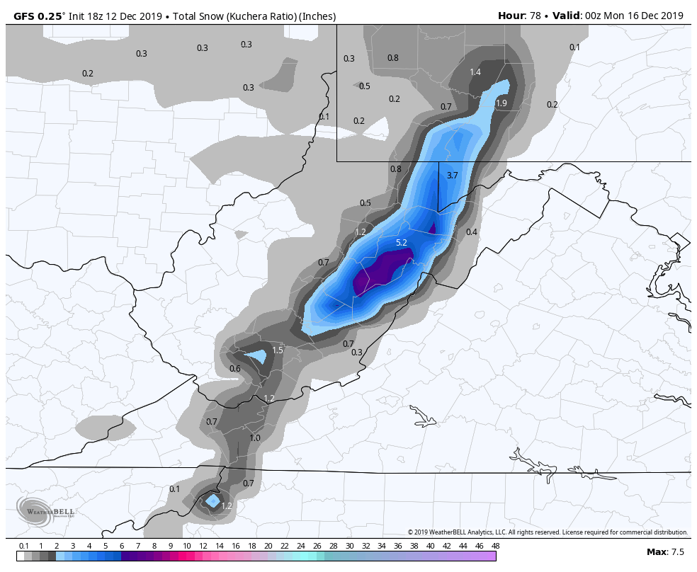
Saturday night- as of now, a steady period of snow looks likely, with periods of varied intensity into Sunday with a tapering down through the day. Temps on Sunday holding 20s, Wv high ground, upper 20s lower 30s to 2500′ lower to mid 30s below 2500. Forecast mentioning rain mixing in during the day on Sunday are very very unlikely. 850temps(near 5000′, roughly near the highest Wv areas) are modeled -5c to -8c. When its precipitating across the high ground, temps at 5000′ of 17f to 23f, you are not changing to liquid. There is no diurnal and even less so on December 15th.
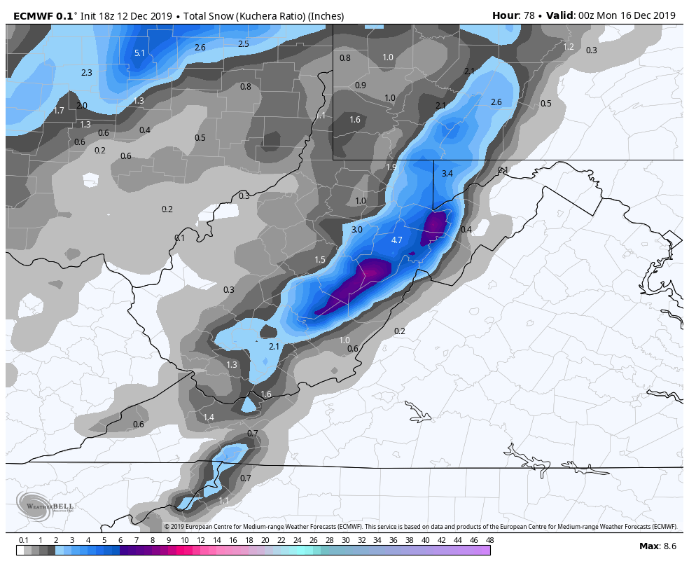
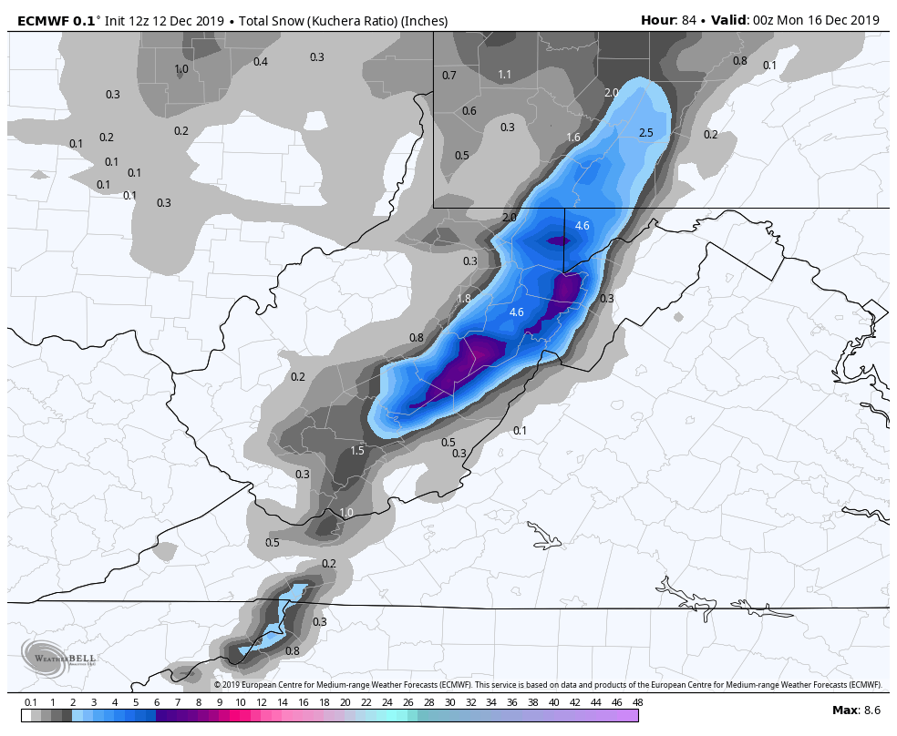
A struggle within the modeling has been precipitation amounts and therefore snow fall amounts. Lots of agreement currently in place within the models and that has not been all that common. A early call, if you can say Thursdsy afternoon prediction for Saturday night into Sunday is early, is a 3-6″ snowfall across the Wv high ground, with 2-4″ with higher pops across Garrett, Preston, and southern high ground of Pa.
Likely tweaks on timing and amounts will occur.
A look at the models and the amount of agreement. These models will not pick up on those isolated, secluded valleys that remain below freezing. The mesoscale 3km Nam will do better(not perfect), and will post more with it tomorrow morning. It does much better than the HRRR which has a exaggerated consistent warm bias.
12z ECMWF
2m Temps
850 temps
MSLP/6HR/PRECIP TYPE
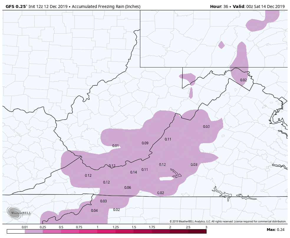
Freezing rain

Snowfall
12z GFS
2m Temps
850 Temps
MSLP/6HR/PRECIP
Freezing rain
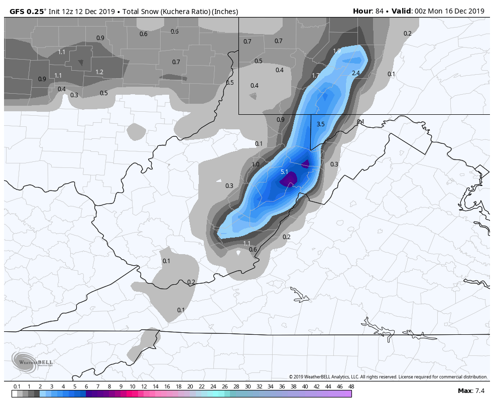
Snowfall
12z Canadian
MSLP/6HR/PRECIP
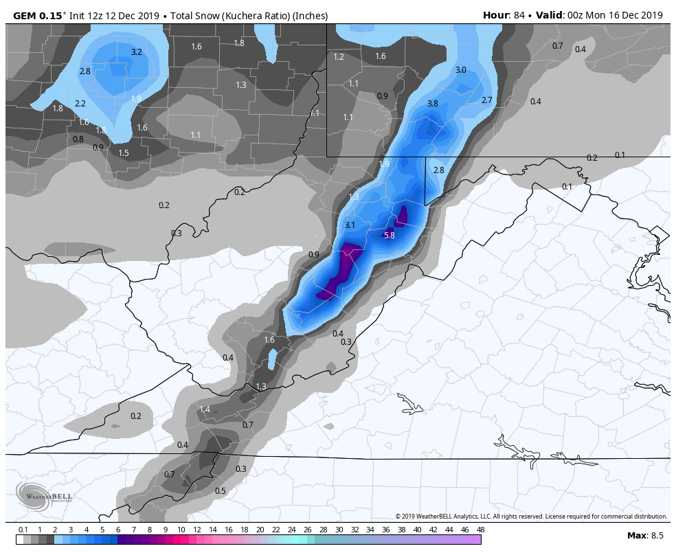
Snowfall
Again, these are model runs, only tools, not the gospel. Stay tuned
WPC OUTLOOK:
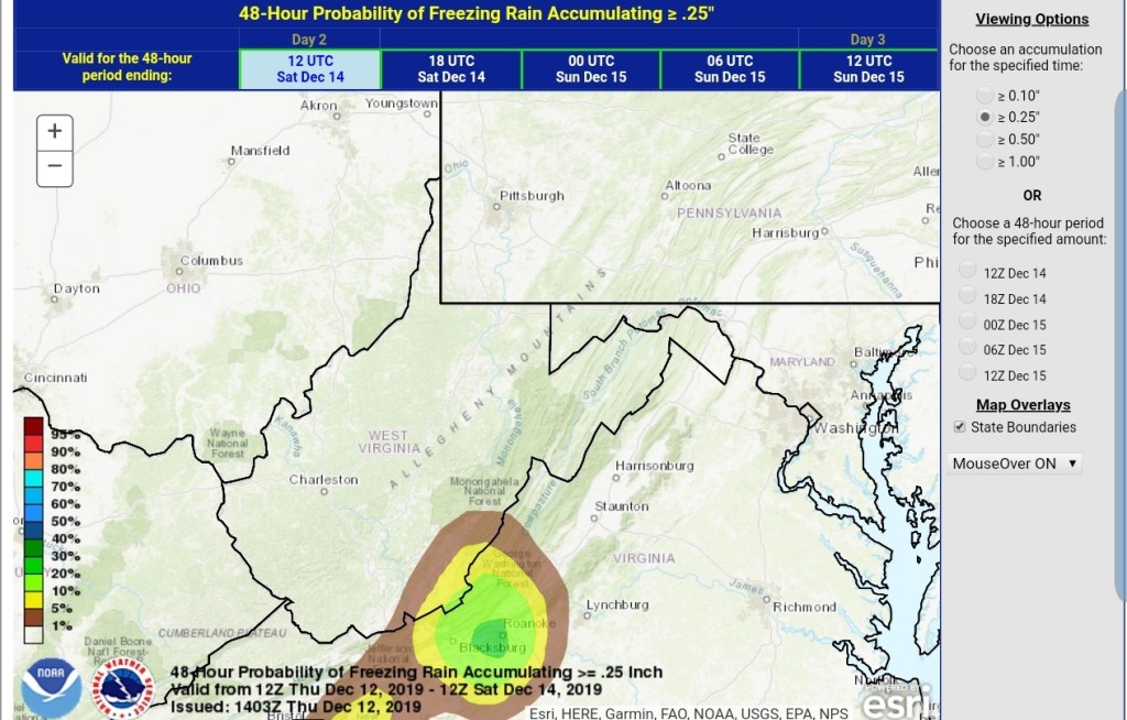
Ice- which for the southern areas mainly comes in early tomorrow, and then watch for lingering cold pockets tomorrow night in the deeper valleys. More widespread initially.
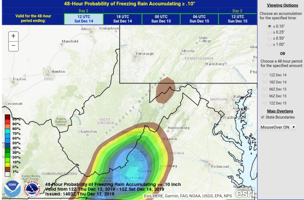
WPC Freezing rain maps.
NWS Advisories
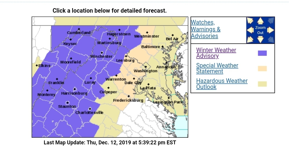

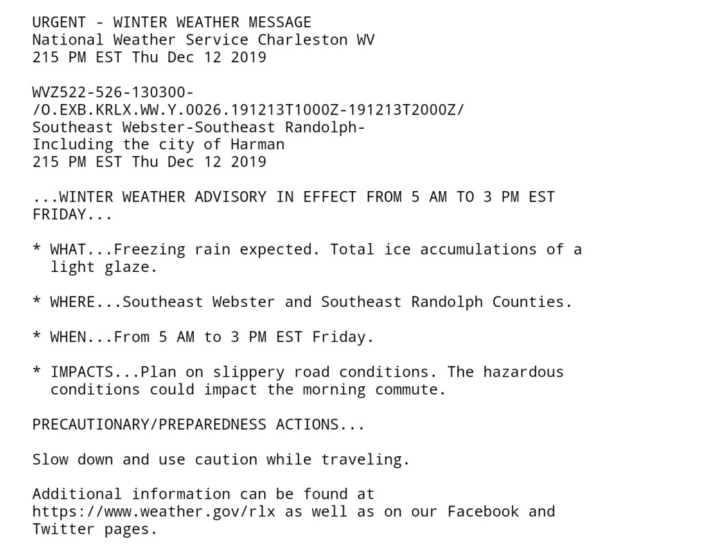

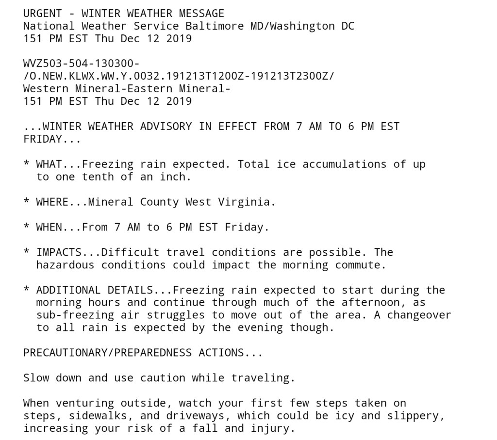
NWS products

18z GFS snowfall through Sunday 7pm
18z ECMWF snowfall