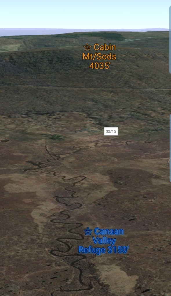
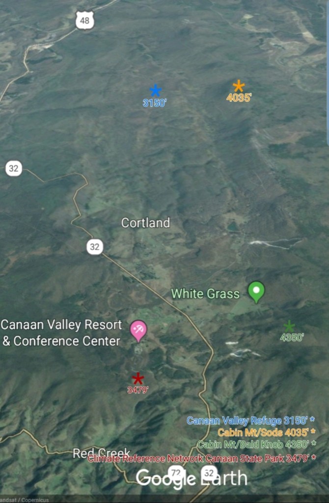
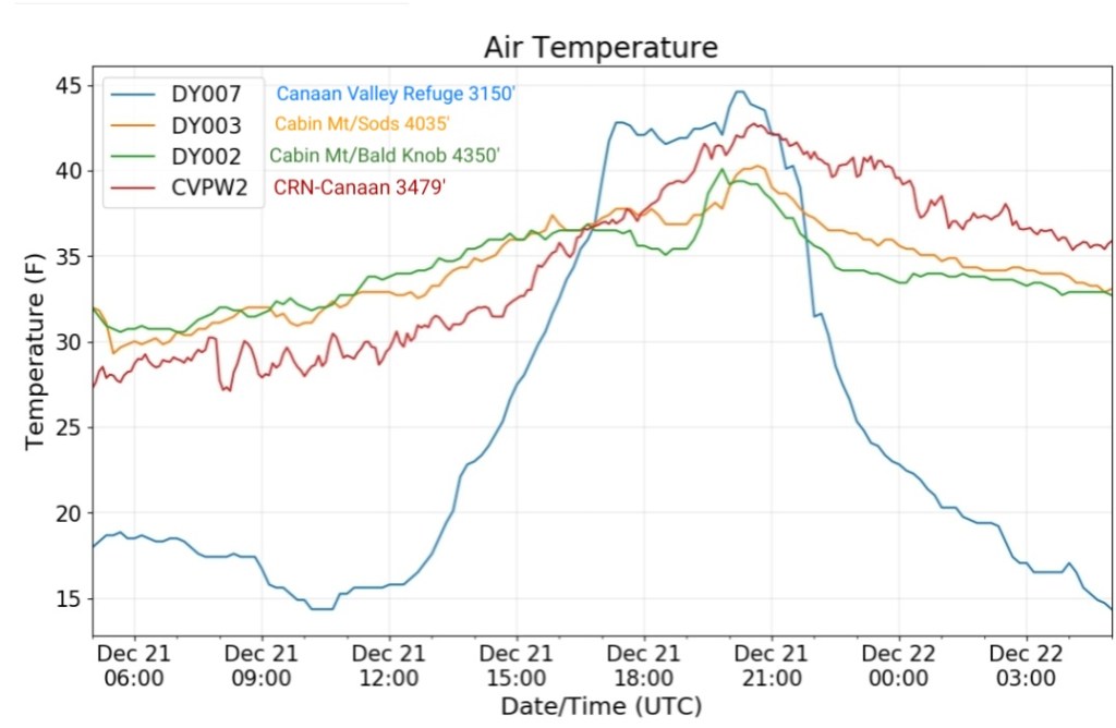
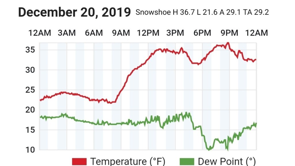
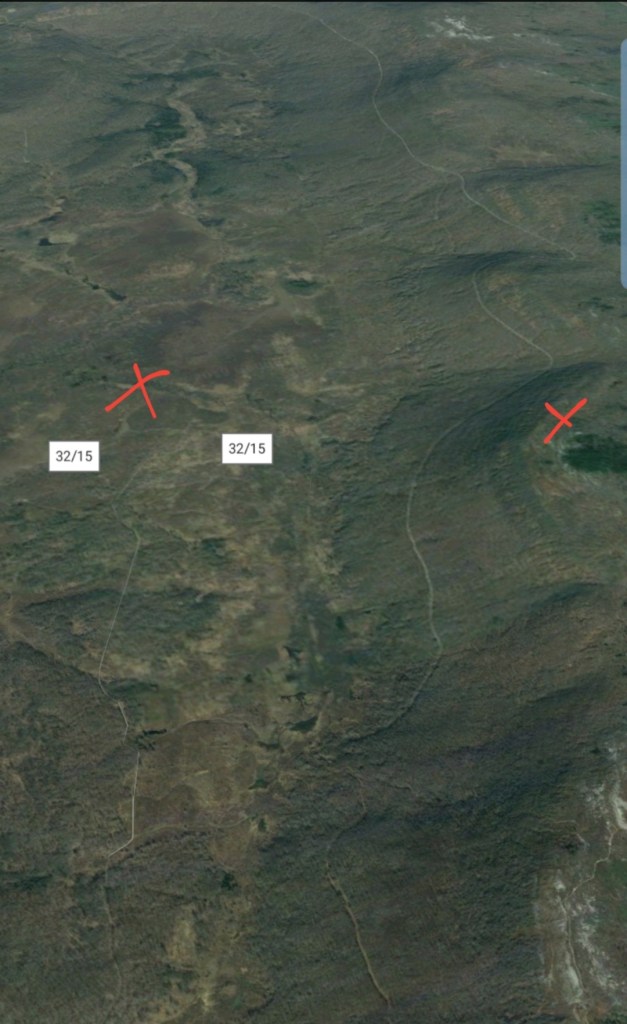
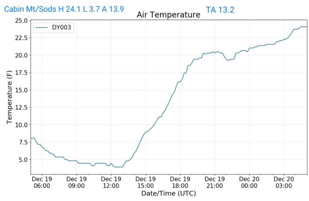
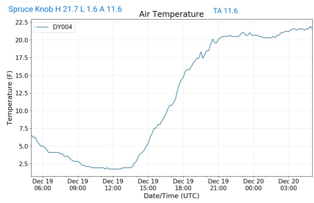
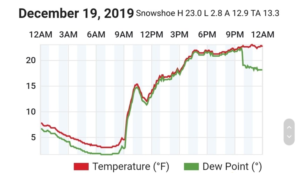
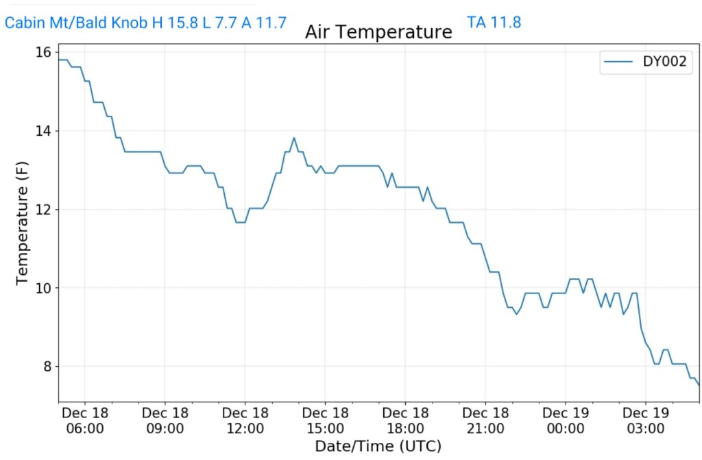
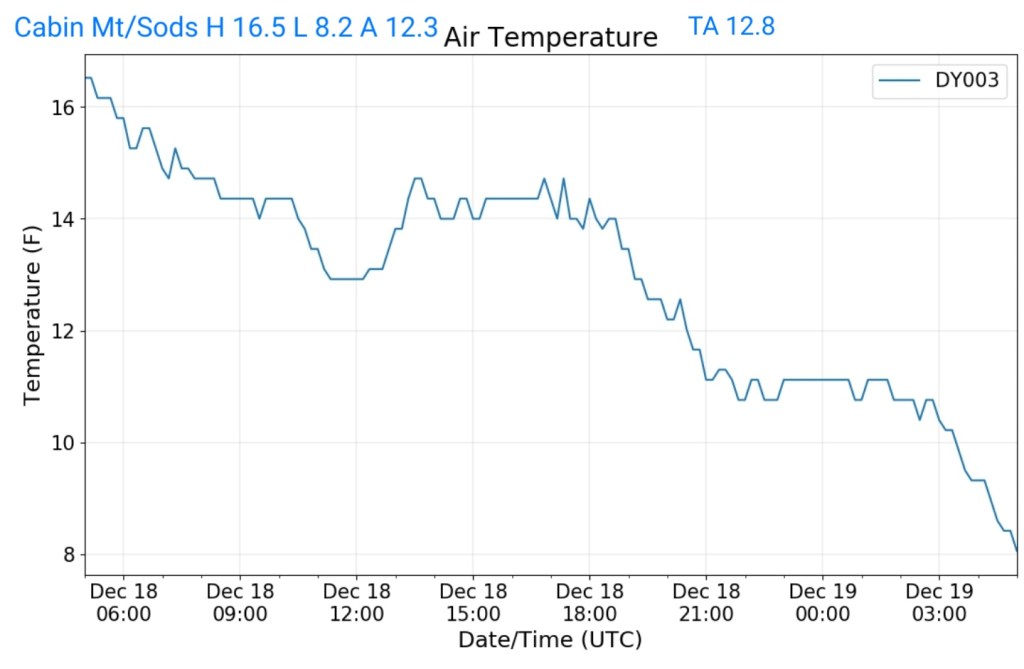
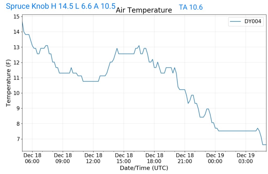
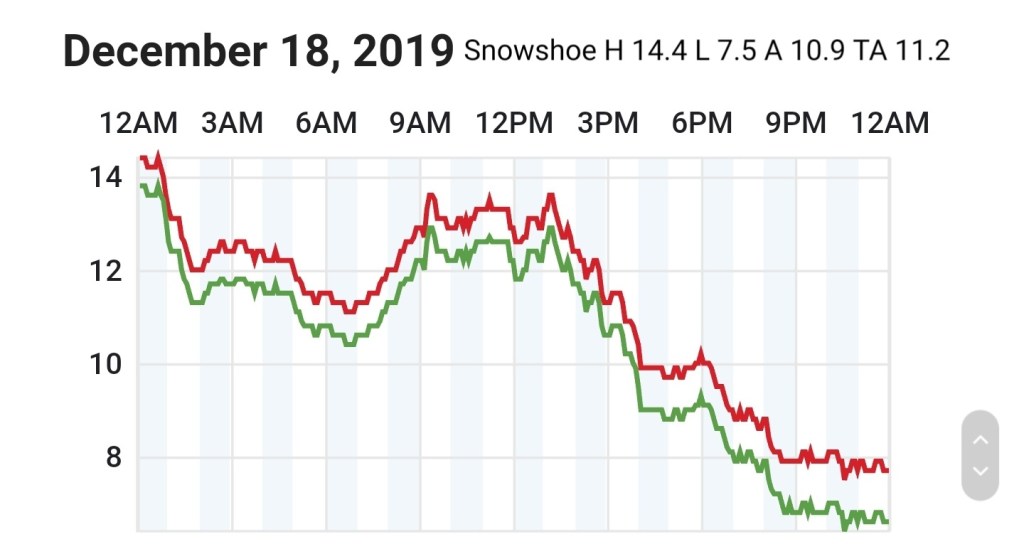
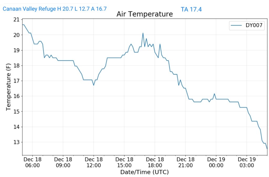
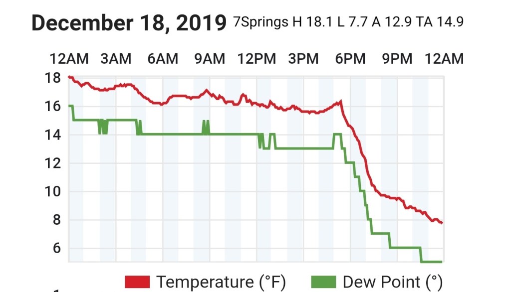
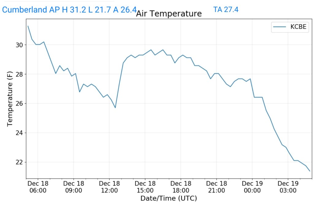
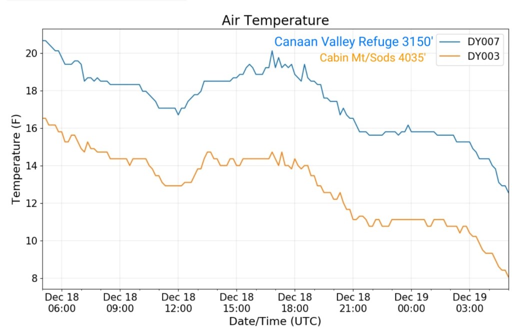
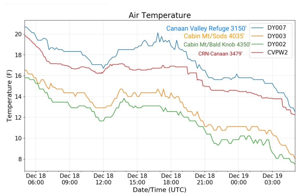
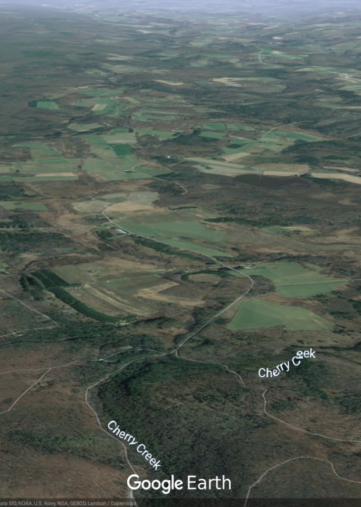
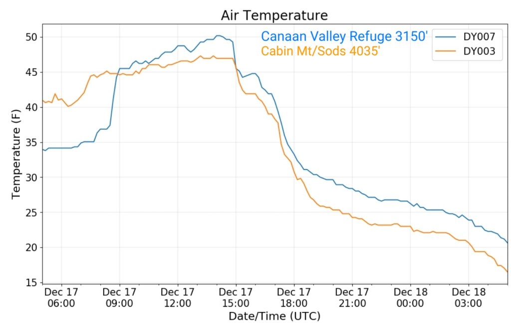
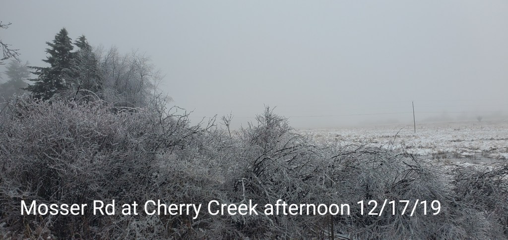
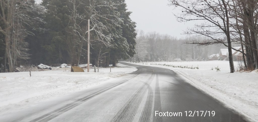
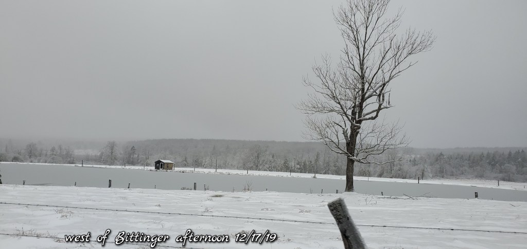
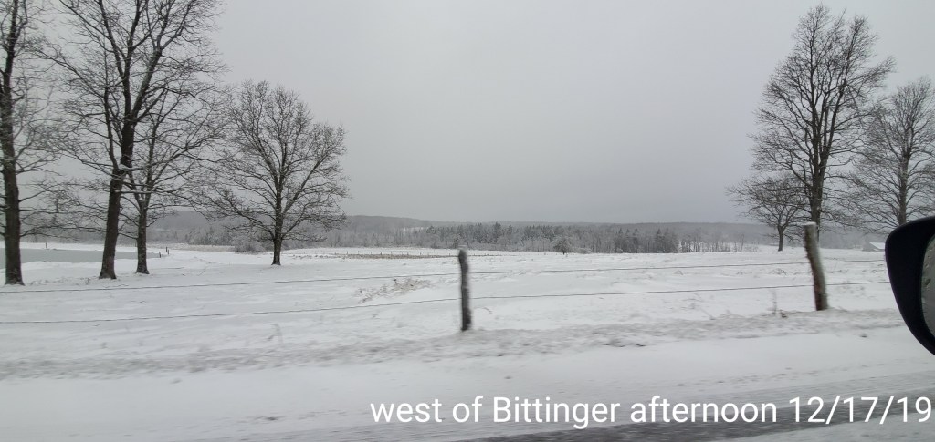
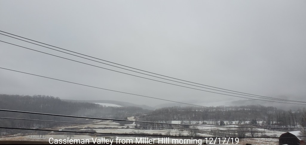
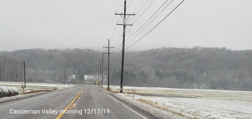
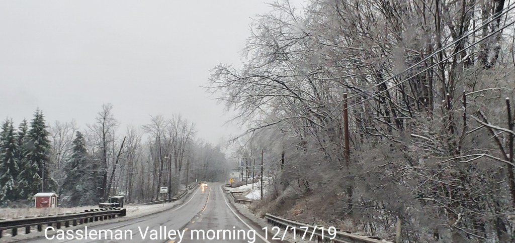
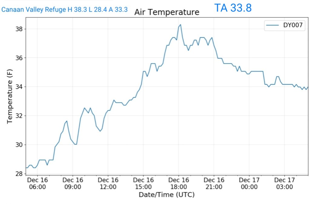
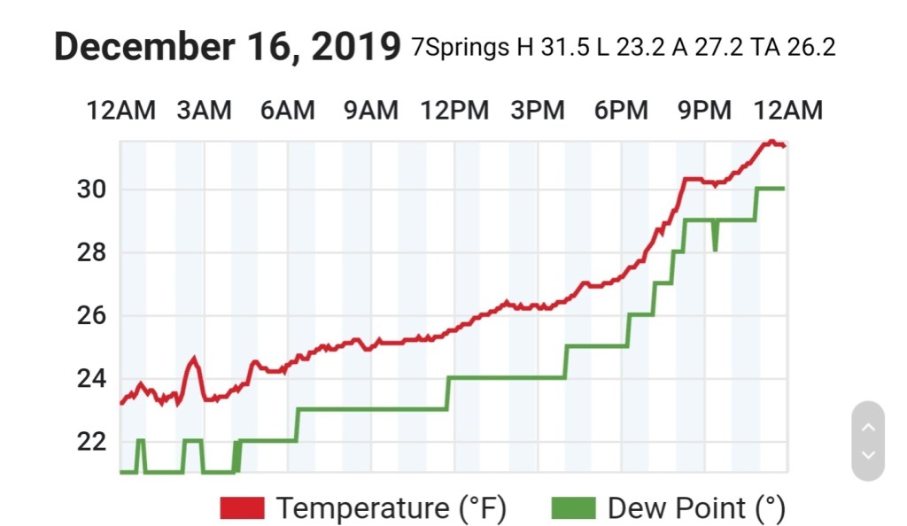
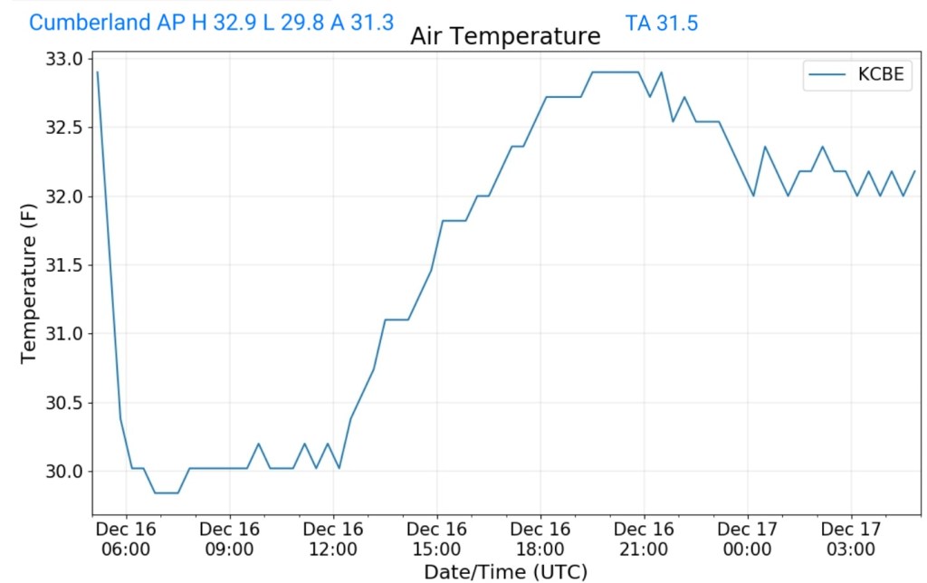
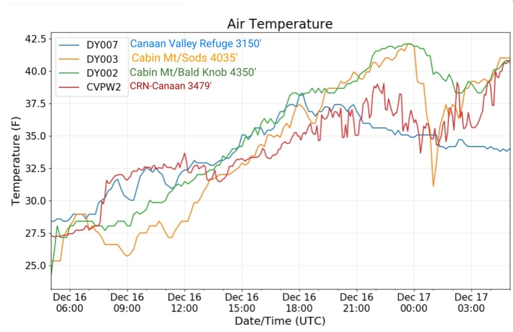
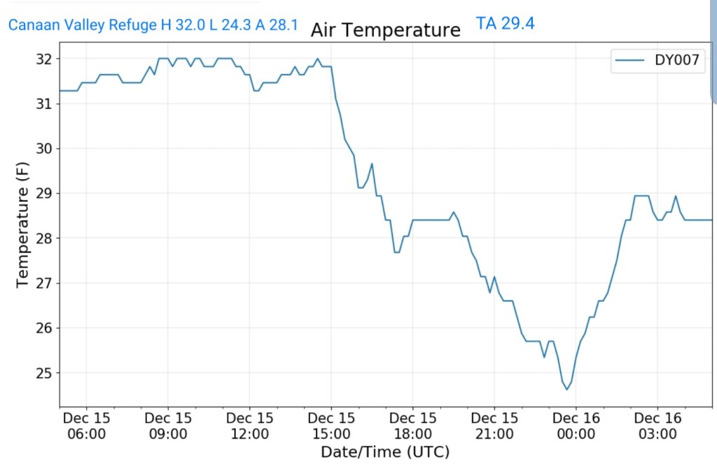
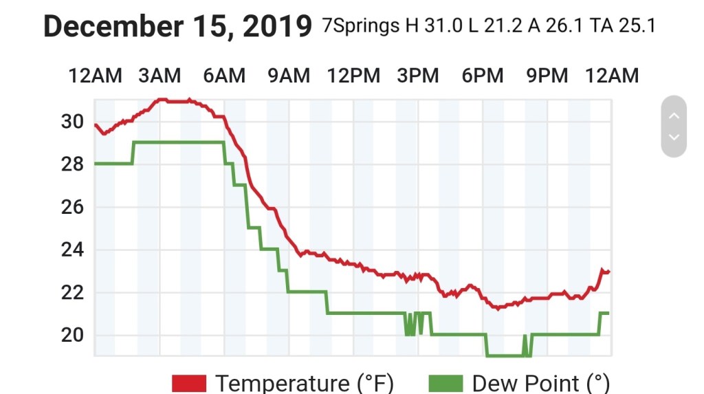
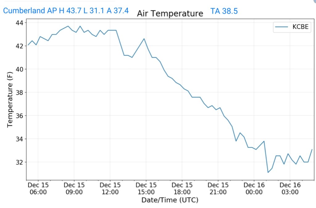
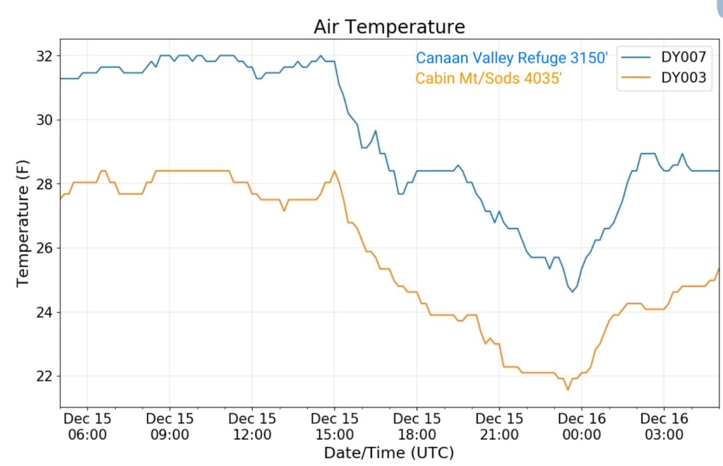
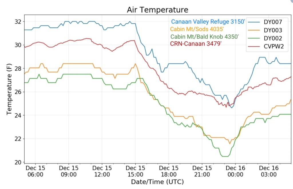
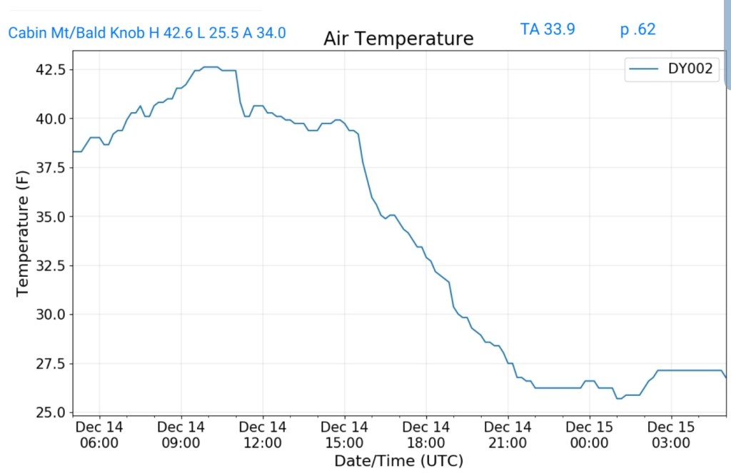
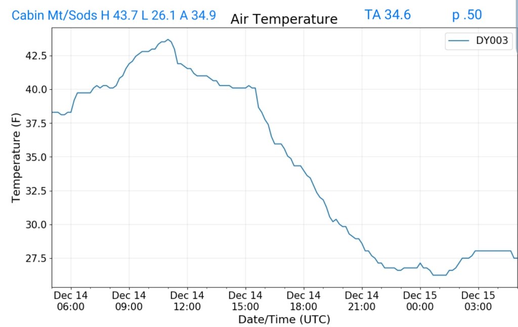
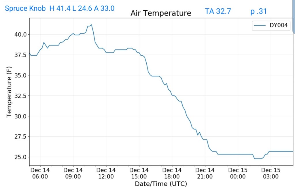
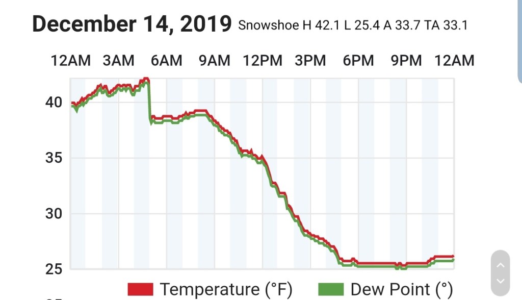
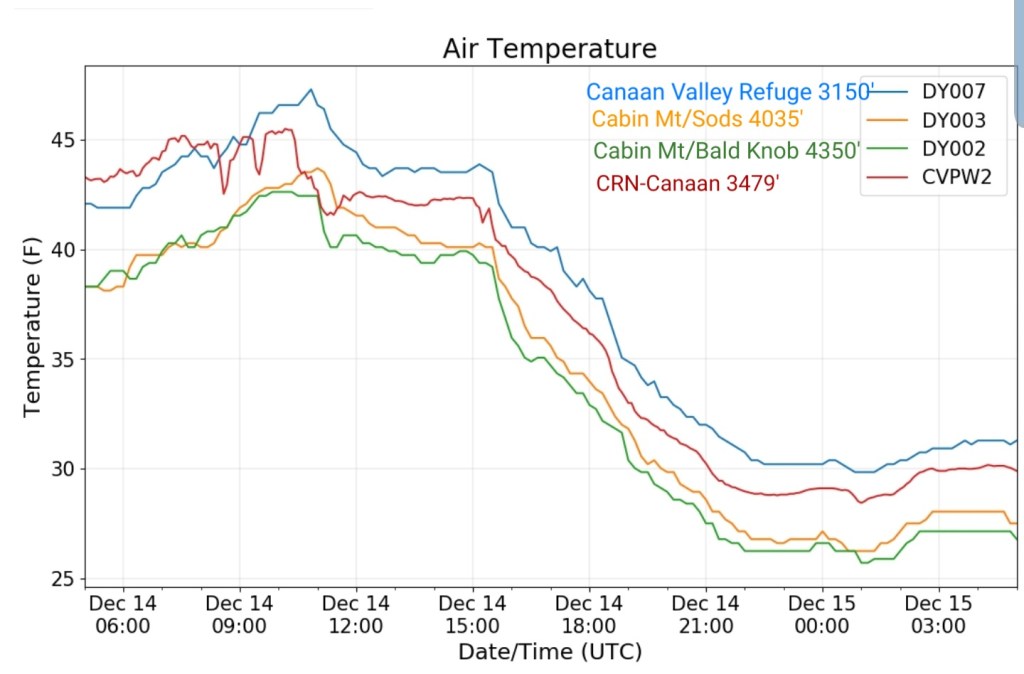
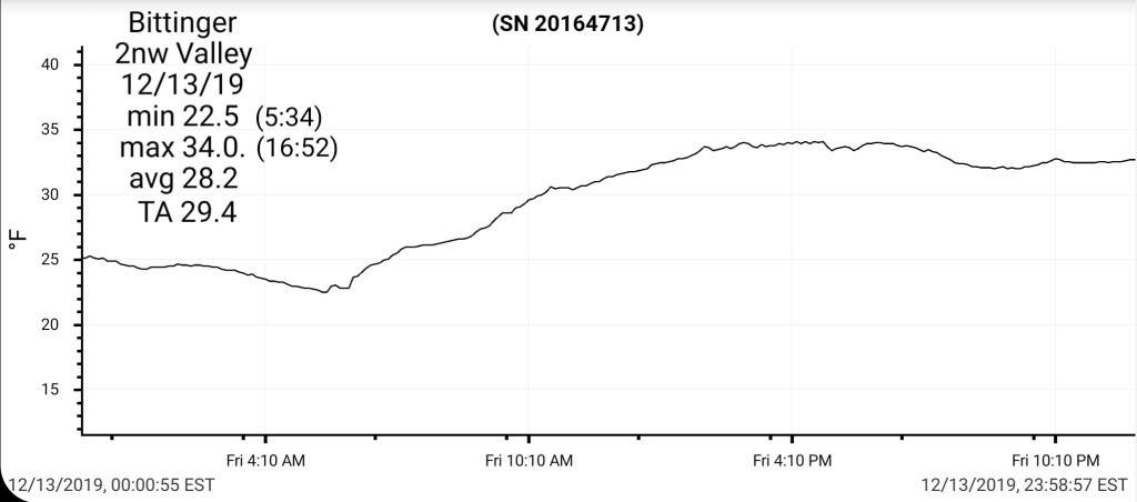
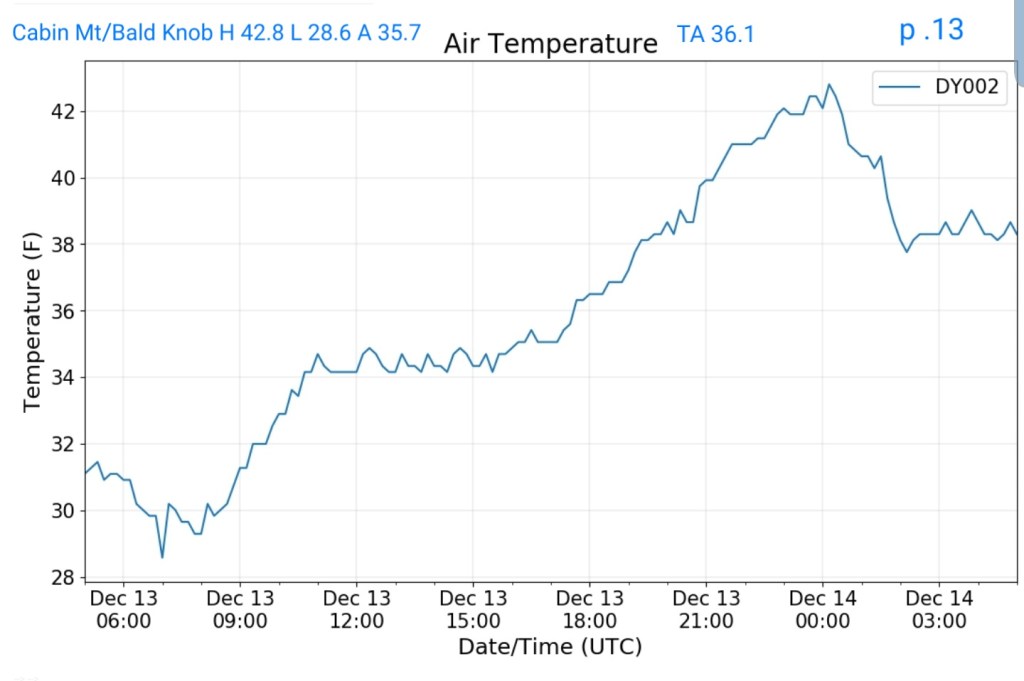
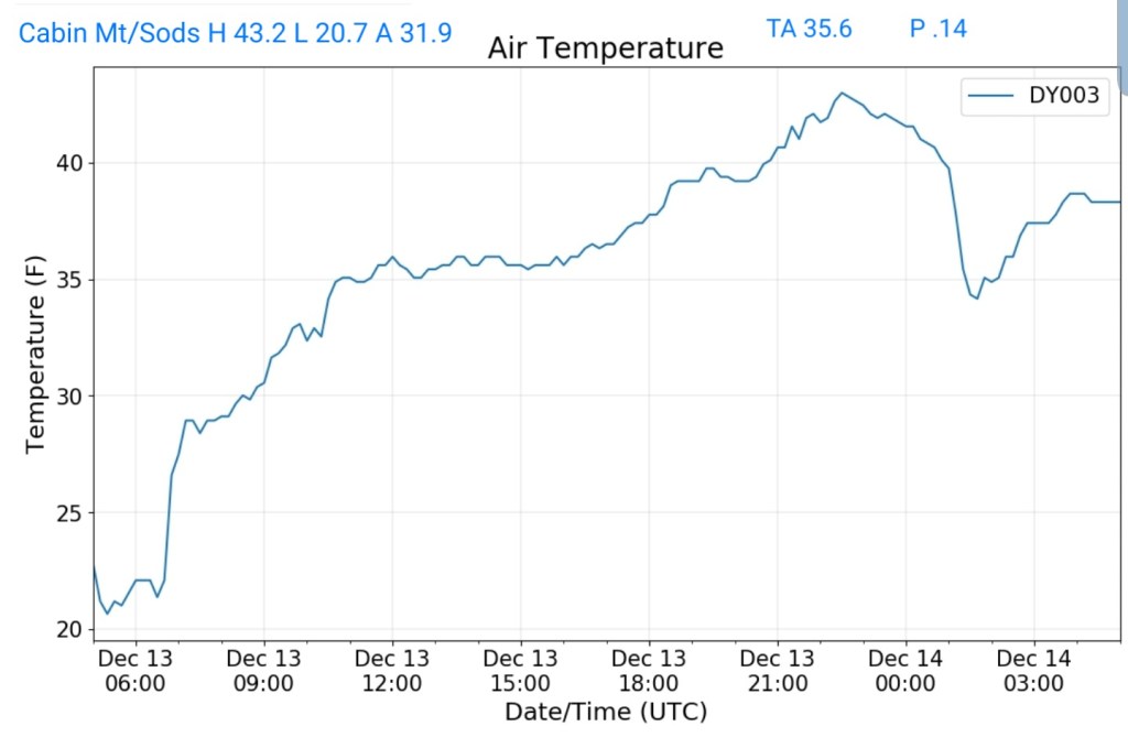
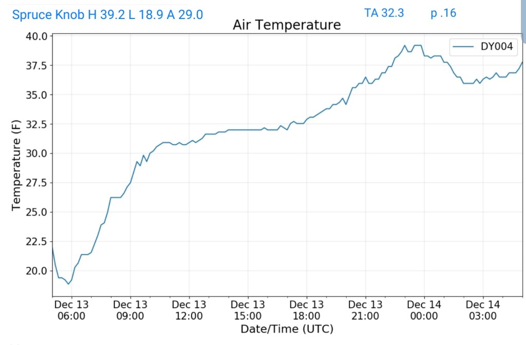
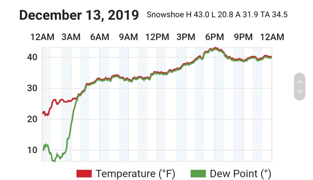
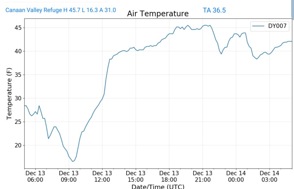
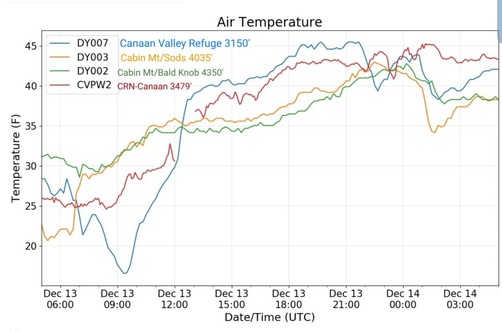
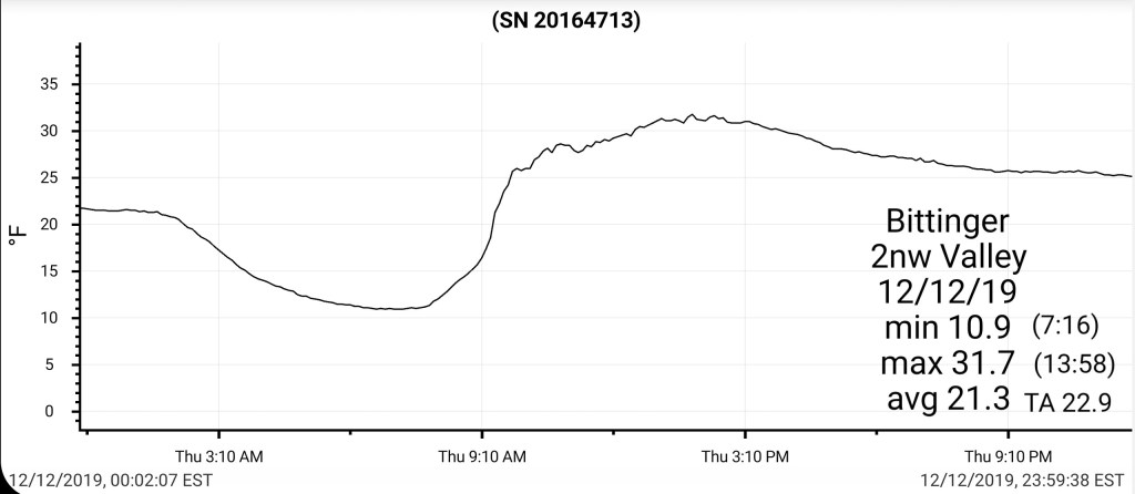
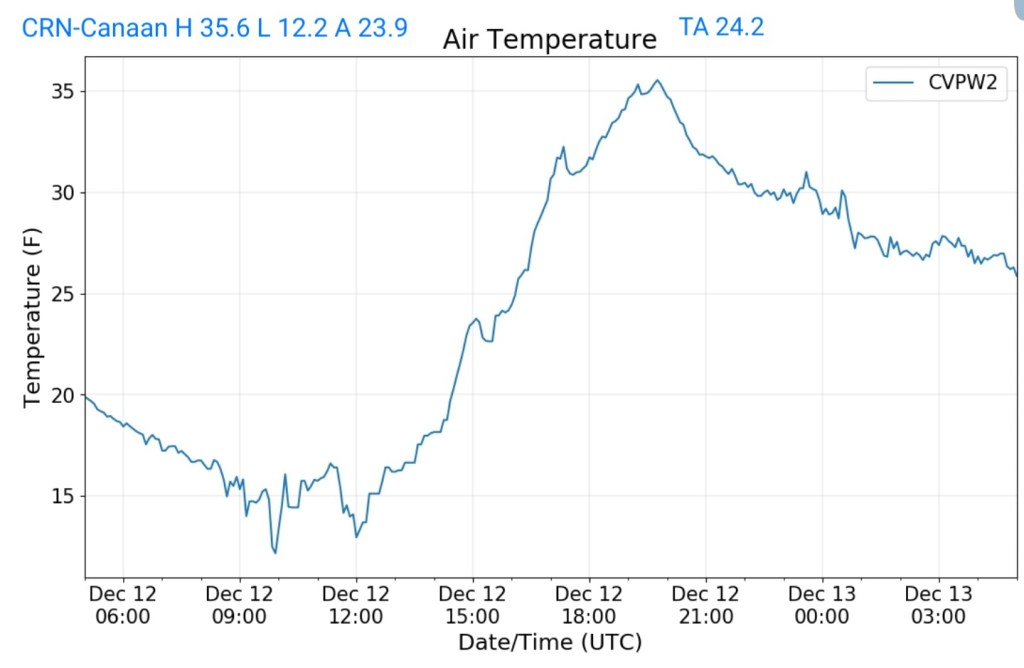
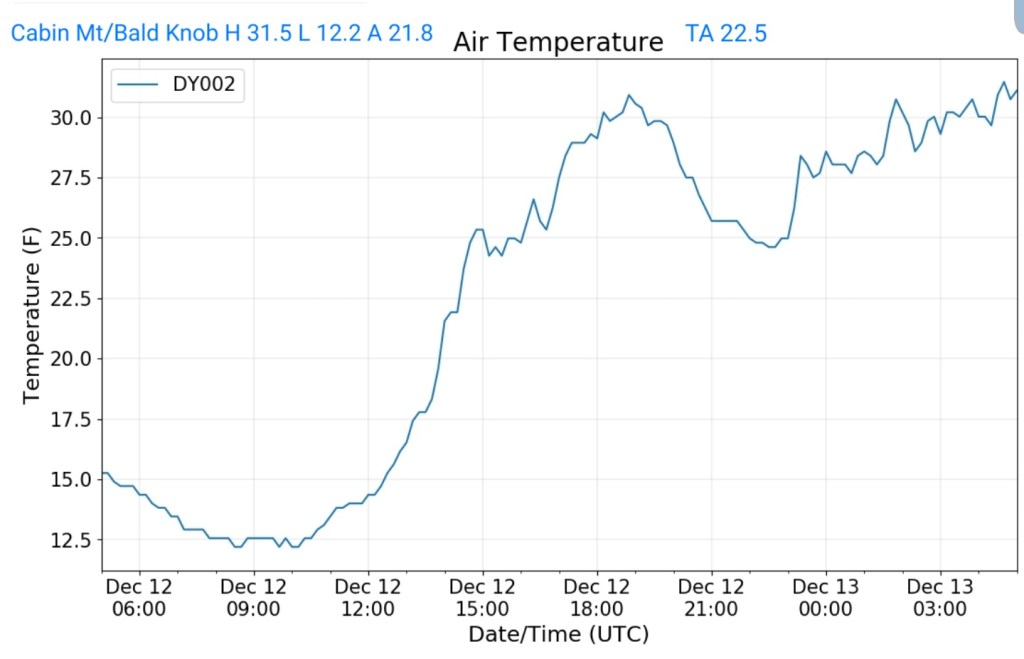
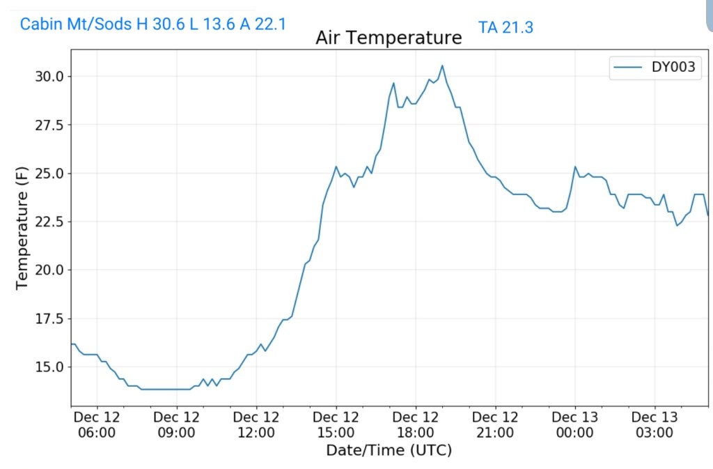
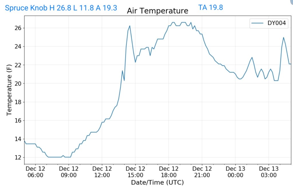
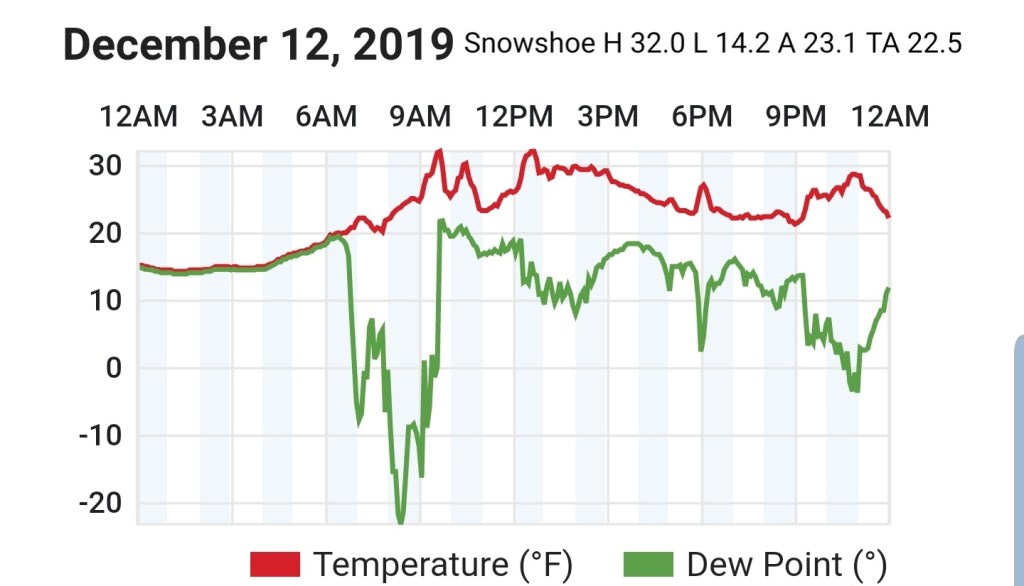
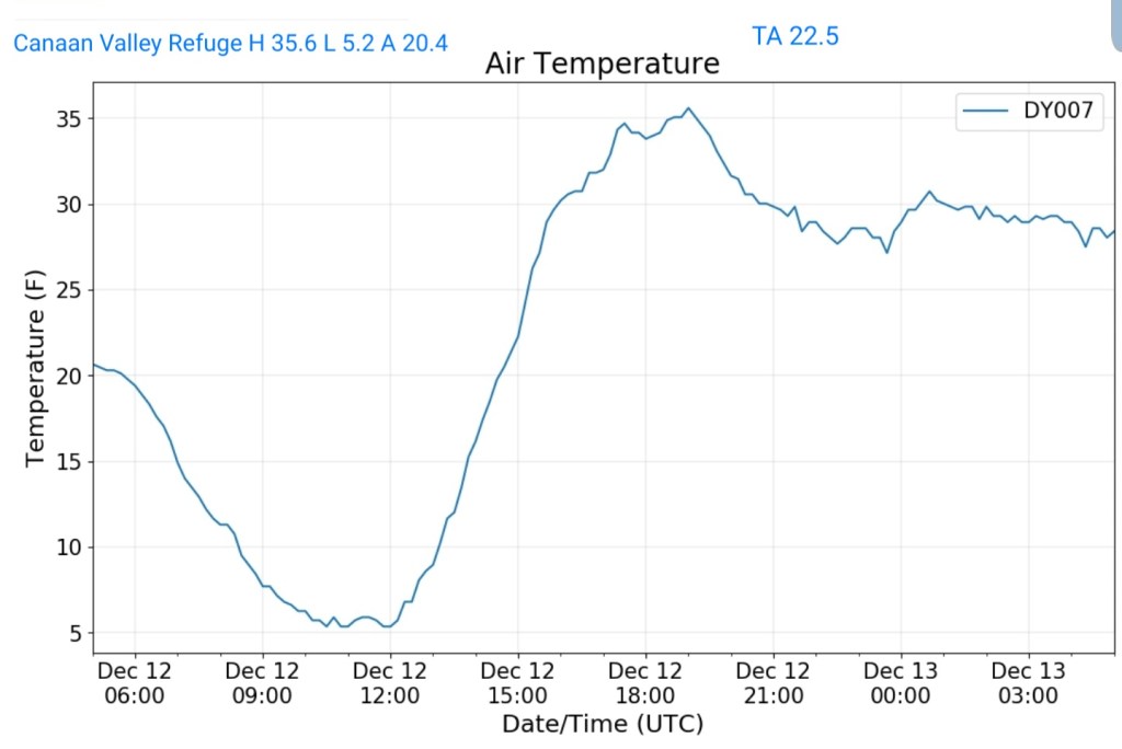
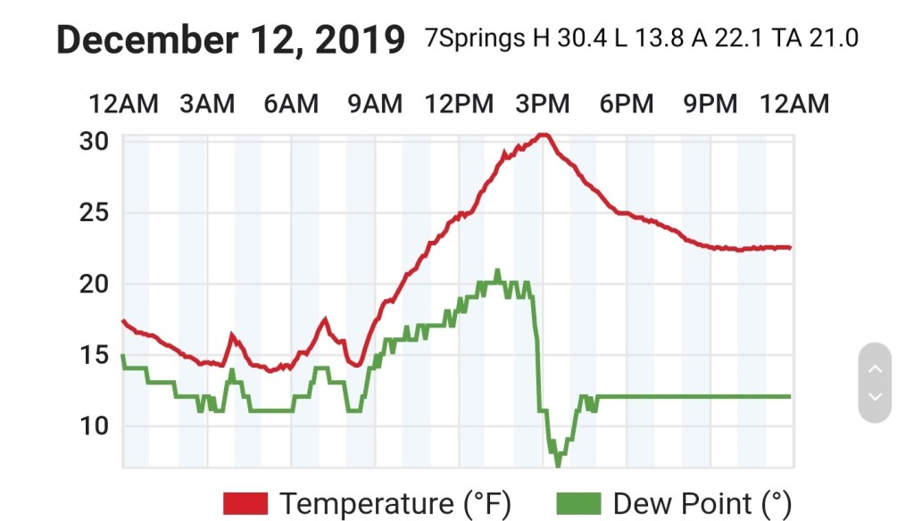
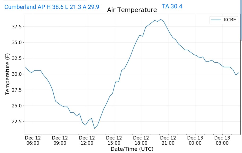
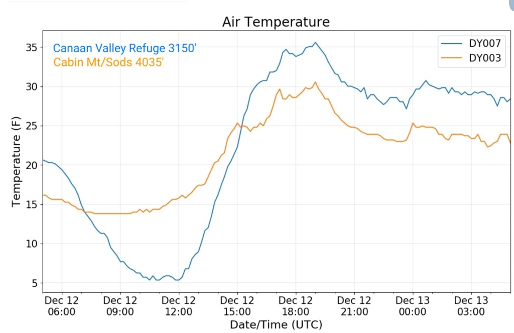
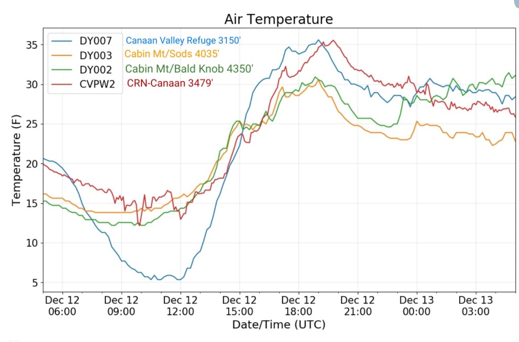
Really to illustrate the variation in a calm, still dry airmass with snowcover. The sheltered valleys really hold much chillier than elsewhere during the day and all valleys much colder at night.
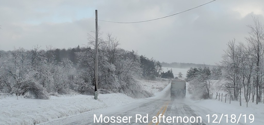
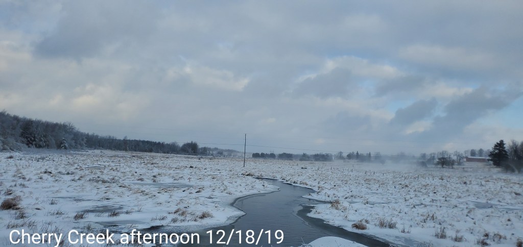
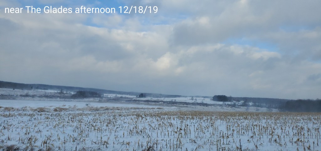
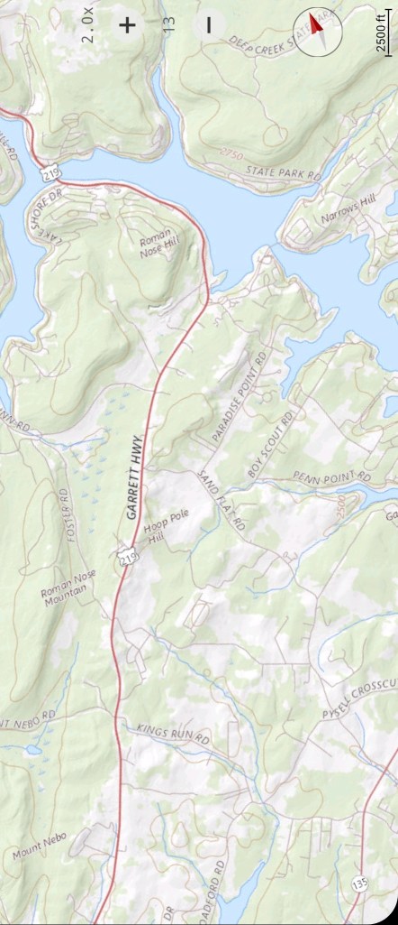
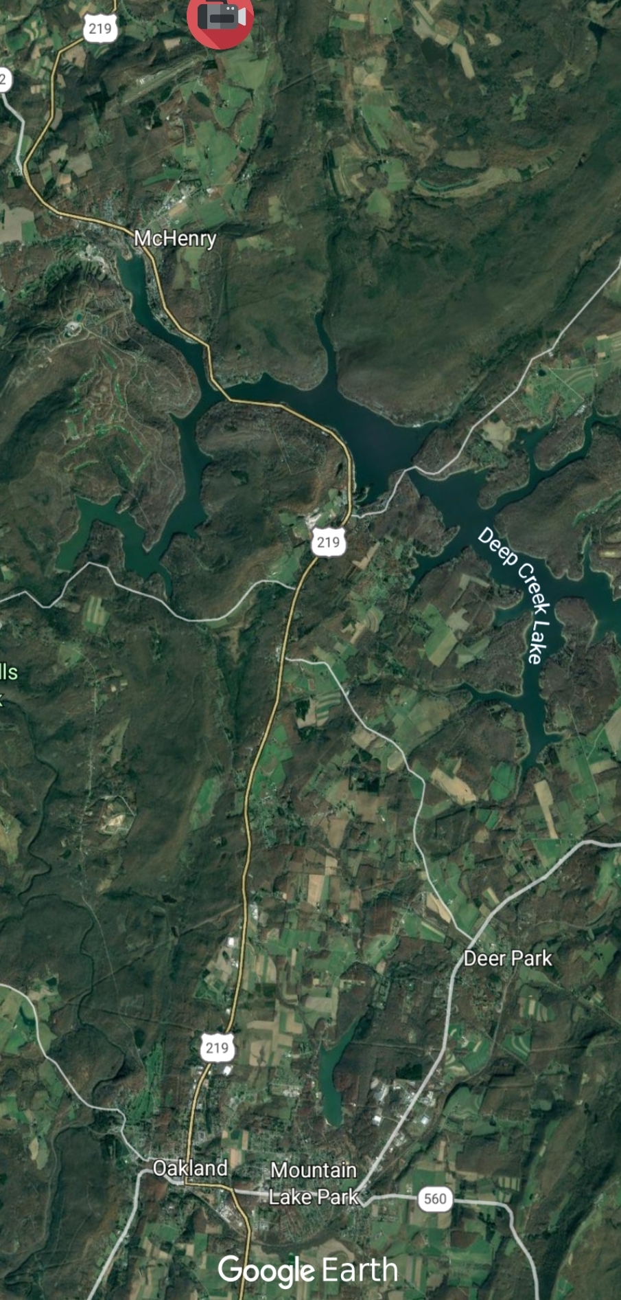
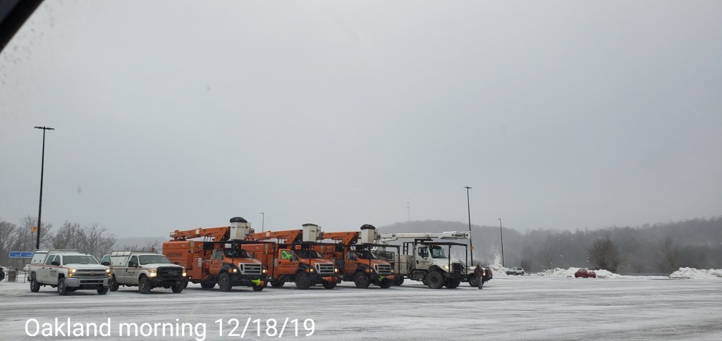
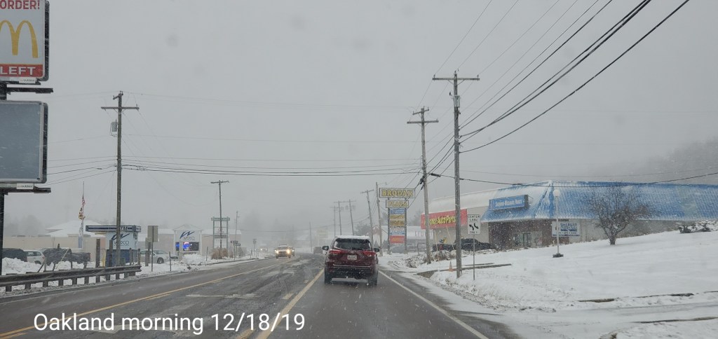
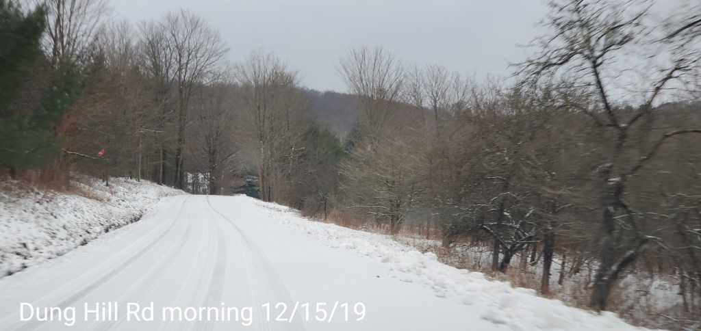
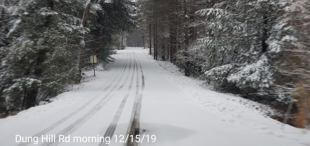
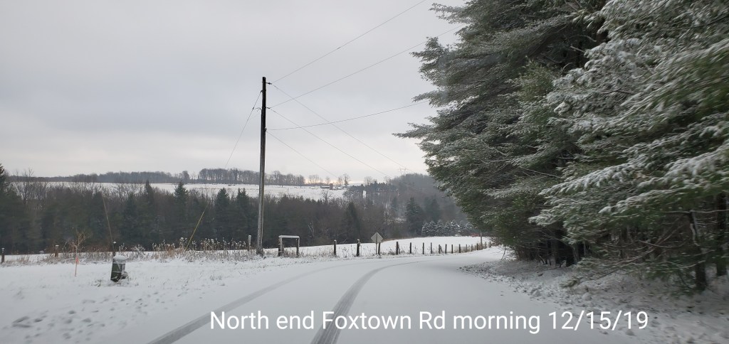
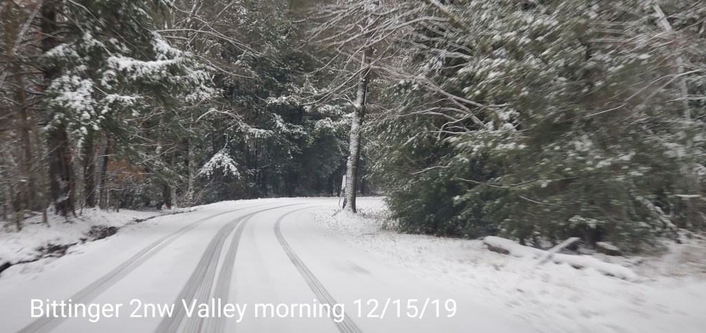
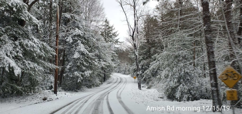
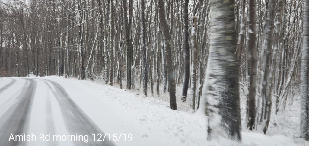
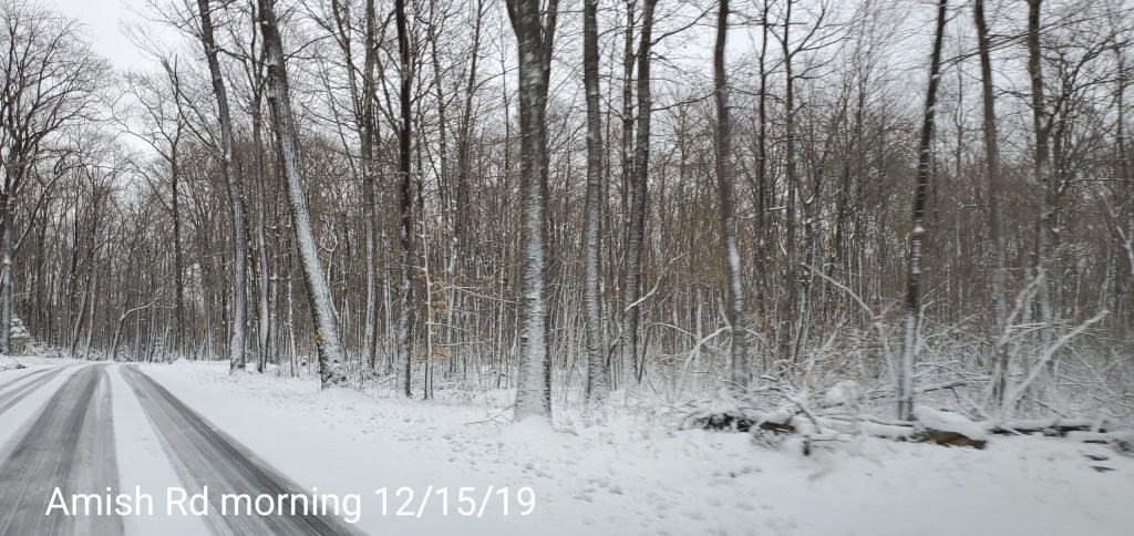
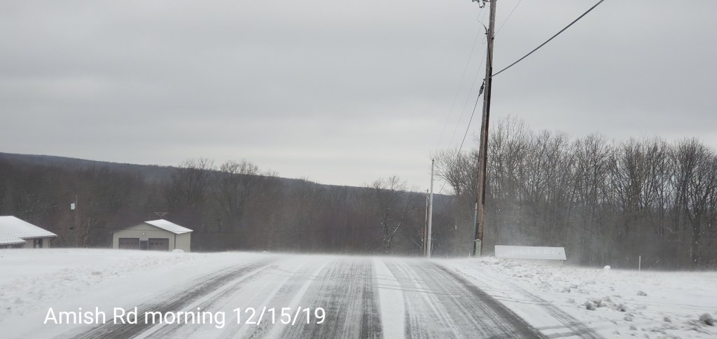
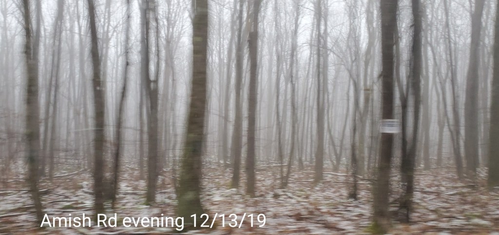
Few more from Garrett
RTMA
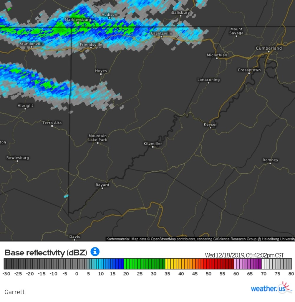
Radar
Void today
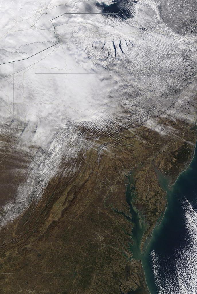
Satellite
Flow
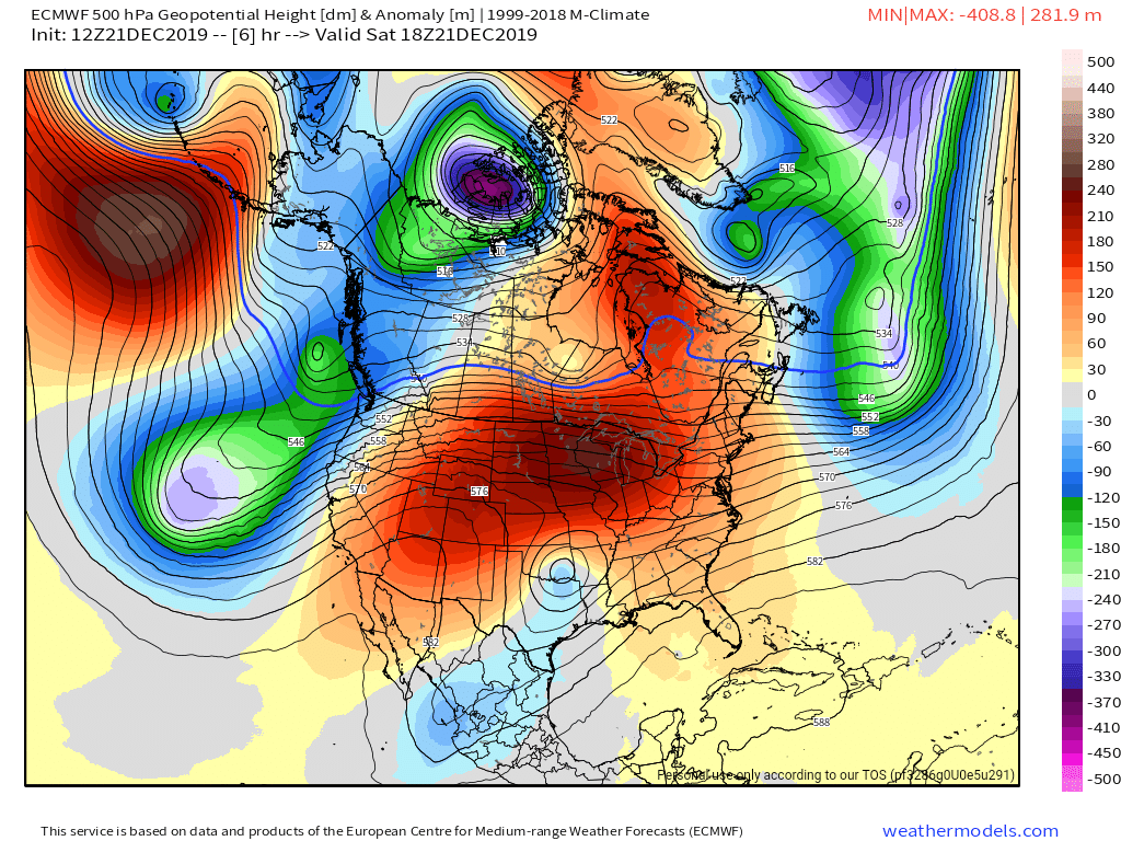
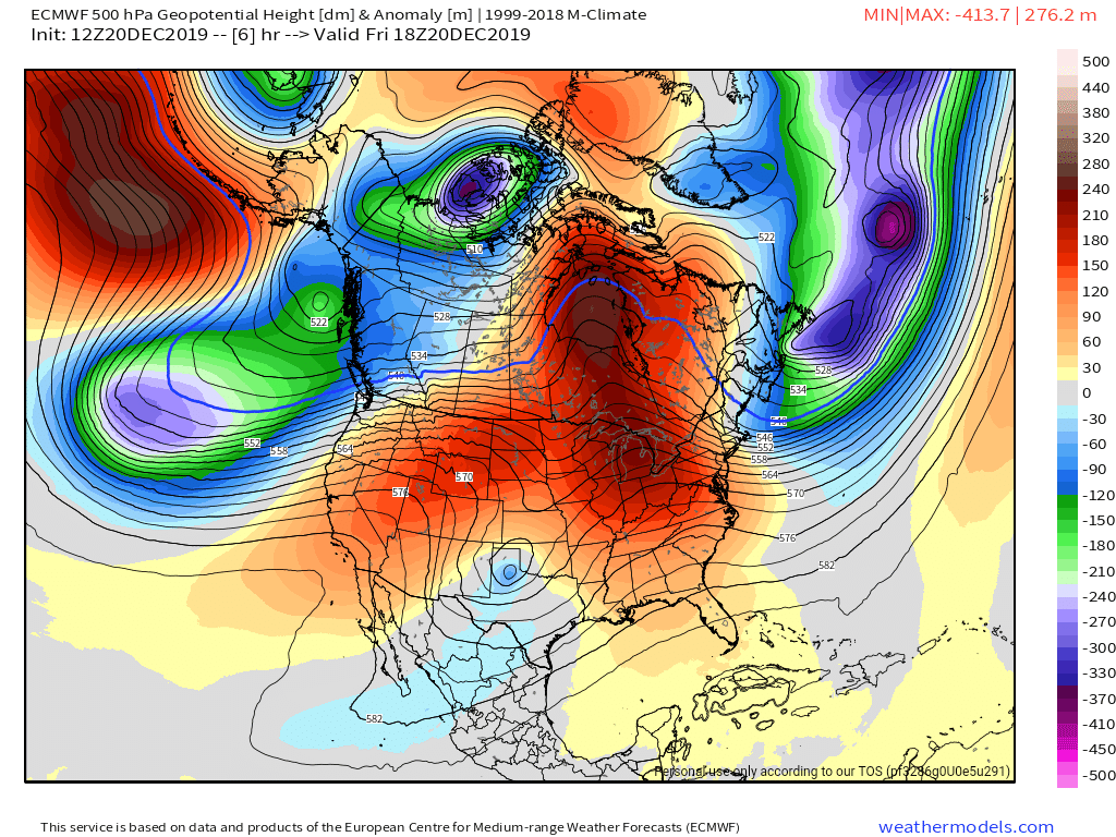
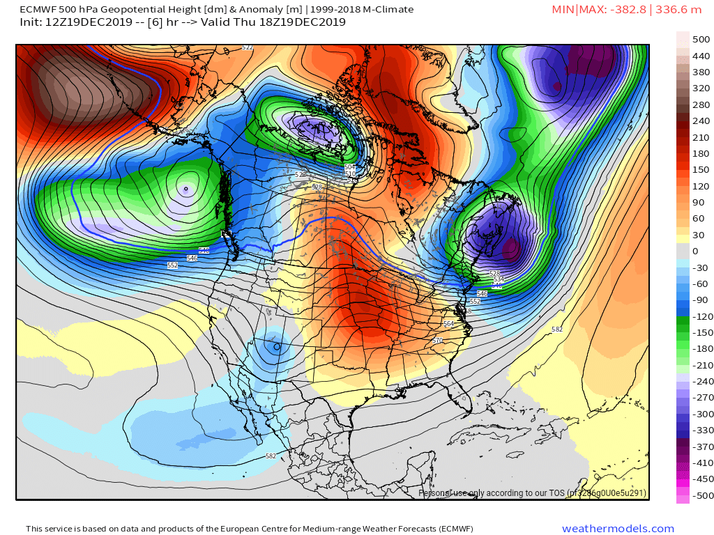
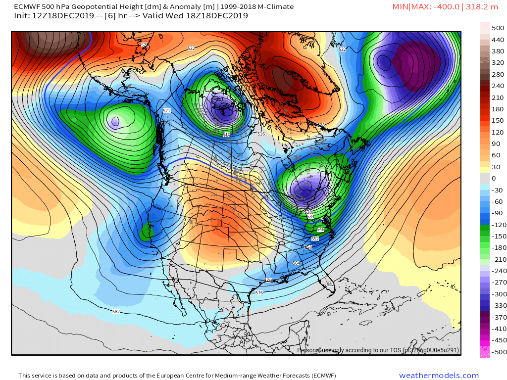
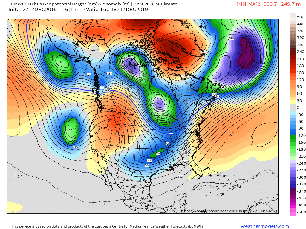
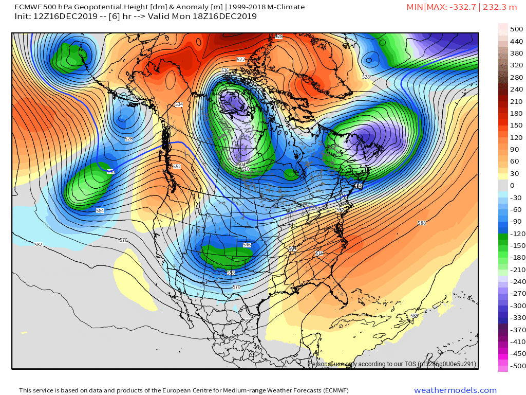
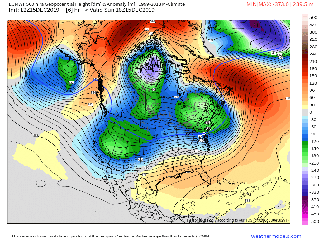
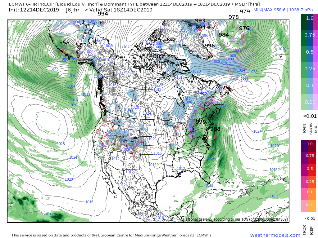
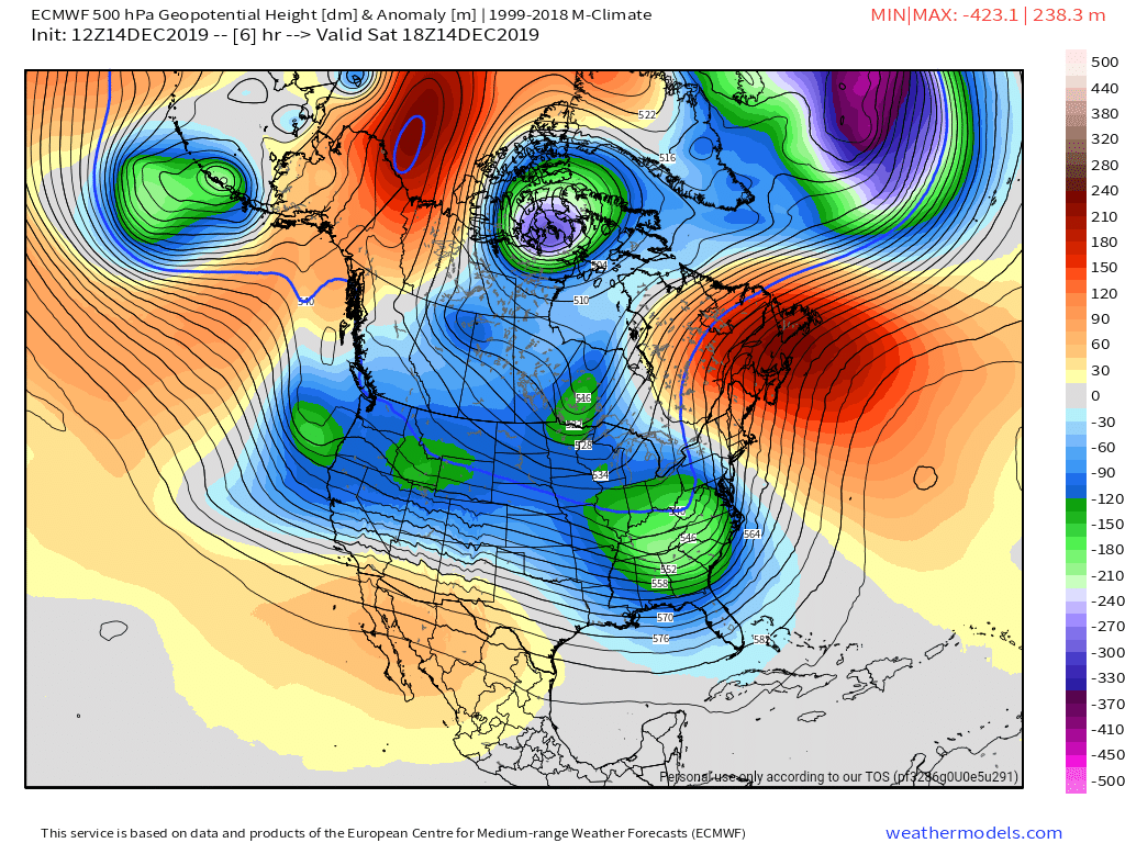
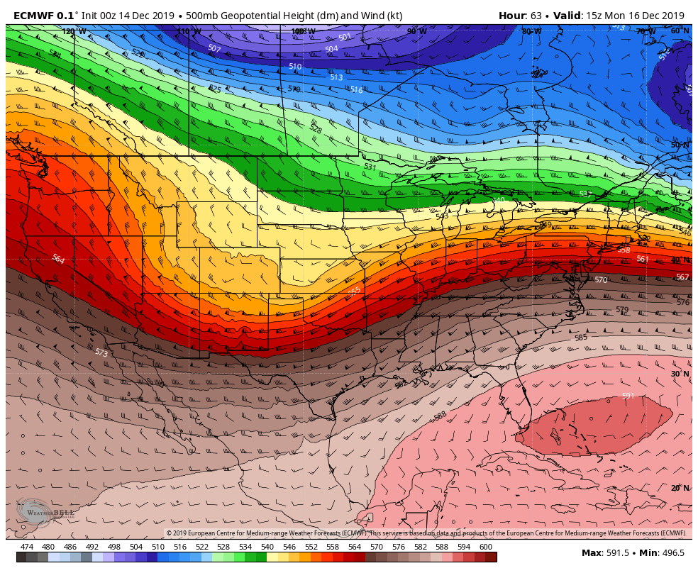
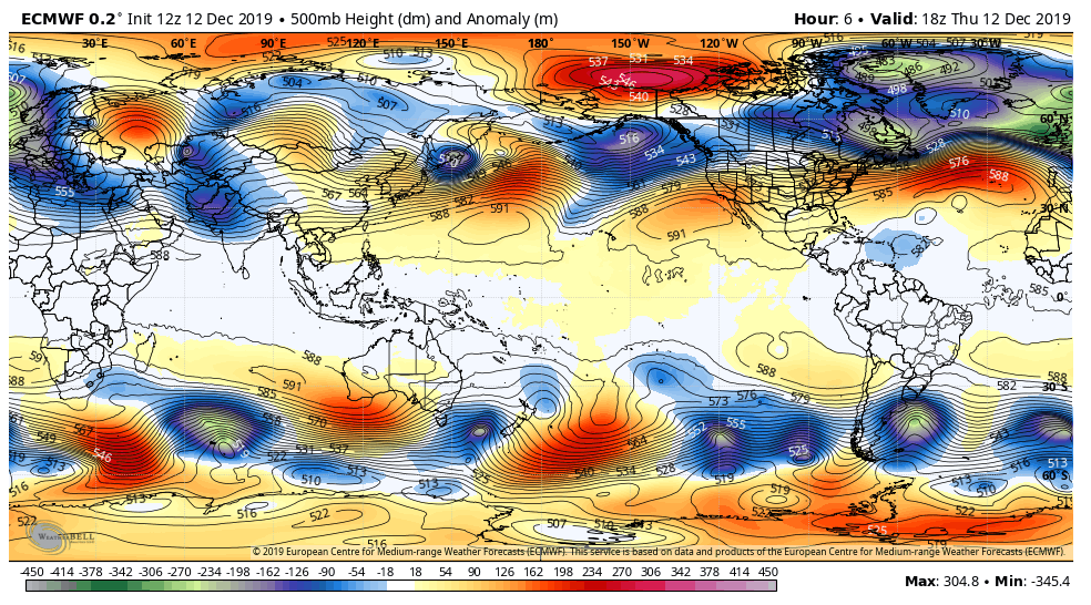
Surface features and 500mb height anomalies and flow
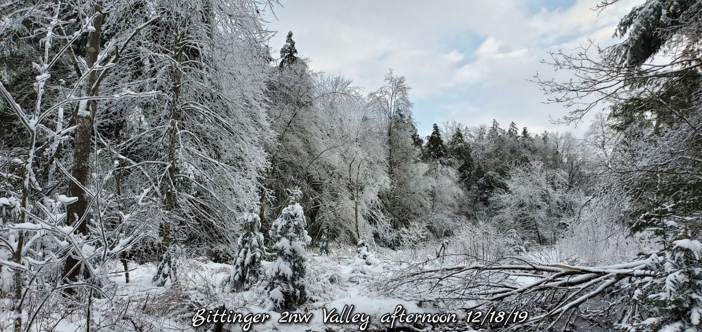
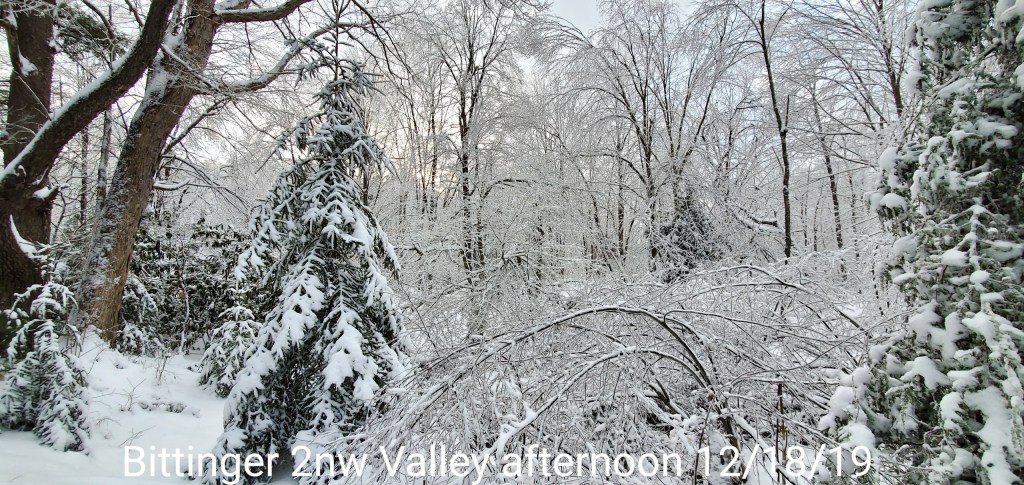
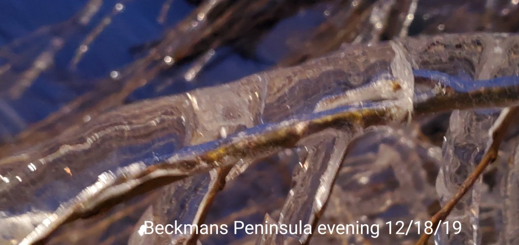
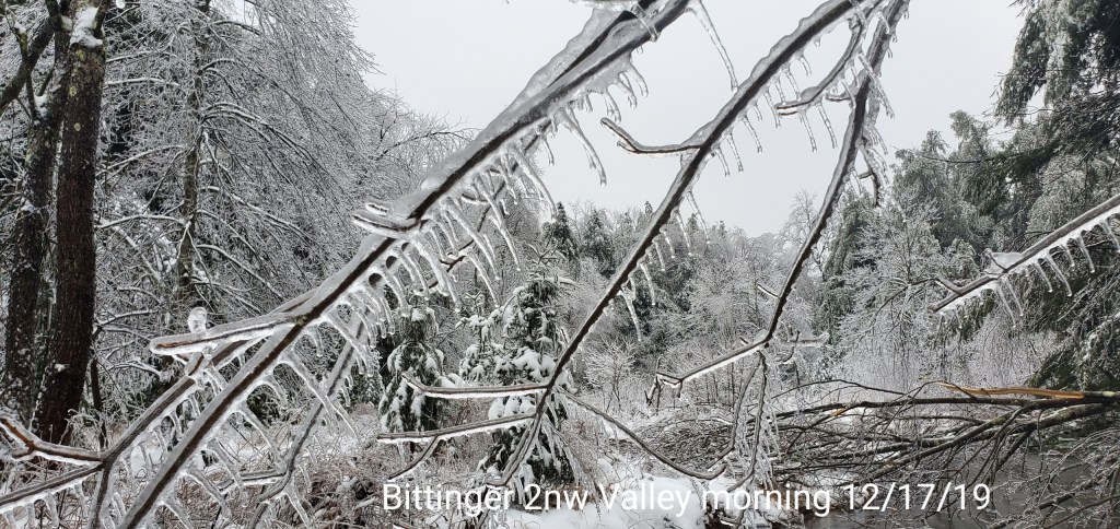
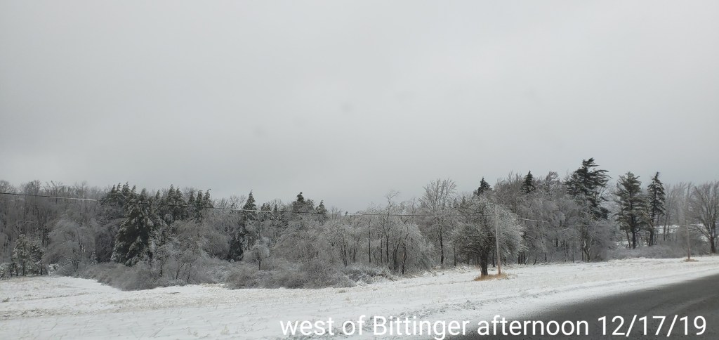
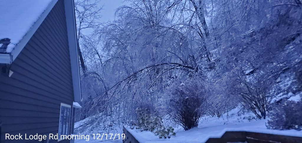
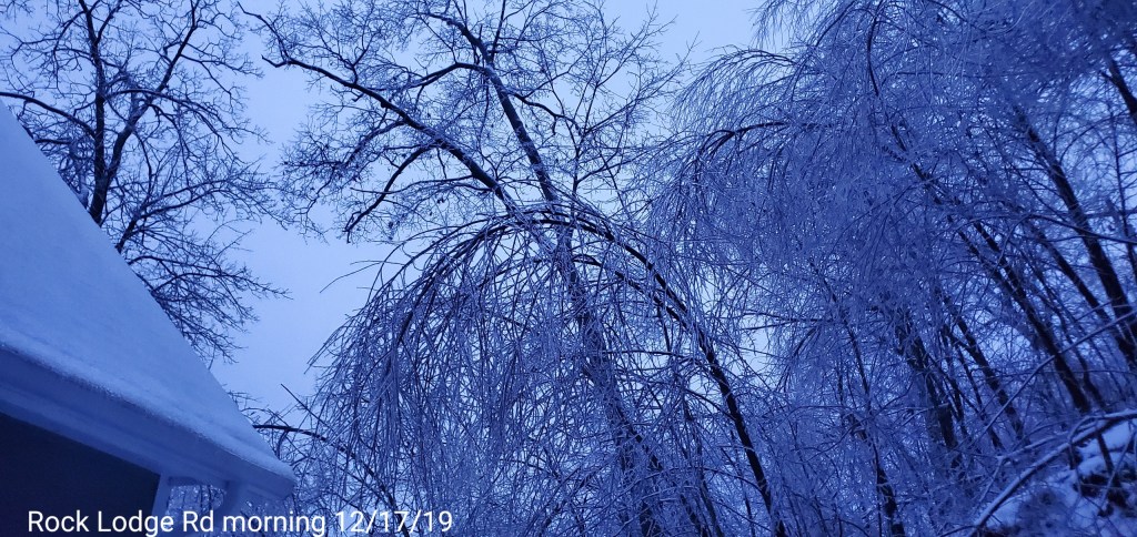
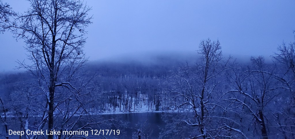
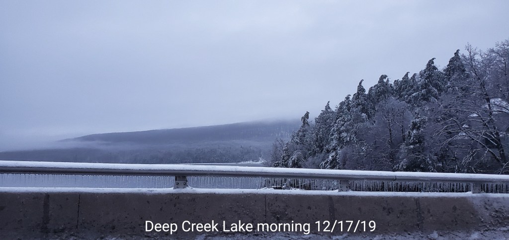
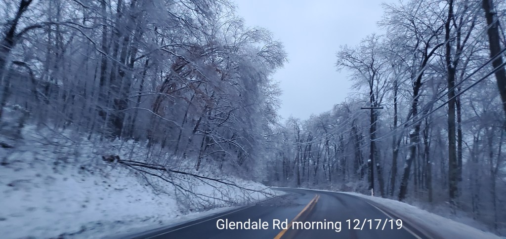
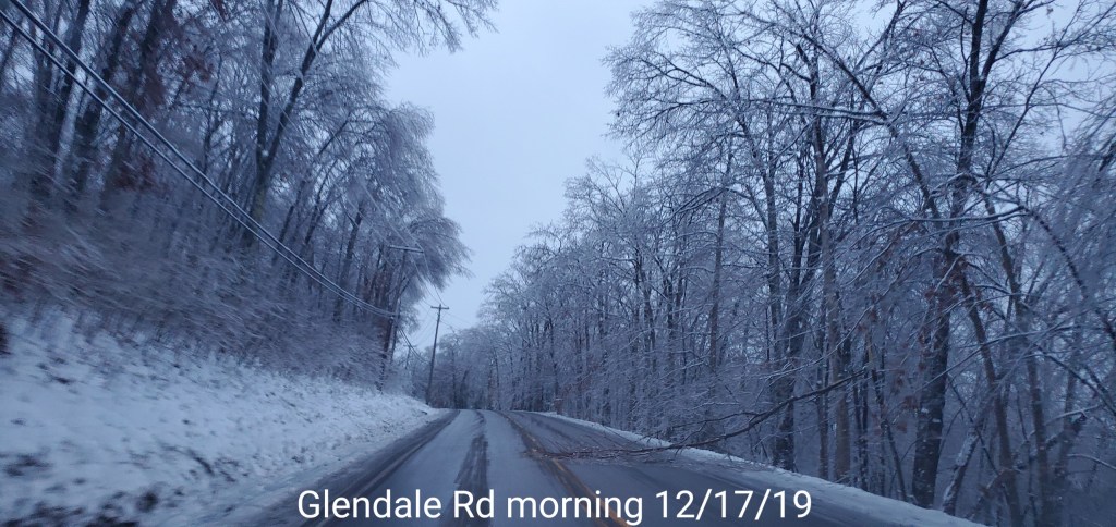
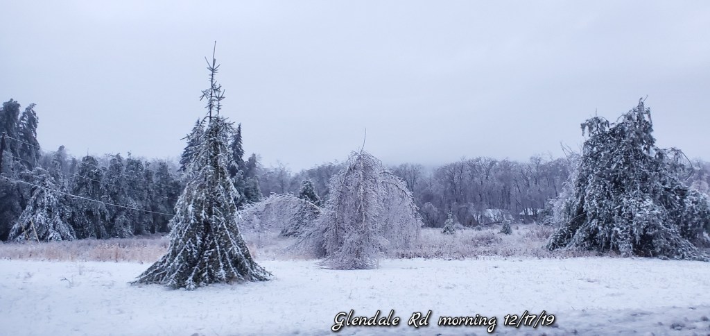
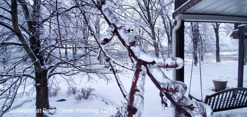
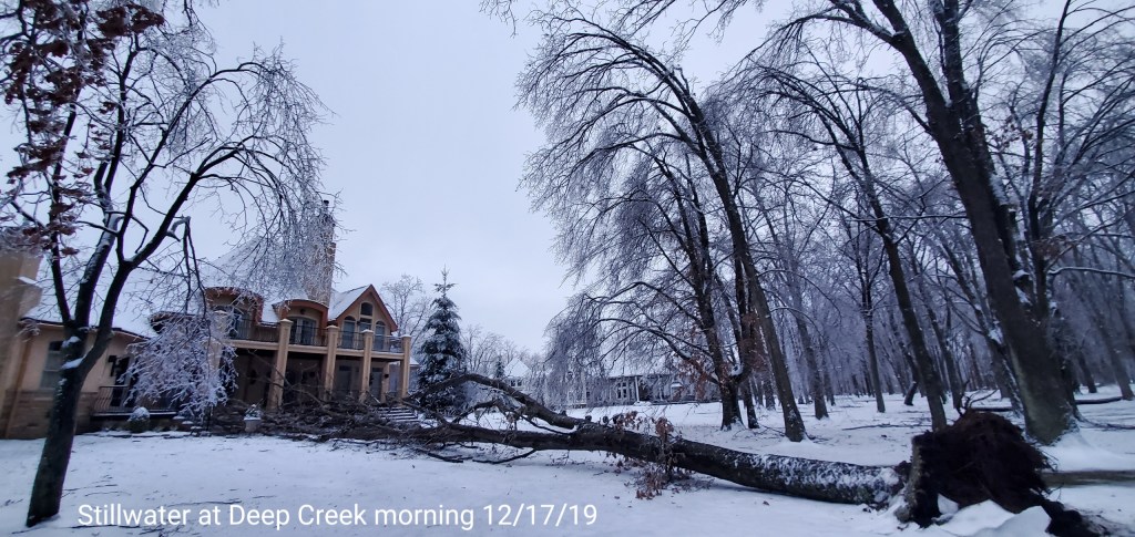
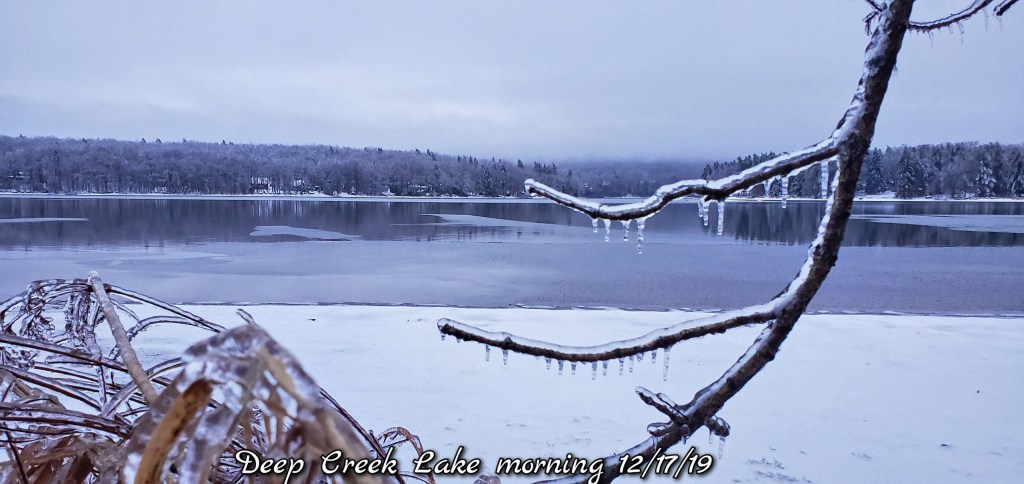
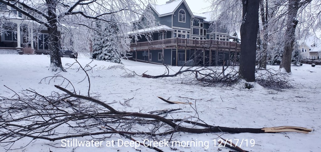
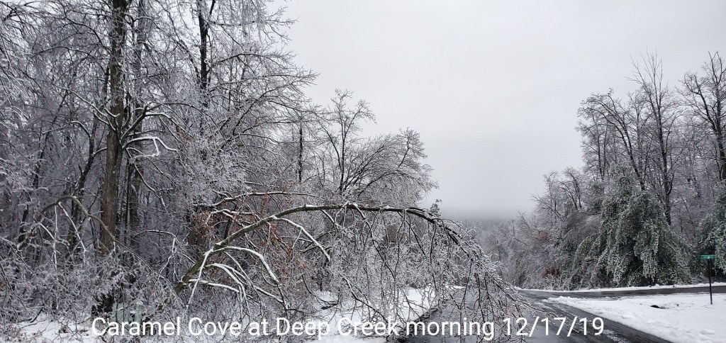
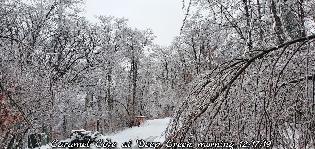
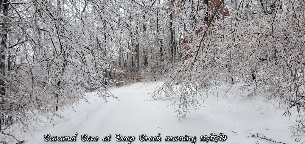
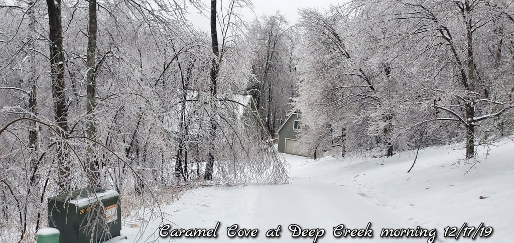
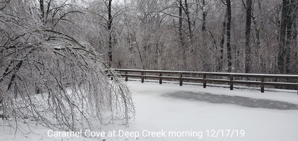
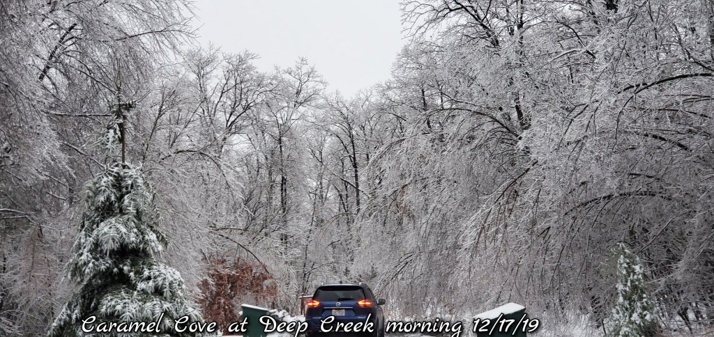
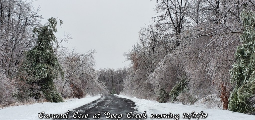
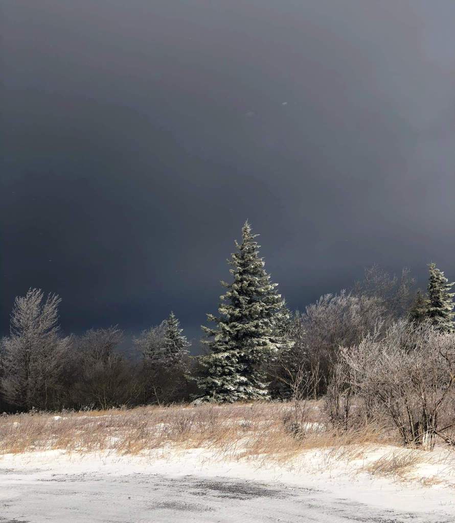
Early am snow showers remained, but quickly cleared out. Leaving behind blue skies and ice covered trees in what was about as beautiful as a winter gets. 9.5 out of 10. Snow depth could be greater and the long range forecast could look much better. That slightly dampened the beauty of today, but not really.
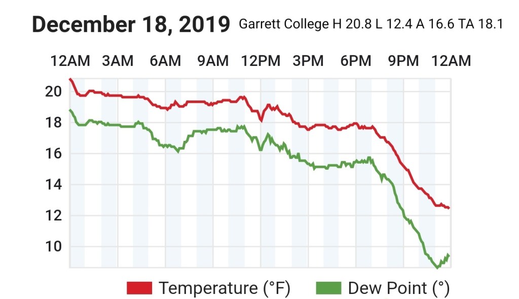
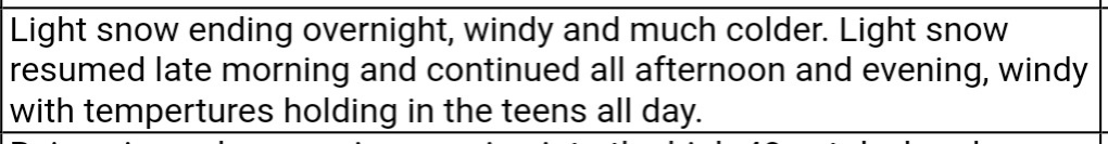
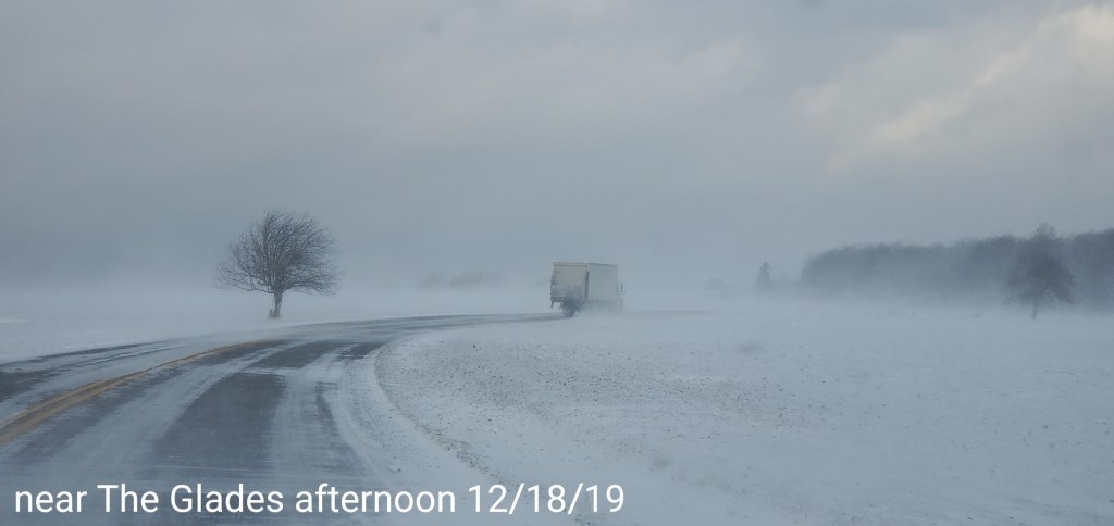
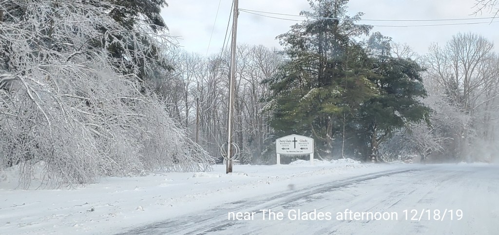
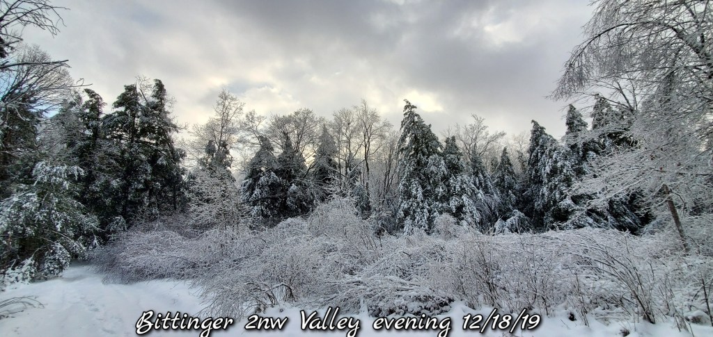
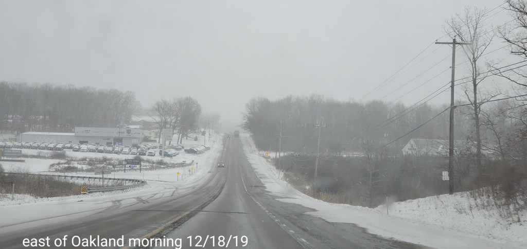
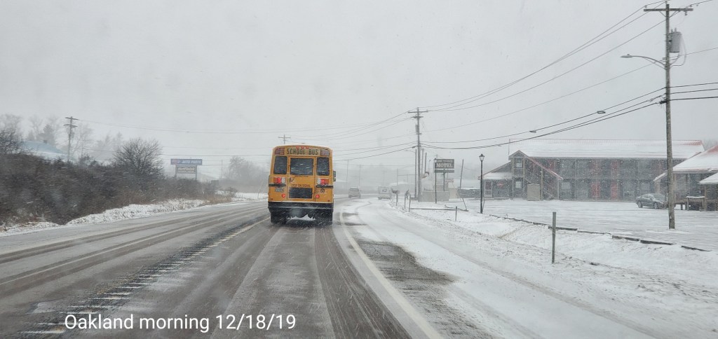
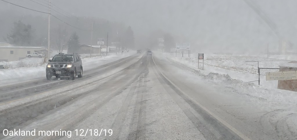
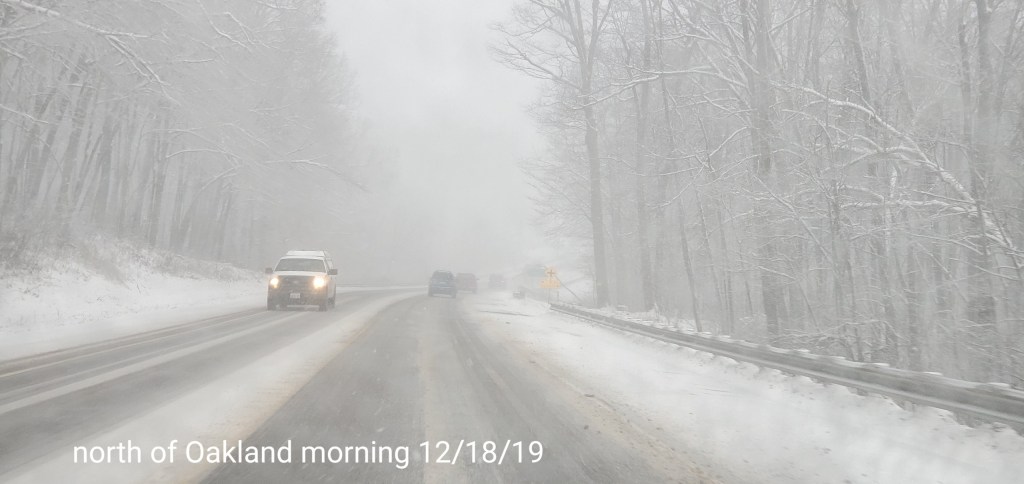
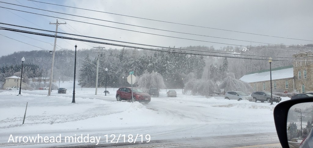
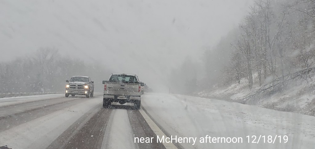
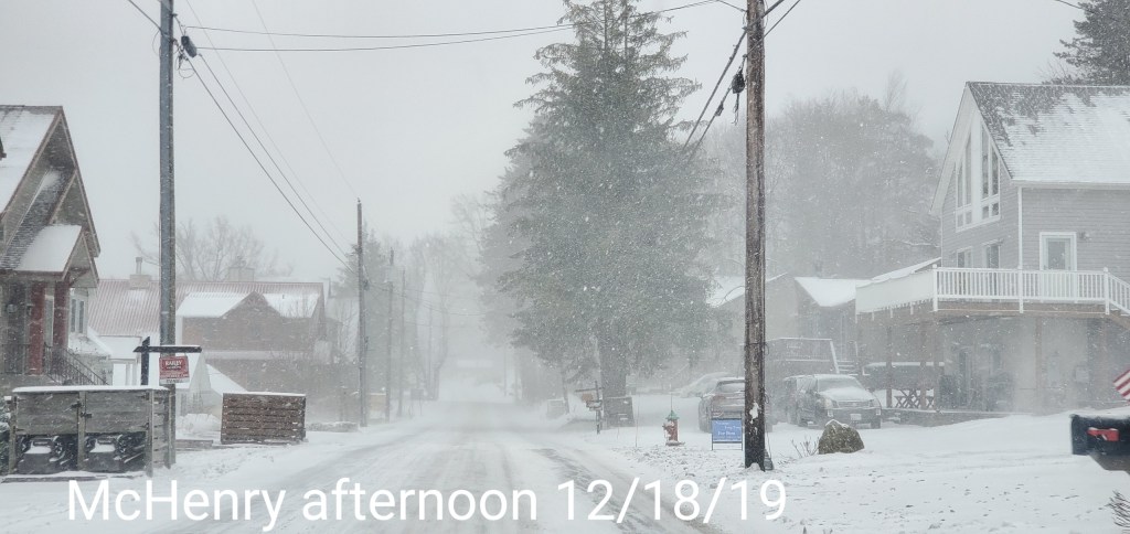
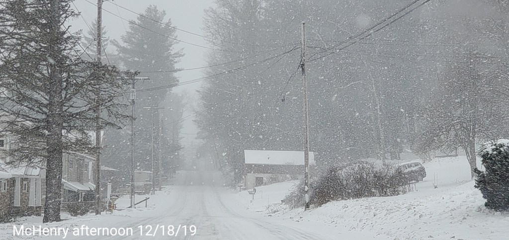
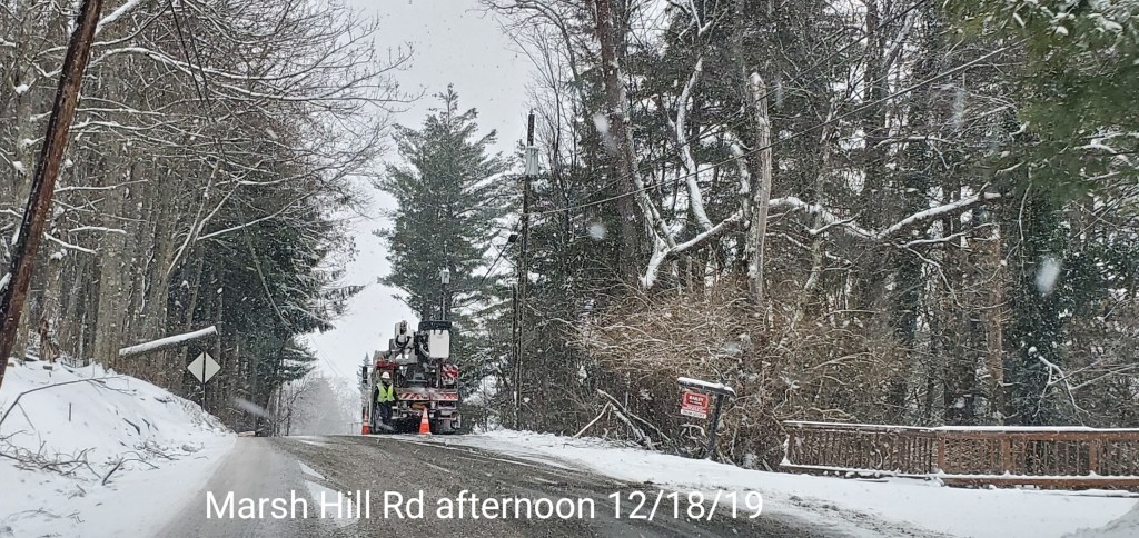
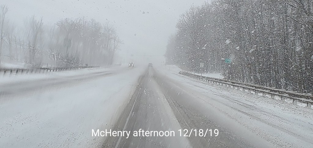
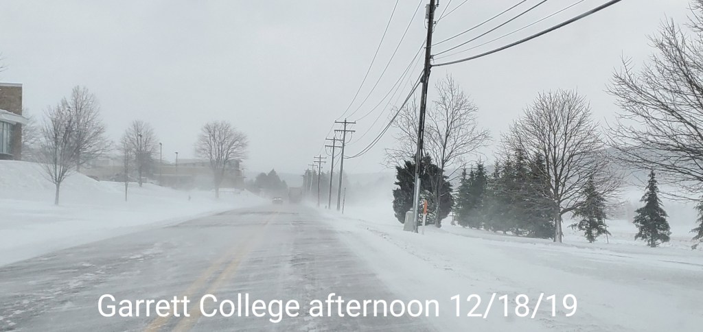
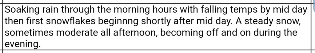
After skies cleared for awhile overnight, snow moved back in early morning(8am), and continued in varied fashion through the day with some heavier squalls at times. A brief very heavy one around 7pm.
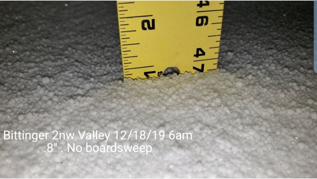
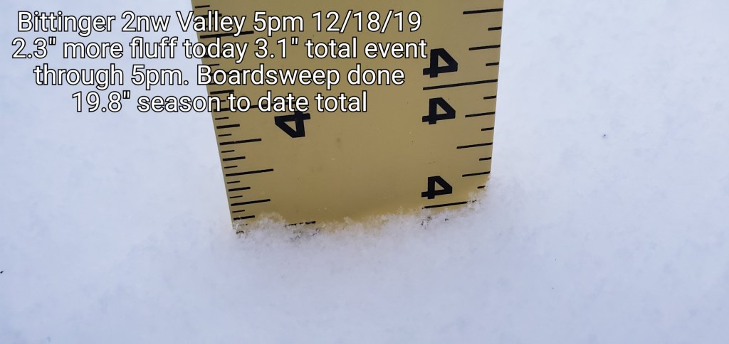
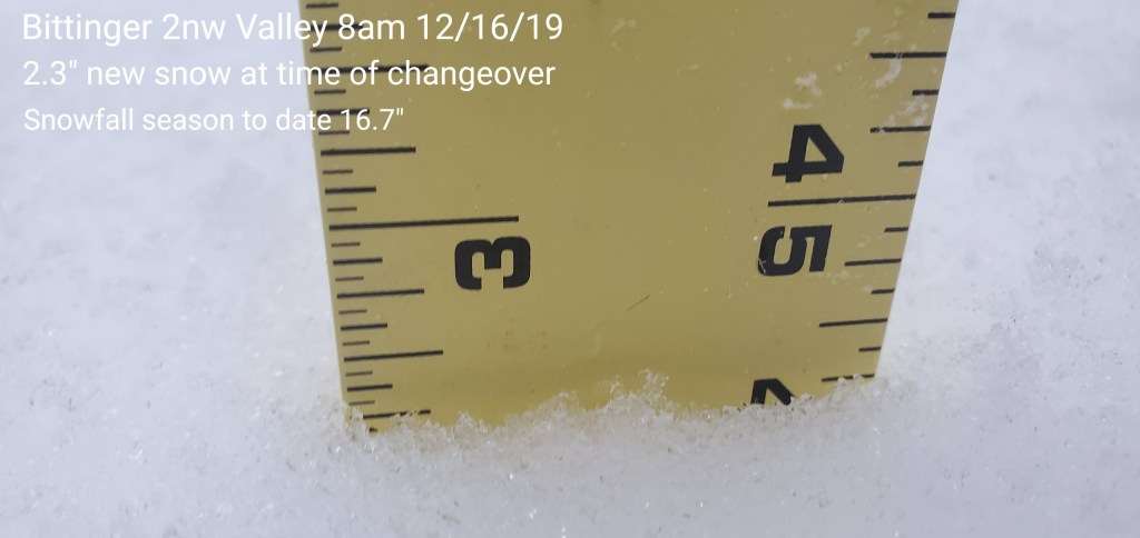
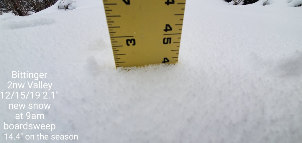
Snowfall- .8″ yesterday afternoon through overnight till 6am , no boardsweep done. Through 5pm another 2.3″ from snowshowers and squalls today for an event total of 3.1″
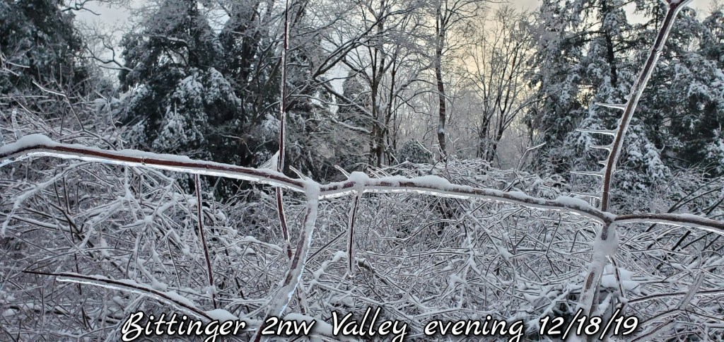
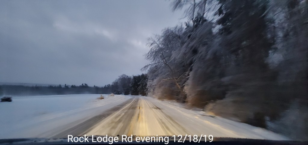
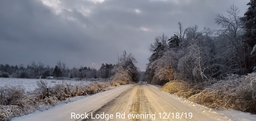
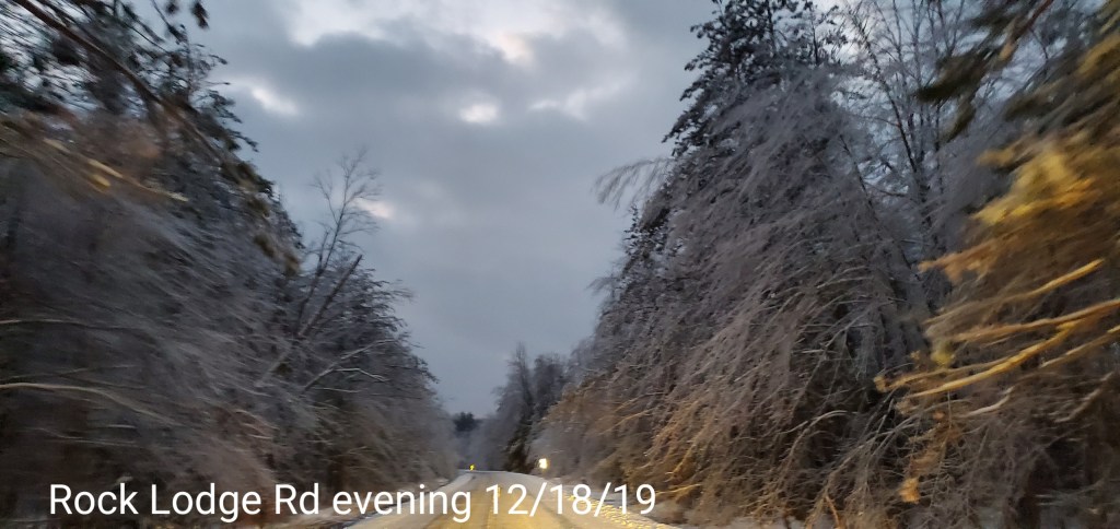
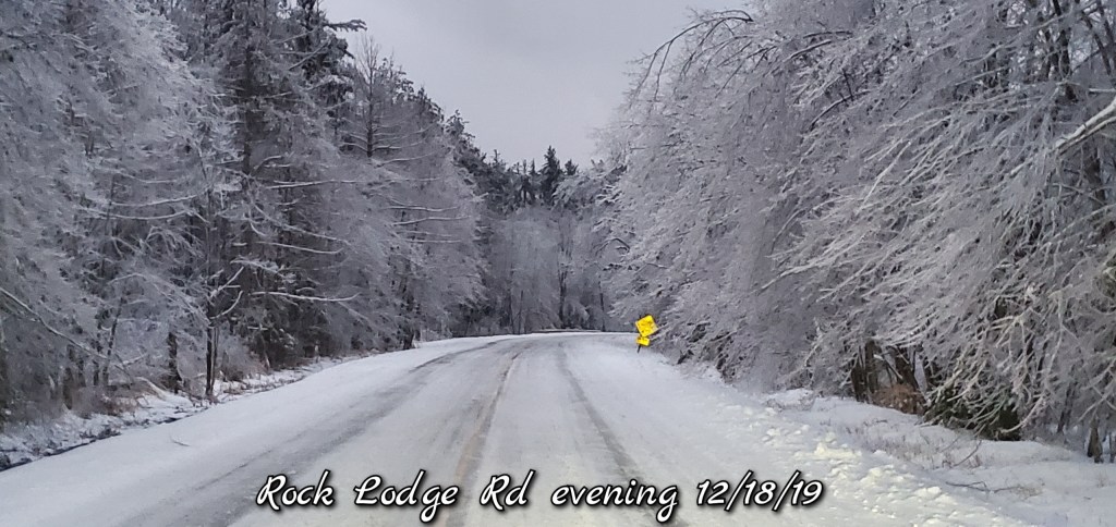
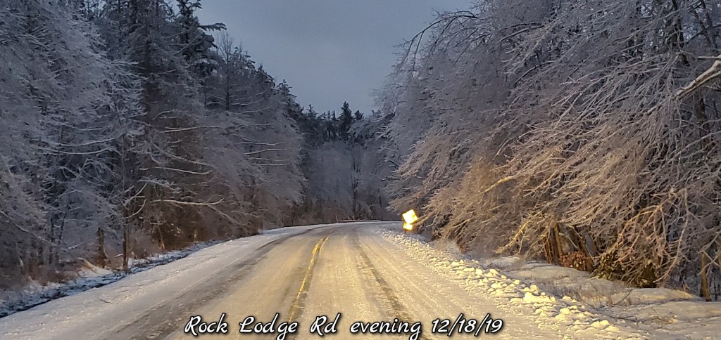
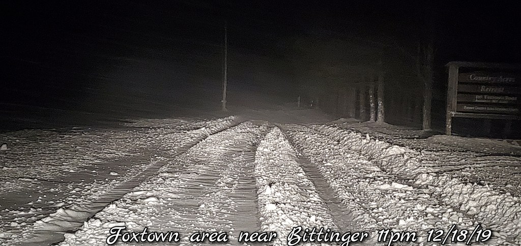
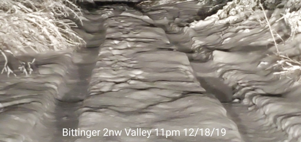
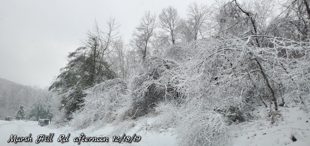
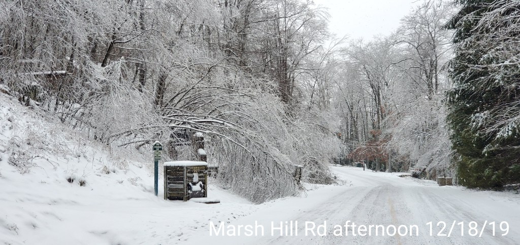
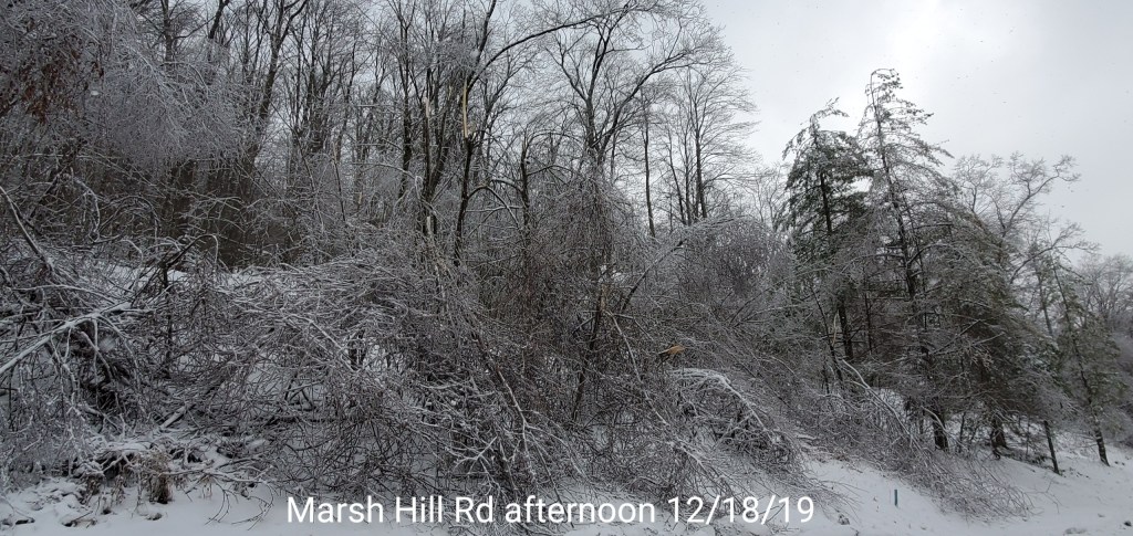
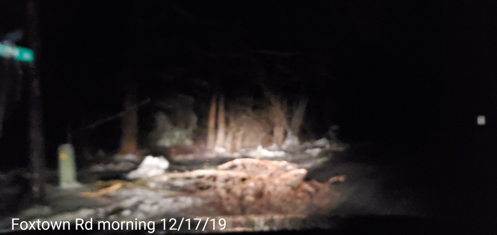
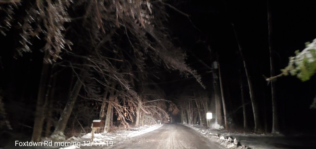
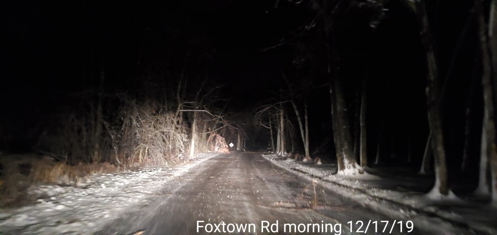
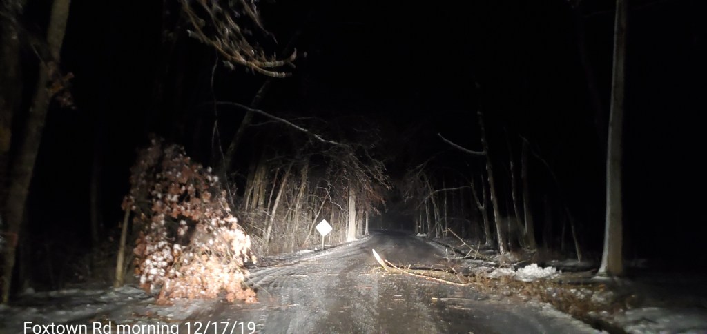
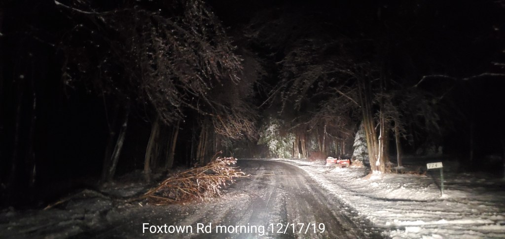
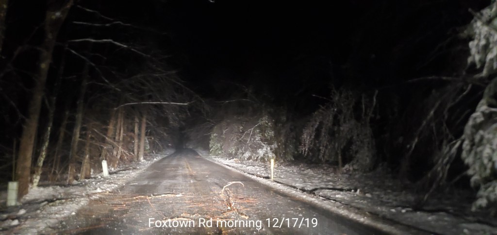
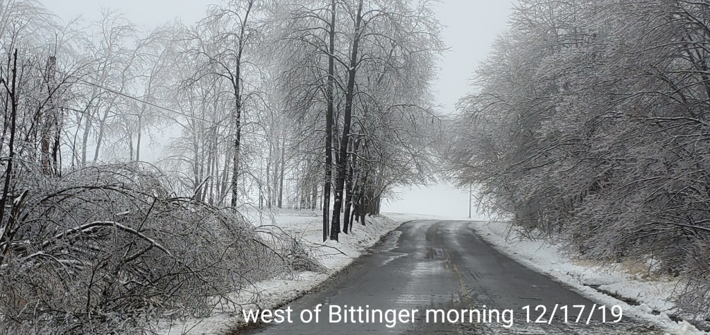
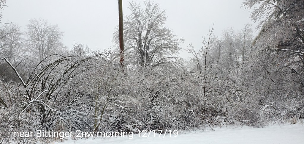
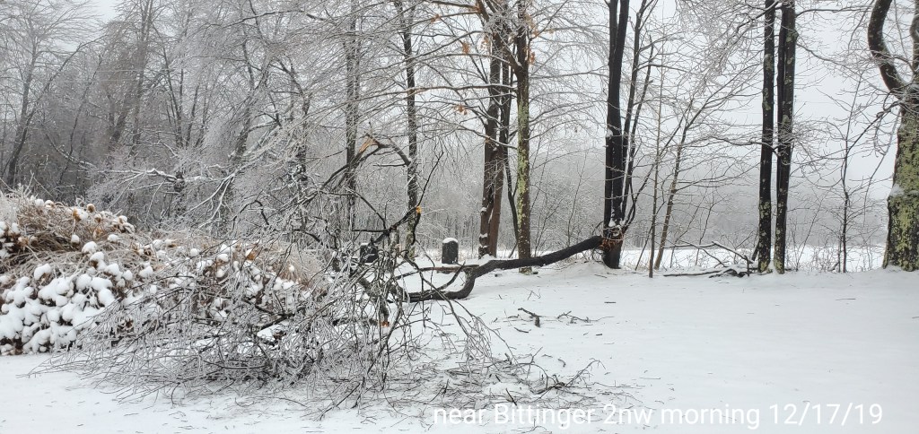
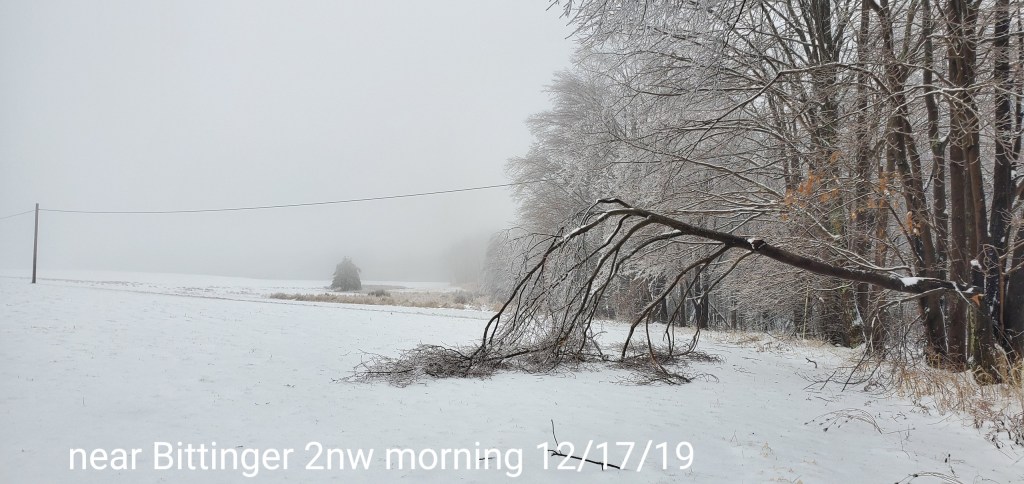
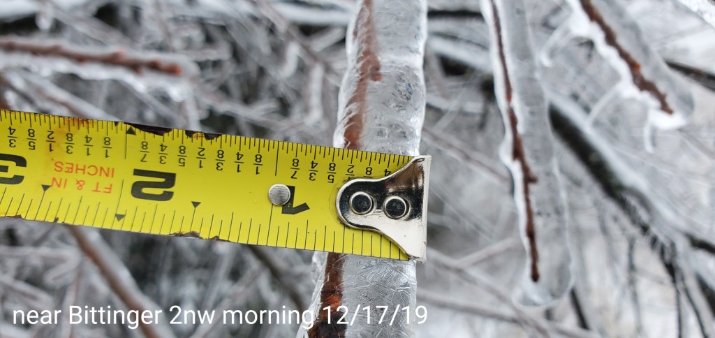
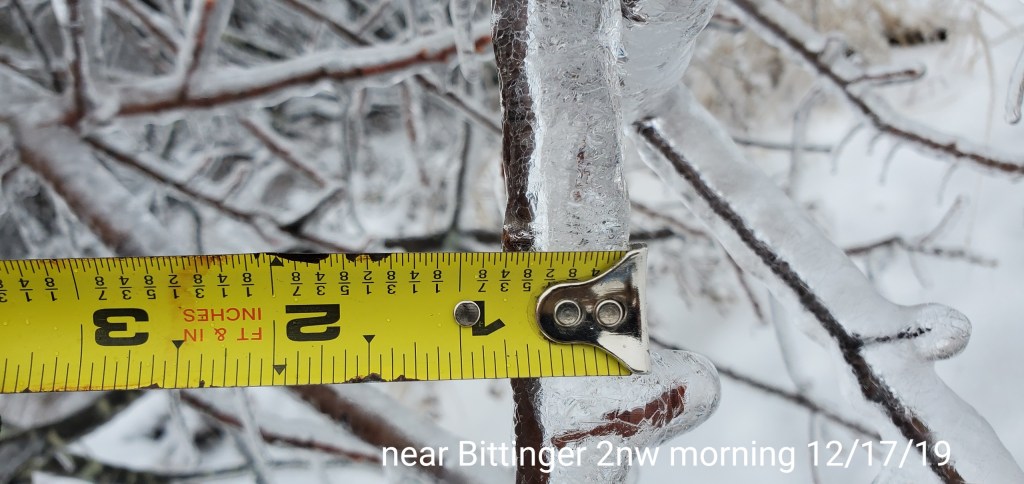
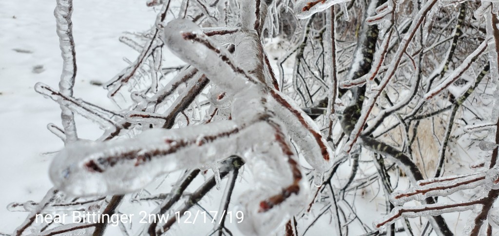
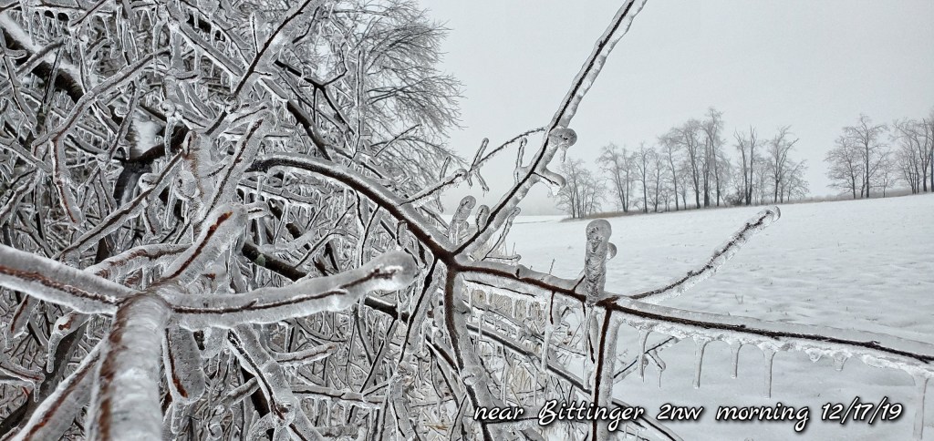
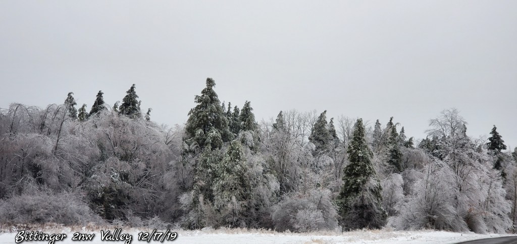
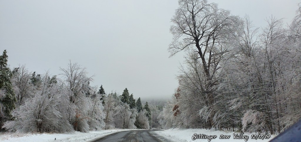
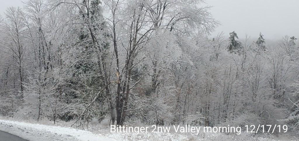
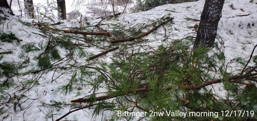
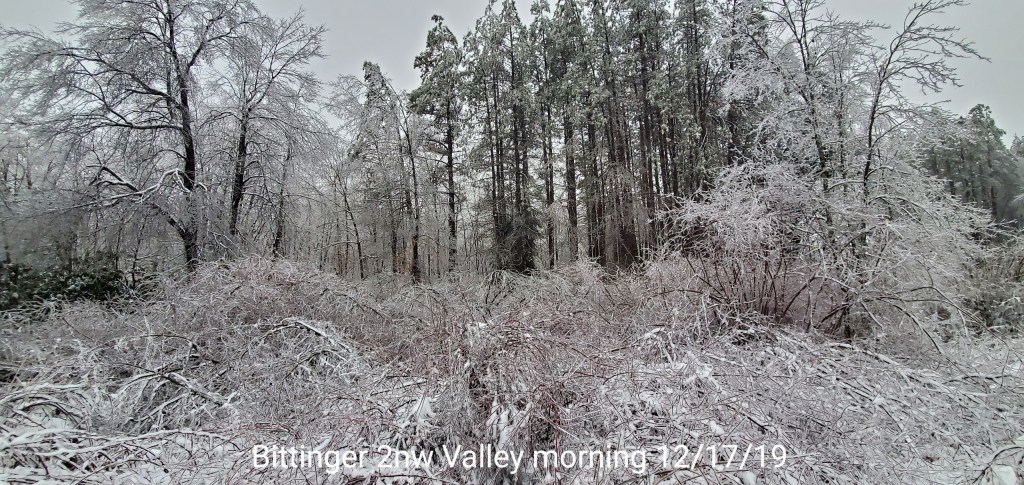
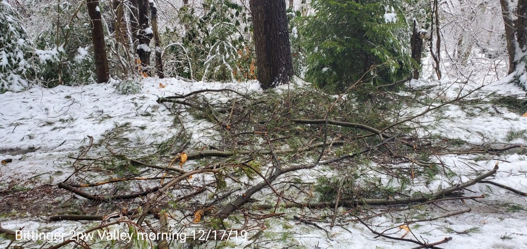
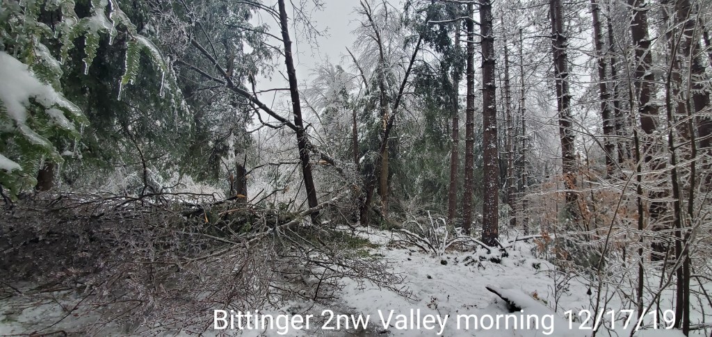
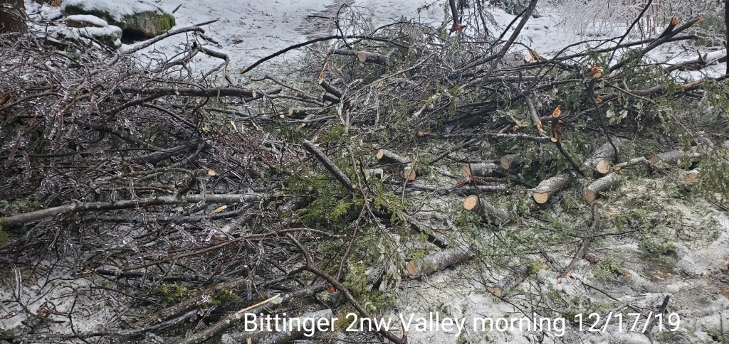
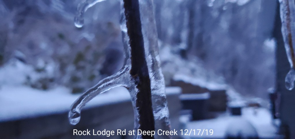
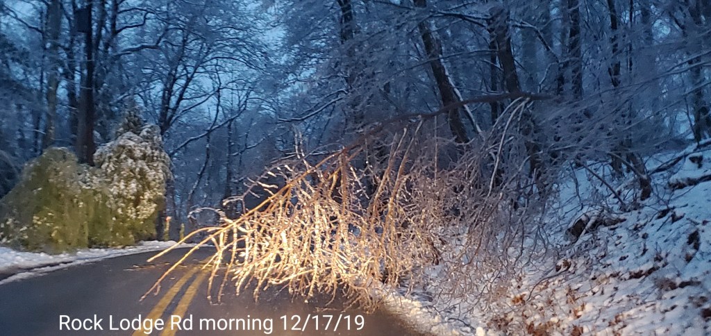
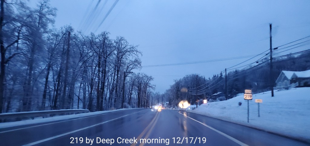
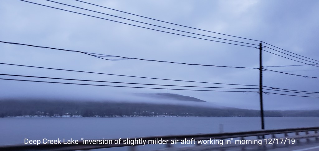
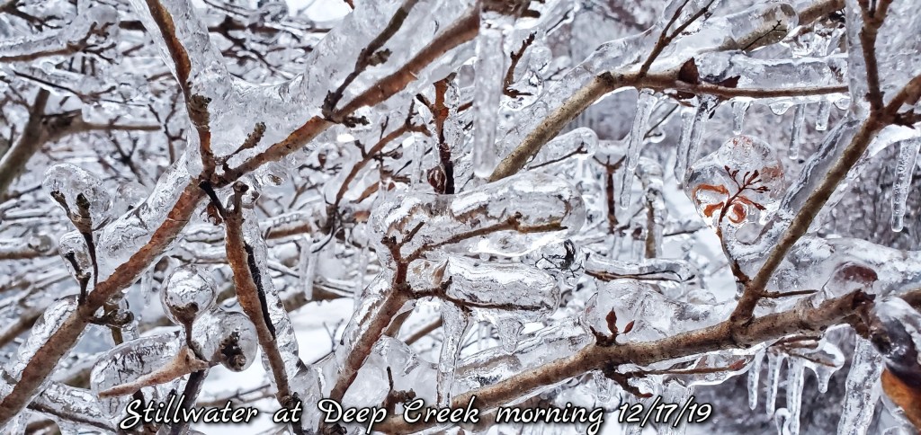
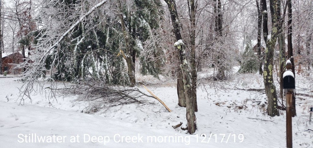
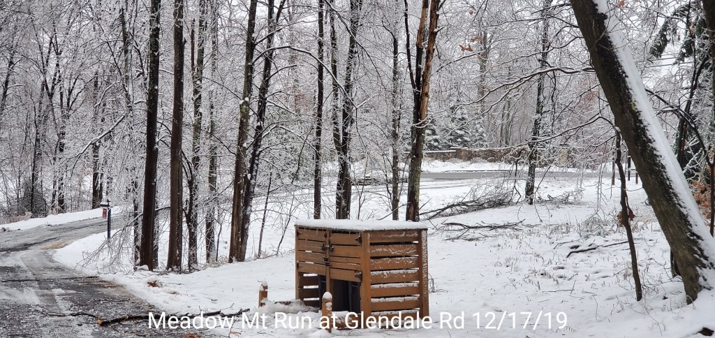
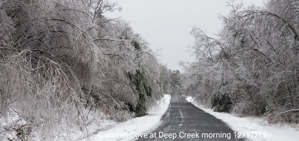
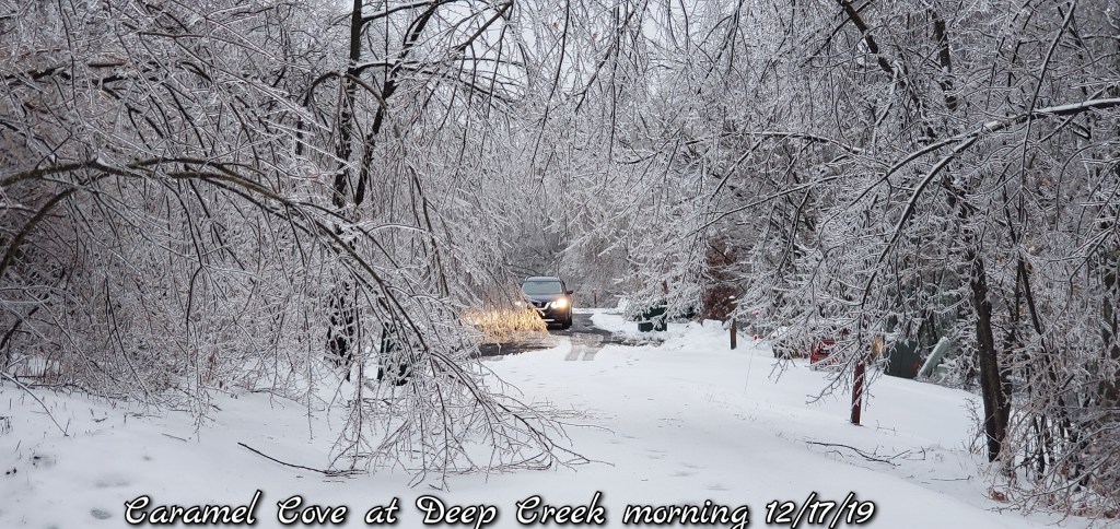
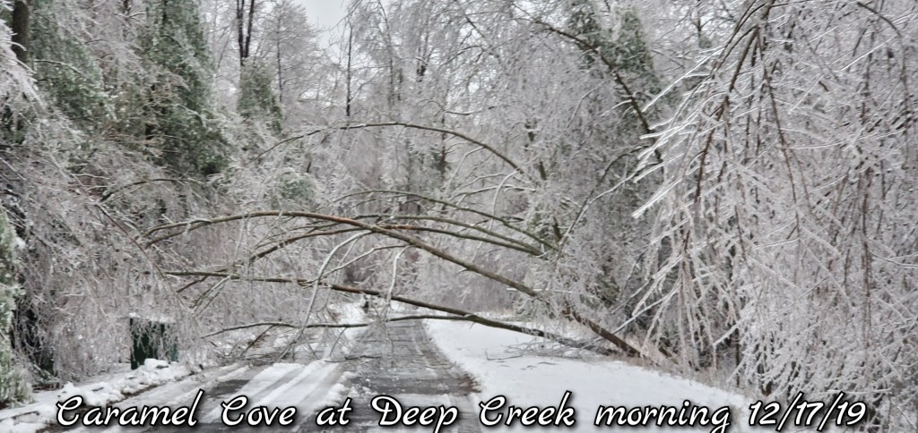
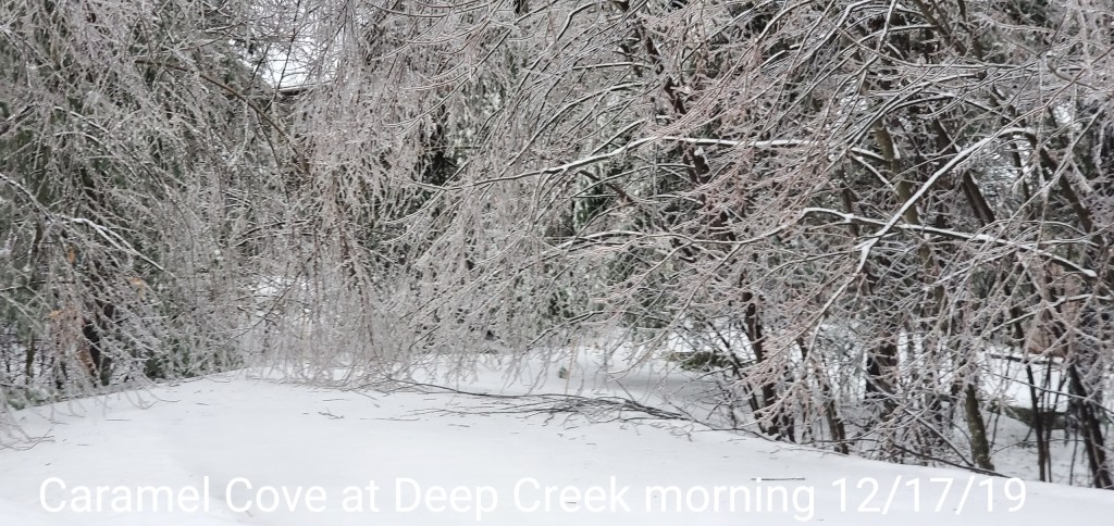
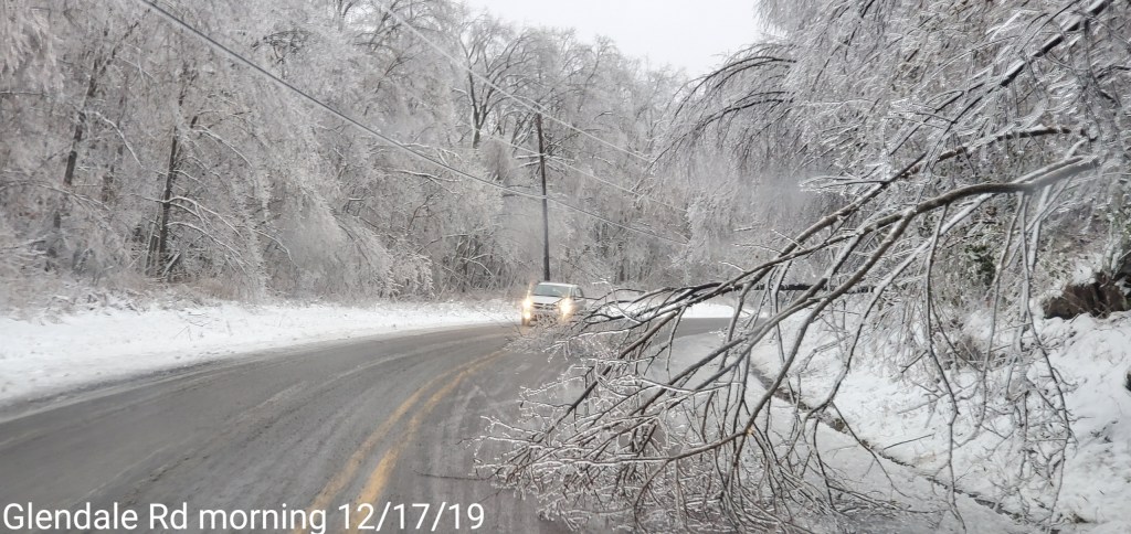
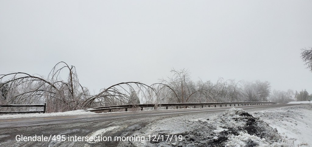
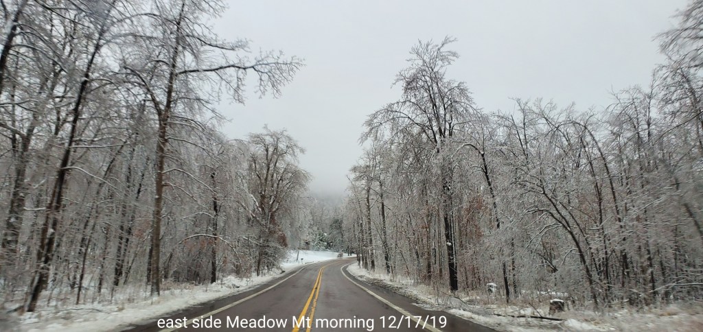
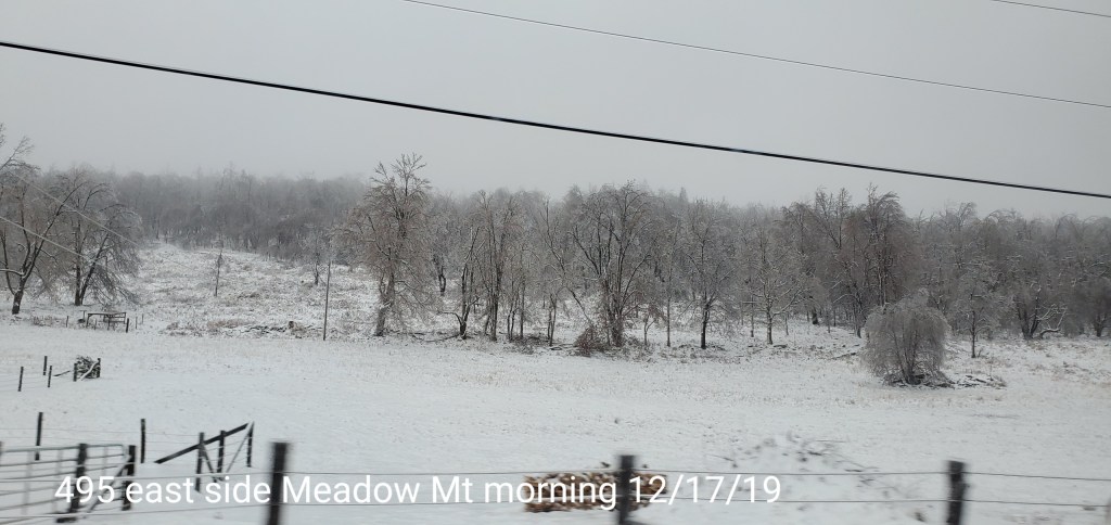
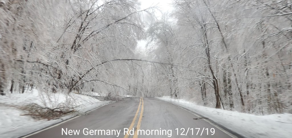
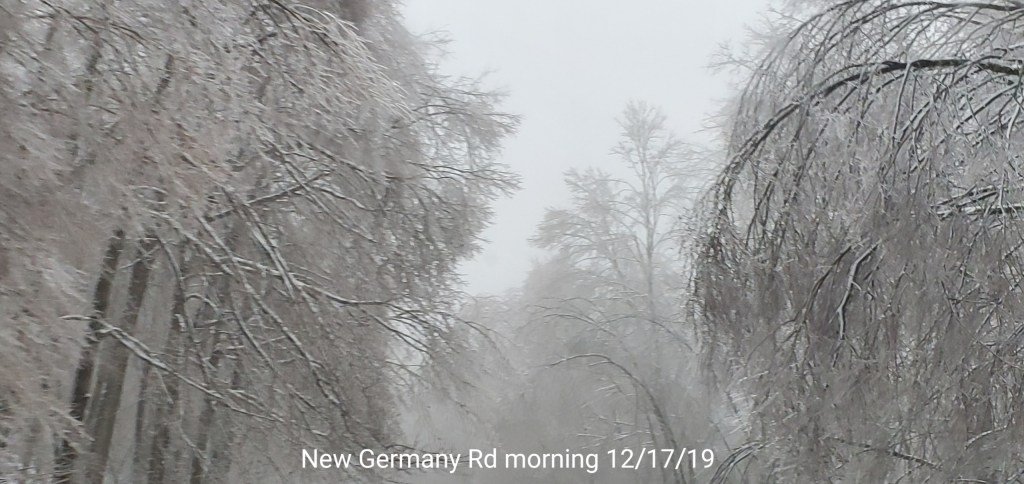
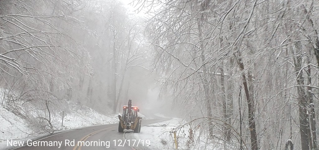
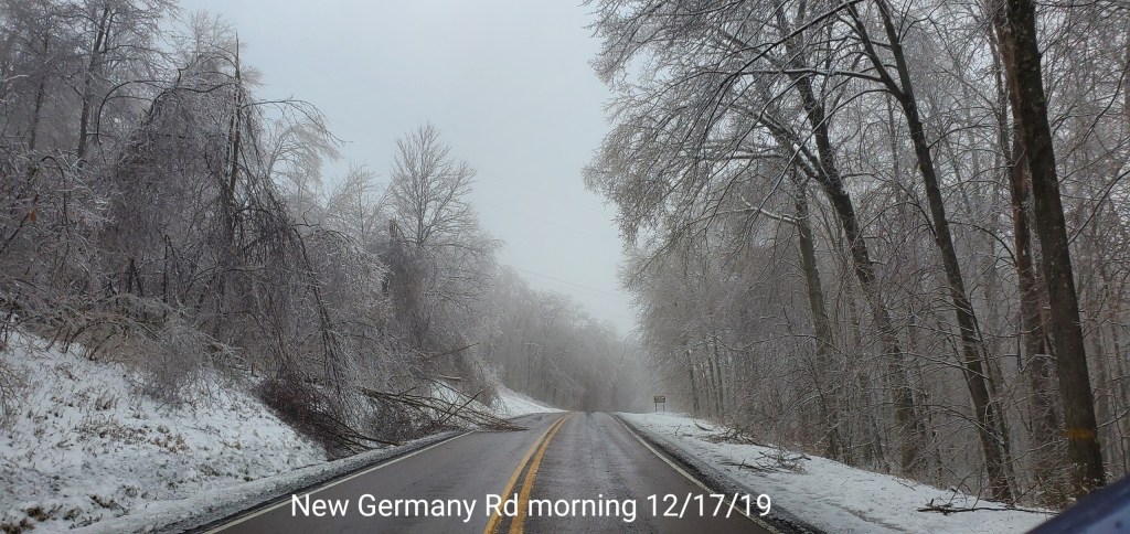
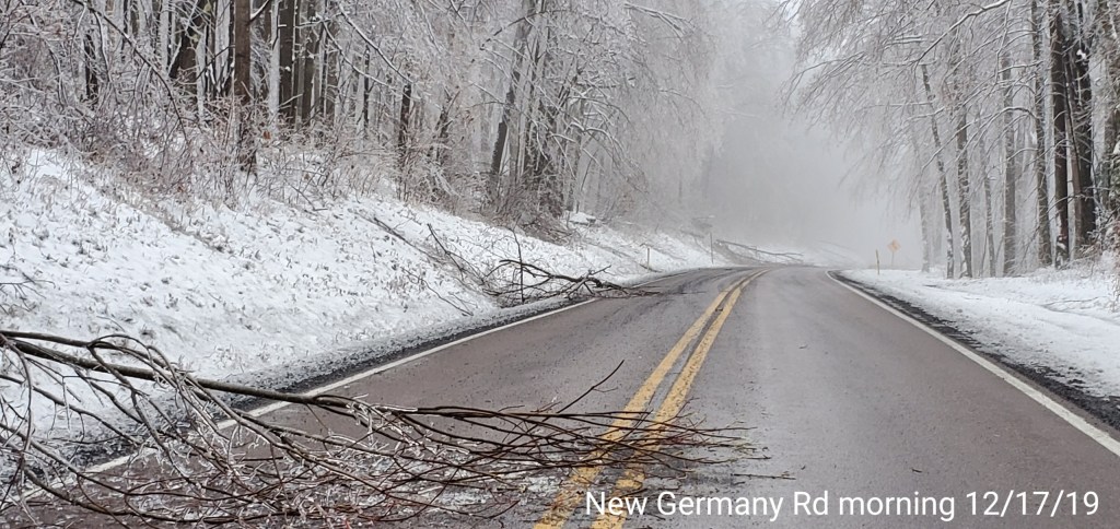
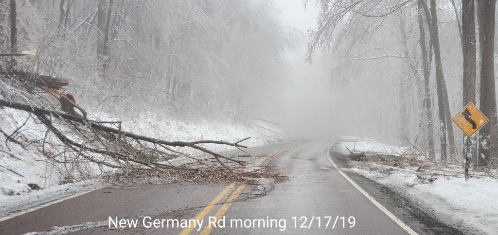
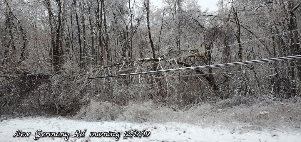
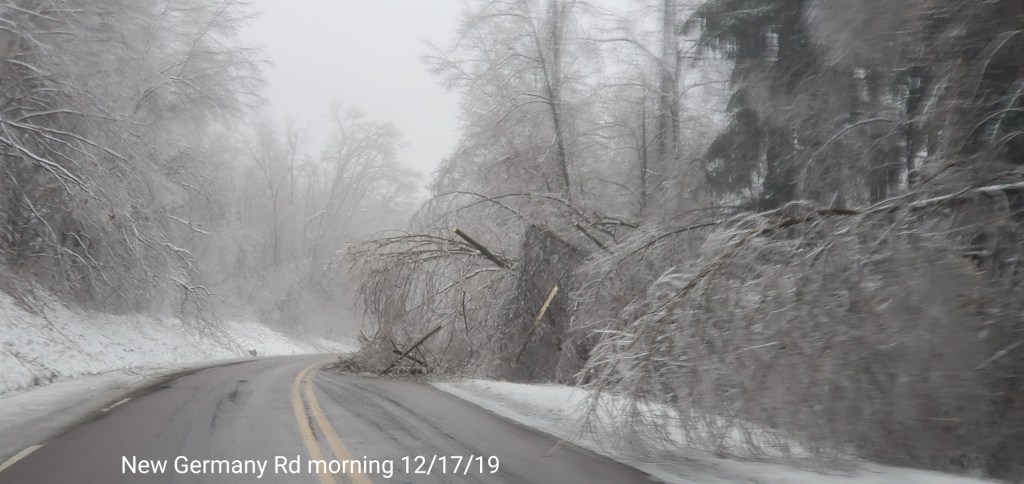
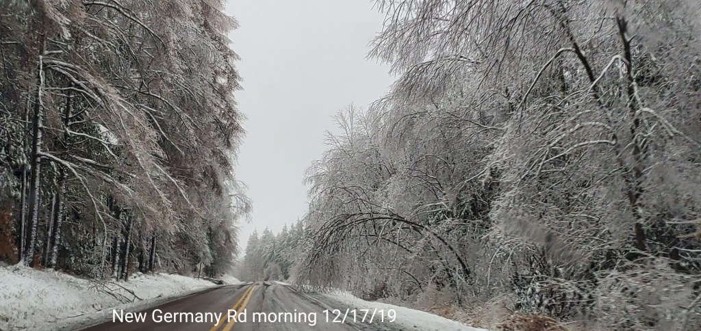
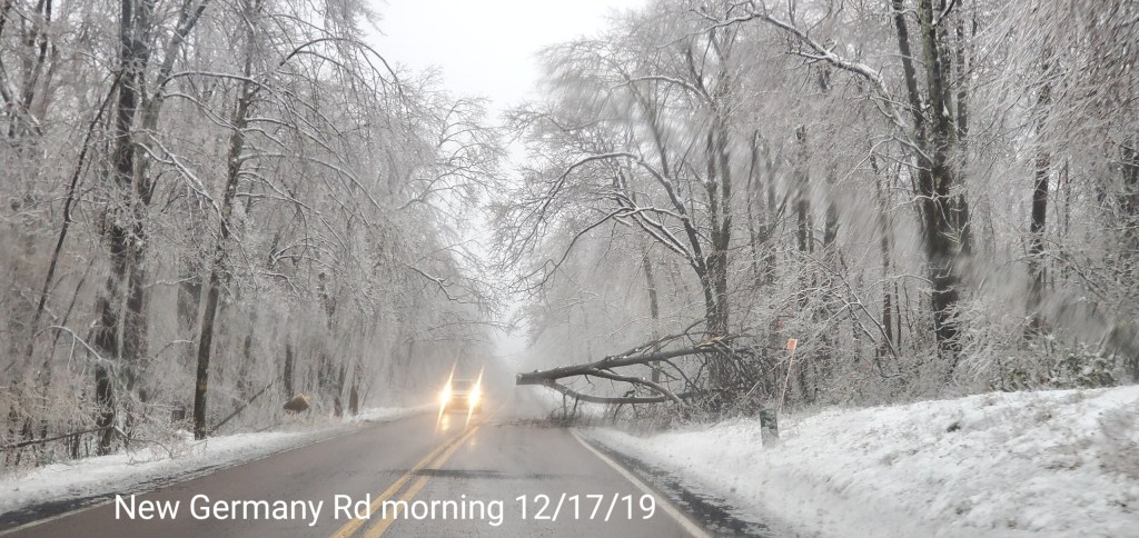
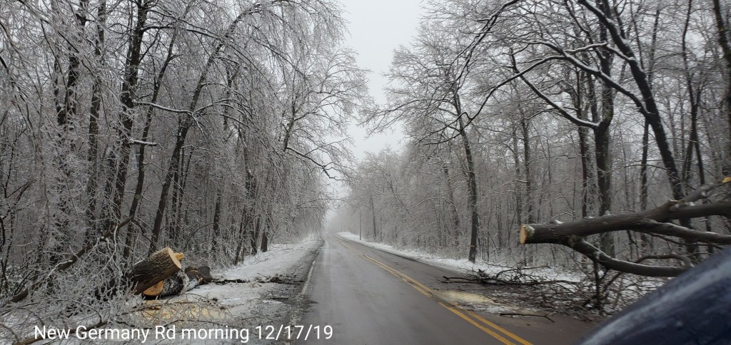
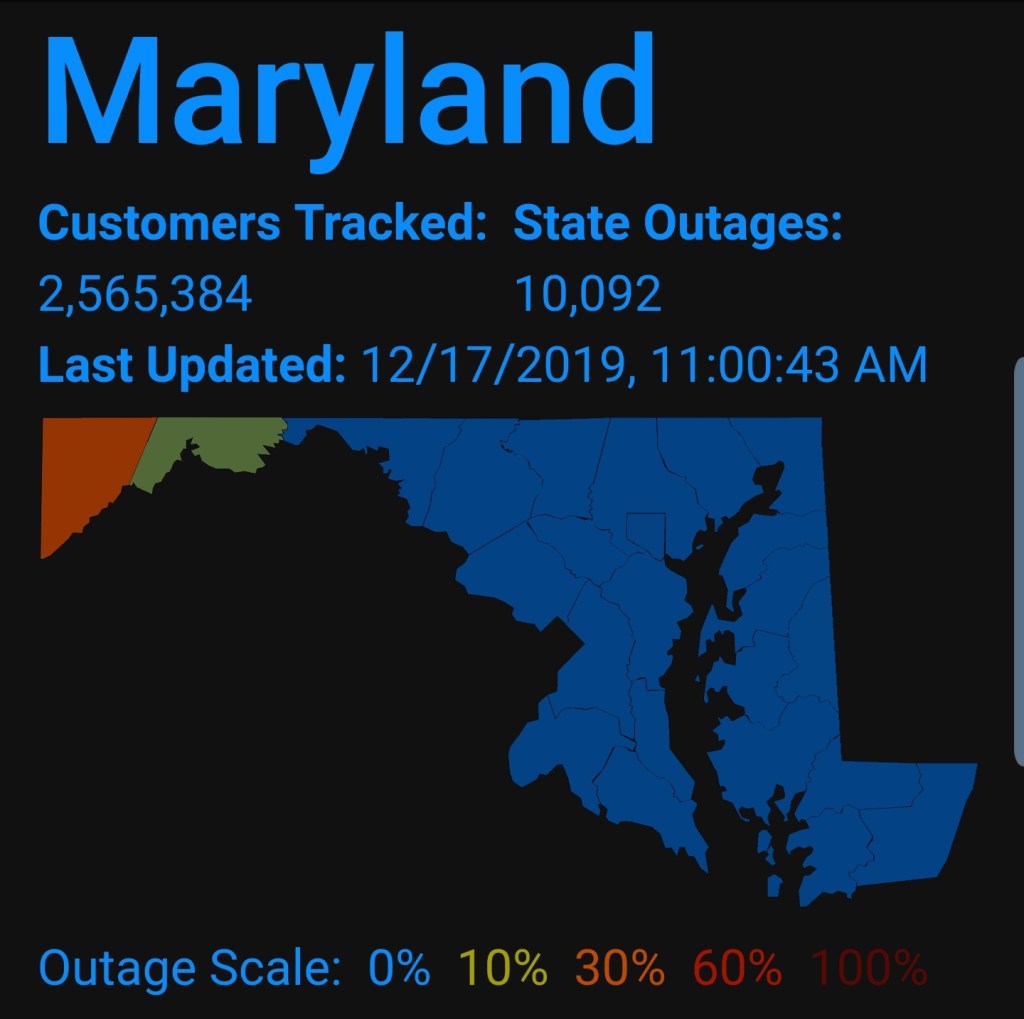
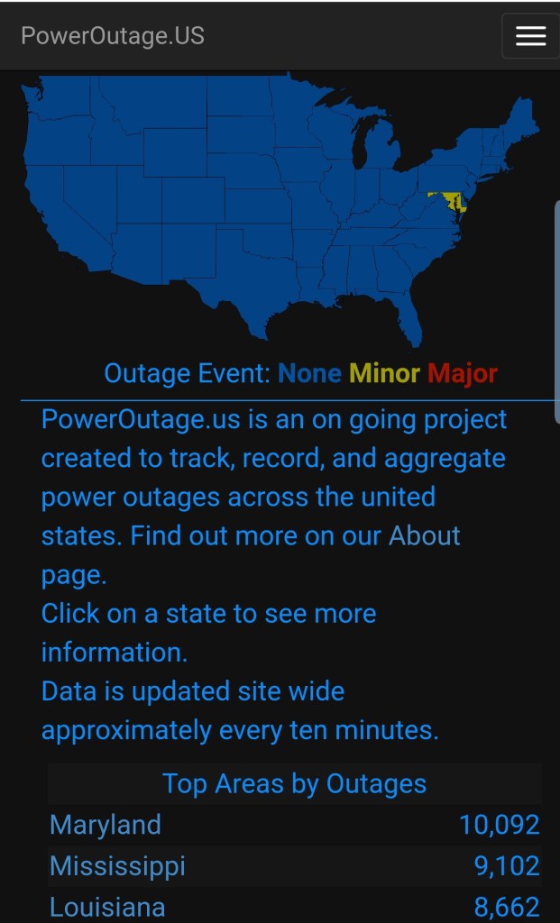
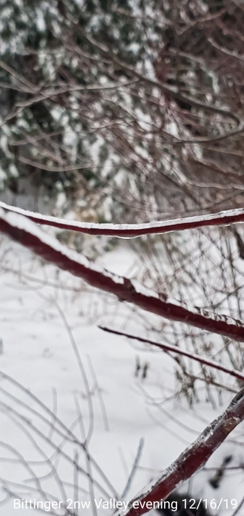
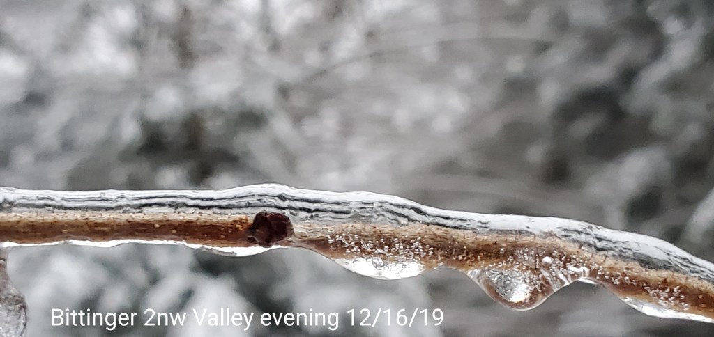
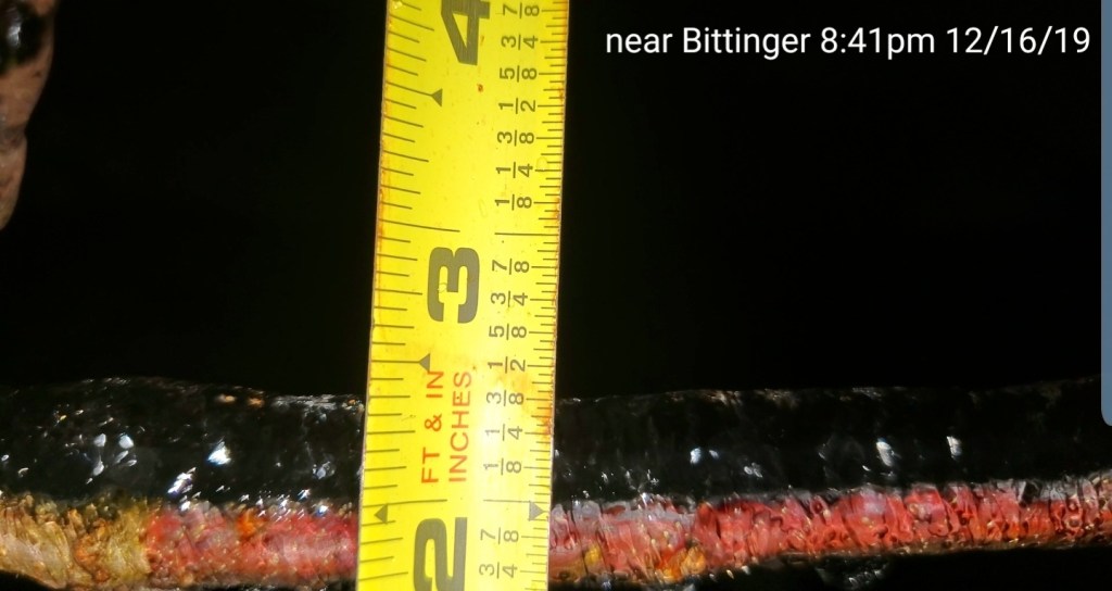
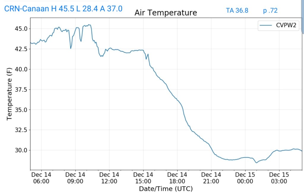
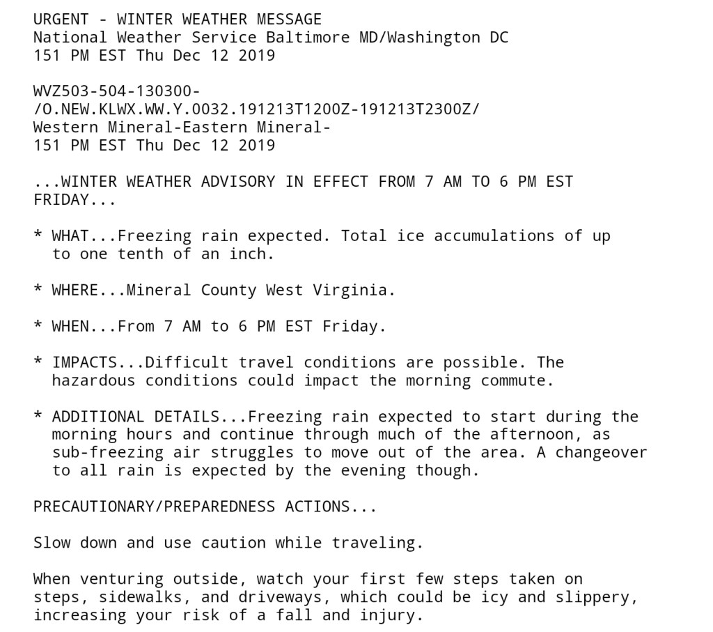
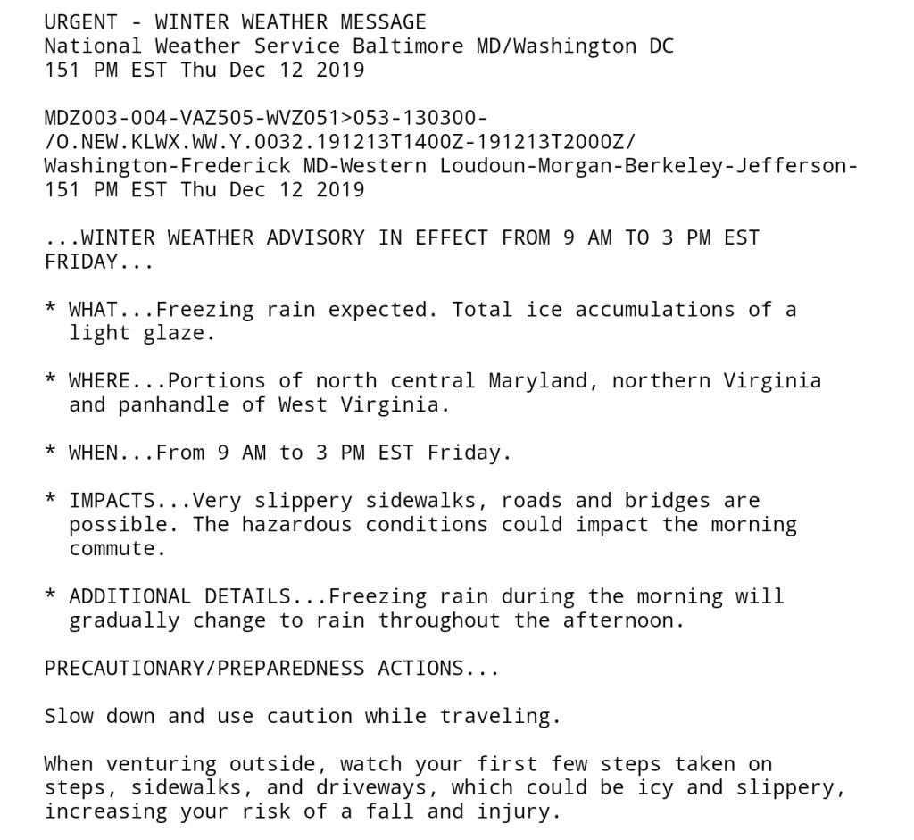
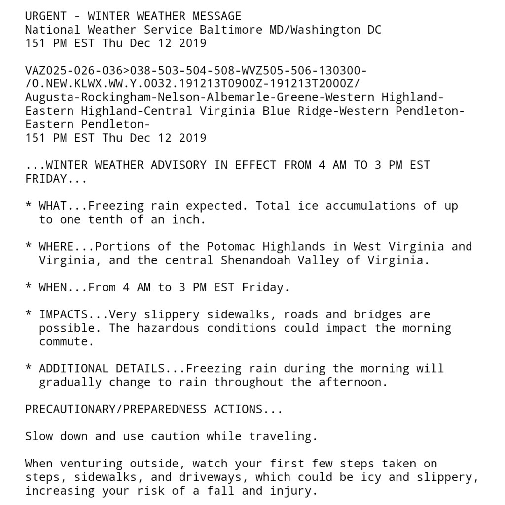
Ice ice baby. Major ice event across the eastern half of Garrett, and in some instances stretched into western Garrett. Overnight as far west as Preston County, before temps moderated there. Trees, limbs began falling 9-10pm and with that, power outages began. Some roadways blocked. All the while, very mild air and a rain out just to the south in Wv. Temps fell to the upper 20s at Mt.Storm early overnight last night, but sat at 50 this morning while below freezing remained in areas in Garrett. A brief surge of milder air came across mid morning, however not enough to scour out the cold in the high valleys in Garrett. The highest elevated areas in the ice zone lost more ice than the lower elevated areas with the brief mild surge that was followed by wind and colder air by midday. Leftover rain today changed to snow early afternoon as the colder air returned. Ice never came off the trees. Some high ground saw a little more melt than valleys in central Garrett with the slightest intrusion of mild air mid morning.
Snowfall season to date total 16.7, minor accumulation through nightfall to be added tomorrow
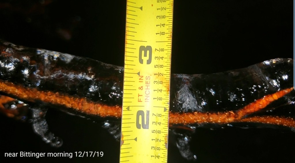
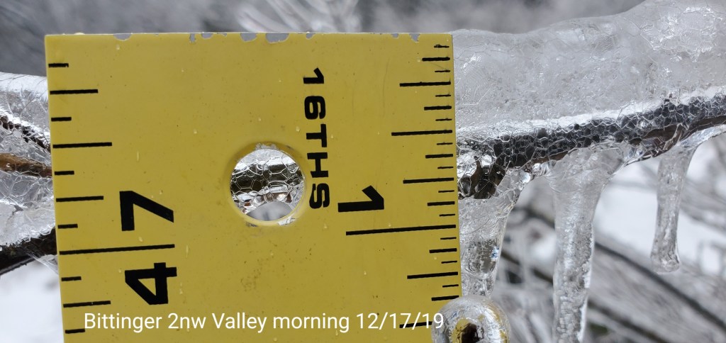
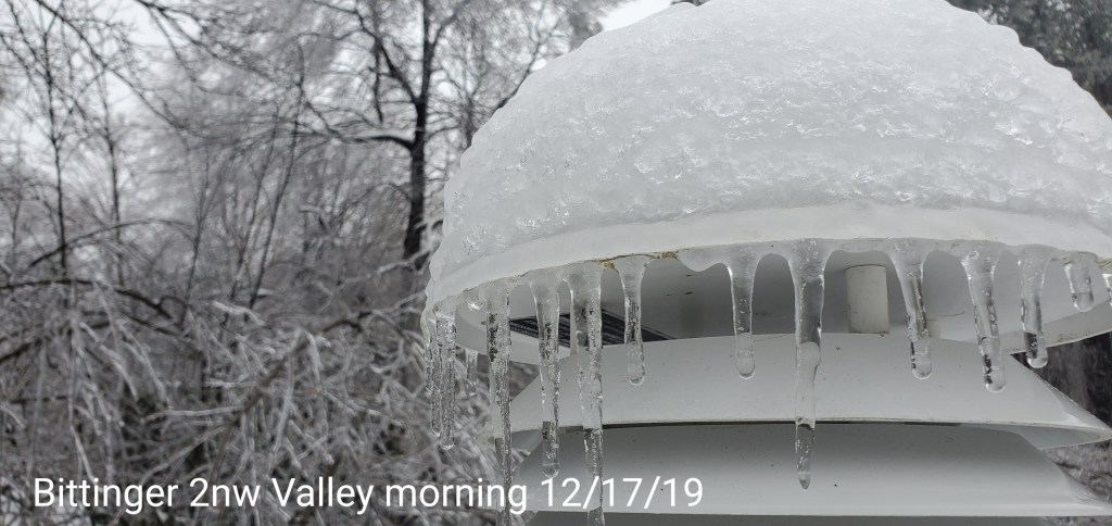
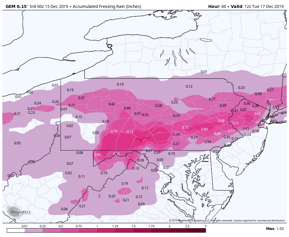
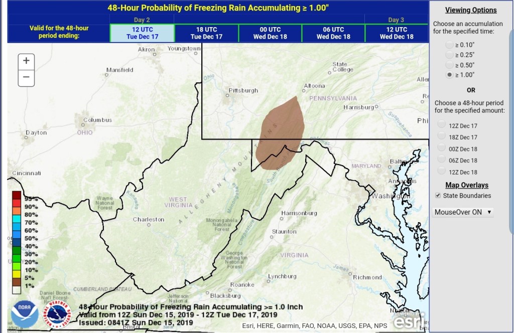
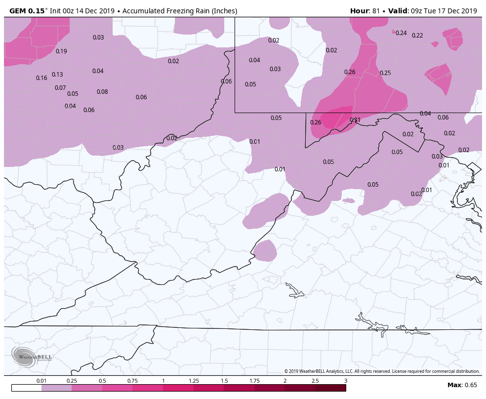
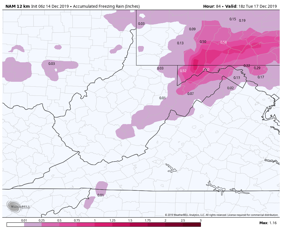
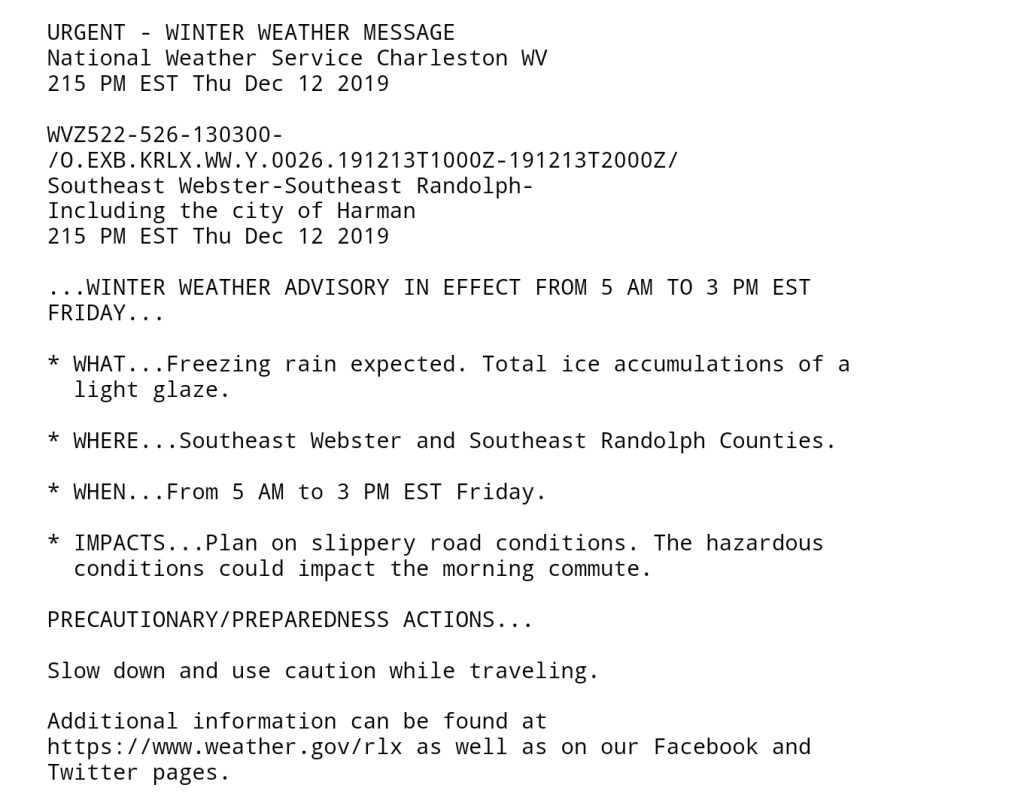
Freezing rain amounts, always a difficult judgement as freezing rain varies object to object. If its wind faced, if its marginal more can run to the end of tree limbs vs the upper parts etc…that said .4 to .6 range was common.
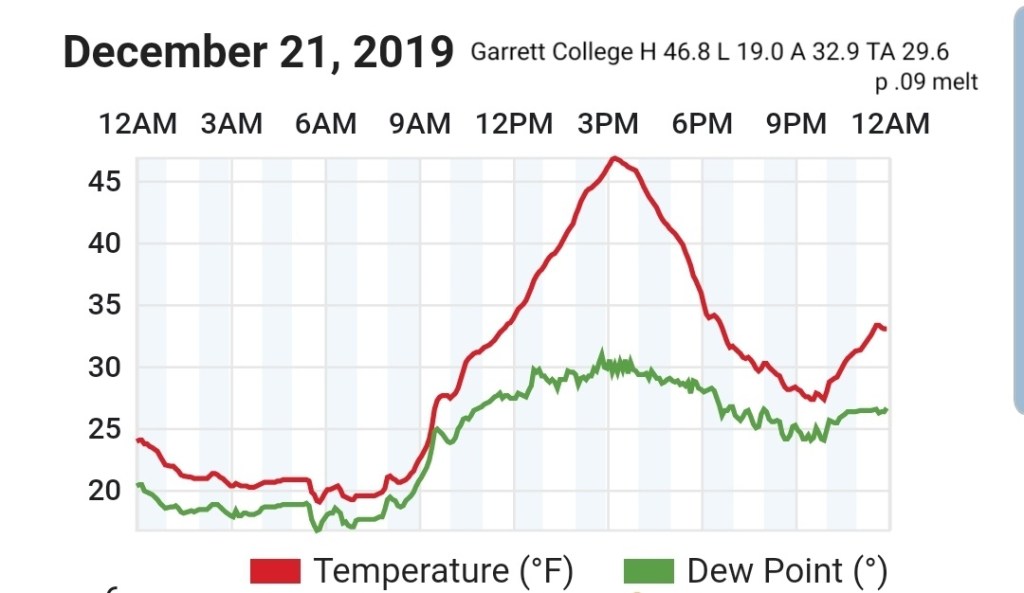
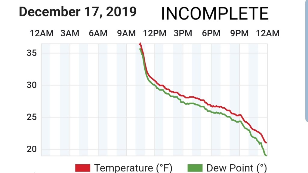
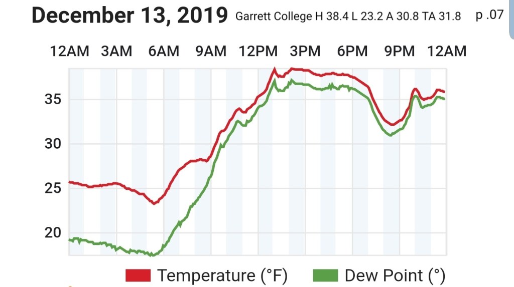
Garrett College
Due to the power outage, data is missing for the first 10 hours today. That leaves today’s data incomplete at GCC. The min temp does stand as the min as that occured after power was restored.
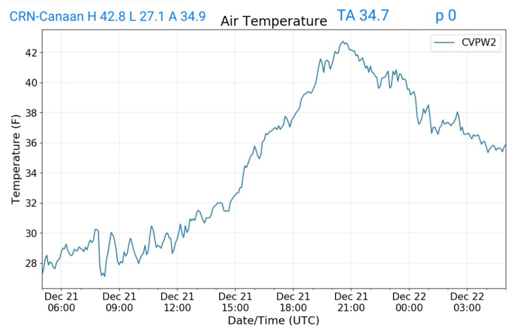
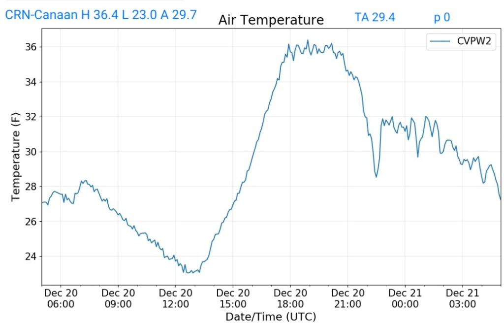
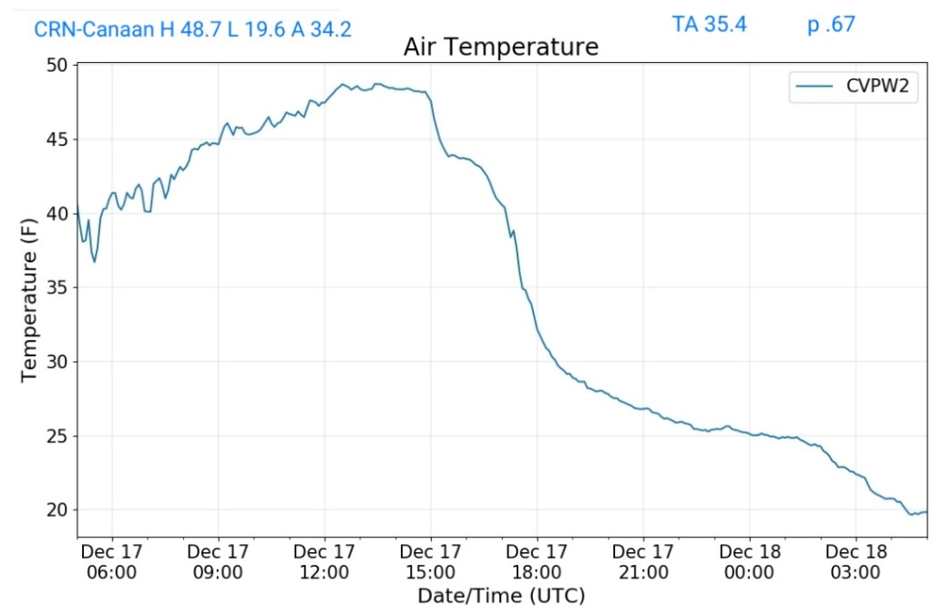
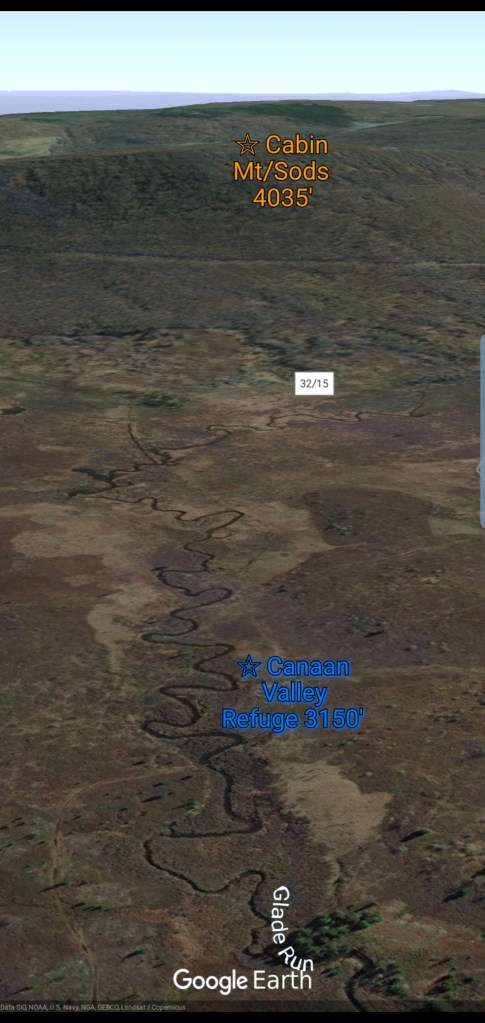
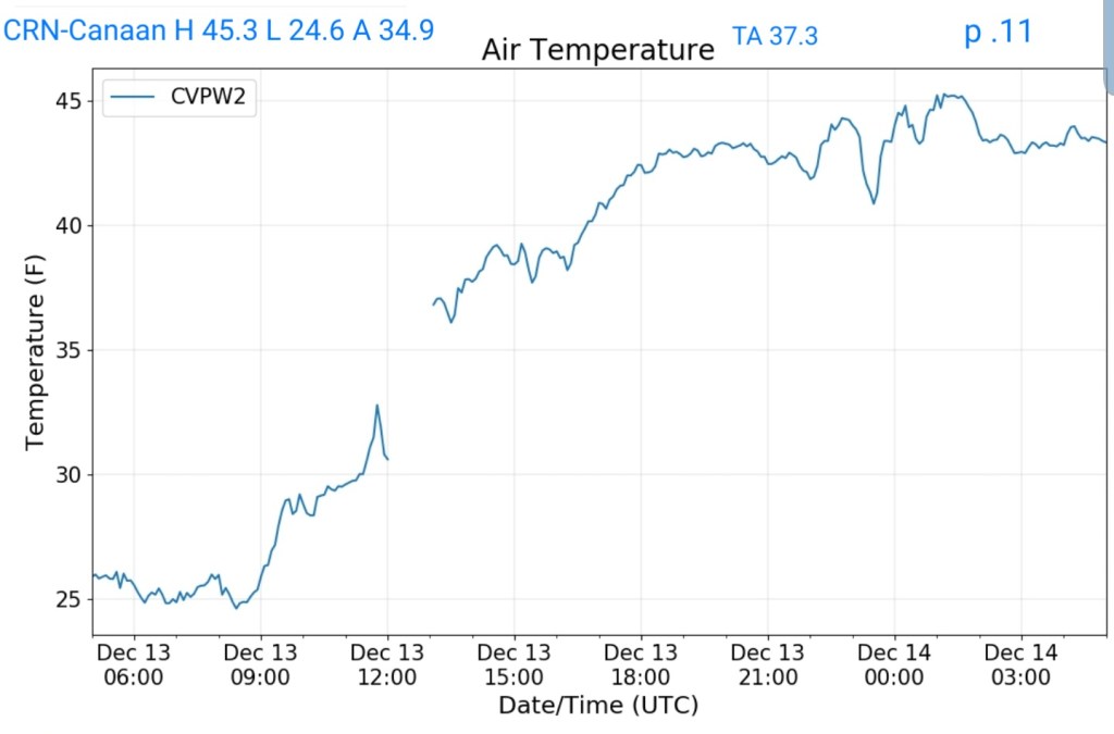
Canaan Heights/Davis 3SE
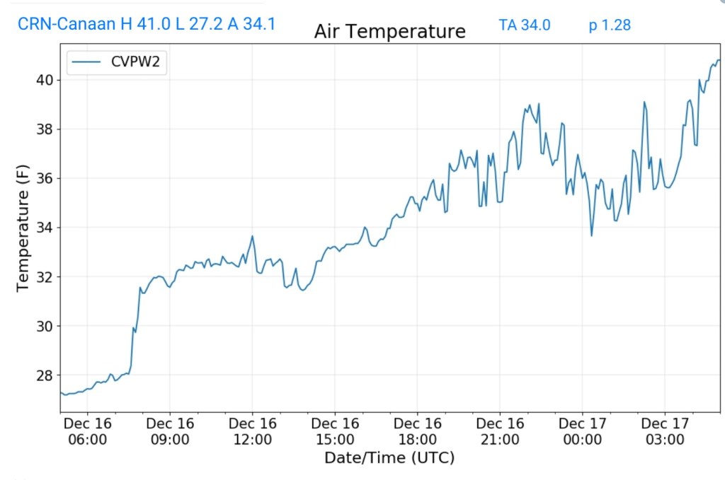
This zone remained in the rain
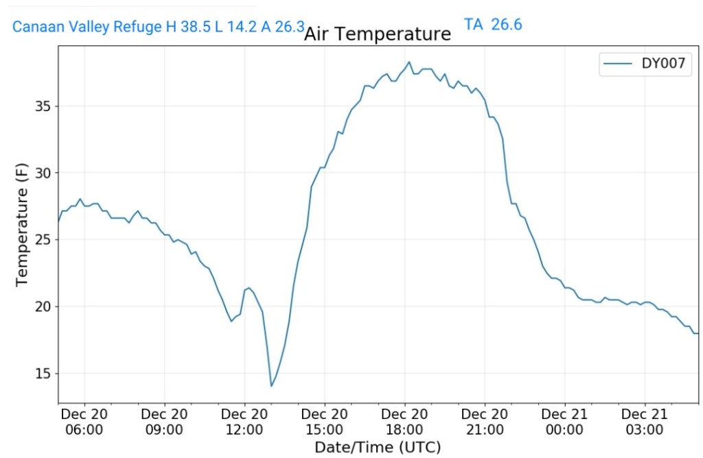
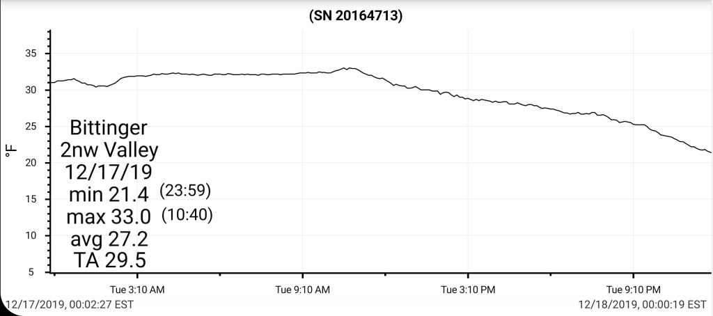
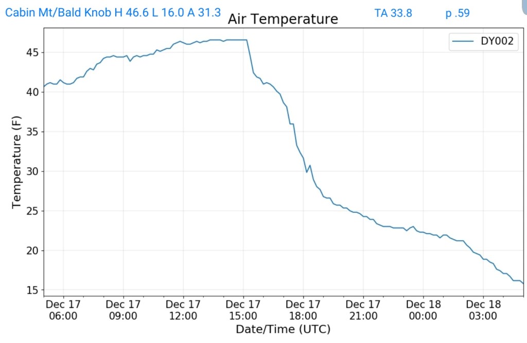
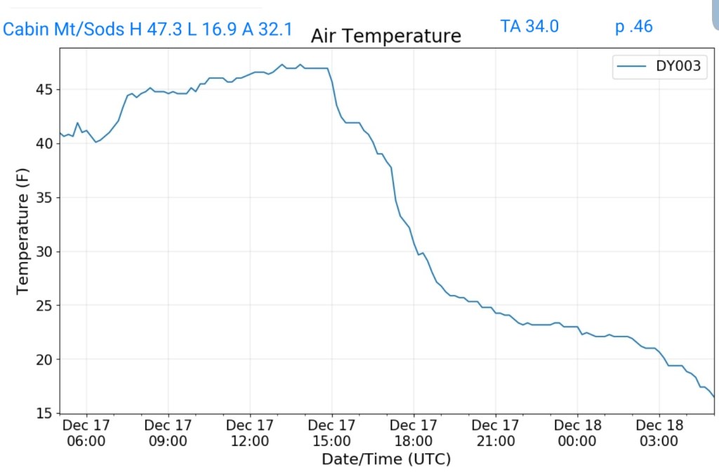
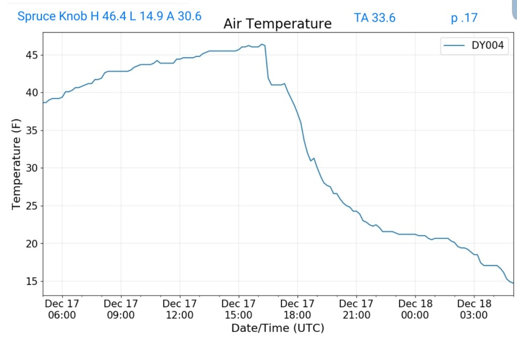
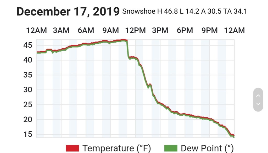
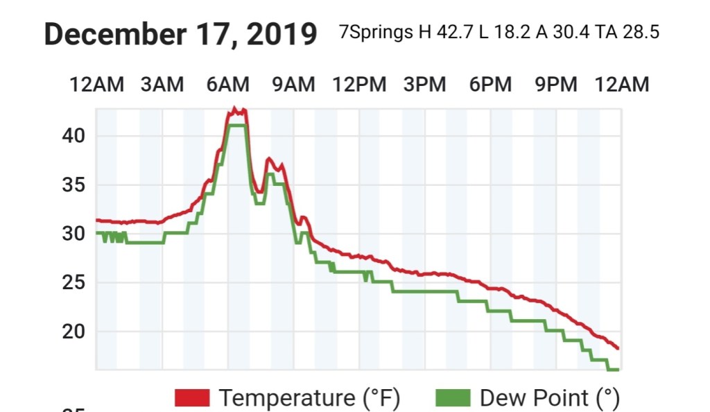
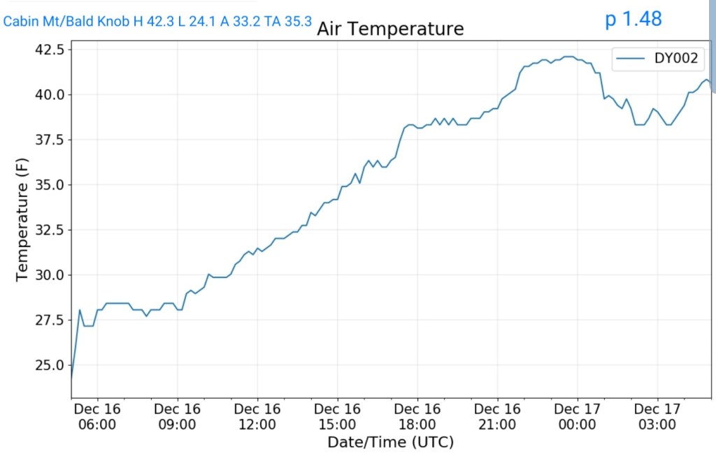
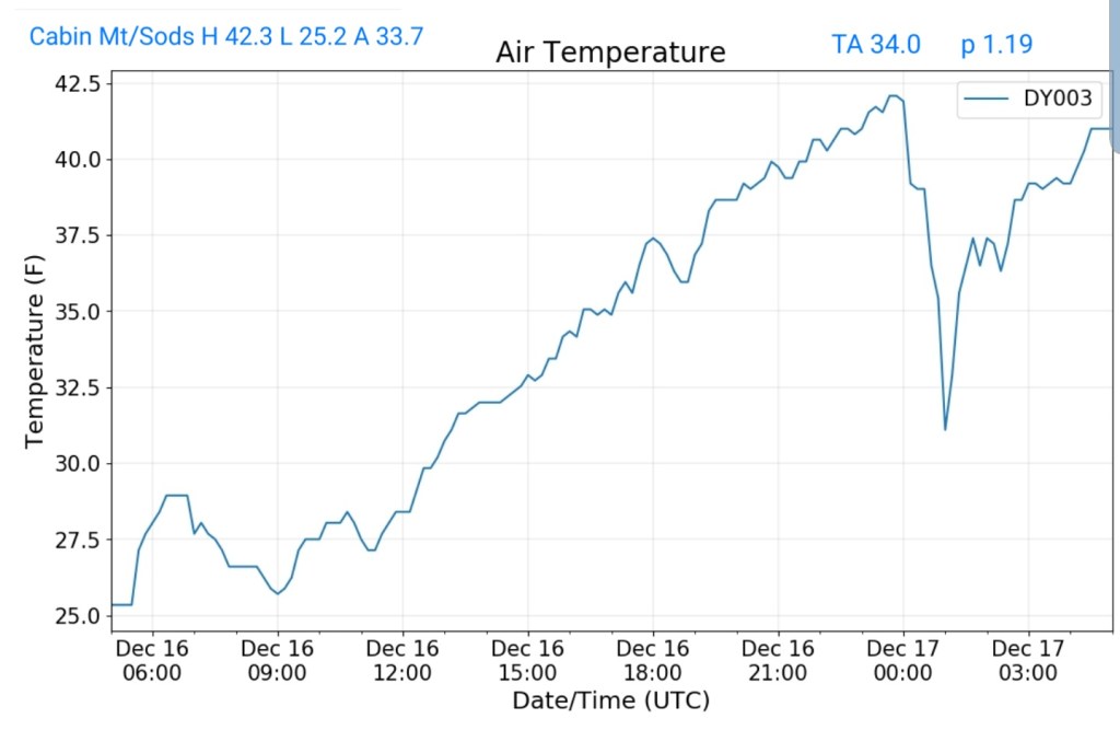
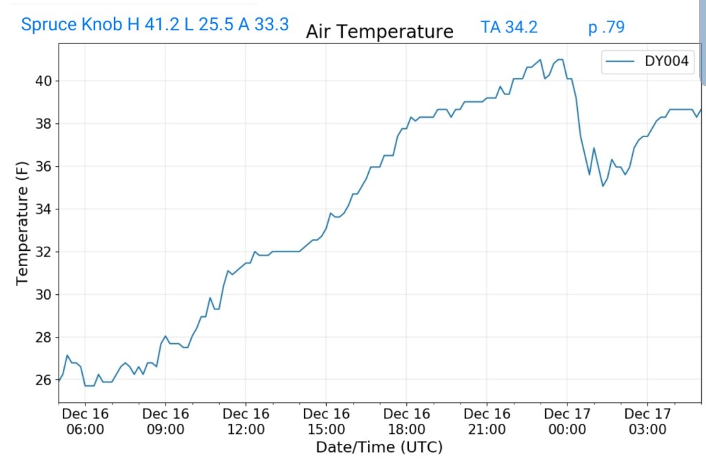
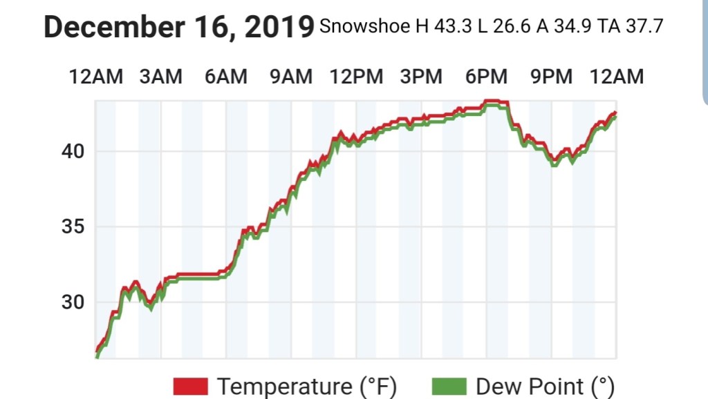
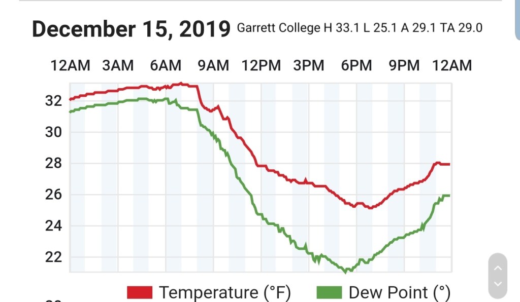
MIN[14.2]—MAX[48.3]—AVERAGE MEAN[31.2]
Snowfall stands at 26.3″ additional today will be added in the morning
Surface features and 500mb height anomalies and flow
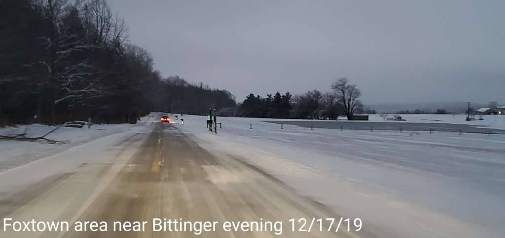
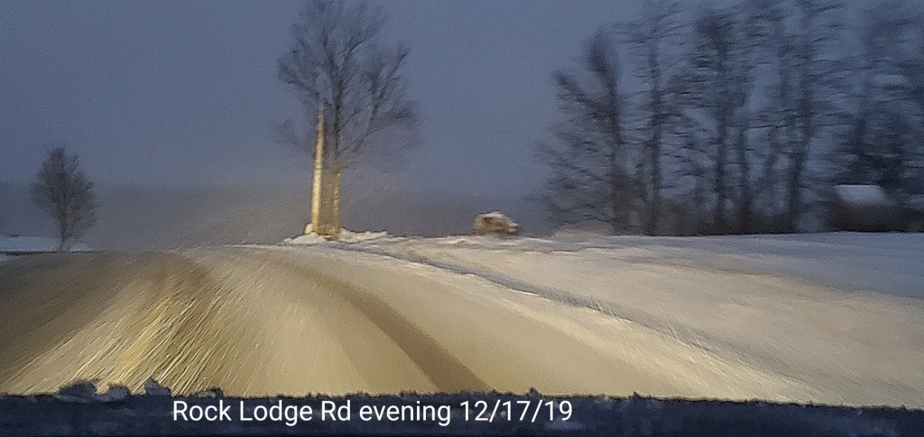
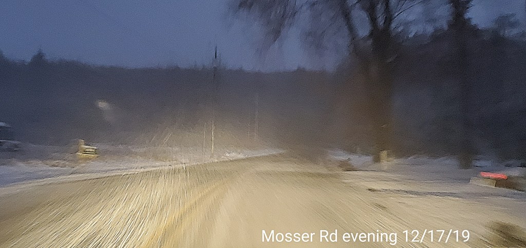
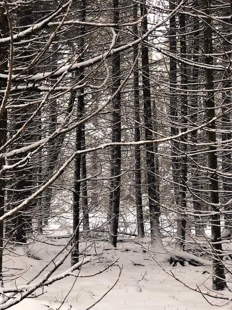
Pics to come…
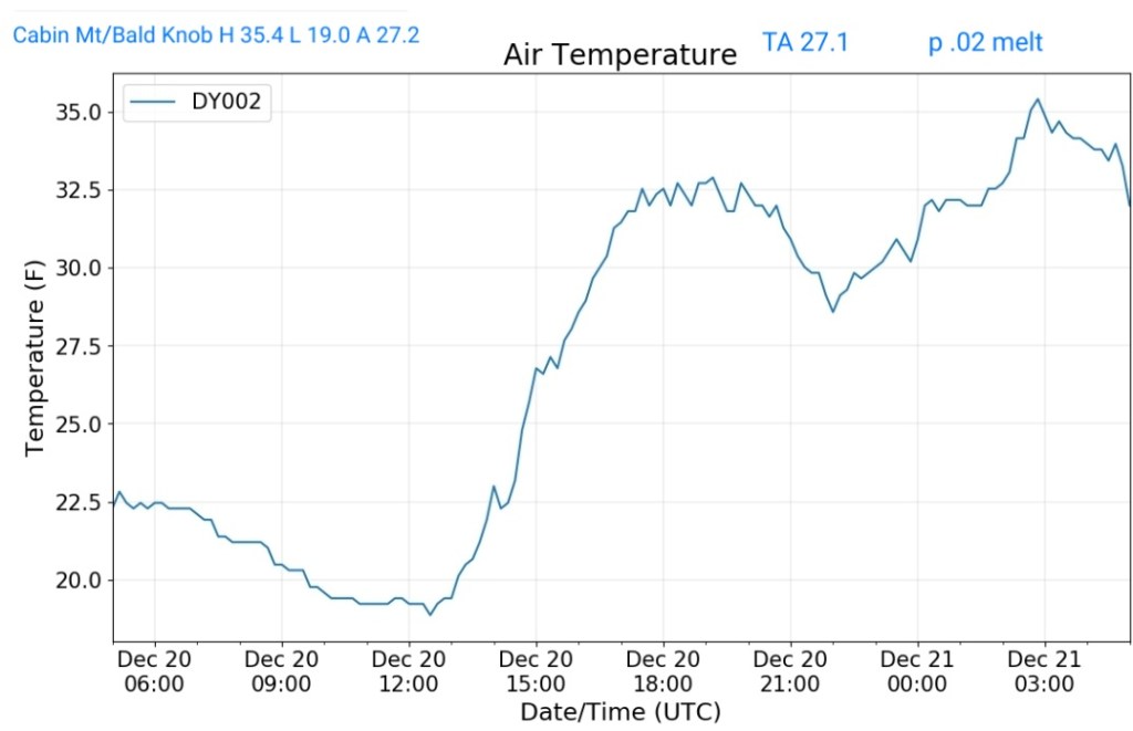
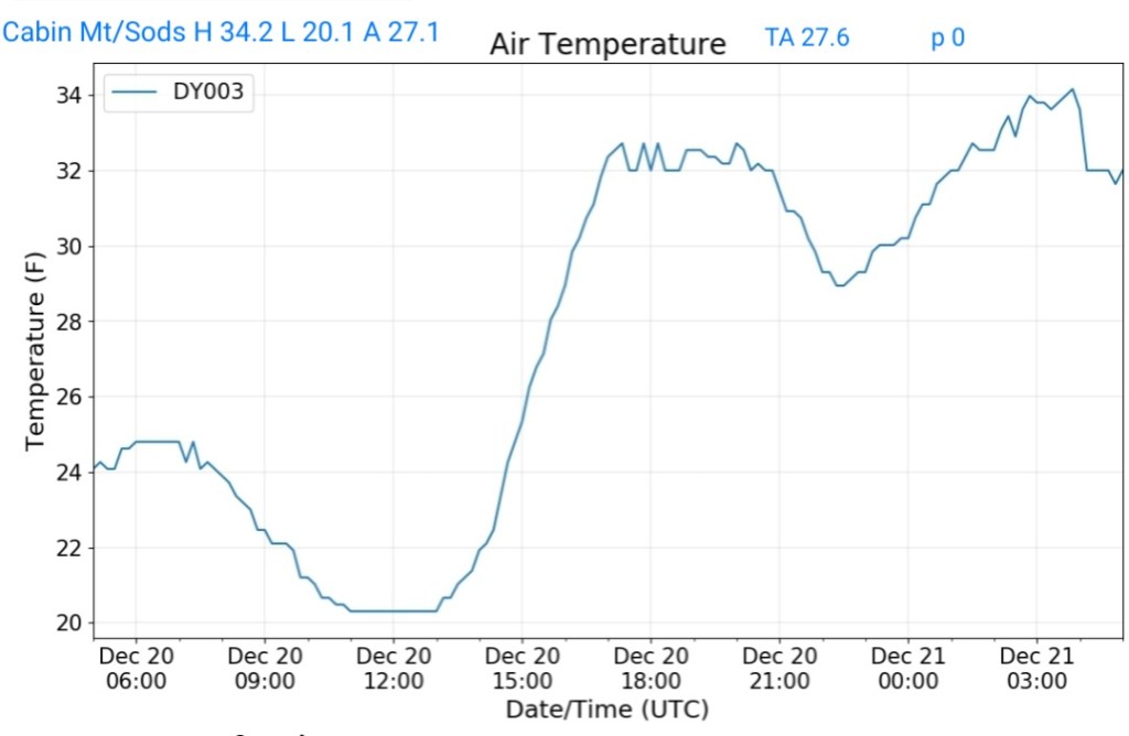
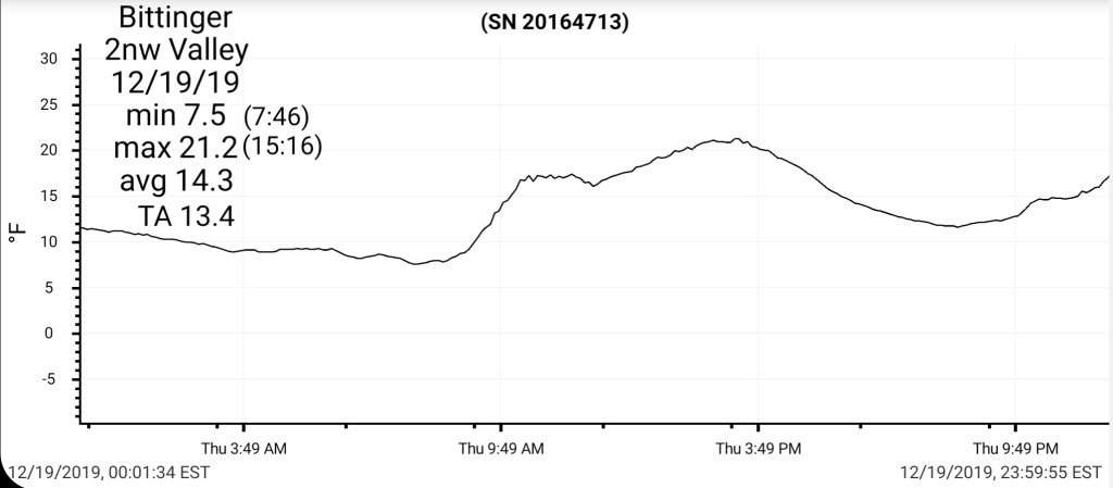
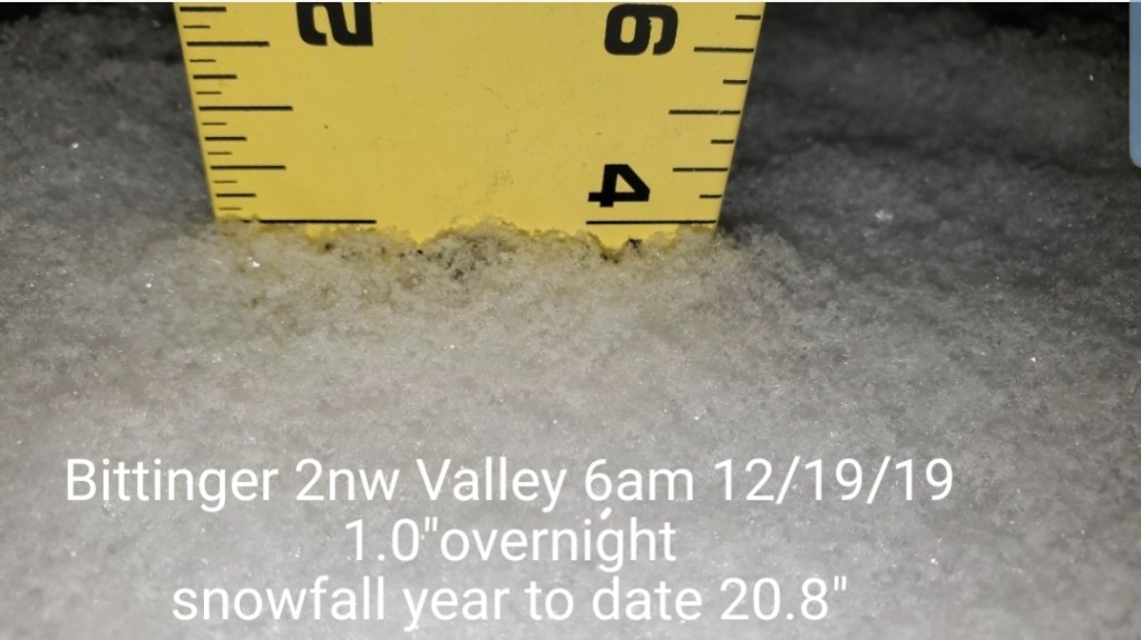
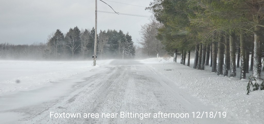
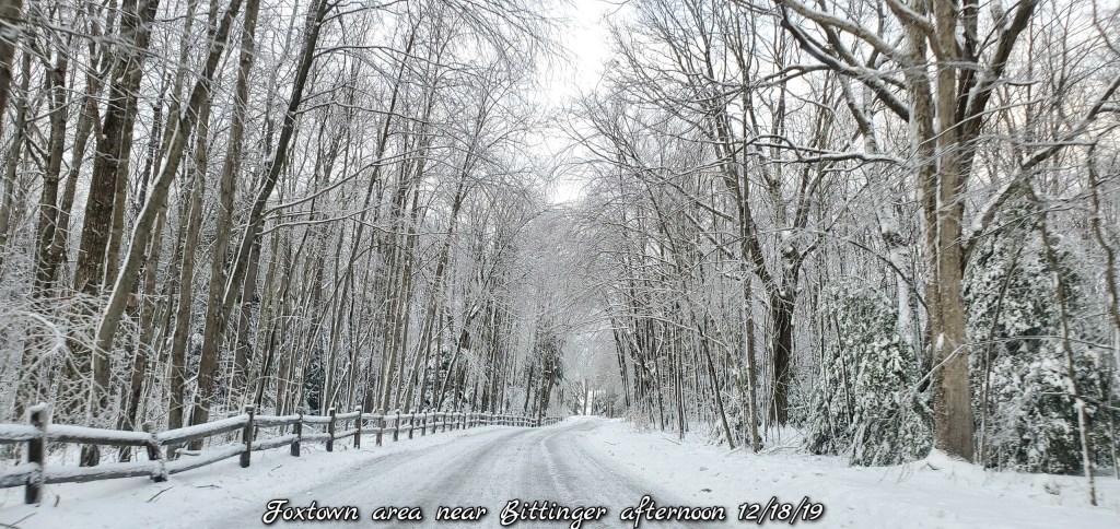
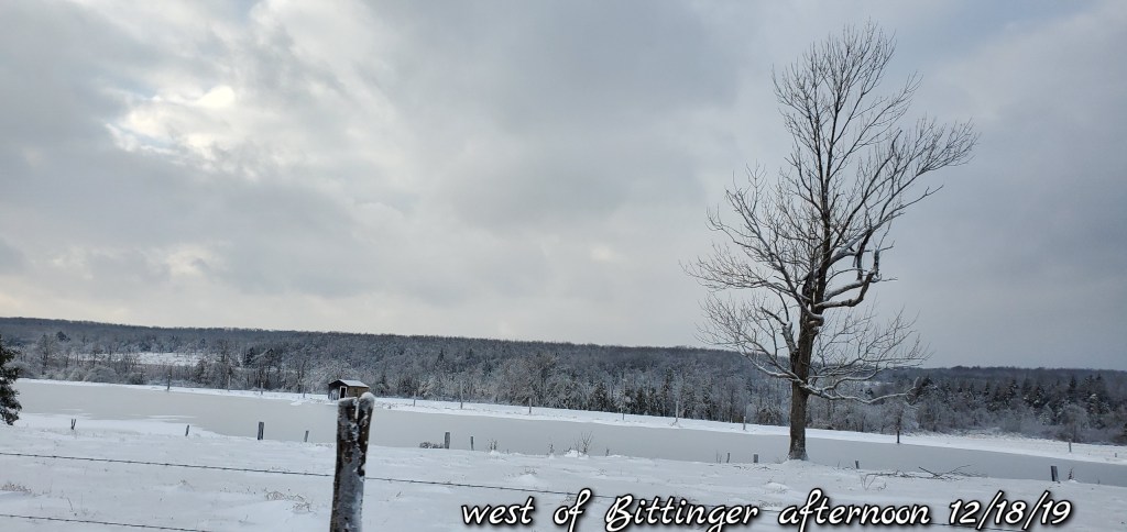
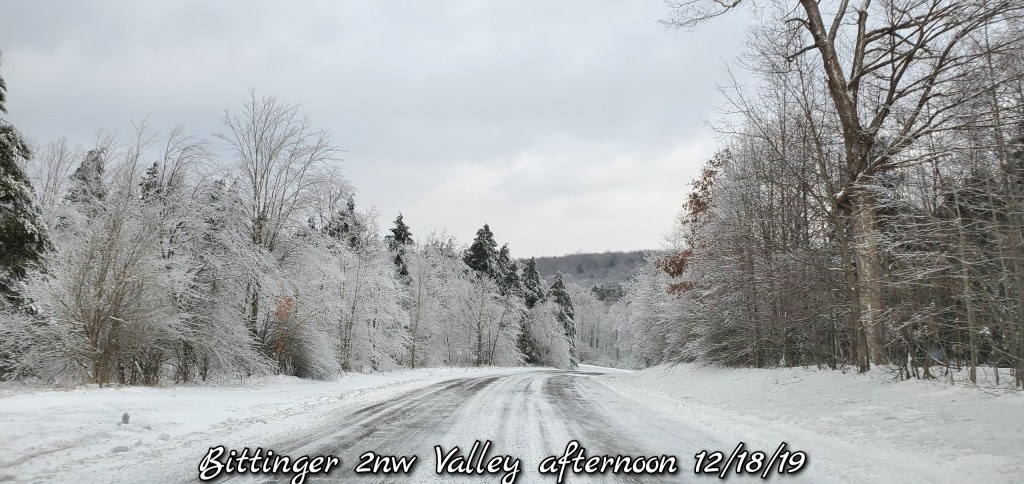
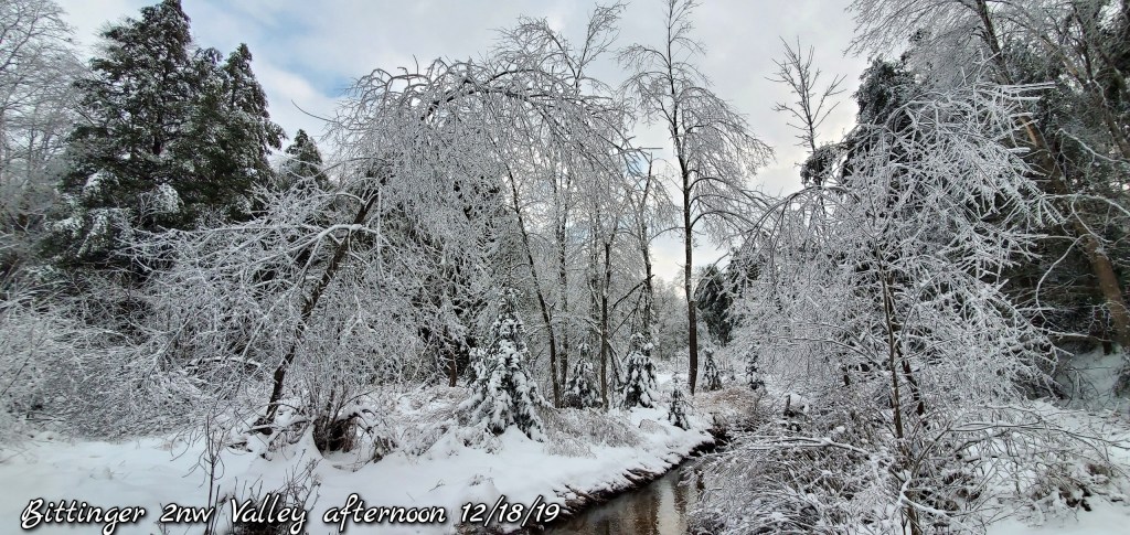
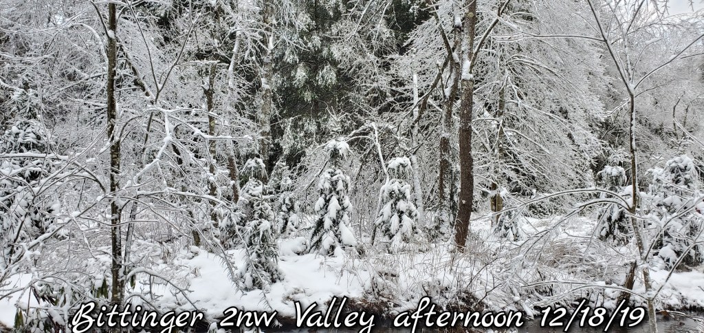
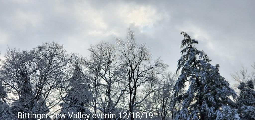
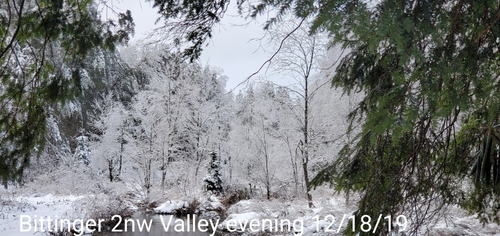
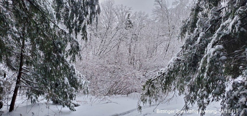
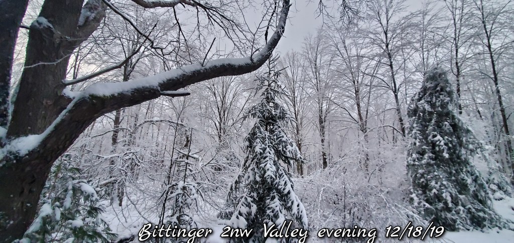
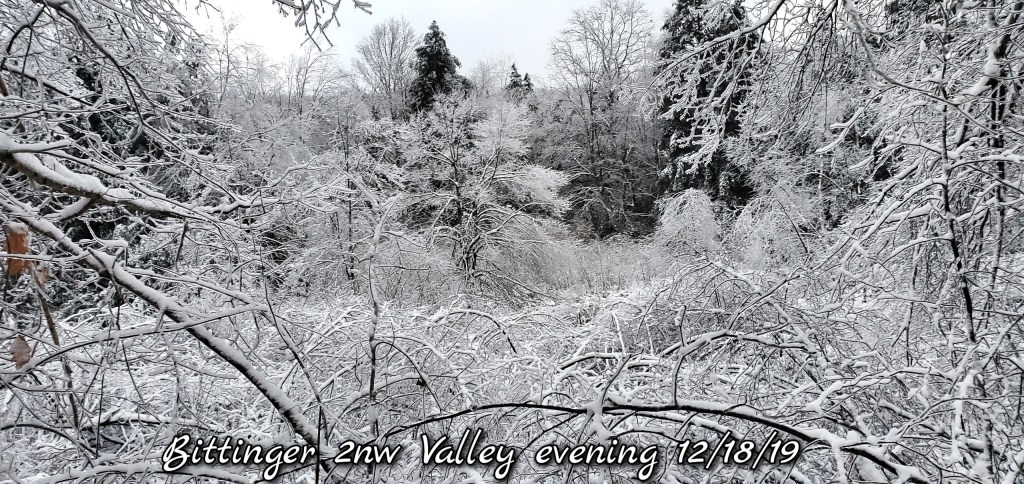
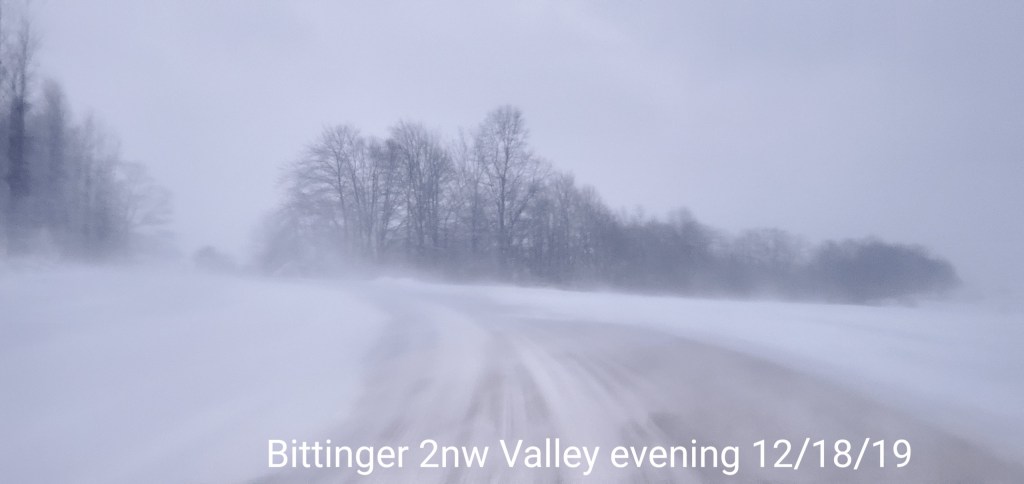
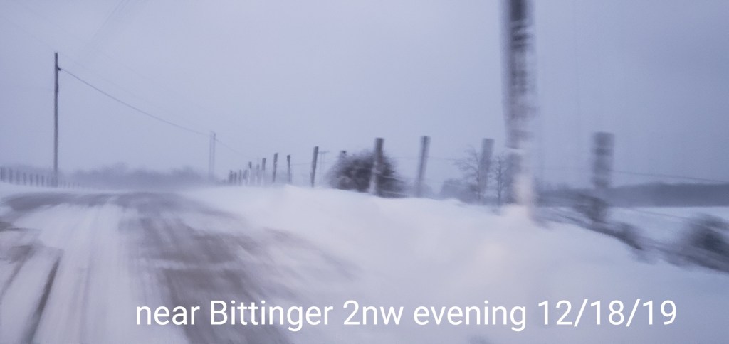
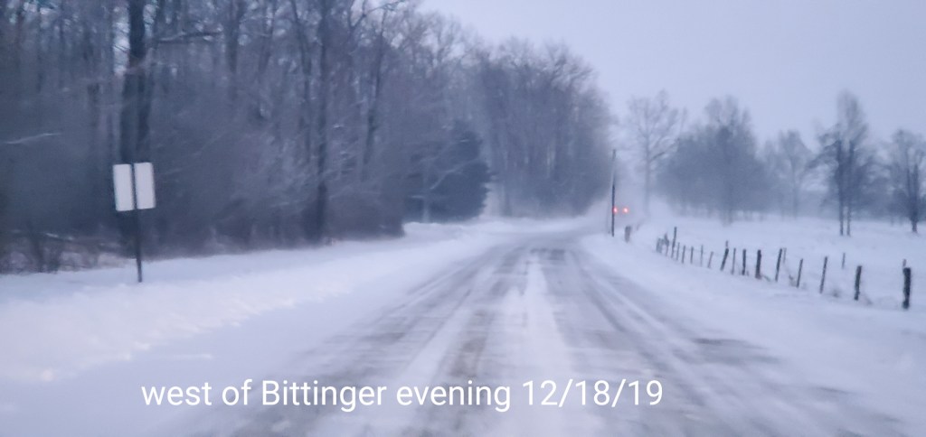
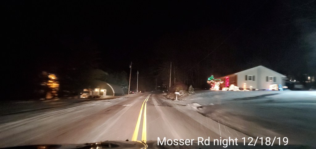
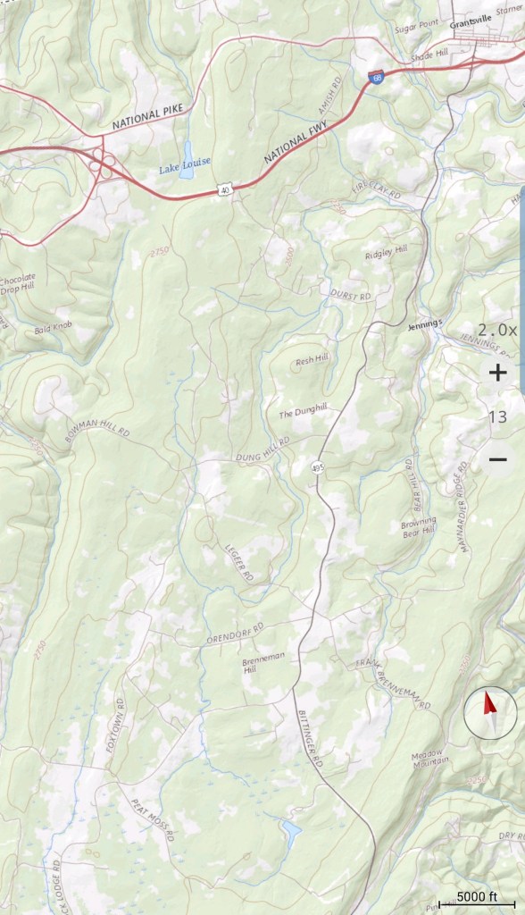
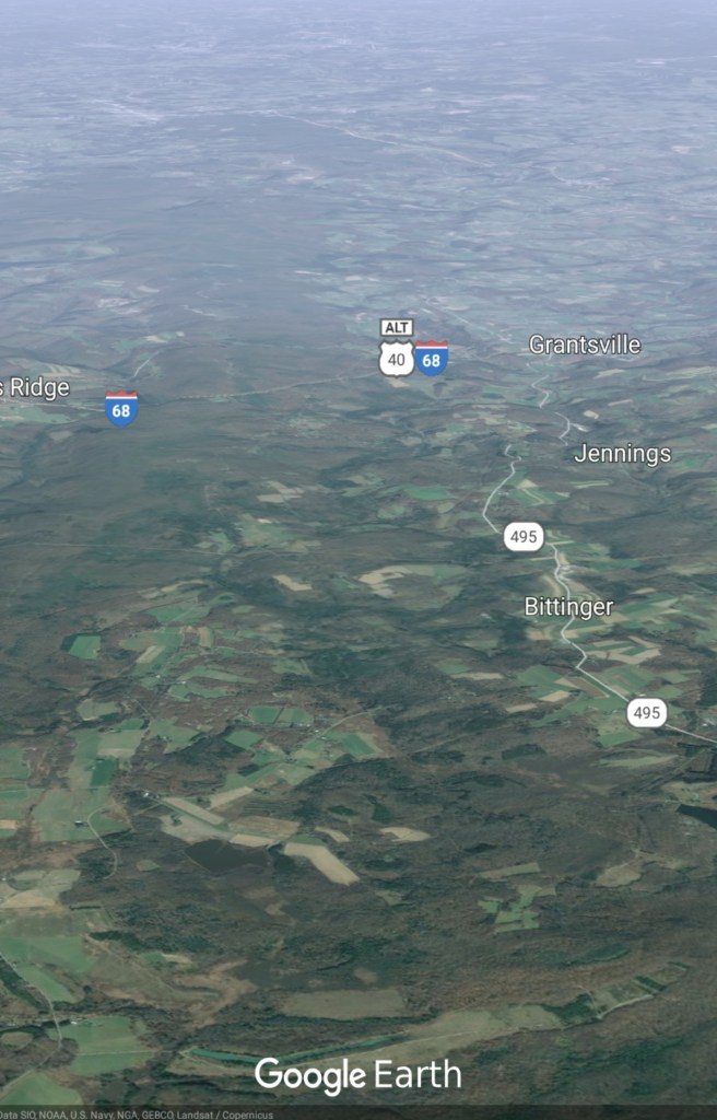
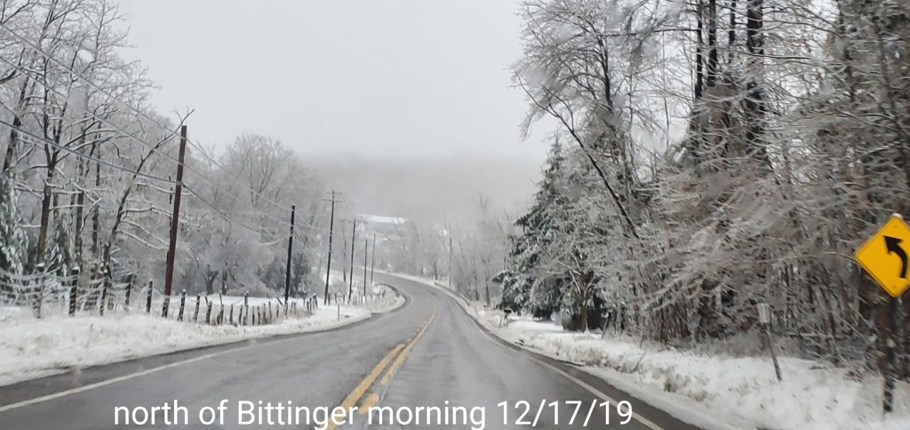
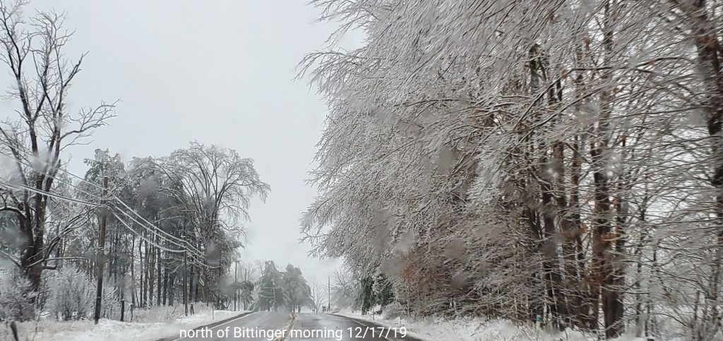
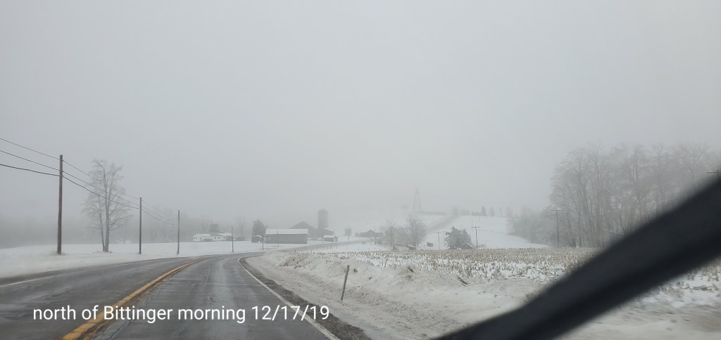
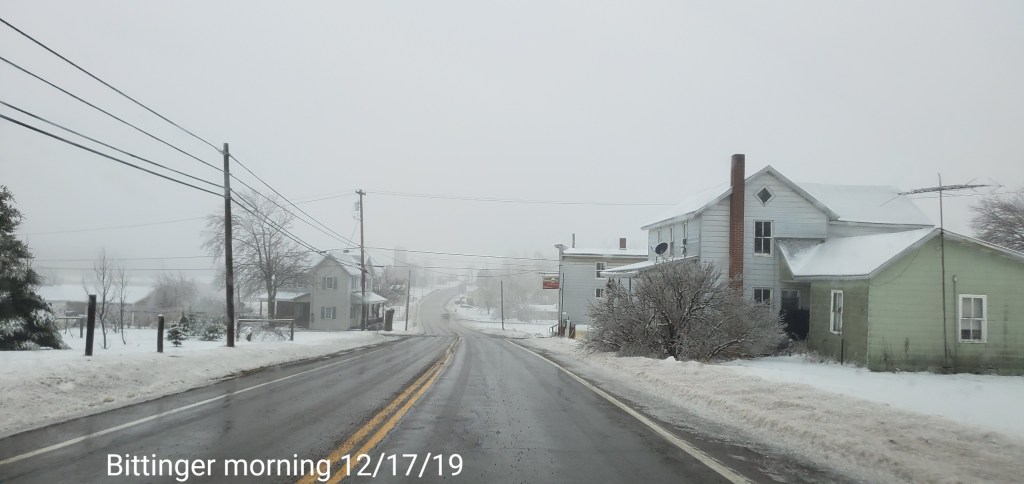
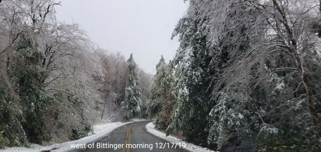
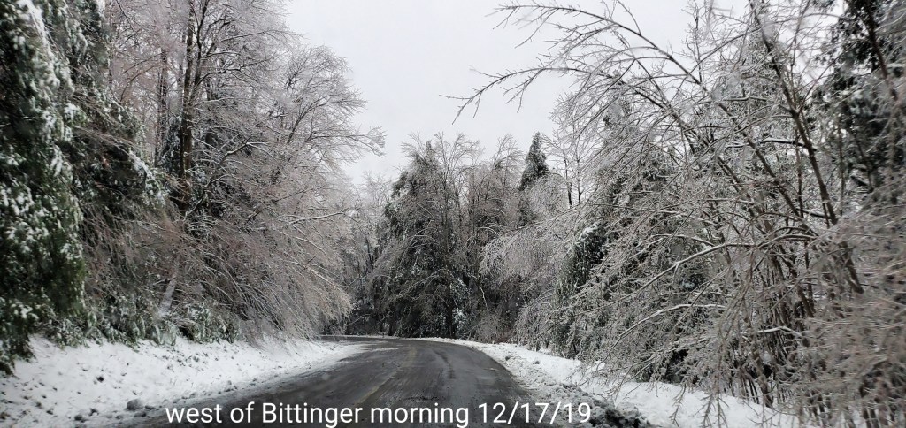
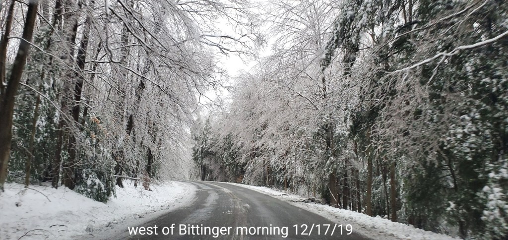
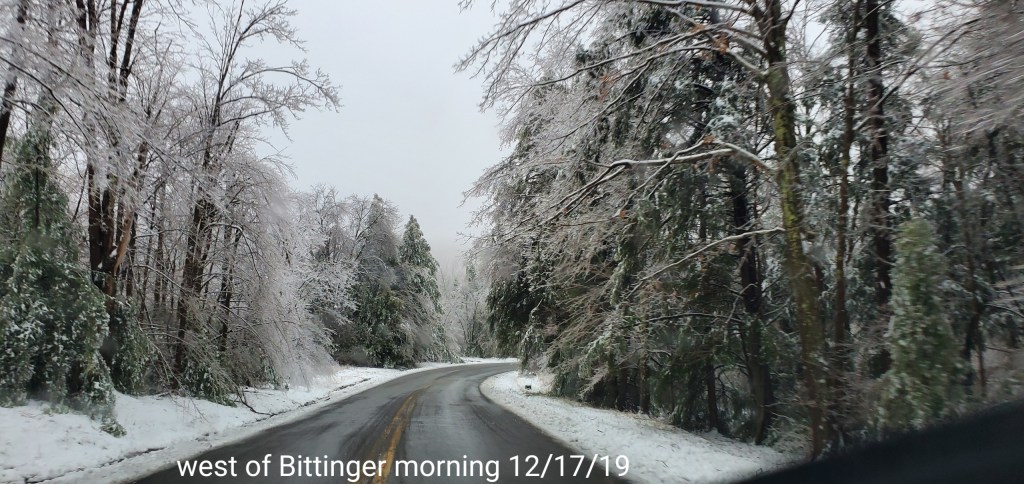
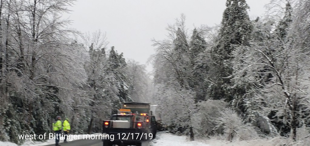
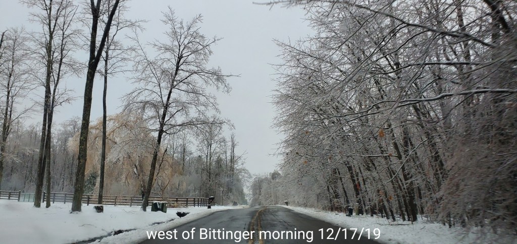
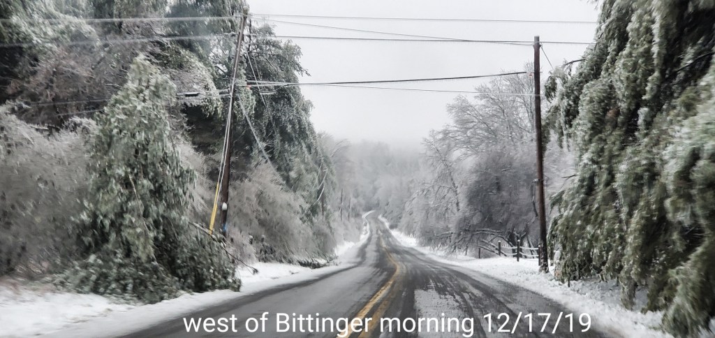
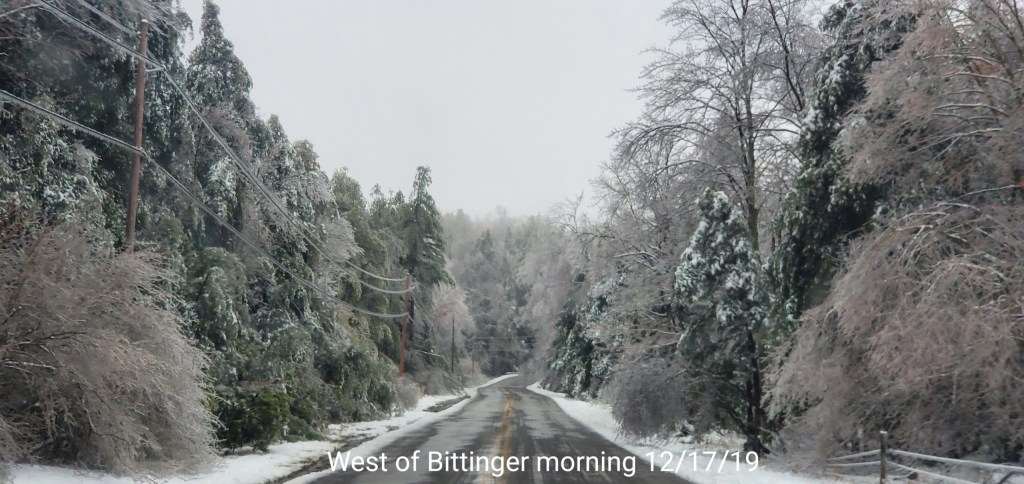
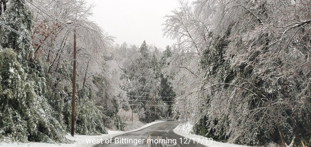
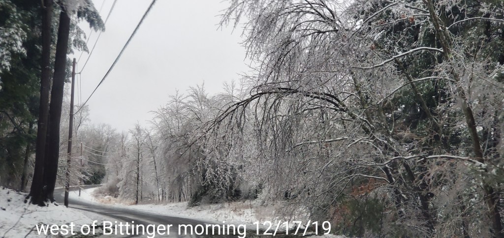
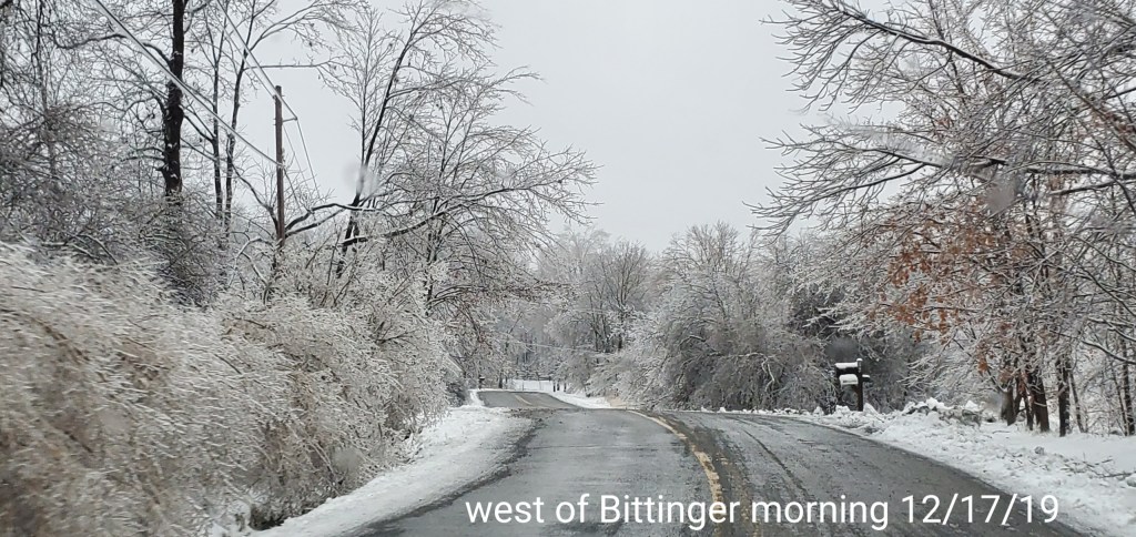
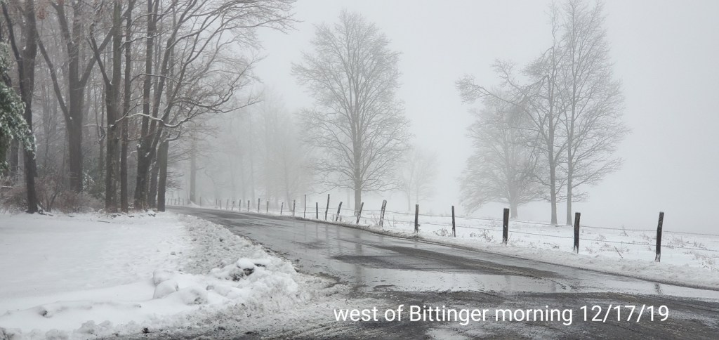
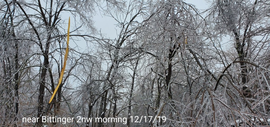
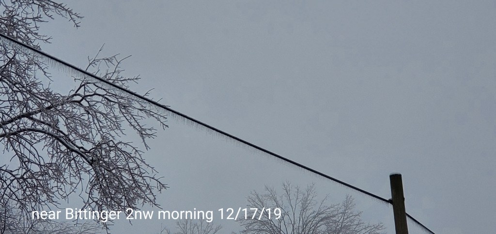
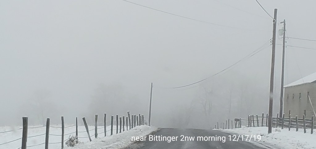
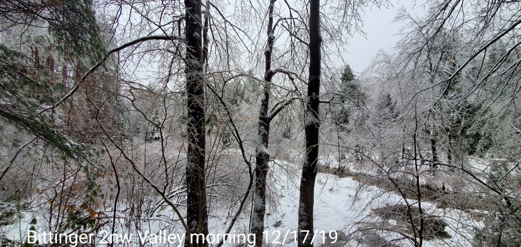
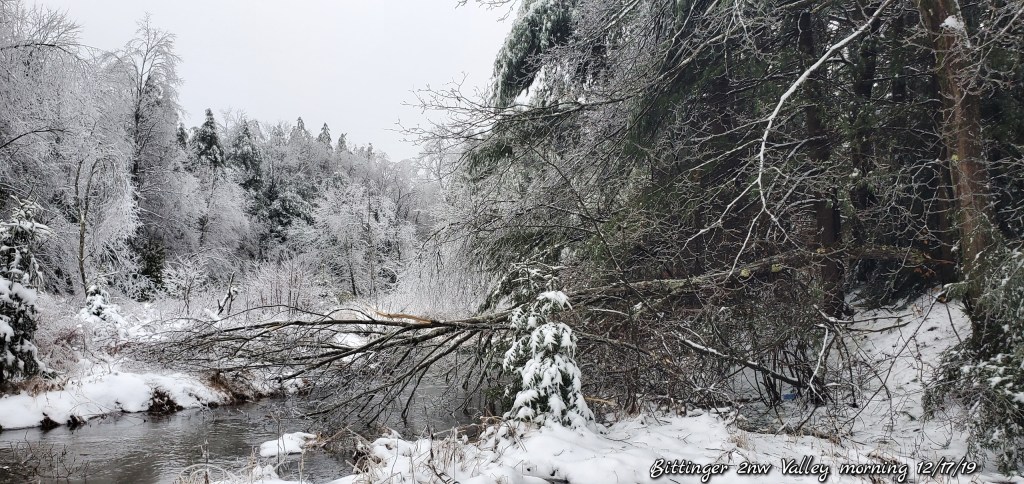
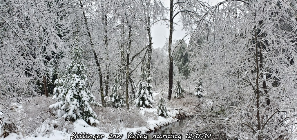
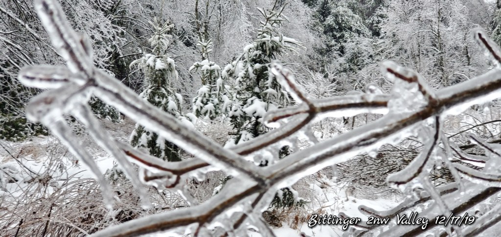
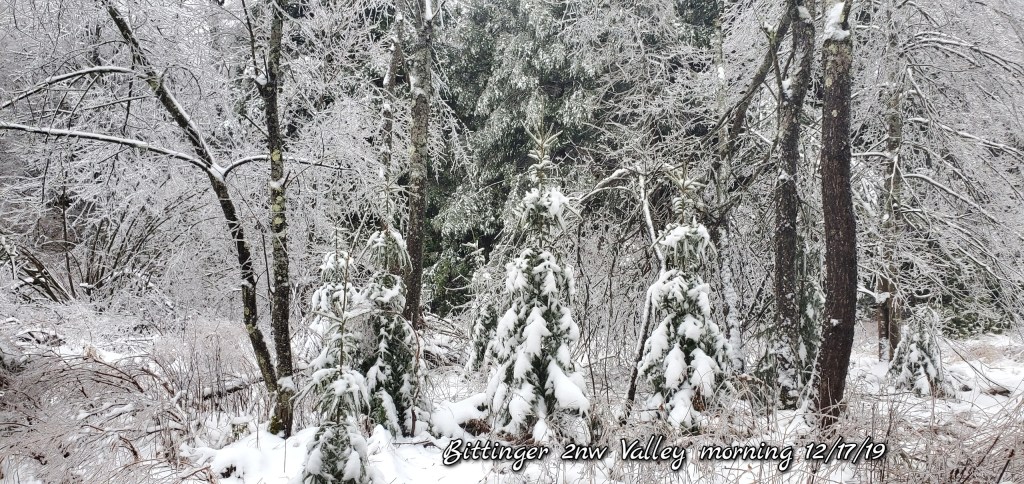
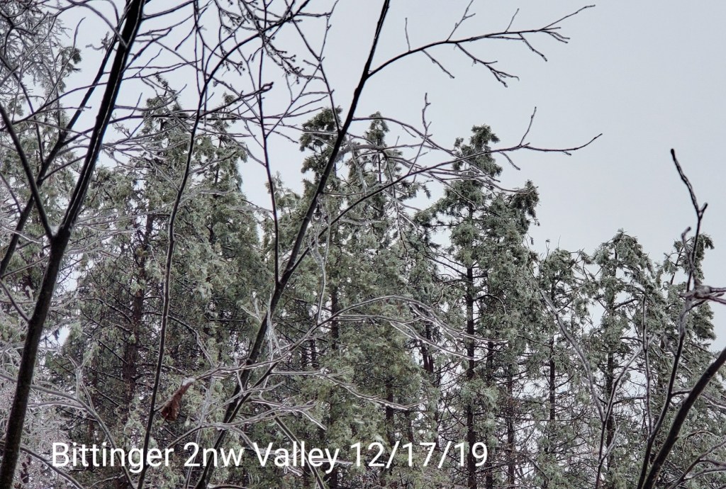
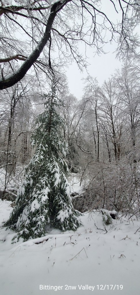
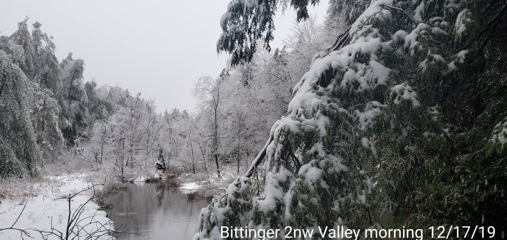
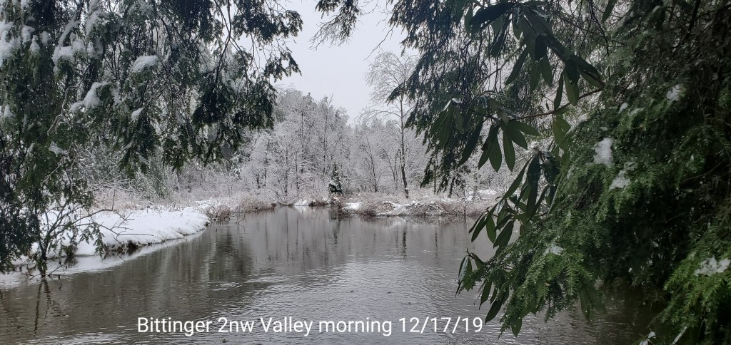
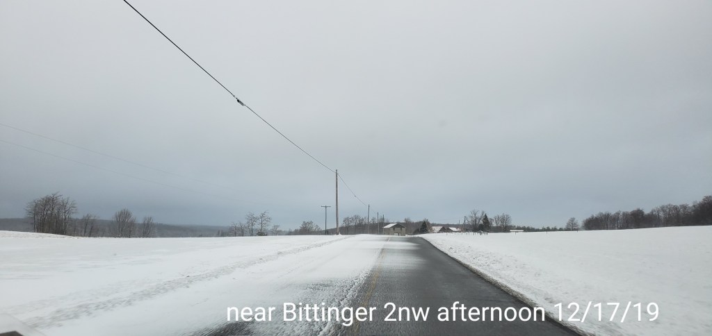
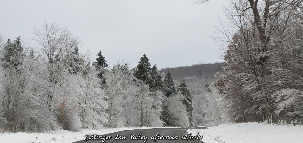
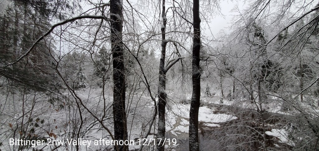
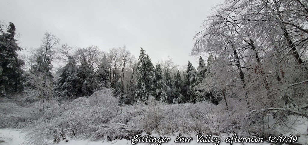
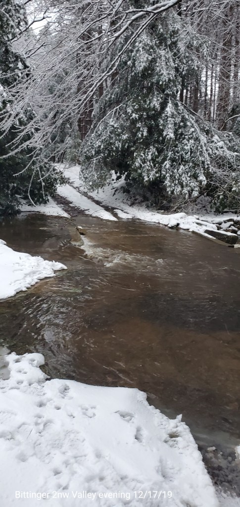
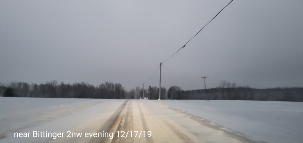
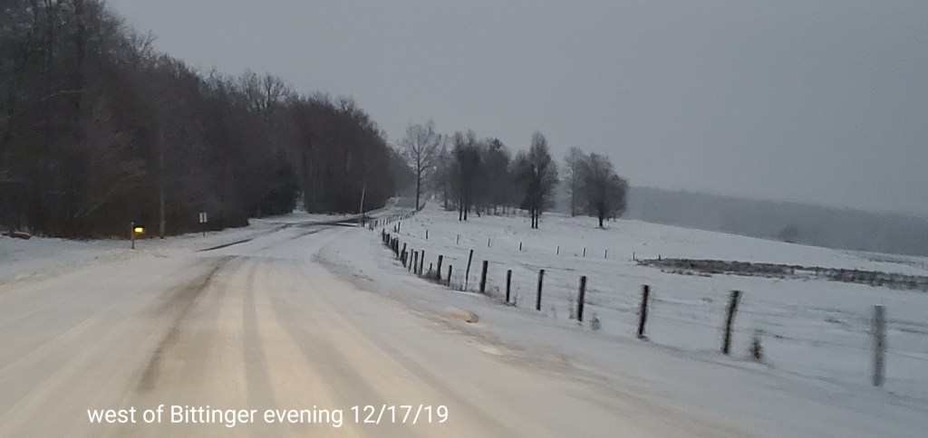
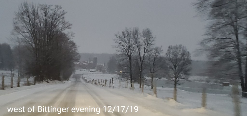
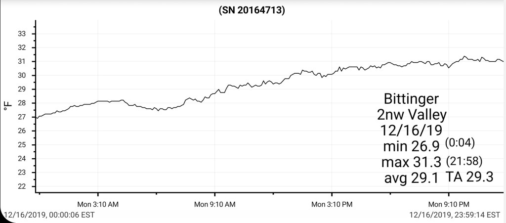
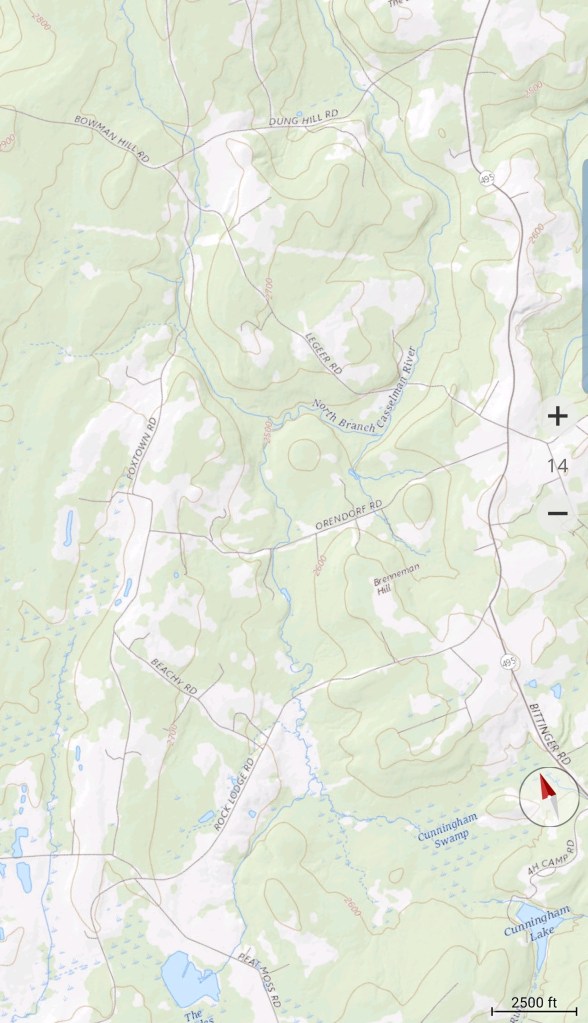
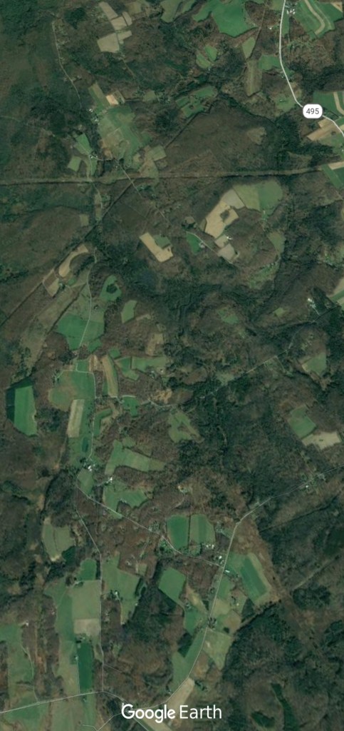
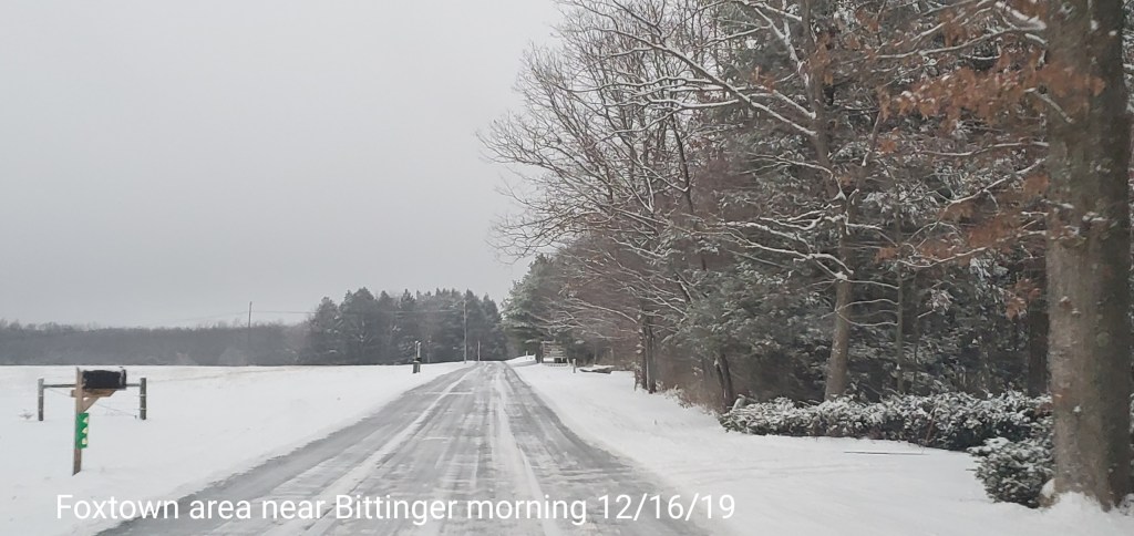
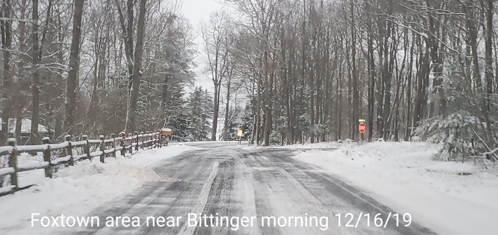
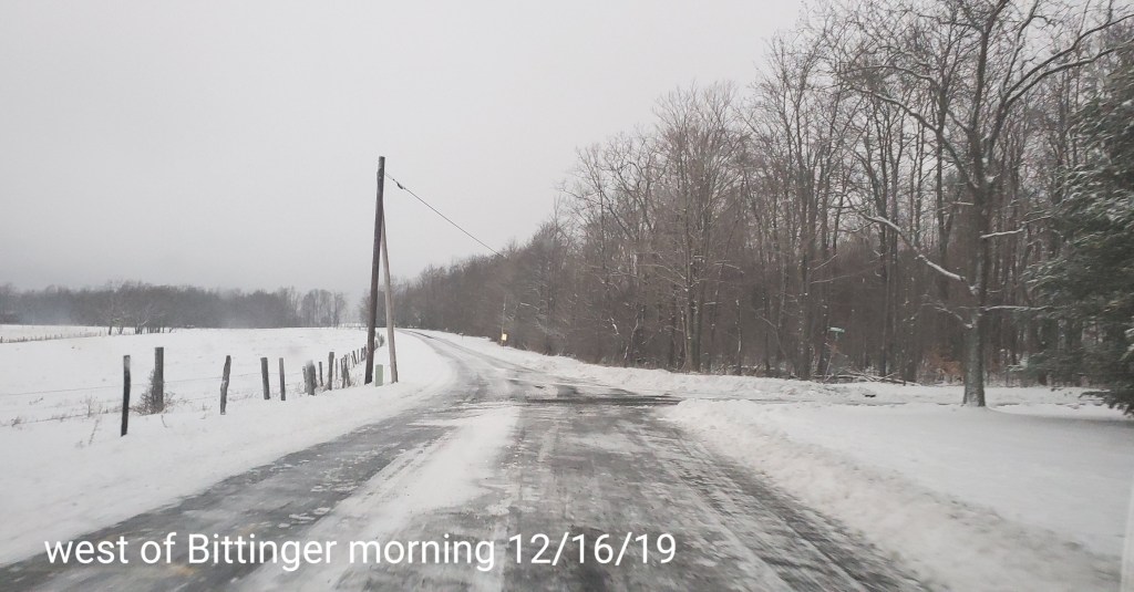
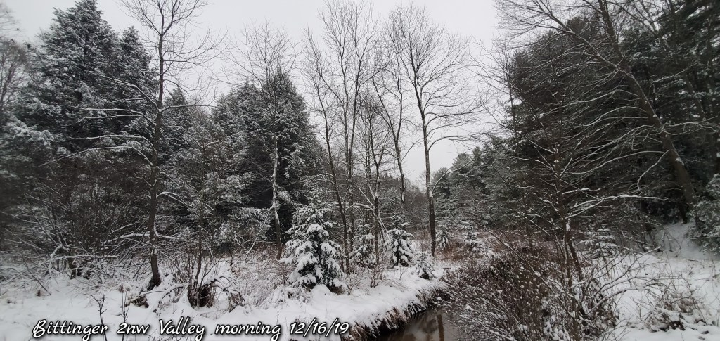
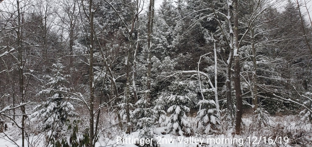
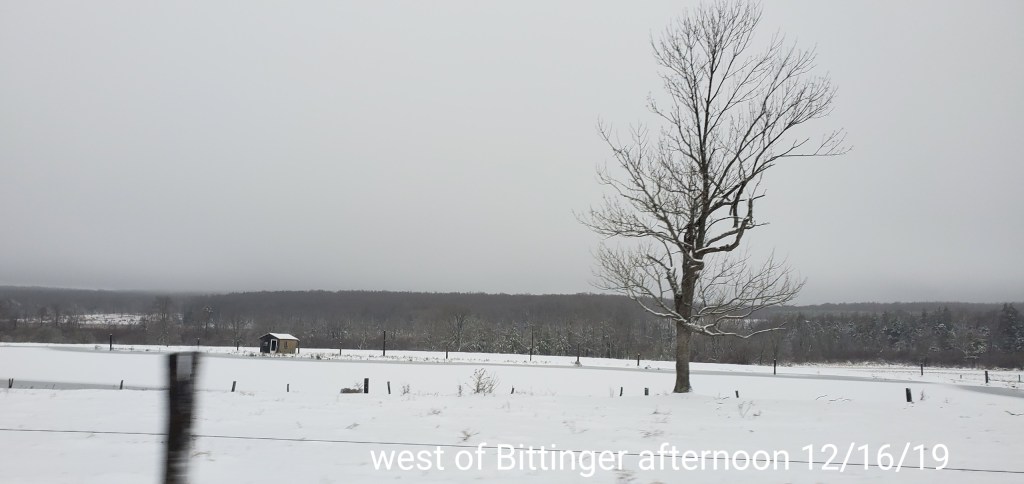
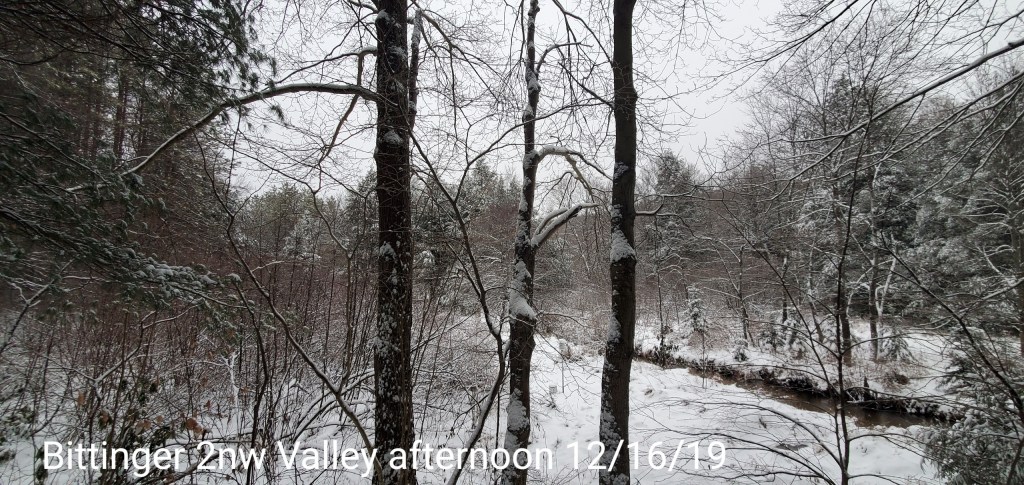
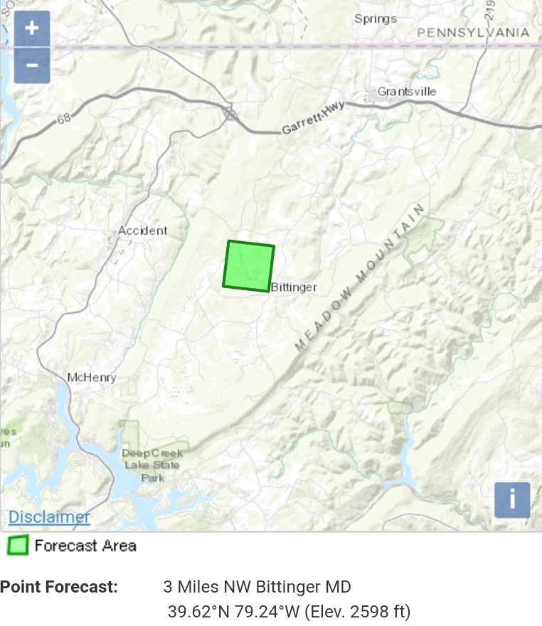
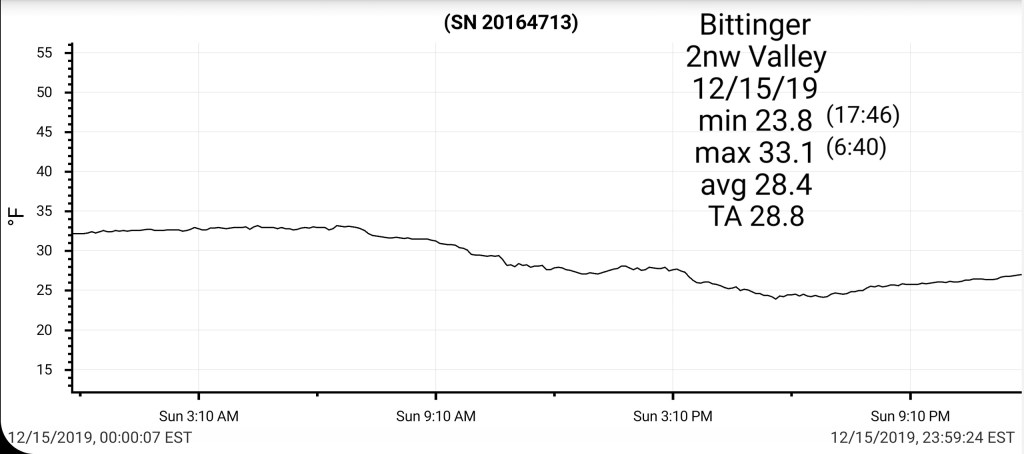
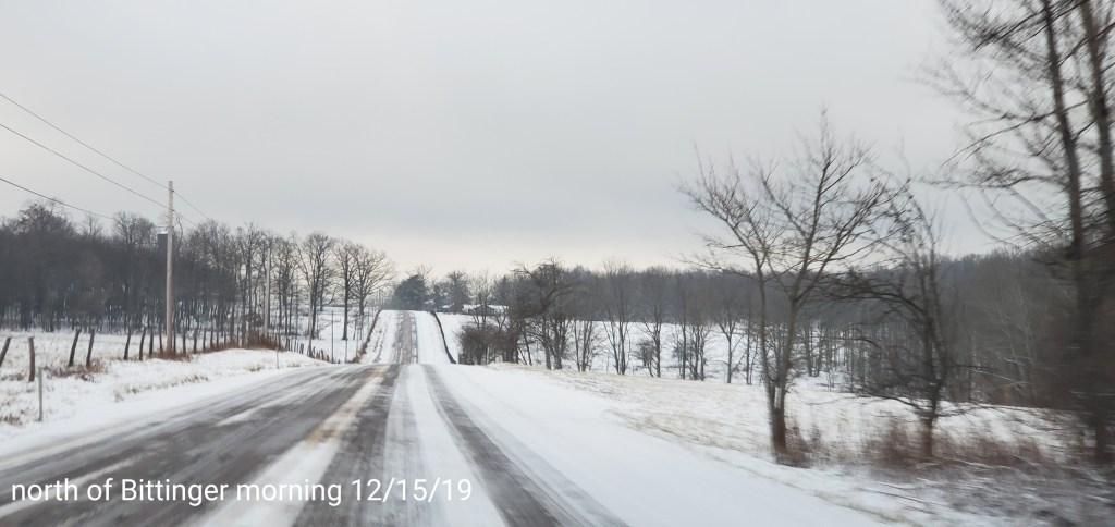
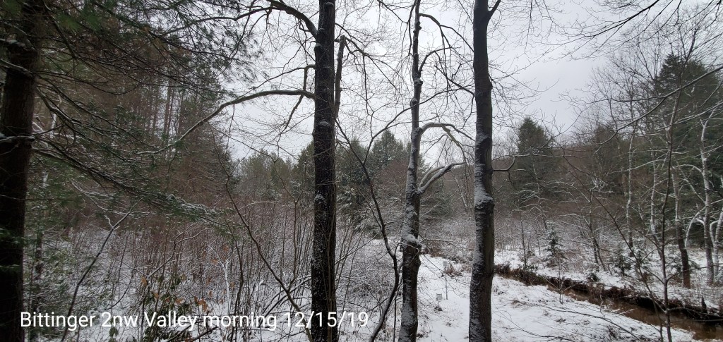
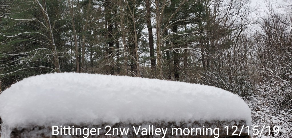
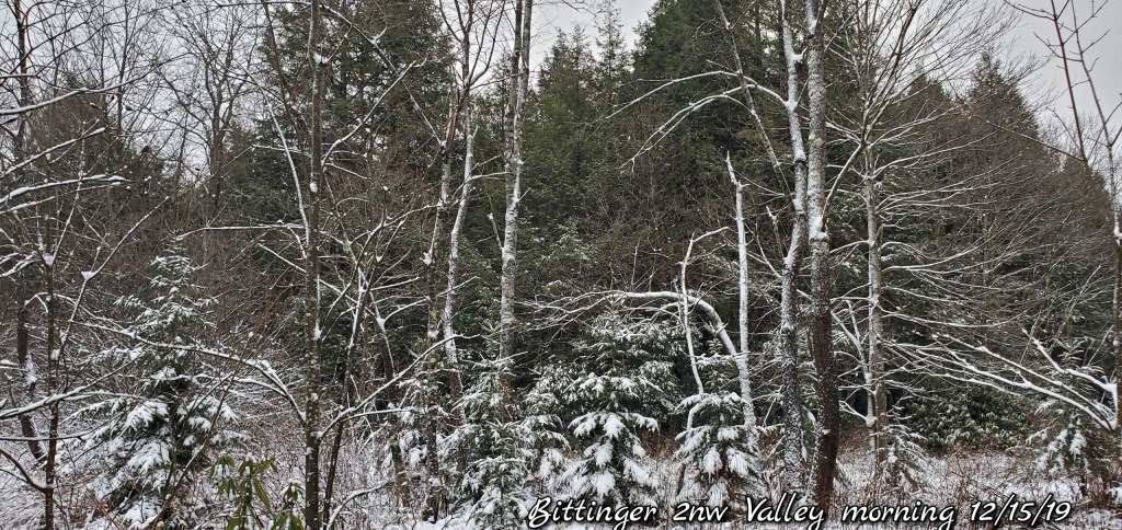
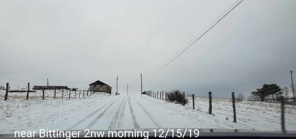
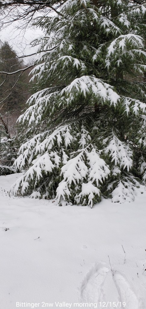
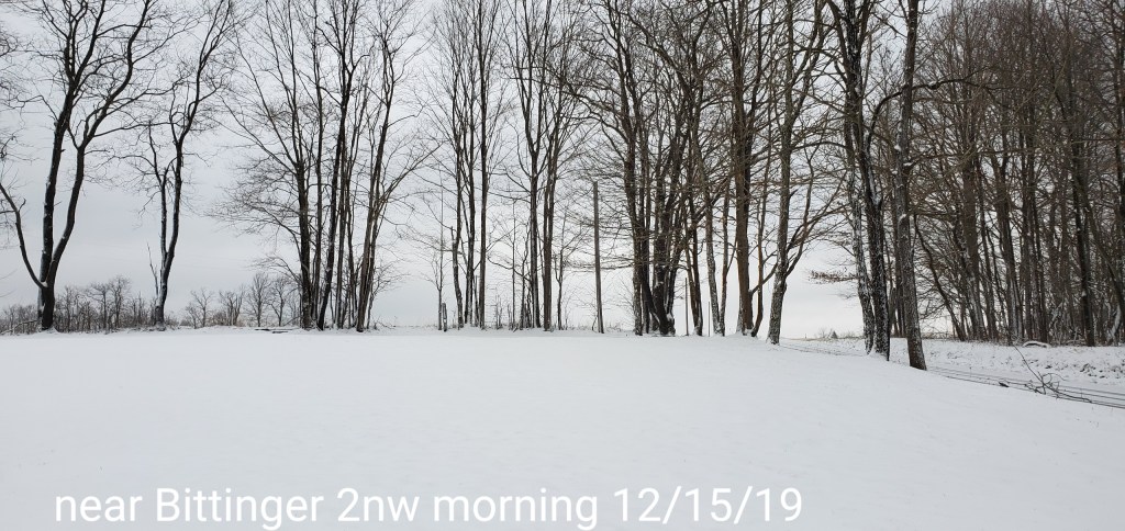
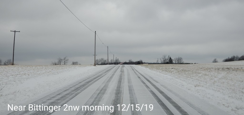
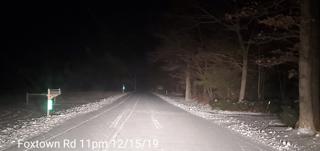
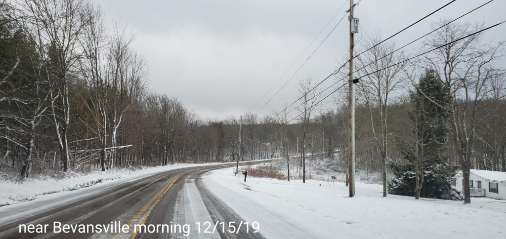
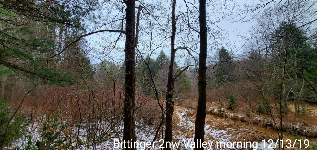
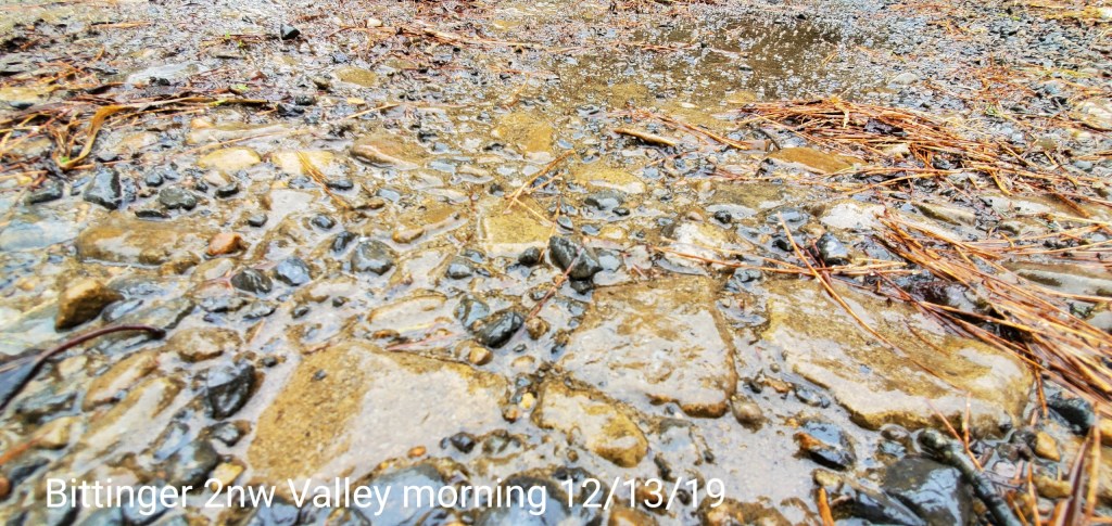
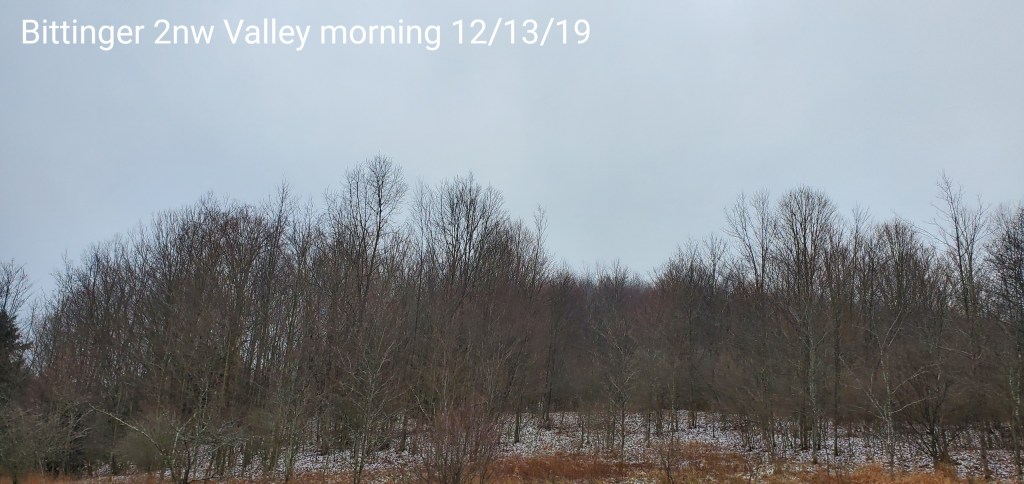
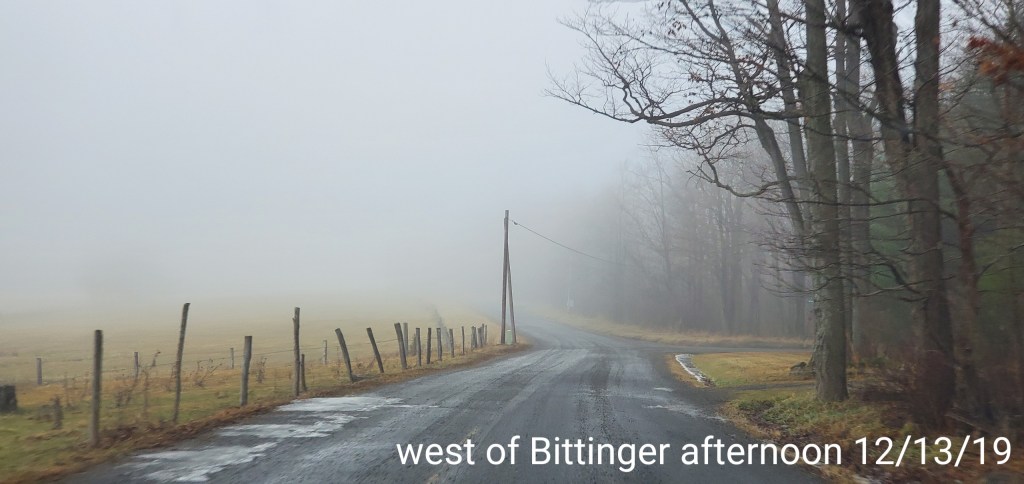
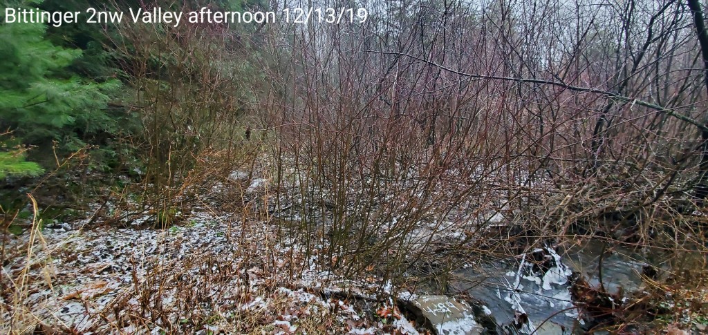
Bittinger area
Early a.m pic
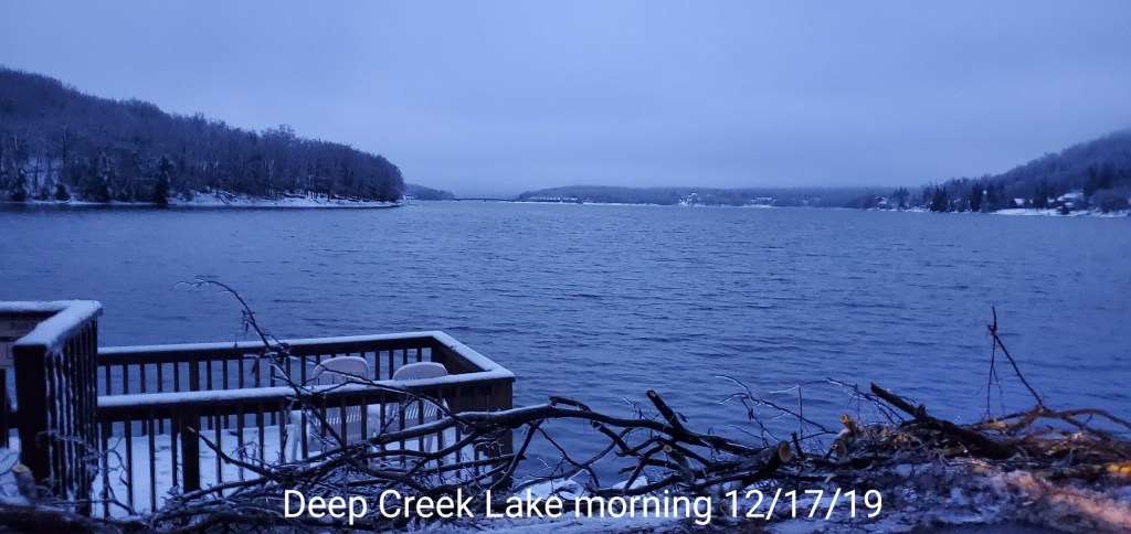
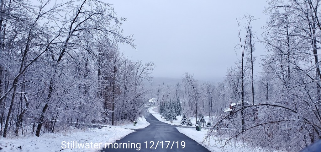
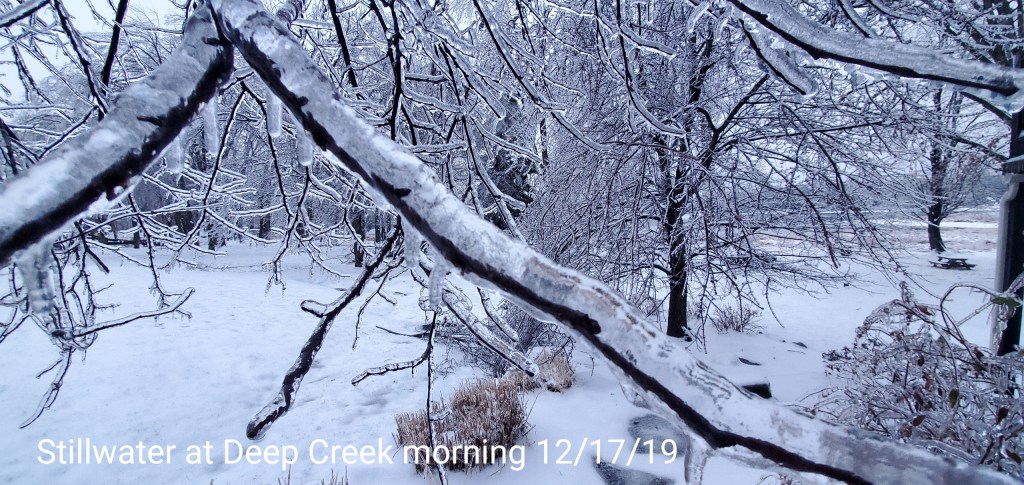
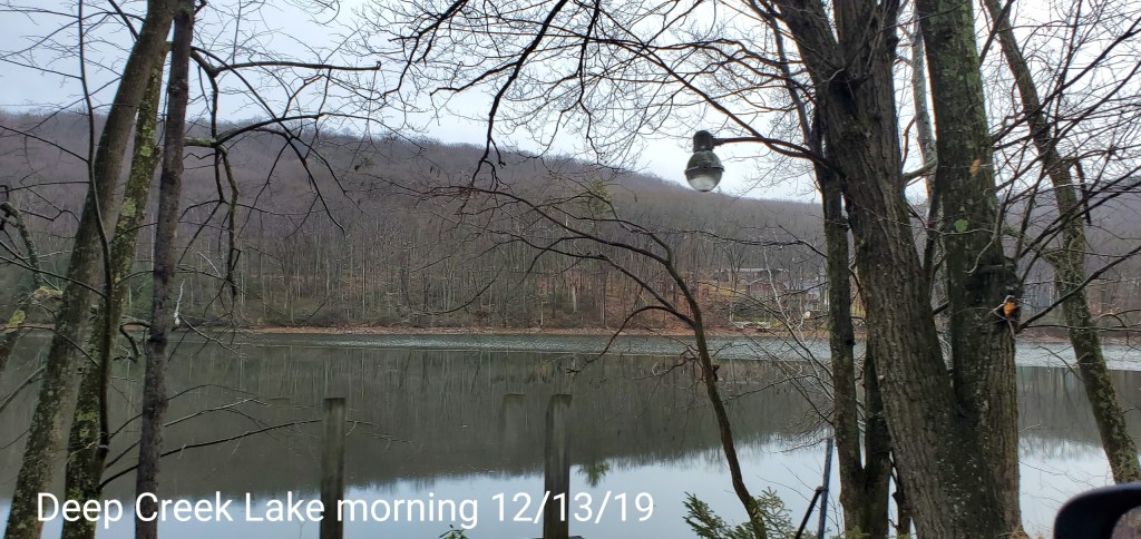
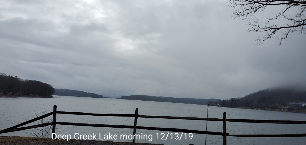
Deep Creek Area
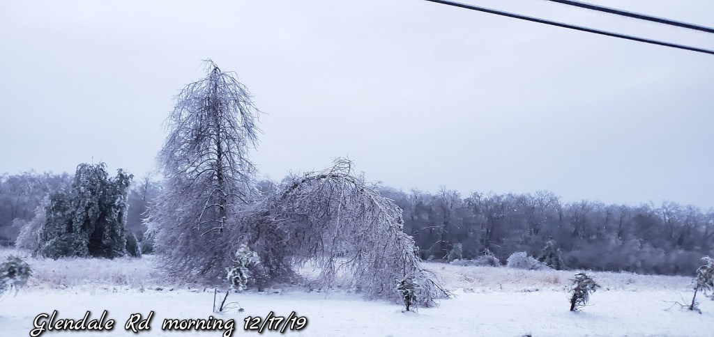
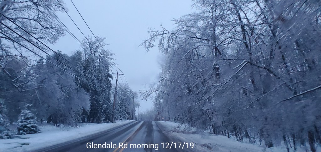
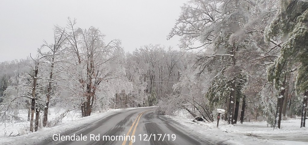
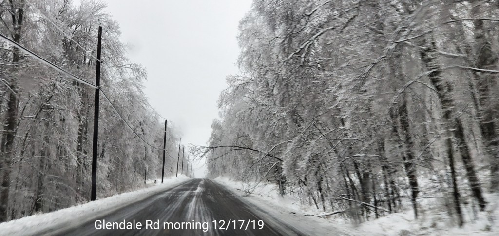
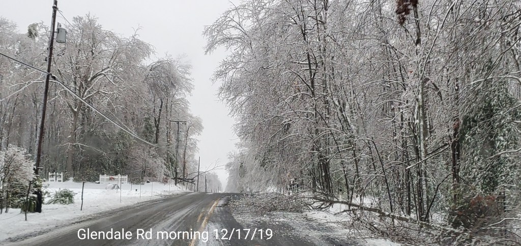
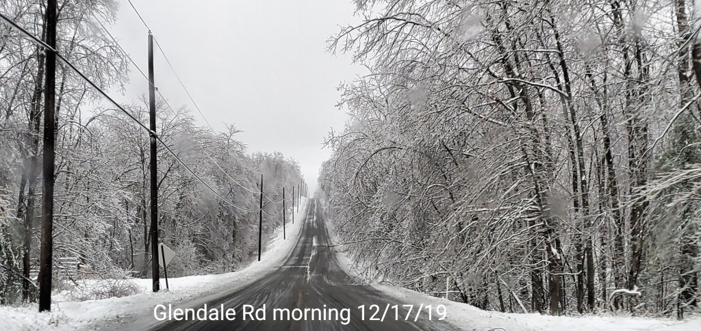
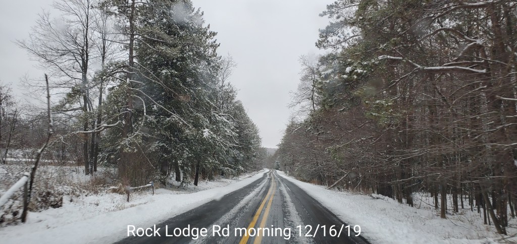
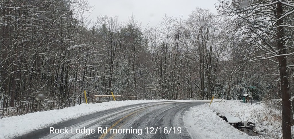
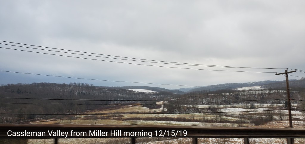
On out Glendale
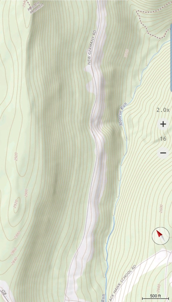
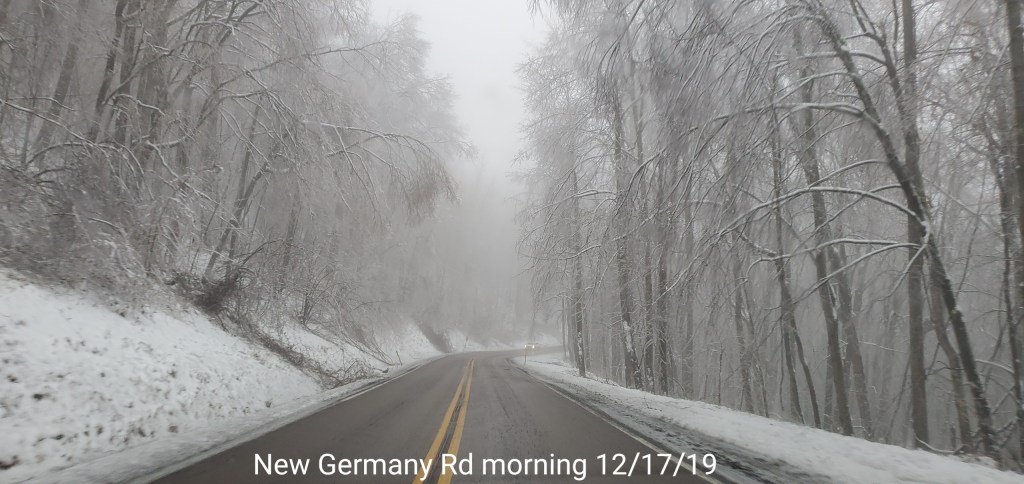
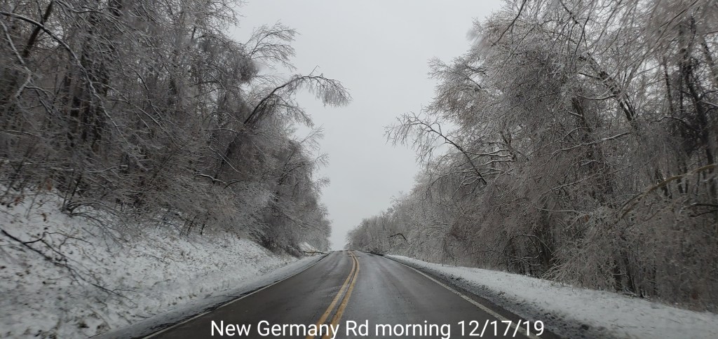
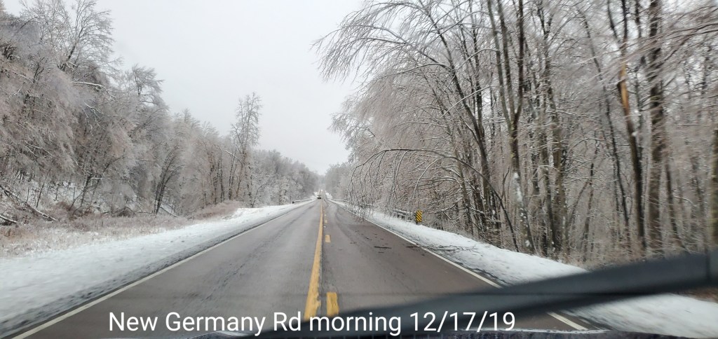
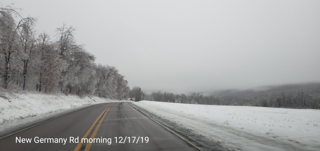
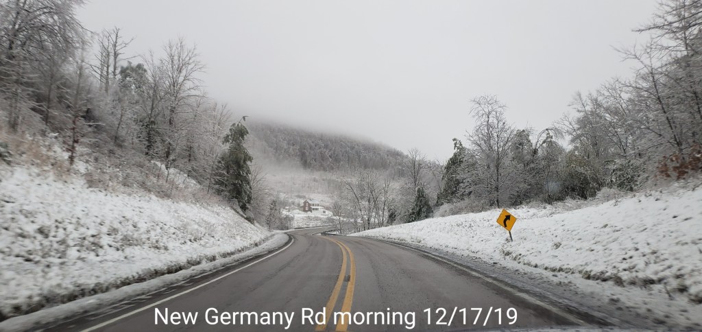
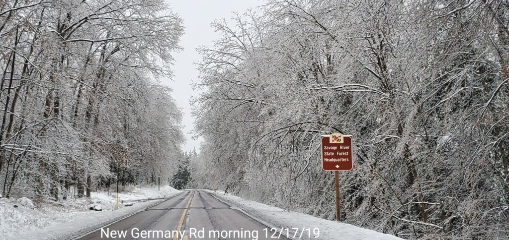
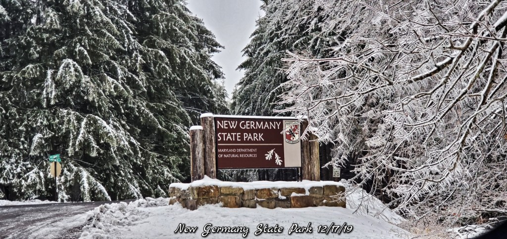
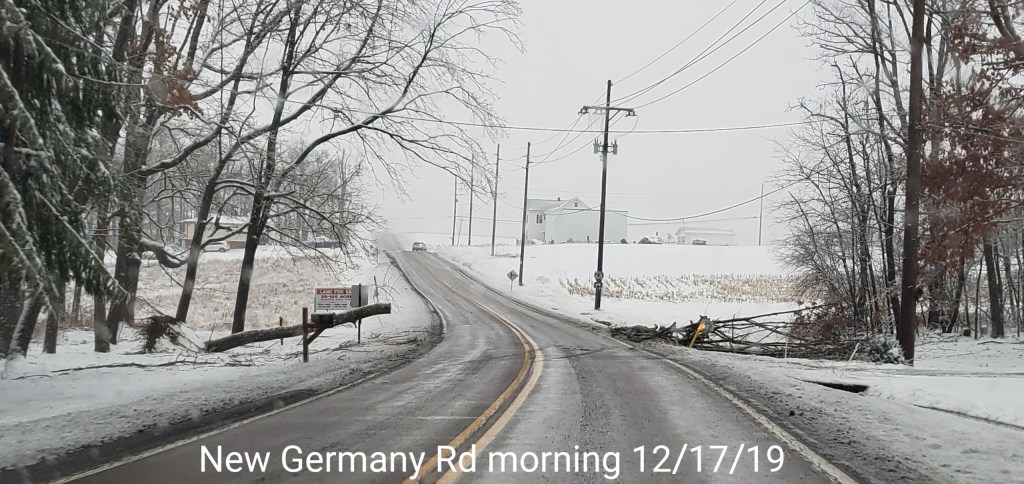
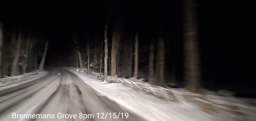
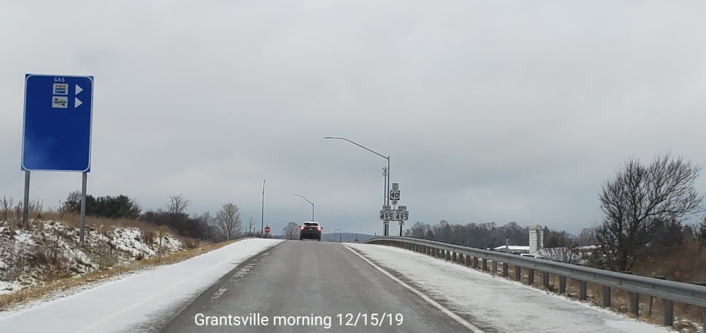
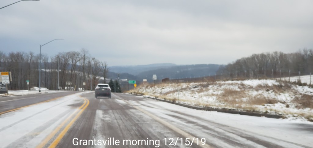
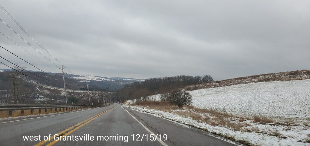
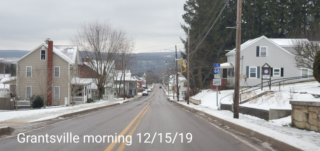
New Germany Rd towards Grantsville
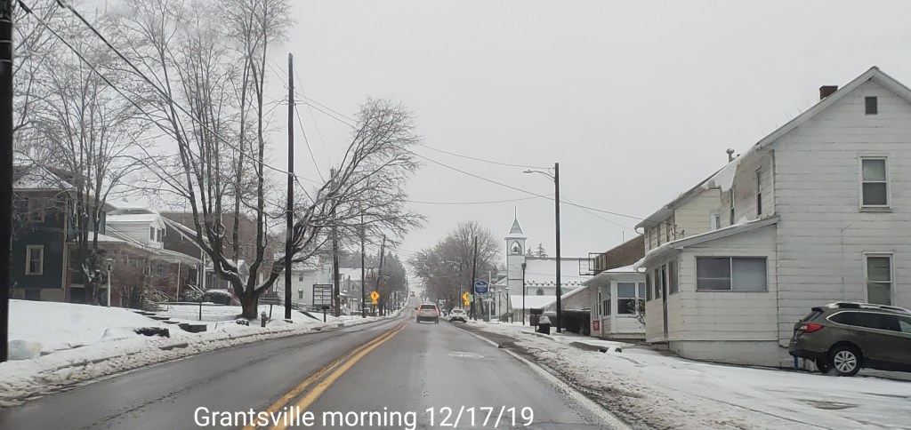
Grantsville area
Power Outages
High water side of the event.
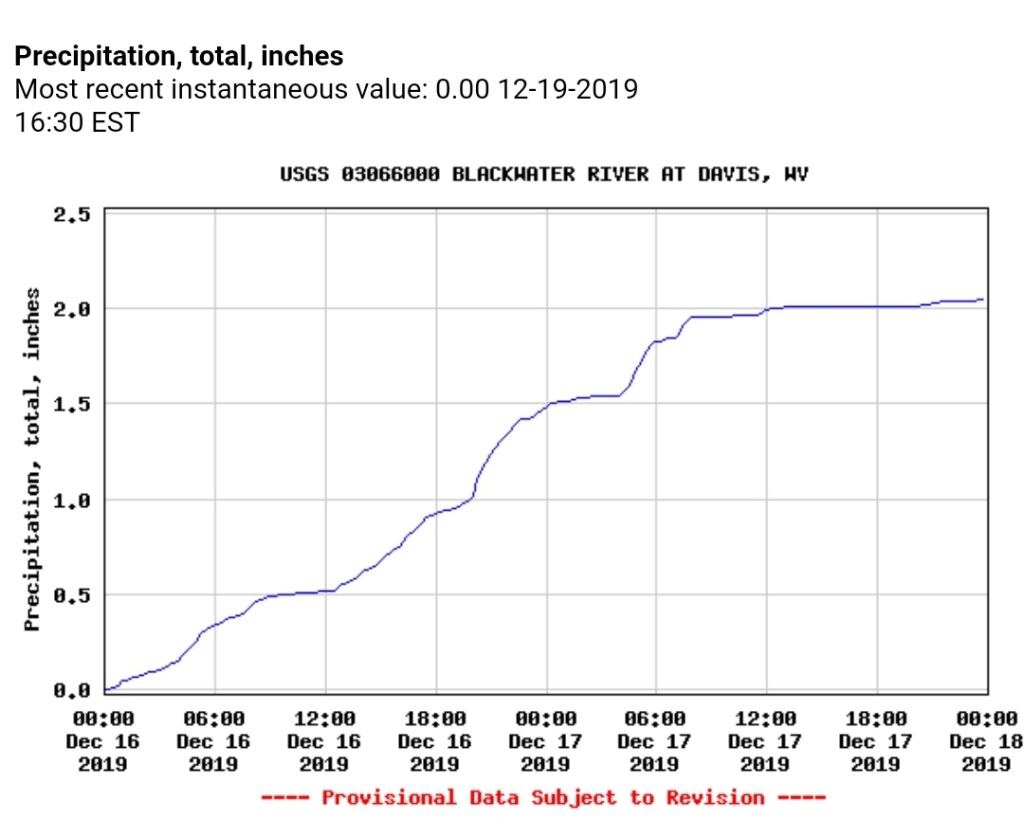
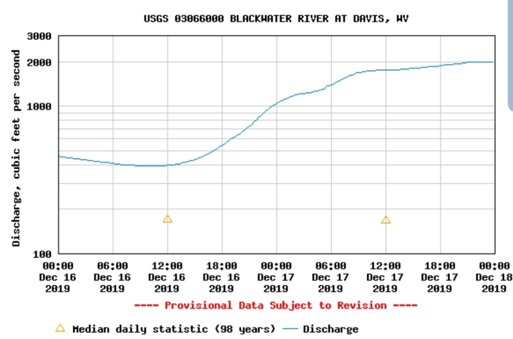
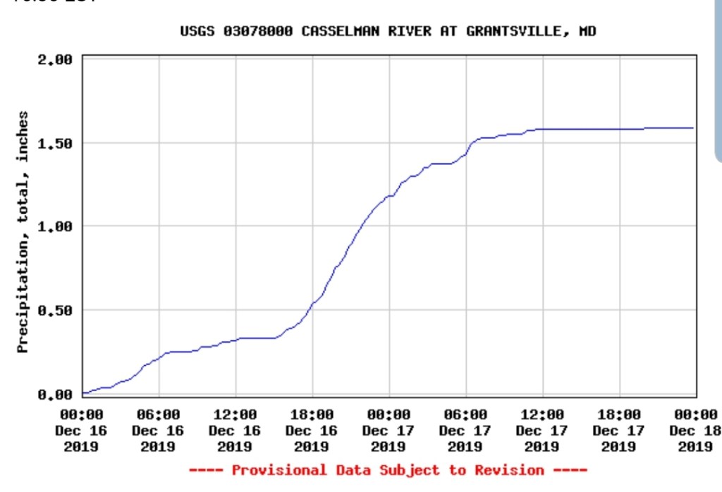
1-2″+ of rain sent area water ways well above typical flow. This occurred even in the ice zones as well, however some of that was limited with a lot of ice remaining on the trees. In other areas, such as Blackwater, flow surged to 2000cfs prior to midnight.
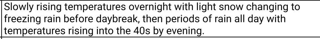
Snow overnight, changing to freezing rain in the morning. Plain rain Wv high ground. Light freezing rain through the day, increasing in coverage and intensity late day and by overnight, the tree load was greatly increasing.
Surface features and 500mb height anomalies and flow
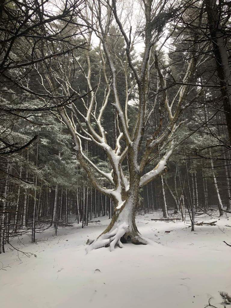
pics to come-
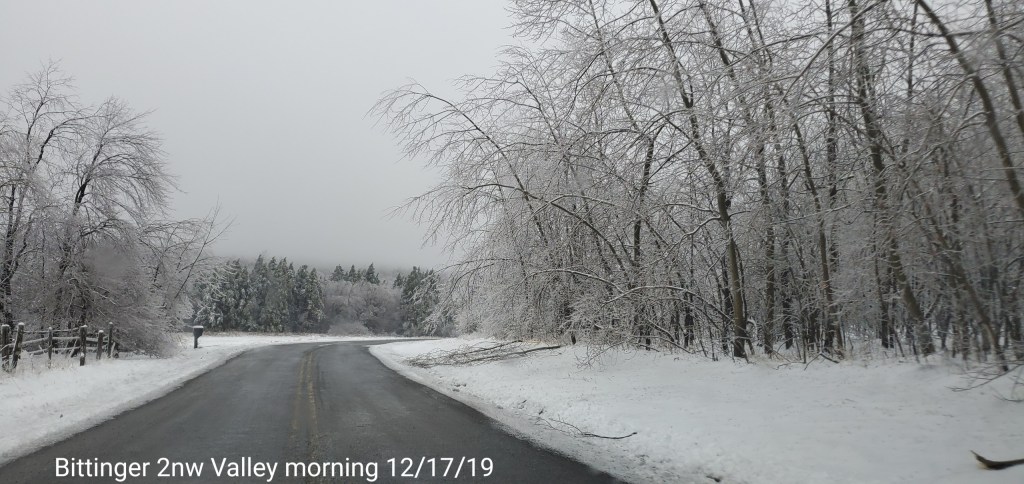
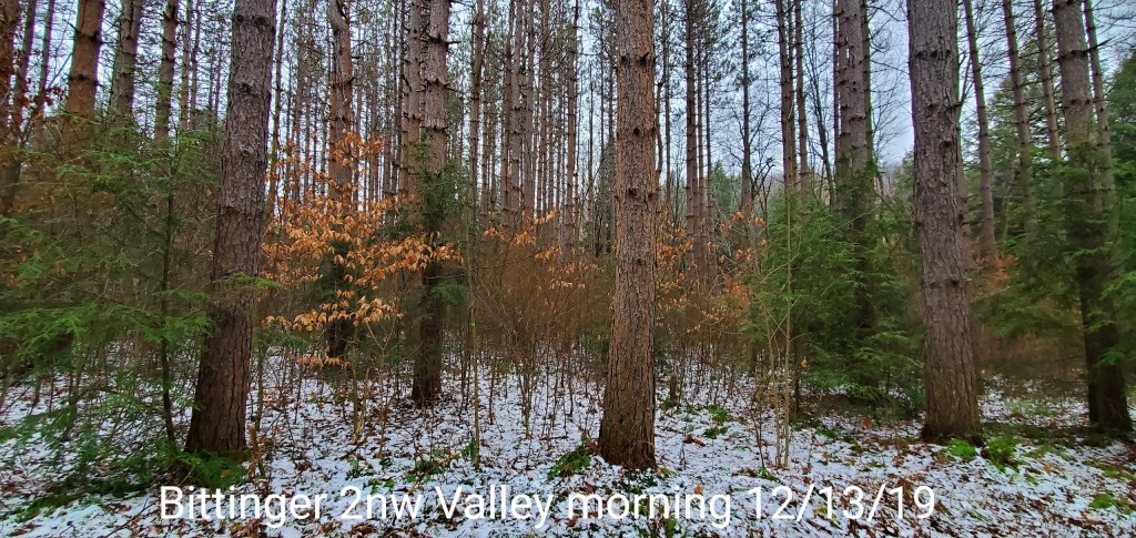
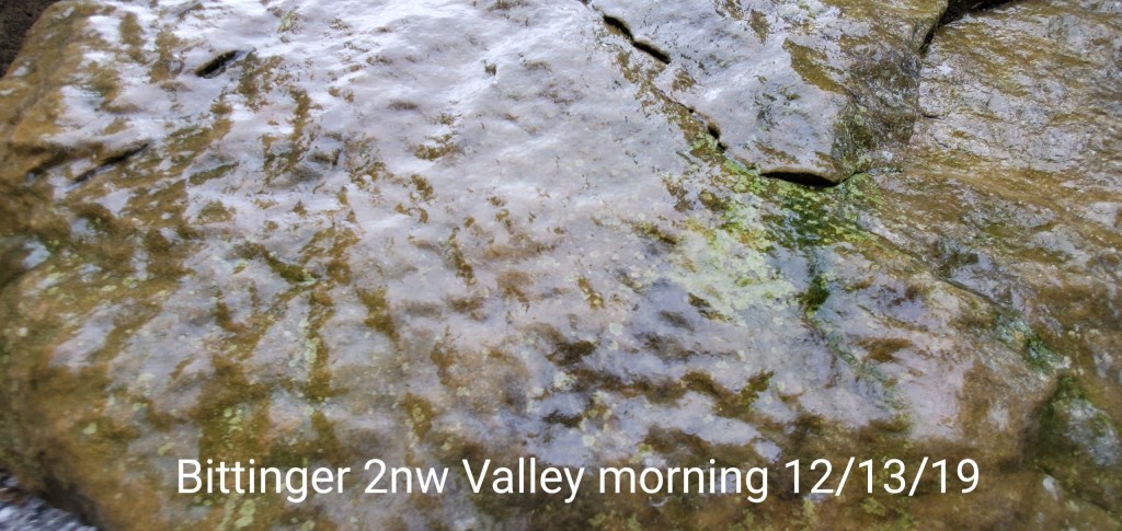
Bittinger area
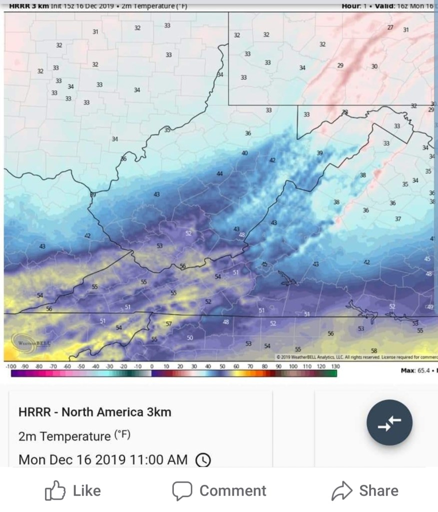
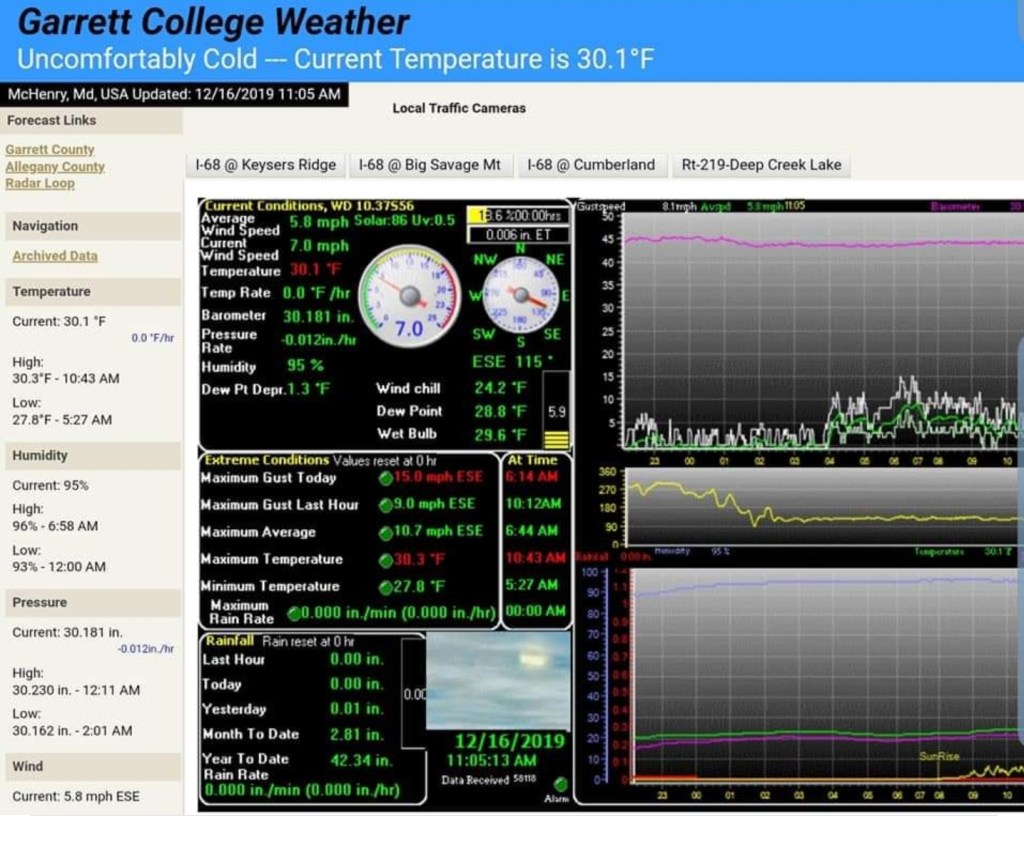
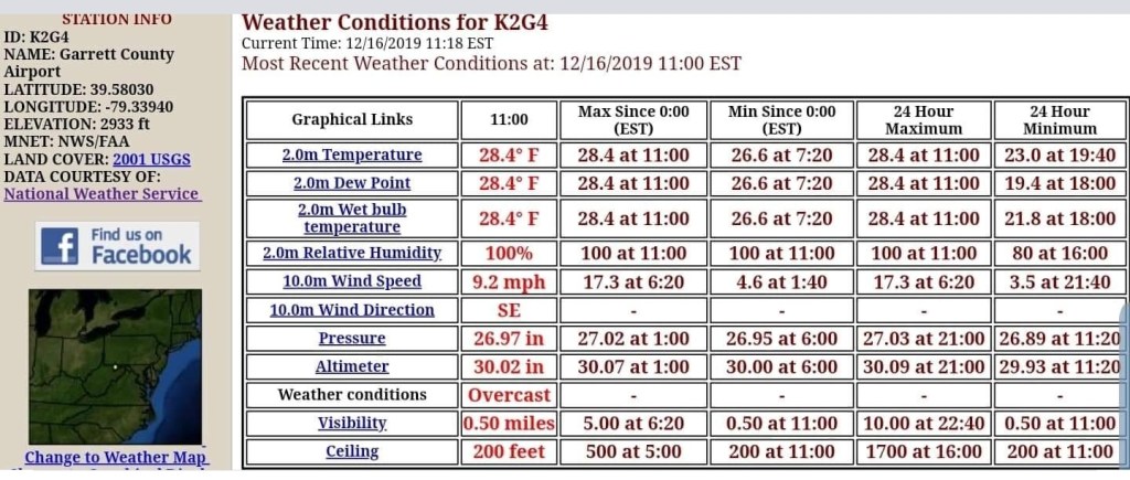
Model evaluation-
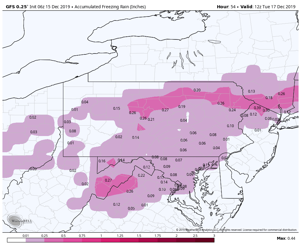
This has been pointed out time and time again on just how horrible the HRRR model is. The notorious warm bias exist every time. Sometimes as much as 4-8. The model does not even initialize right. Its flat out terrible. Today it had a 3-5° warm bias to start the run. Sadly the new upgraded GFS look to have that same bias although there is not a lot of examples that with it, however today was one. It went way to warm and the area would have avoided any ice issues had the GFS been correct. In reality, the worst ice storm in years.
Hrrr
Morning update:
7am, the snow aspect across the high ground is and in some cases has wrapped up. Now the lull phase. Overall, precip in what is expected to be the highest impacted ice zones should be fairly light, pockets of steadier precip then backs off through much of the day today, and then increasing later. Freezing rain looks fairly light during the morning and early afternoon hours.
By later today into the overnight, temps along the Allegheny Front, into central Garrett and points east, northeast look to drop 2-3°, from daytime maxes today that may briefly eek above freezing. At this time, precipitation is on the increase. The most significant icing may occur in the hours of 4pm to 4am in these areas. Especially the higher east facing ridges. This could be significant icing in those areas. Ice will occur outside of this zone, this is circled for greatest impact zone.
East facing ridges could see in excess of .5 total ice accretion as we go through tonight.
The WPC outlook looks as follow:
The models, the model parameters for freezing rain are consistently overdone. In a marginal temperature setup and moderate rain+, not everything freezes as it falls. Some is able to run off before freezing. Models do not factor that and will overdo ice amounts. With a east wind, those high east facing ridges get aided by the wind in freezing more of the rain. That said, model rundown
My favorite in the setup the
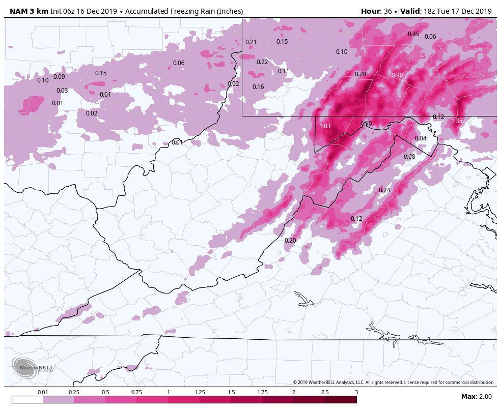
6z 3km Nam
2m temps
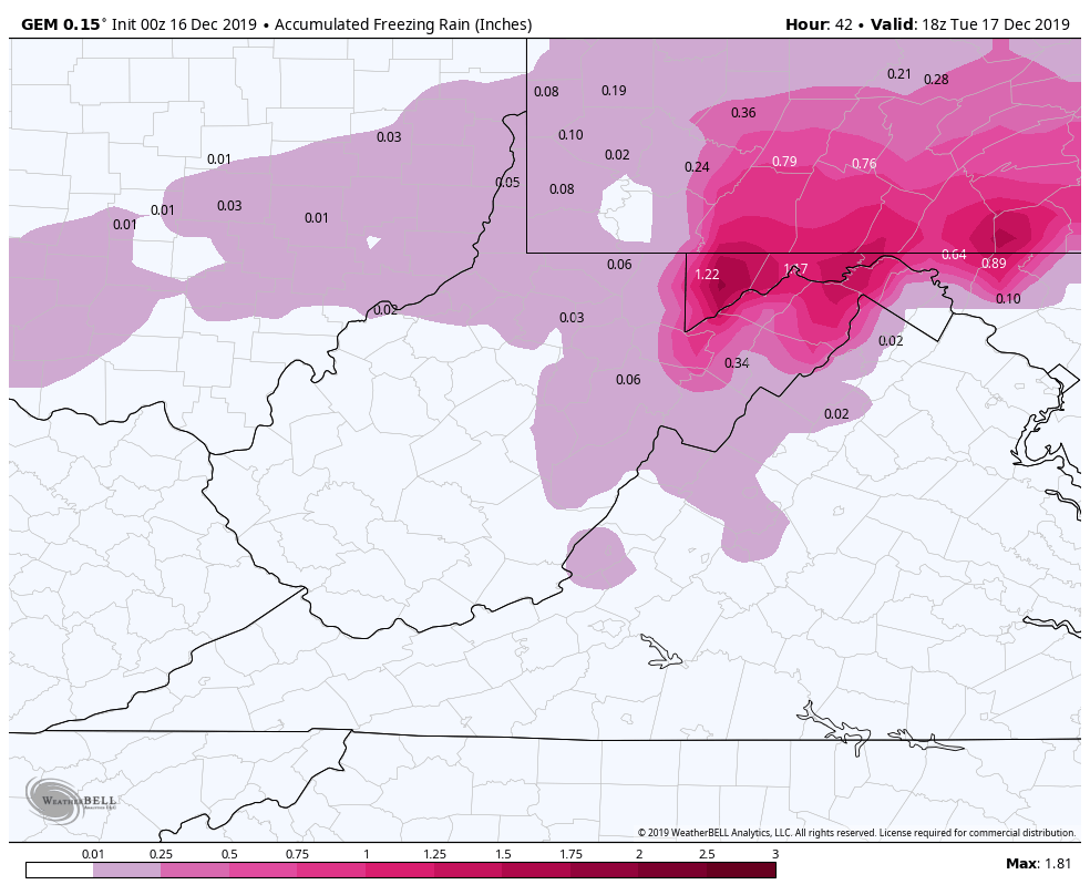
6z ICON
2m temps
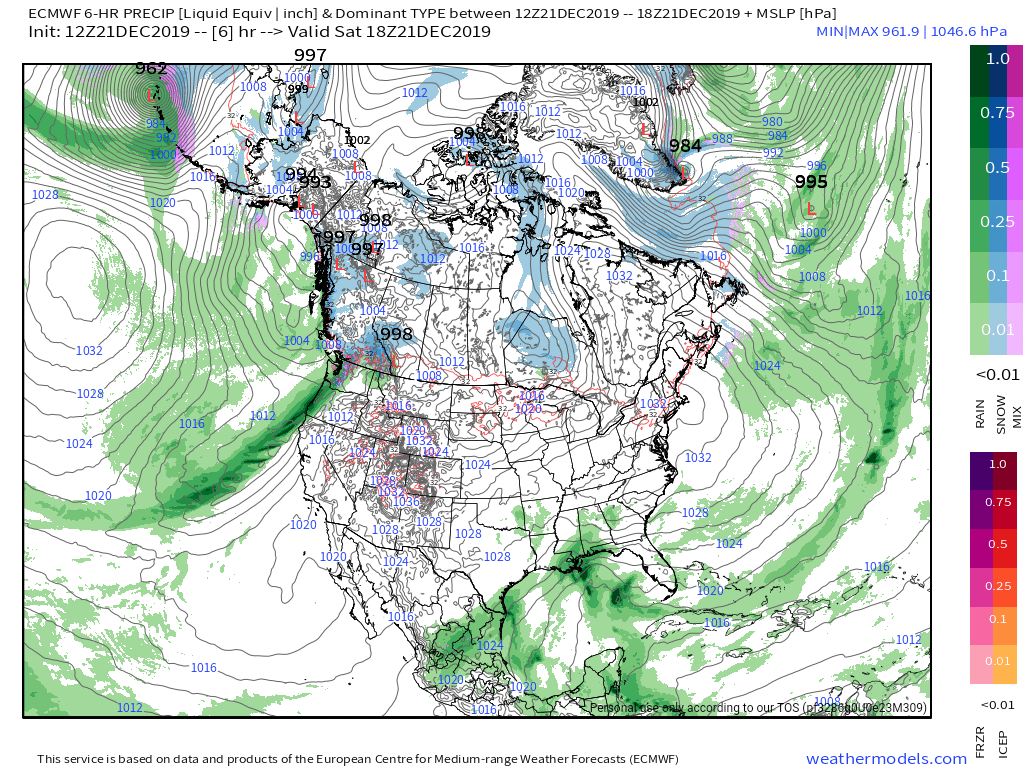
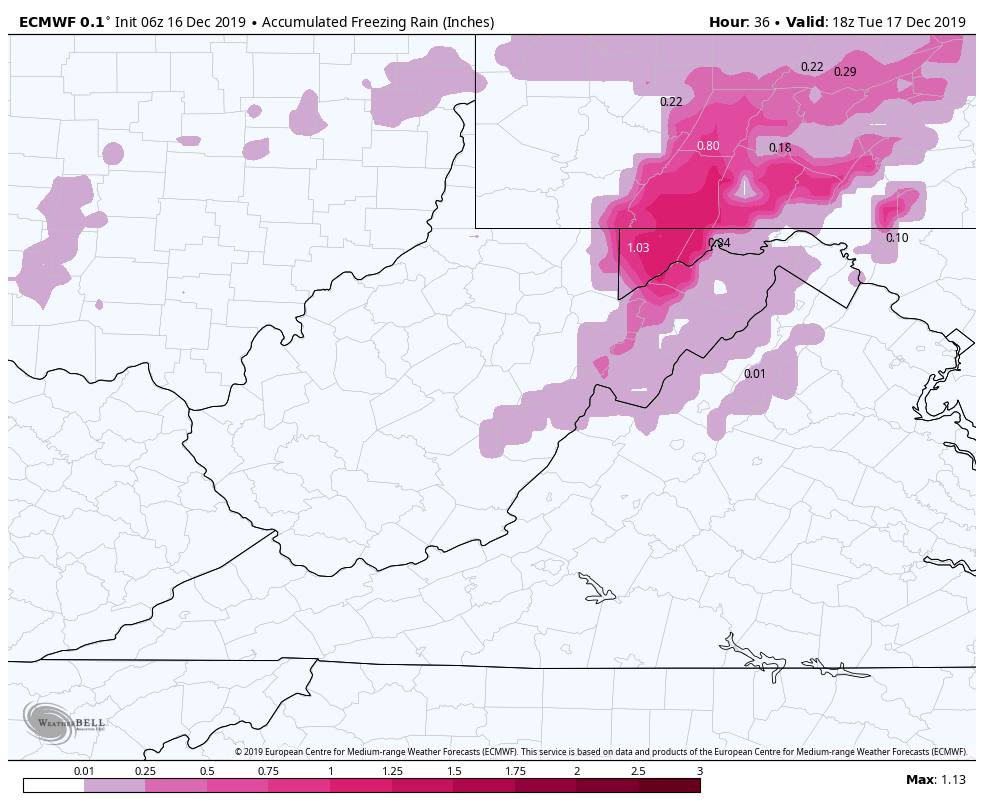
6z ECMWF
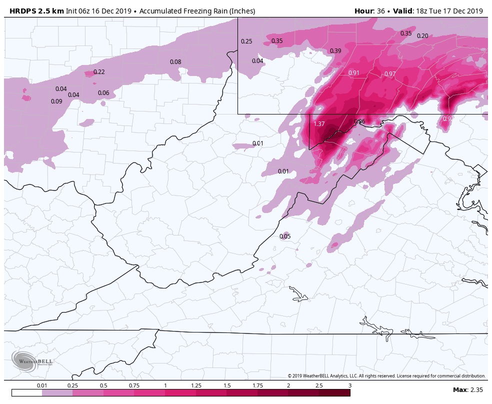
6z HRDPS
6z HDPS Canadian
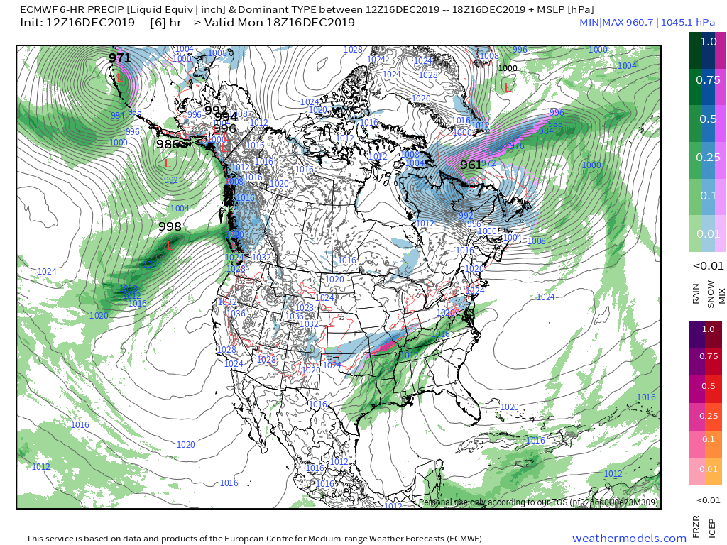
6z ECMWF
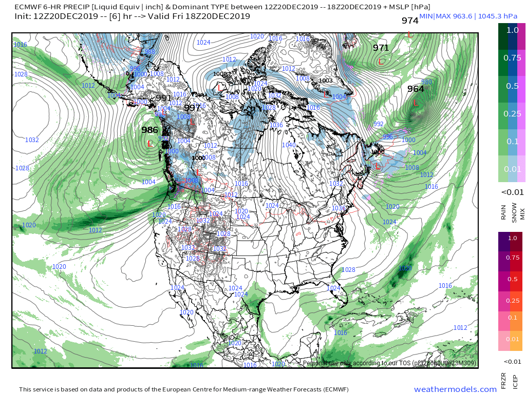
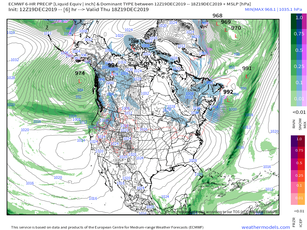
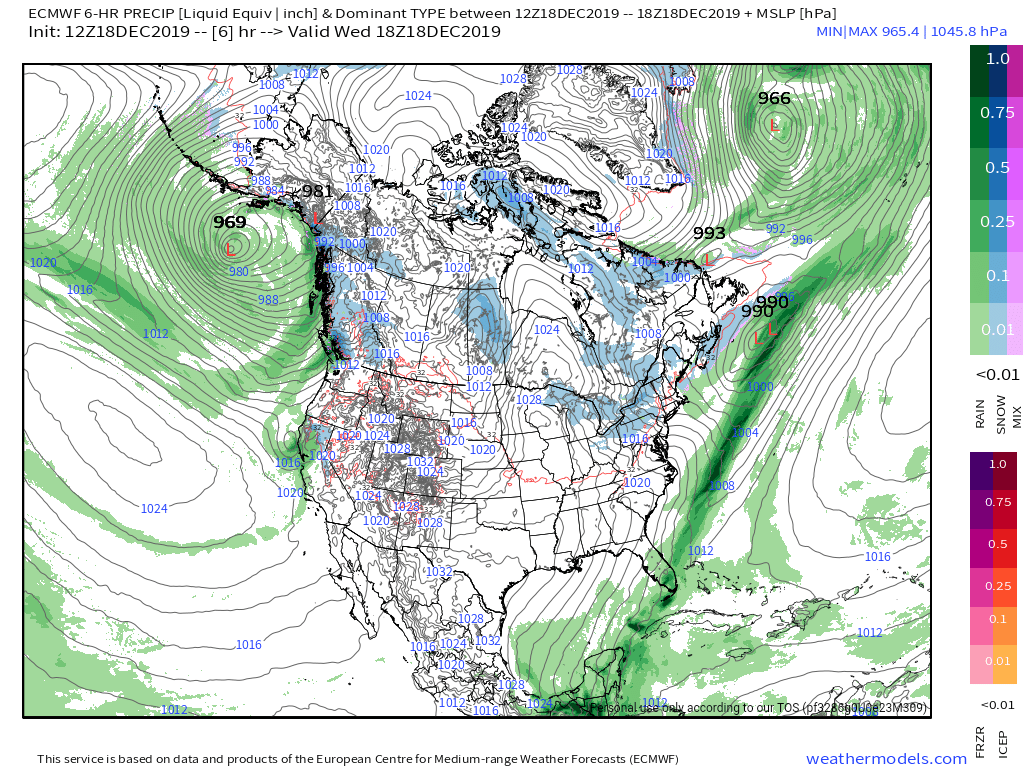
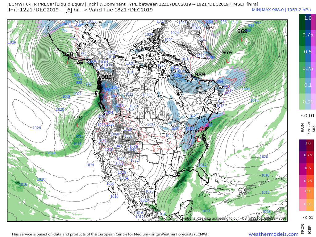
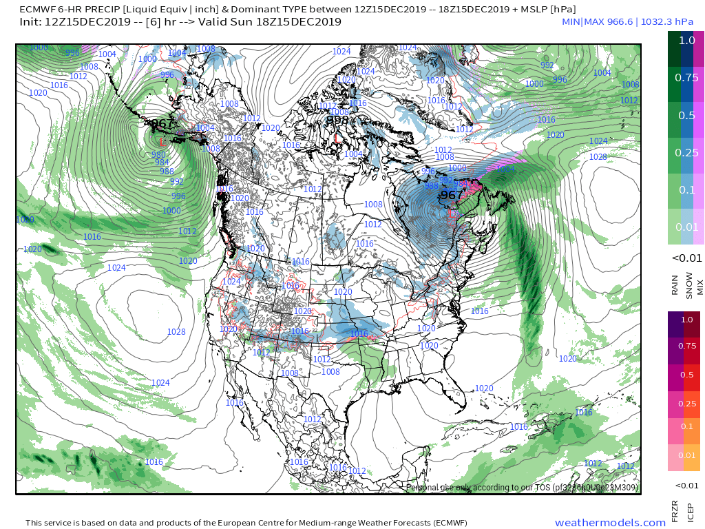
MSLP/6HR/PRECIP
Will get to the GFS in a bit..
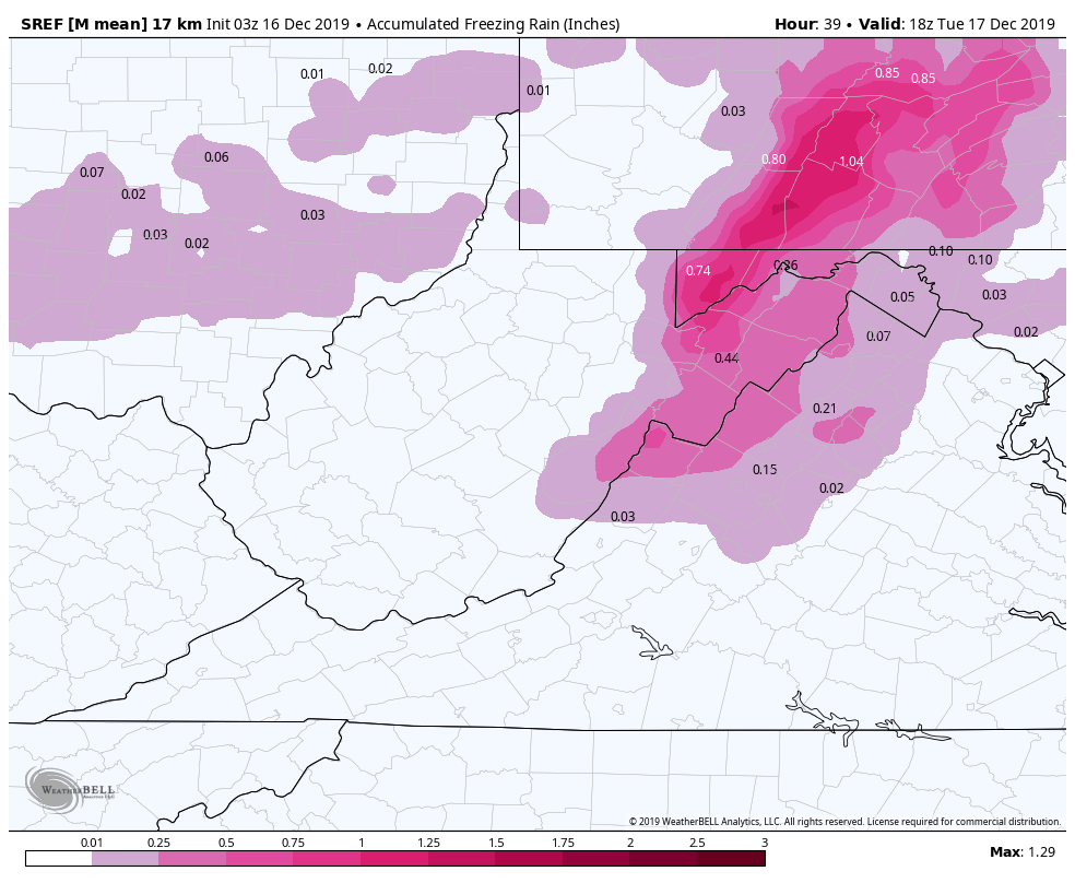
Ice amounts off the models. Again, these are overdone but still suggest significant icing. Also more expansive than reality will have it. Model product listed within the image.
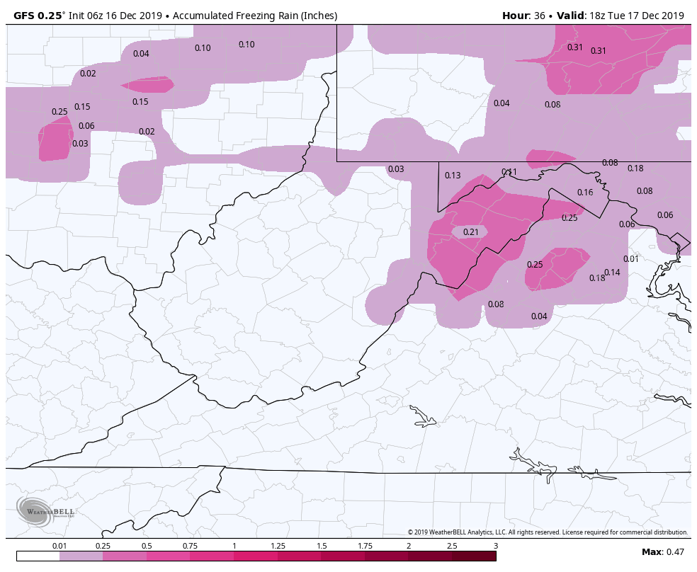
Ok, those are some bonkers amounts that are overdone. Now we jump to the GFS. The 6z in this case but it doesn’t matter. Every GFS run has been warmer, and brings very little ice. This is the upgraded GFS, and its either scoring big points here beating every model or its falling to the same fate as the HRRR and has a notoriously warm bias with these setups. I am mainly posting all of these to look back and see the model bias after the fact. Models are tools, with biases.
6Z GFS
2m Temps
Ice off the GFS…what ice? Minor event
Some NWS point and clicks in the ice zone. Much better on timing now.
Surface features and 500mb height anomalies and flow
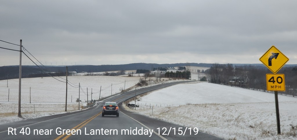
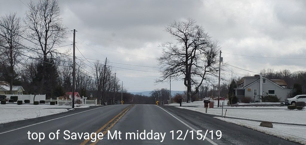
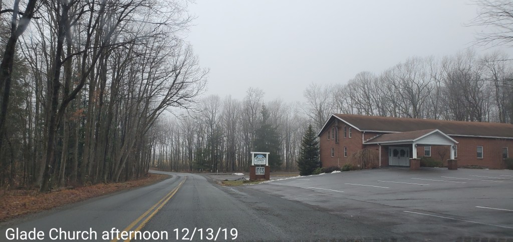
Pics today-
Bittinger area
Grantsville area
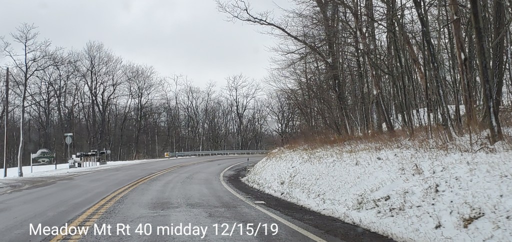
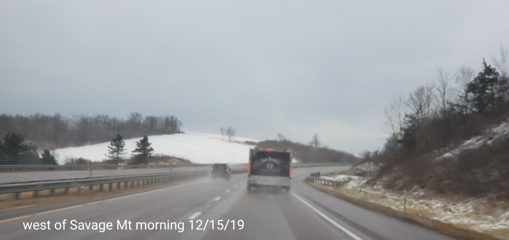
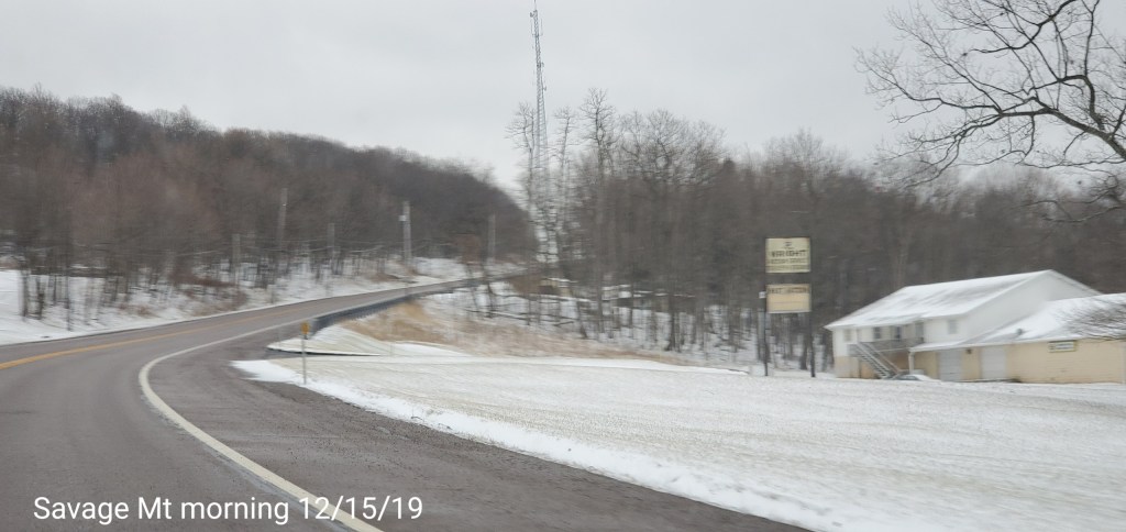
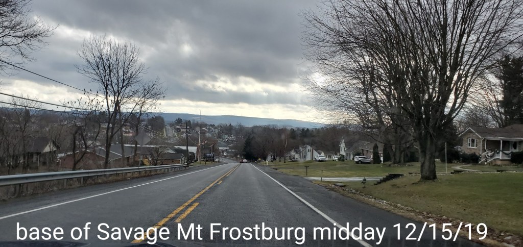
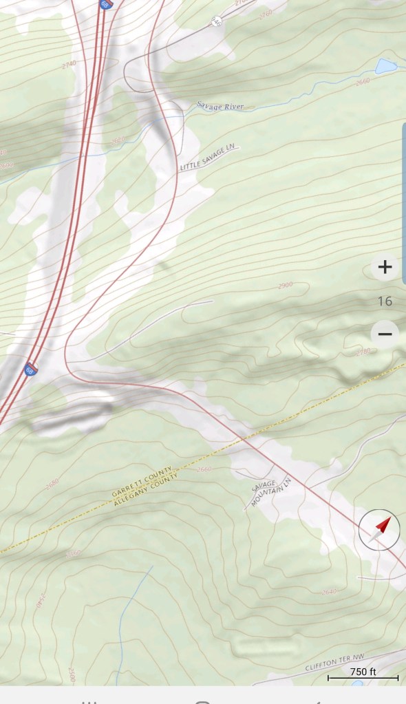
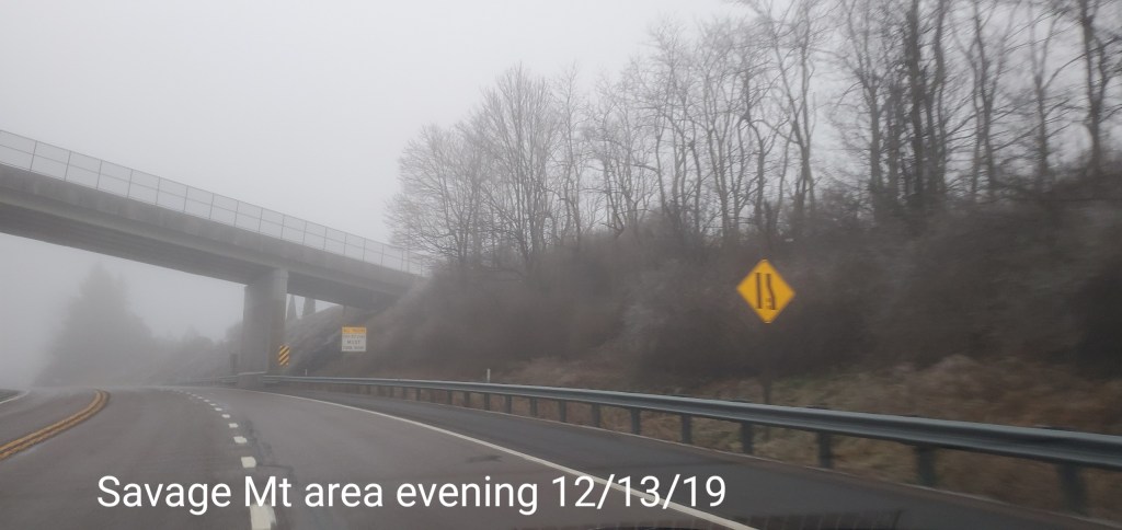
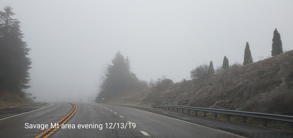
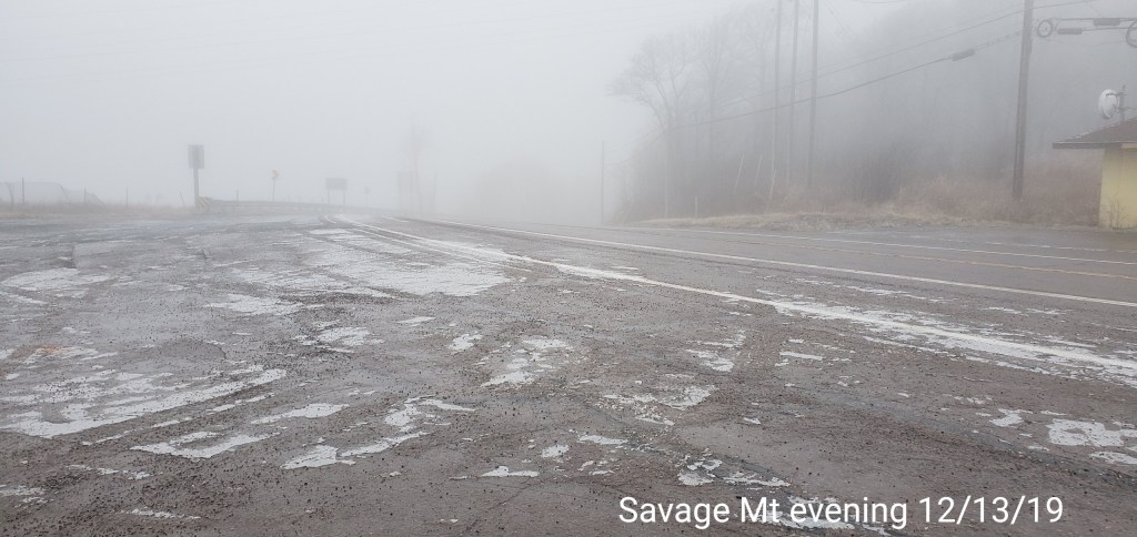
East to Savage Mt
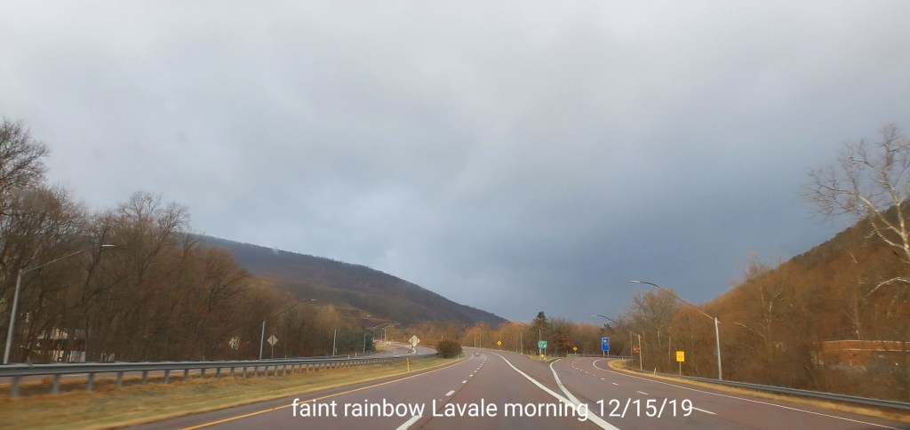
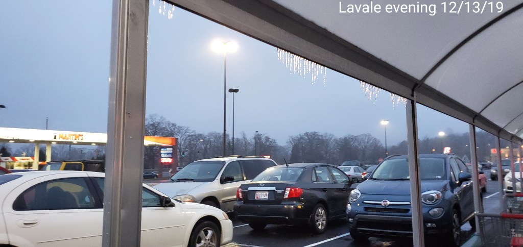
Lavale
Had to post the faint rainbow in Lavale before going up to the snow
Photos by Ashley Berg at Dolly Sods
Morning update 9am
Snow activity in a varied fashion may add an additional 1-2″ as colder air seeps in through the morning. Morning temps hovering near freezing and even above below 2500-2800- in many areas except the Wv high ground in the 20 . The bigger story begins overnight into tomorrow morning.
This has a potential to be a power disrupting event in the central and eastern parts of Garrett, north into southern Pa and along the Allegheny Front and east. The cross hairs so to speak look to be eastern Garrett, parts of Allegheny and adjacent areas into Pa and down to Mt. Storm.
It would not at all be surprising if some of these areas never got above freezing with the event and it’s a event that’s moisture loaded. I would suspect the winter weather advisories may change to ice storm warnings in these areas. We shall see.
The GFS remains an outlier for the event, with much model agreeance by the various other models. The Nam, and more recently the ICON are models that typically handle this well. The ECMWF is in agreement. The GFS is on its own and will score major points if its correct. If it is, it’s a minor event winter wise.
This pushes in early morning Monday. A quick thump of snow
00z ECMWF
looks possible, a brief change to sleet. What often occurs is a precip lull that allows the column to warm and then sleet to freezing rain rapidly occurs after the snow end . Areas east, lower elevations will likely remain snow longer, the cold air depth, column is more favorable there and that is typical.
850s off the 0z ECMWF tomorrow morning
The high WV ground will be the first to change and go to plain rain and will be the less icy of the region. However, it still remains to be seen just how quick that milder air gets in there. Freezing rain should occur back to Backbone and Canaan Mts briefly at least, unlike these past ones.
From east of 219 and near Sand Flat to the Swanton area, angle to Mt.Storm, and points north, northeast this looks to be a duration ice event. Stay tuned.
Jump to the models. My favorite in the setup as it performs well . The 3km Nam
6z 3km Nam
2m temps
Closer look at Garrett(central time on this map)
0z ECMWF
2m temps
MSLP/6HR/PRECIP
6z ICON
2m temps
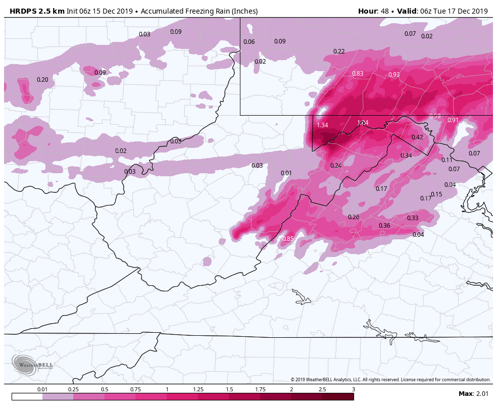
HRDPS(Short range Canadian)
2m temps
overdone very likely
0z Canadian
Ice totals
Now the GFS. A much milder outlier
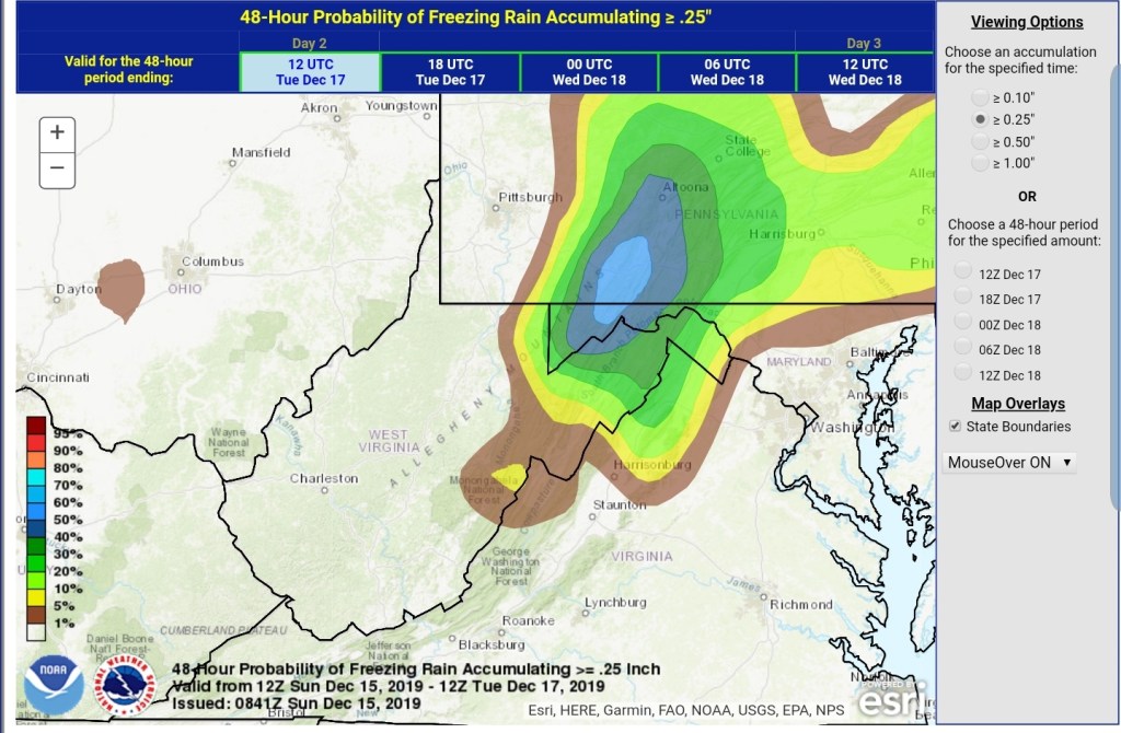
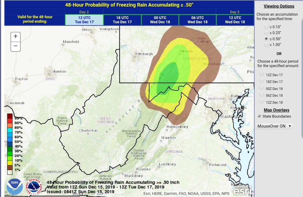
WPC OUTLOOK
For freezing rain accretion
Will post more through today. Updates etc as this is a potential major event in some areas.
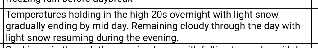
Rainy morning, some pockets of ice in the deep valleys east yet this morning. Cold air changing rain to snow across the high ground midday, afternoon. Light accumulations by nightfall.
Surface features and 500mb height anomalies and flow
Videos today from webcams
Post generated 7am 12/14/19
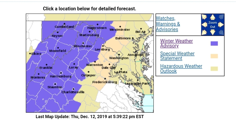
Icy pockets remain in some of the deeper valleys on the east side of the Alleghenies at the time of this writing shortly before 7am this morning. Traveling in that area, use caution. Otherwise today, we watch for the rain to snow transition as colder air from the west encroaches on the area.
Modeling is generally showing this to occur late morning, early afternoon for the WV high ground, and occurring shortly thereafter north across Garrett, Preston, and the southern Pa high ground.
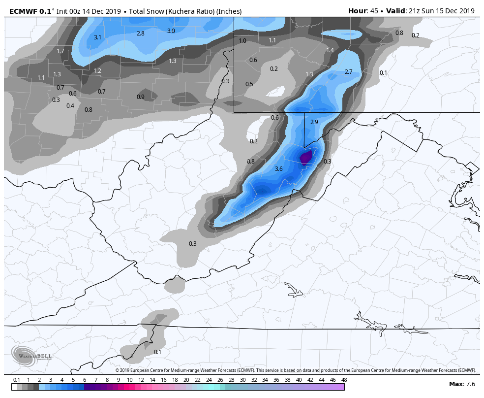
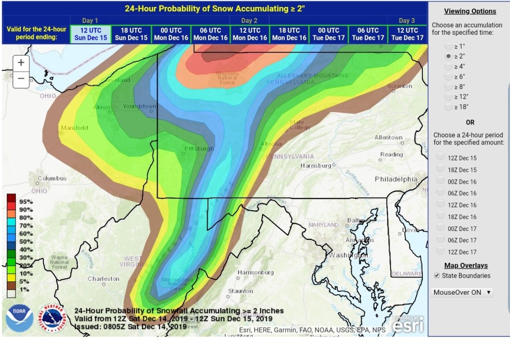
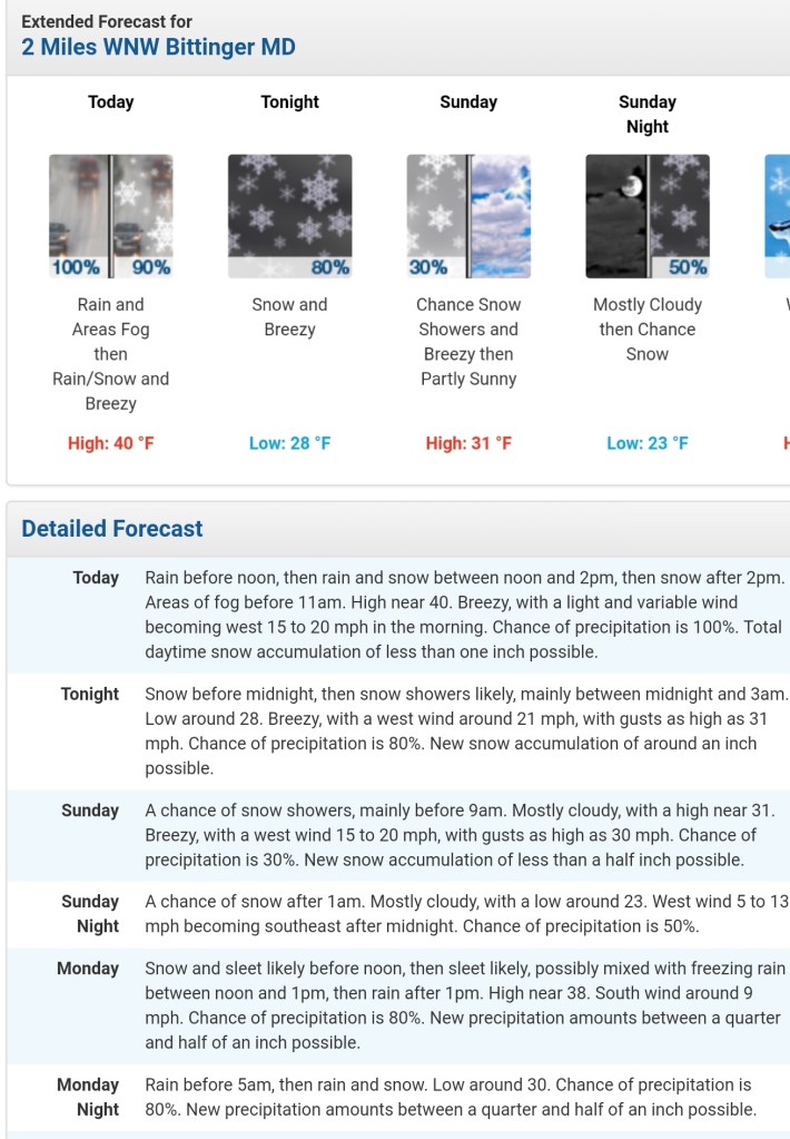
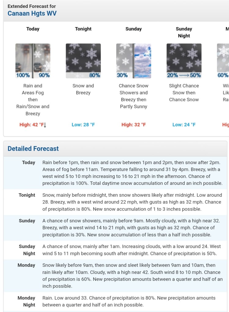
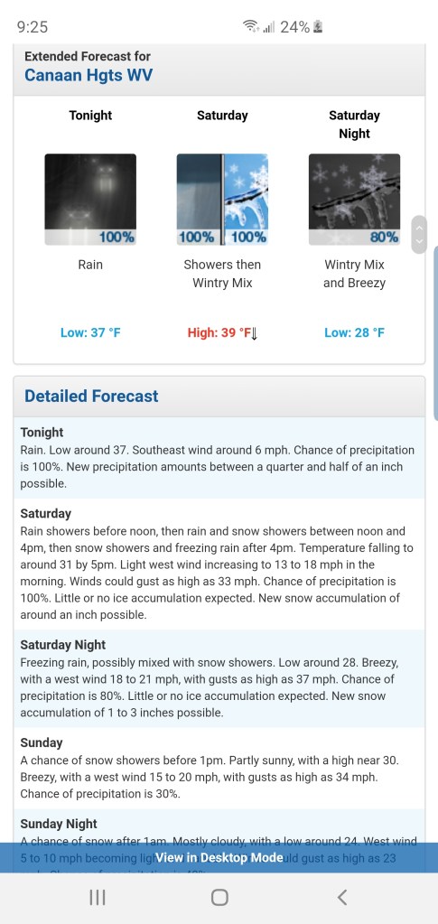
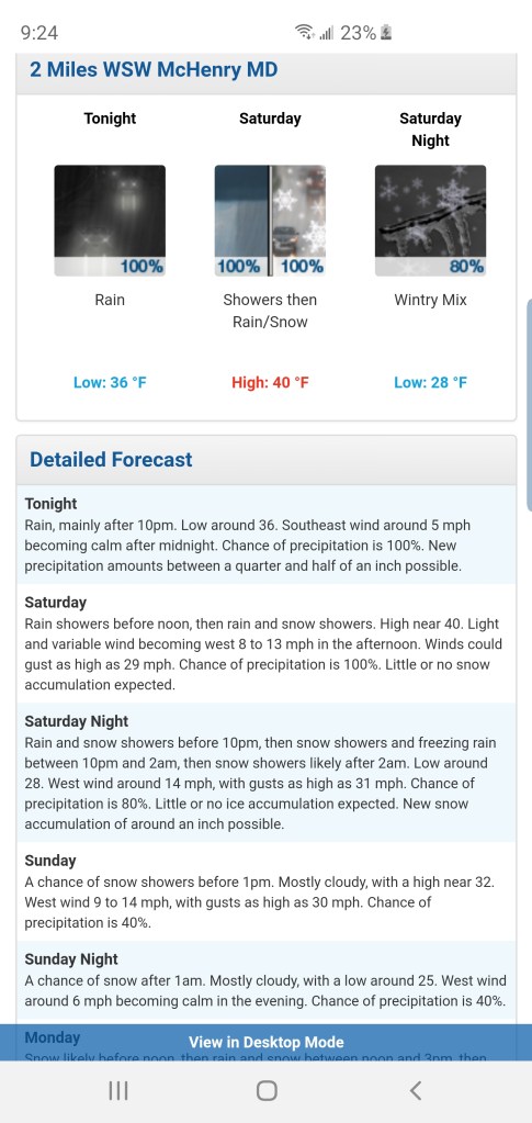
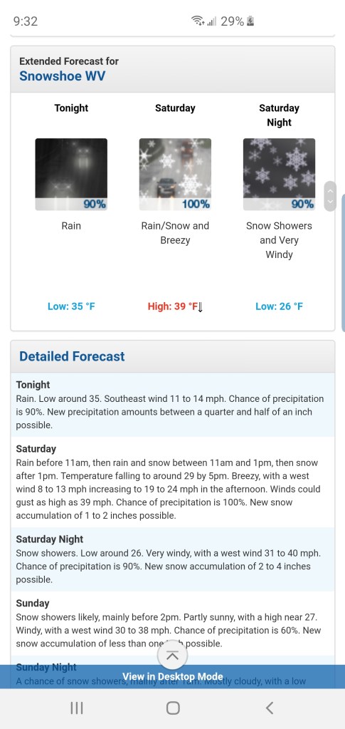
From 12pm today through 4pm Sunday, this appears to be a 3-6″ snowfall for the Wv high ground.(3000’+) As always lean low to mid range and if it performs well, the upper range can be reached. 2-4″ for Garrett, Preston and north into the southern Pa high ground above 2500′. Slightly lower amounts under 2500′. Again, low to mid range looks likely and after some weird forecast last night, the NWS has came around to close to this, but holding it low and at the time of this writing, holding this under winter weather advisory criteria and that may give travelers in this area a false sense of what road conditions will be…
As we go into Monday, the next system is quickly upon us. Once again, the region will be quartered up as some will remain with wintry precip and others to rain.
We all should begin as a round of snow, that transitions briefly to sleet, then to freezing rain and then plain rain.(not all) How long the snow holds on, is a bit of a question mark. It may be a quick brief thump(1-2″) a relaxing in precip, and that allows a warm column to get in aloft SW to NE. This transitions the Wv high ground quickly to a mix and to rain.
However the typical, classic, common, normal, routine, holdouts, The Allegheny Front, this looks to be Spruce Knob and north and duration is longer north, and north central Garrett County, points north, east, this looks to be a duration of a wintry mess. The models will help display that, and if you live here, you’ve seen this play out so many times over the years. This is the high ground and again the lower elevations east involved. Lots of times these systems will hold snow/sleet longer east side of Savage Mt to Frostburg and Lavale with greater accumulations there, than say Grantsville. (Sleet looks minimal with this particular event)That’s something to watch for Monday.
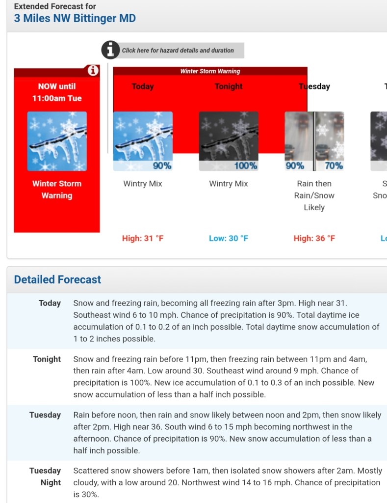
Ice accretion does look to be a concern from the Bittinger area, and points east, north east. Especially the high ground and east facing areas as a strong east wind occurs during this time. With a strong east wind, temps do not just magically spike above freezing. The common NWS error is to forecast the warm air into the typical freeze zone much to soon. Sometimes anywhere from 2 hours to 12 hours to soon. Granted, things have time to adjust yet, but already their Monday forecast looks too soon to rain. I would rather, in these instances have a forecast call for ice a little longer(Tuesday a.m even) than expected for safety purposes in which what winter forecast are for than call for it to end sooner than it does than put people out in about making plans while conditions are still poor.
So, let’s jump to the models. Both the weekend event and early week included:
0z ECMWF
2M Temps
MSLP/6HR/PRECIP TYPE
10m Wind Gust
Snowfall through the weekend event
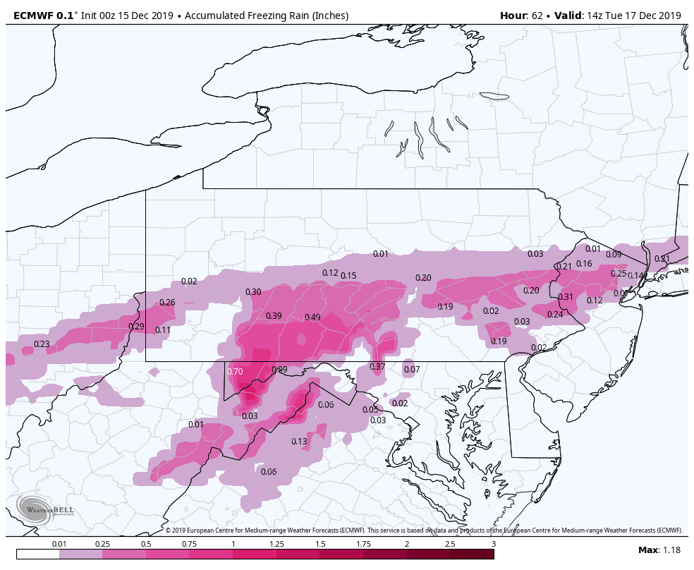
Ice through the Monday event – too note, this is likely overdone.
6z GFS
2m Temps
MSLP/6HR/PRECIP TYPE
Snowfall amounts off the weekend event
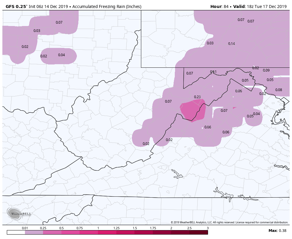
Ice through the Monday event-looks underdone
0z Canadian
2m Temps
MSLP/6HR/PRECIP TYPE
Snowfall off the weekend event
Ice for the Monday event
06z 12km Nam
2m Temps
MSLP/6HR/PRECIP TYPE
Snowfall off the weekend event-Nam is notorious for putting out to much liquid with systems. Not a strong suit of the model
Ice for the Monday event. Having said about to much liquid with systems, by that I mean precip in general, the Nam does agree some with the ECMWF with this event. Saying is, when then NAM and ECMWF , pay attention
6z ICON
This model is up there with the Nam in handling temperatures with these east flow/cold air damming events
2m Temps
adding the wind streamers with temps, that east flow Monday. Again, those classic areas, temps do not magically rise very fast.
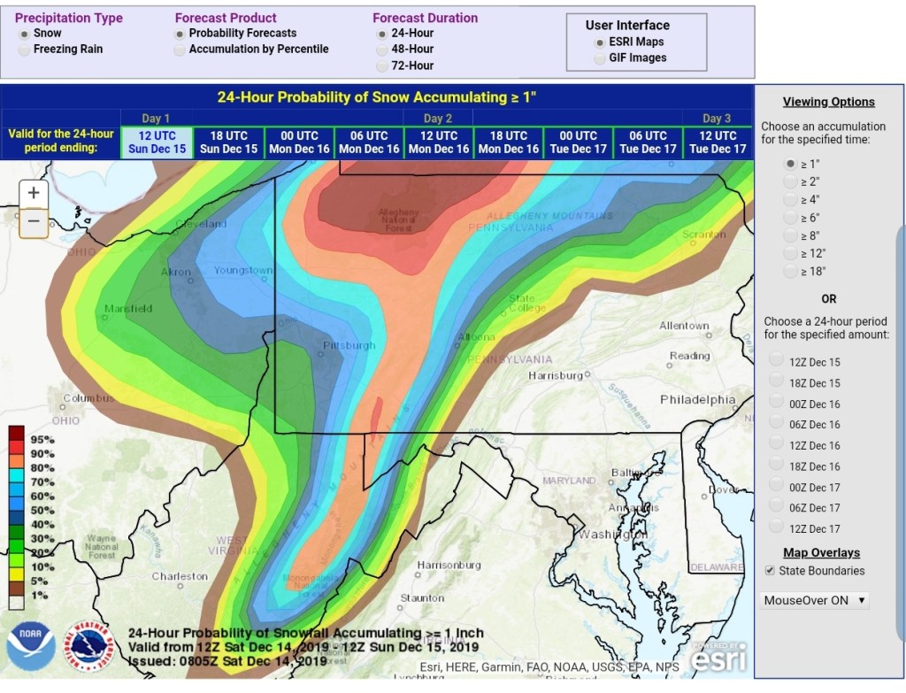
Let’s hop to the WPC outlook for the snow event this weekend and ice early week.
Snowfall probabilities
48 hr 4″ probability
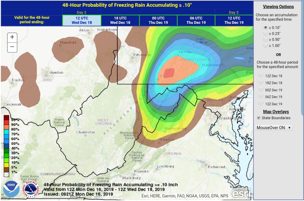
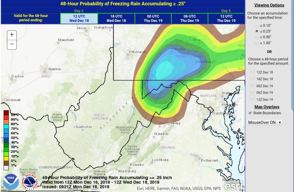
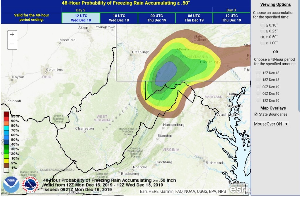
WPC Ice potential
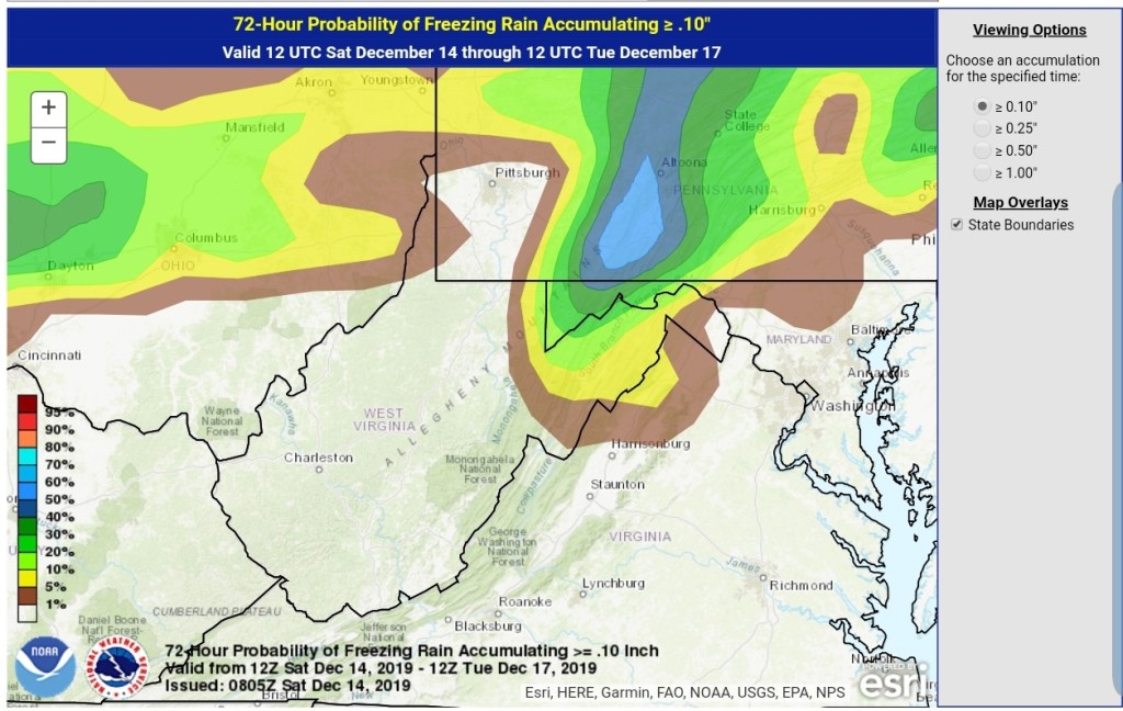
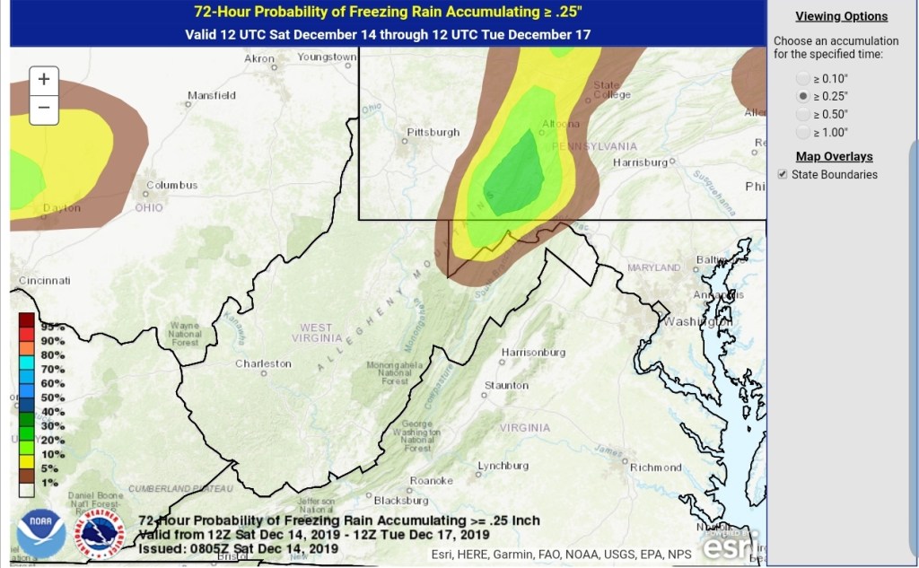
.10
.25
.50
New NWS forecast, wording is much improved for the weekend event, over the strange wording from last night.
Few weeks ago I made a post about this, freezing rain to rain to snow pattern. Its held. Several years ago Bob Leffler had told me, he was taught to watch the 500mb heights off Miami. When you see that ridge build, do not plan on a consistent snowy pattern in the Wv high country, and basically look for what we are seeing with this current pattern. The SW flow aloft is not conducive for anything more than brief hots of snow, cold, followed by a warm intrusion aloft with the following system and repeat. Well, that rule, which I would call it a rule, has worked nearly 100%.
Heres the 500 for early week
590 heights off Miami is not what you want to see in the WV high ground if you want winter to hold its ground
That said, there are signs this relaxes and other teleconnections become more favorable down the road. Unfortunately, models just aren’t that good at it. This year, the setup is very December 2013ish. Without the blowtorch days…and we all should remember where January 2014 went…
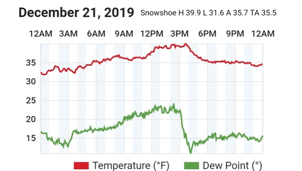
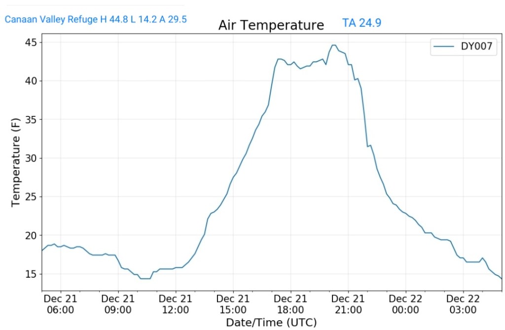
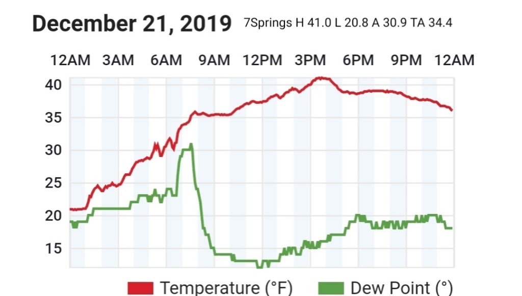
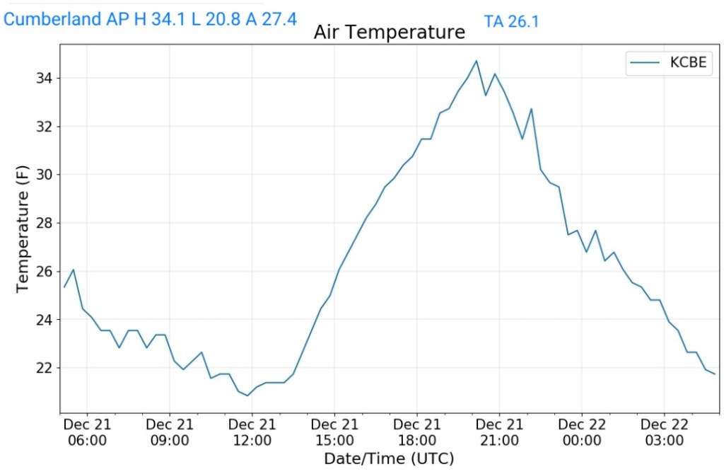
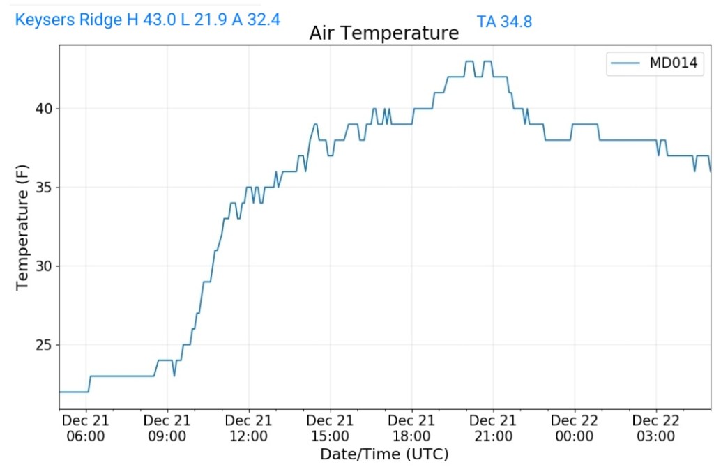
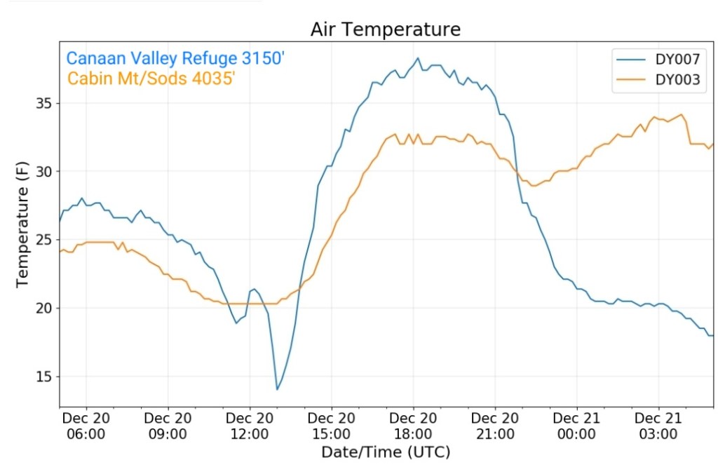
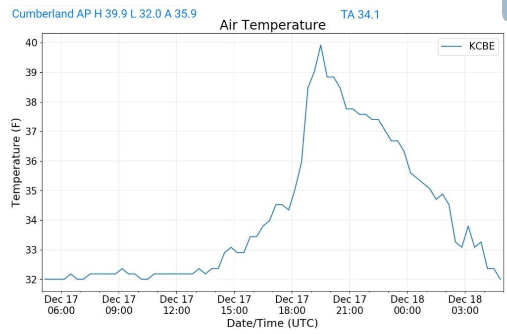
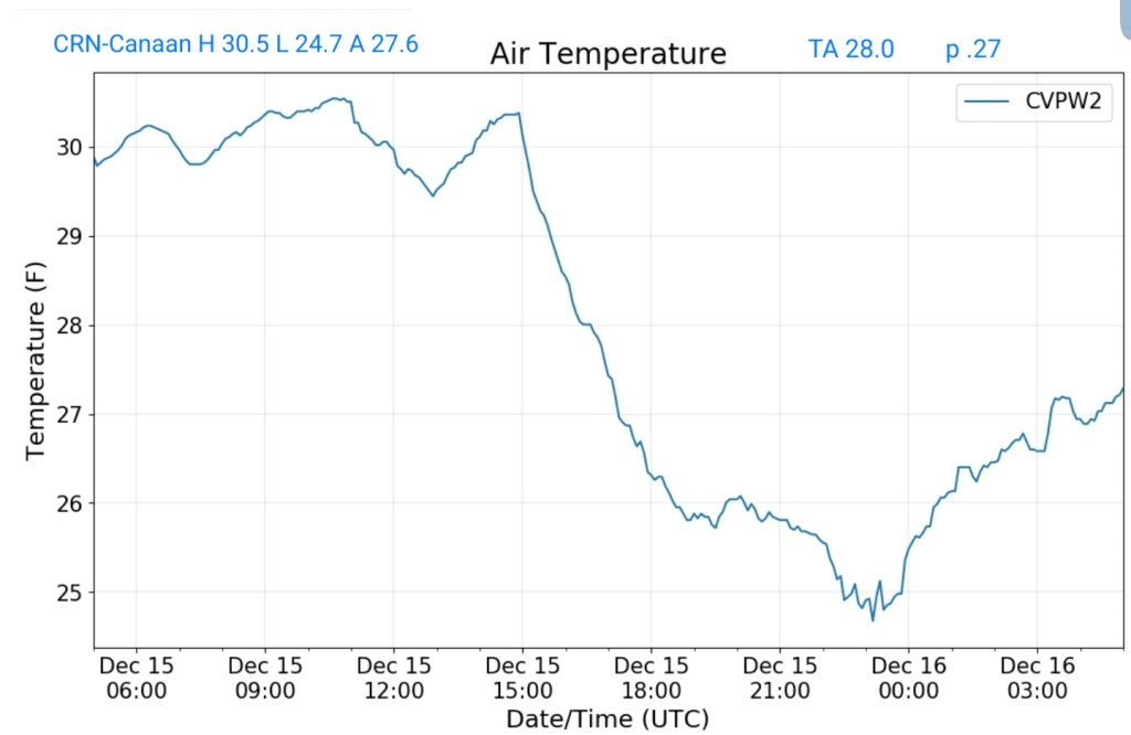
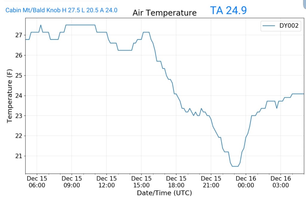
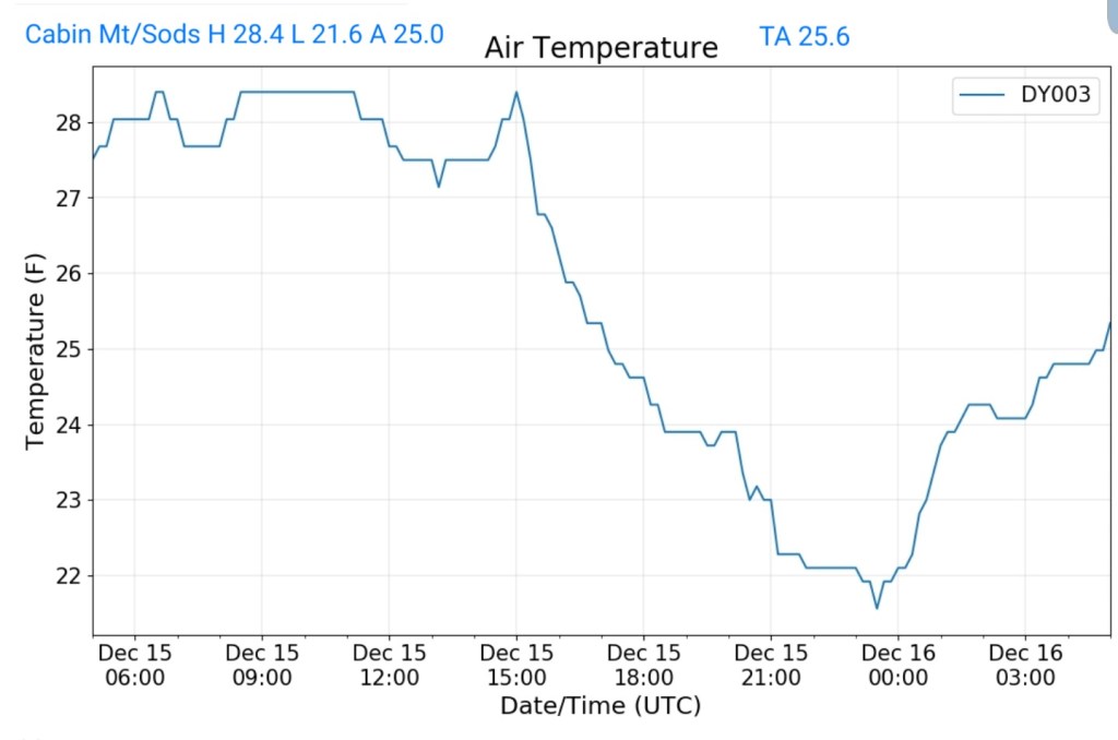
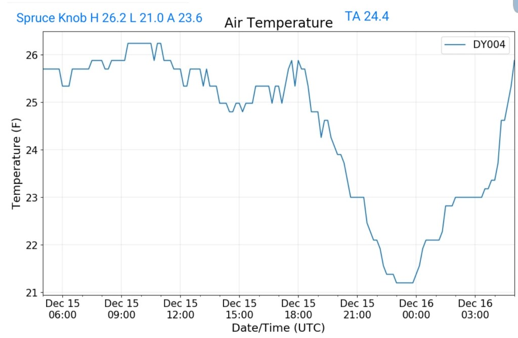
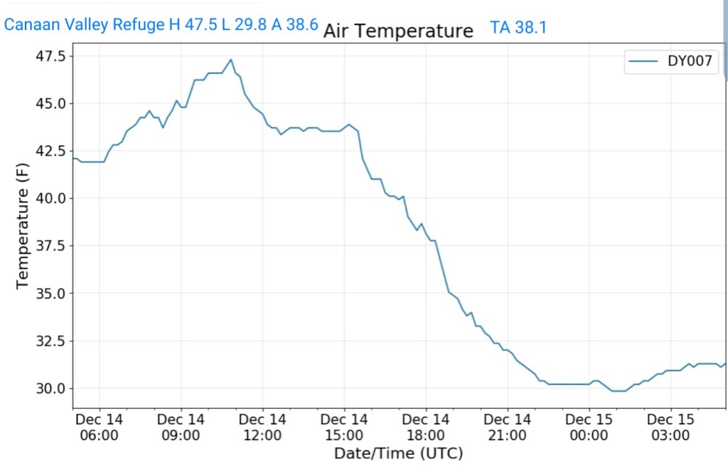
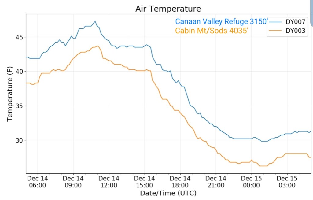
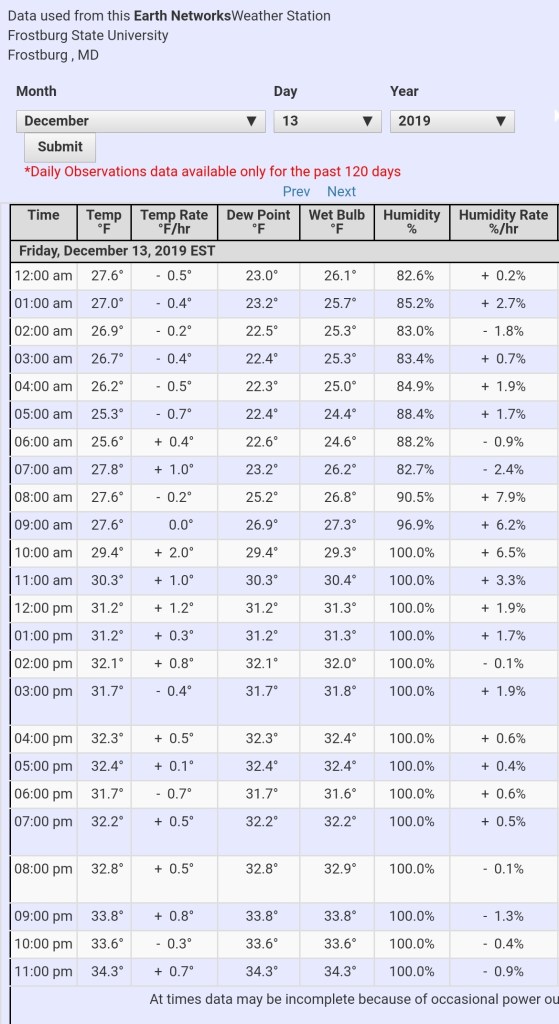
A variety of weather in the area. The classic ice zones got some light glaze, the valleys on the east side of the Mts picked up a quicker glaze in the morning that lead to very slick conditions. Temps varied as you’ll see below and the RTMA gives a good handle. Some deeper colder valleys held below 32.
(Forgot to download from the nullschool site, so a different version today since nullschool does not archive)
Surface features and 500mb height anomalies and flow
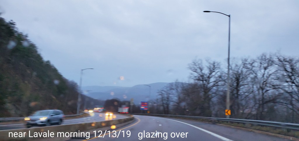
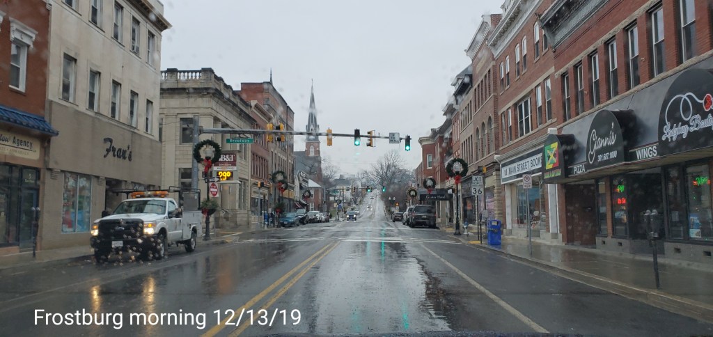
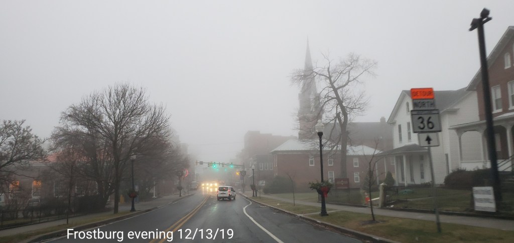
pics today-
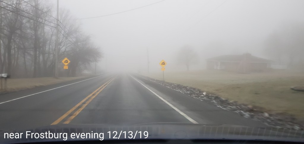
Lavale to Frostburg
Cold air loves to hang in these low valleys in this area after a departing cold air mass in place
Savage Mt area
Grantsville to Bittinger area
Initial very light glaze, high valleys held cold. Not as good as the deeper valleys do, but the high valleys still cooler than the high ground from in this area and west
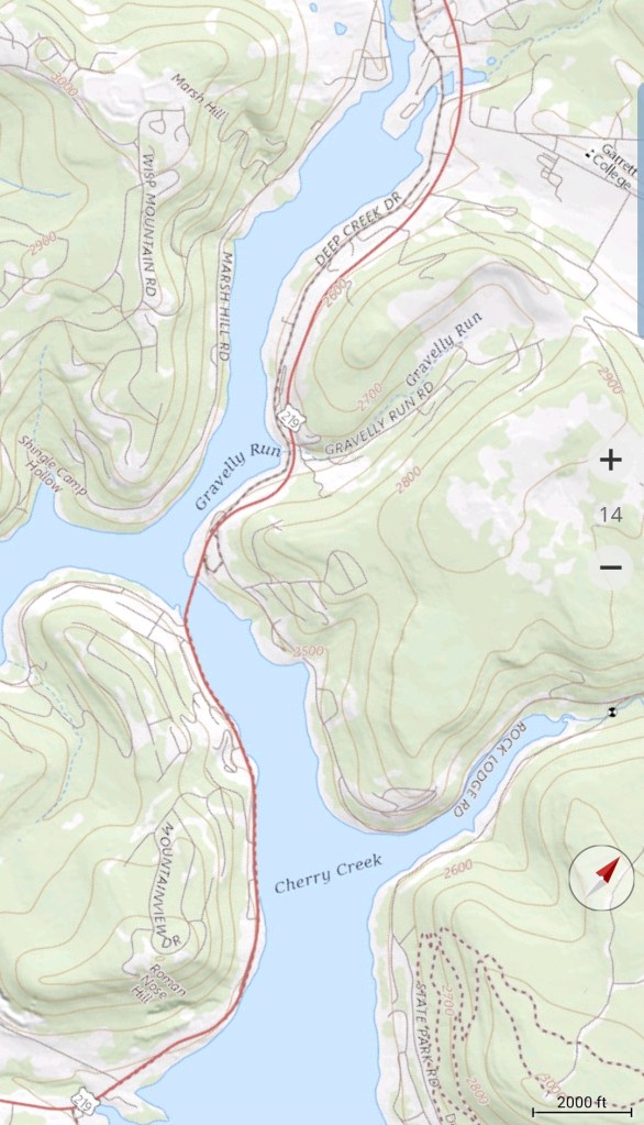
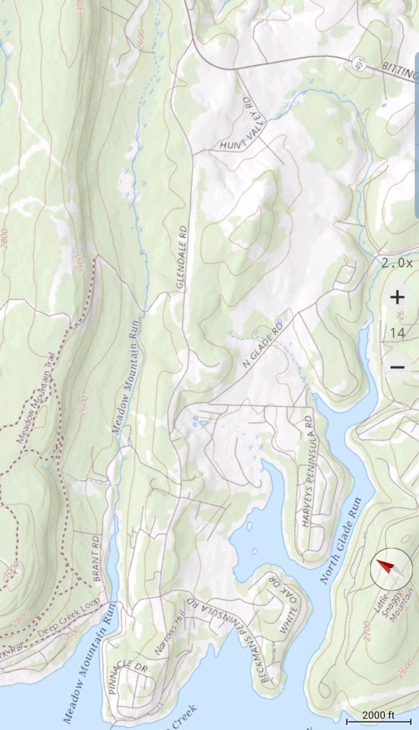
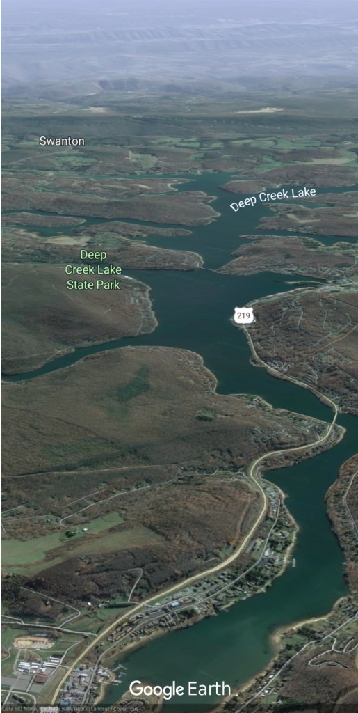
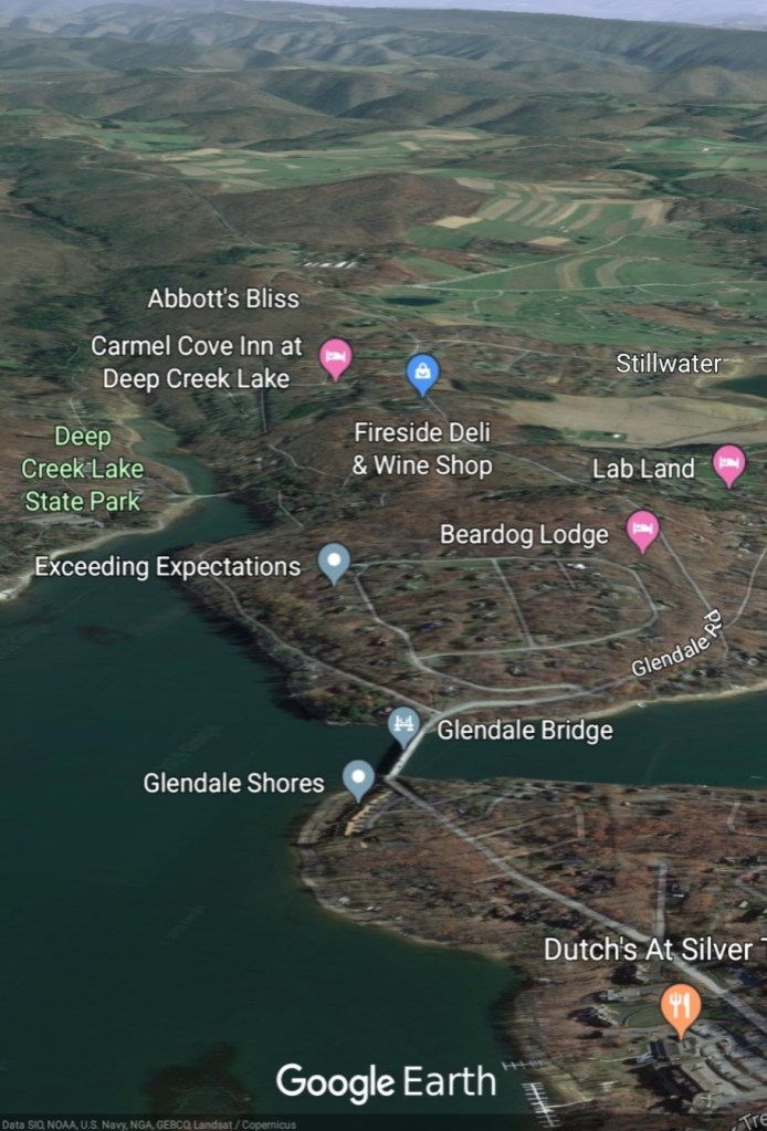
Deep Creek Lake
Smooth area is a thin ice cover
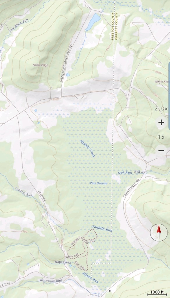
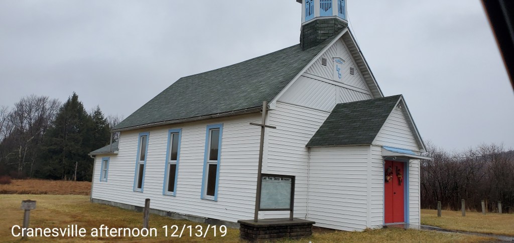
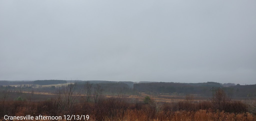
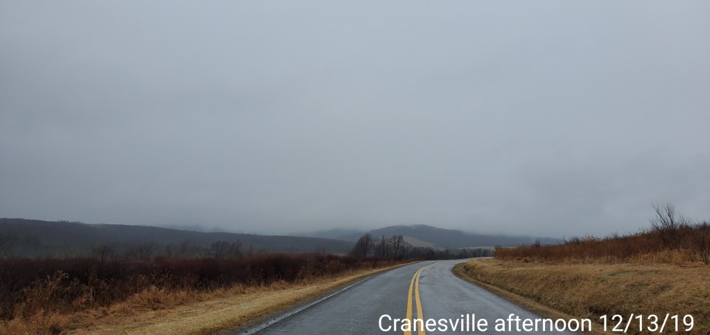
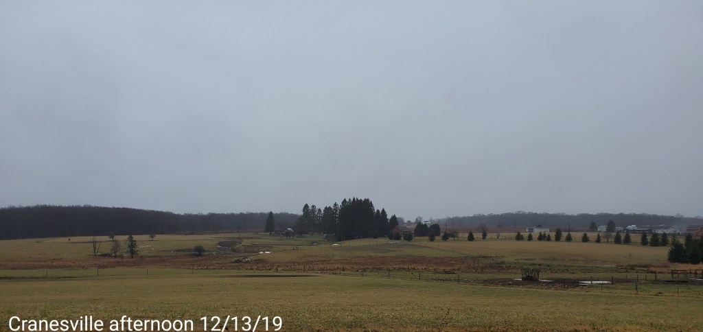
Cranesville area
Far enough west, not nearly as ice prone in these setups
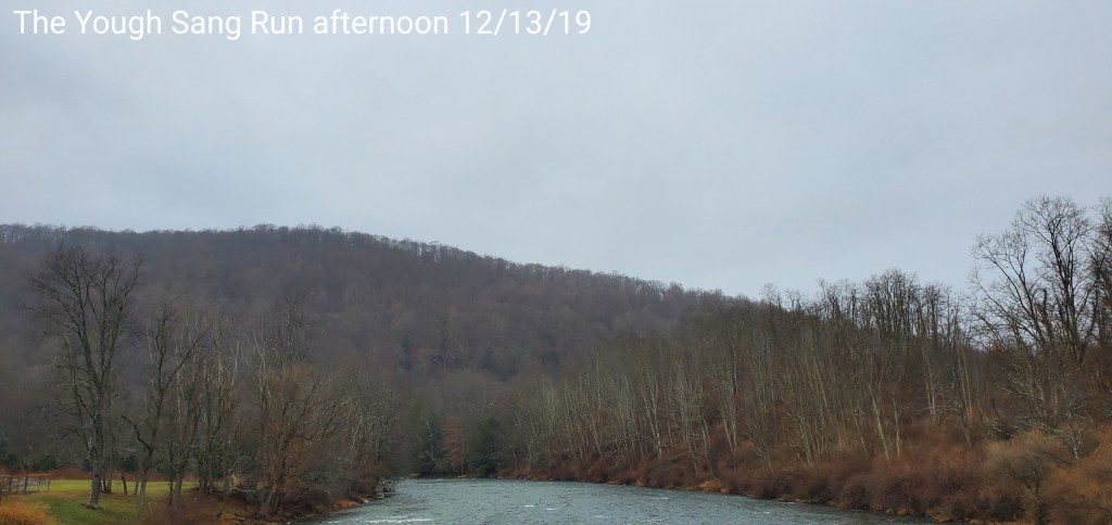
The Yough-Sang Run
Colder Deep Valleys east
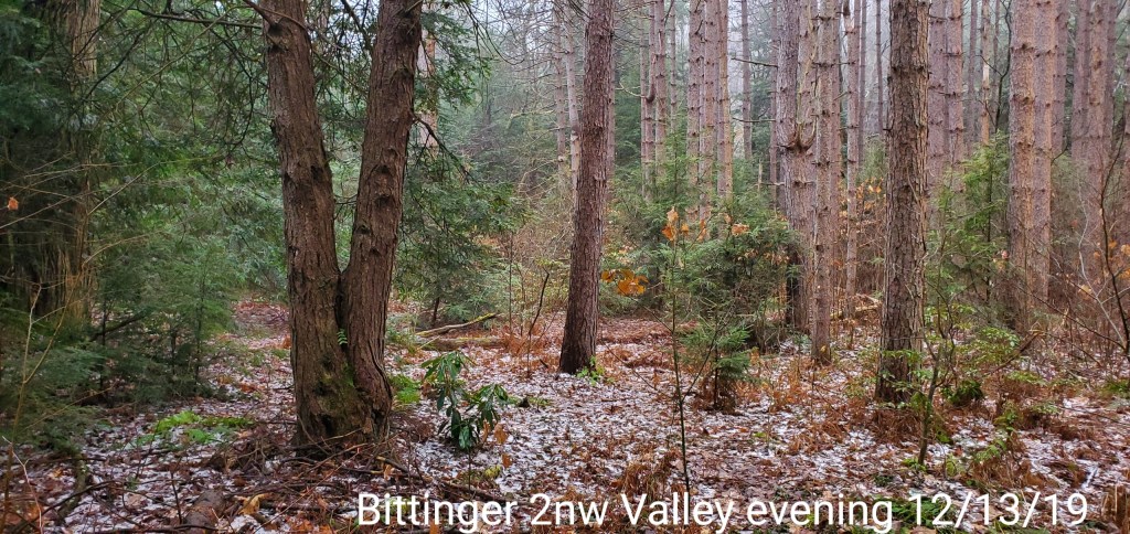
Late evening update: 12/13/19
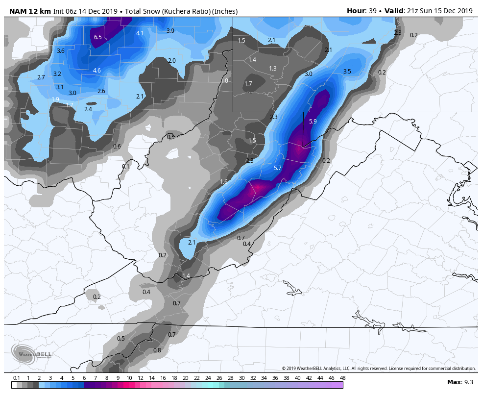
Some quick views of the latest model guidance for snowfall that begins first in the Wv high ground midday, early afternoon tomorrow, early to mid afternoon north of Canaan.
Overall looks like a 3-6″ event Wv high ground, as always I lean low to mid and allow for a good performance to achieve the high en .
2-4″ Garrett, Preston into the Southern Pa high ground.
18z ECMWF
18z GFS
12z Canadian
Some very bizarre wording from the Pitt NWS. As great as their service has been early on this season, the past few days has just been a tad strange. The misunderstanding of how the ice setup this morning works, now this…
Freezing rain possibly mixed with a snow shower tomorrow night, 1-3″????!!! That may be the first in recorded history for the area.
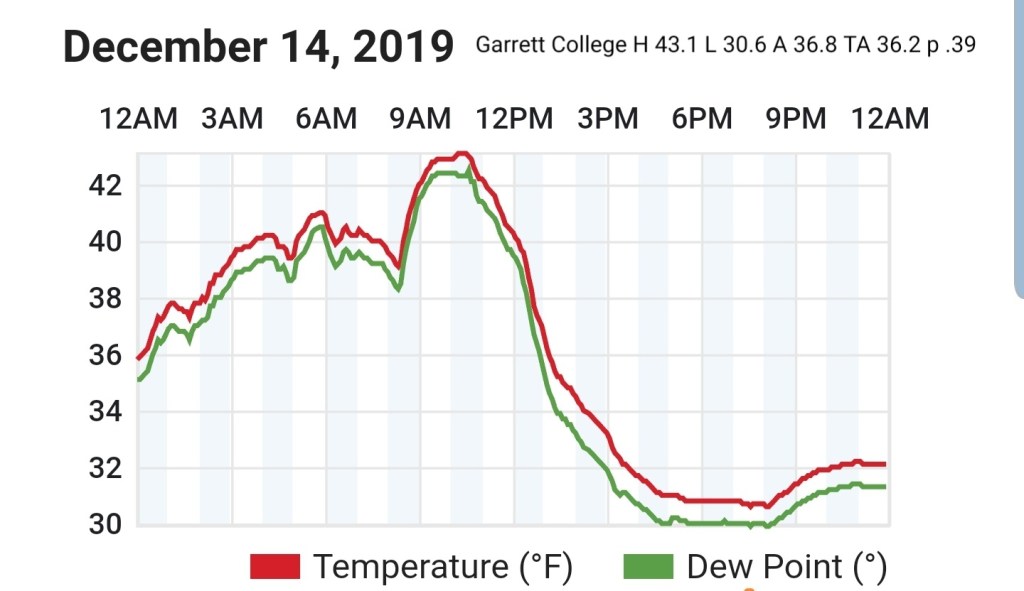
For Garrett… lots of areas colder than forecast mins for daytime maxes today. Temps slow to rise overnight…the mins are and will be colder than forecast.
Charleston more in line with modeling on their end
Surface features and 500mb height anomalies and flow
Afternoon update:
Afternoon thoughts based off the latest model runs-
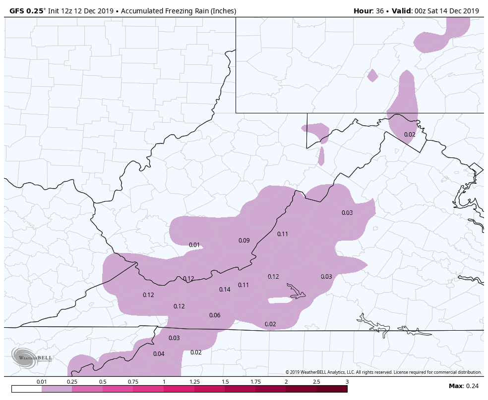
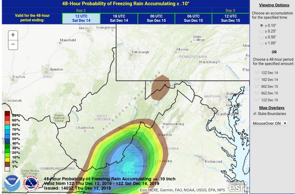
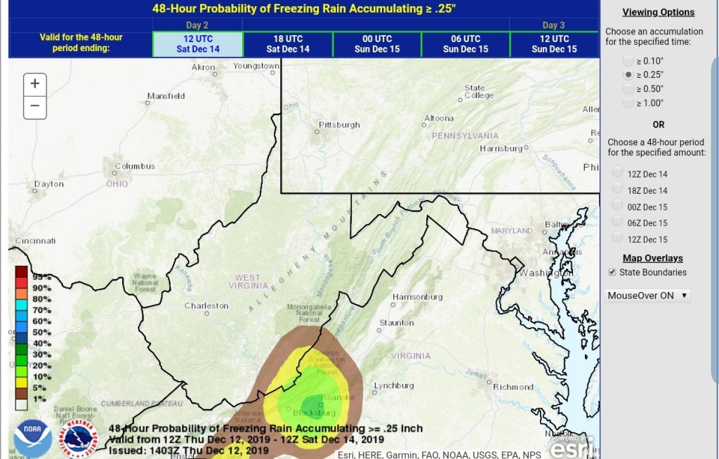
Light precip pushes in to the southern areas in the region in the morning. Main concern is a light freezing rain glazing things over. This pushes north through the day. Overall precip is mostly light. Tomorrow night, any areas in the classic high elevation ice zones(those same spots that’s saw ice on Dec 1) that are typical holdouts for freezing rain, those areas will rise +32 early in the night. The remaining areas to watch for freezing rain turns to the deeper valleys, the Savage River valleys and valleys mainly east of the Allegheny Front. Those pockets may hold below freezing into Saturday morning.
Temps creep up across the board post dawn Saturday, rain into the afternoon region wide. Early to mid afternoon that rain begins to transition to snow, first across the WV high ground, then north into Preston, Garrett and high ground in southern Pa.
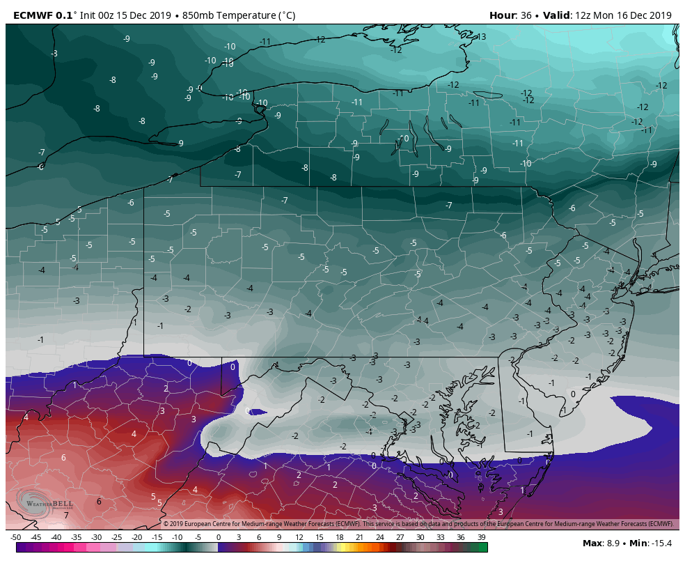
Saturday night- as of now, a steady period of snow looks likely, with periods of varied intensity into Sunday with a tapering down through the day. Temps on Sunday holding 20s, Wv high ground, upper 20s lower 30s to 2500′ lower to mid 30s below 2500. Forecast mentioning rain mixing in during the day on Sunday are very very unlikely. 850temps(near 5000′, roughly near the highest Wv areas) are modeled -5c to -8c. When its precipitating across the high ground, temps at 5000′ of 17f to 23f, you are not changing to liquid. There is no diurnal and even less so on December 15th.
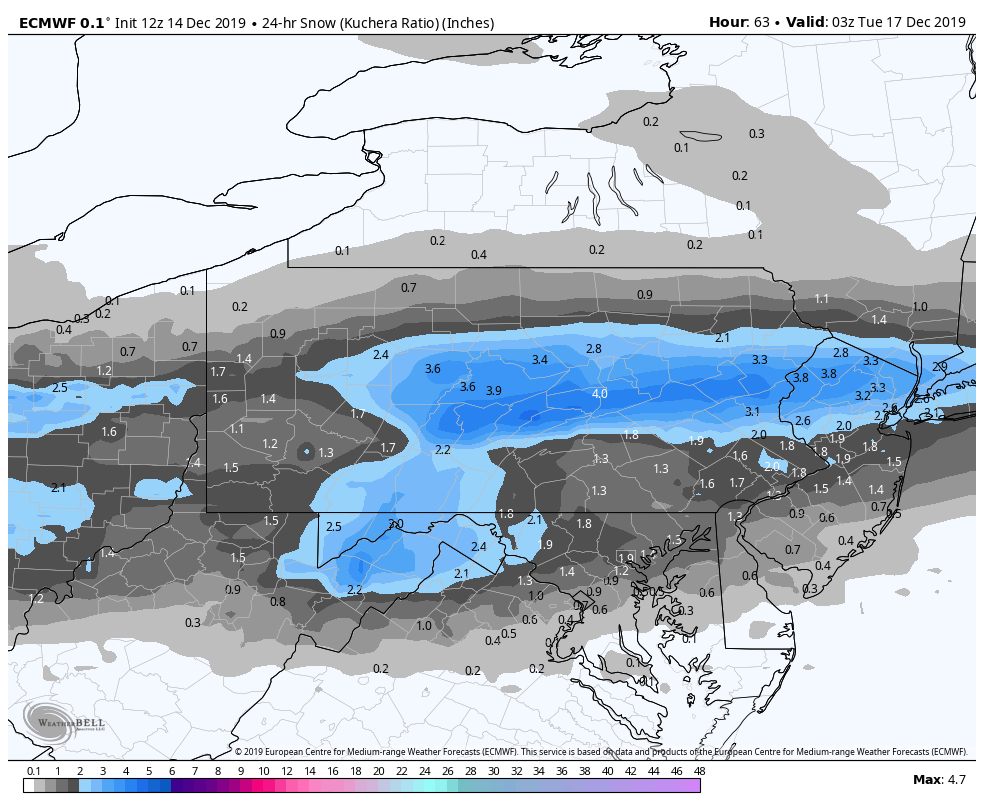
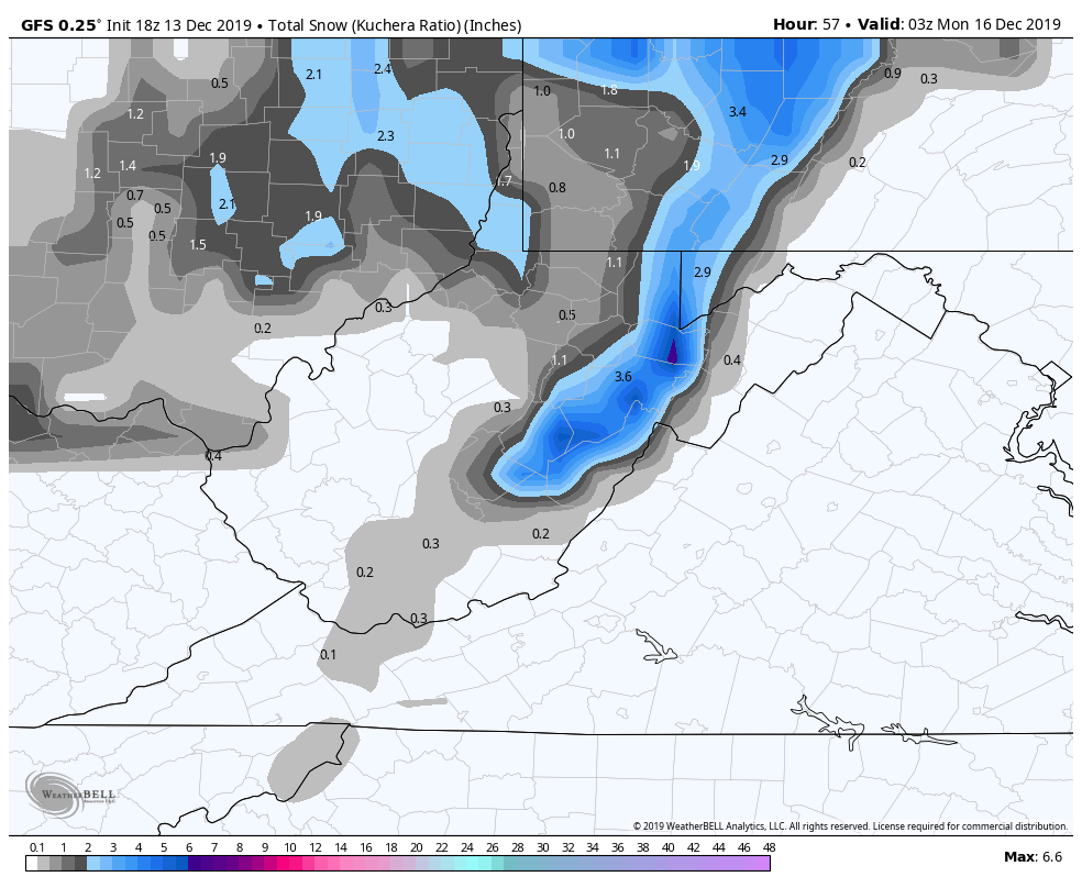
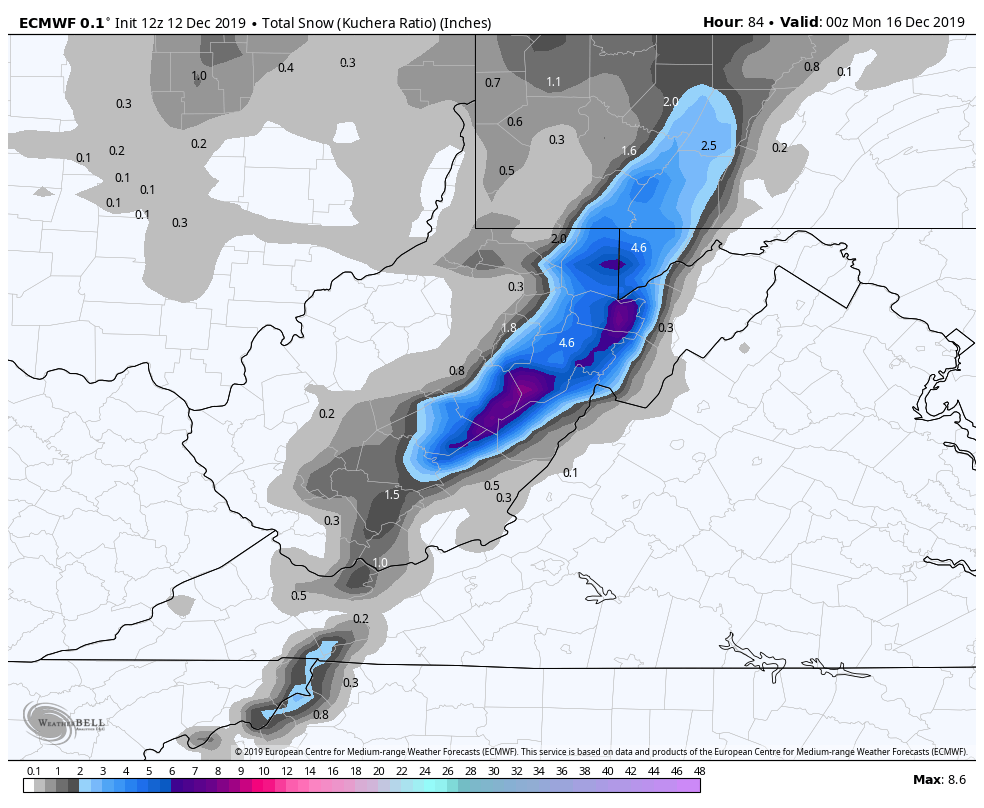
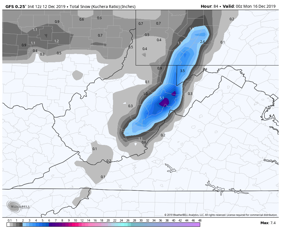
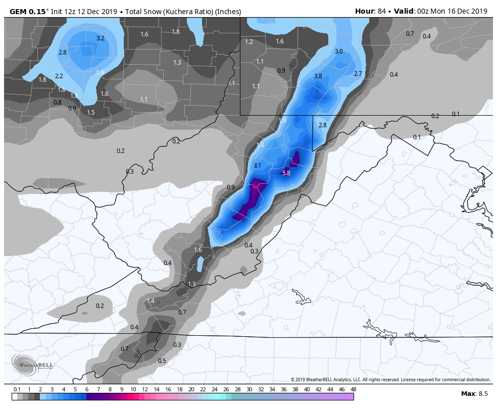
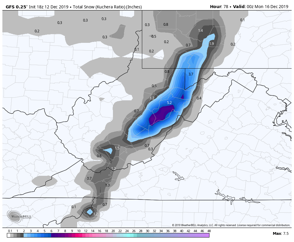
A struggle within the modeling has been precipitation amounts and therefore snow fall amounts. Lots of agreement currently in place within the models and that has not been all that common. A early call, if you can say Thursdsy afternoon prediction for Saturday night into Sunday is early, is a 3-6″ snowfall across the Wv high ground, with 2-4″ with higher pops across Garrett, Preston, and southern high ground of Pa.
Likely tweaks on timing and amounts will occur.
A look at the models and the amount of agreement. These models will not pick up on those isolated, secluded valleys that remain below freezing. The mesoscale 3km Nam will do better(not perfect), and will post more with it tomorrow morning. It does much better than the HRRR which has a exaggerated consistent warm bias.
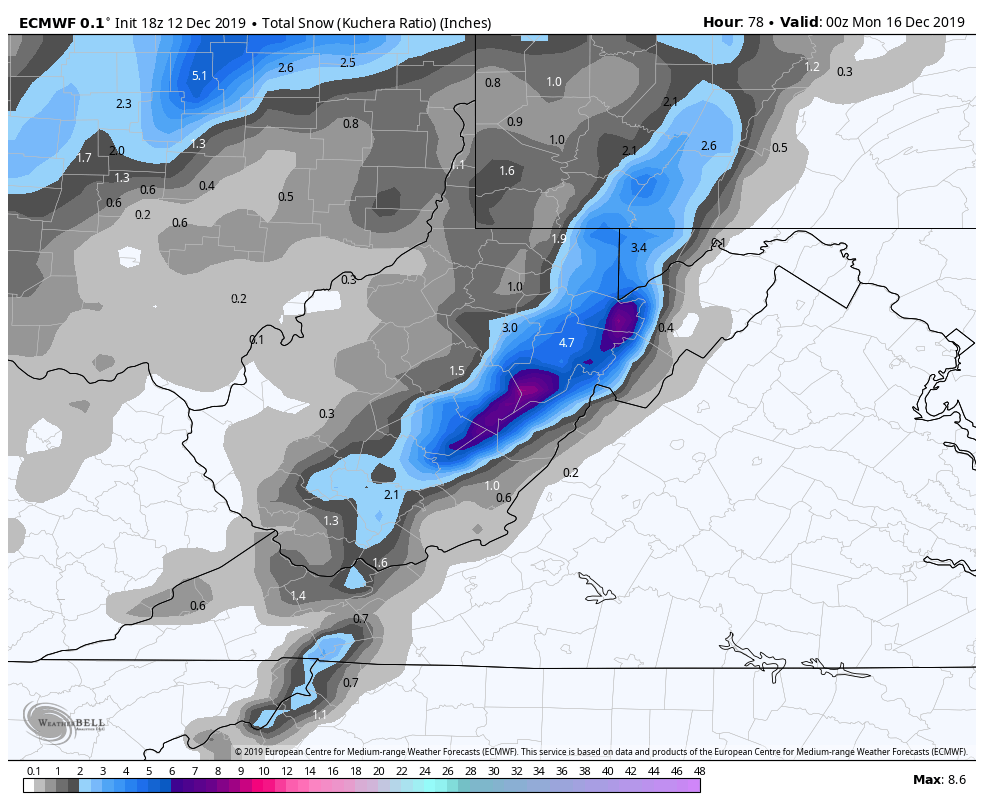
12z ECMWF
2m Temps
850 temps
MSLP/6HR/PRECIP TYPE
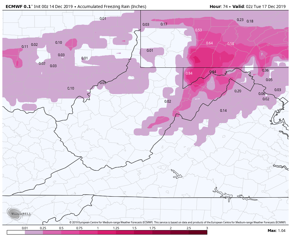
Freezing rain
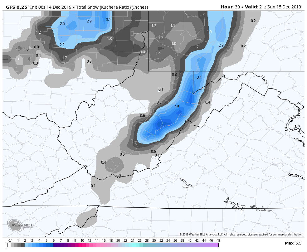
Snowfall
12z GFS
2m Temps
850 Temps
MSLP/6HR/PRECIP
Freezing rain
Snowfall
12z Canadian
MSLP/6HR/PRECIP
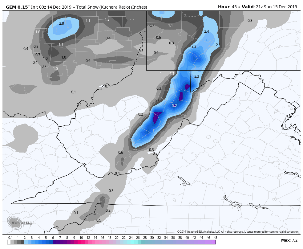
Snowfall
Again, these are model runs, only tools, not the gospel. Stay tuned
WPC OUTLOOK:
Ice- which for the southern areas mainly comes in early tomorrow, and then watch for lingering cold pockets tomorrow night in the deeper valleys. More widespread initially.