March 3, 2020
Mar 3(Tues)
A awesome sunrise, quickly giving way to some showers. Those subsided in the afternoon for a period, before more pushed through mid afternoon. Creating plenty of social media rainbow pics. Later on, some thunderstorms pushed through that contained first soft hail, then also snow around 9:30-10pm, didn’t stick.
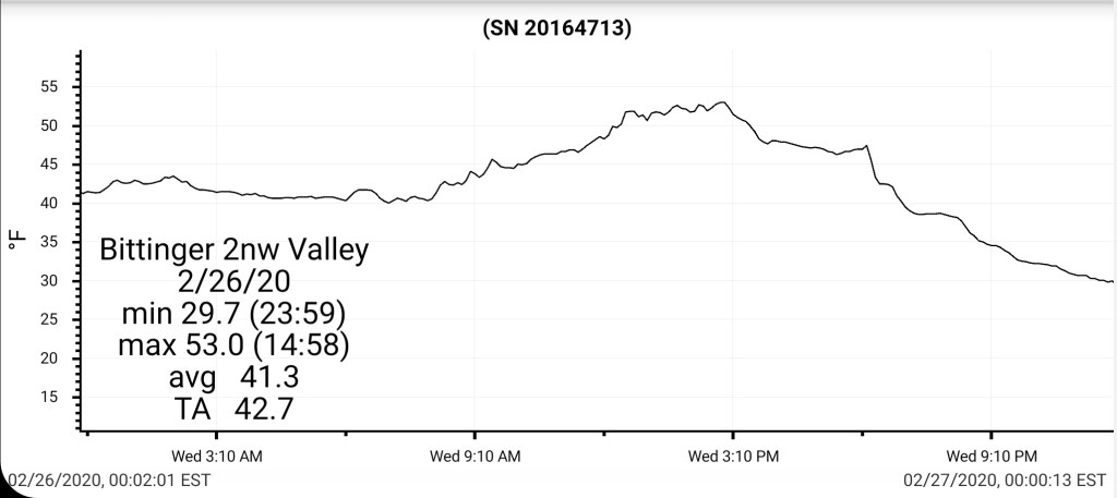
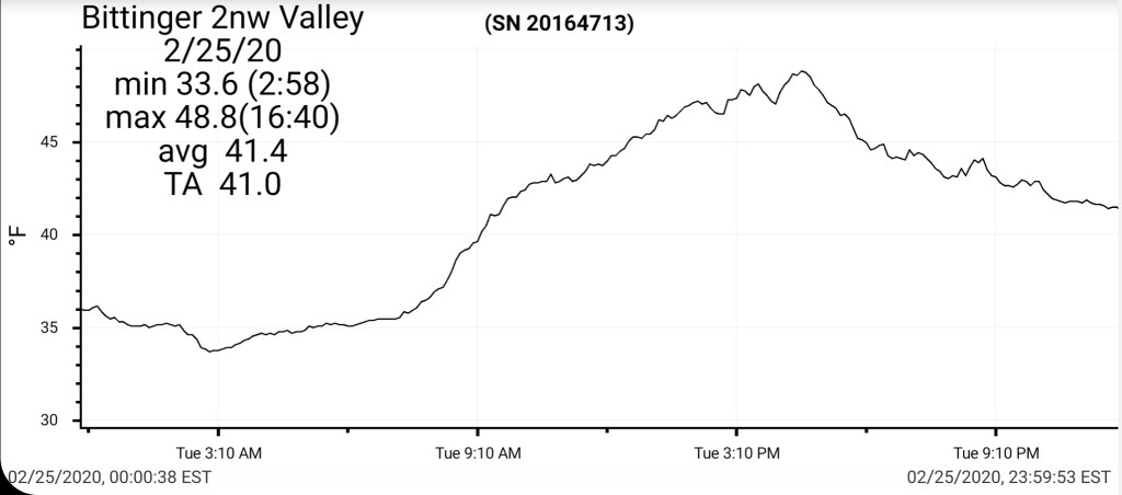
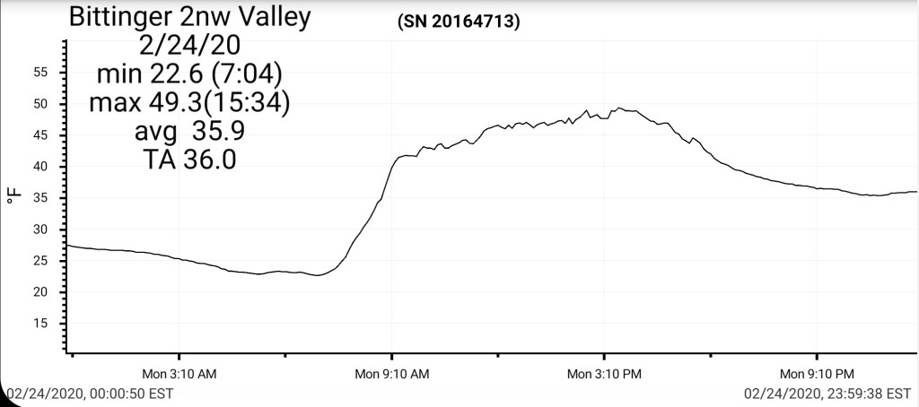
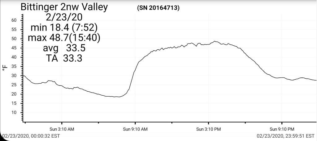
Bittinger 2nw Valley
No new snowfall, although snow was in the air around 9:30-10pm. About the time of the rapid drop on the daily temp graph.
Snow depth- traces
Season to date total snowfall 60.0″


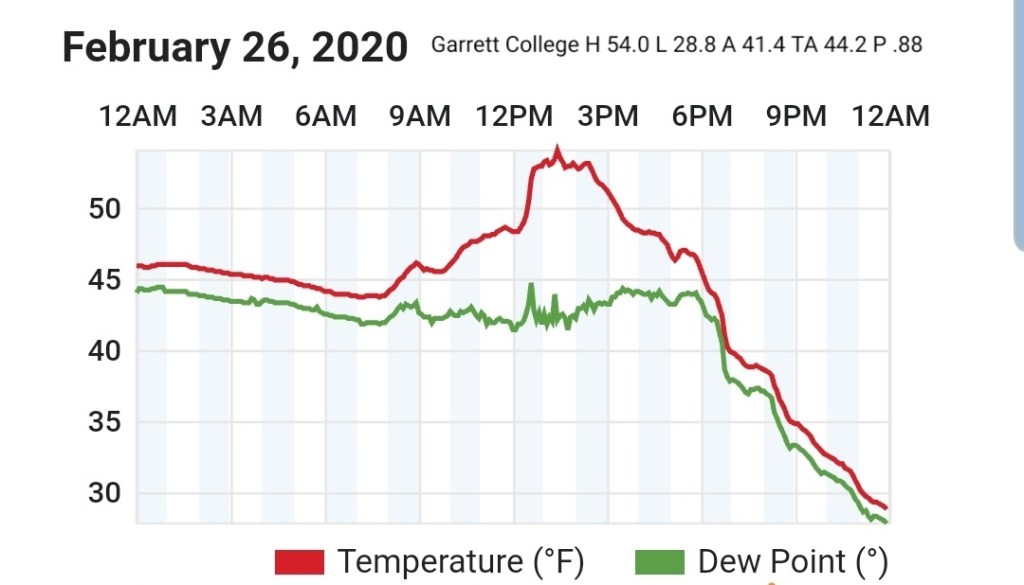
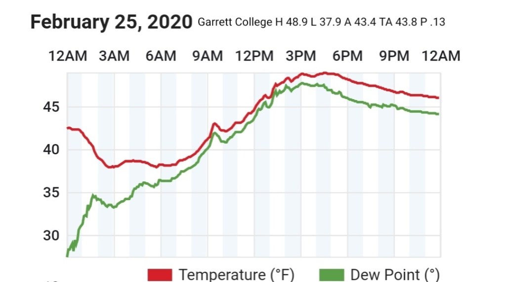
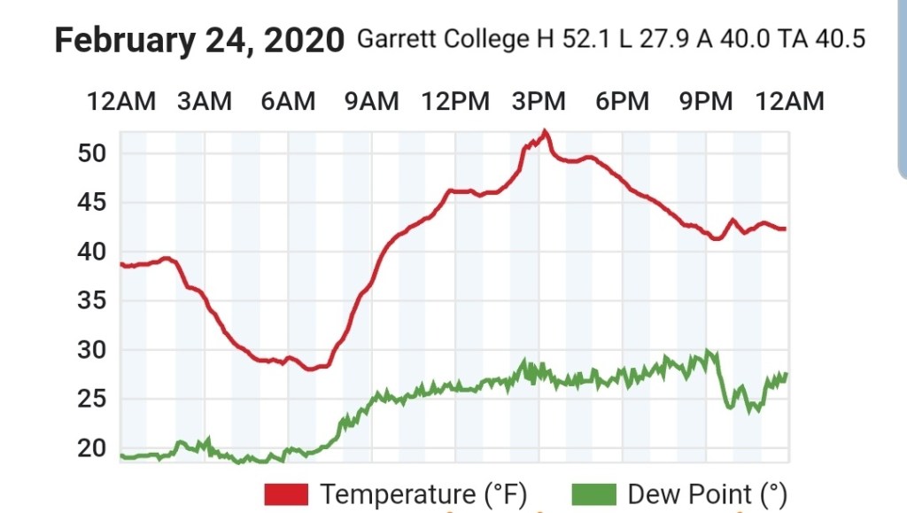
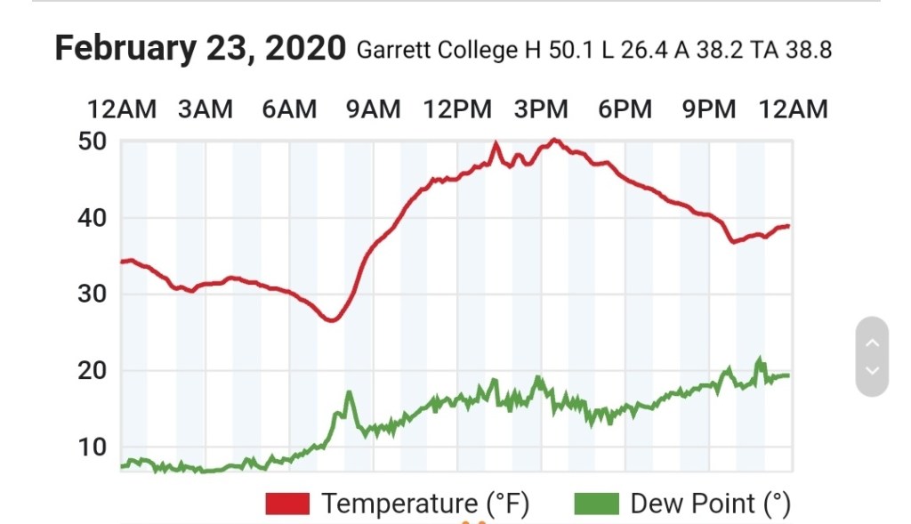
Garrett College


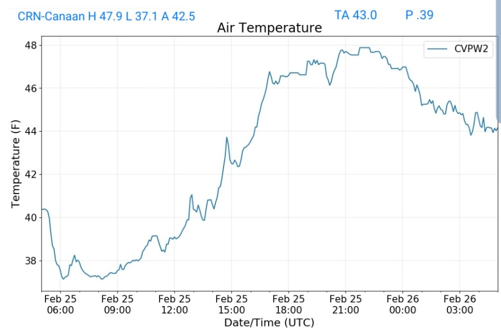
Canaan Heights/Davis 3SE
MIN[33.0]—MAX[51.0]—AVERAGE MEAN[42.0]—PRECIP[.37]7am
No new snow
Snowfall season to date 83.2″
Comments by Dave Lesher at :
Periods of rain and mild; a brief thunderstorm with pea hail in late afternoon. Turning colder late in the day.
The average temperature of 31.7F for the 3-month period of Dec to Feb just ended (aka “meteorological winter”) is the warmest it’s been since the winter of 1998-99. See Table 12.3 below.
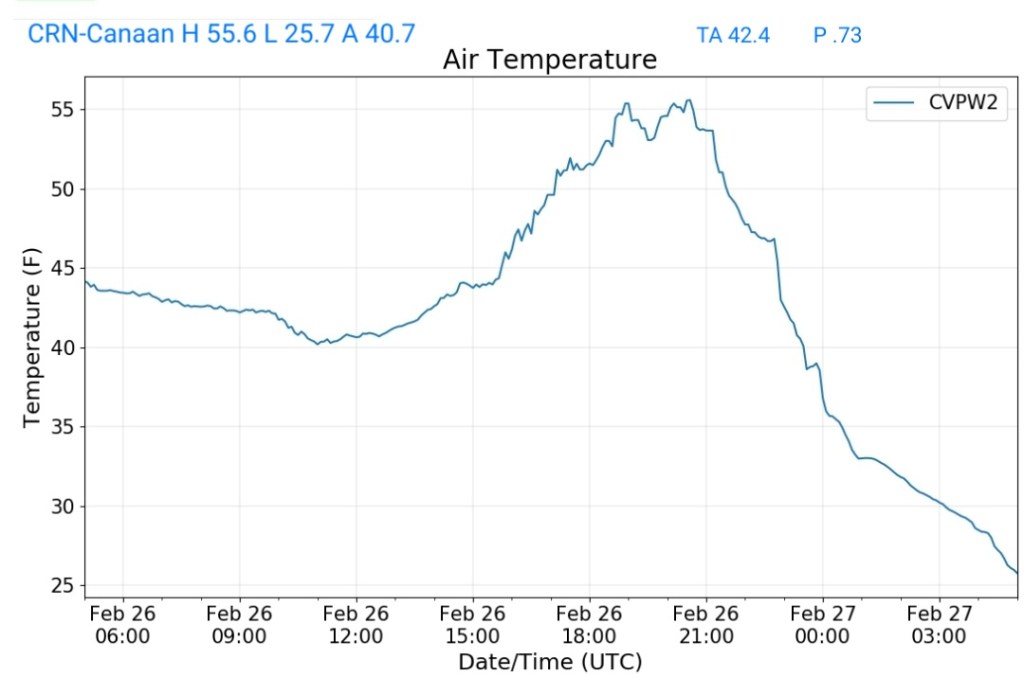
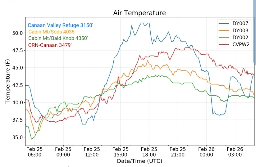
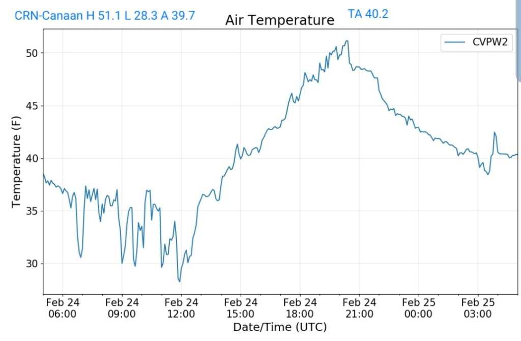
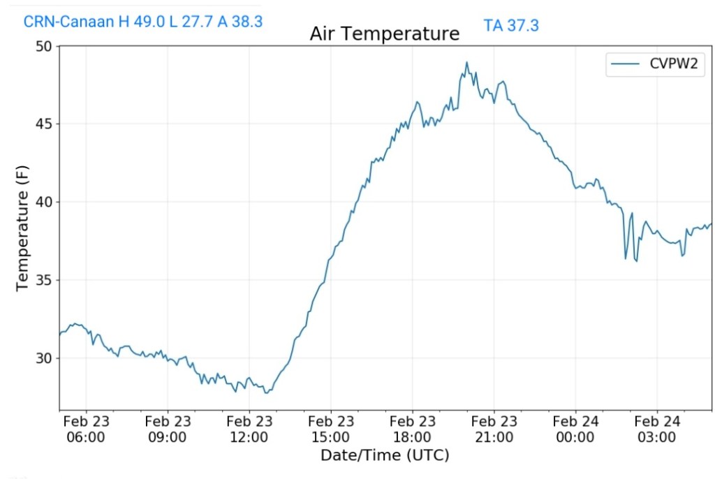
Climate Reference Network Canaan


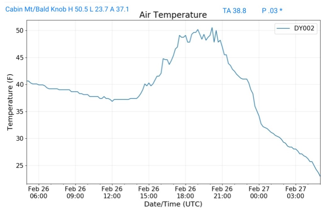
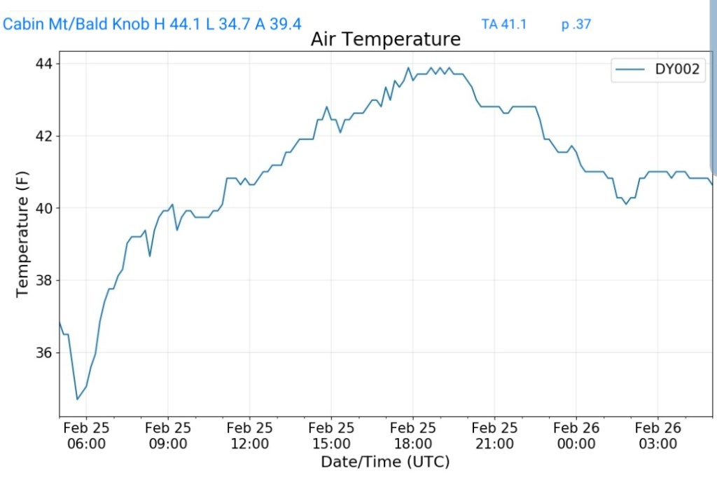
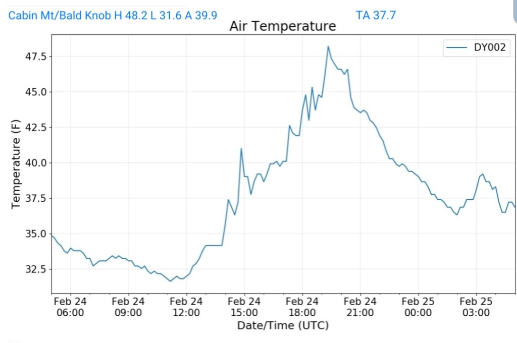
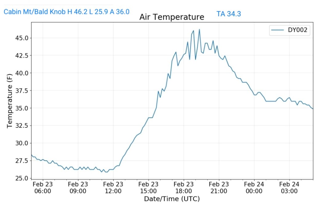
Cabin Mt at Bald Knob


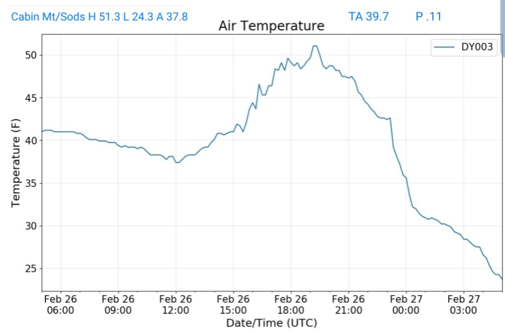
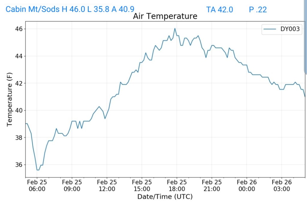
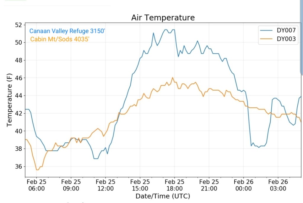
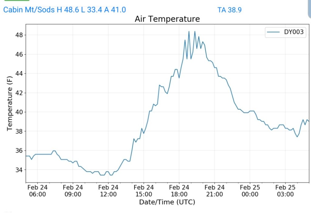
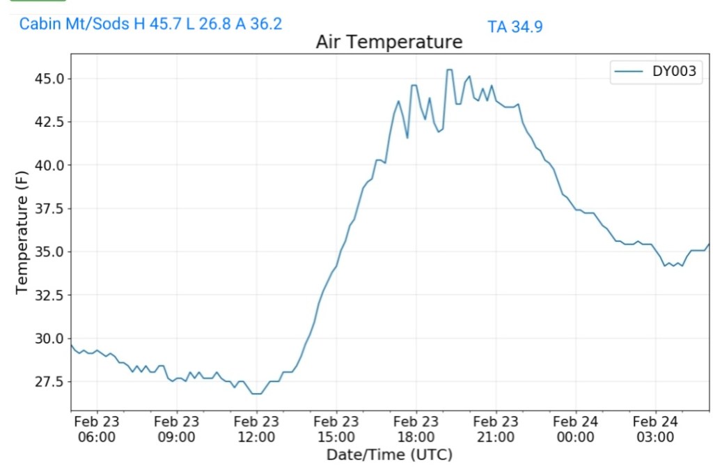
Cabin Mt-Western Sods


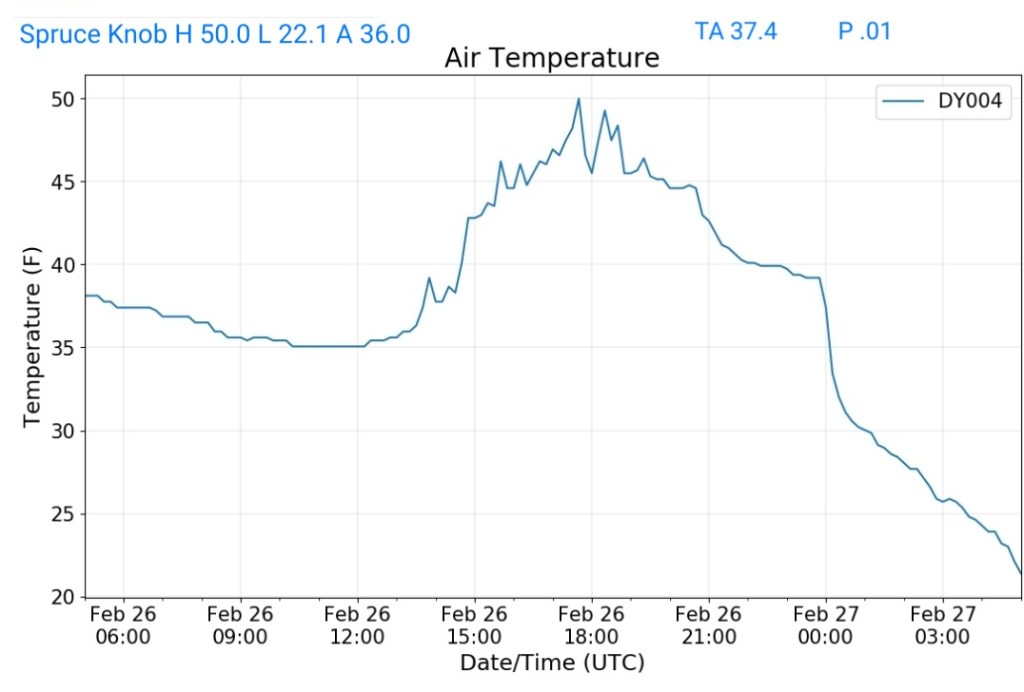
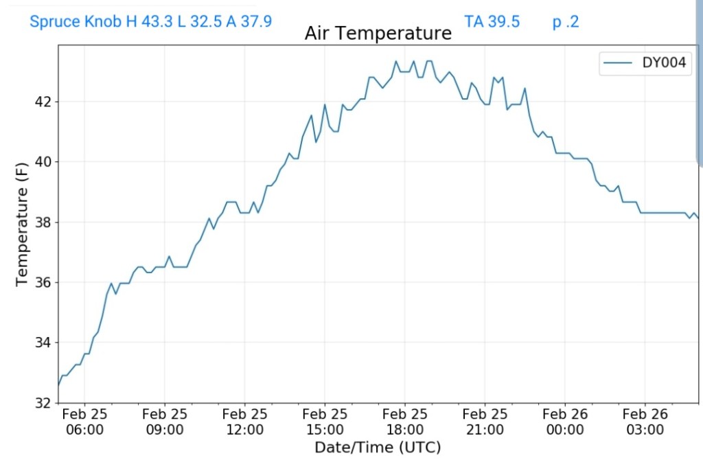
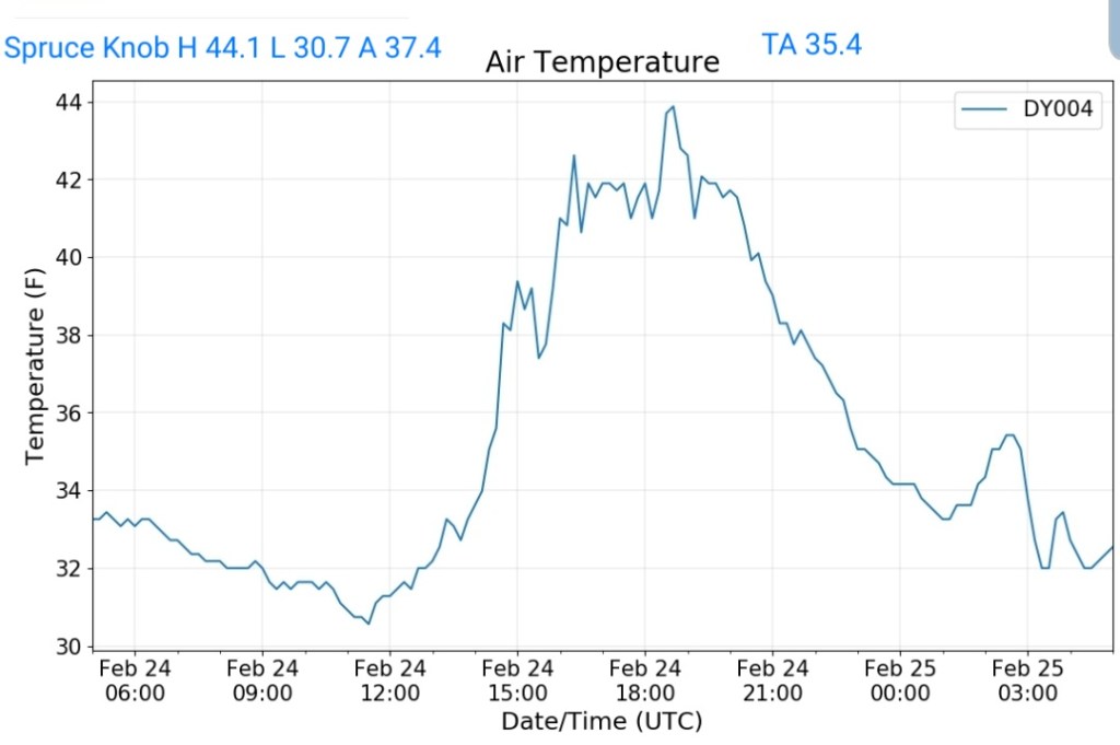
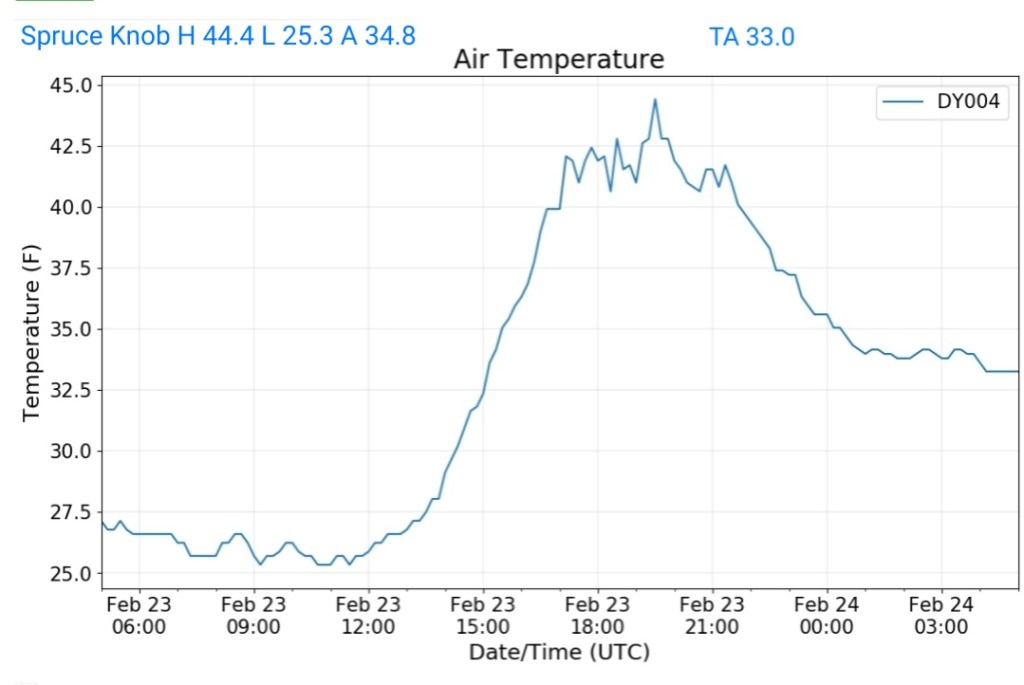
Spruce Knob


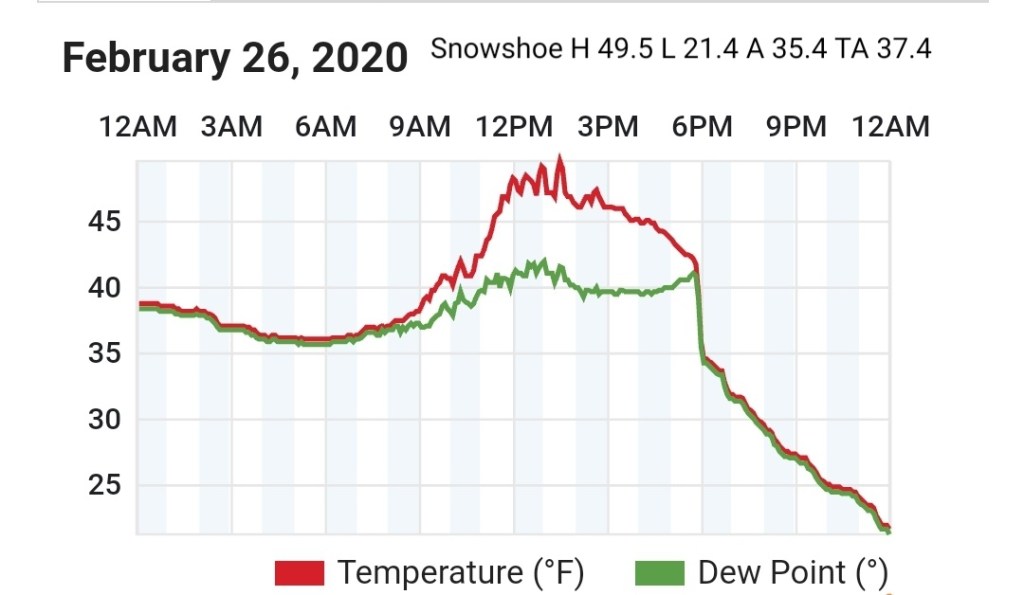
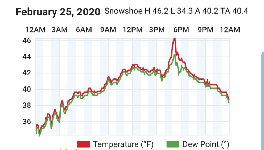
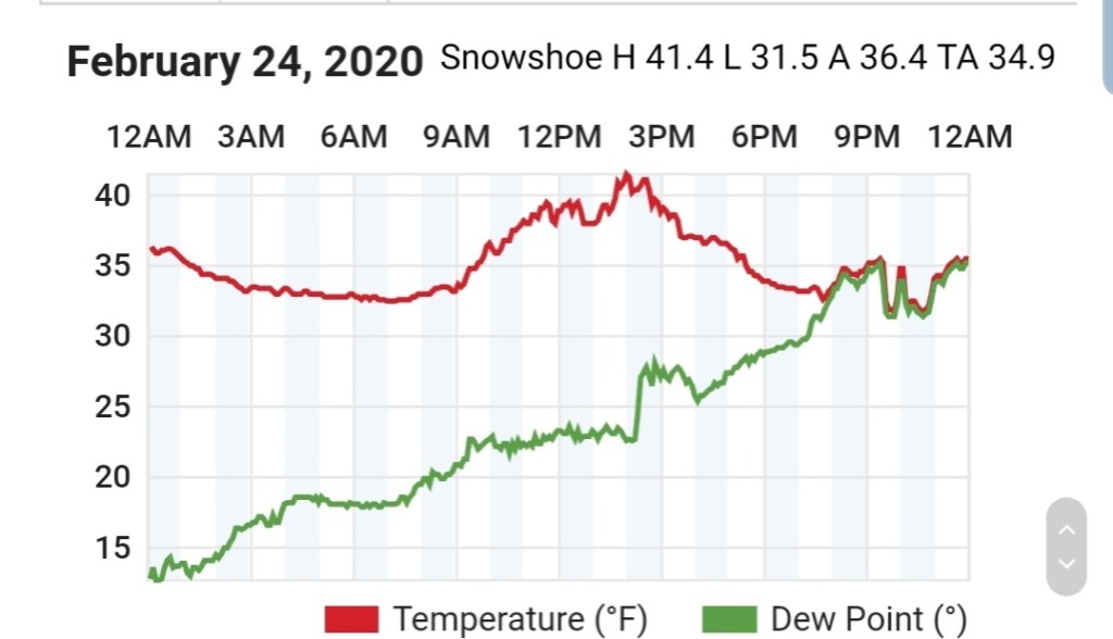
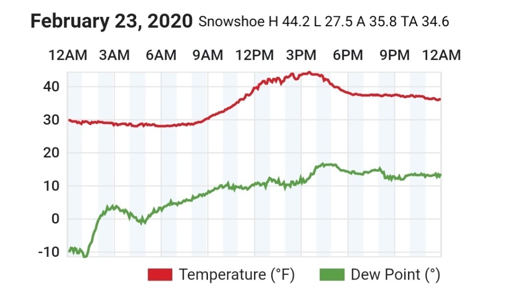
Snowshoe


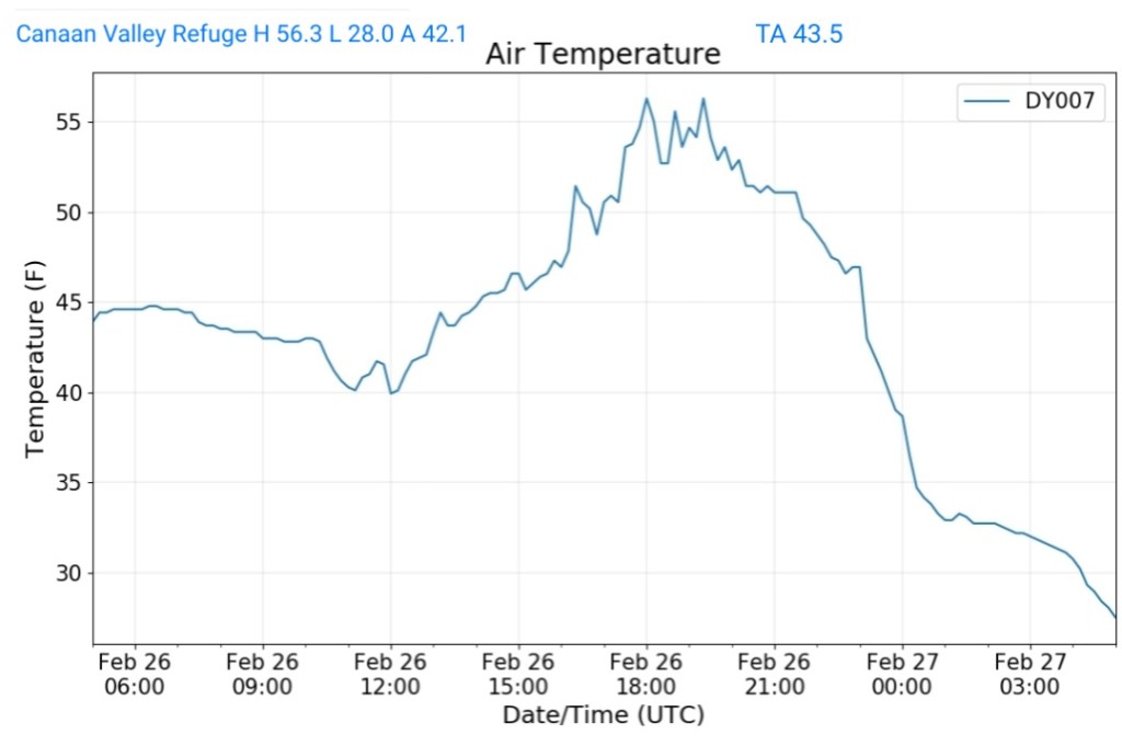
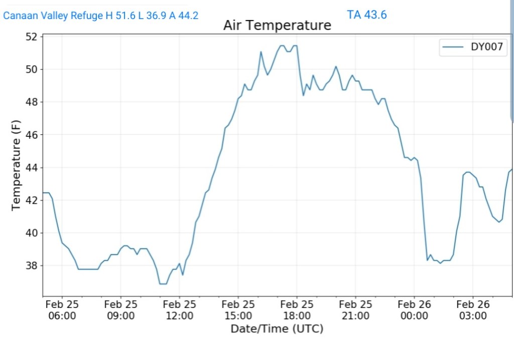
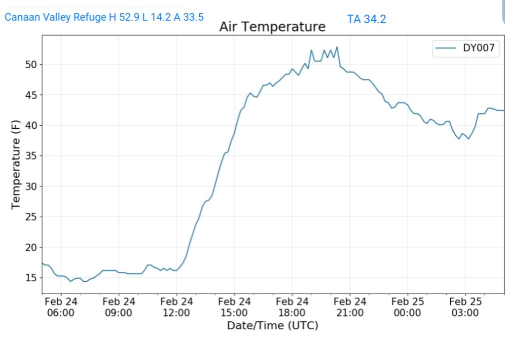
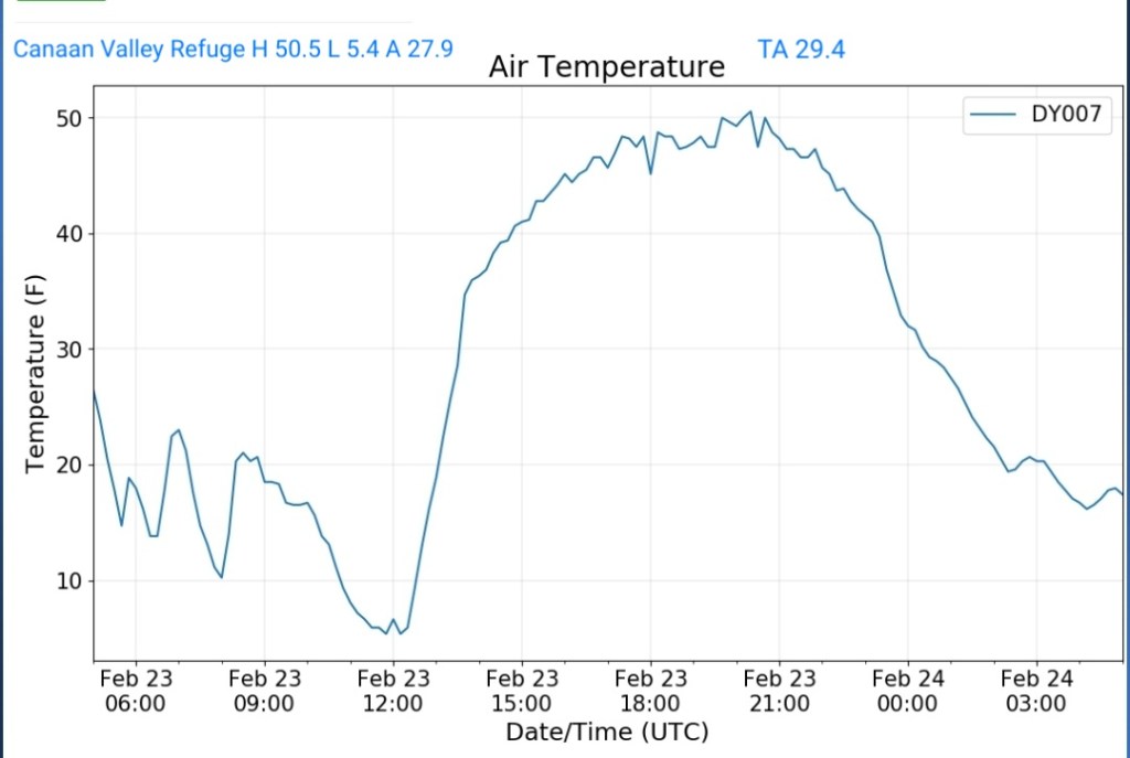
Canaan Valley Refuge


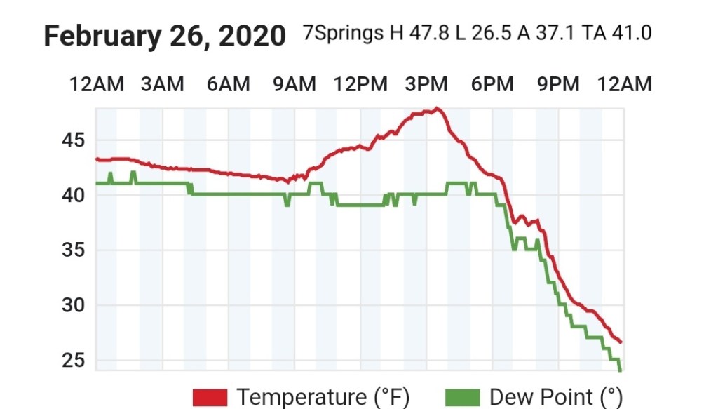
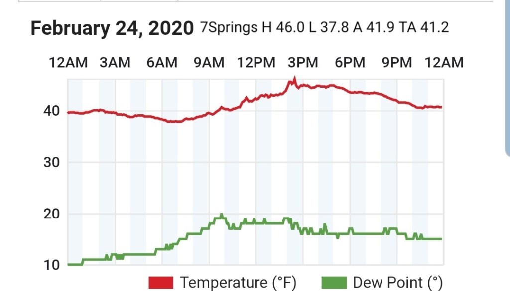
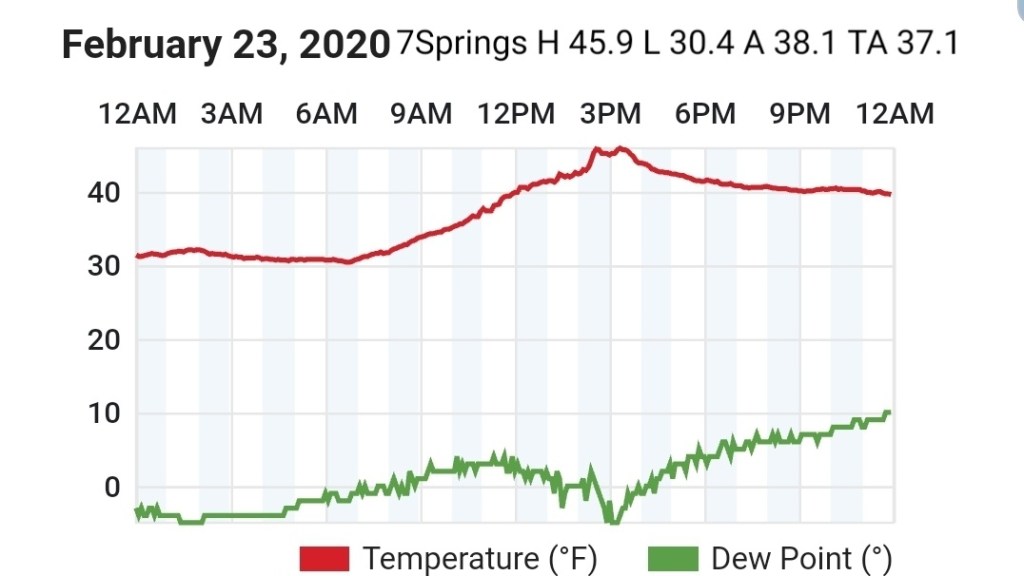
7Springs


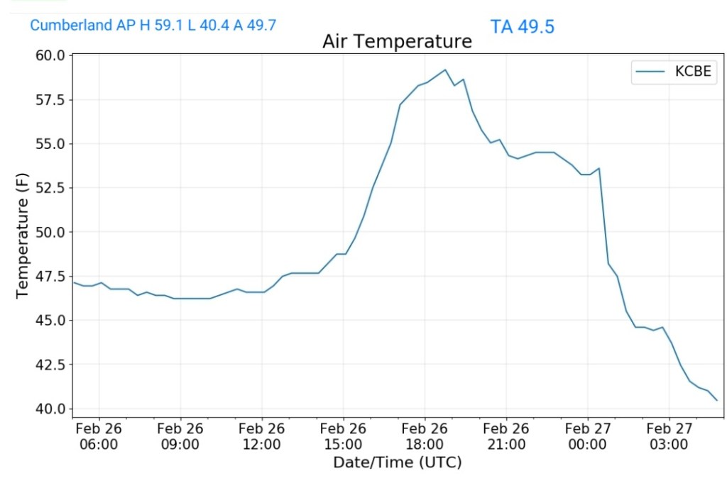
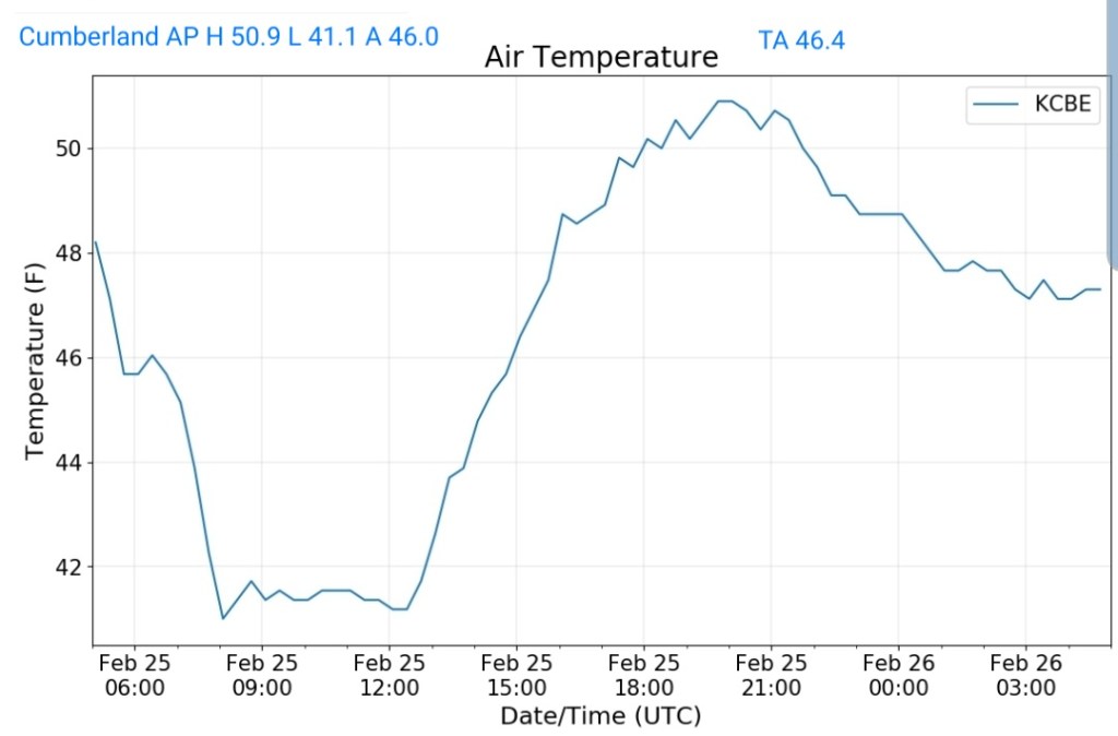
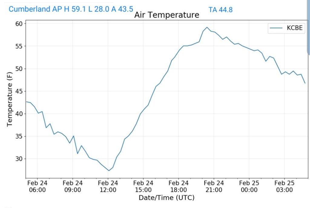
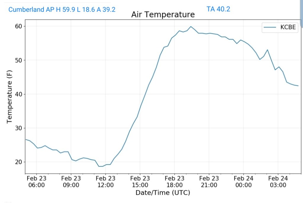
Cumberland Airport


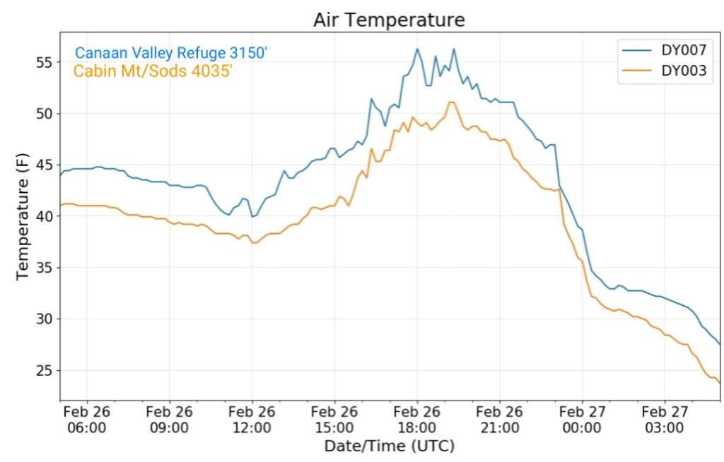
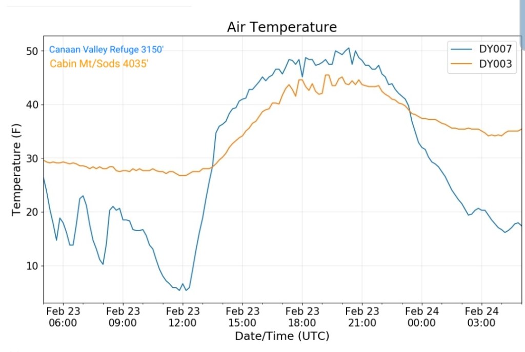
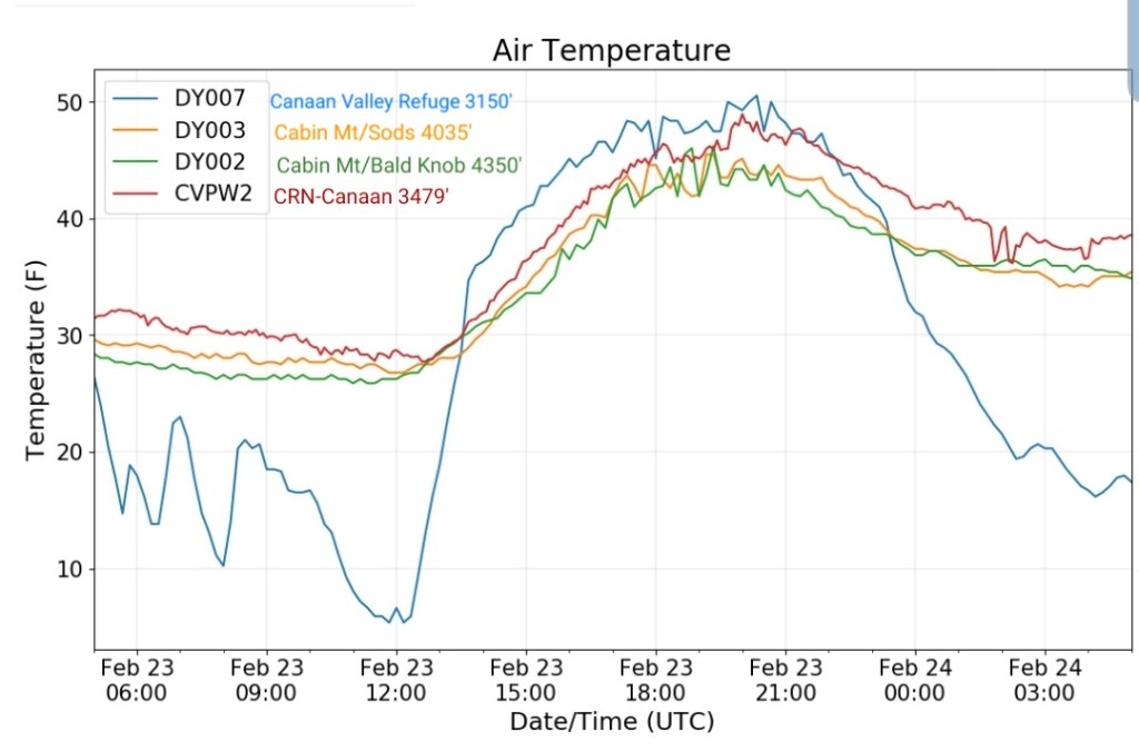
The Valley vs Cabin Mt

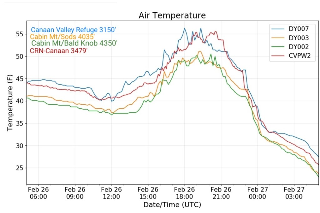
Canaan area temps
Comparison view

RTMA
Radar
Satellite
Flow
Surface features and 500mb height anomalies and flow