February 22, 2020
Feb 22(Sat)
A beautiful day. Sunny start to finish. A very dry air mass in place. Dewpoints single digits above and below 0. A bit breezy.
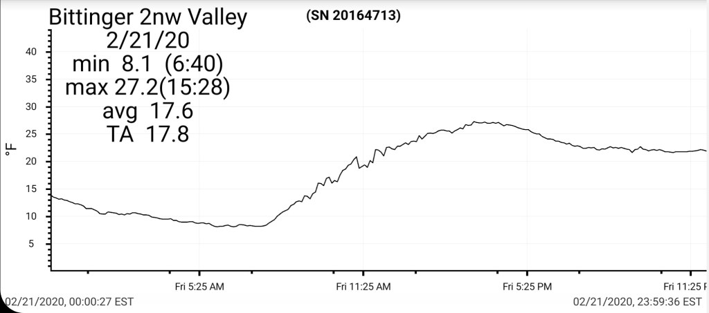
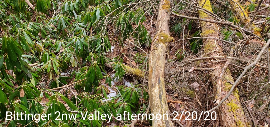
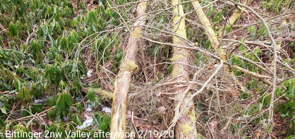
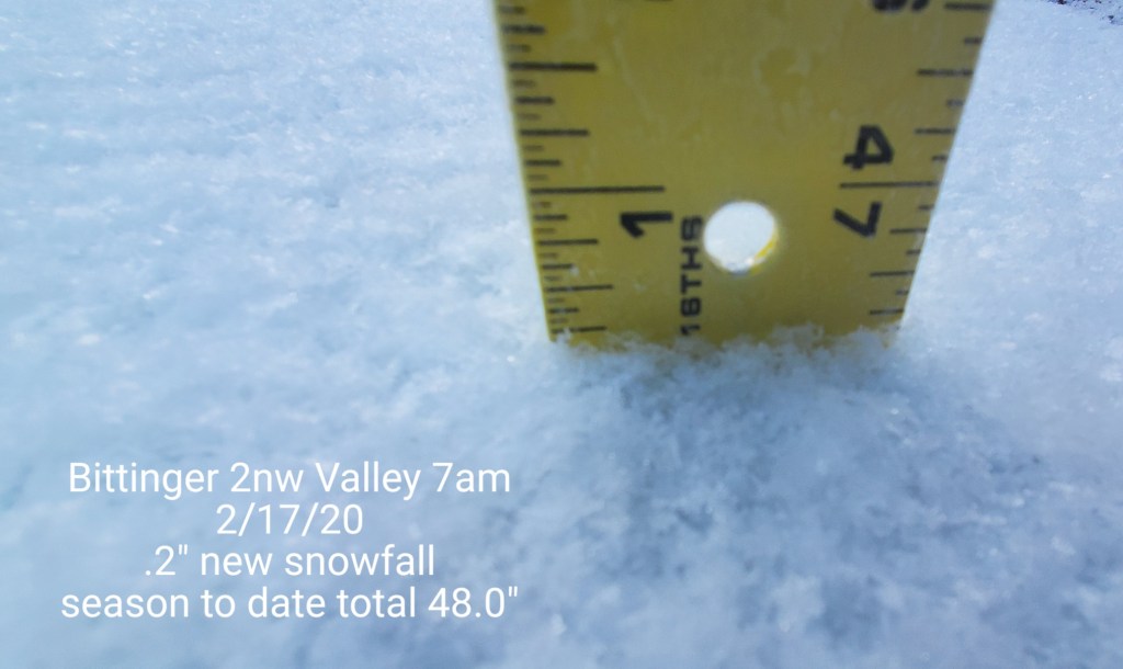
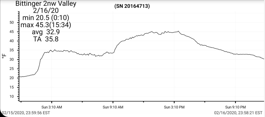
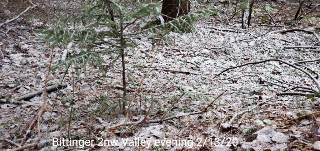
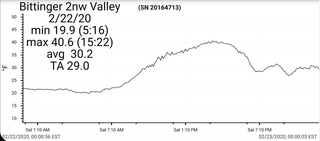
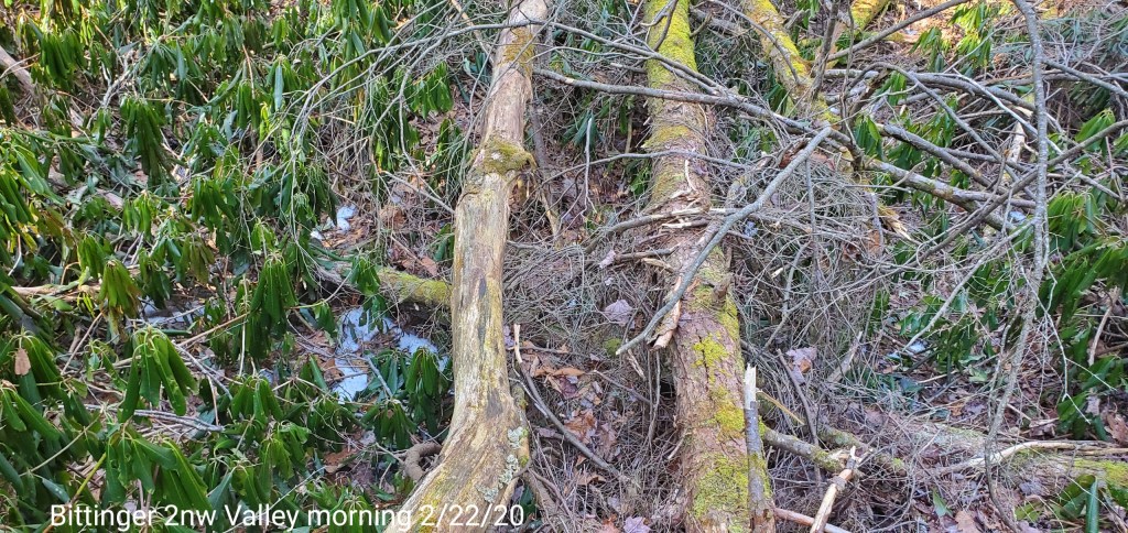
Bittinger 2nw Valley
MIN[19.9]—MAX[40.6]—AVERAGE MEAN[30.2]—TRUE AVERAGE[29.0]
snowfall season to date 48.0
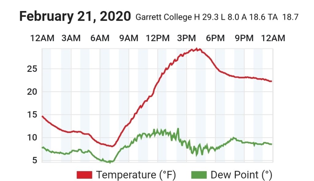
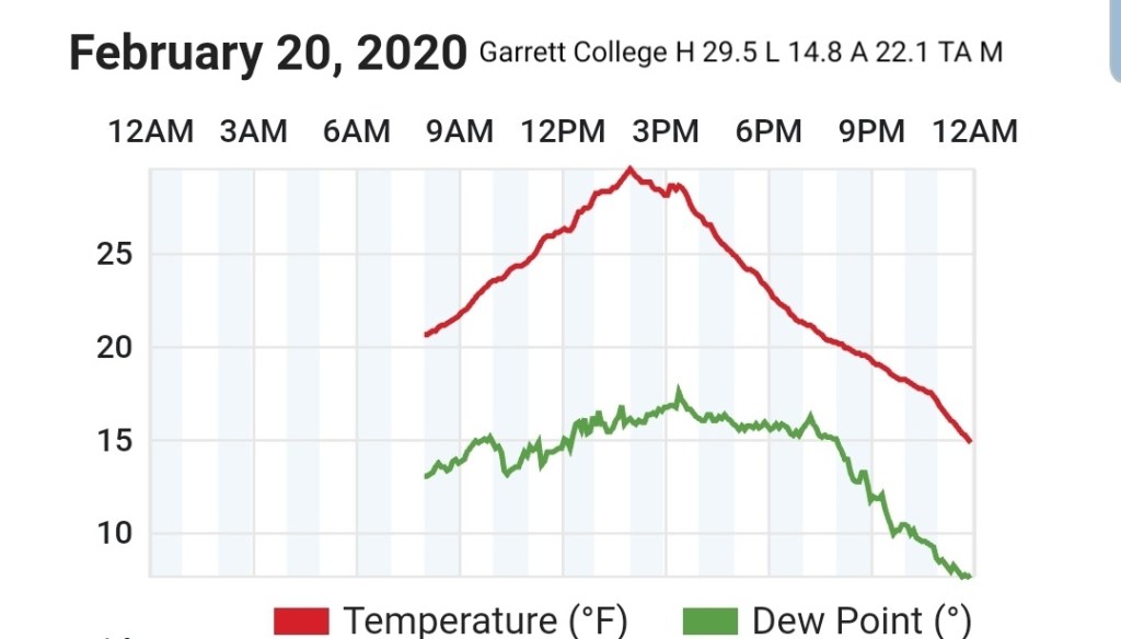
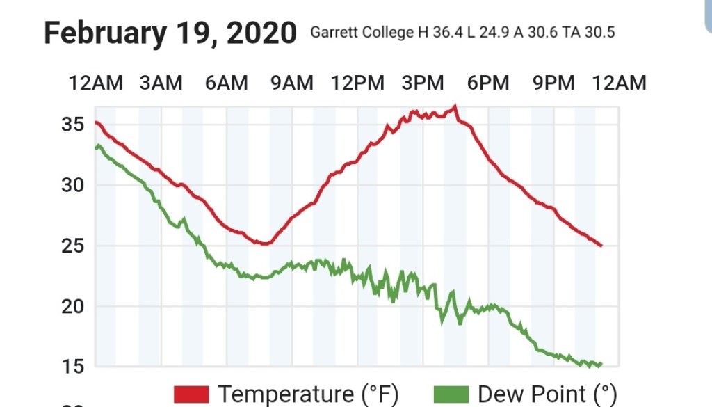
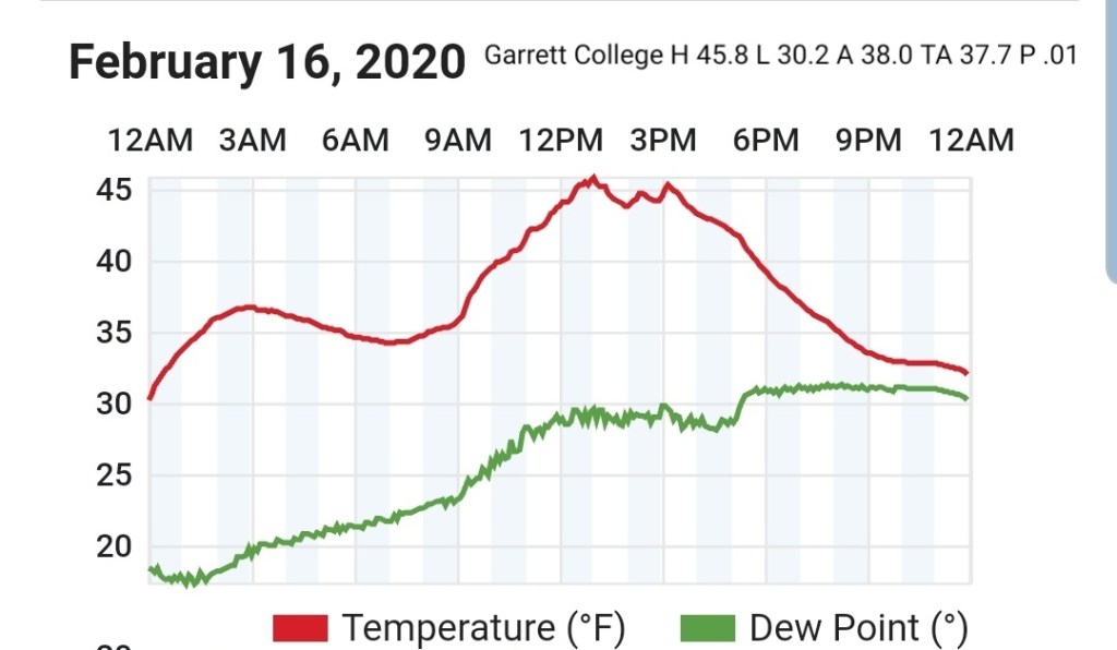
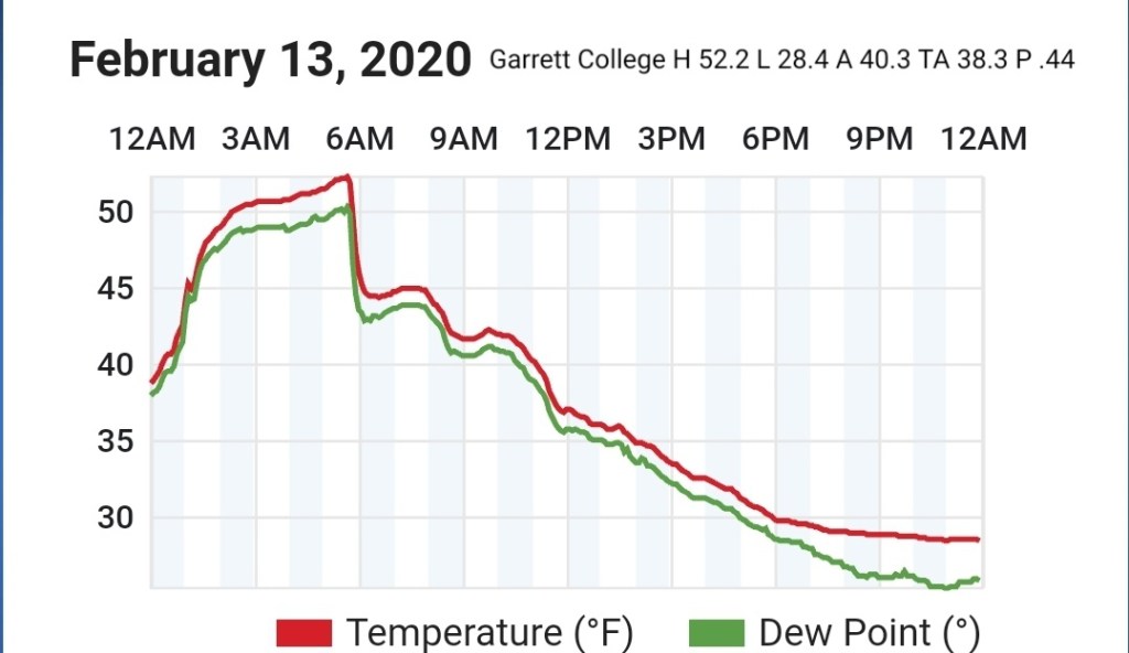
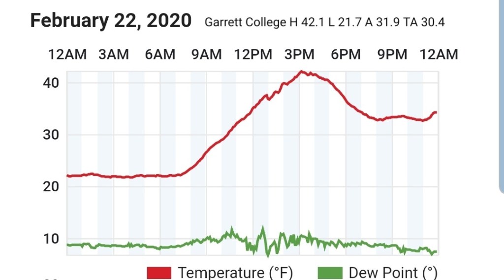
Garrett College
MIN[21.7]—MAX[42.1]—AVERAGE MEAN[31.9]—TRUE AVERAGE[30.4]—PRECIP[0]
Canaan Heights/Davis 3SE
MIN[16.0]—MAX[40.0]—AVERAGE MEAN[28.0]—PRECIP[T]7am
Snowfall season to date 65.8″
Comments by Dave Lesher at:
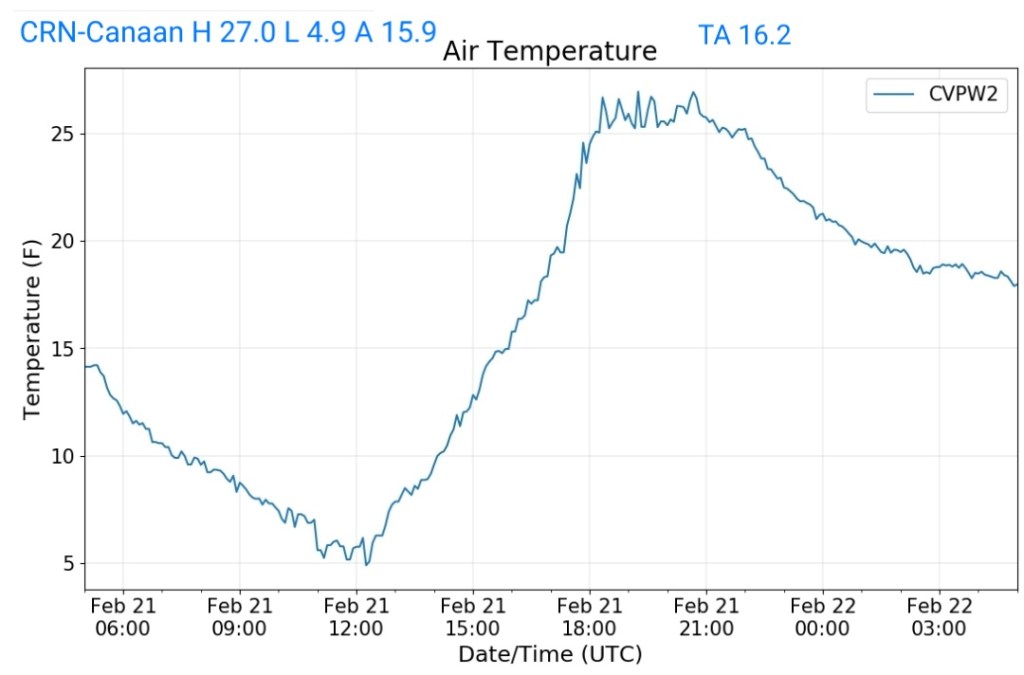
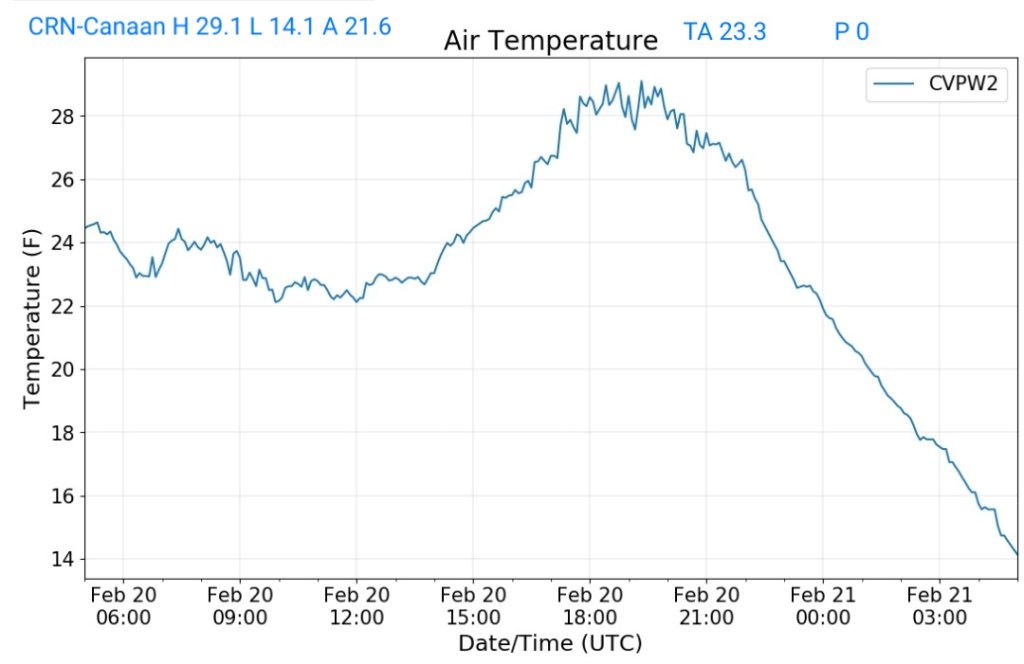
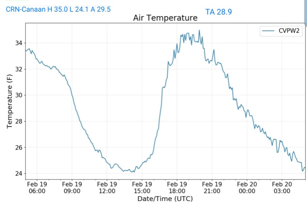
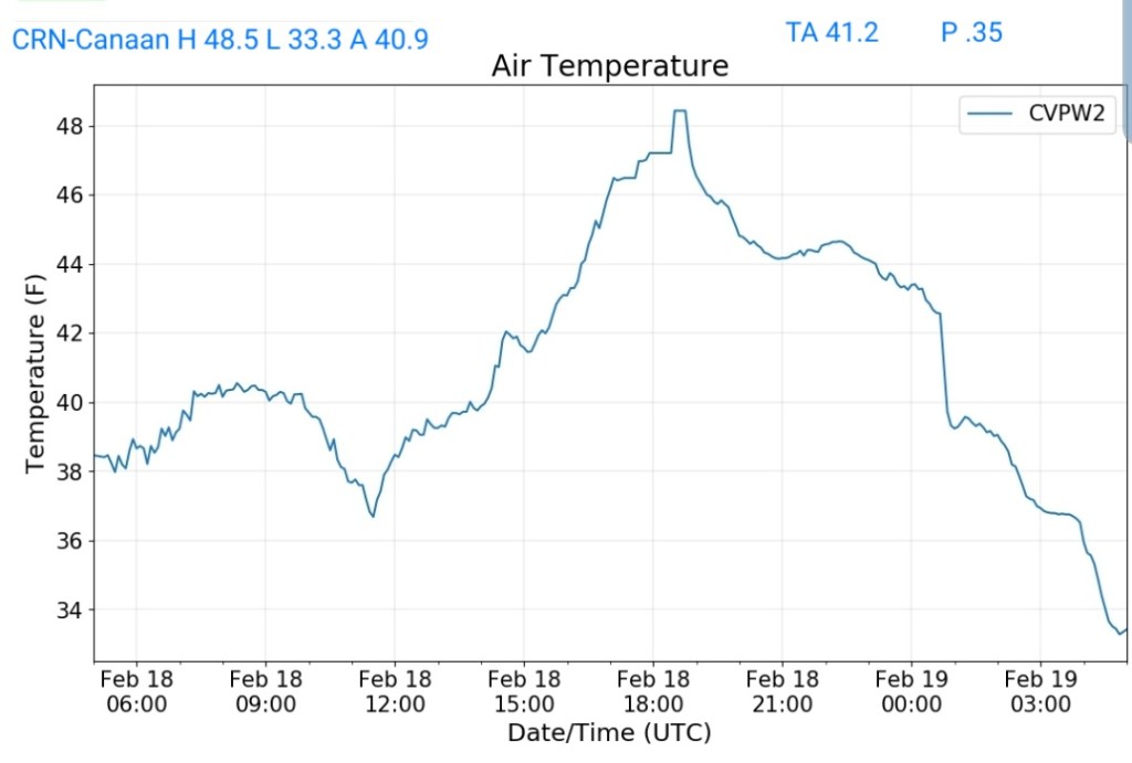
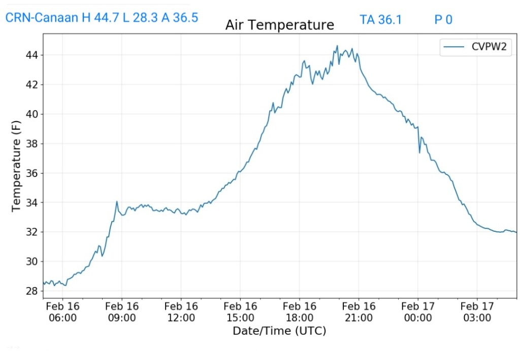
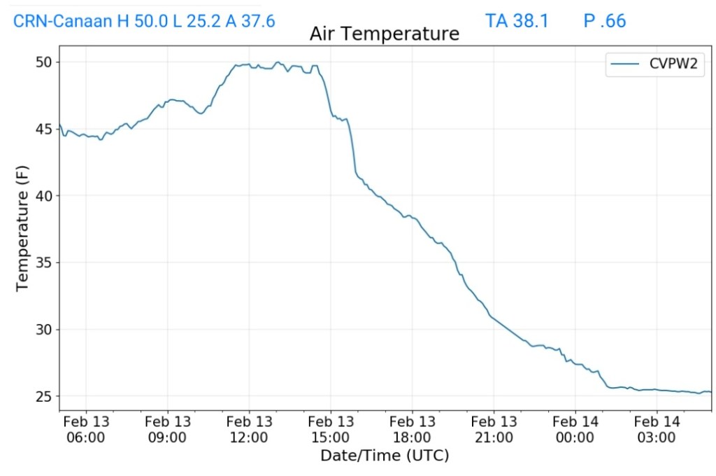
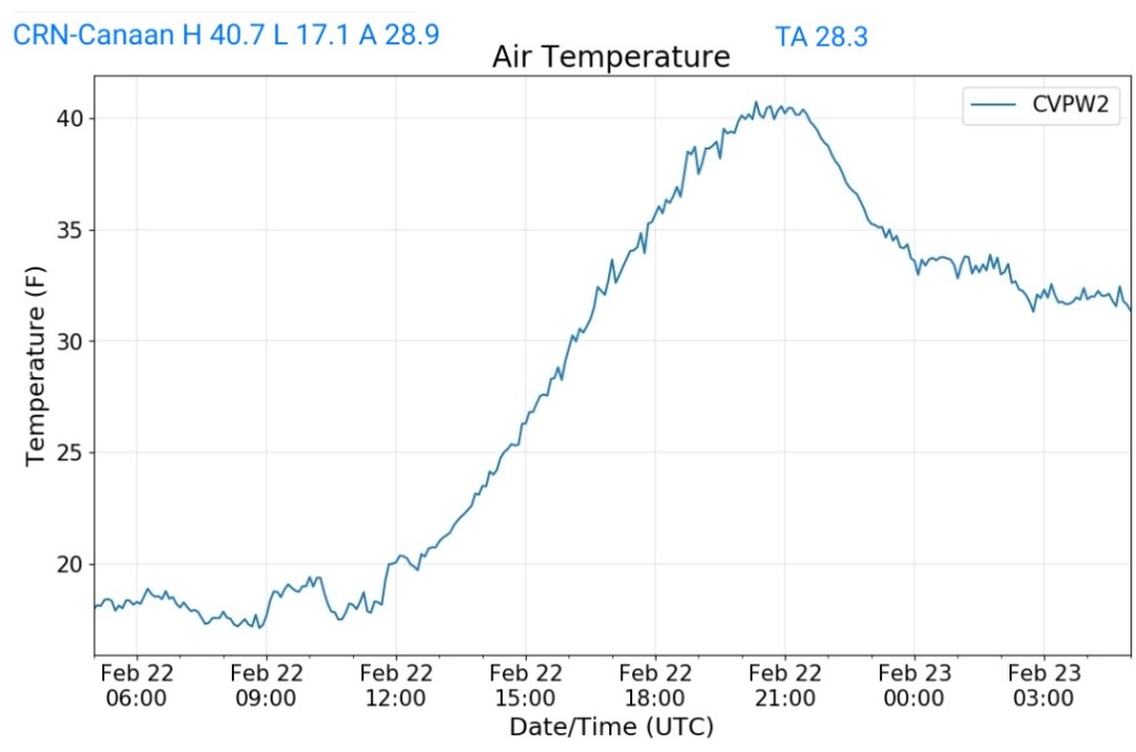
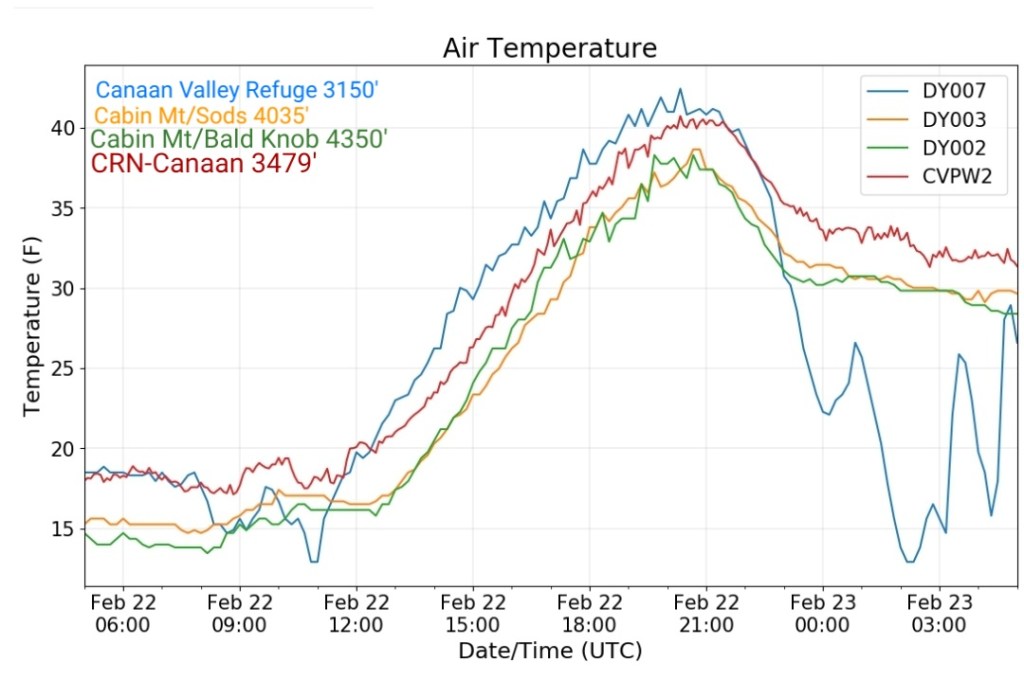
Climate Reference Network Canaan
MIN[17.1]—MAX[40.7]—AVERAGE MEAN[28.9]—TRUE AVERAGE[28.3]—PRECIP[0]
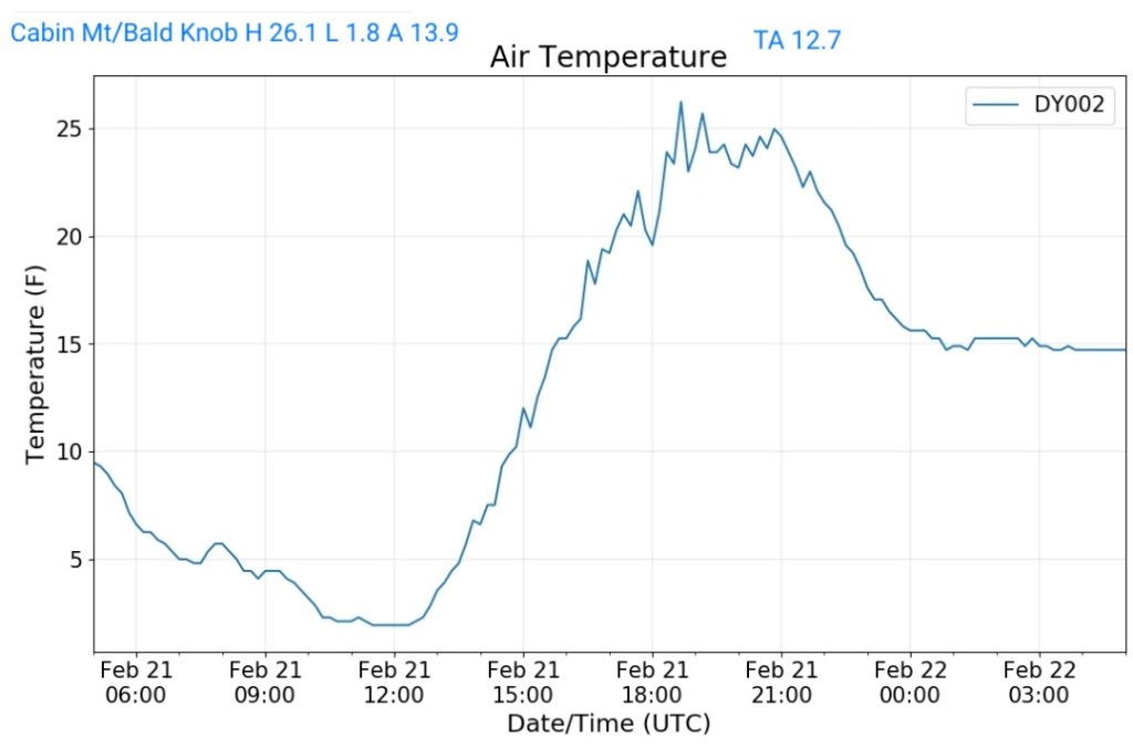
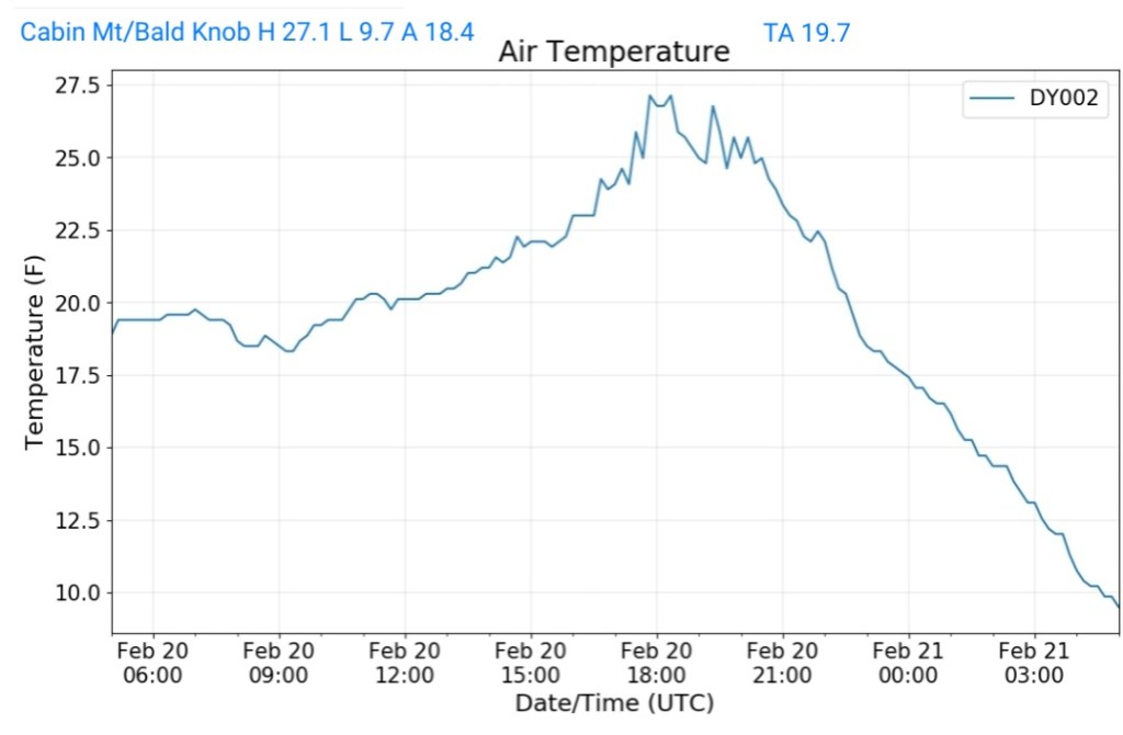
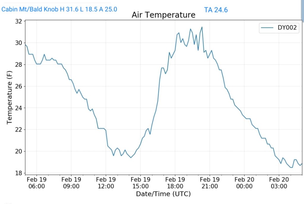
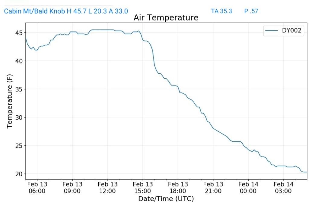
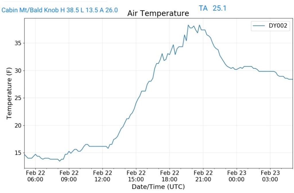
Cabin Mt at Bald Knob
MIN[13.5]—MAX[38.5]—AVERAGE MEAN[26.0]—TRUE AVERAGE[25.1]—PRECIP[0]
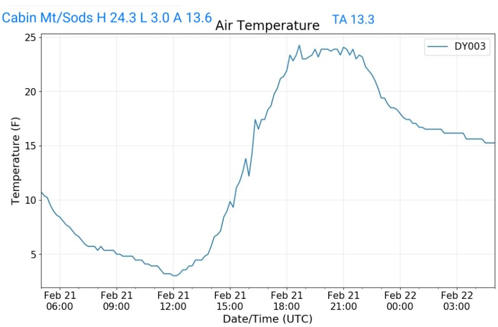
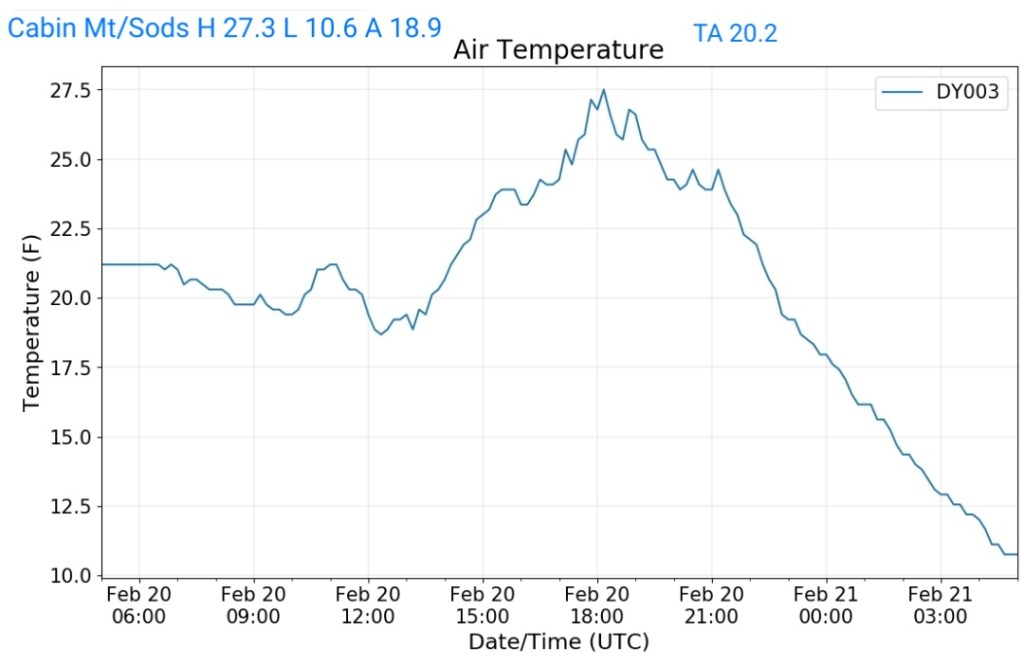
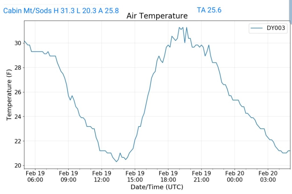
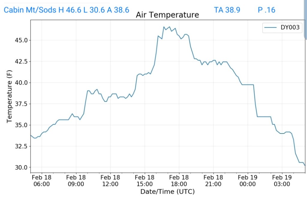
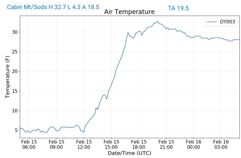
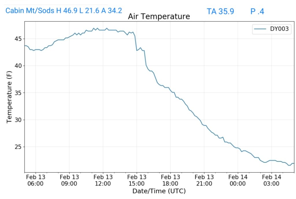
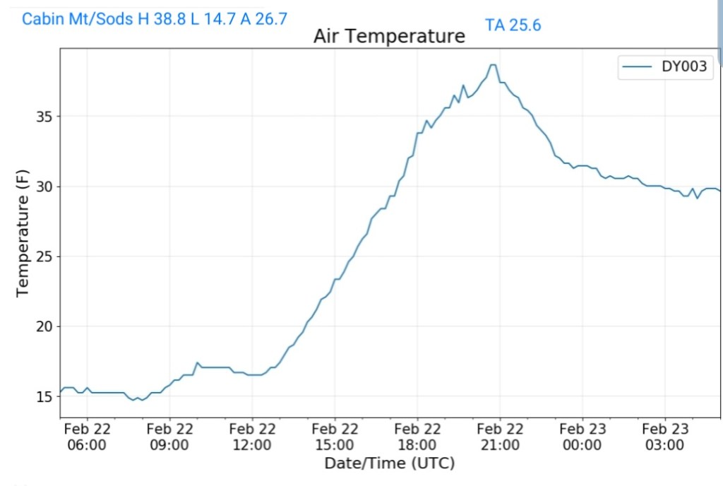
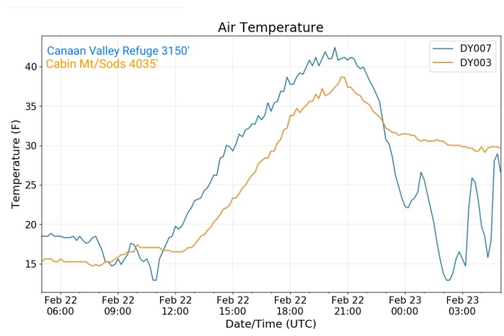
Cabin Mt-Western Sods
MIN[14.7]—MAX[38.8]—AVERAGE MEAN[26.7]—TRUE AVERAGE[25.6]—PRECIP[0]
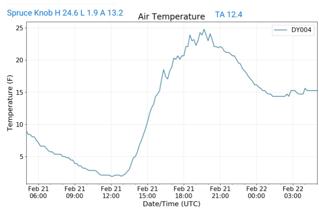
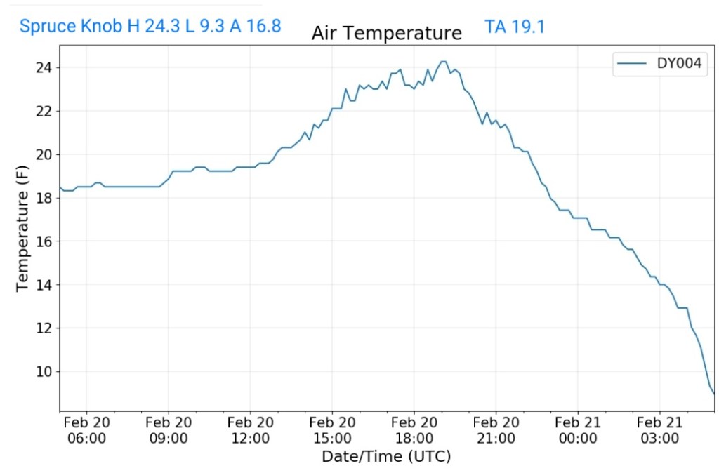
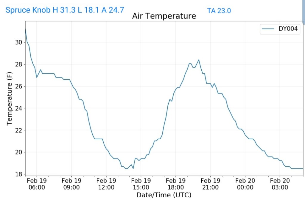
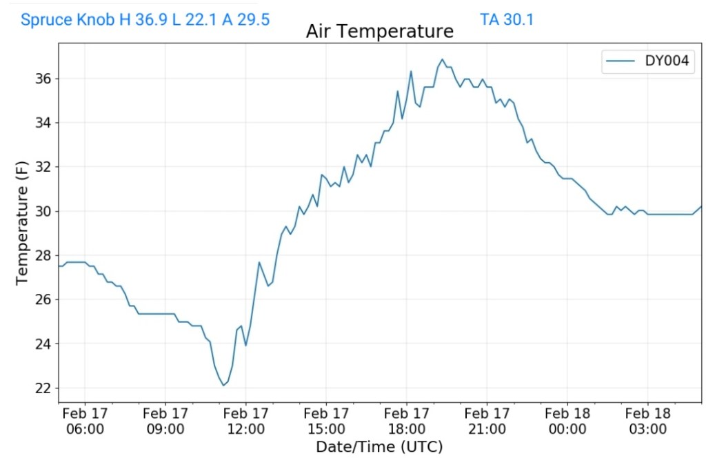
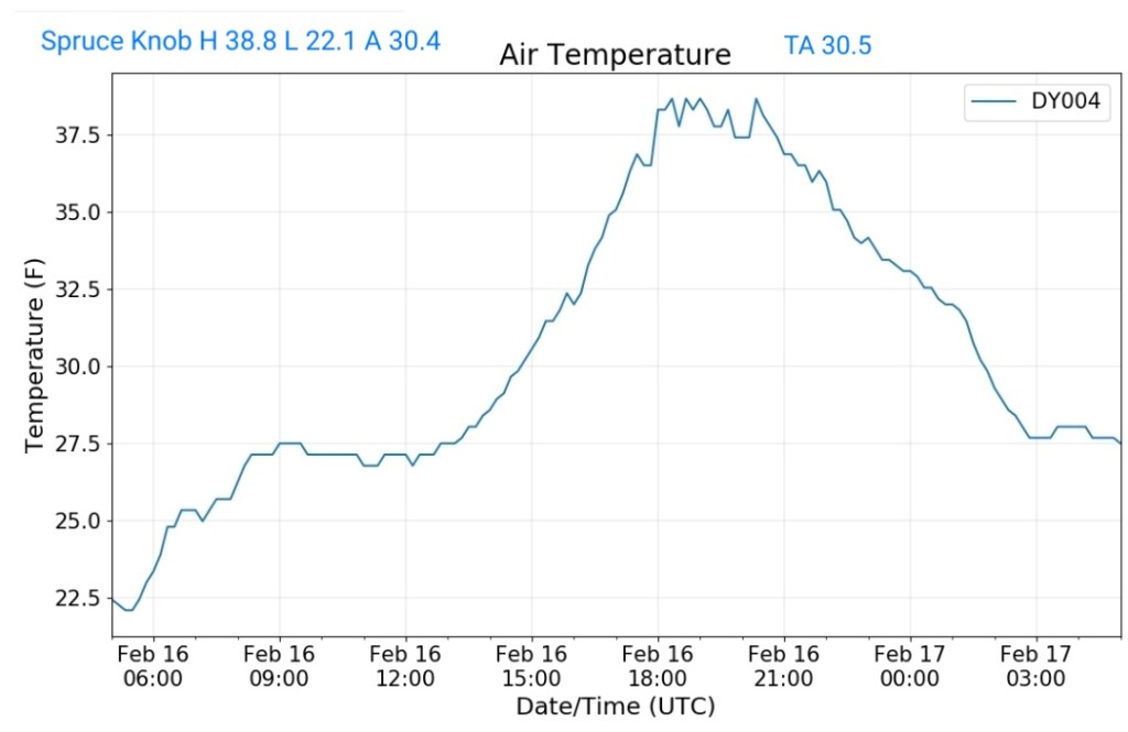
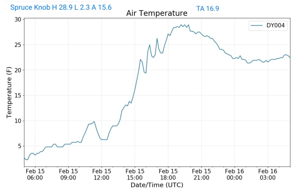
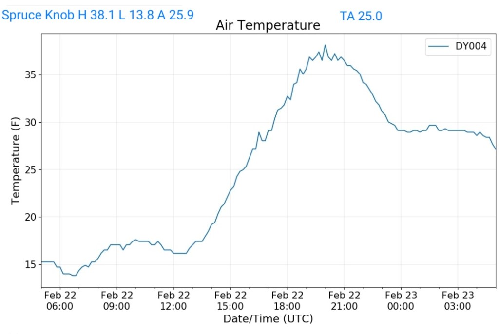
Spruce Knob
MIN[13.8]—MAX[38.1]—AVERAGE MEAN[25.9]—TRUE AVERAGE[25.0]—PRECIP[0]
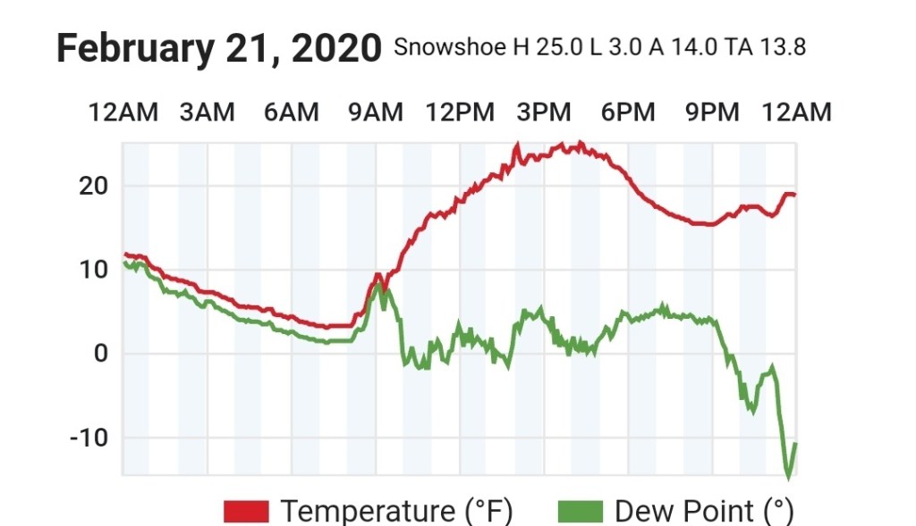
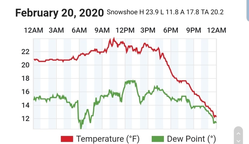
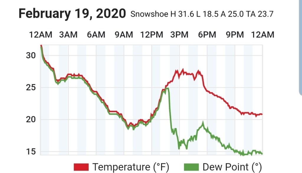
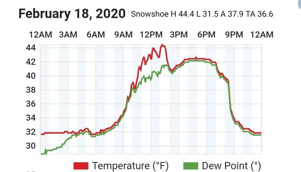
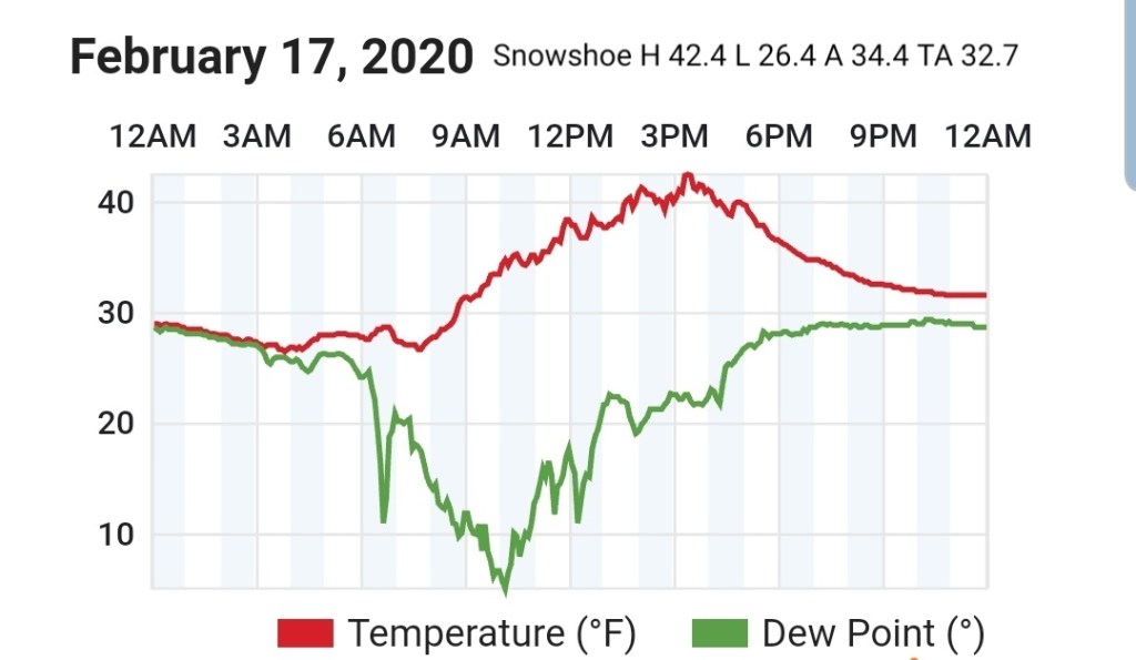
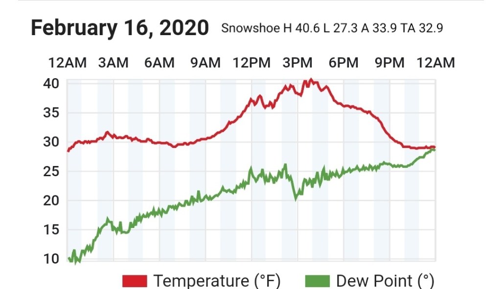
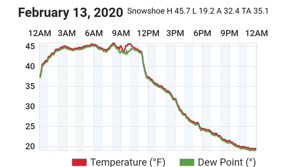
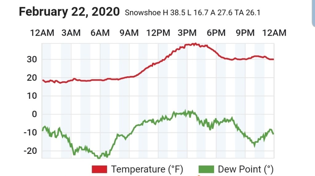
Snowshoe
MIN[16.7]—MAX[38.5]—AVERAGE MEAN[27.6]—TRUE AVERAGE[26.1]
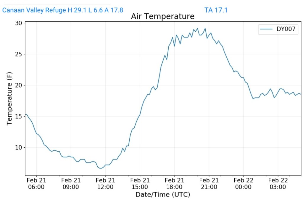
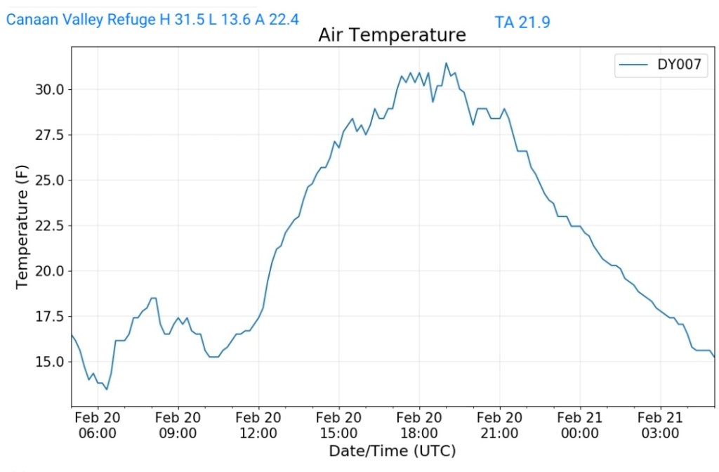
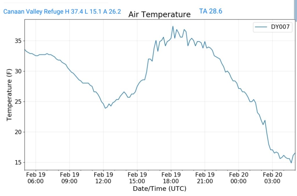
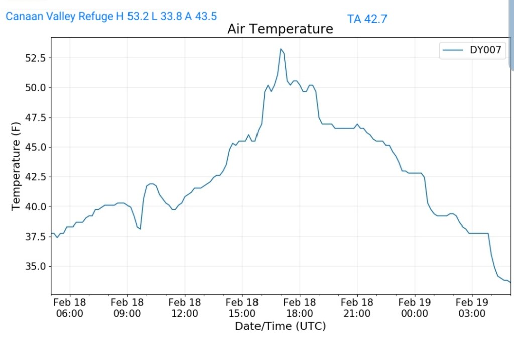
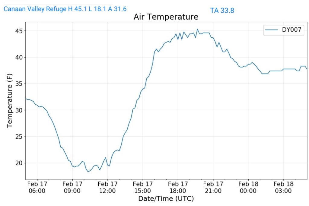
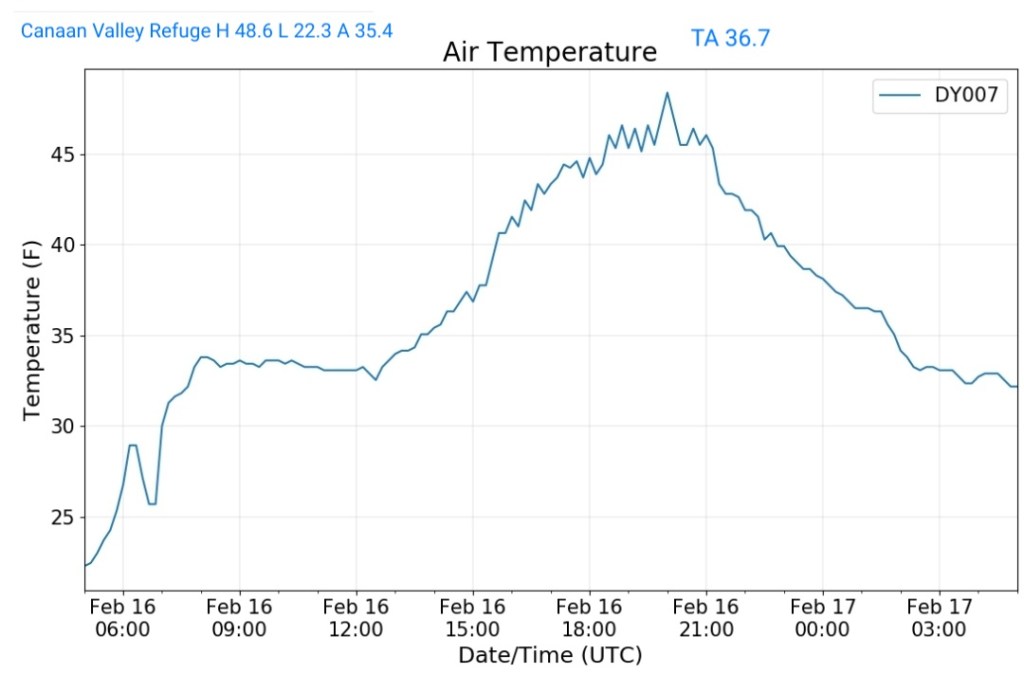
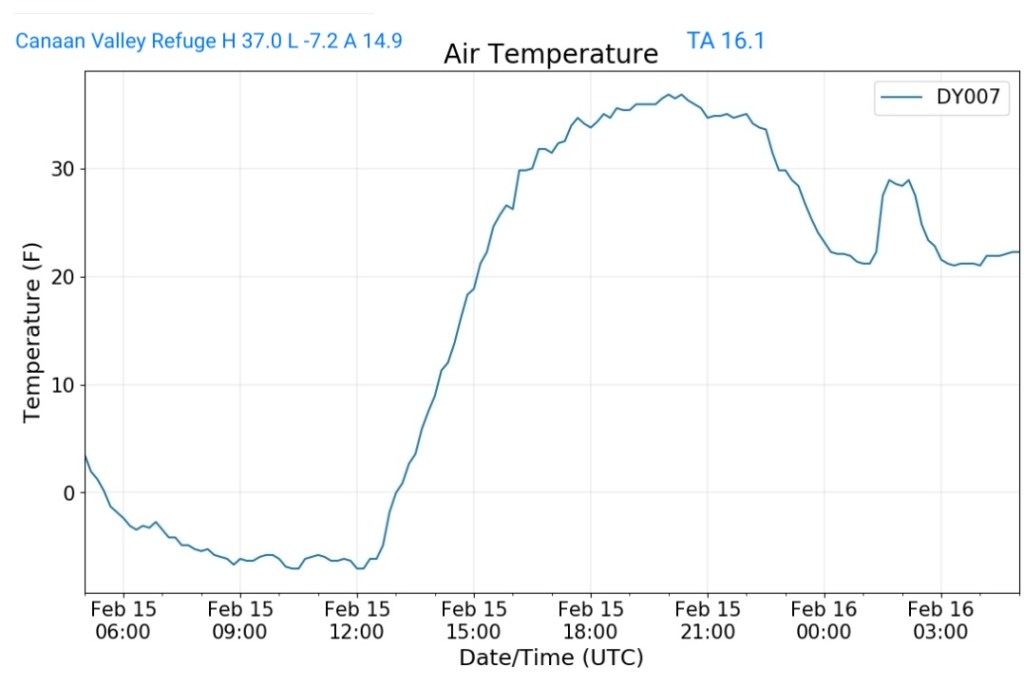
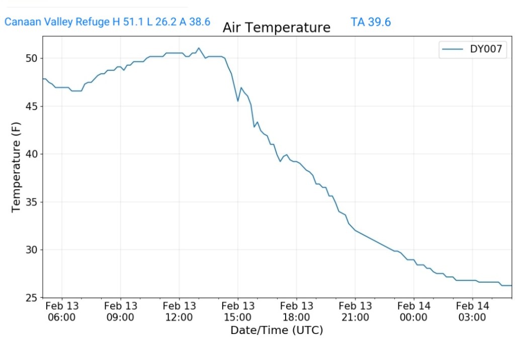
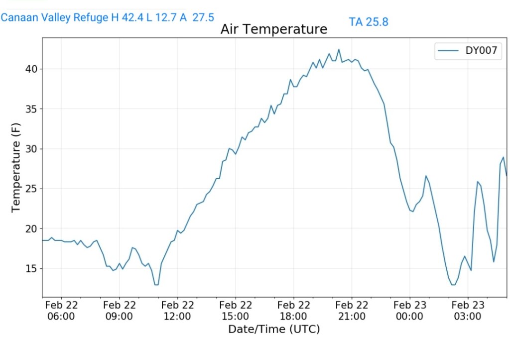
Canaan Valley Refuge
MIN[12.7]—MAX[42.4]—AVERAGE MEAN[27.5]—TRUE AVERAGE[25.8]
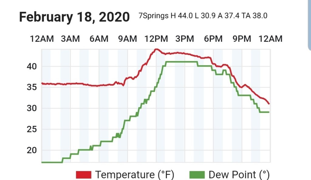
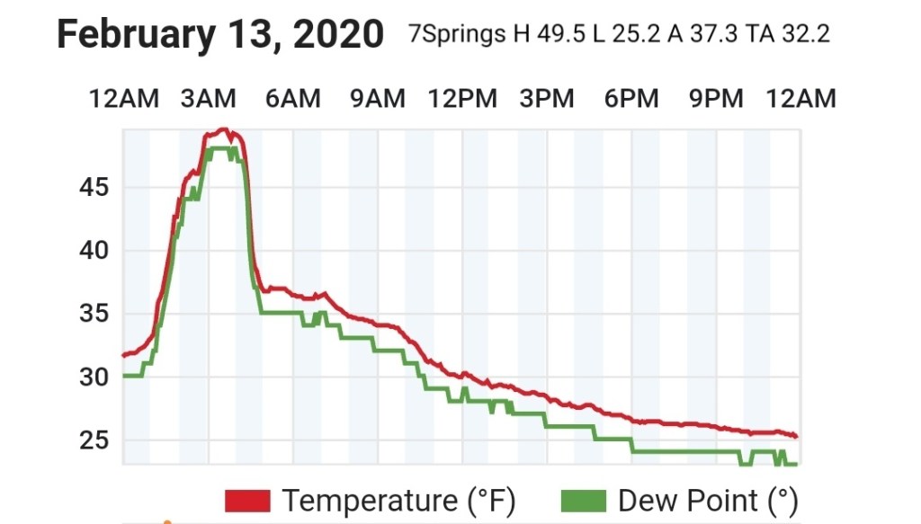
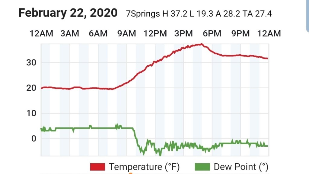
7Springs
MIN[19.3]—MAX[37.2]—AVERAGE MEAN[28.2]—TRUE AVERAGE[27.4]
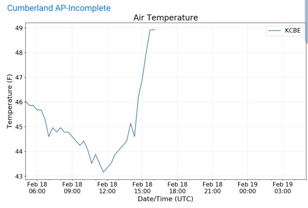
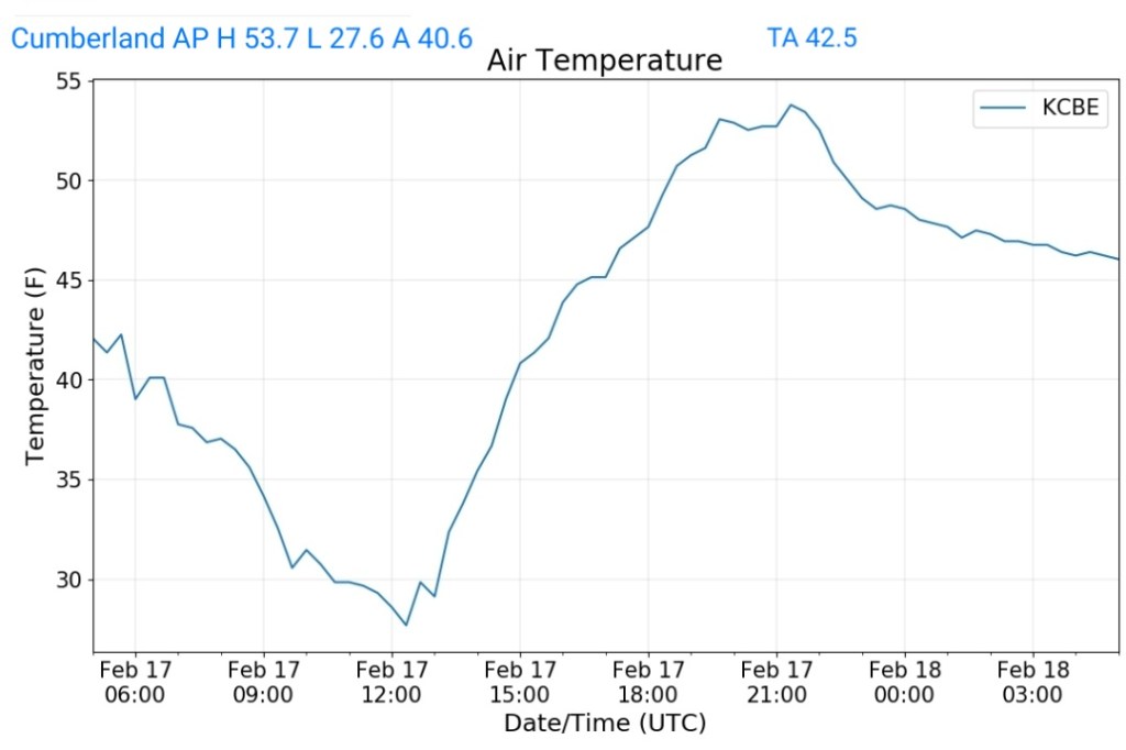
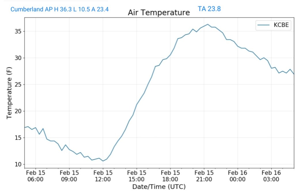
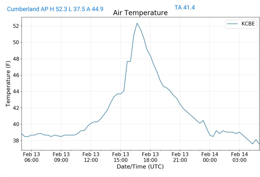
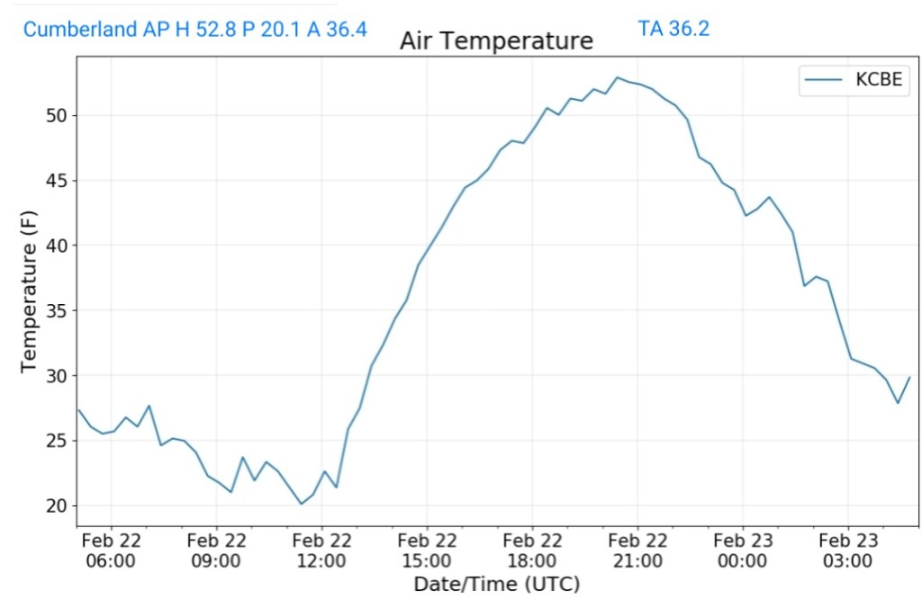
Cumberland Airport
MIN[20.1]—MAX[52.8]—AVERAGE MEAN[36.4]—TRUE AVERAGE[36.2]
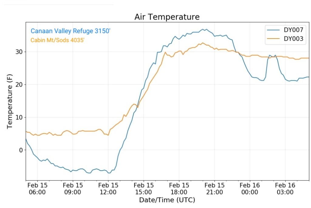
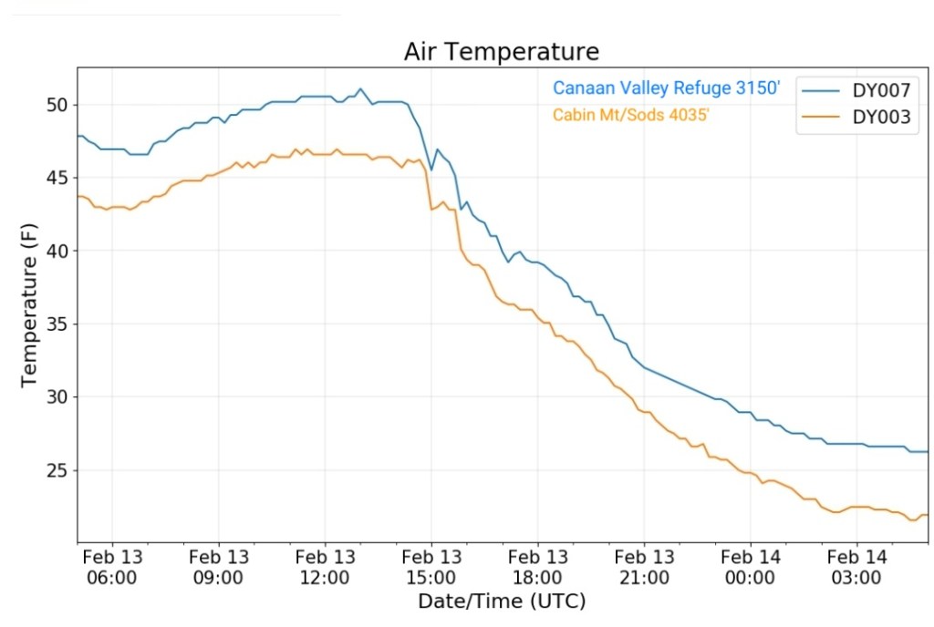
The Valley vs Cabin Mt
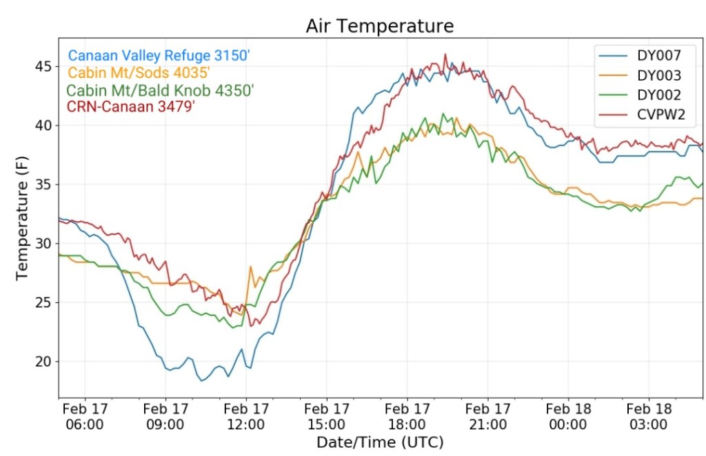
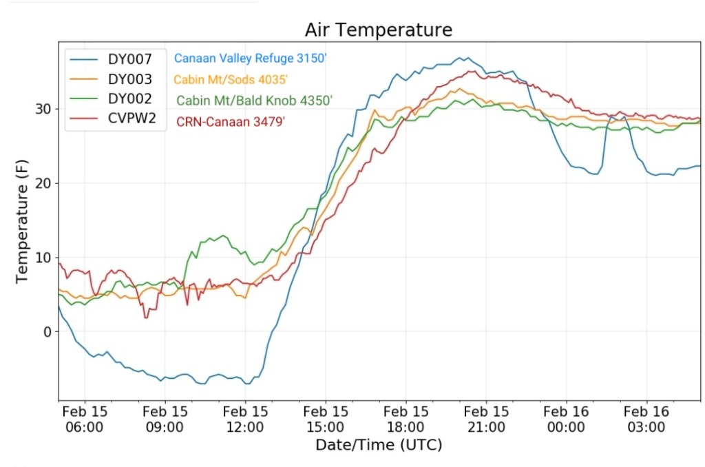
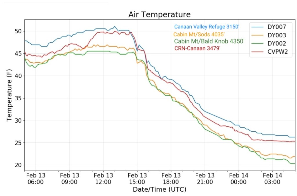
Canaan area temps
Comparison view
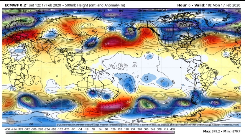
RTMA
Radar
Void of precip