Cloudy, some high elevation fog(some wv rime up high). I had some fine light flakes late day, early overnight.
Temp profile this afternoon
Radar(not much)
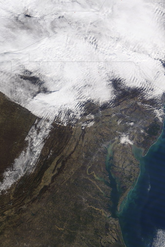
Satellite
Flow
Surface features and 500mb height anomalies and flow
On the models ..
Really really blah pattern for winter lovers.. fast Pacific flow, ridge SE, not much winter action. Model variation late next week offers a slim hope of snow…
Cloudy, some low fog early. Chillier sheltered valleys, milder hilltops. After some steady rain last night, patchy drizzle and sprinkles at times today was all.
Temp profile this afternoon
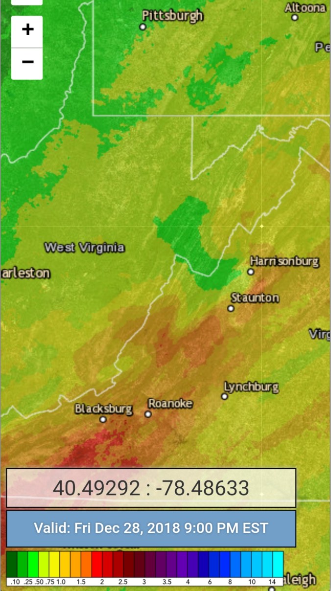
Radar with estimates 9pm-9pm
Satellite
Flow
Surface features and 500mb height anomalies and flow
Partly cloudy start, partly sunny day until mid afternoon when a cloud deck moved in. SE winds
Temp profile this afternoon
Radar
Satellite
Flow
Surface features and 500mb height anomalies and flow
Pics today
On the models…
Rain pushing in tonight. Bigger deal southern Alleghenies. A few pockets along the Allegheny Front may briefly see a little freezing precip, before rapid warming tomorrow a.m. (50s)Areas east of the mts tomorrow may hold chillier. Colder air back in Friday night into Saturday a.m,few flakes even with no accu. Rain returns Monday and not until next week this time do we have a shot for some white. Beyond next weekend winter may make an attempt to take hold more.
Cloudy, showers, some low fog to start. Valleys cooler than high areas. By late morning all areas 48-55.. Some breaks of sun, even a rainbow. Clouds, fog, rain return afternoon, dropping temps, rain to snow by 7pm. Ground white by 8pm.
Temp profile this afternoon
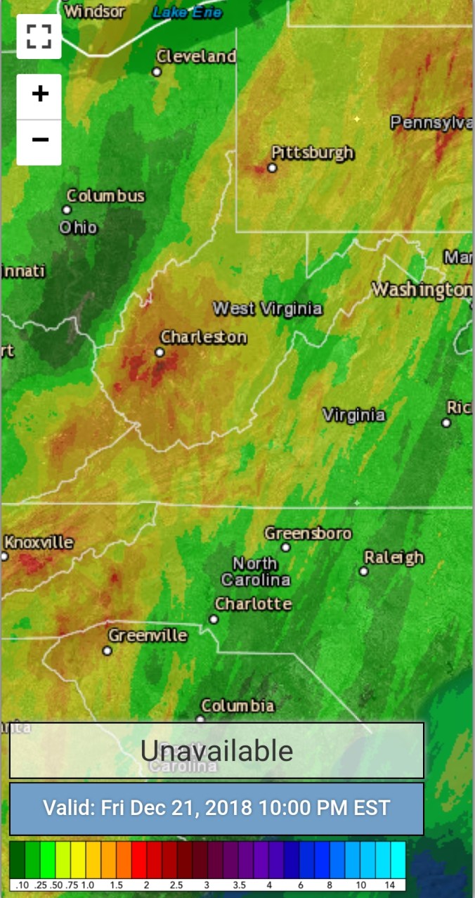
Radar with 24 estimates 10pm. At 7am Bittinger 2nw in at .33
Satellite
Flow
Surface features and 500mb height anomalies and flow
Pics today
Looking ahead
Snow tonight, general 2-4 eastern Alleghenies, 3-6″ central, 4-8 best upslope areas…. A event Sunday night looks to drop a few more inches… Christmas Day looks to have snow on the ground
Mainly clear start, fairly wide temp ranges overnight from valley to high ground. Clouds building in, rain in the afternoon. Temps into the 30-35 range in eastern Alleghenies. Weather Service with their grid forecast will never get this right apparently, despite it being modeled very well.
Temp profile this afternoon
Radar with estimates 9pm-9pm
Satellite
Flow
Surface features and 500mb height anomalies and flow
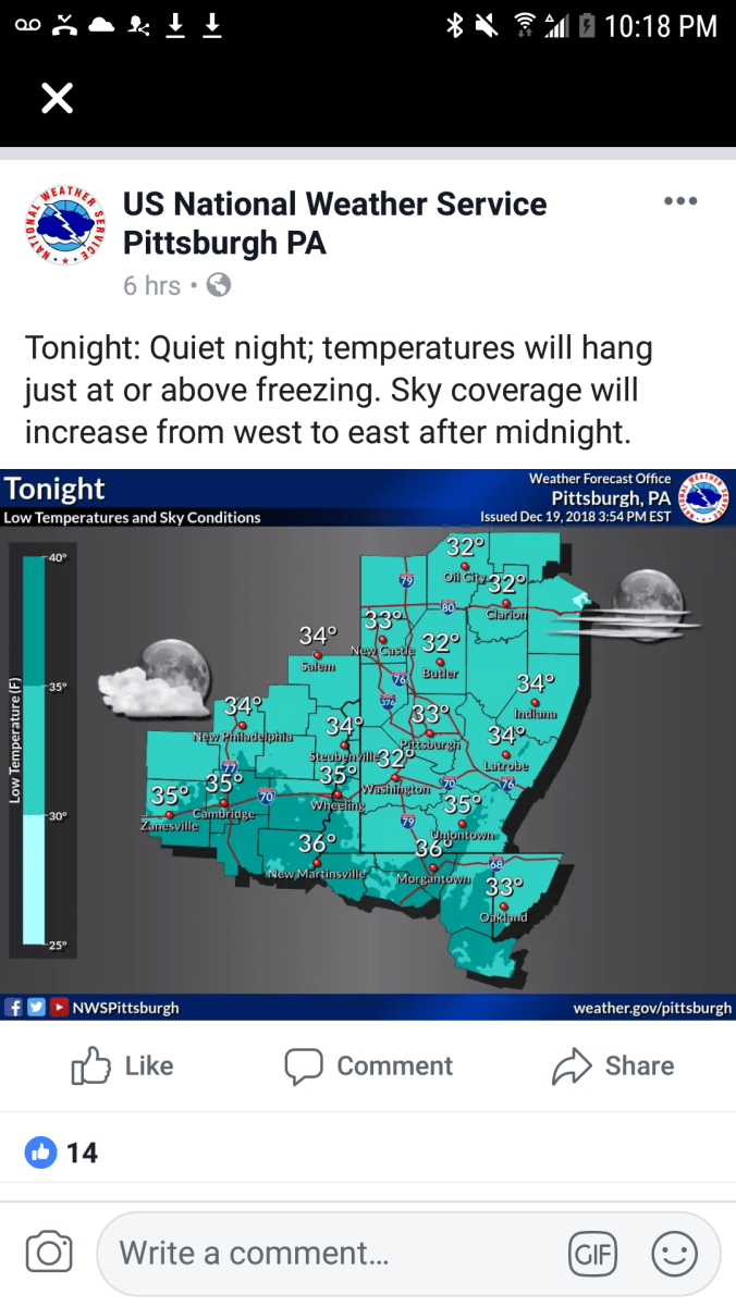
As much as I hate this, the NWS forecast grid, the repeatedly using of this grid to forecast temps in this setup is just plain awful. This is probably the 1000th time I’ve mentioned it over the years. Why on earth is this grid used, when there are high real models that do much better and have proven so, time and time again. No forecast mentioned 30s this afternoon, let alone near freezing. 3km Nam showed it clearly and the models track record in the setup is phenomenal. Let’s look… Temps, then NWS forecast beginning tonight.. You’ll see not only well off this evening, they flood the warmth back in way to fast tonight. Big consistent warm bias…
12z 3km Nam 2m temperatures from the morning
Now a look back to last night..
That was min forecast. That is airport grid based..That forecast done poor for most locations. High ground held near 36-40 most of the night. A lot of towns sit a little lower, a lot of people live in valleys, hollows, creek bottoms. Temps there ran mostly 20-27°. (Coldest pockets teens) Why would you not give a forecast for those 2 distinct areas vs a general 32° everyone near or above freezing…not even remotely near reality. The temps were off that not very long after that forecast was issued.