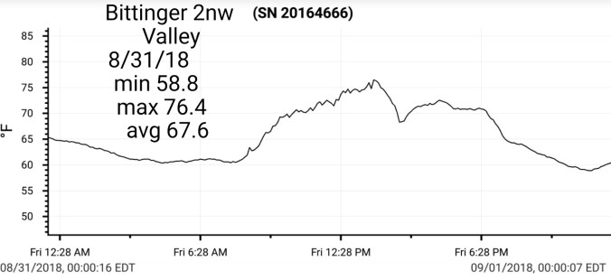
Sept 3. min. max. avg
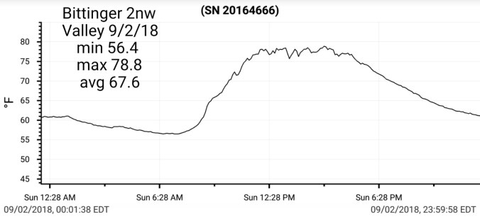
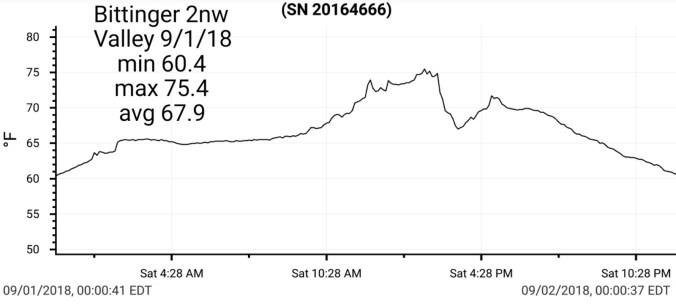
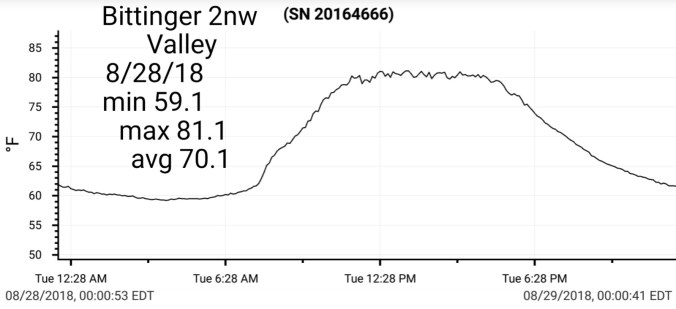
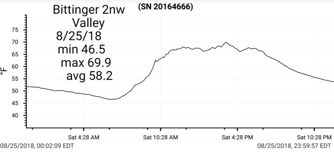
Bitt 2nw valley 57.3 82.1 69.7
Garrett College 60.6 86.2 73.4
Can-Heights 61.6 79.3 70.4
CRN-Canaan 59.7 80.9 70.3
Cabin Mt 62.8 77.7 70.2
Cabin Mt north 64.6 78.8 71.7
Spruce Knob 61.5 75.4 68.4
Snowshoe 65.3 77.9 71.6
Can-Valley Floor 51.6 80.8 66.2
7Springs 71.3 82.7 77.0
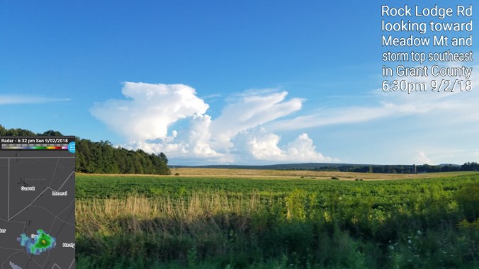
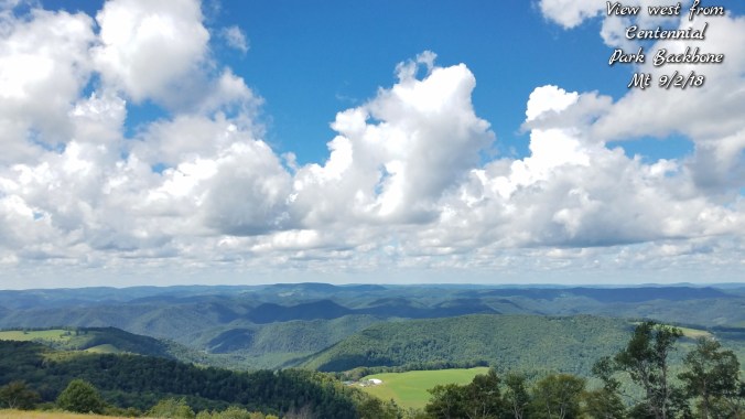
Mainly clear start, a few clouds. Some valley fog. Clouds bubbling late morning and showers, storms building first along the eastern ridges then developing west. Warm, muggy, the showers were enough to kick temps back into the upper 60s where they occured.
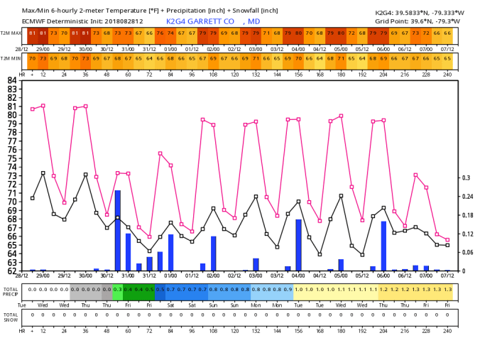
Temp profile this afternoon


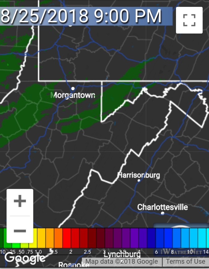
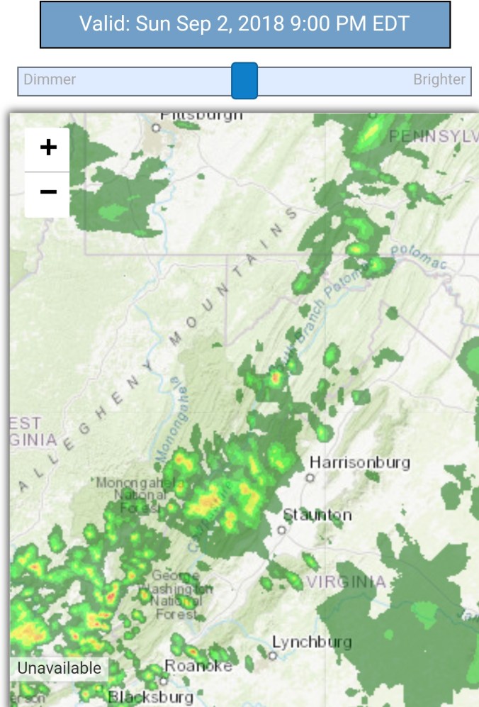
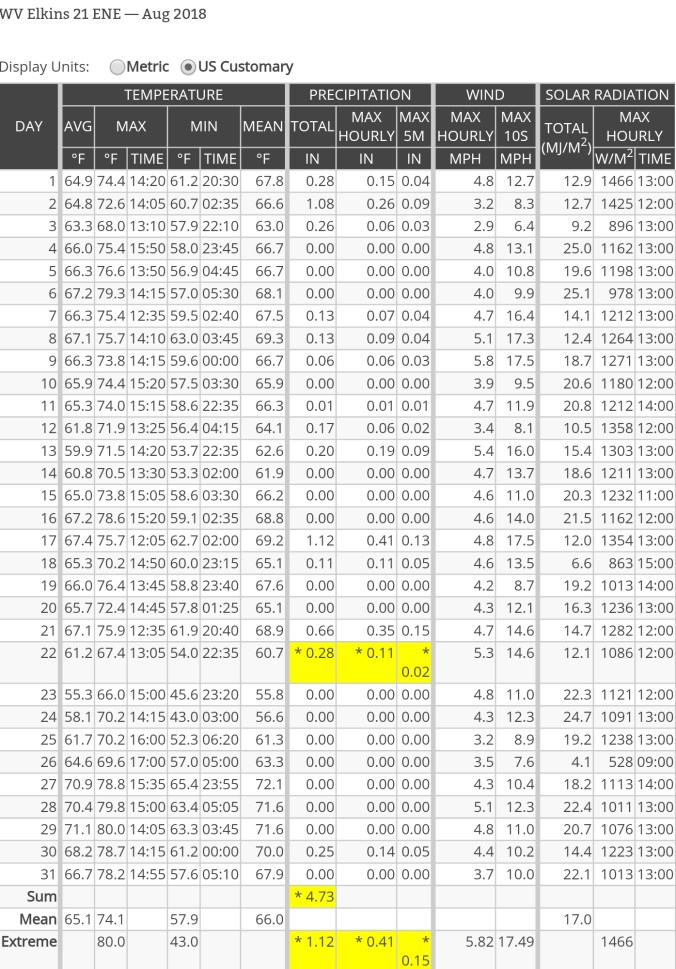
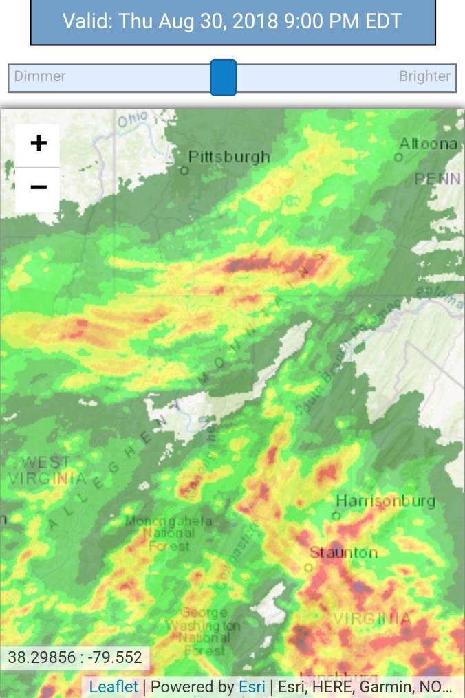
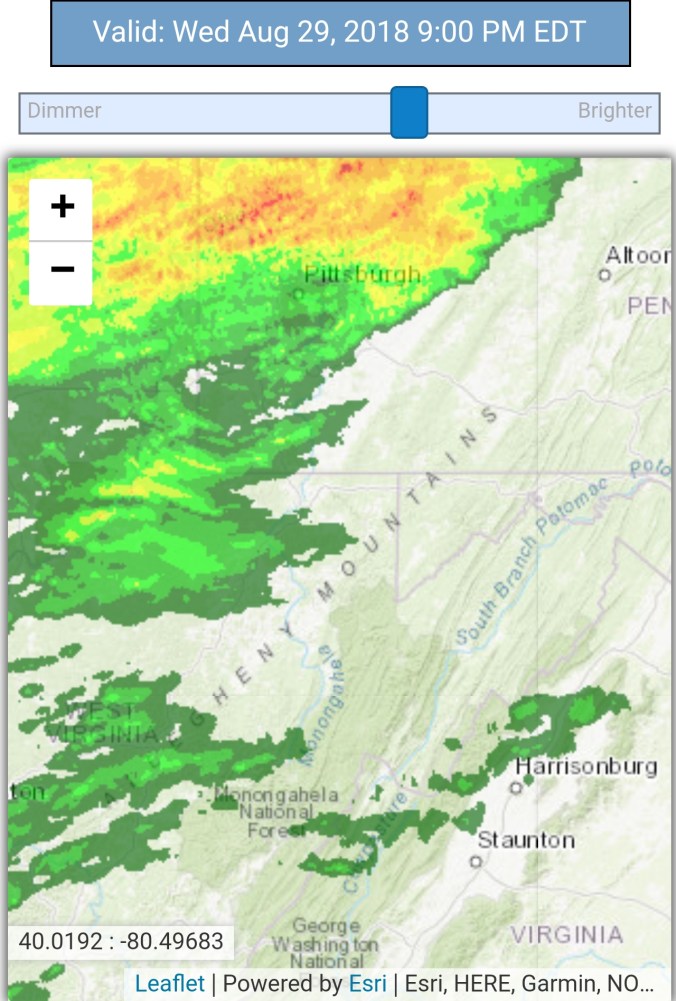
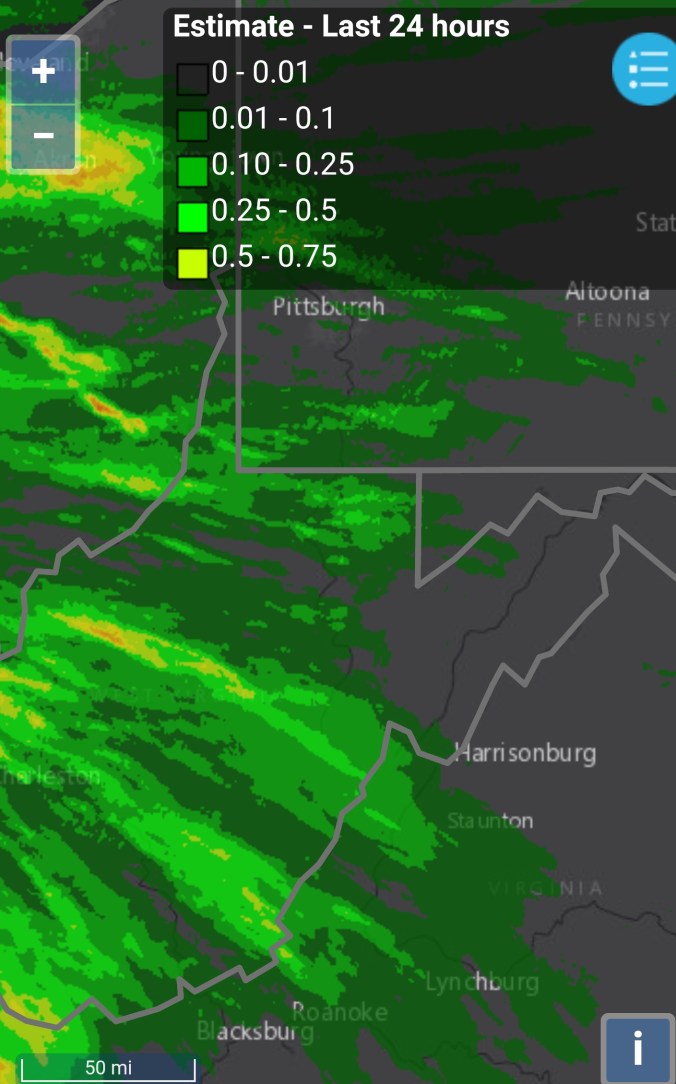
Radar with estimates 9pm-9pm. I picked up .4 at Bittinger 2nw Valley with a afternoon downpour


Last pic is looking north from near Bittinger 2nw.
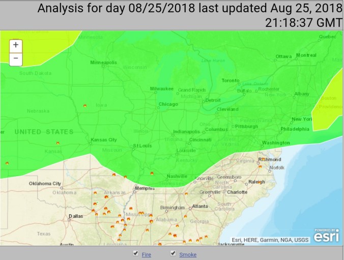
Satellite
Flow
Surface features and 500mb height anomalies and flow(594 heights over the area)


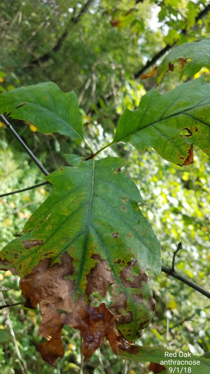
Monitoring the leaf drop
This is really a common site. In some areas, birch, remaining unaffected maples will have to really perform well to get good fall foliage this year. My hopes for a good foliage season is very low. Not that there won’t be color, or good areas, but in general as a whole, not very high on it. The reds at Dolly Sods, the yellow Birches in Canaan and especially Blackwater Canyon still should be a go.


Very early in the month….this year starting off night and day different vs last year. Last year on September 2nd, I did not get out of the 40s during the daylight hours, before touching 50 after nightfall.


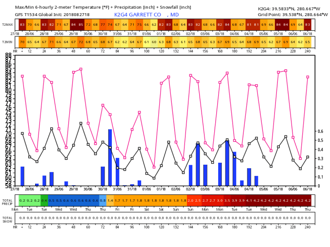
18z 3km Nam
2m temperatures
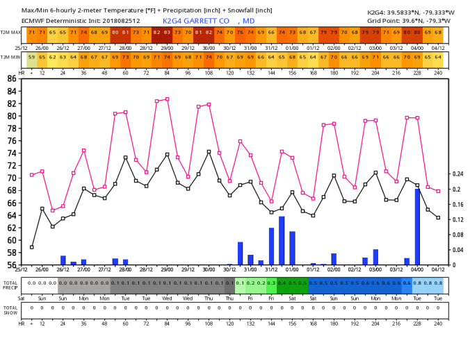
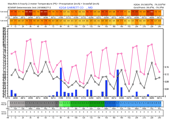
12z ECMWF meteogram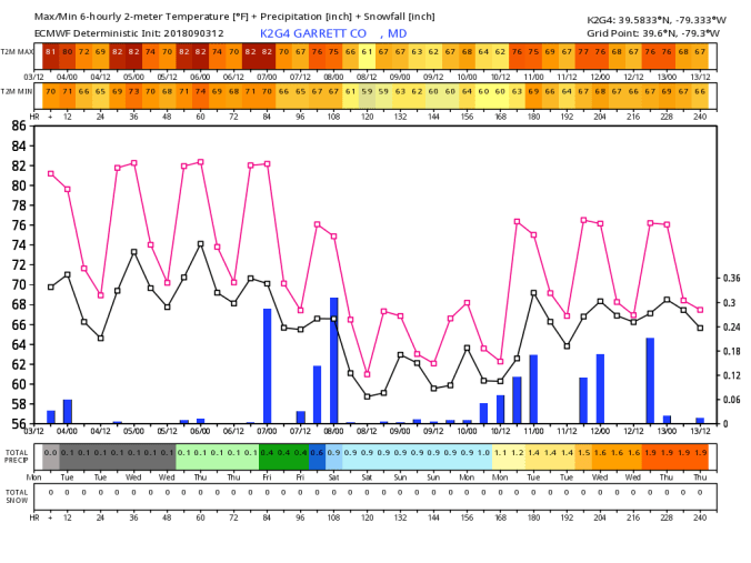
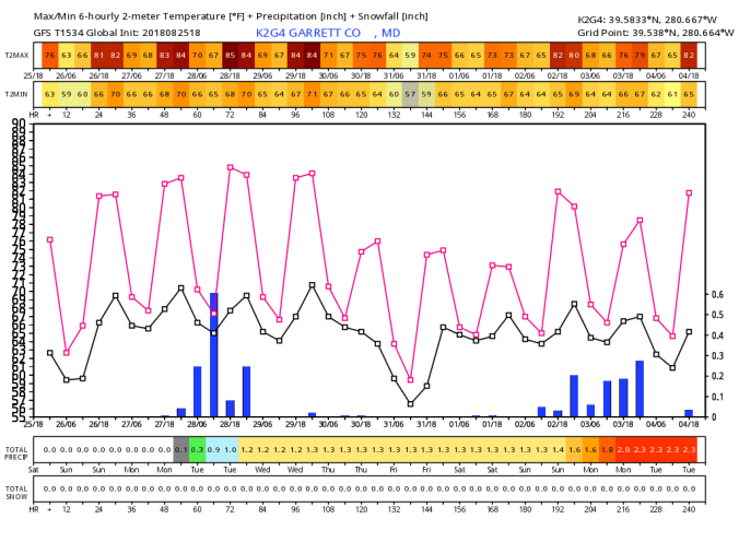
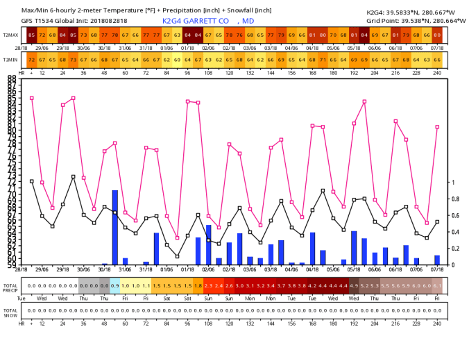
18z GFS meteogram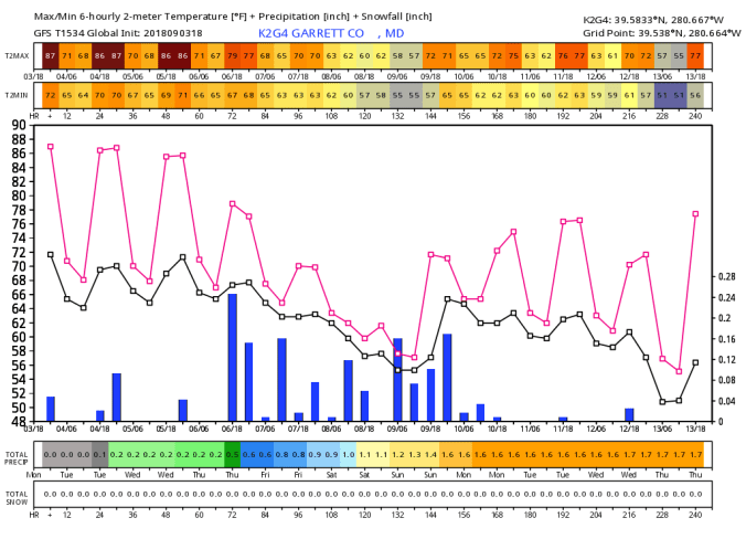
SST temp anomalies and 7day change


T.S Gordon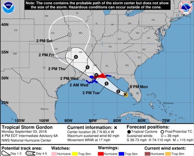
18z 3km Nam


 Warmest Max 80.0


 Satellite


 Satellite


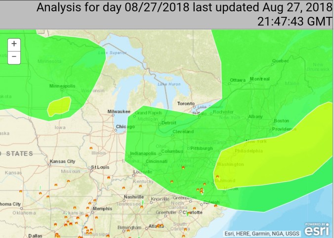


 Satellite this afternoon


 Min at The Glades