Sept 13. min. max. avg
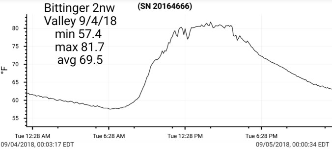
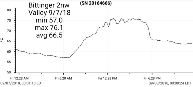
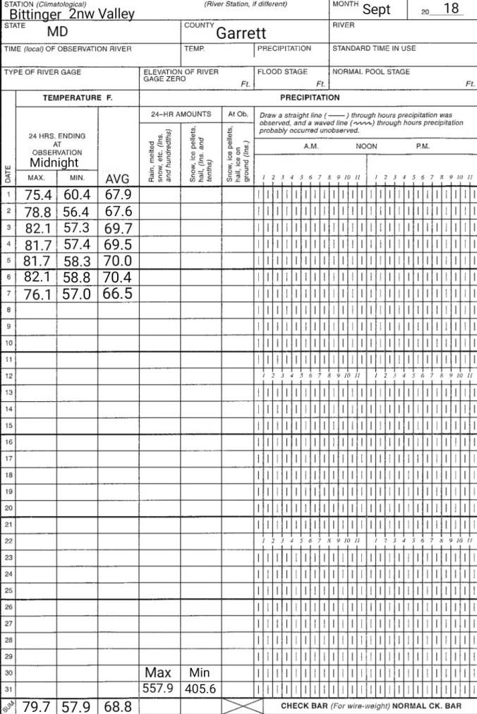
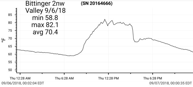
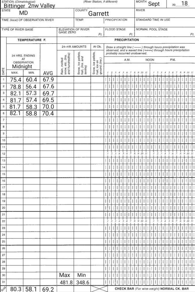
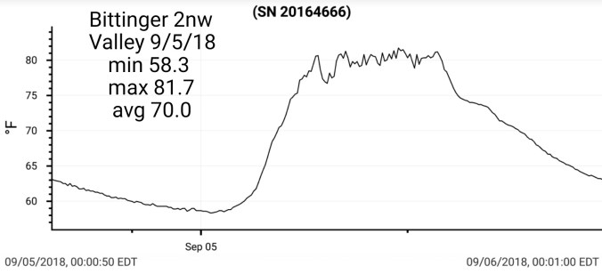
Bitt 2nw valley 65.0 74.6 69.8
Garrett College 65.9 76.7 71.3
Can-Heights 63.7 74.4 69.1
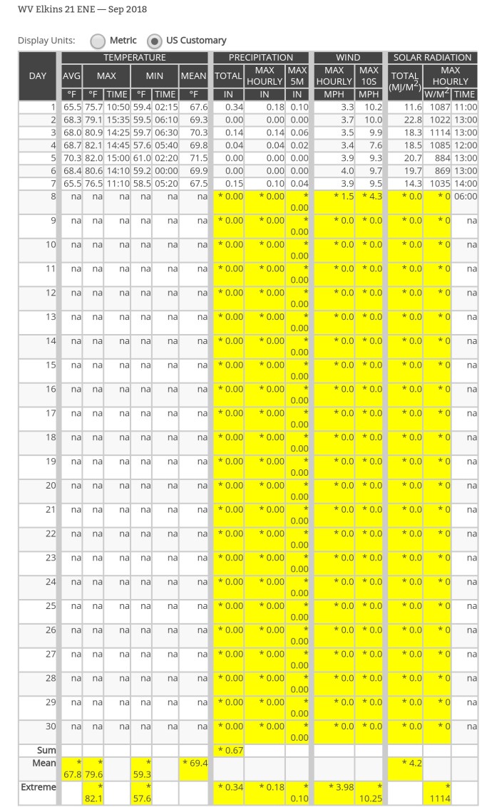
CRN-Canaan 63.3 76.5 69.9
Cabin Mt. 60.8 71.2 66.0
Cabin Mt north 61.5 71.2 66.3
Spruce Knob station down
Snowshoe 60.3 70.2 65.2
Can-Valley Floor 64.9 76.6 70.7
7Springs 64.5 73.6 69.1
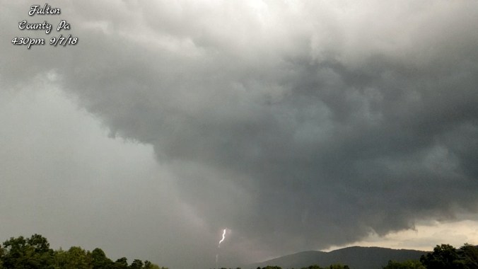
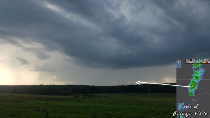
Foggy, drizzle to start, giving way to some sun and clouds mixed, with some light rain by nightfall. There was a period of very light run under partly cloudy skies. Se flow today, thanks to high north, and Florence south
Temp profile this afternoon, downsloping side on the western side heating up today with the Se flow


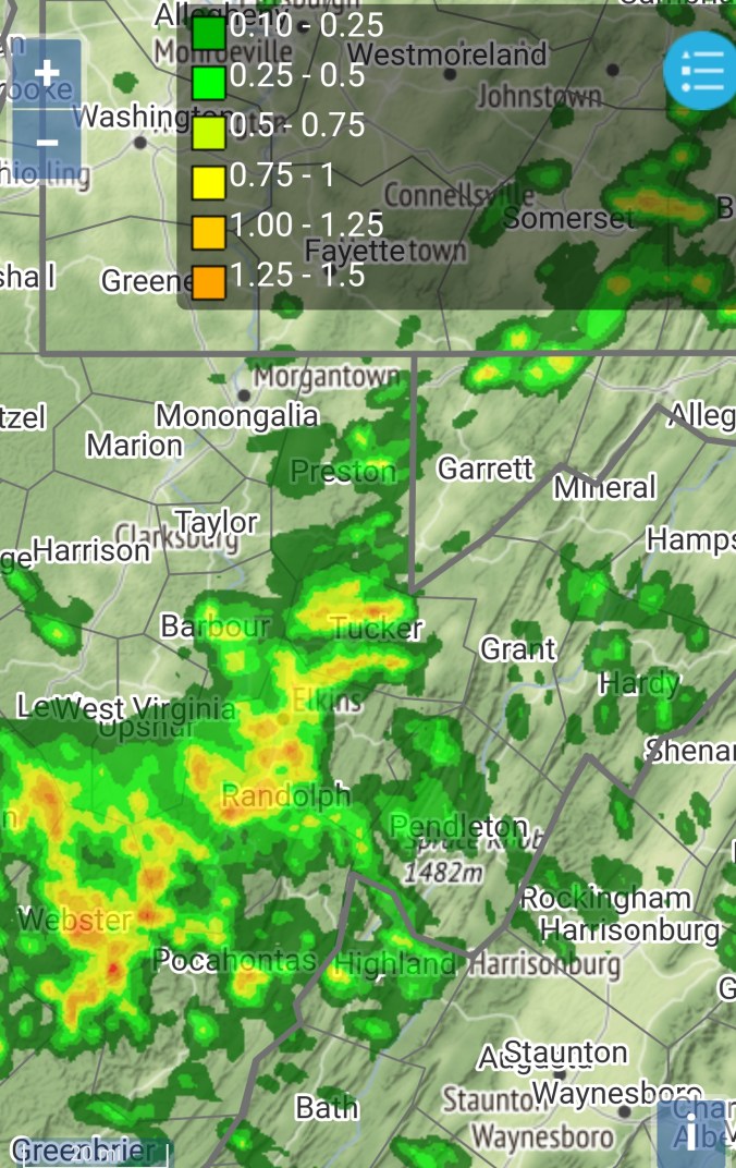
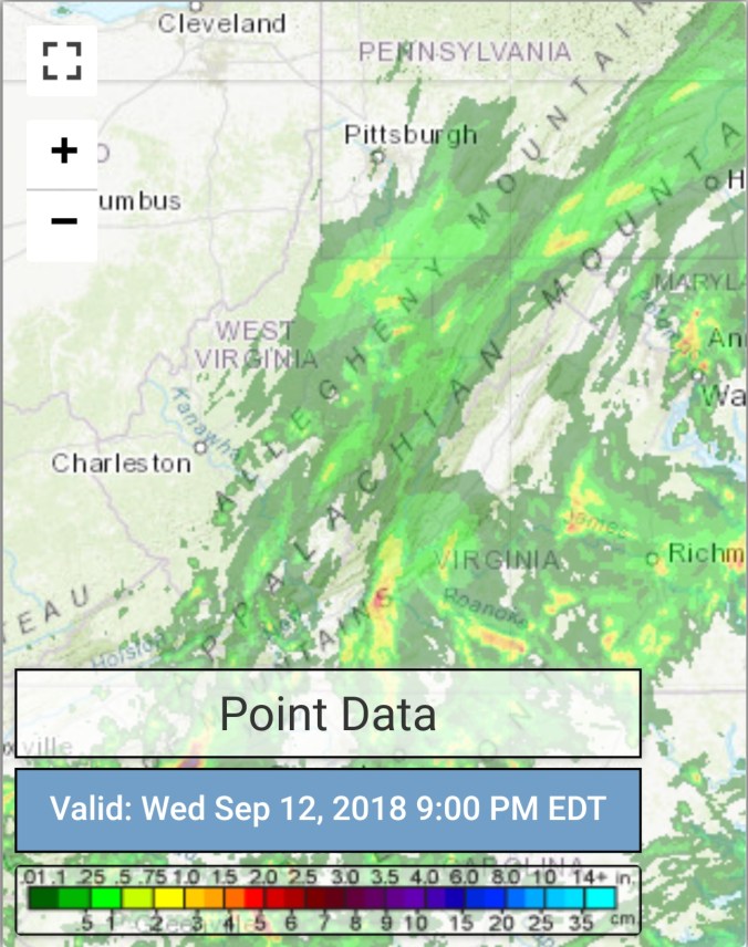
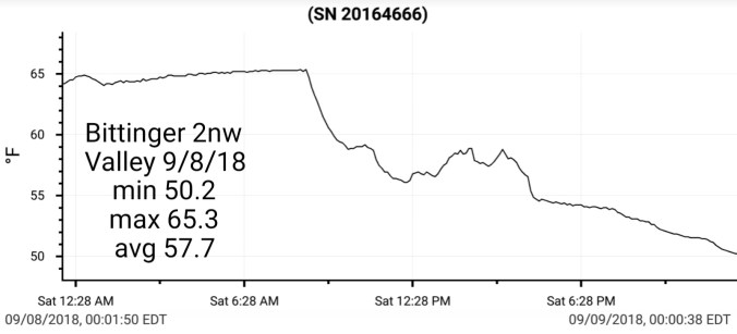
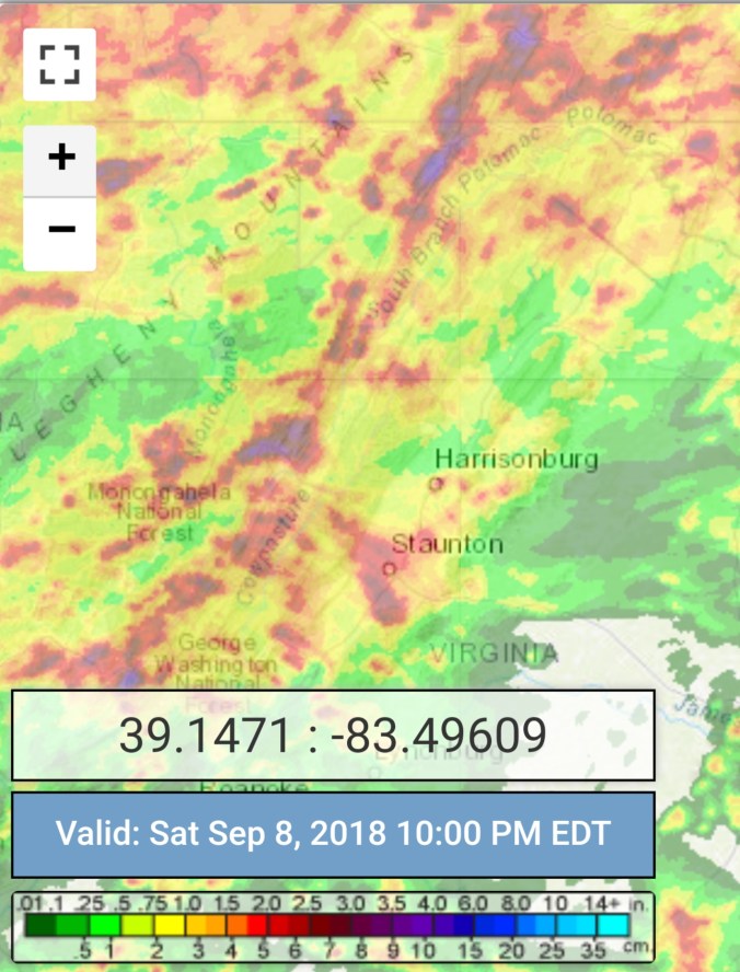
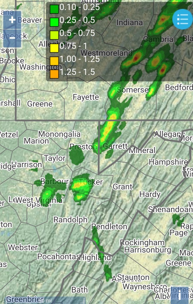
Radar with estimates 9pm-9pm , trace Bittinger 2nw Valley

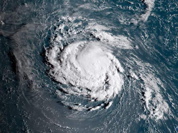
Satellite
Flow
Surface features and 500mb height anomalies and flow


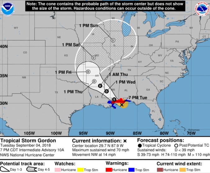
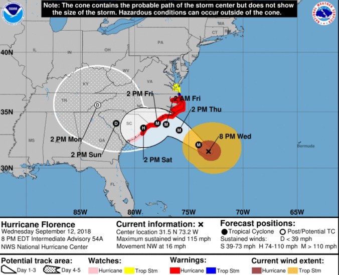
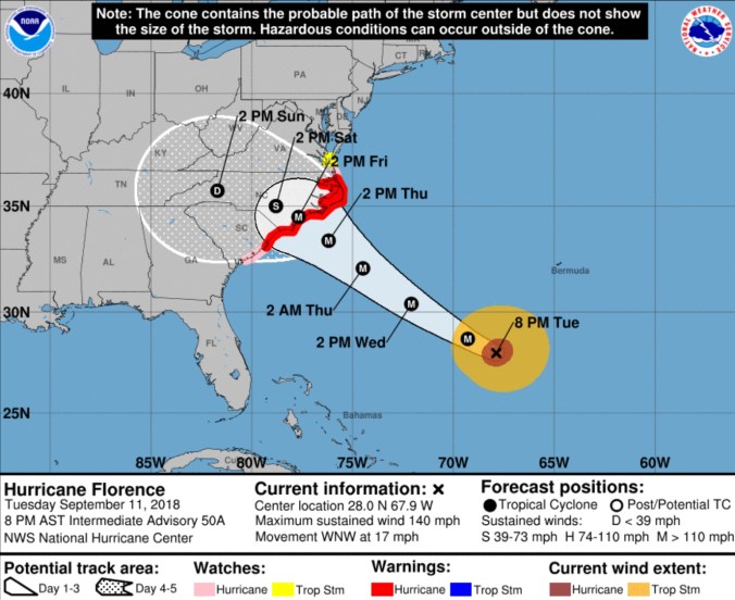
Florence
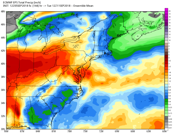
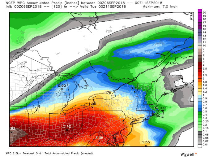
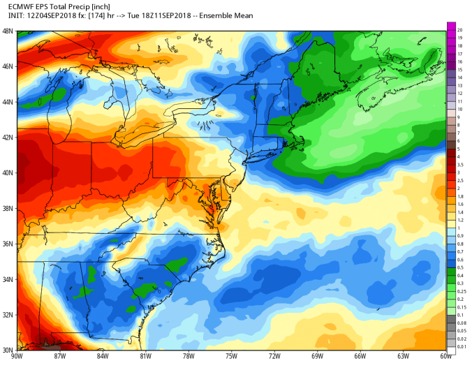
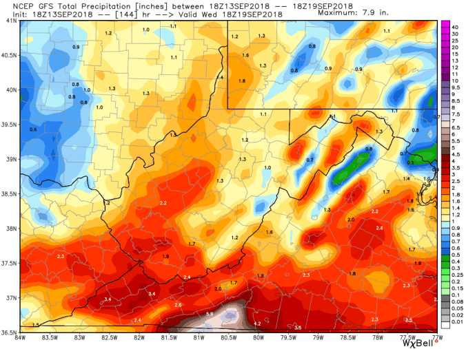
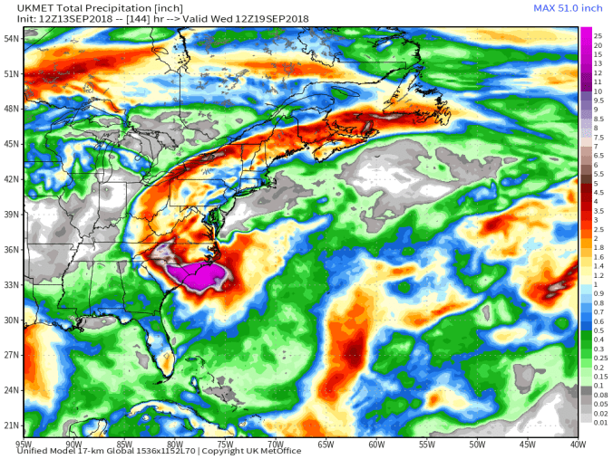
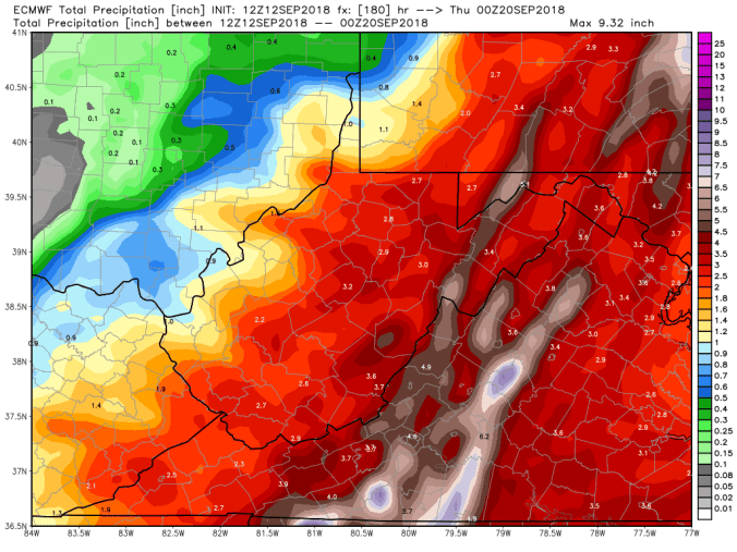
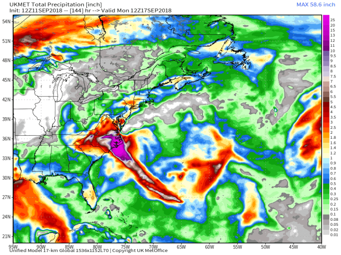
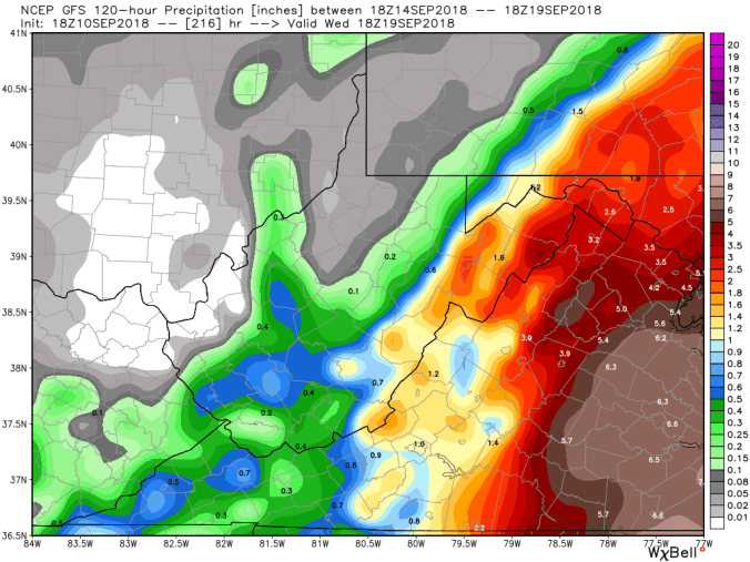
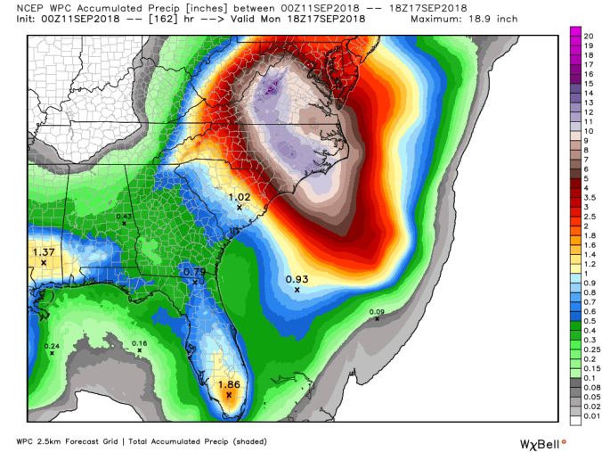
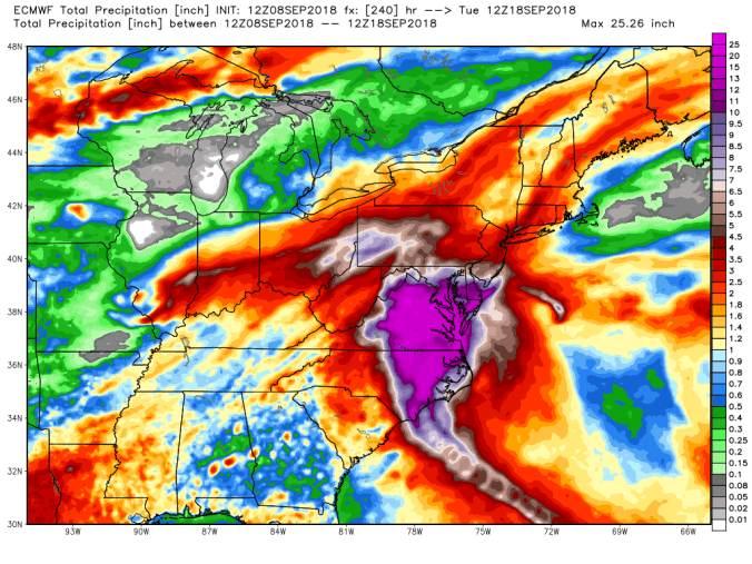
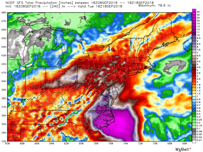
Florence remnants look to impact our area Sunday nighy/Monday am timeframe through early Wednesday possibly. Timing will yet need tweaked. Rainfall amounts are looking to be in the 1-3″ range, with up to 4″ in areas.

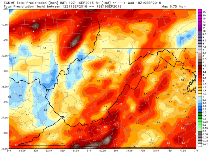
12z ECMWF precip type next 240hrs(totals through Florence remnants, as is the GFS)

18z GFS precip type next 384hrs
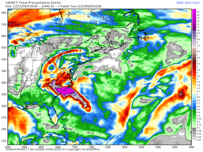
12z UKMET 6 hourly precip
Spaghetti Charts


And that was Florence, now before and after. A continuous moist east flow, with the shower risk over the next few days. Little temperature flucuation from nighttime lows, and daytime highs. With the east flow, west side of the mountains remaining warmer, as seen here on the 3km nam
18z 3km Nam 2m temperatures
18z 3km Nam Simulated Radar
Further out, weeklies finally showing a breakdown of the ridge and brings more fall like air week 3-4. Models originally had this occuring mid month.
next 46 days, weeklies do see our first flakes, in late week 2-week 3 Oct peiod. Take that with a grain of salt, and 3 tablespoons more.


Tomorrow night, I plan to show some comparisons of current foliage vs last year, with month to date temps. Much colder Sept last year, with leaves much further along. Also, this year is influenced by anthracnose in areas, which will hinder colors in areas.


 Satellite


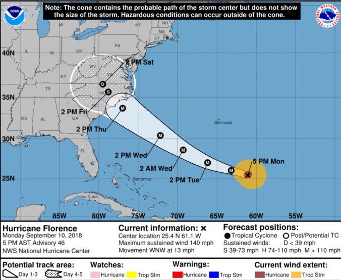 Say it takes on the southern route of that cone, or stalls east, our impact may be small and it may stay dry until late weekend or early next week. That is one scenario.
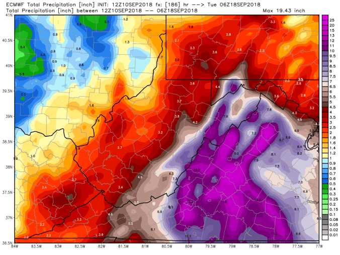


 Satellite


 Radar with estimates 9pm-9pm .1 with evening burst at Bittinger 2nw Valley by 6pm , next recording will be Saturday, away tomorrow
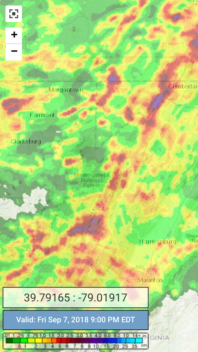


 Radar with estimates 9pm-9pm, .1 Bittinger 2nw Valley through 3pm reading, remainder will go on tomorrows amount.
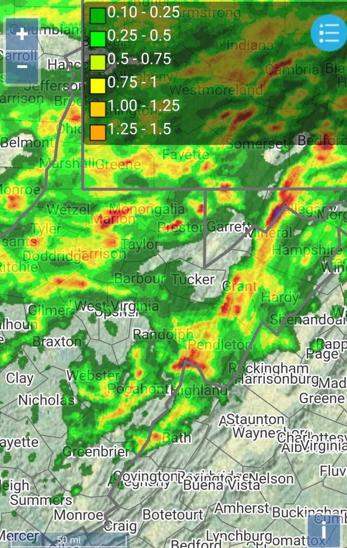


 Satellite