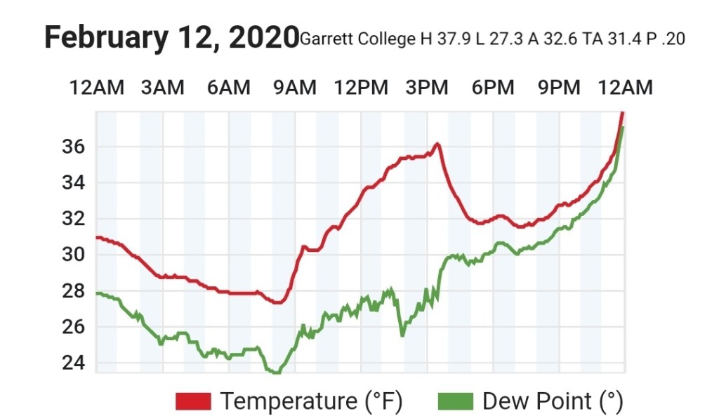
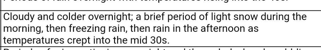
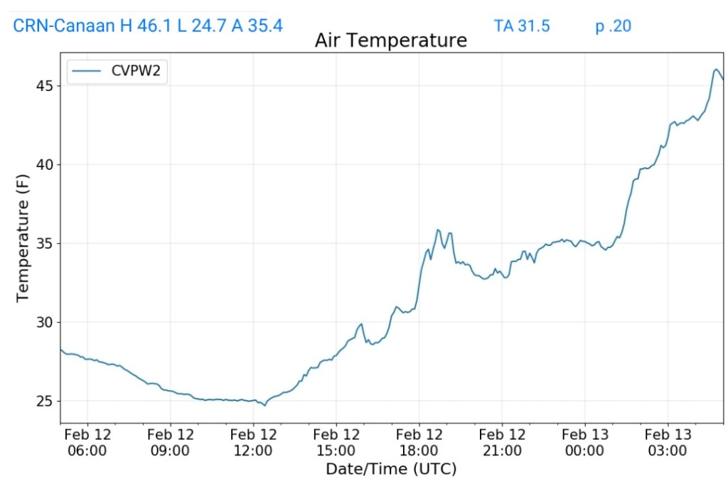
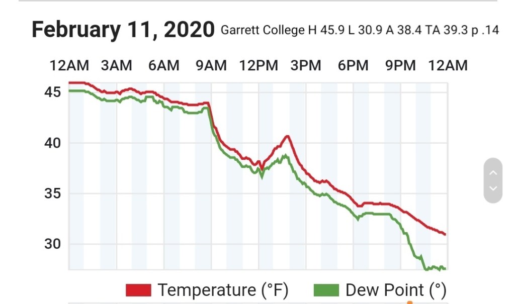
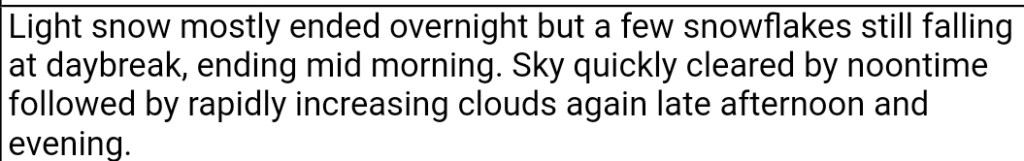
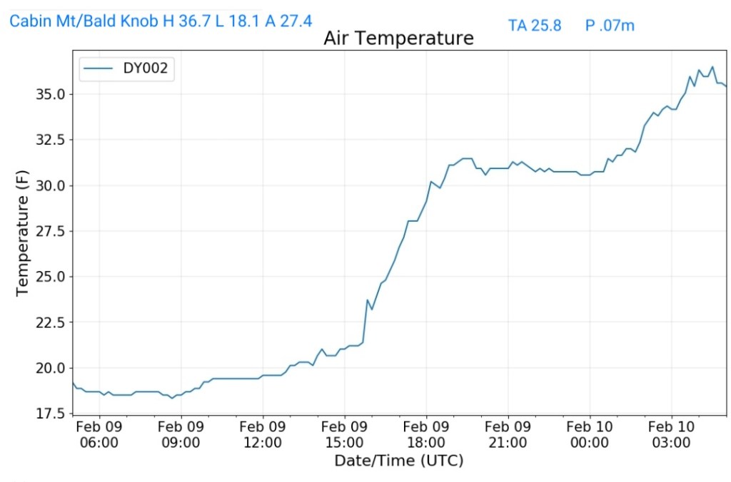
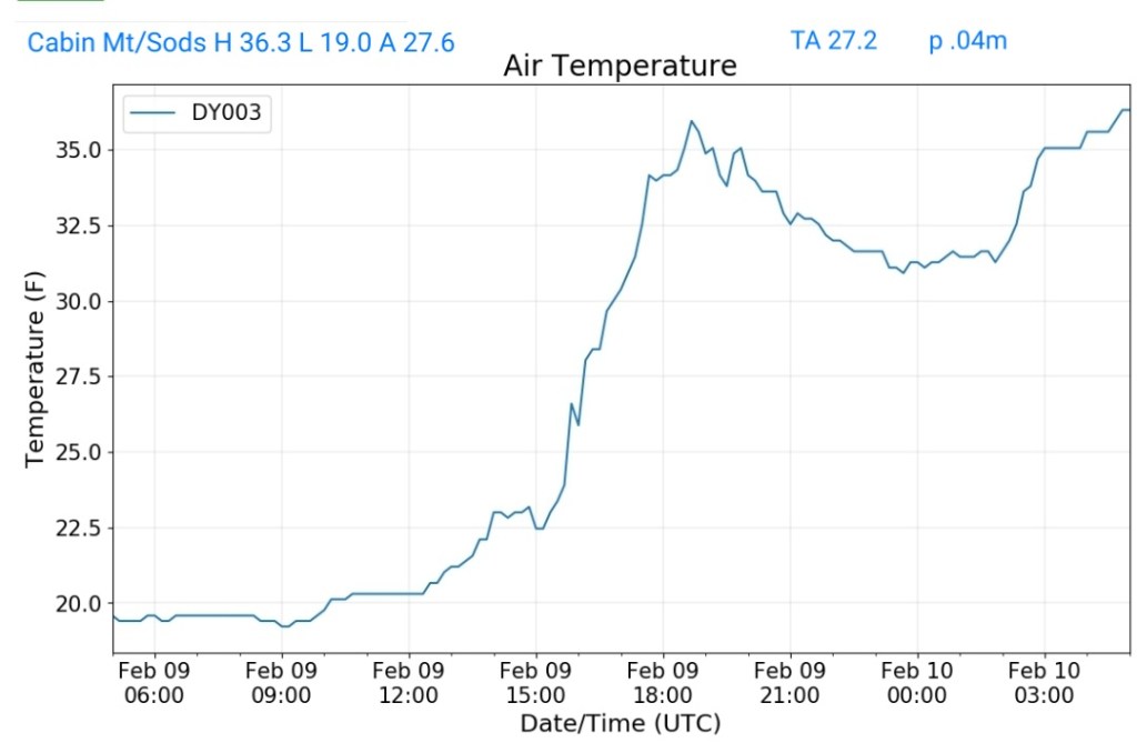
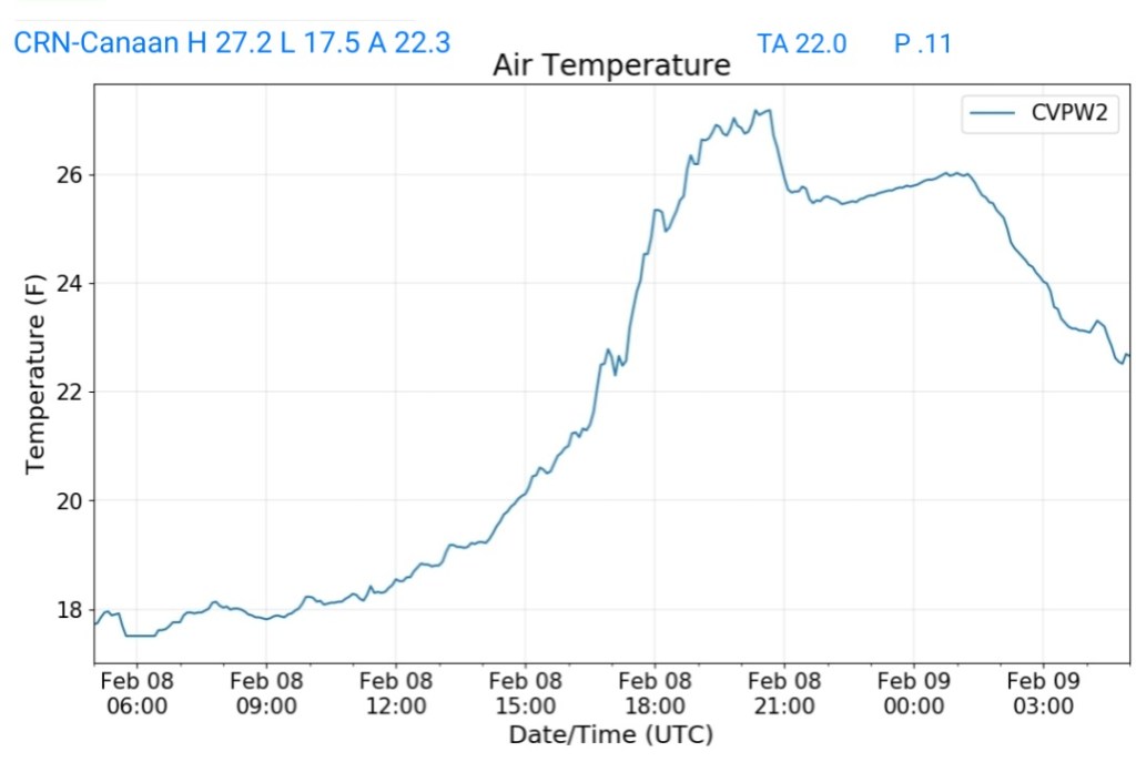
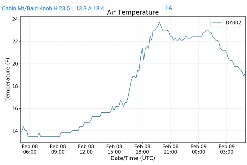
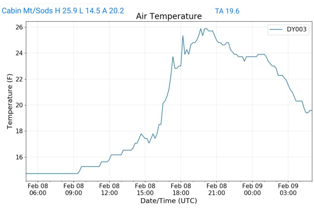
Cloudy, chilly day with some snow falling in the afternoon, changing to sleet, freezing rain and eventually rain just prior to midnight, with some light ice on things after midnight. That setup varied area to area. Not a major event.
Flurries early, even a brief light snow shower that left a trace, then clouds broke for some midday sun, before clouding back over in the afternoon, with some scattered flurries late day.
After some heavy pockets early overnight, light lingering snow occured early morning with a few flurries about during the day until another wave of precip crossed the area starting late afternoon, early overnight. Mainly cloudy today with a glimmer of sun.
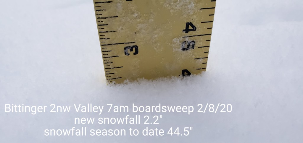
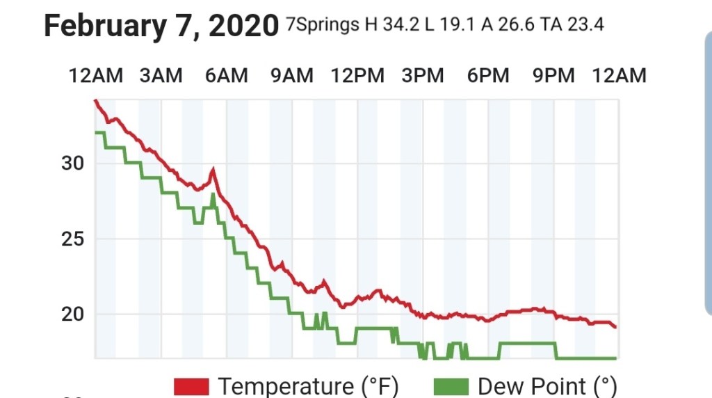
New snowfall of 2.2″ from 5pm last night through 7am boardsweep. With the light snow this morning and again restarting later afternoon, another .3″ fell at the 5pm boardsweep with snow continuing.
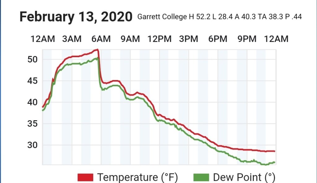
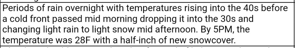
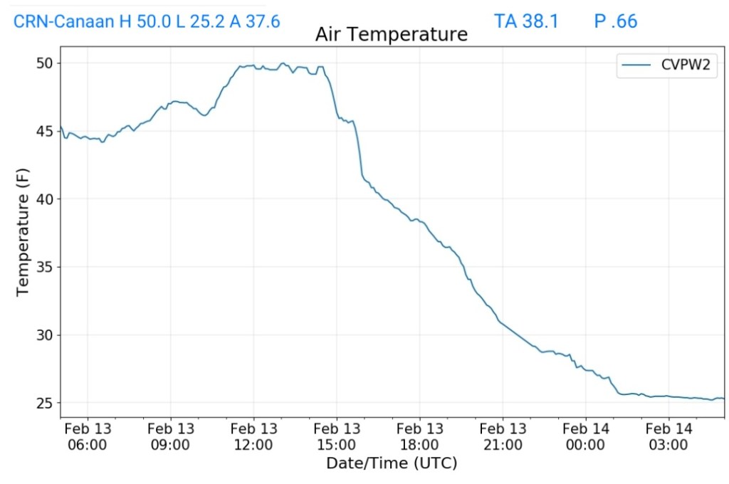
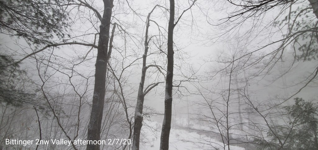
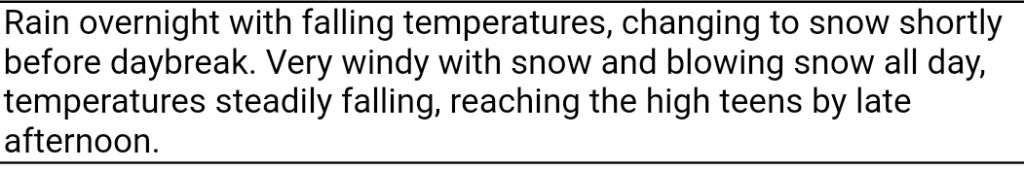
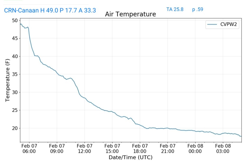
Rain overnight changing to snow before 6a.m. A brief heavy burst around 7am, then light before increasing in the afternoon. Towards nightfall and through 10pm some heavy squalls pushed across the area and put down some rapid accumulation.
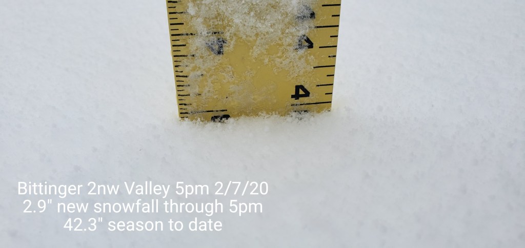
New snowfall through 5p.m boardsweep at 2.9″.The heavy squalls that occured after 5pm will be included in tomorrow mornings 7am tally. No measurement or boardsweep was done this morning since the snow had just began.
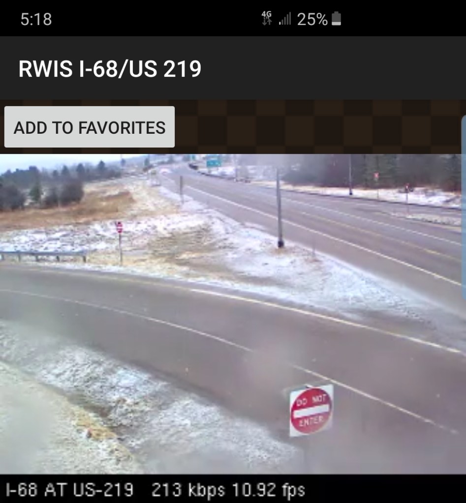
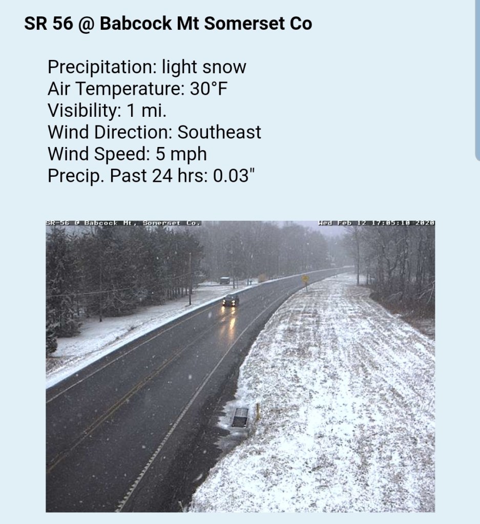
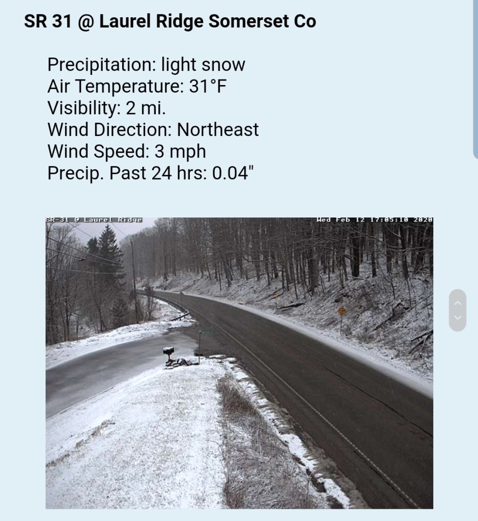
Radar doing poor at showing precip over the high ground.
Satellite
Flow
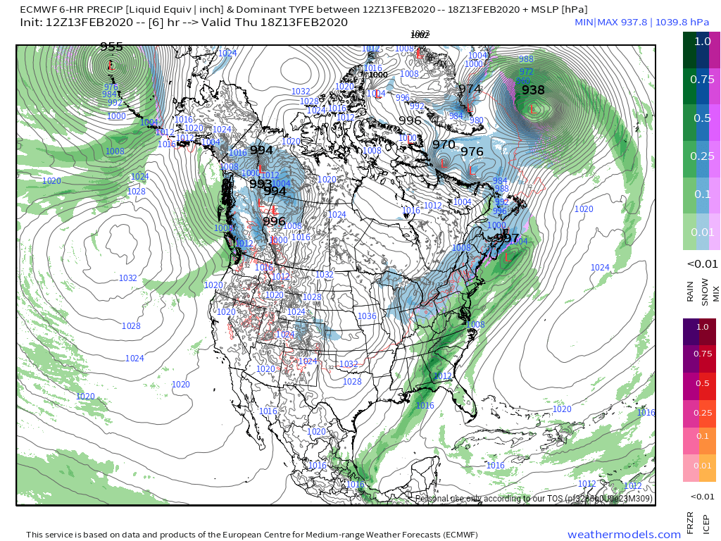
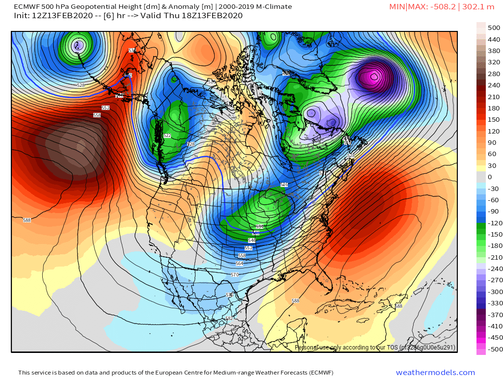
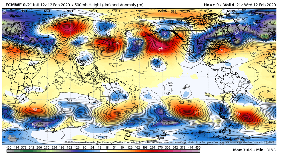
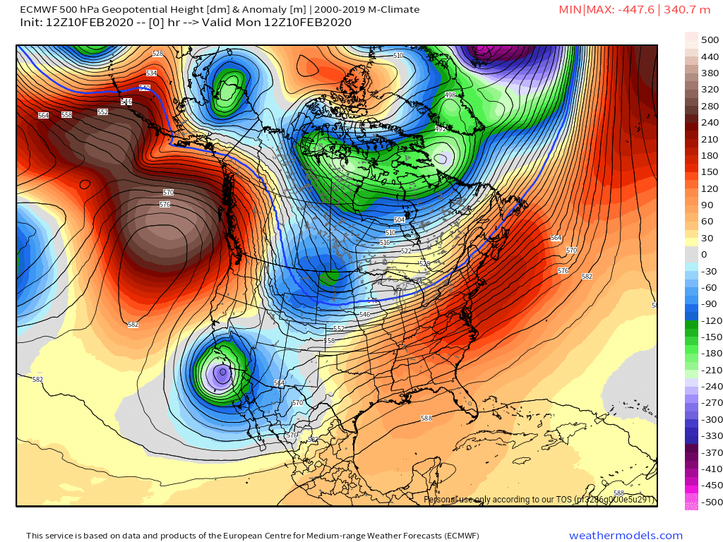
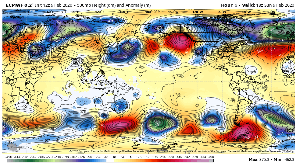
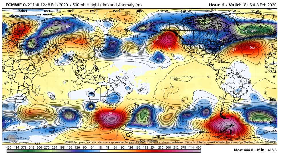
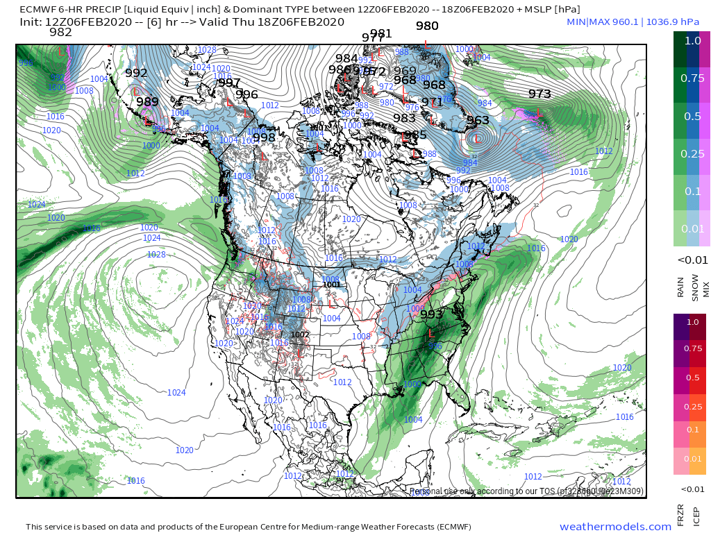
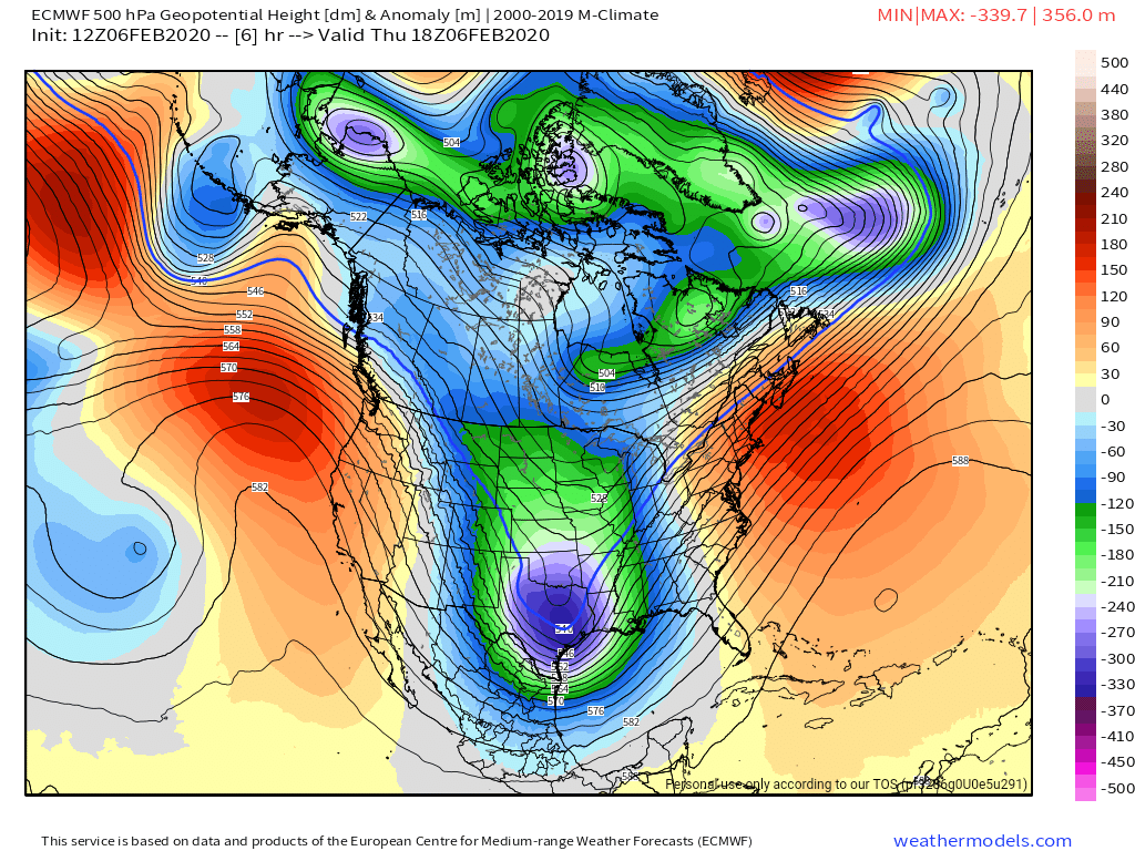
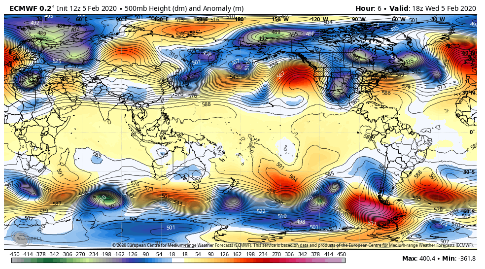
Surface features and 500mb height anomalies and flow
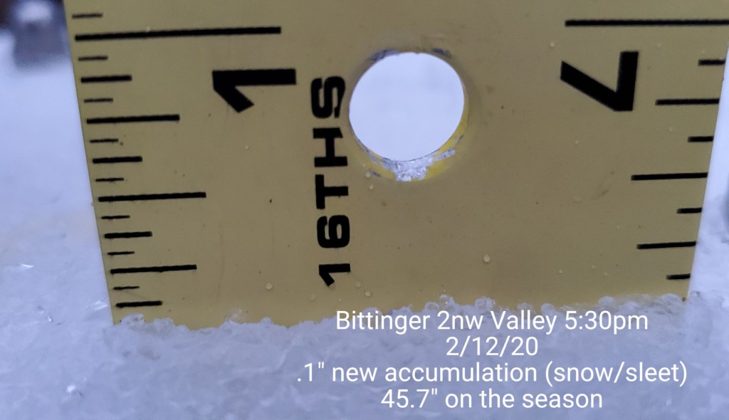
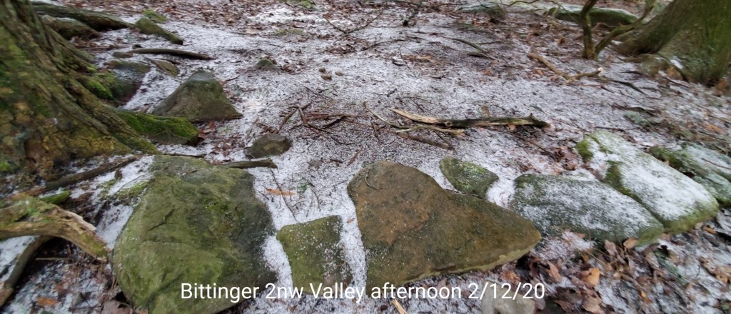
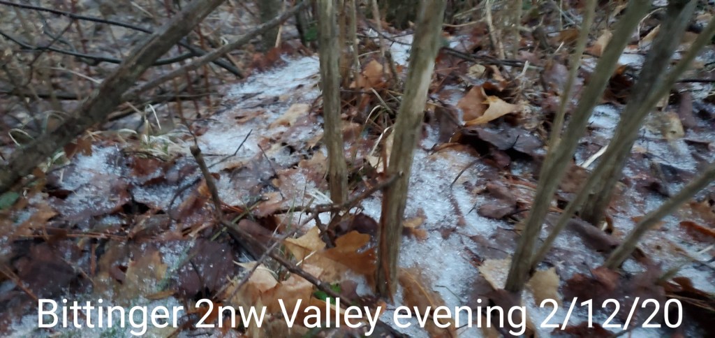
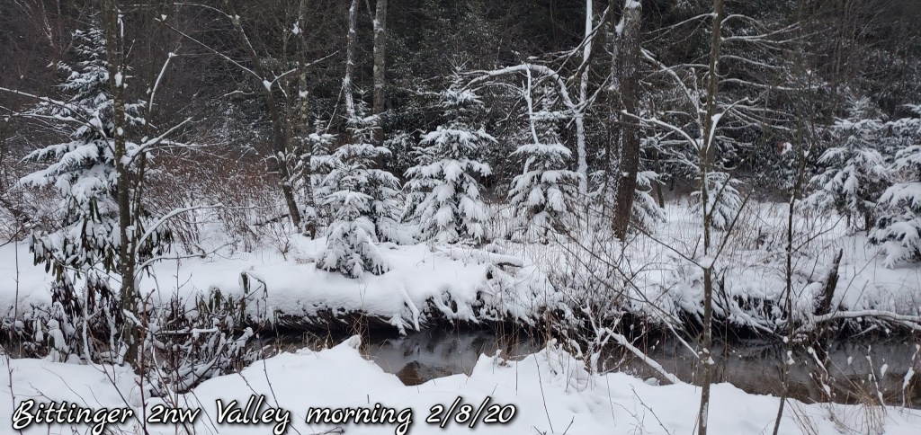
pics today
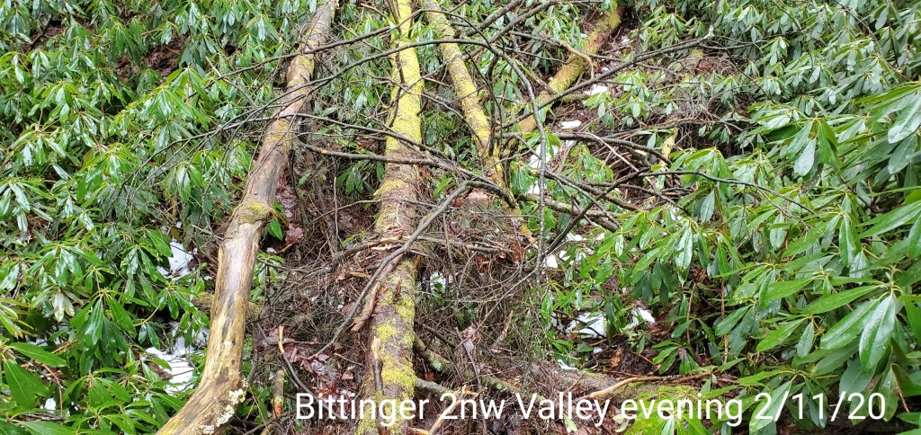
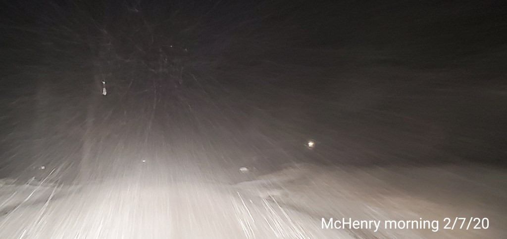
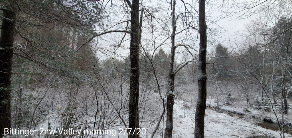
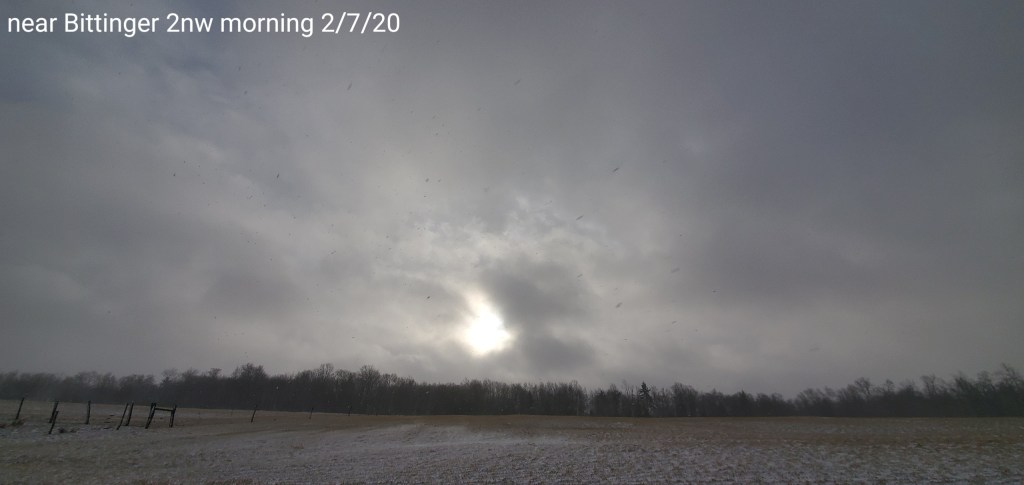
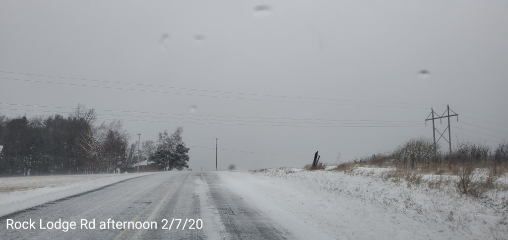
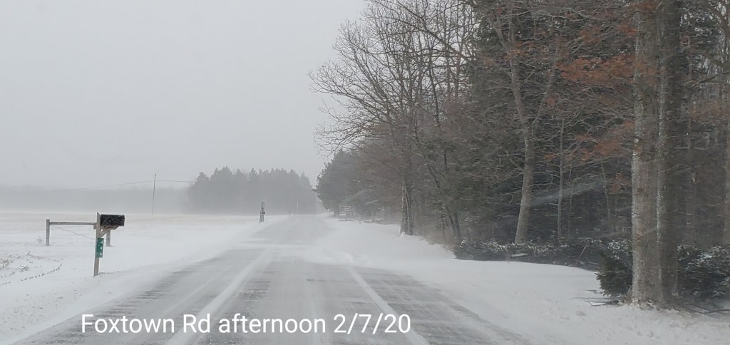
Bittinger/McHenry area
webcams
10 am update-
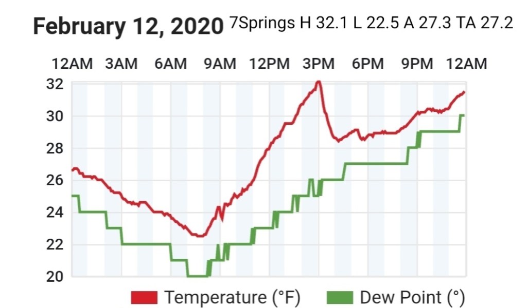
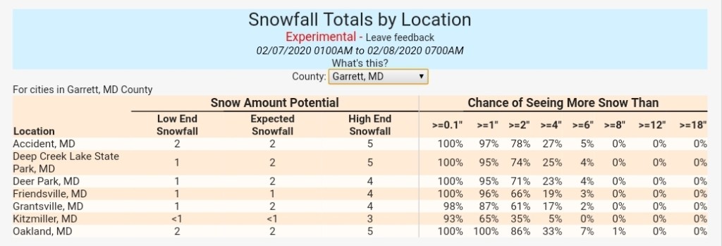
The haves and have notes with the initial thump. Through around 9 am, reports of 2 to near 4″ have occured on the west side of the mts… and along the western ridges in the northern Alleghenies. A 3″ report near 7Springs, 4″ report near the Pre/Mon/Taylor County border in Wv, and the same as you go towards Pittsburgh, with nearly 5″ reported in Indiana , Pa. While at 8am near Bittinger I was at .9″.
So, a boom in areas with the initial burst and a bust in areas. Interesting in the fact that once again, a scenario that’s become common place and way too frequently. The models initialized wrong again. The GFS max amounts, as well as short range mesoscale guidance was just further east..with several inches by 7am further east. About 50 miles or so vs reality. I do not ever recall models initializing wrong so frequently time and time again.
Now, the initial burst was 1 aspect of the event. Forecasted totals through Saturday a.m are still well within range, but missing out on the initial burst for the majority of the high ground, which modeling totally blew, that’s a setback, but can be made up in some lake streamers and upslope later on.
-My thoughts from yesterday for this event were as followed
My thoughts on some select areas for part 1…
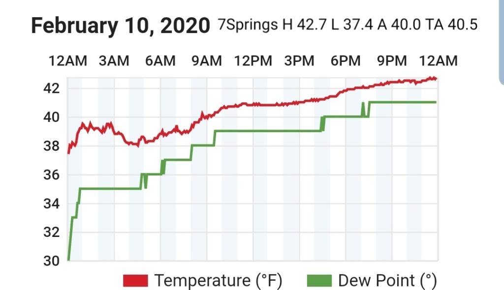
7Springs 3-6″
Somerset 1-3″
Mt.Davis 3-6″
Grantsville 1-3″
Bittinger 2-5″
Oakland 2-4″
Cranesville 3-6″
Terra Alta 3-6″ (Any interested weather gurus here? A snow observer needed in this area)
Coopers Rock 2-4″
Davis 4-7″
Canaan Heights 4-7″
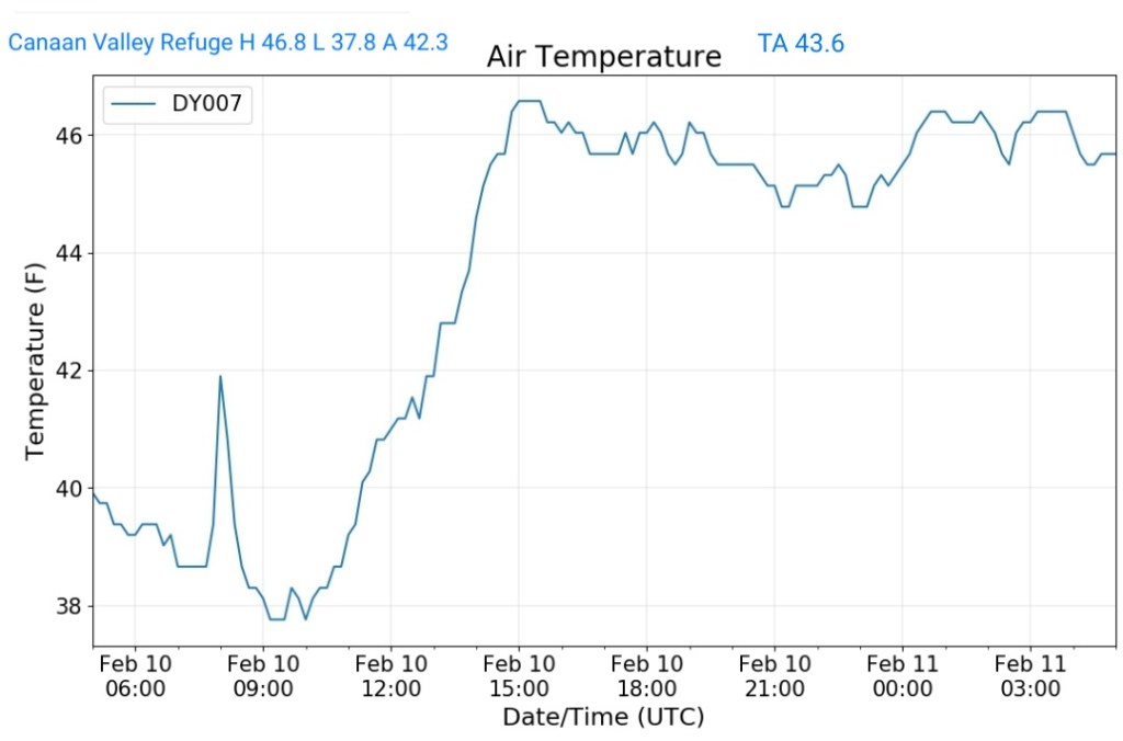
Canaan Valley 3-6″
Parson 1-3″
Whitmer 2-4″
Onego 1-2″
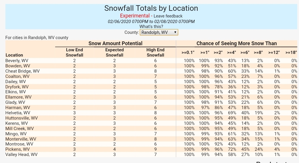
Elkins 2-4″
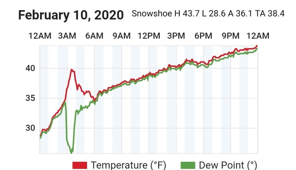
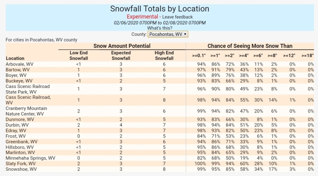
Snowshoe 4-7″
Highland Scenic Highway 4-7″
Marlinton 1-3″
Those totals are well within reach still. And 7Springs is already there and likely Coopers Rock close if not. Guidance yesterday afternoon would have suggested upping the amounts. But again, it’s been beyond poor.
Still watch for heavy burst, some streamers and isolated whiteout conditions at times. Other wise snowfall varying from light at times to moderate and over the duration of the next 24 hours should get into the totals window. Some areas on the west side of the Mts will likely exceed expected totals.
Surface features and 500mb height anomalies and flow
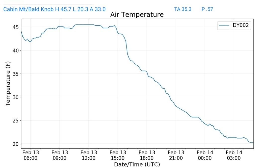
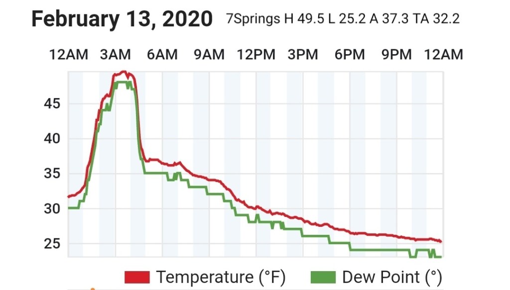
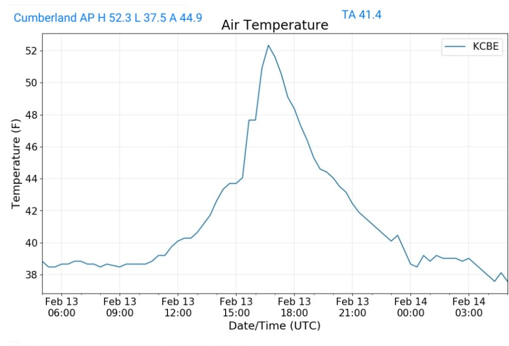
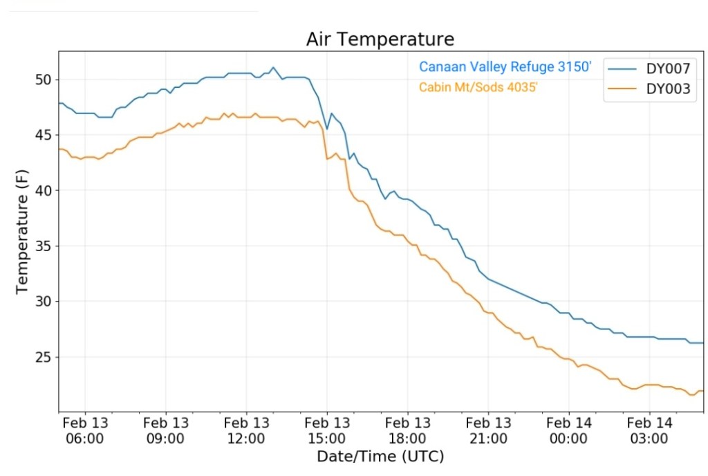
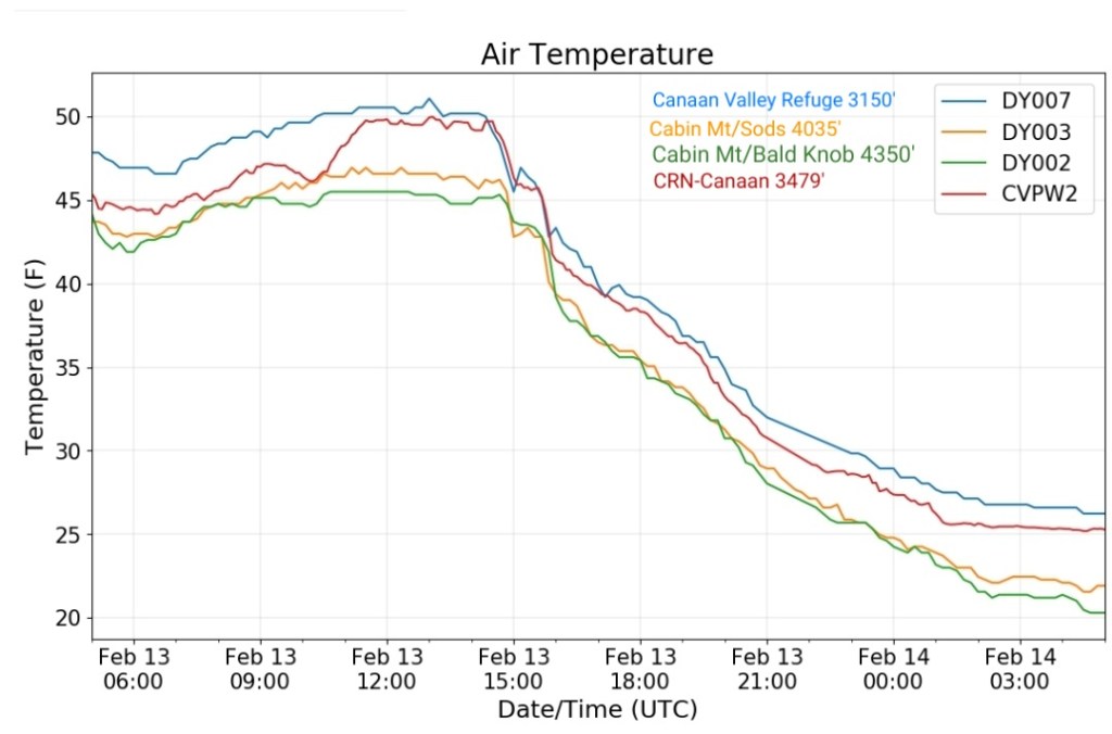
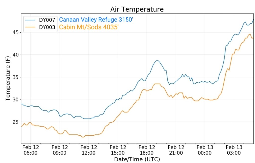
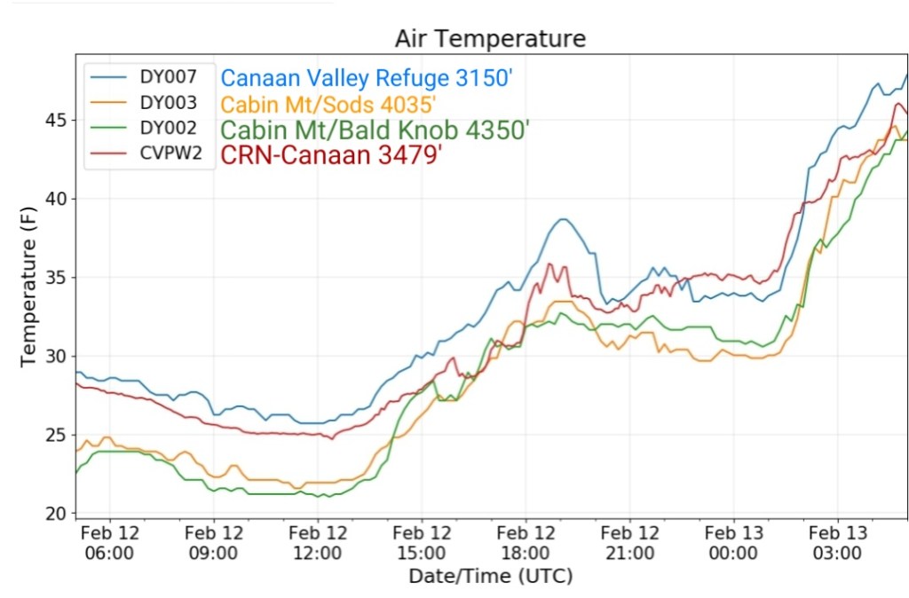
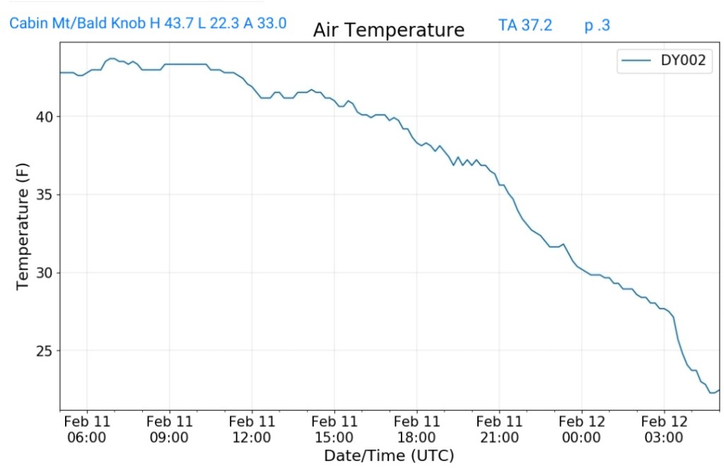
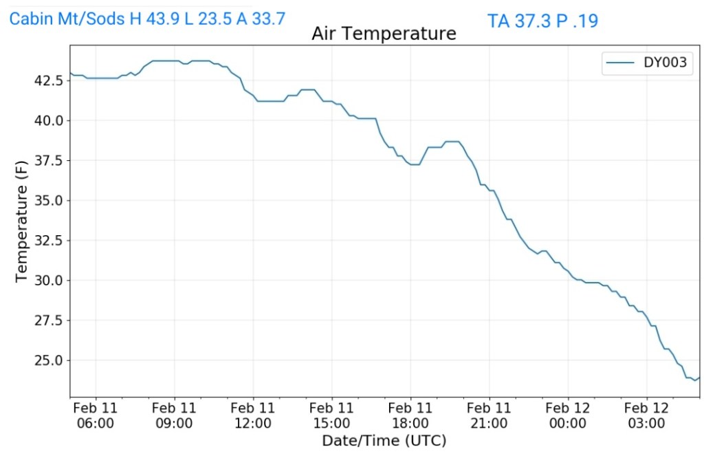
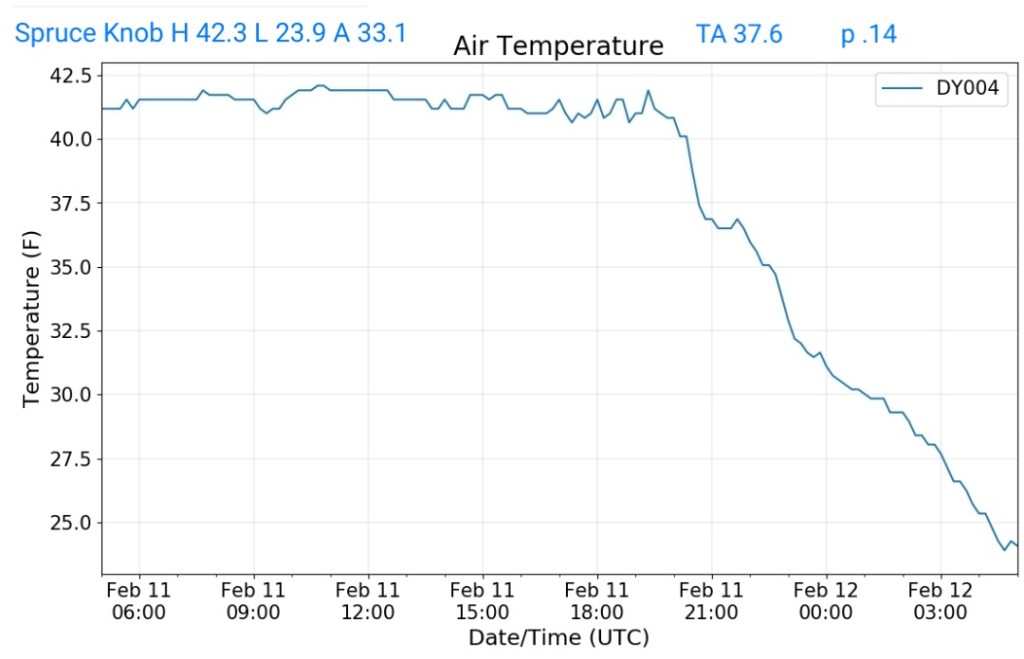
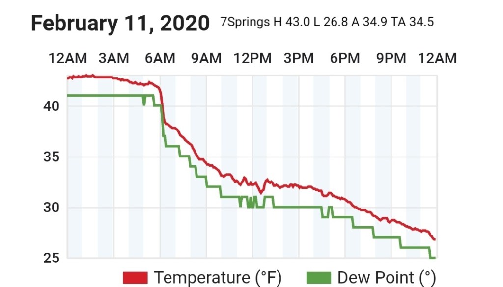
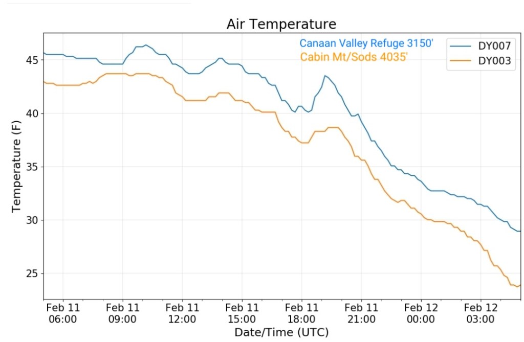
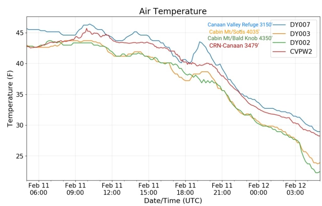
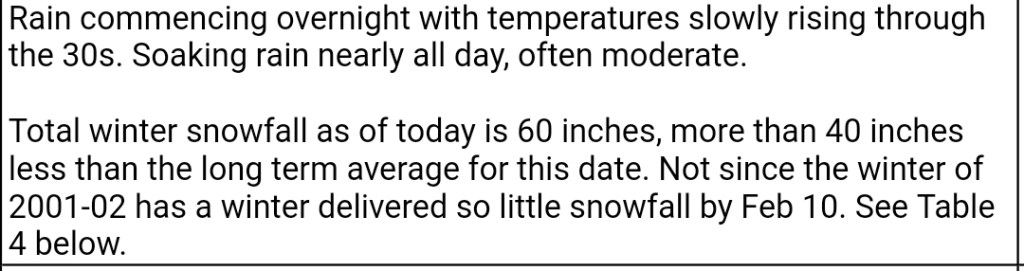
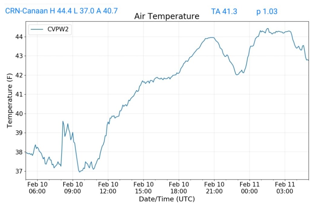
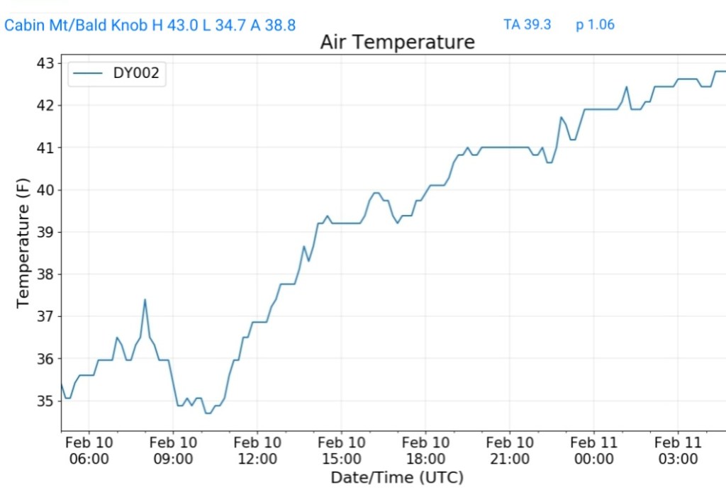
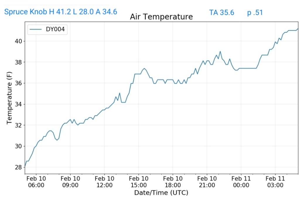
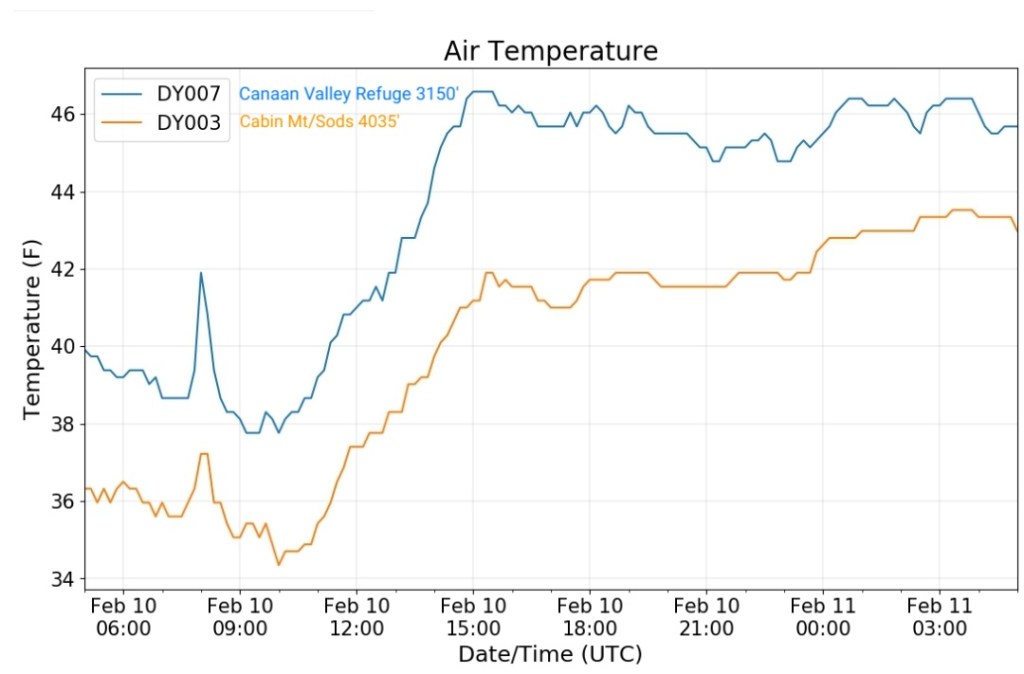
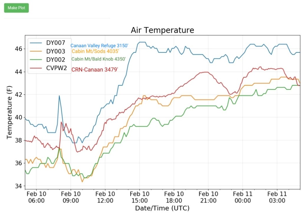
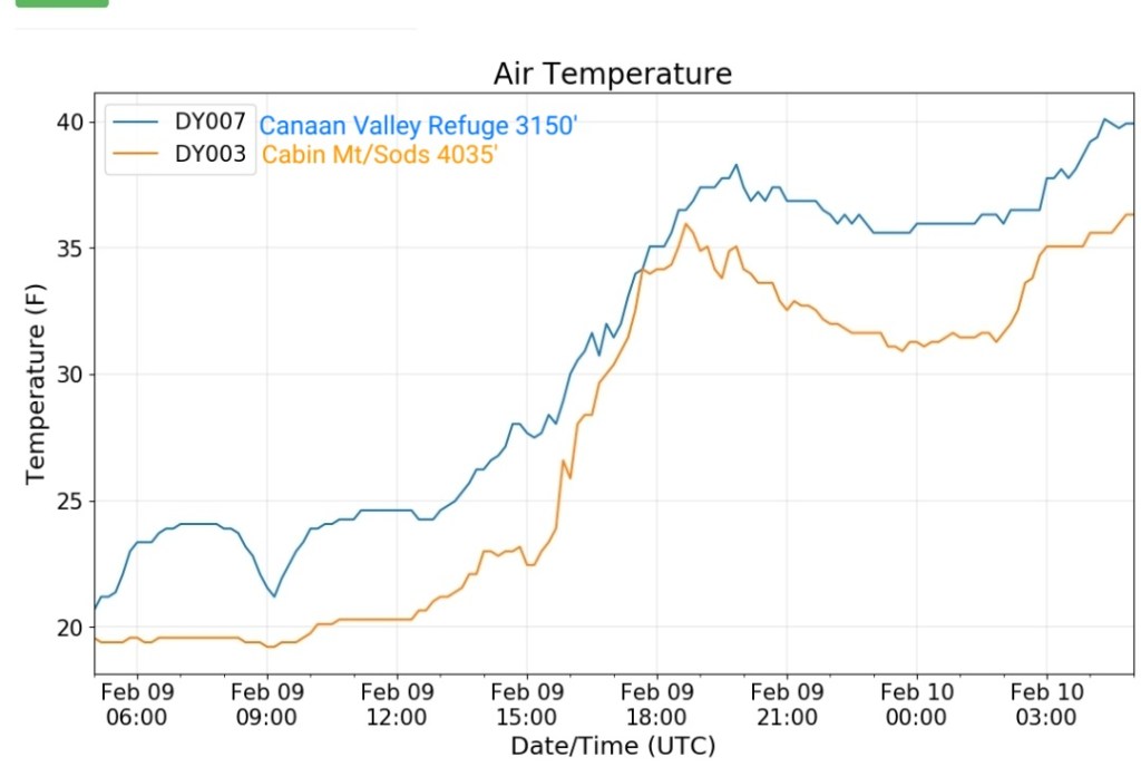
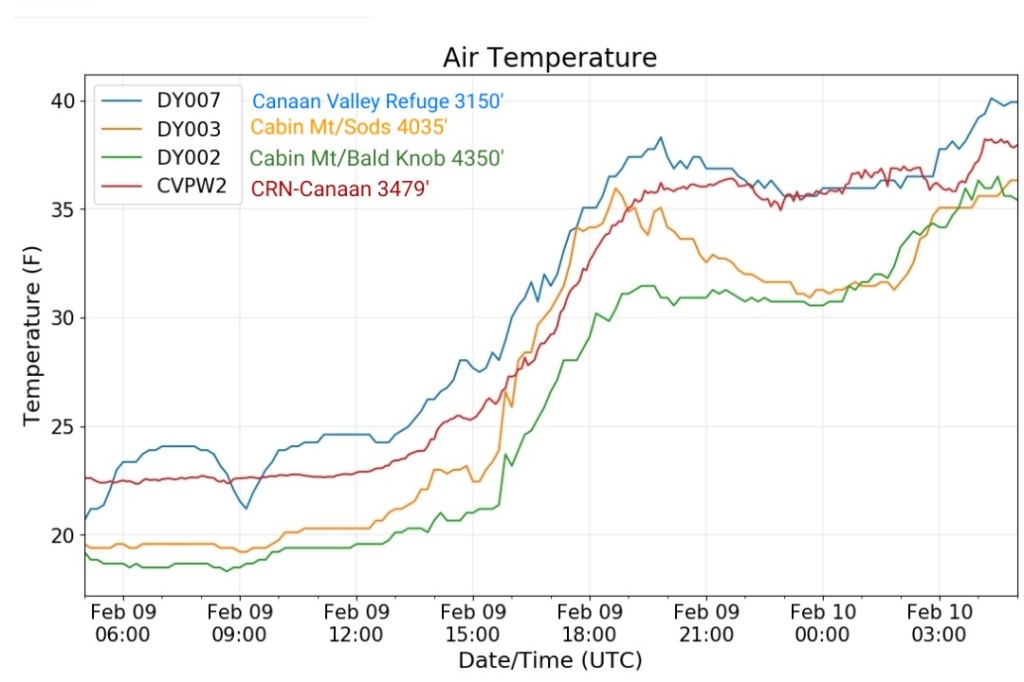
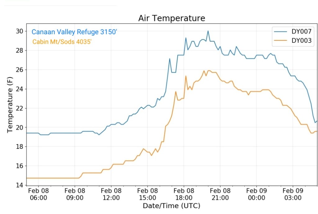
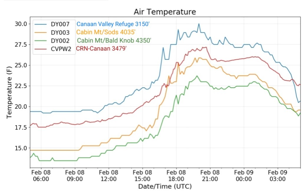
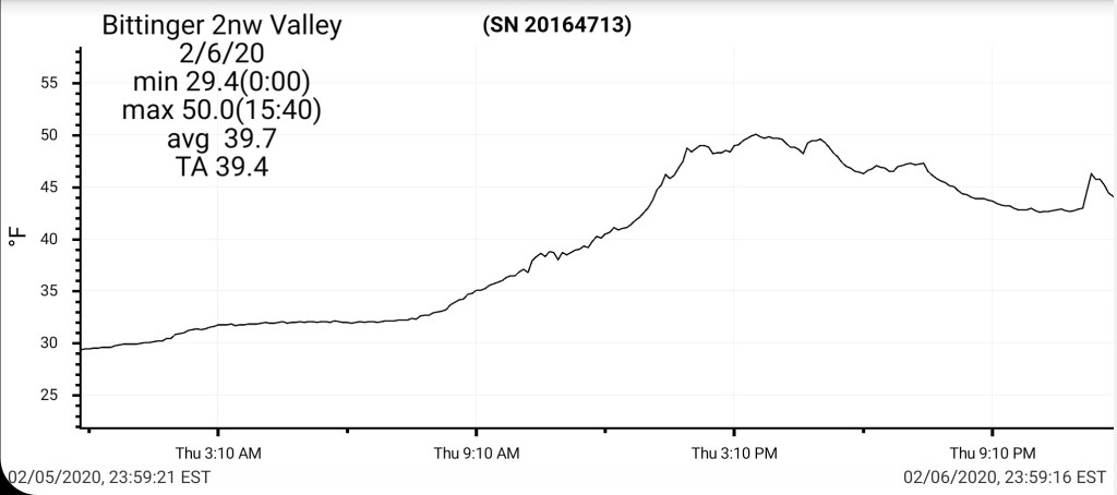
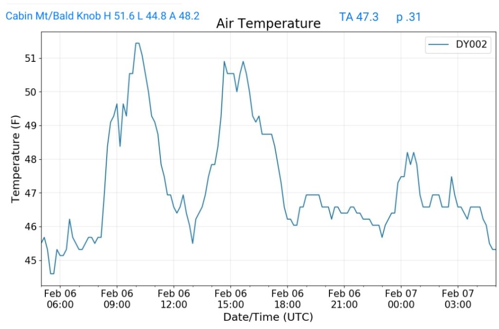
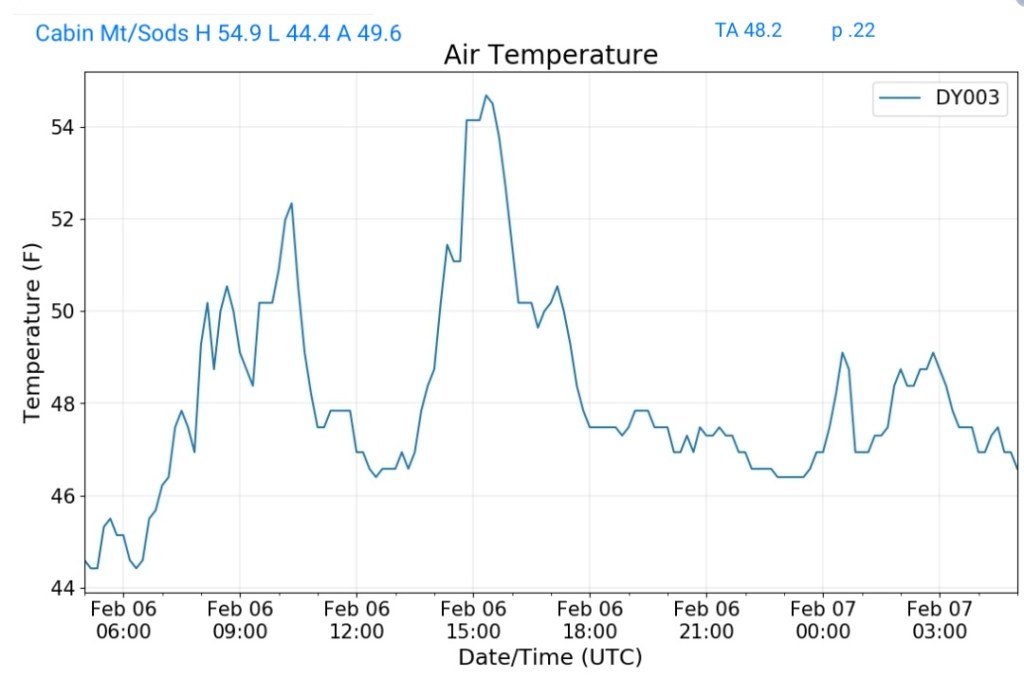
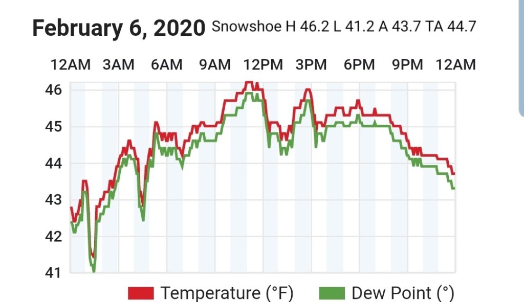
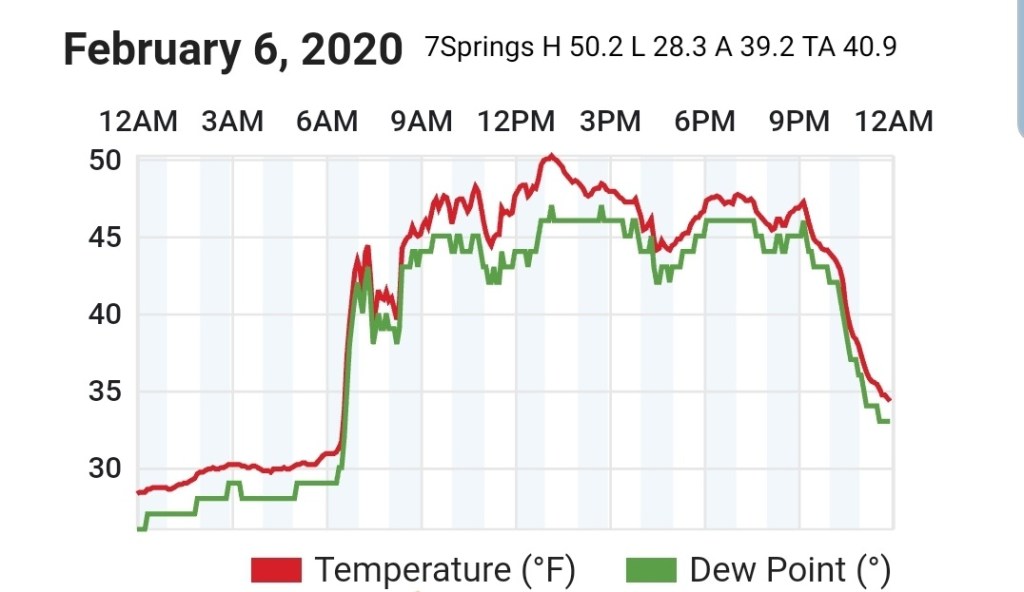
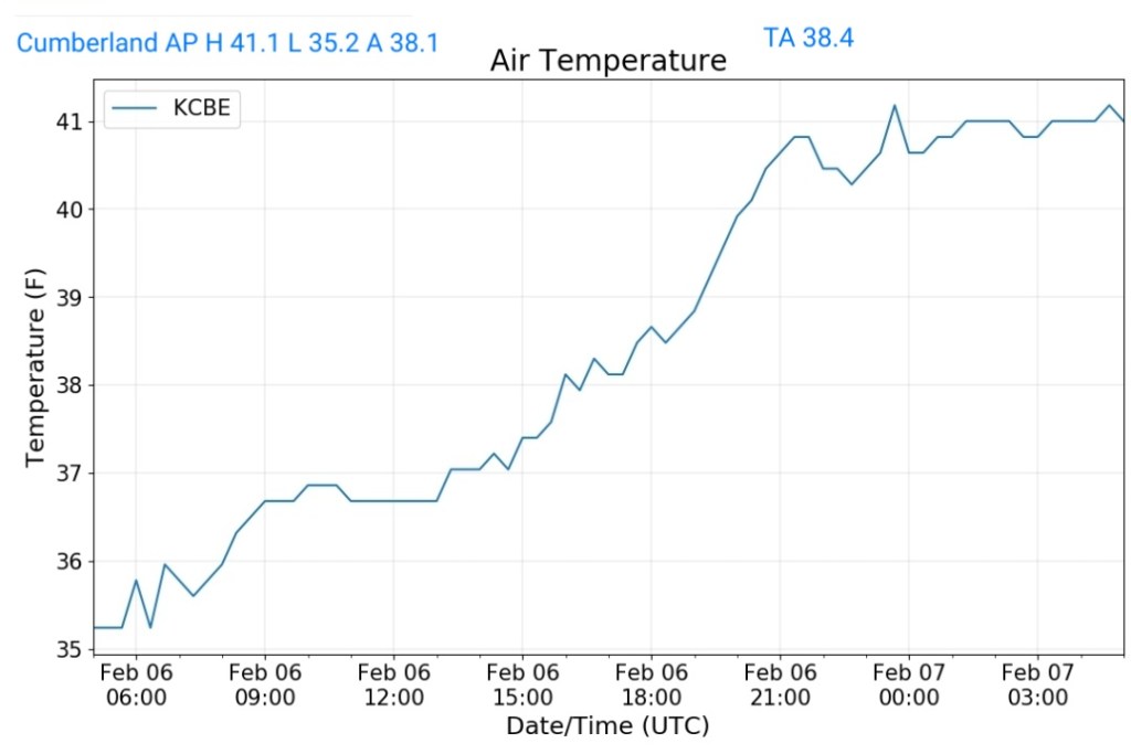
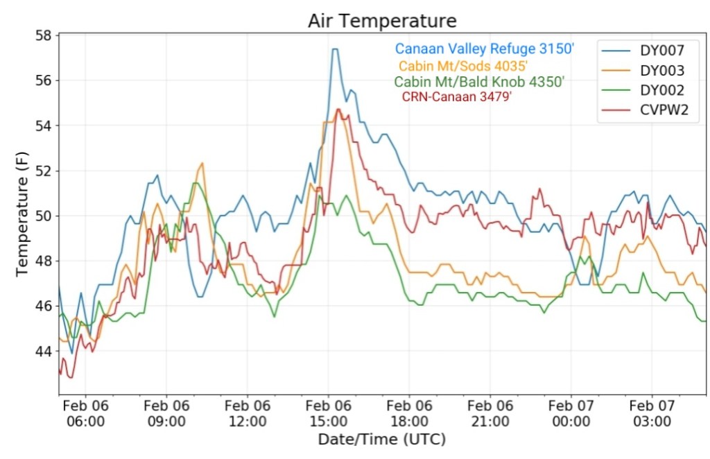
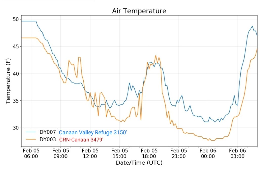
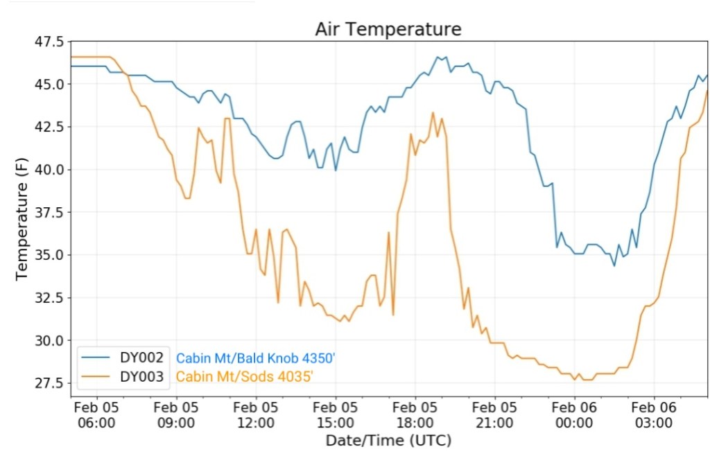
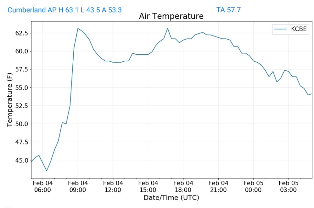
The roller coaster ride of temps continues ….
After a chill down yesterday for parts, not all of the area, we rebound today and fall again tomorrow.
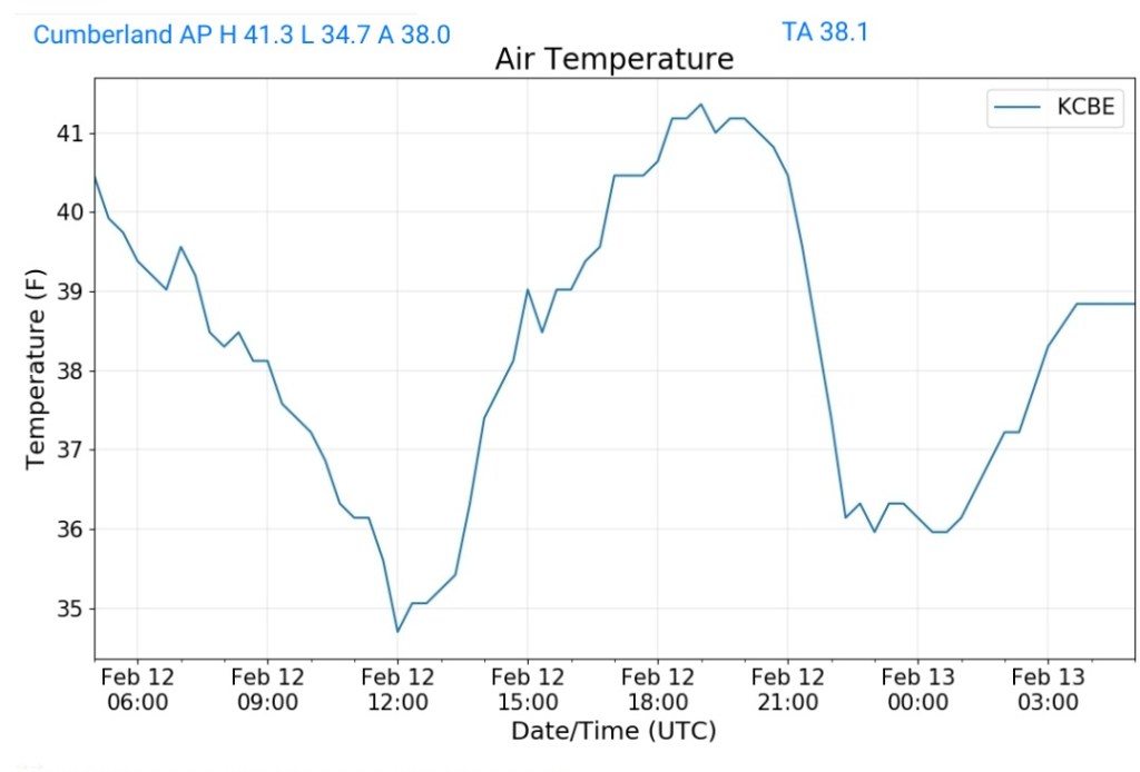
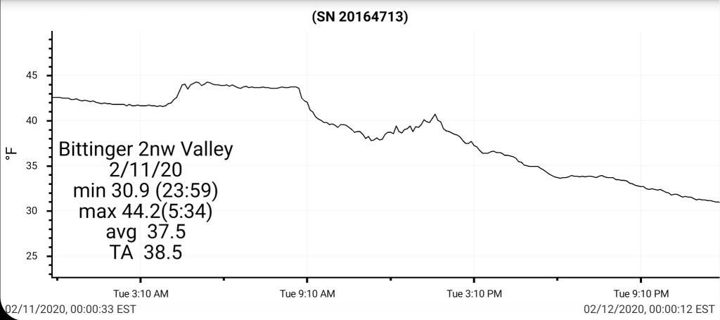
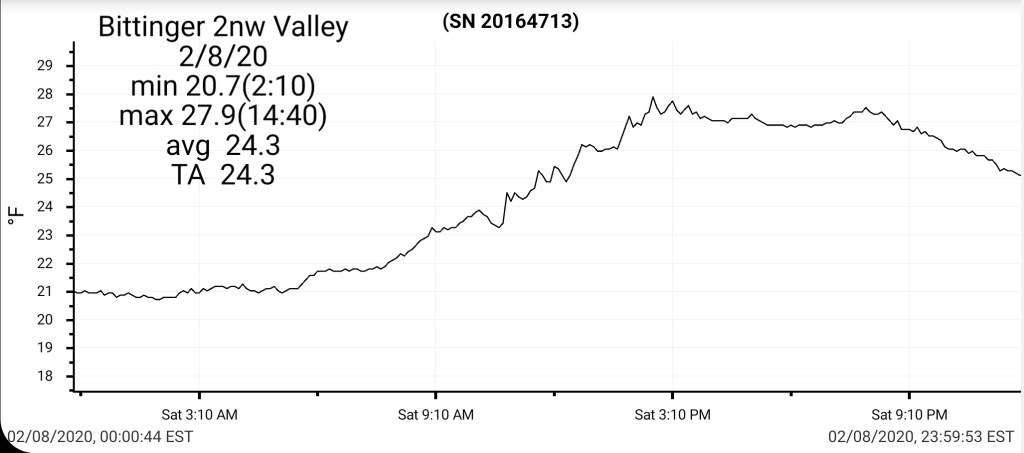
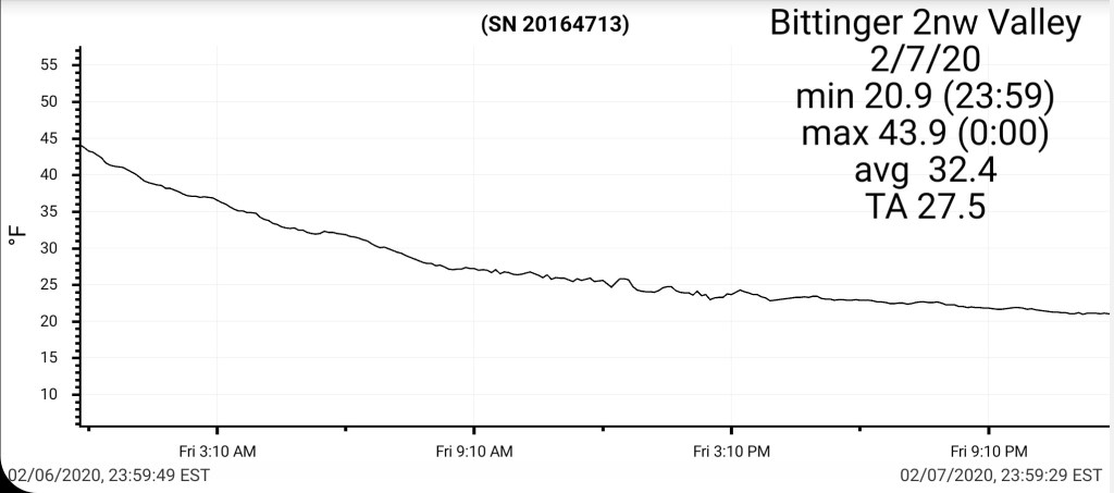
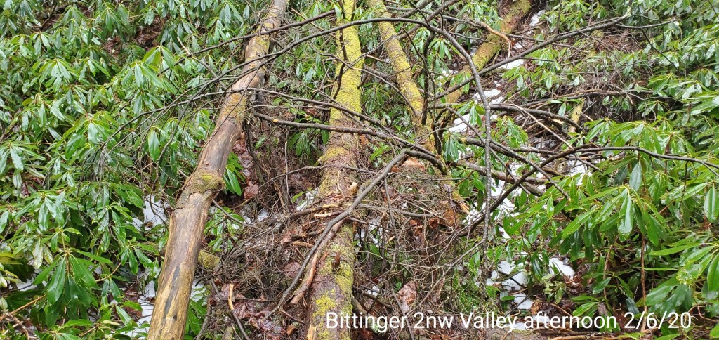
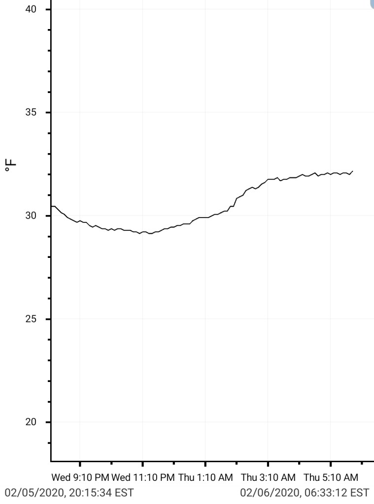
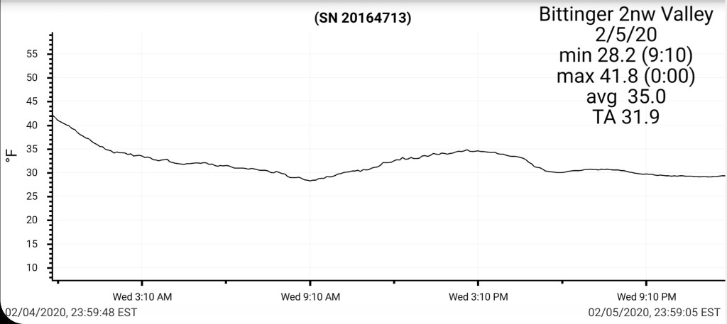
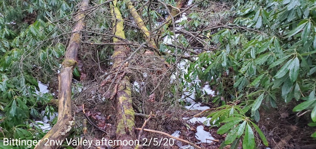
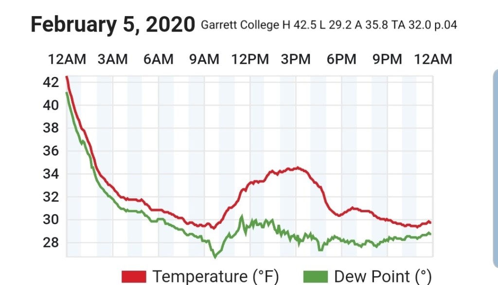
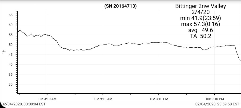
The ice event overnight underperformed mainly due to a lack of moisture. Temps did come into the expected range overnight. My temps near Bittinger were in range and there was trace ice , but not enough to cause any issues…
Temps rising today, holding steady the first part of the night and falling late
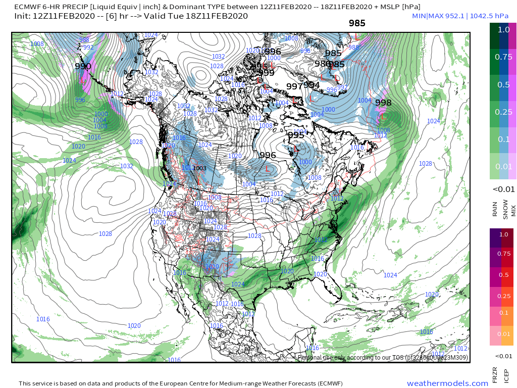
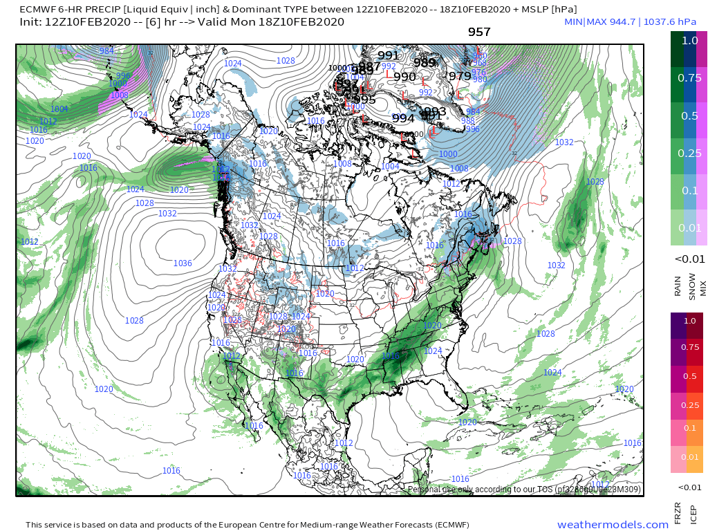
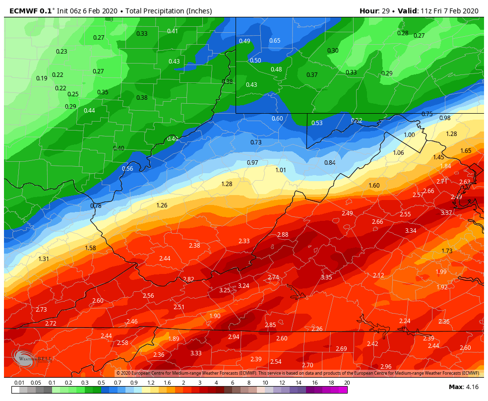
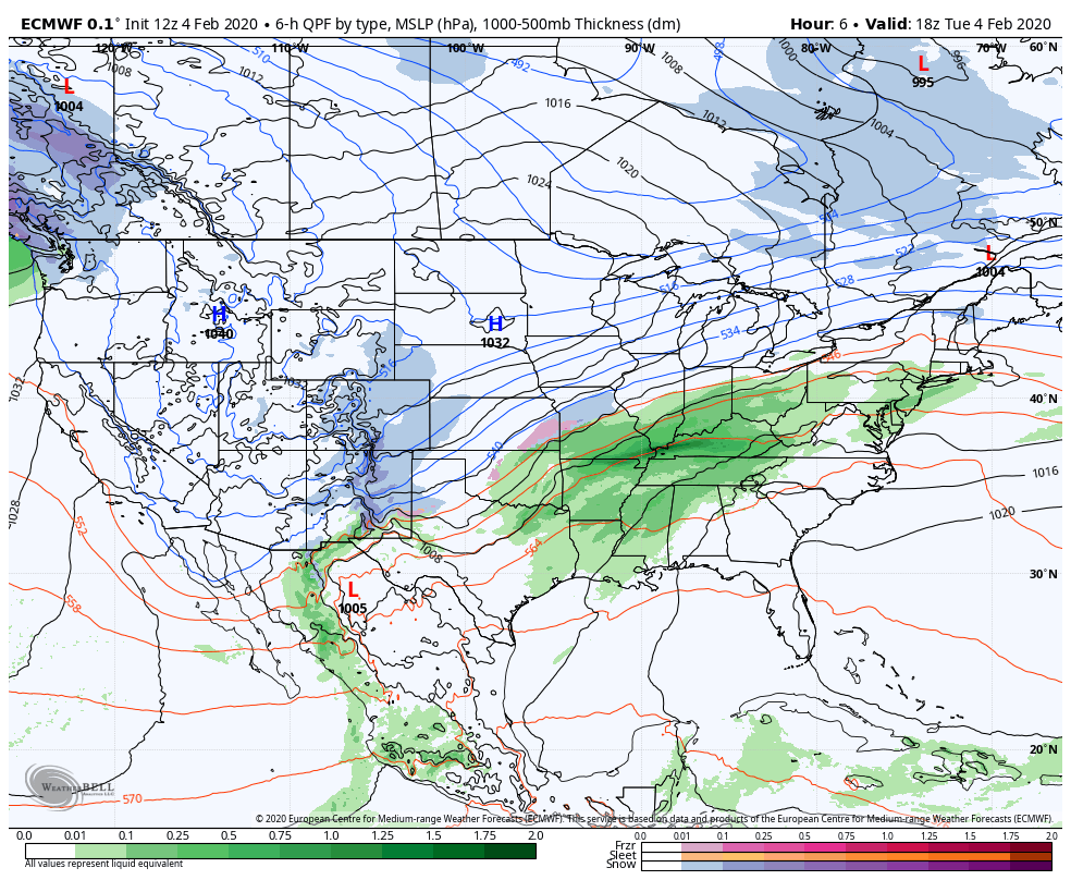
Rainfall this afternoon and overnight off the models
6z ECMWF and 6z GFS
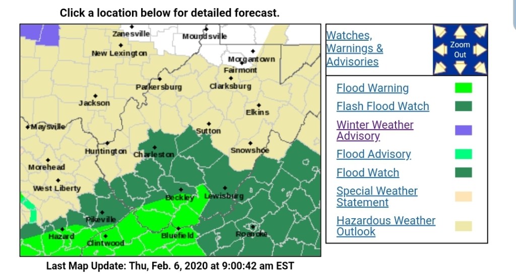
Not surprisingly the NWS has a Flood Watch in the expected heavy rain areas
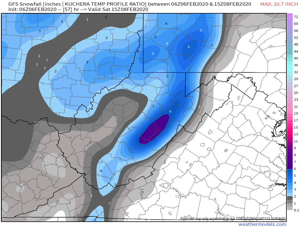
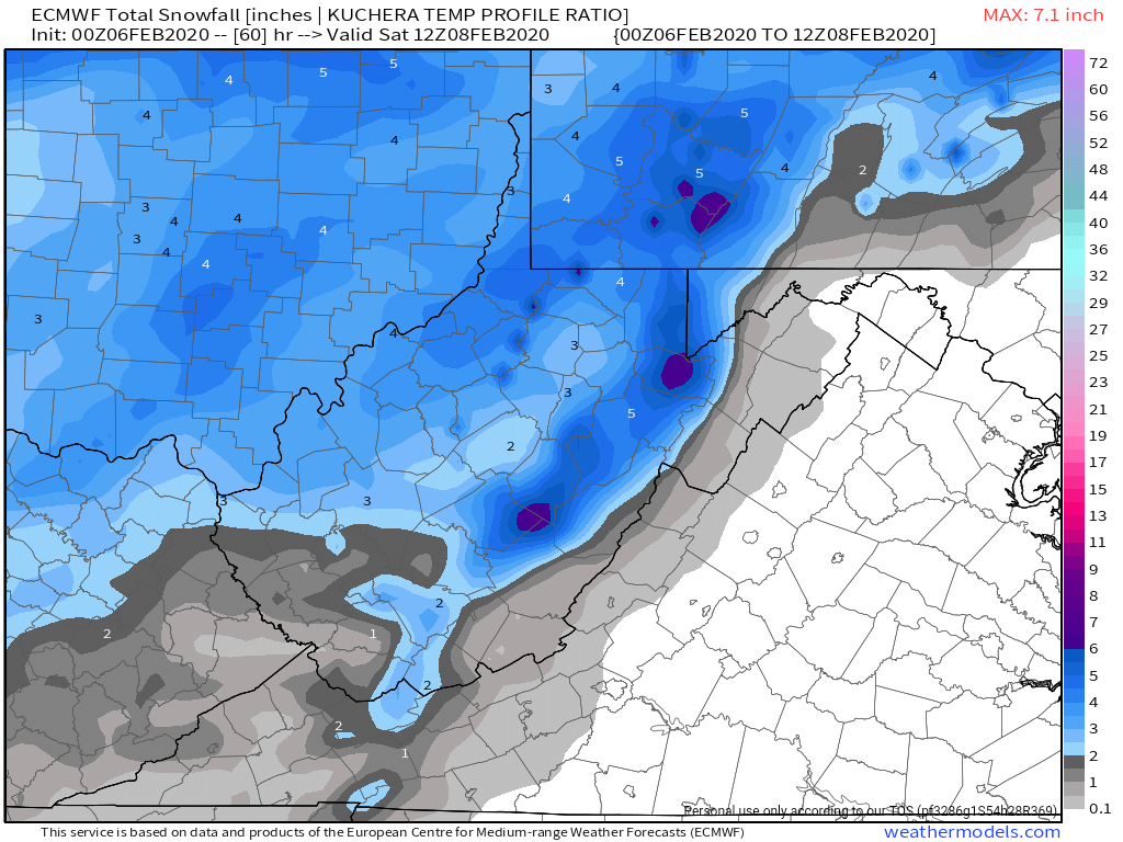
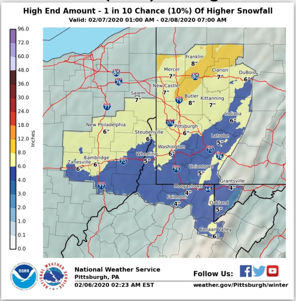
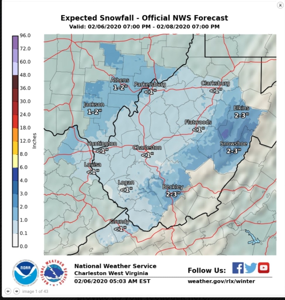
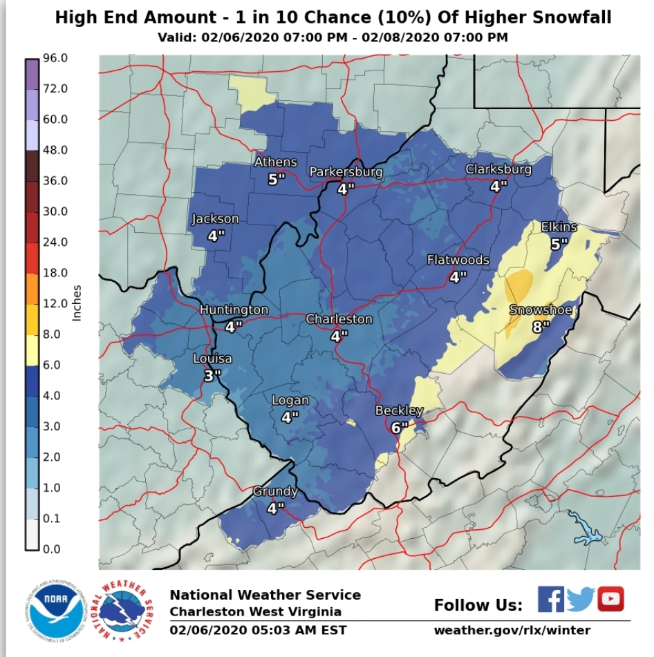
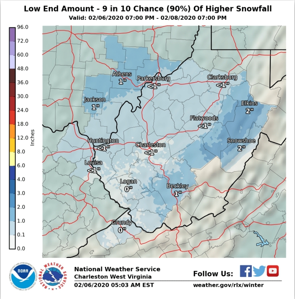
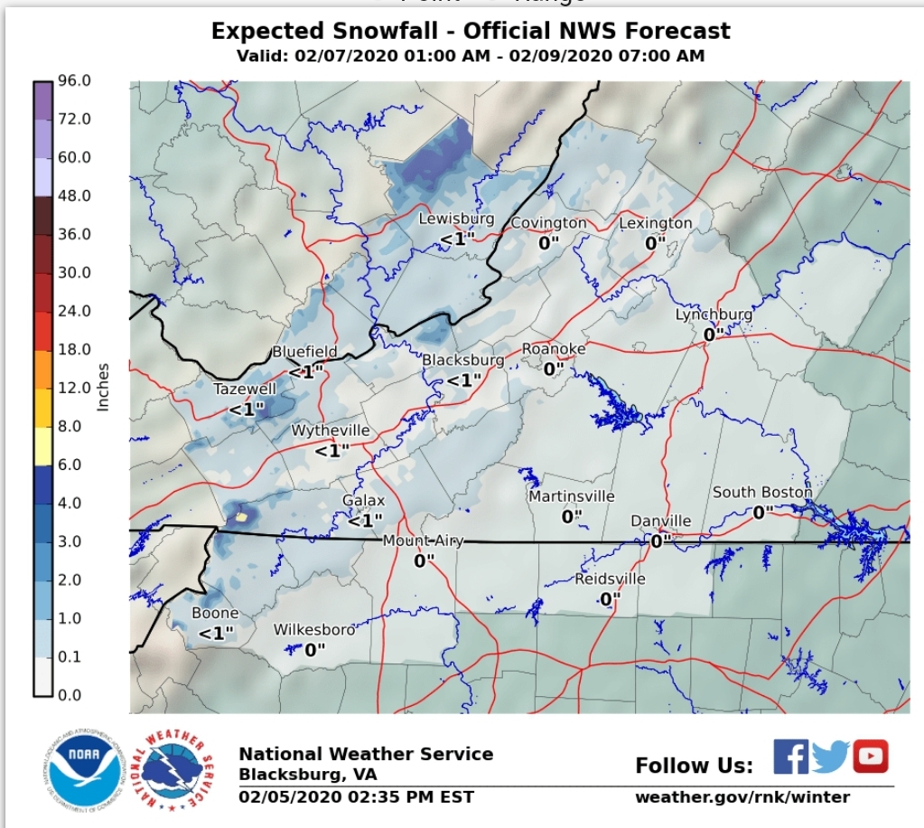
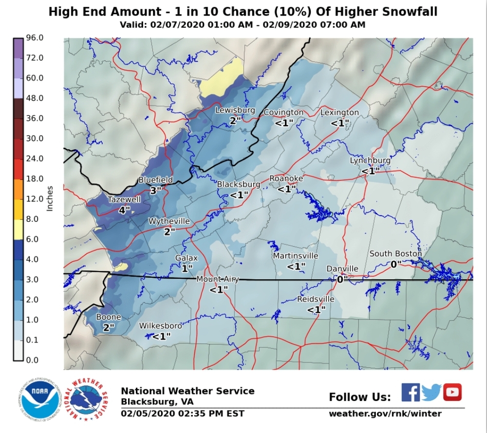
Towards tomorrow morning the wet turns to white. I think this has the potential to be a bit dramatic from 1 hour to the next early tomorrow morning as rain goes to snow and a quick thump of snow after changeover. By quick thump a rapid 1-3 inches over a couple hour period. That’s something that will need monitored today and again early tomorrow morning, but something to be aware of. Overall the snow activity runs into Friday night with even spotty activity until Saturday morning. The brunt of this round should be done prior to midnight.
Now I’ll run through models and NOAA products as well as my thoughts on part 1
6z GFS
6z ECMWF
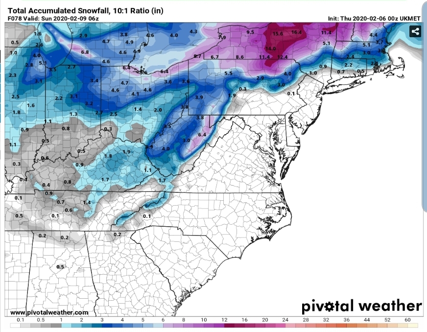
UKMET (10 to 1)
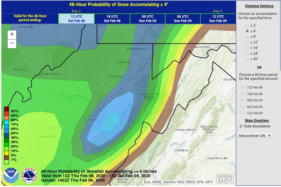
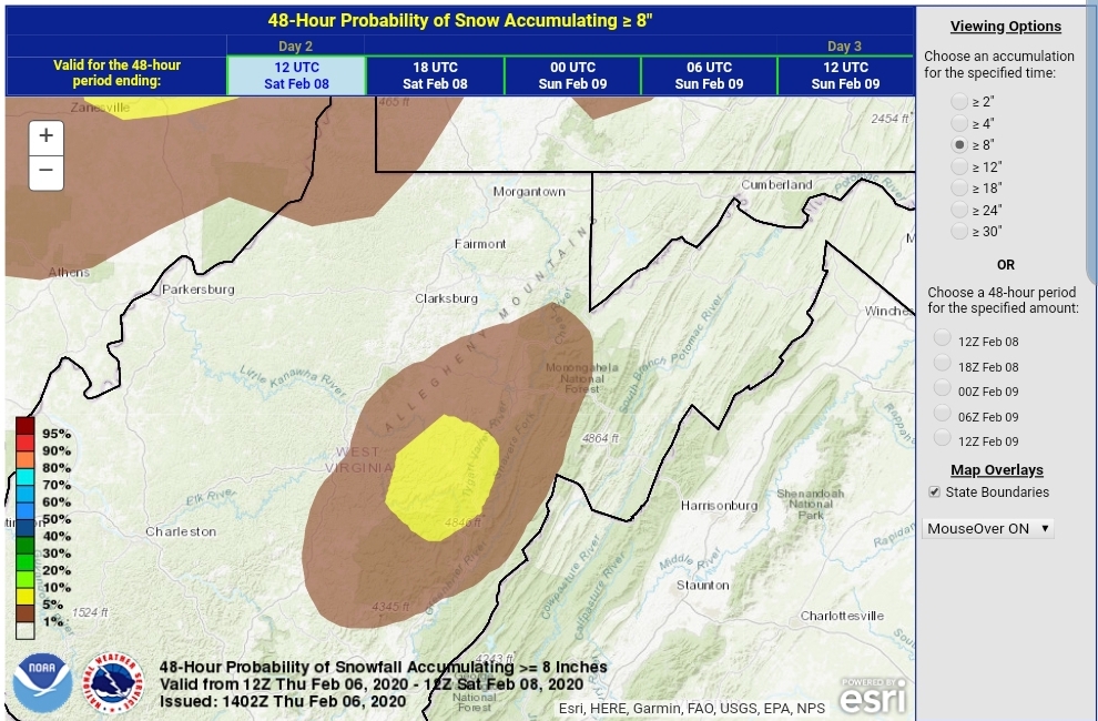
WPC- typically they do better with this and actually show the max over the high ground. This is like what a model physics error does and places the max west of the Mts like this is the Rockies here. It is not. Again a tool, not a high res look.
The NWS for part 1 through Saturday a.m … I see some odd things from Charleston on max potential. It looks like the elevation factor was less of an influence in their forecast than should be.
I’m not going to bother with the State College products as they are only going out until tomorrow 1pm with the graphics above.
My thoughts on some select areas for part 1…
7Springs 3-6″
Somerset 1-3″
Mt.Davis 3-6″
Grantsville 1-3″
Bittinger 2-5″
Oakland 2-4″
Cranesville 3-6″
Terra Alta 3-6″ (Any interested weather gurus here? A snow observer needed in this area)
Coopers Rock 2-4″
Davis 4-7″
Canaan Heights 4-7″
Canaan Valley 3-6″
Parson 1-3″
Whitmer 2-4″
Onego 1-2″
Elkins 2-4″
Snowshoe 4-7″
Highland Scenic Highway 4-7″
Marlinton 1-3″
Again watch for changeover early tomorrow morning. A quick thump could disrupt schools in the morning.
Now Saturday night with another disturbance. That overall looks like a widespread 1-3″ type event. Tweaks may be needed.
Surface features and 500mb height anomalies and flow
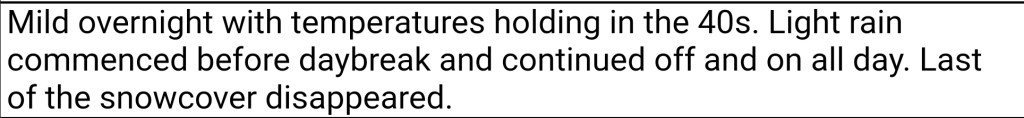
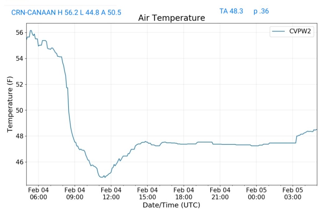
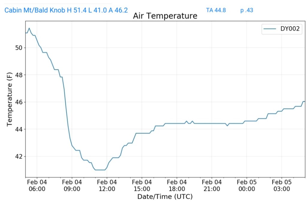
February 4, 2020
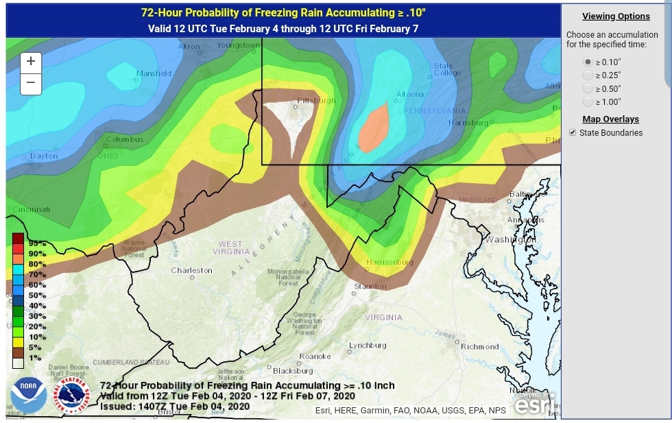
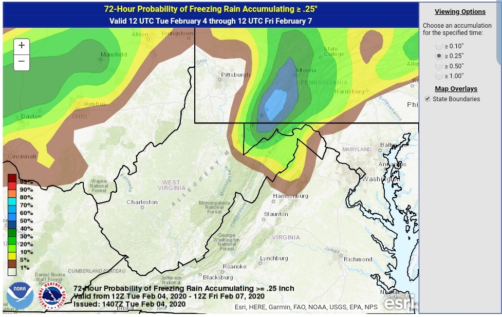
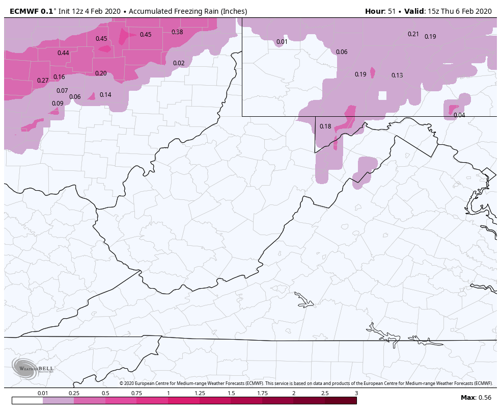
As we go through the overnight and into tomorrow, colder air works in from the north. This continues into the overnight Wednesday. Later in the day Wednesday into the very early hours of Thursday, parts of the area look to be in the freezing rain scenario. It’s those same typical locations that should see the longest duration of freezing rain. The duration being from later tomorrow into Thursday a.m. It would not he surprising, but more likely will be expected to see some winter weather advisories issued by the NWS for later Wednesday through 7am Thursday for Garrett and points east, northeast.
Ice amounts to me look limited in most areas. From the Bittinger area and east from Meadows Mt to Savage Mt and to Dan’s Mt, south to Mt Storm, north into Somerset County , looks like the greatest risk to pick up potentially .1 to .3 ice. Due to marginal temps, and overall a short duration of the event, anything potentially higher than .3 would be on the exposed east facing ridges in this area as east winds look to be gusting at this time and that aids in freezing on contact much faster with temps 28-32 than areas not impacted by the wind.
Road issues will likely be minimal, but as always with ice, it may look wet and in reality, its ice. Use caution.
WPC OUTLOOK
12z Euro
(Probably a touch more widespread than this)
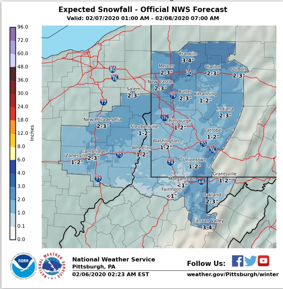
PITT/STATE COLLEGE/STERLING NWS
Overall that looks good, below 2500, maybe a touch high.
The duration is brief, its rapidly out Thursday morning. Like clockwork the east wind dies, a moment of calm weather creeps in, for a hour temps slowly rise into the mid 30s early Thursday then with a snap, SW winds blow in rapidly seeing temps fly into the 50s and the ice will quickly become a memory.
Just as fast as the warmth comes back in, rain will encroach and temps will begin falling overnight Thursday and by Friday morning accumulating snow returns. As we go through the day Friday, looks like light to moderate accumulation of 2-4″ may be likely. That will be accompanied by strong gusty winds, 20-40mph with blowing snow and temps falling into the 20s, with teens by late afternoon across the Wv high ground.
After that a lull Saturday with more accumulation potential Saturday night.