January 24, 2020
Jan 24(Fri)
Cloudy, precip breaking out mid morning. Temps fell to and below freezing and that produced a few hours of freezing rain. Spotty freezing areas through the afternoon. Rain picked up after nightfall. Appears a few Wv high areas had some snow occur.
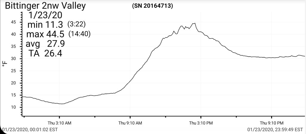
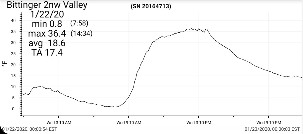
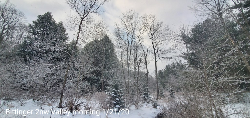
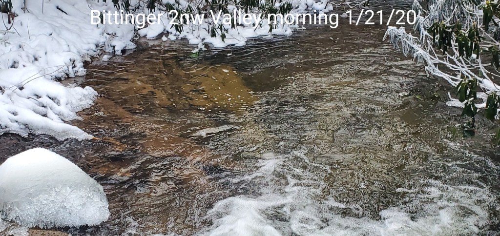
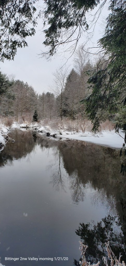
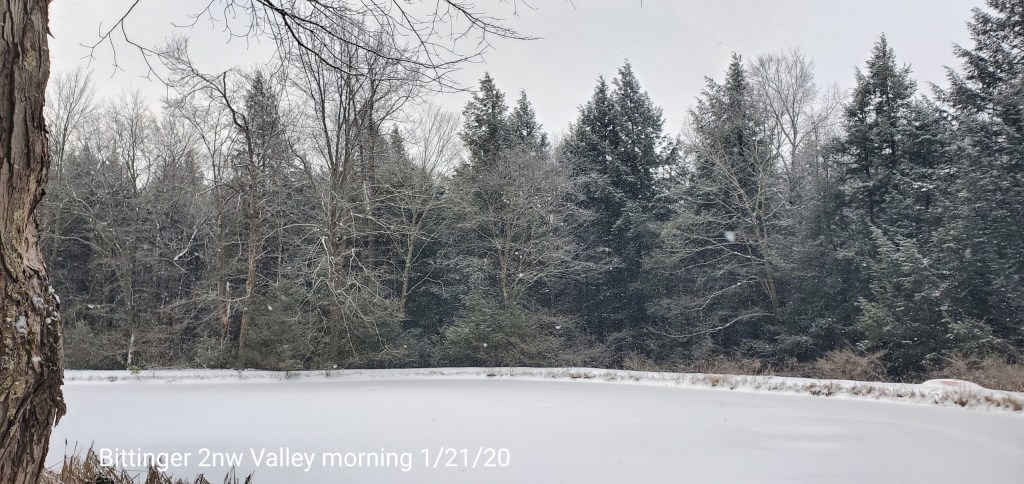
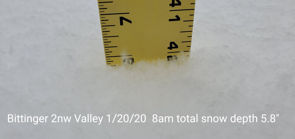
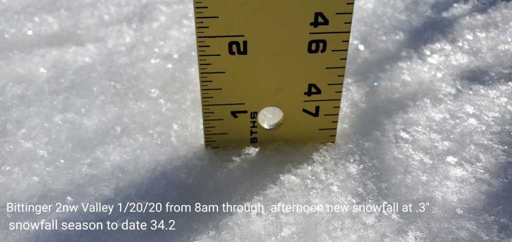
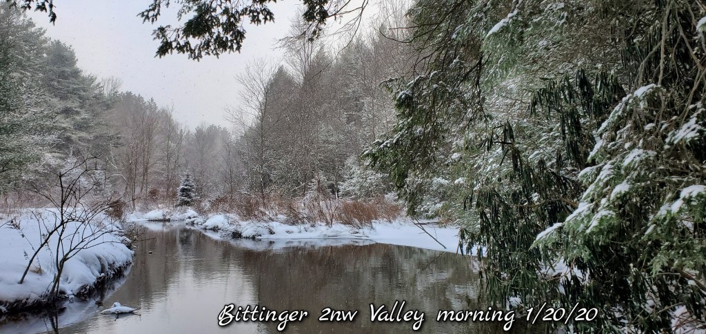
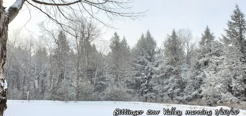
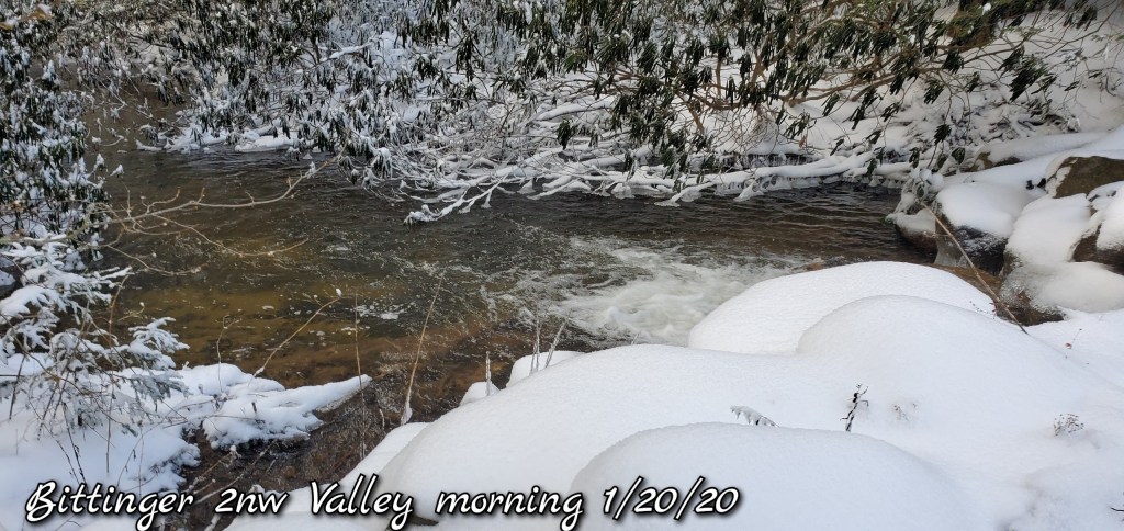
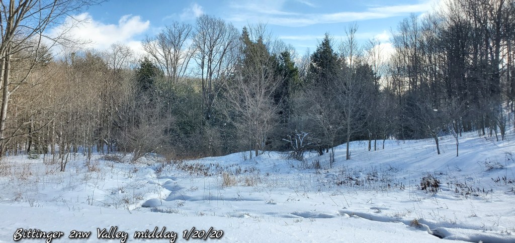
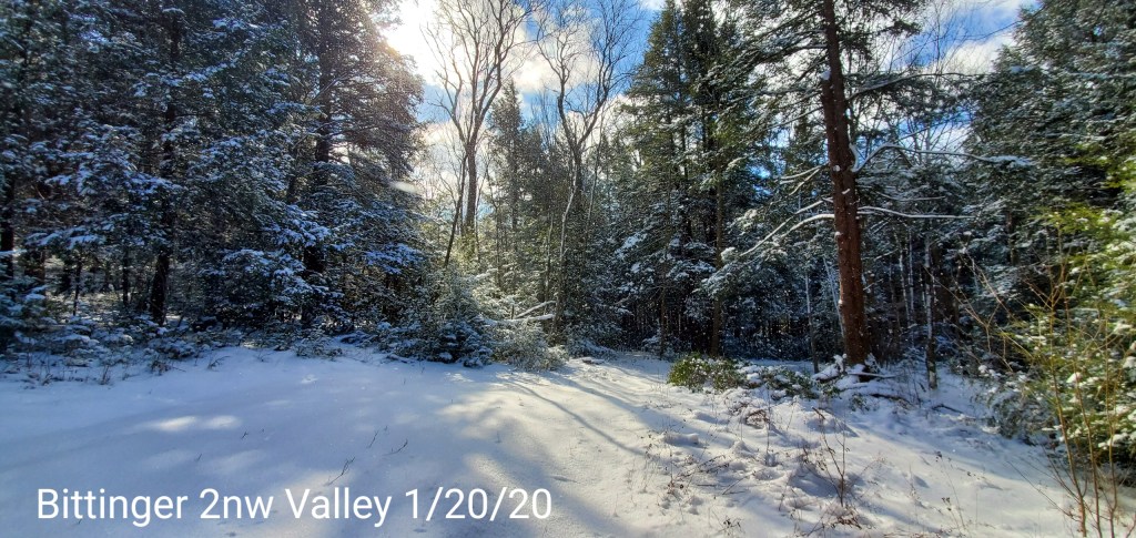
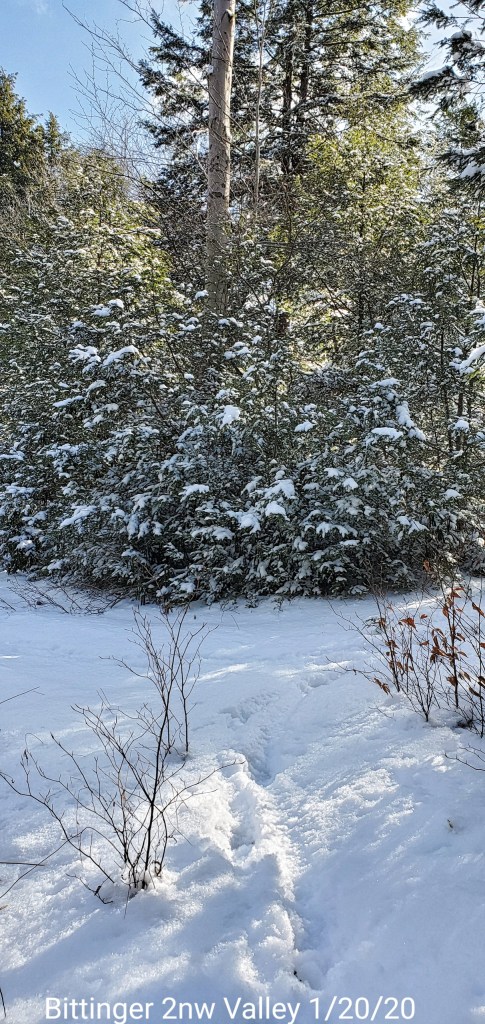
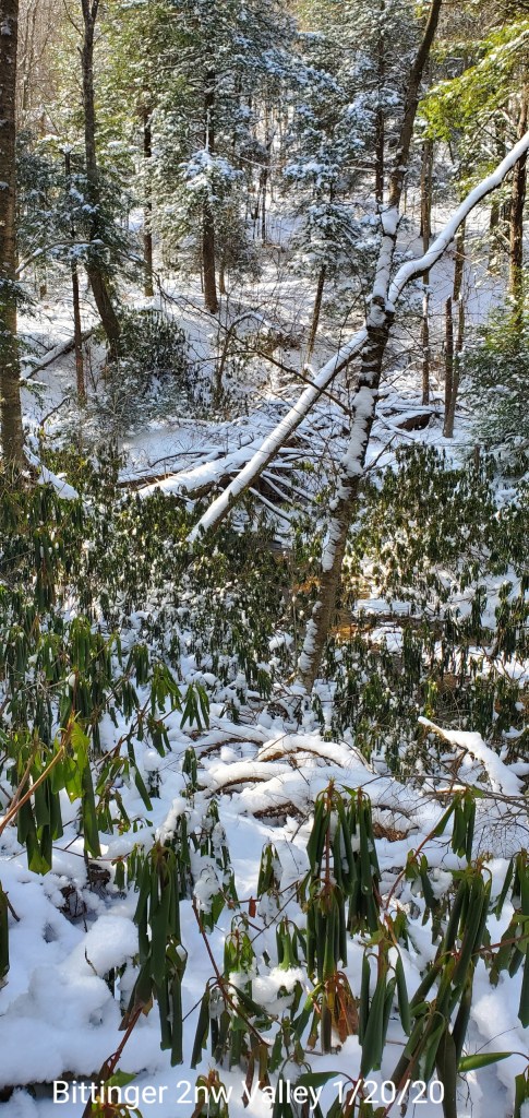
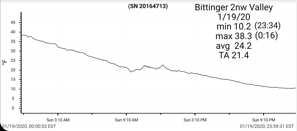
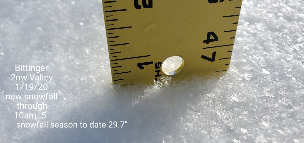
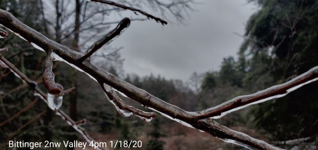
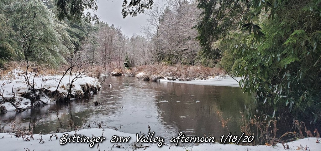
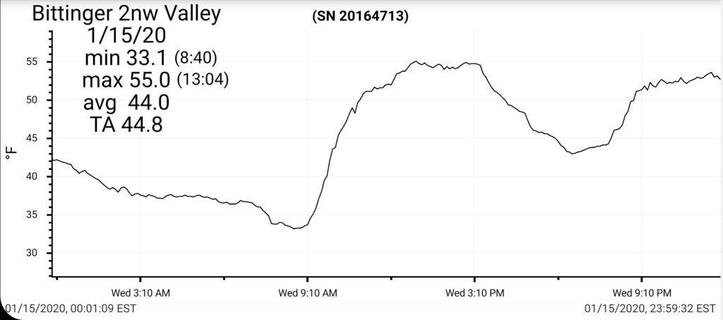
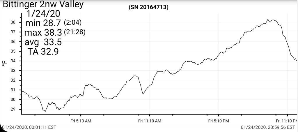
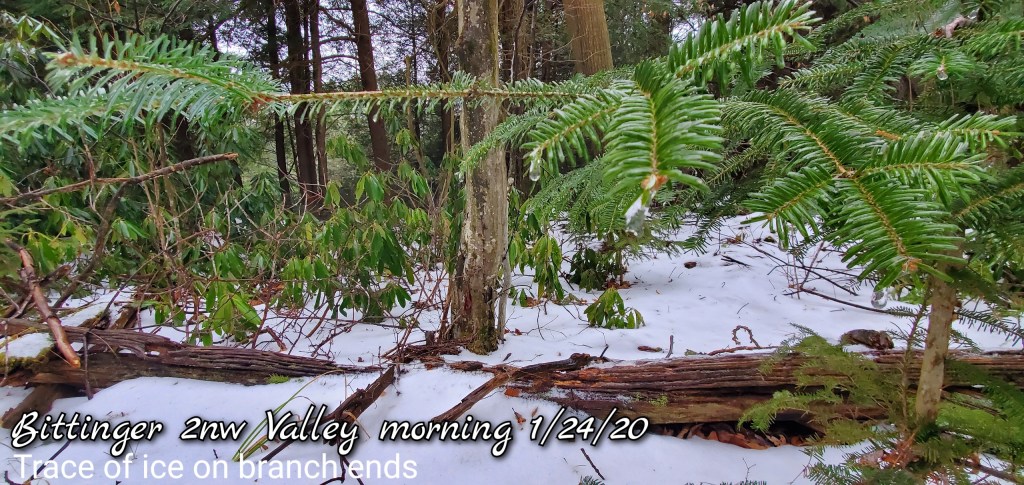
Bittinger 2nw Valley
MIN[28.7]—MAX[38.3]—AVERAGE MEAN[33.5]—TRUE AVERAGE[32.9]
Snowfall season to date 34.7″
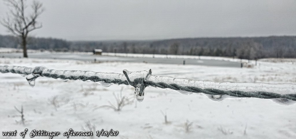
Trace of ice this morning. Water droplets on branch ends were forming ice.
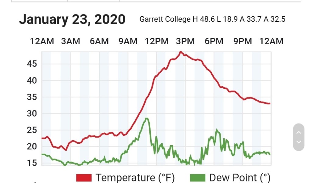
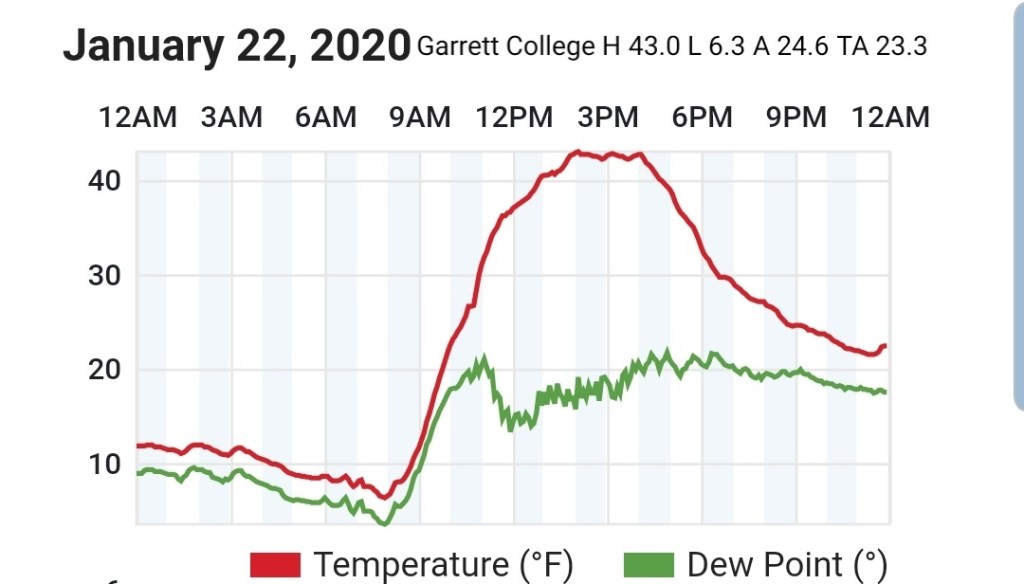
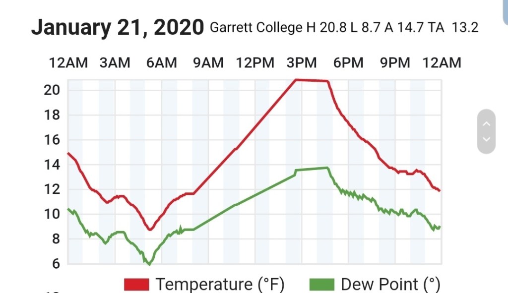
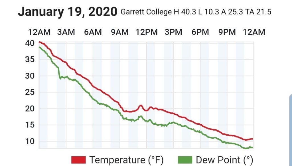
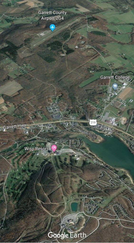
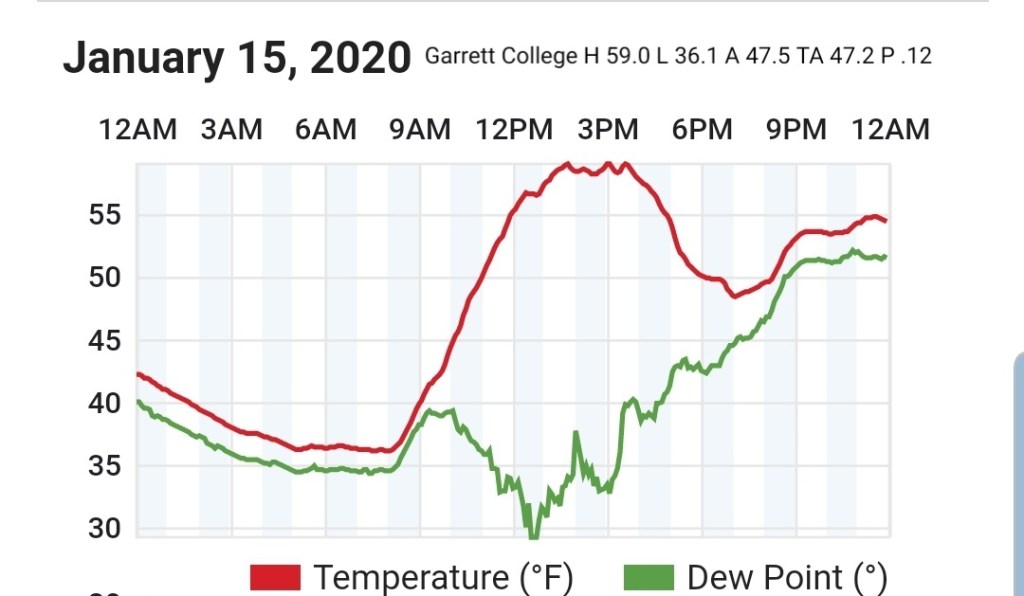
Garrett College
MIN[31.4]—MAX[37.8]—AVERAGE MEAN[34.6]—TRUE AVERAGE[34.0]—PRECIP[.54]

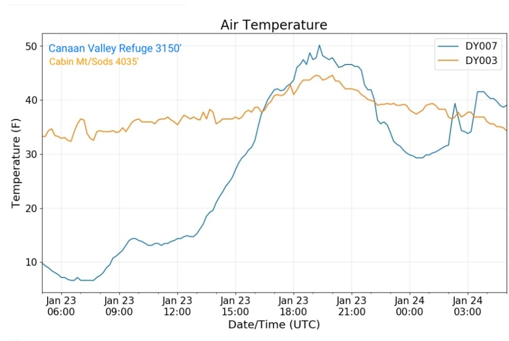
Canaan Heights/Davis 3SE
MIN[35.0]—MAX[40.0]—AVERAGE MEAN[37.5]—PRECIP[0]7am
Snowfall season to date 46.2″
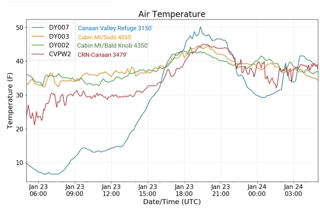
Climate Reference Network Canaan
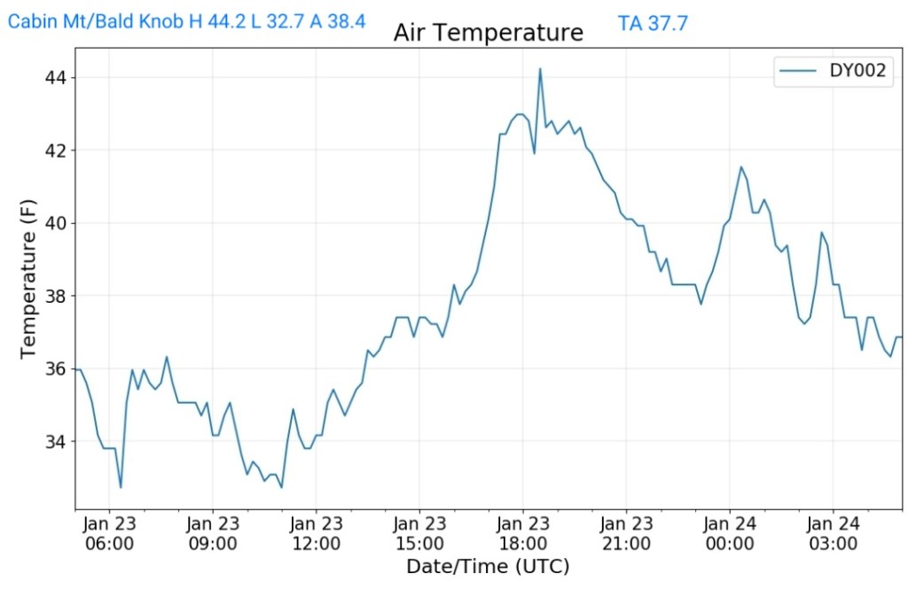
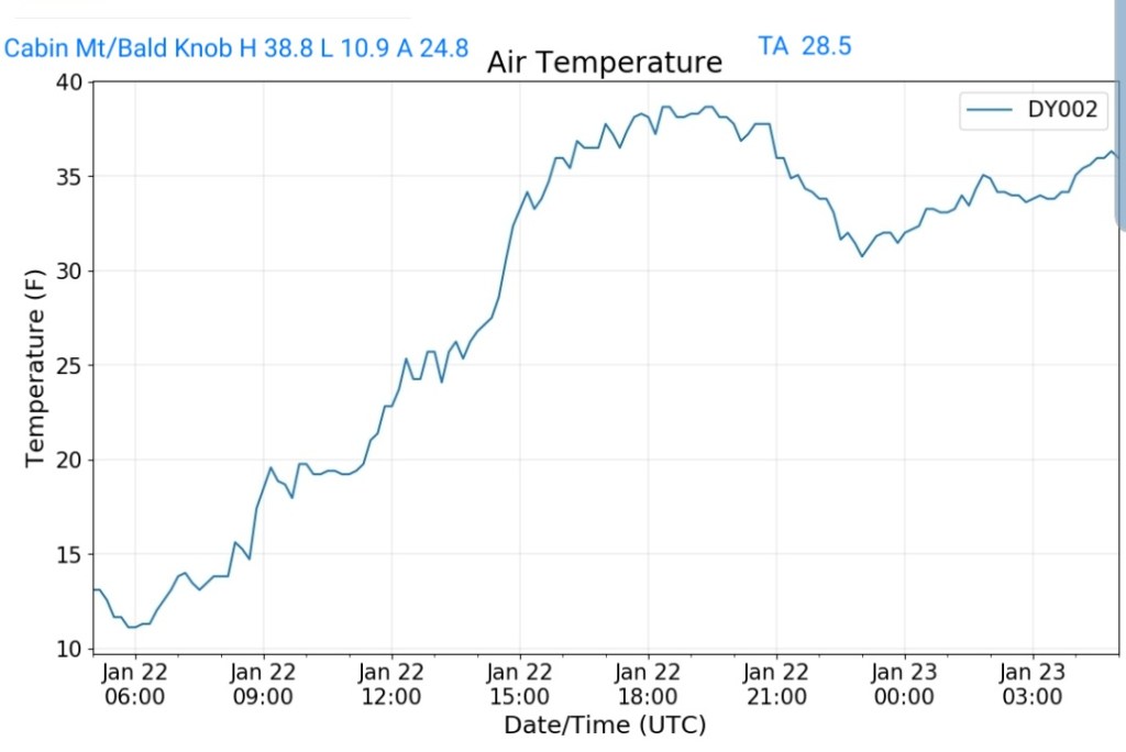
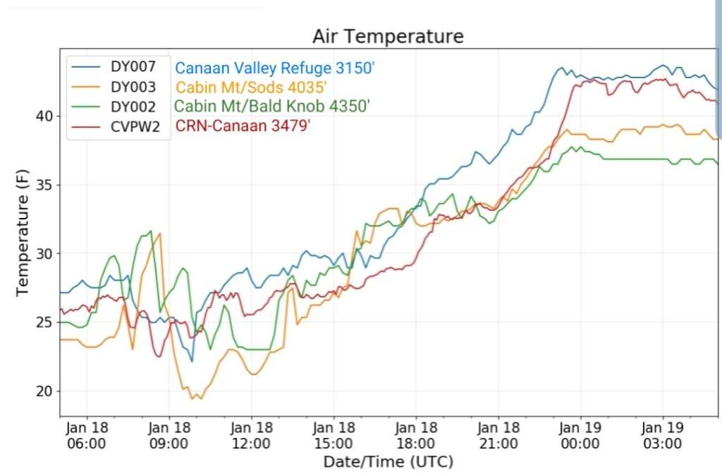
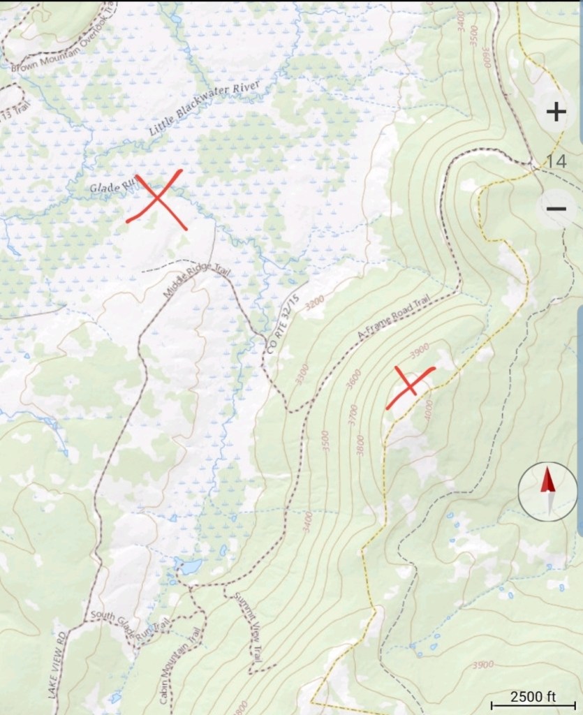
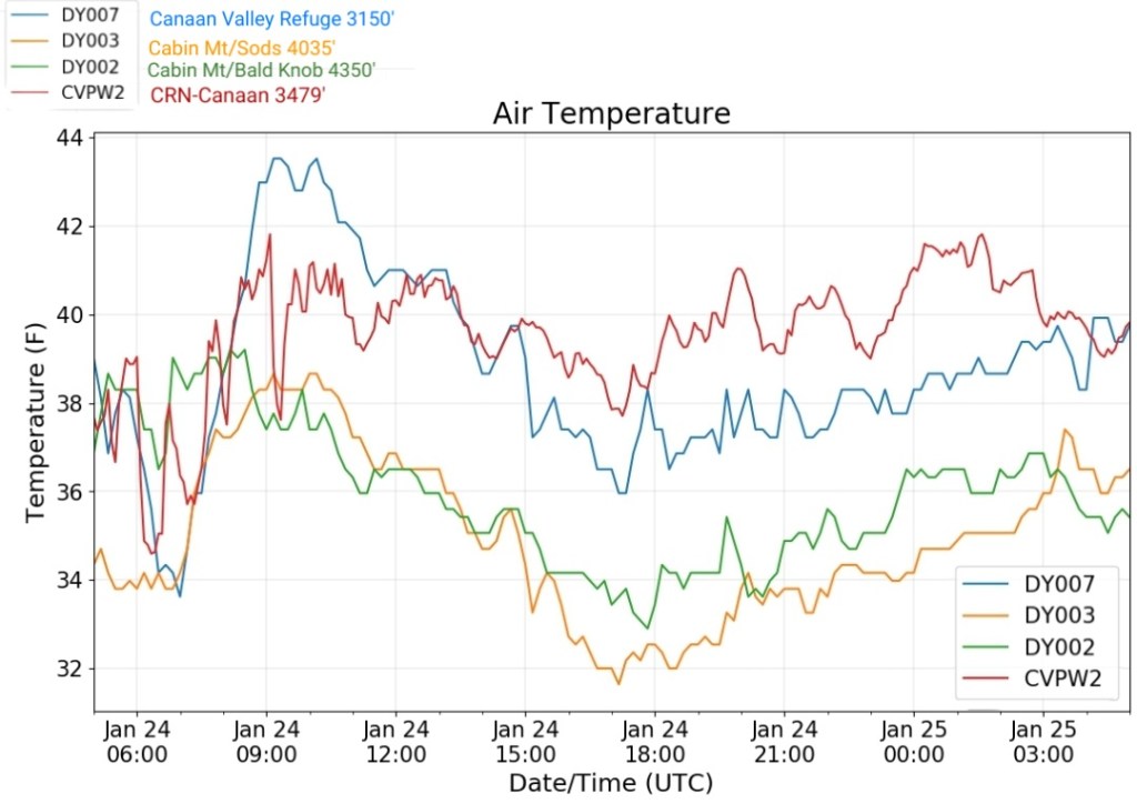
Cabin Mt at Bald Knob
MIN[32.9]—MAX[39.2]—AVERAGE MEAN[36.0]—TRUE AVERAGE[36.0—PRECIP[1.03]

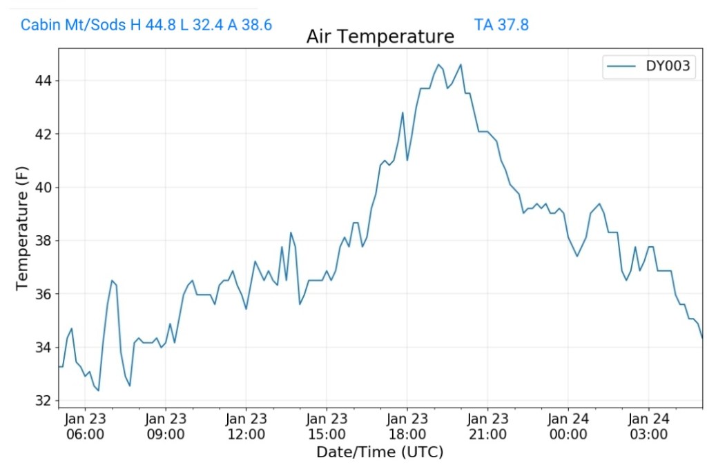
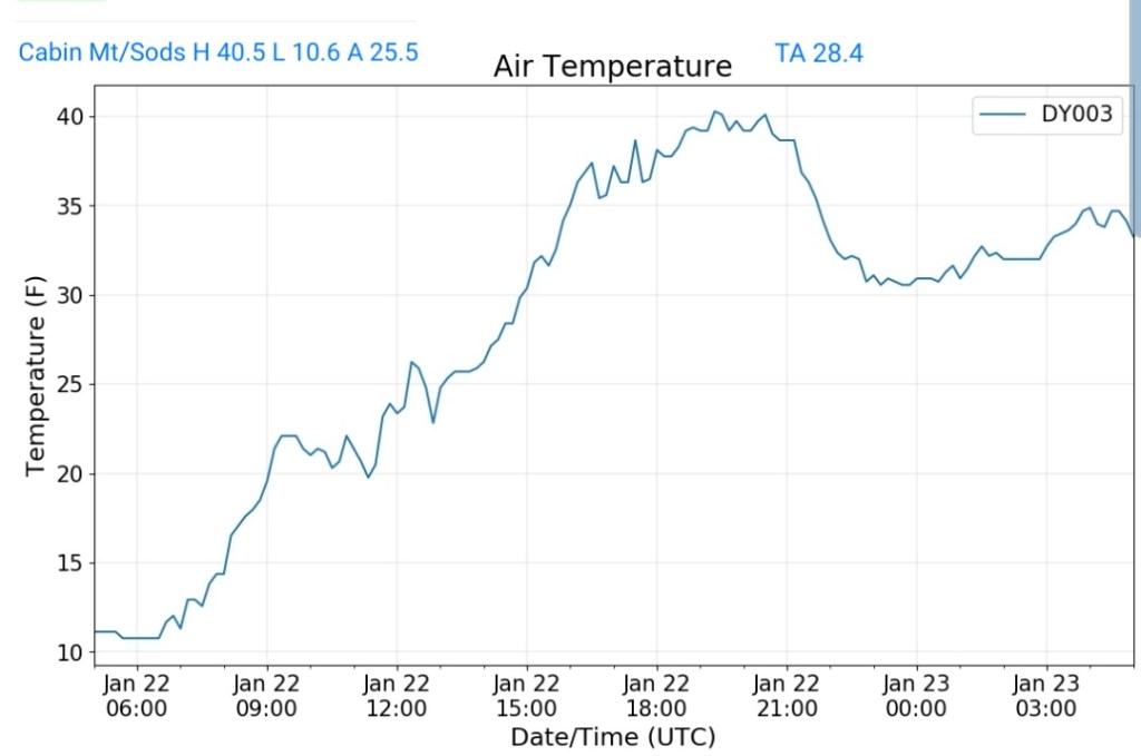
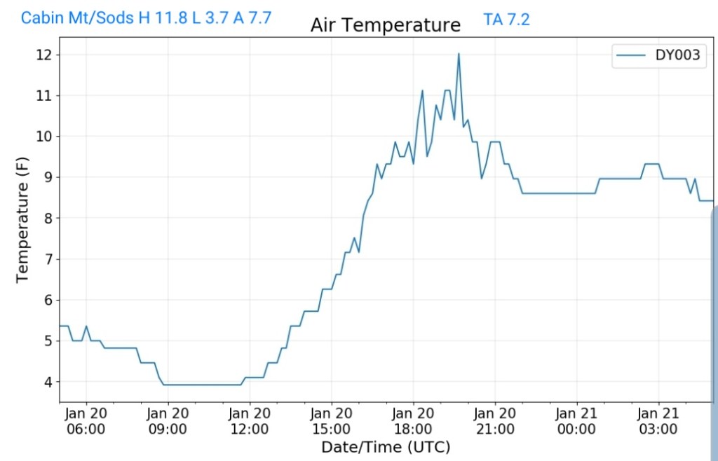
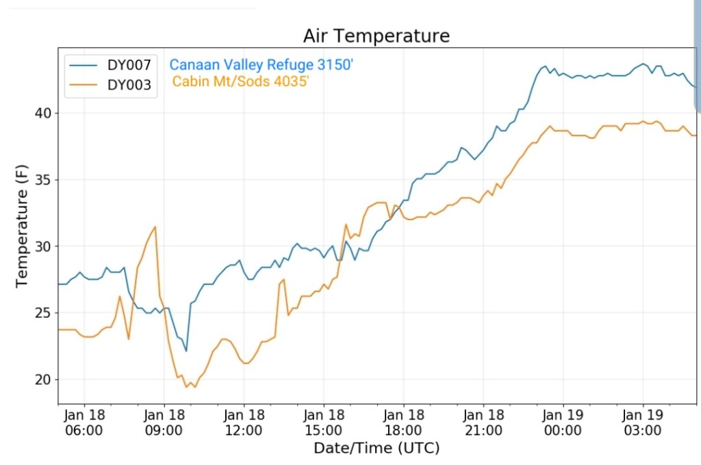
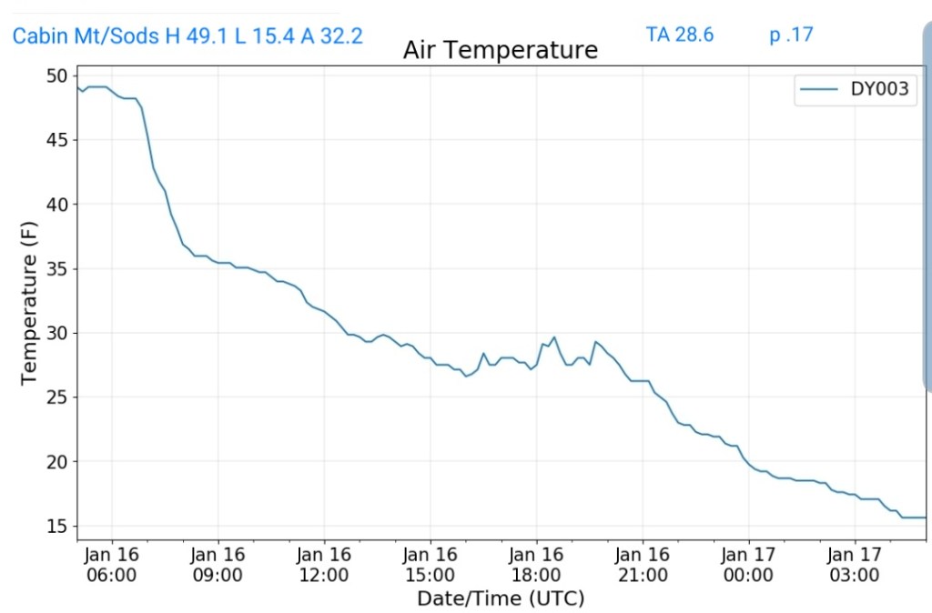
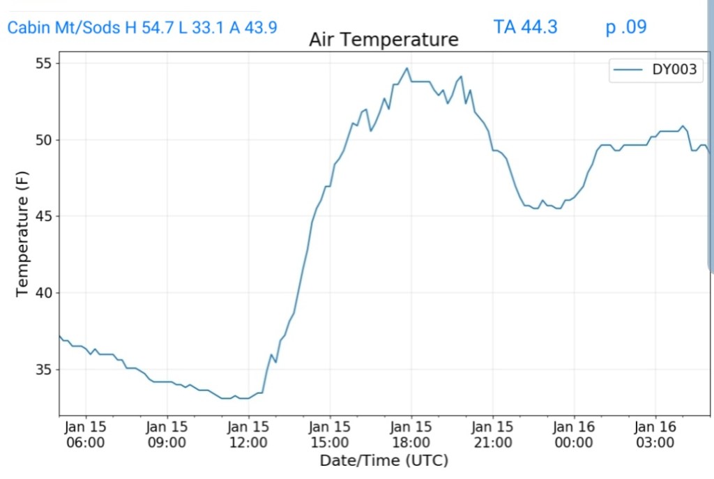
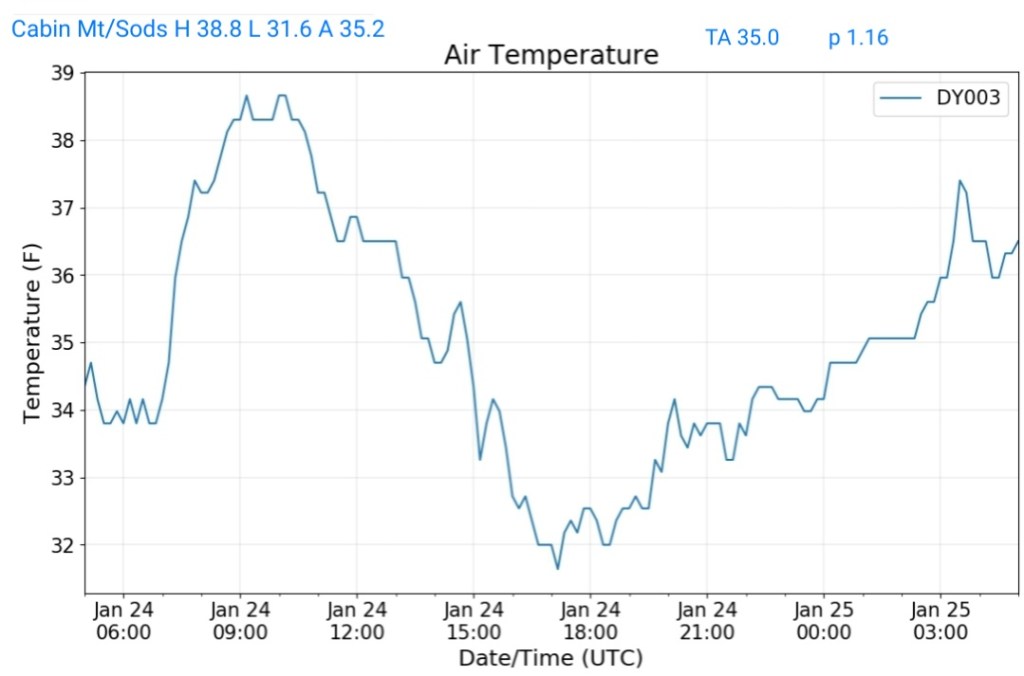
Cabin Mt-Western Sods
MIN[31.6]—MAX[38.8]—AVERAGE MEAN[35.2]—TRUE AVERAGE[35.0]—PRECIP[1.16]
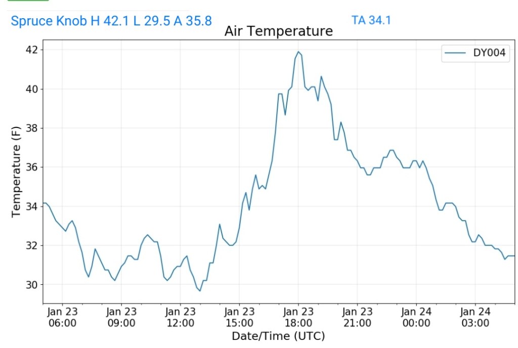
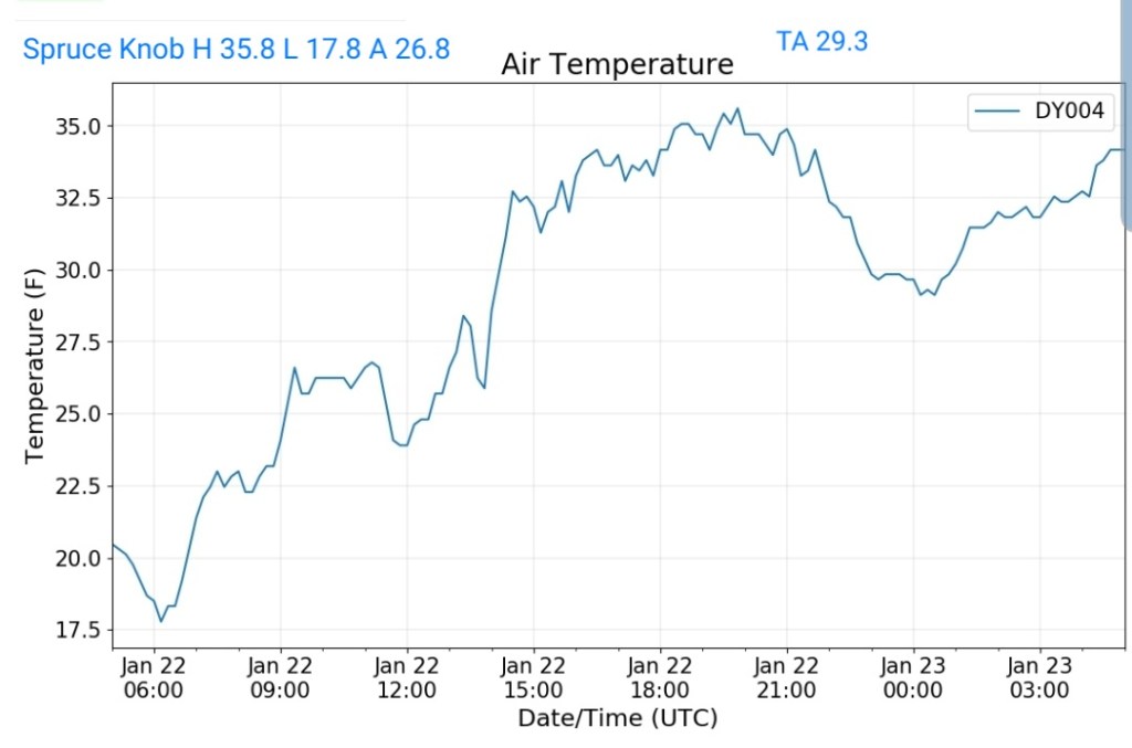
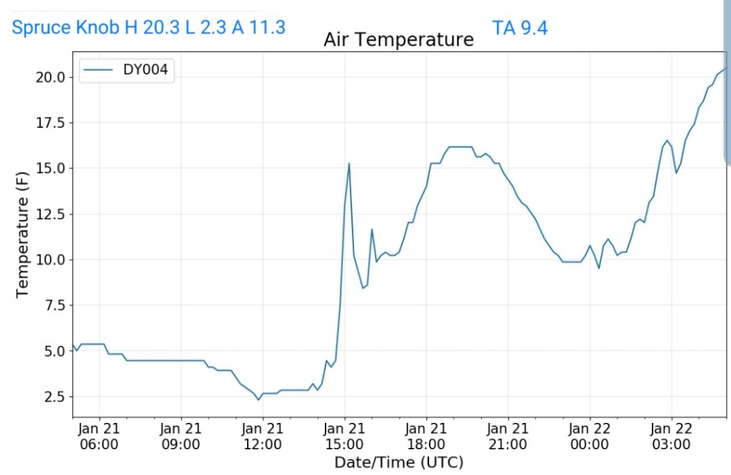
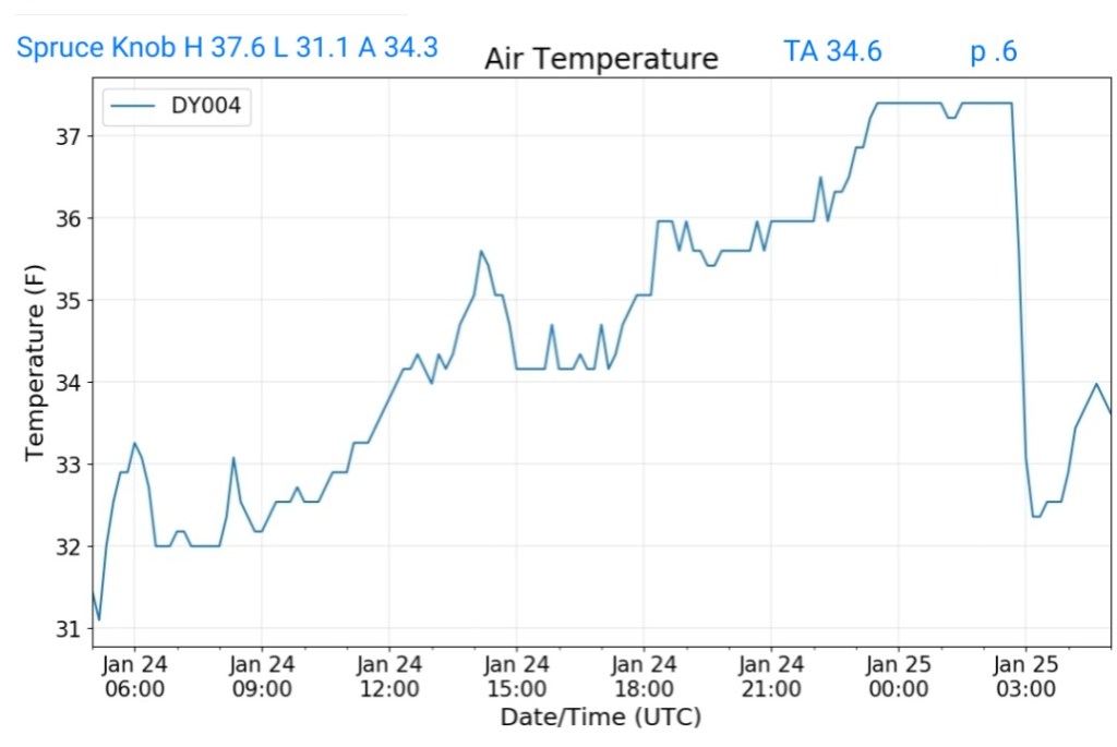
Spruce Knob
MIN[31.1]—MAX[37.6]—AVERAGE MEAN[34.3]—TRUE AVERAGE[34.6]—PRECIP[.6]
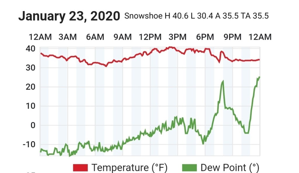
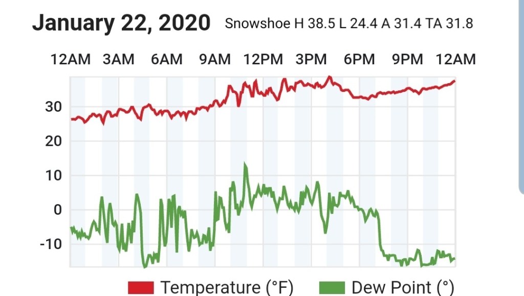
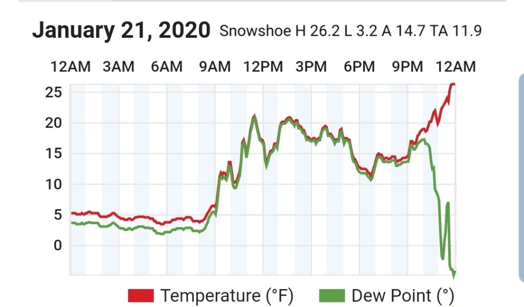
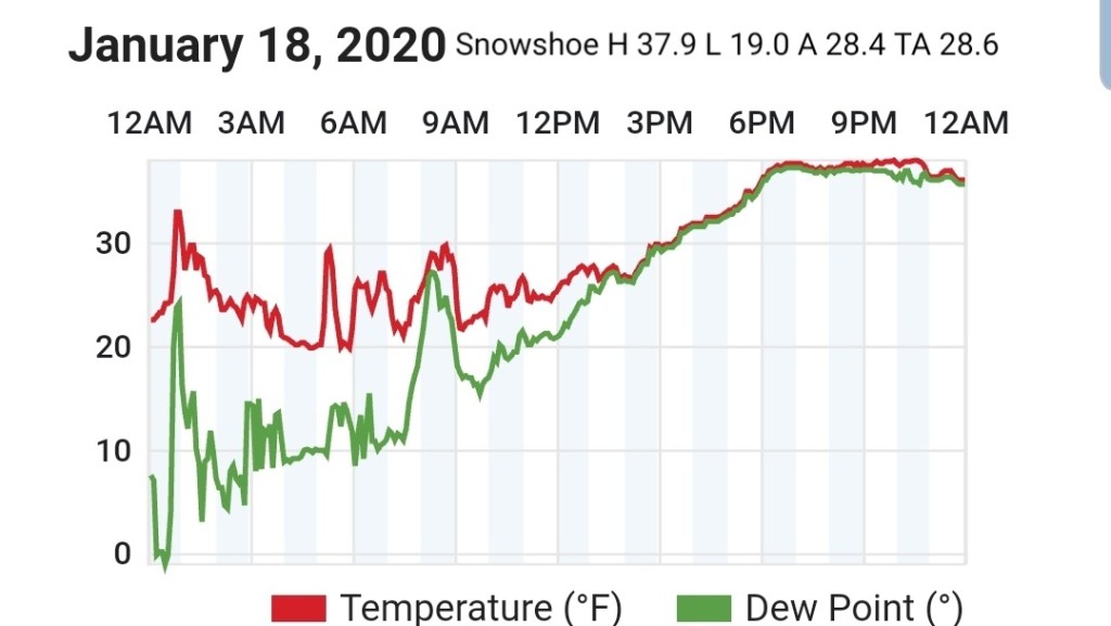
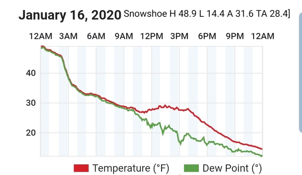
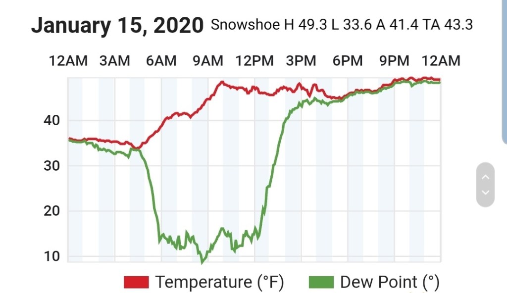
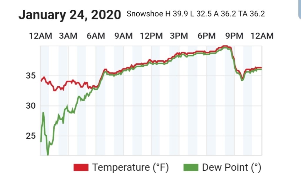
Snowshoe
MIN[32.5]—MAX[39.9]—AVERAGE MEAN[36.2]—TRUE AVERAGE[36.2]
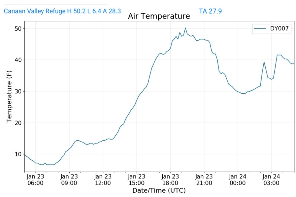
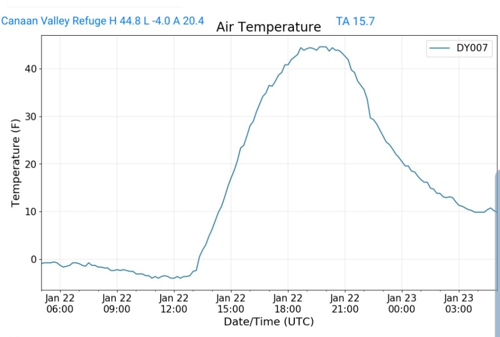
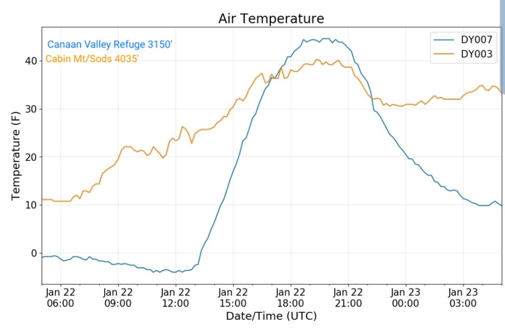
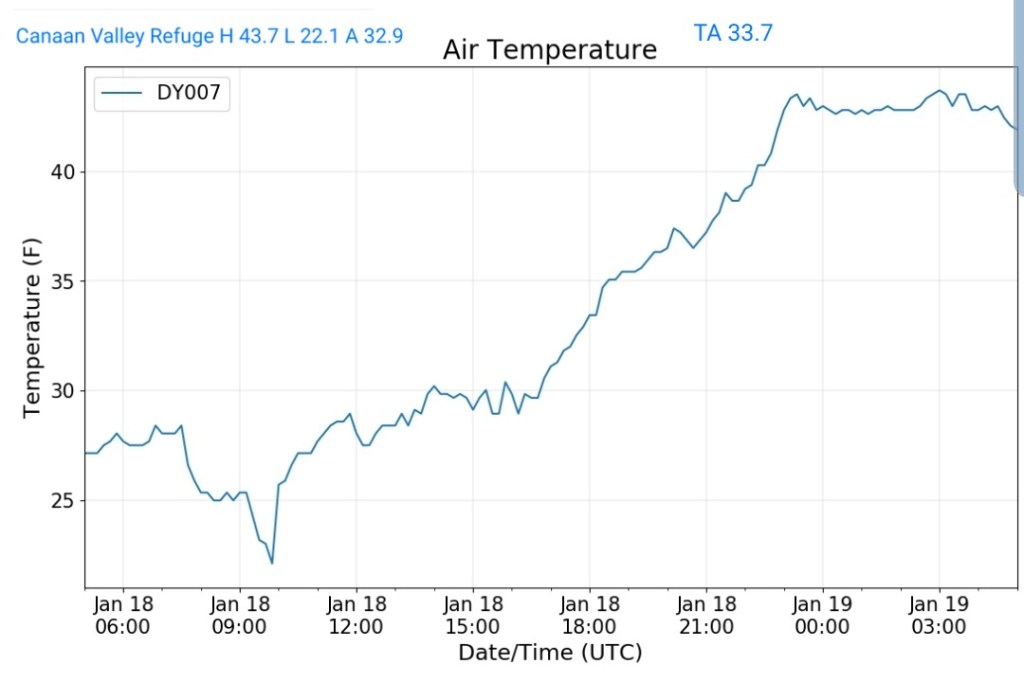
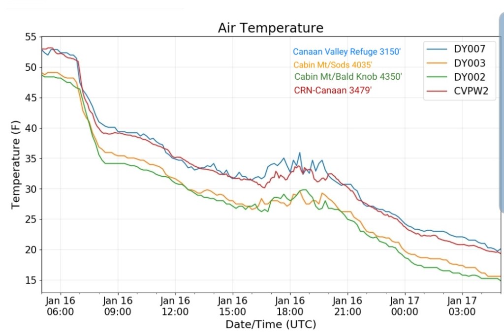
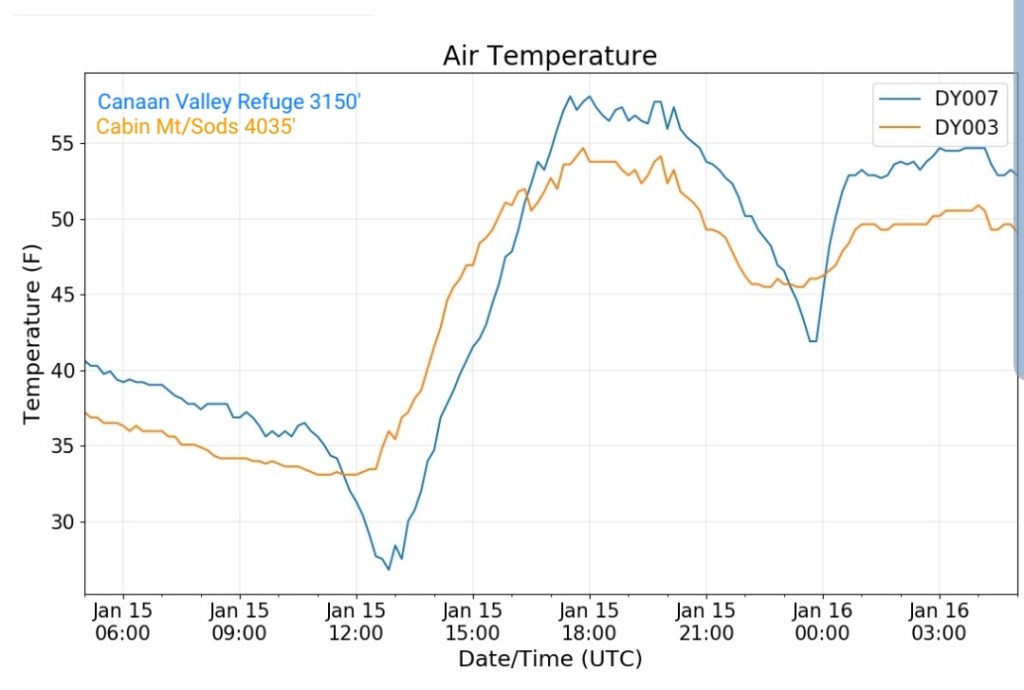
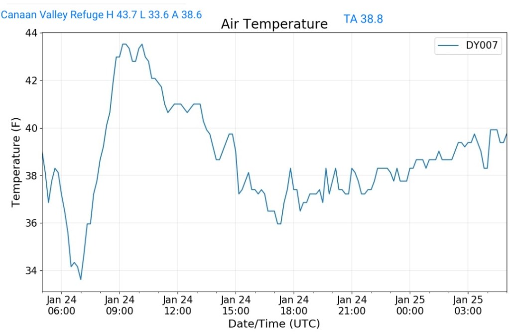
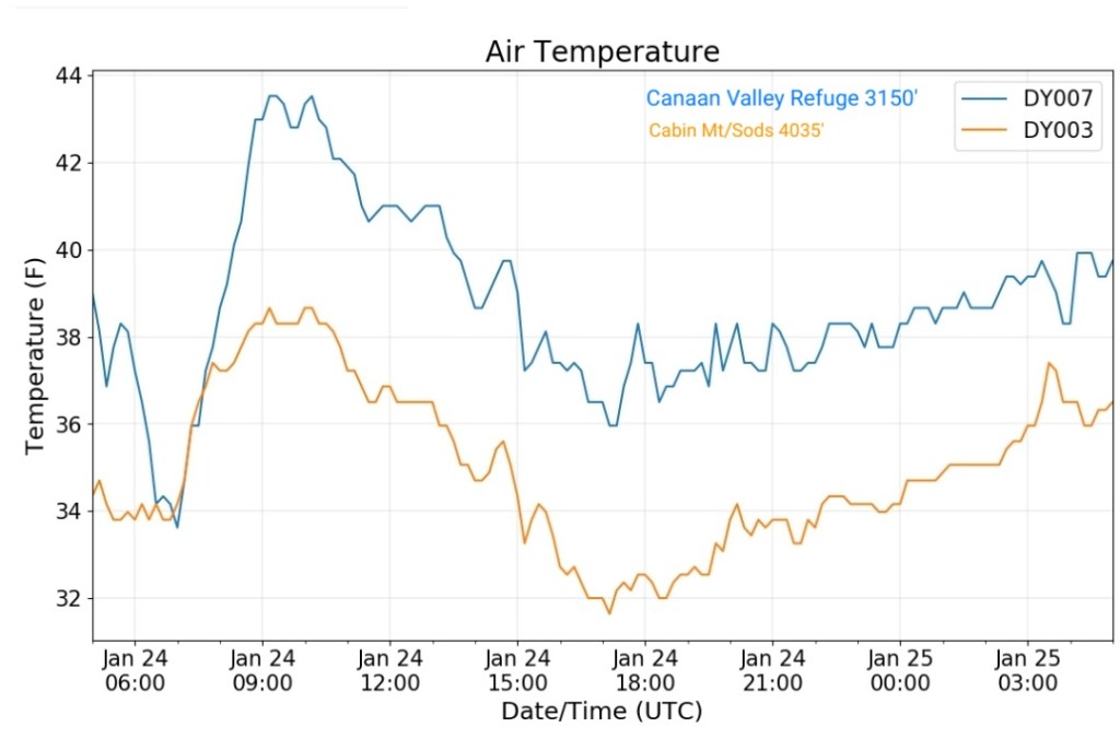
Canaan Valley Refuge
MIN[33.6]—MAX[43.7]—AVERAGE MEAN[38.6]—TRUE AVERAGE[38.8]
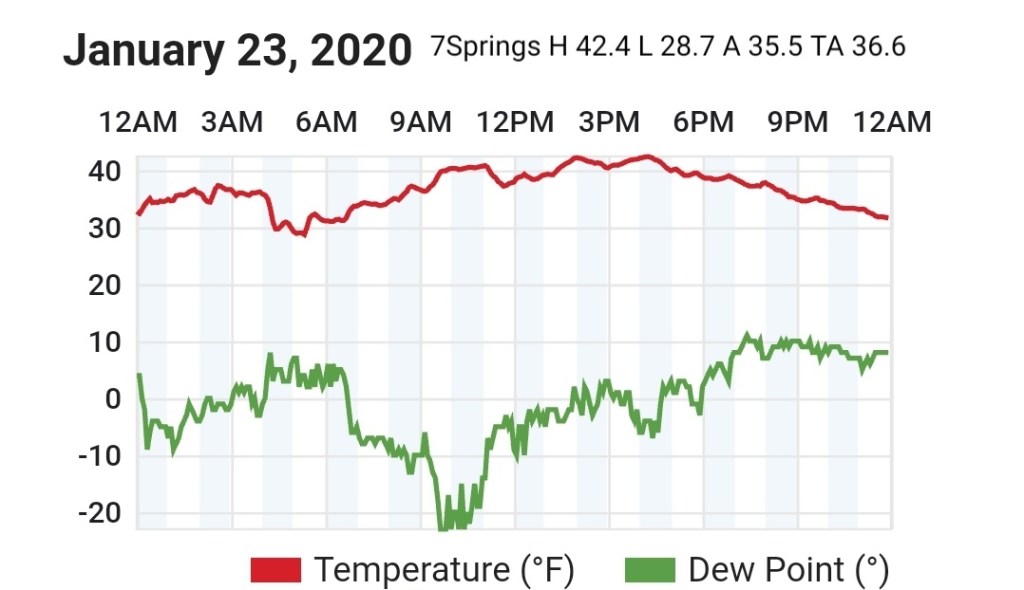
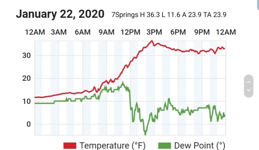
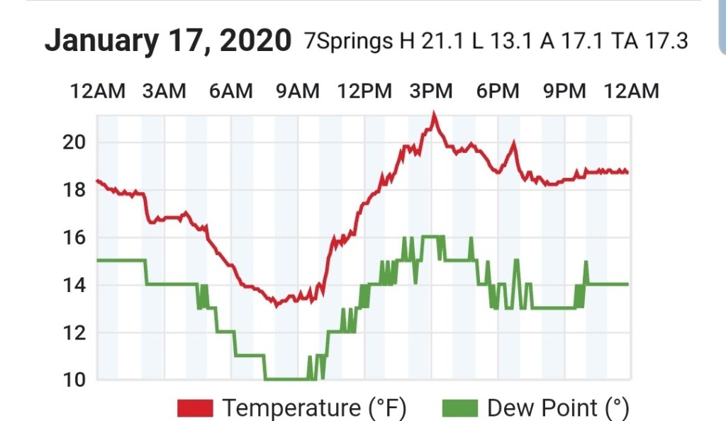
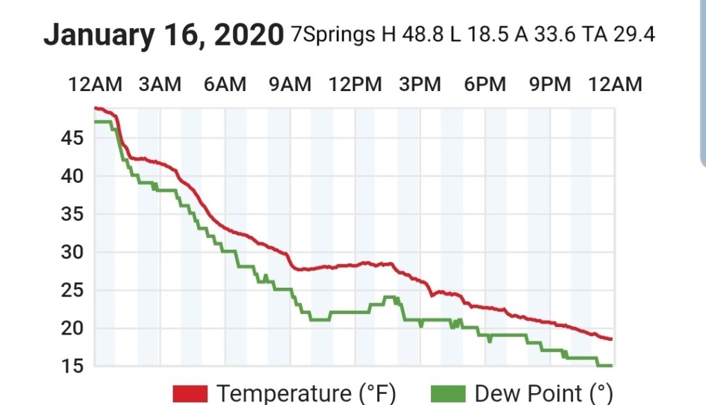
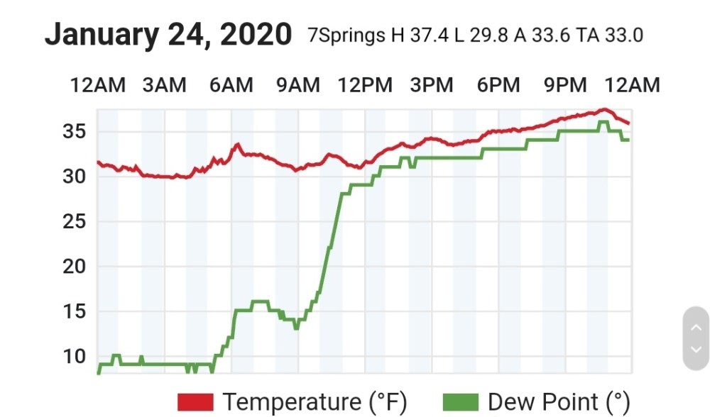
7Springs
MIN[29.8]—MAX[37.4]—AVERAGE MEAN[33.6]—TRUE AVERAGE[33.0]
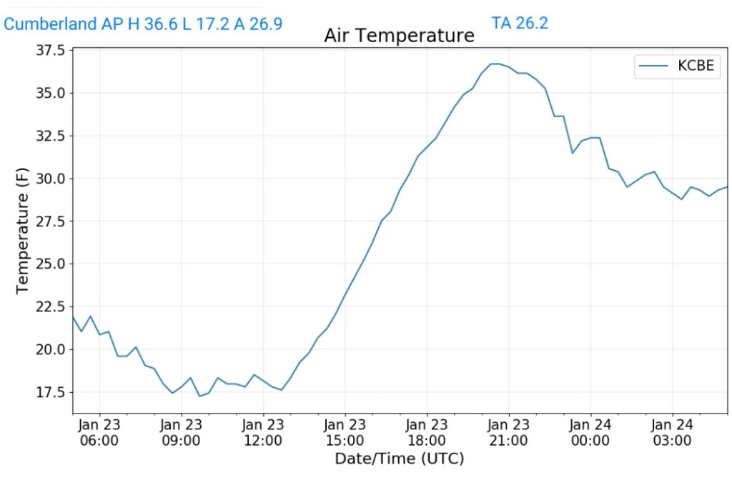
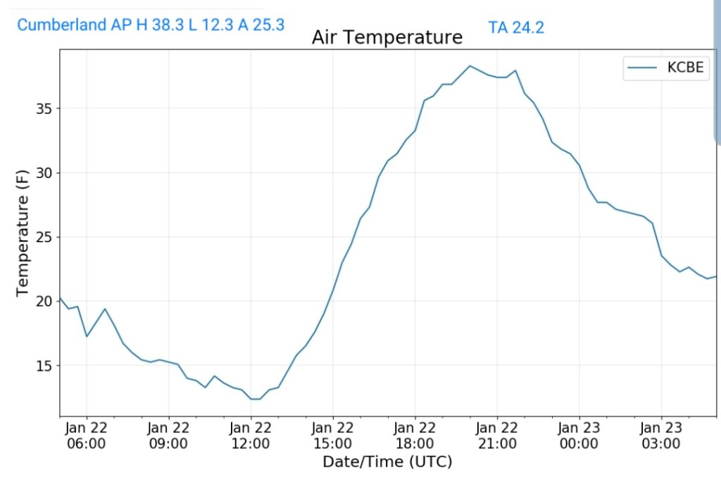
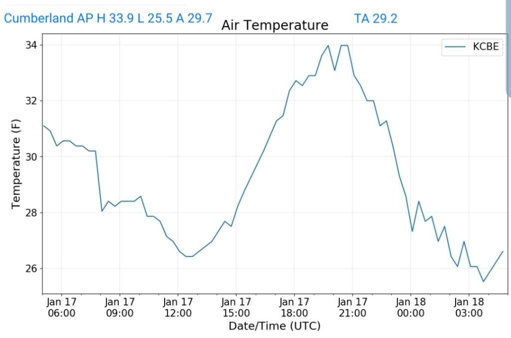
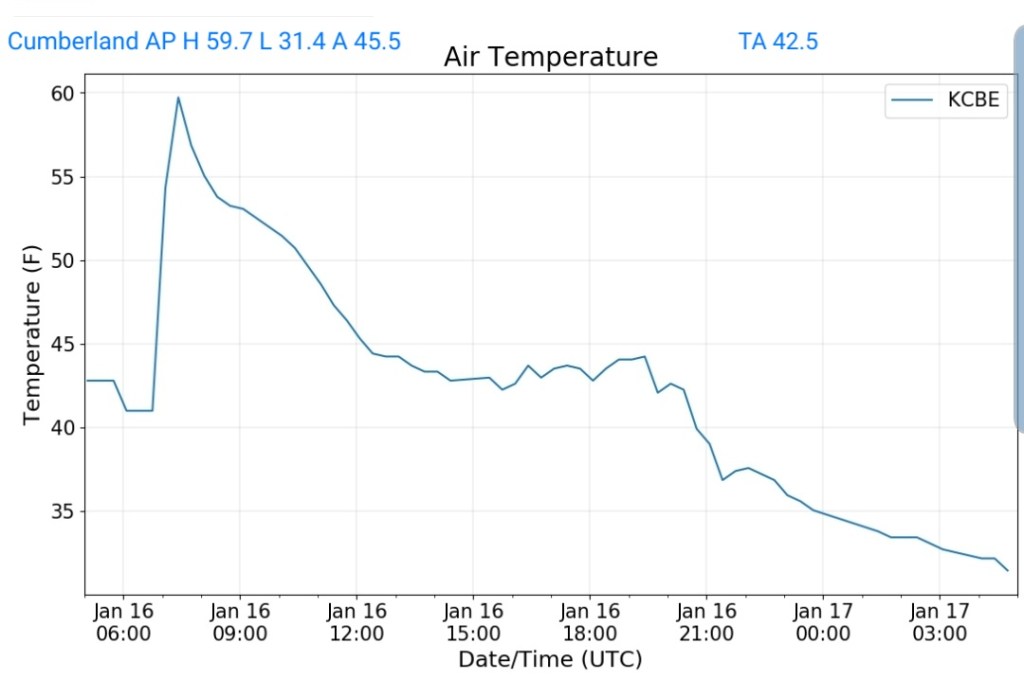
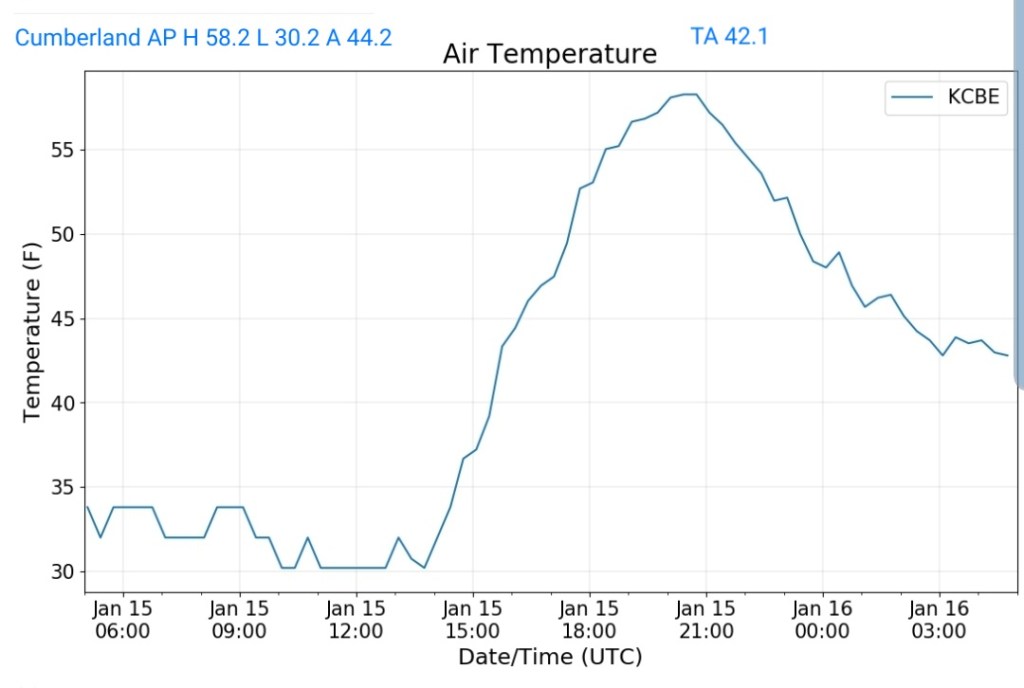
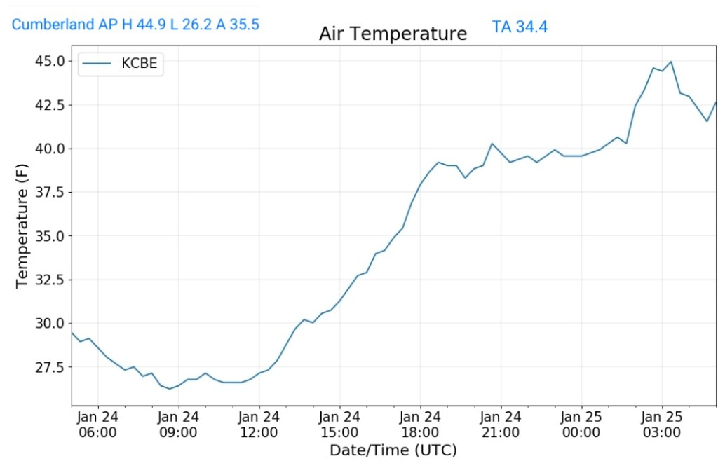
Cumberland Airport
MIN[26.2]—MAX[44.9]—AVERAGE MEAN[35.5]—TRUE AVERAGE[34.4]
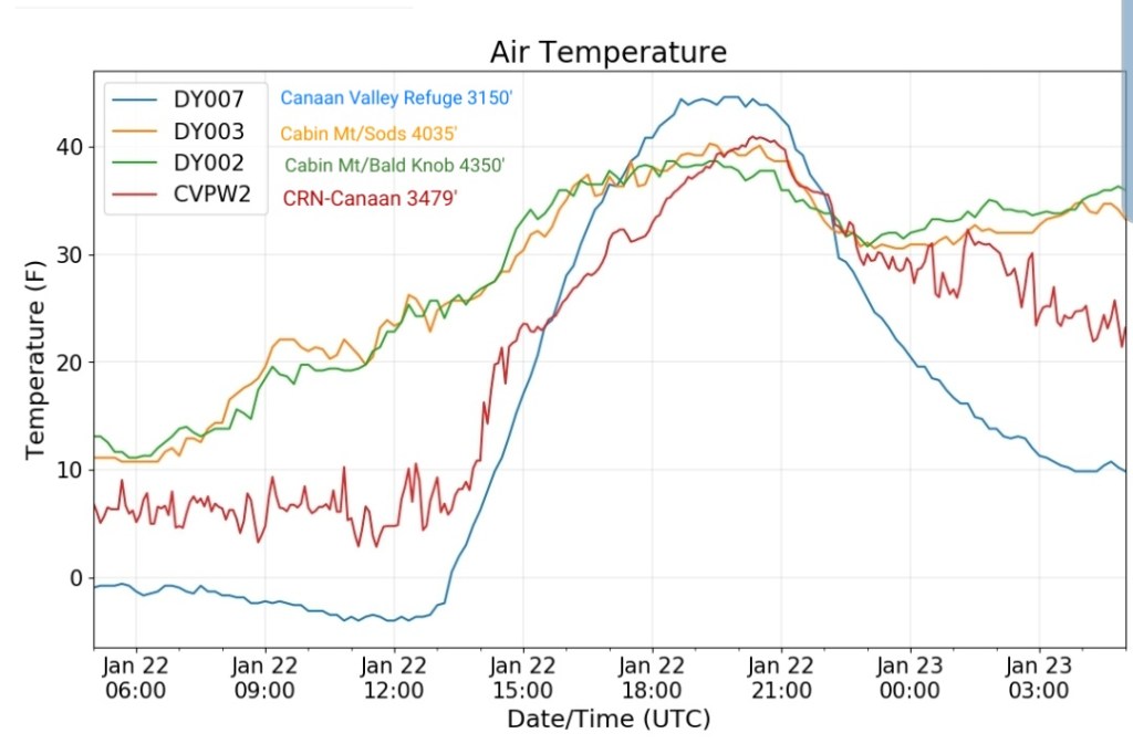
The Valley vs Cabin Mt
Canaan area temps
Comparison view
RTMA
Radar
Satellite
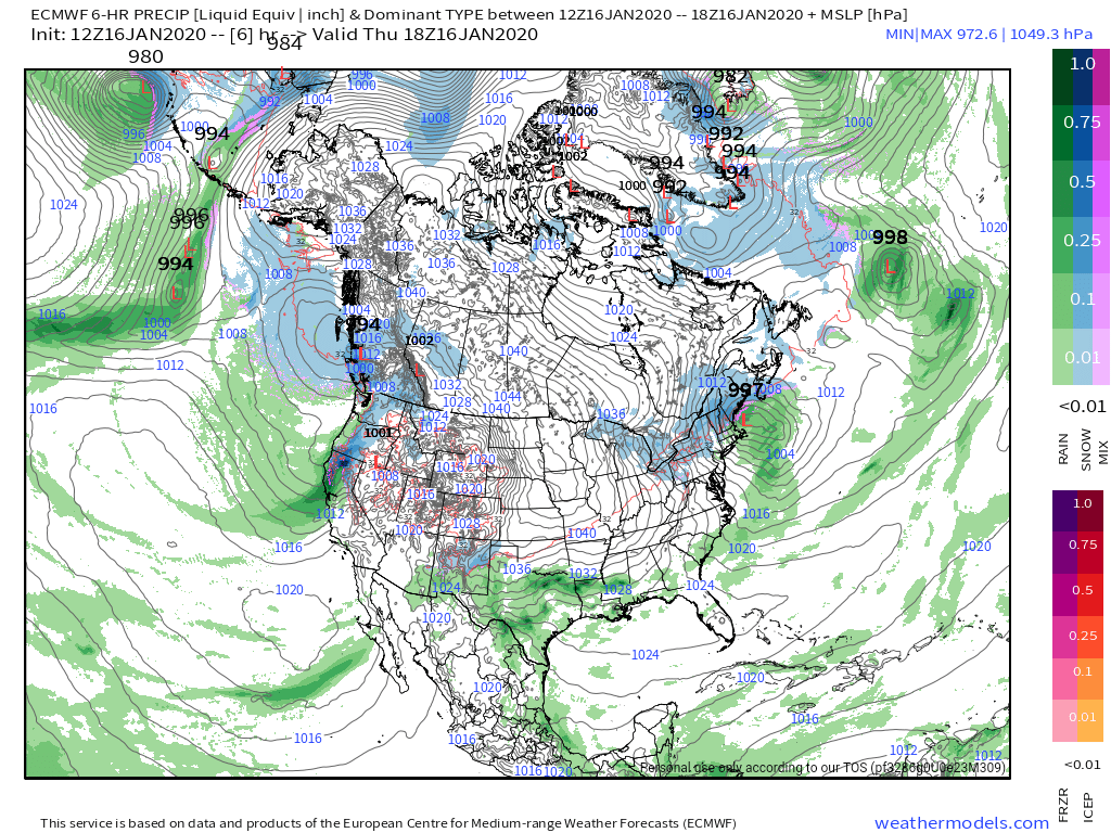
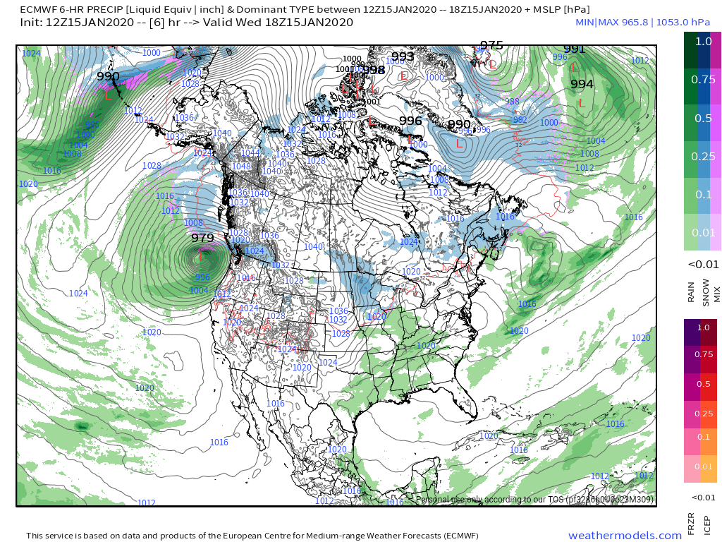
Flow
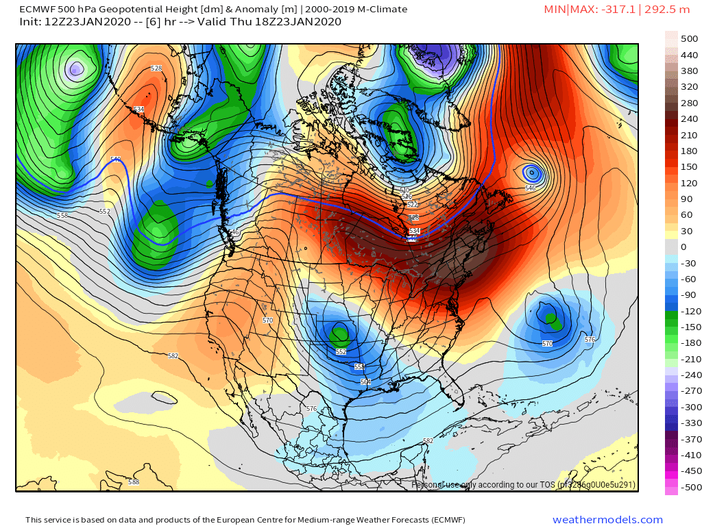
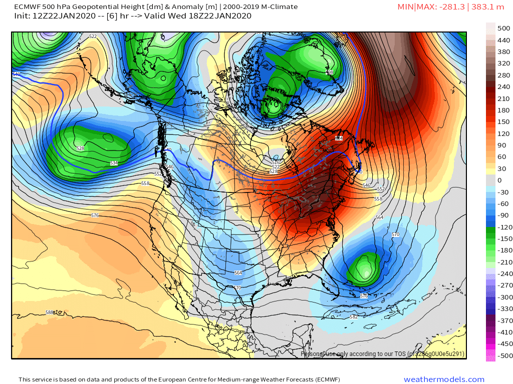
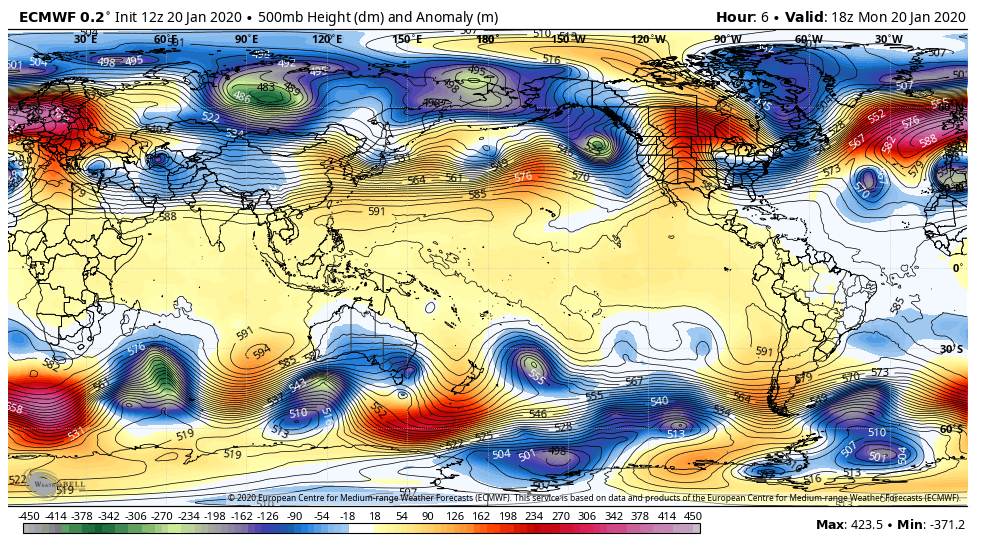
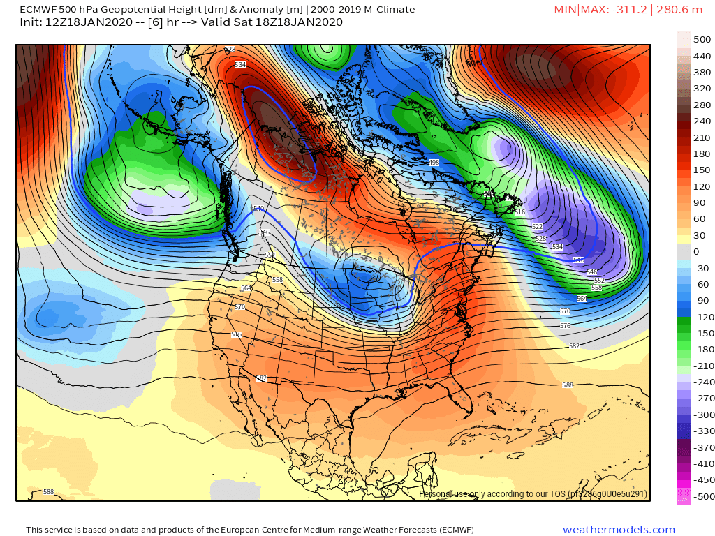
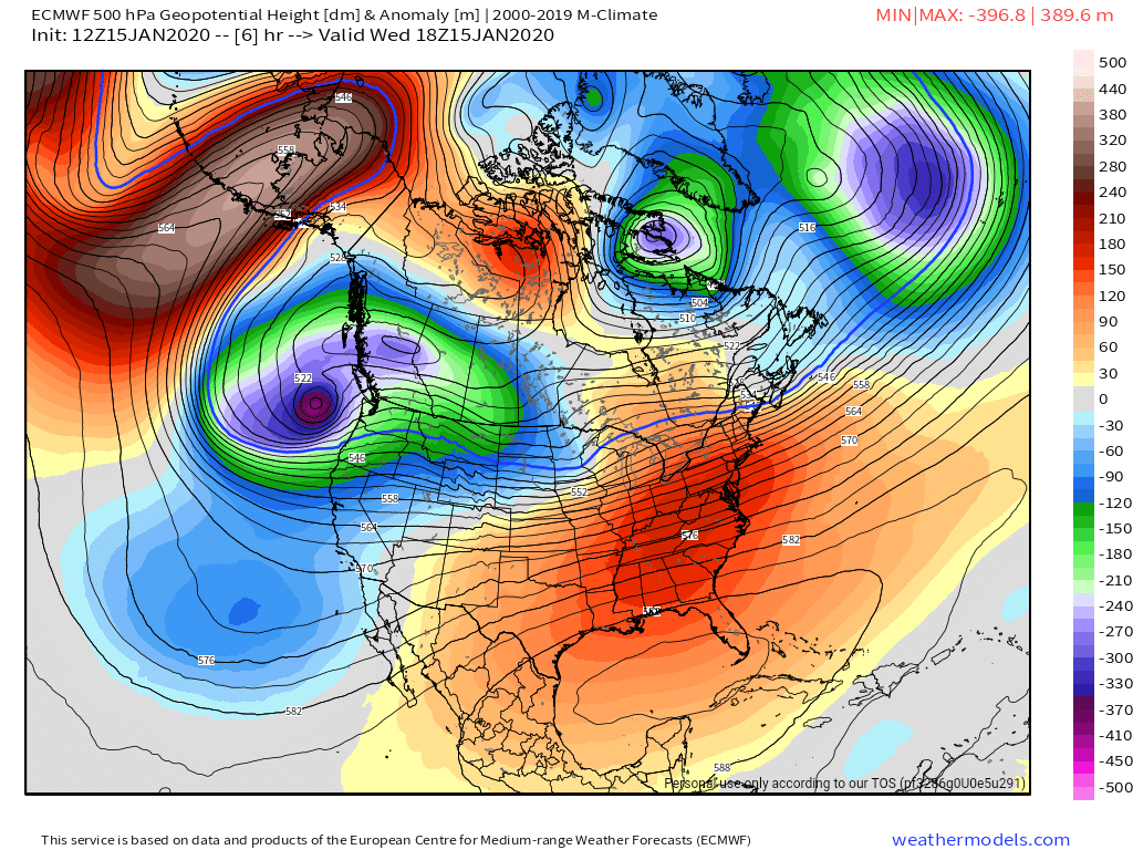
Surface features and 500mb height anomalies and flow


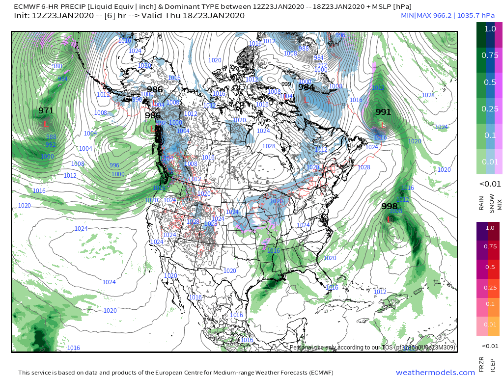
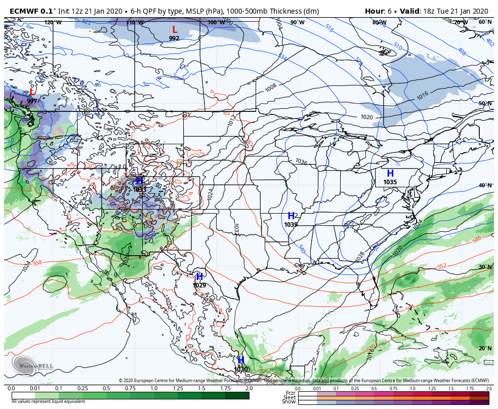
The unreliable models
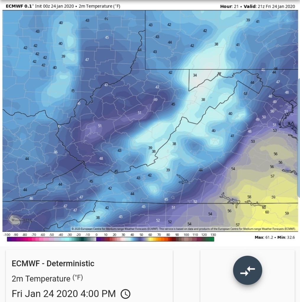
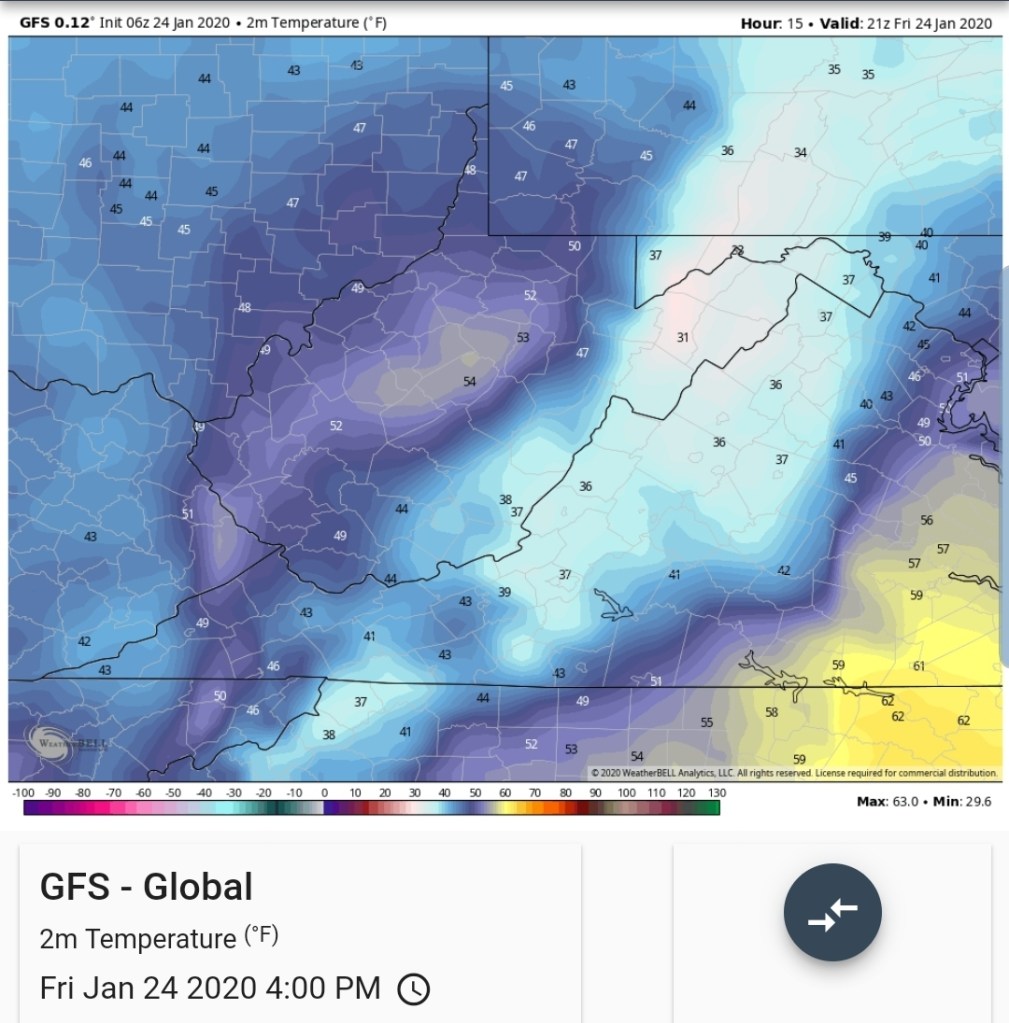
Its typical for long range modeling to rarely verify. Long range 5-7 days +. Time and time again they show snowstorm after snowstorm in the long range and backs away. That’s normal. Unfortunately. However more recently the models have been doing subpar in the short term, 5 days and in and even the day of. The 18 hour HRRR is worthless 99% of the time. For example, at 8am this morning, its 6-7° off on surface temps and by 4pm, its 4-10° warmer than any other modeling. Its rarely of value. Overnight, watching the Spruce Knob, Snowshoe temps. The 850 level. Models were in general +2 to +5c at 850. Reality was 0 to +1c. Prior events, the GFS has been putting out snow from the point of initialization, that was not there and did not occur.
These issues cause poor forecast. On that particular day the GFS was doing this, a few other models were as well. The weather service at that time increased their snowfall forecast, I held 1-3″. What occured, a few flakes.
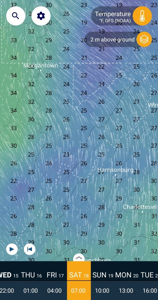
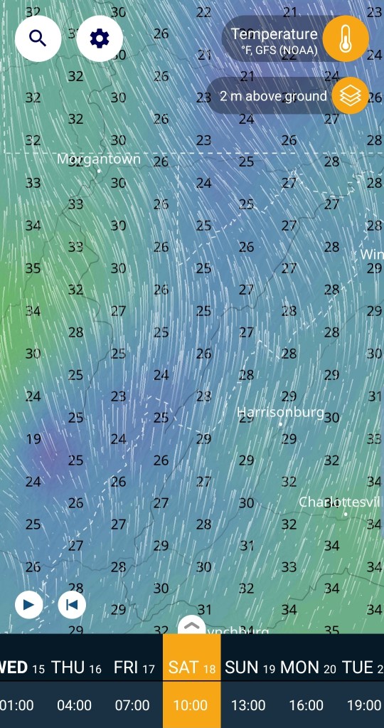
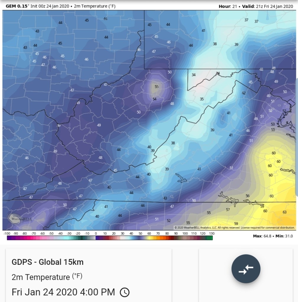
What does this entail today. With a very borderline setup, aloft and the surface, it’s enough to make one gunshy. For example, let’s go to 4pm today
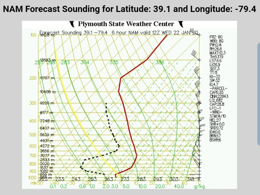
3km Nam(Personally I feel this is 2-4 too cold) again, having to use biases as these models are only tools

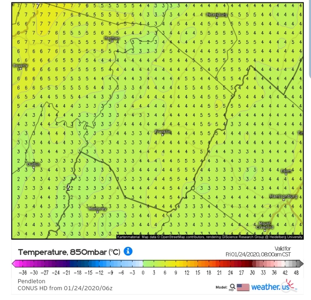
But what about the HRRR at 4pm, 3km as well
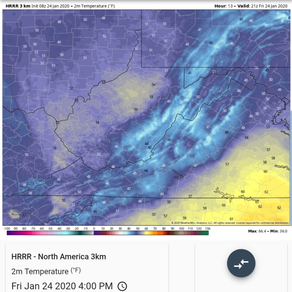
In my area in Garrett, that’s a 10 degree difference at 2m. That’s horrible.
0z ECMWF
6z GFS
0z Canadian
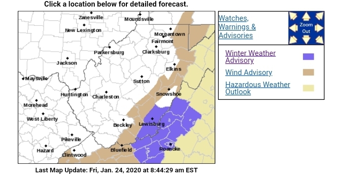
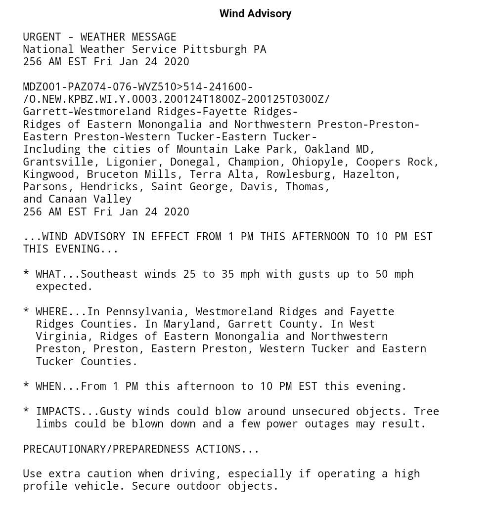
This is a common theme for the HRRR to be way off in these events. With SE winds, even a wind advisory issued today, the tops and EAST sides of the ridges most impacted by that and its possible on the Allegheny Front, eastern Garrett, temps hold near freezing just after onset of precip for a touch of ice on the east sides that are most wind impacted.
Up high, 4000’+ and especially 4500’+ still in play for wet snow today and overnight. I’m just not sold on the model accuracy enough to rule it out.
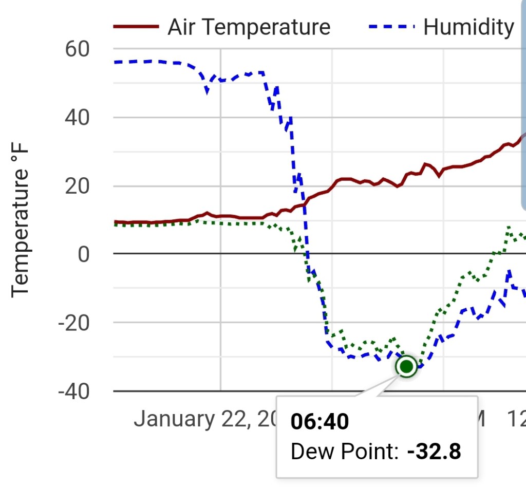
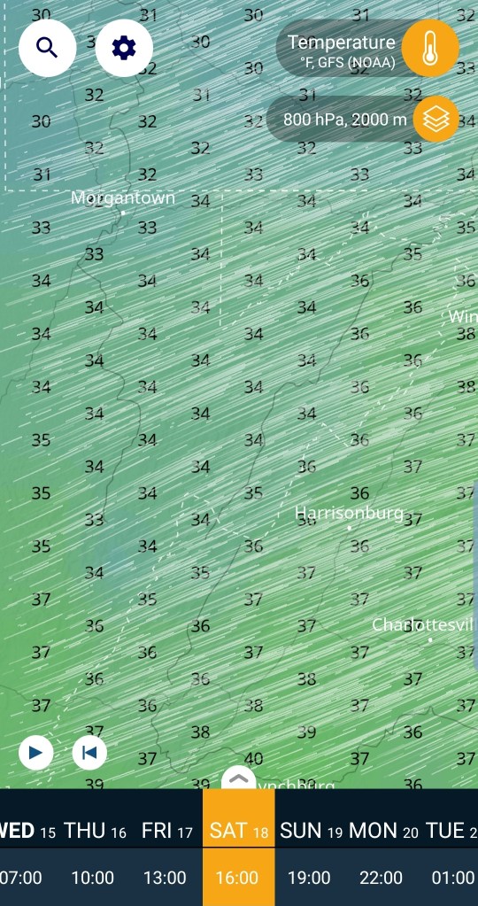
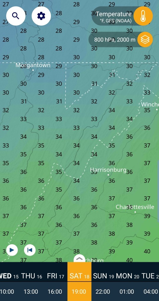
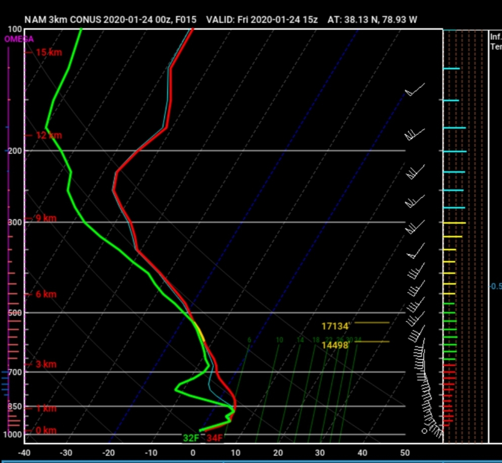
Spruce knob at 9am is at 1.7°c
The 3km Nam at 9am modeled at +3 to +4 at 850
HRRR at +2
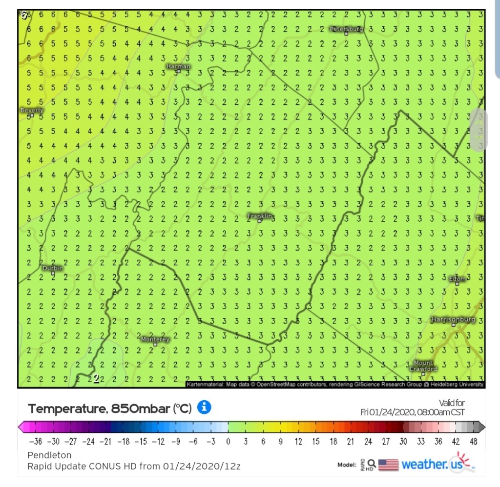
modeling is a touch warm. ..soundings off the 3km Nam
Present , a touch warmer at 850 than reality.
In a marginal temperature event, the high ground , while it looks a hair mild, may yet be in play. Don’t quite rule it out.
This is a rain producer for most. The key point of the above gripe-
Allegheny Front and eastern Garrett from Mt.Storm north has a slim shot at light icing briefly this afternoon. The WV high ground 4000-4500′ has a shot at wet snow later today and overnight. Some uncertainty exist.
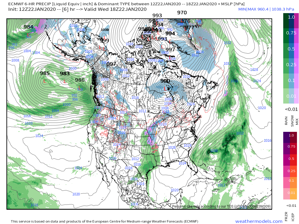
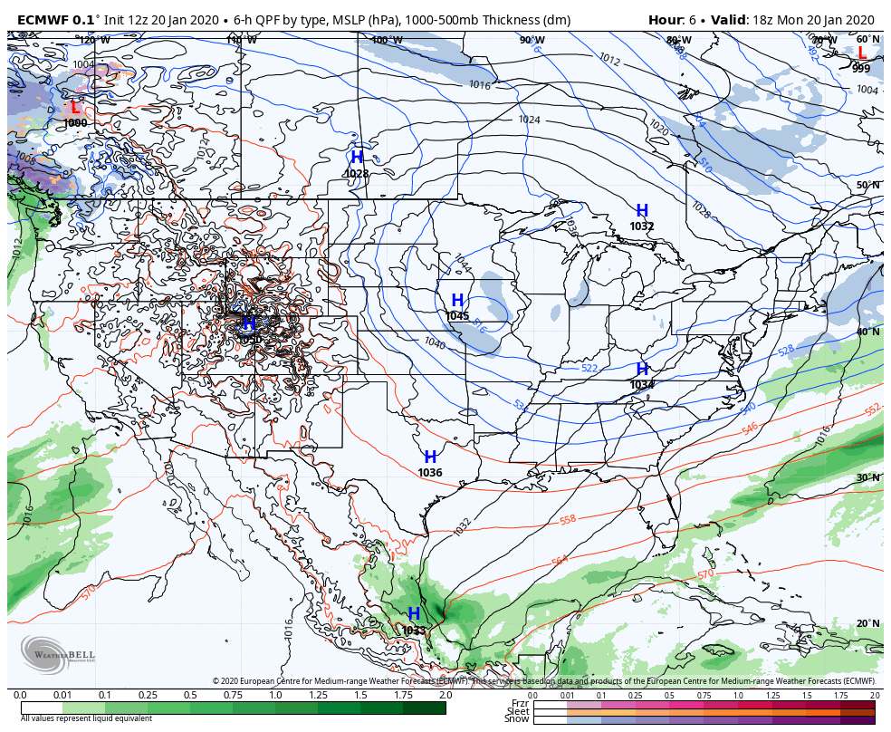
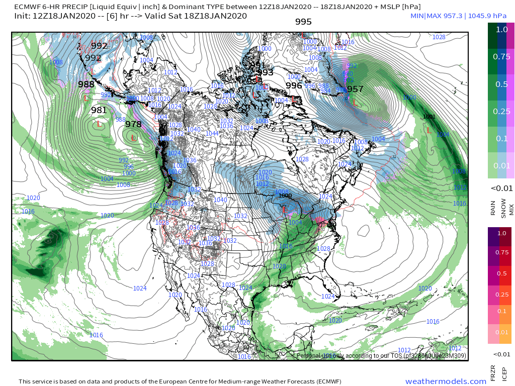
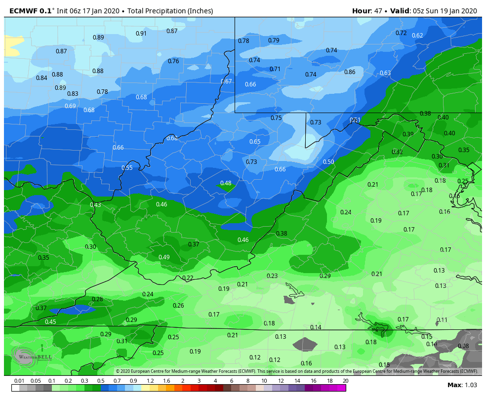
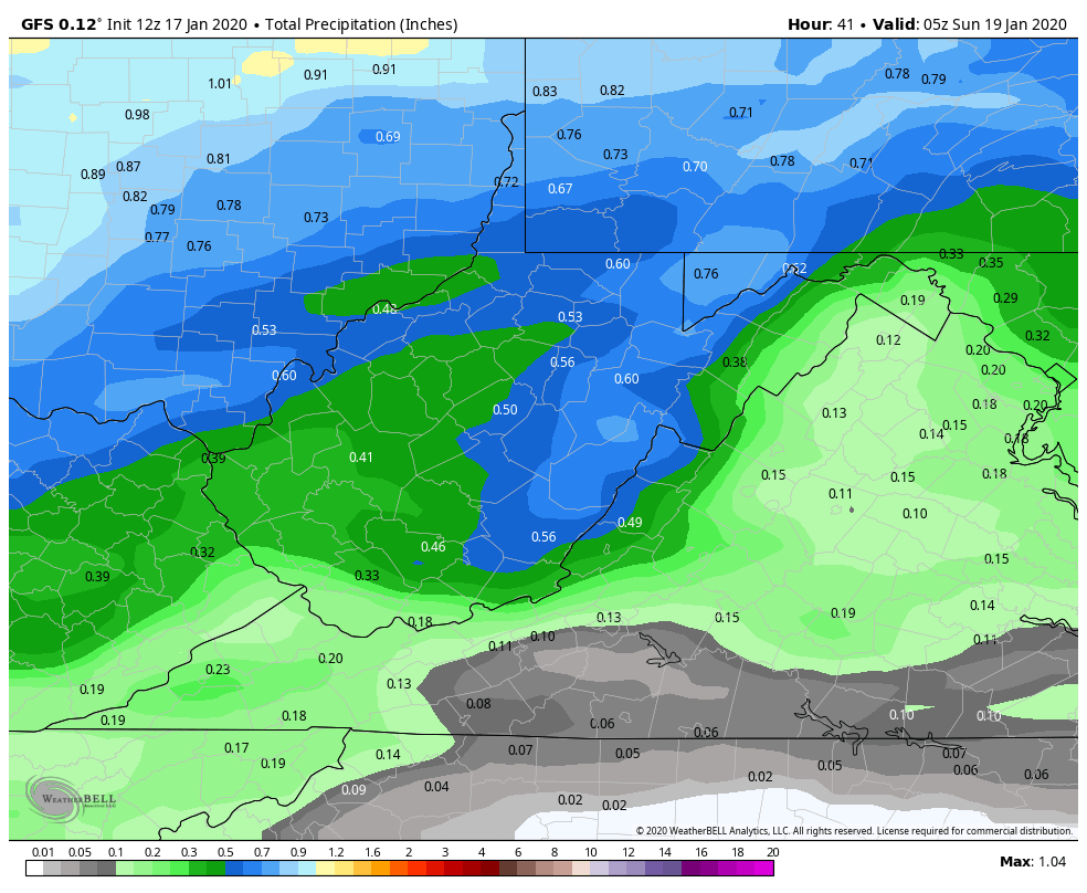
Rainfall amounts off the 6z ECMWF and 6z GFS

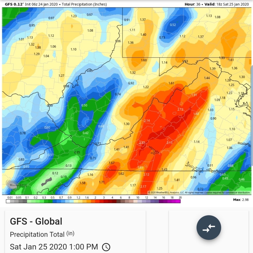
That will likely cause some high waterways. Stay tuned for any localized small stream flooding info to your local NWS.
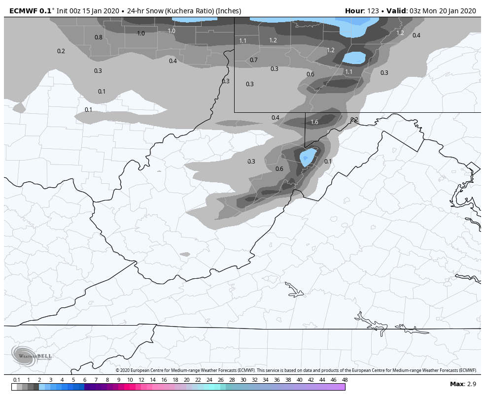
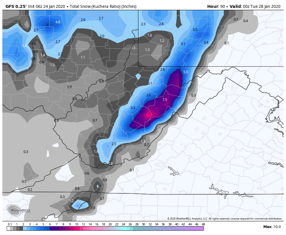
Then we turn eyes to upslope. Later Saturday through Monday, with a weak disturbance Monday, a general 3-6″ on favored upslope areas, 1-3″ east of that. This may linger in a varied fashion to Tuesday. Not sure why some forecast have took out any wording of snow Monday and Tuesday.
Through 7pm Monday the 6z ECMWF and 6z GFS.
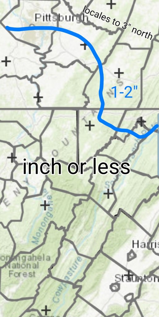
Unreliable modeling… last week the GFS did a little better with the high ratio, low water content upslope. Overall the ECMWF has done better between the 2. The GFS has over done snow frequently. This is not a high ratio event, I’d lean to a blend of the images. I’d go 3-6″ Cranesville, Terra Alta, Canaan, Cabin Mt, Cheat Mt to Snowshoe, 2-4″ 7Springs, Bittinger, Mt.Storm, 1-3″ Somerset, Finzel, Grantsville, Meadow Mt and east, and down along the east side of the Allegheny Front above 3500′.

Points of post –
Modeling has been unreliable, from initialization to days out
Above 4000 to 4500 needs watched for potential wet snow late day early overnight. Its close enough to not rule out.
Brief icing in Garrett, and along the Allegheny Front possible late morning, afternoon. Very marginal and may not occur.
Strong SE winds today
Some moderate to heavy rain may cause small stream flooding overnight.
Upslope snow in varied fashion late Saturday through early week.